Details
-
 Hike type
Ferrata
-
 Difficulty
EEA
-
 Distance
18.20 KM
-
 Altitude MIN
1206.00 mt
-
 Altitude drop +
2014 mt
-
 Parking
-
 Landscape

-
 History

-
 Duration
11h 30m
-
 Altitude MAX
3220.00 mt
-
 Altitude drop -
-2014 mt
-
Hike type
Ferrata
-
Difficulty
EEA
-
Distance
18.20 KM
-
Altitude MIN
1206.00 mt
-
Altitude MAX
3220.00 mt
-
Altitude drop +
2014 mt
-
Altitude drop -
-2014 mt
-
Duration
11h 30m
-
Landscape
-
History
-
Parking

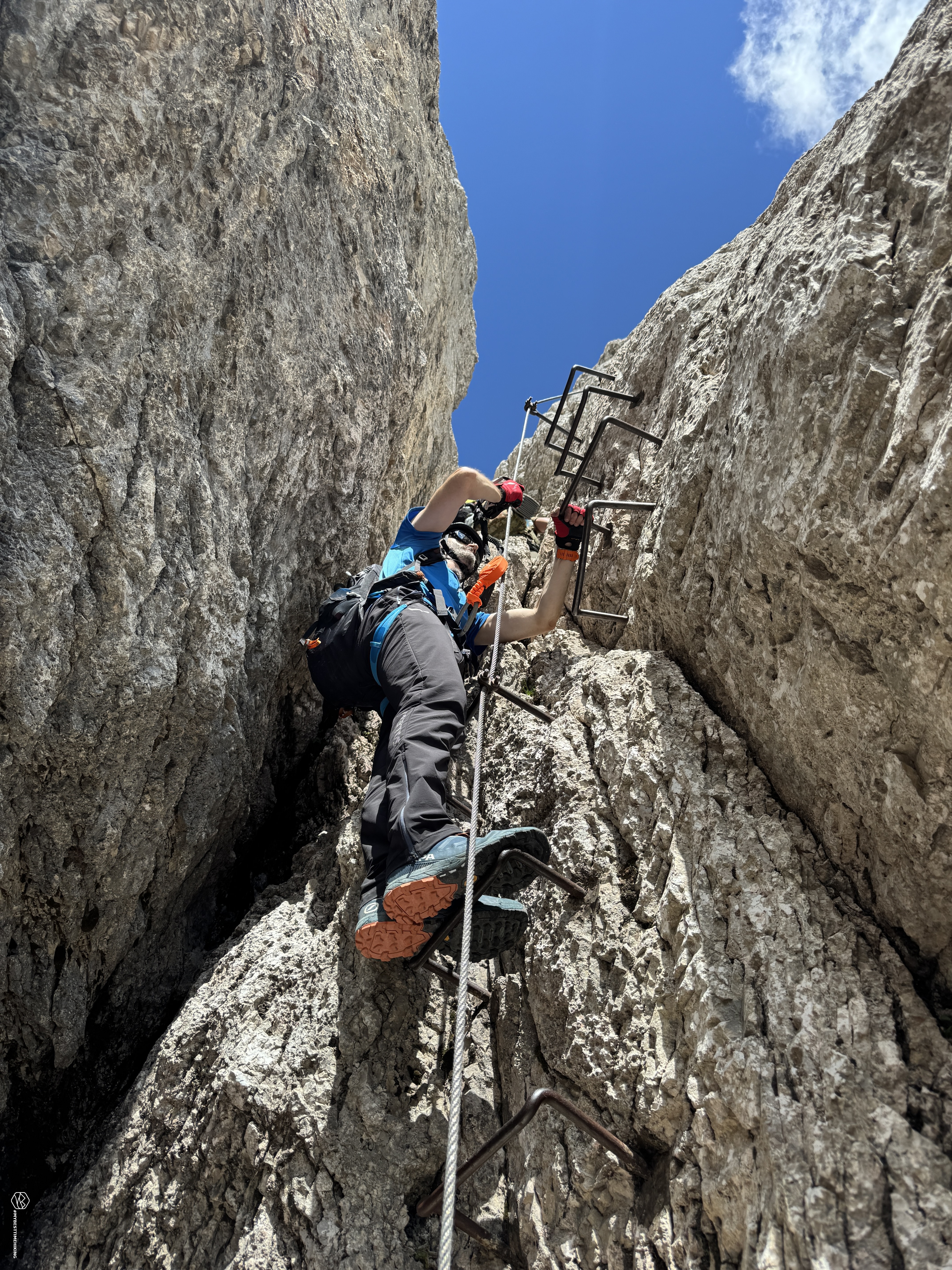
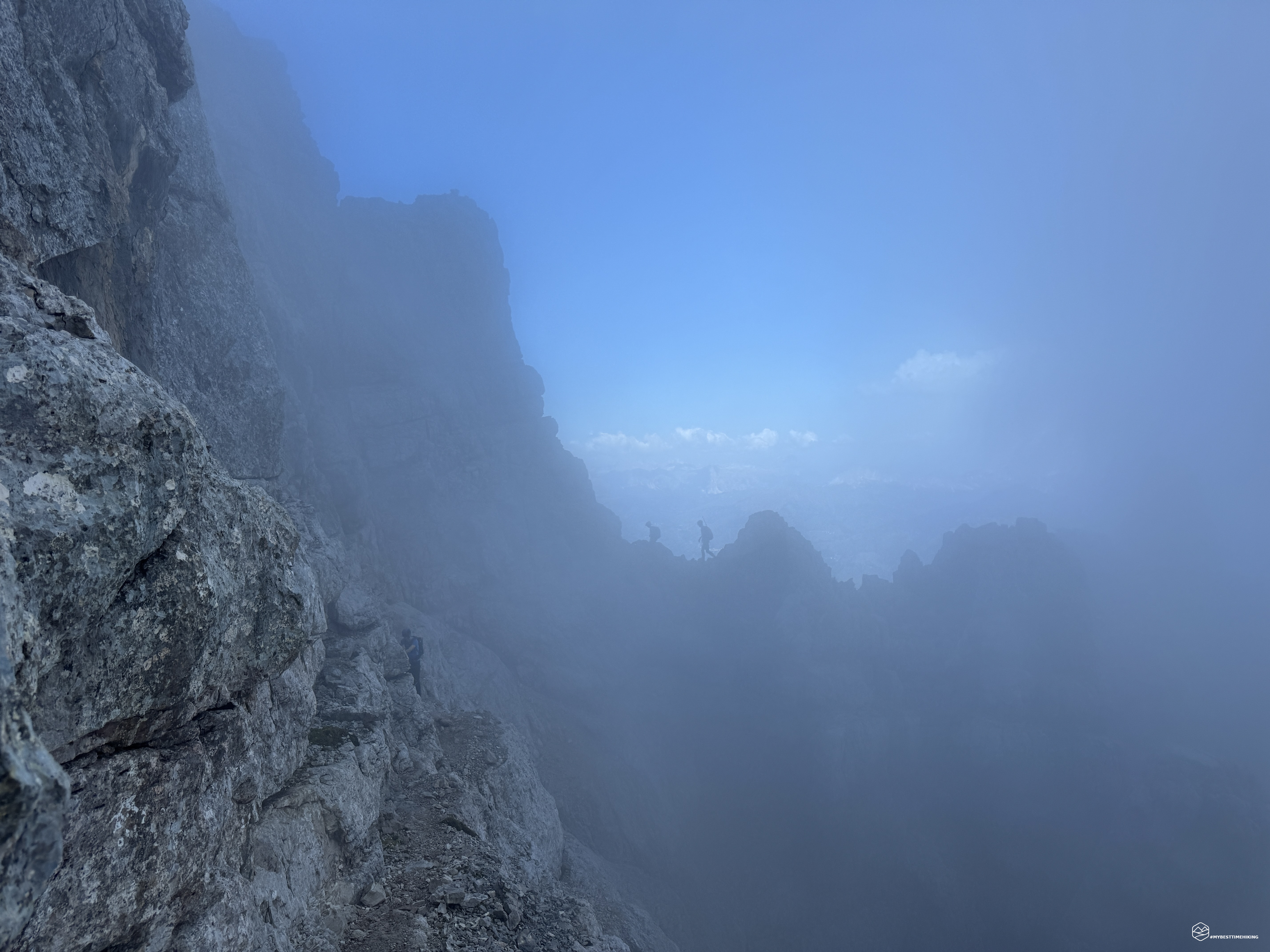
Today's adventure takes us to the Zoldo Valley on the Civetta massif for an epic traverse, completing all the trails available on this magnificent mountain. Accompanying me on this excursion is Angelo, his second personal 3000-meter peak. Today's excursion includes the great north-to-south traverse of Civetta via the Alleghesi via ferrata, the summit, and the descent via the Tissi via ferrata!
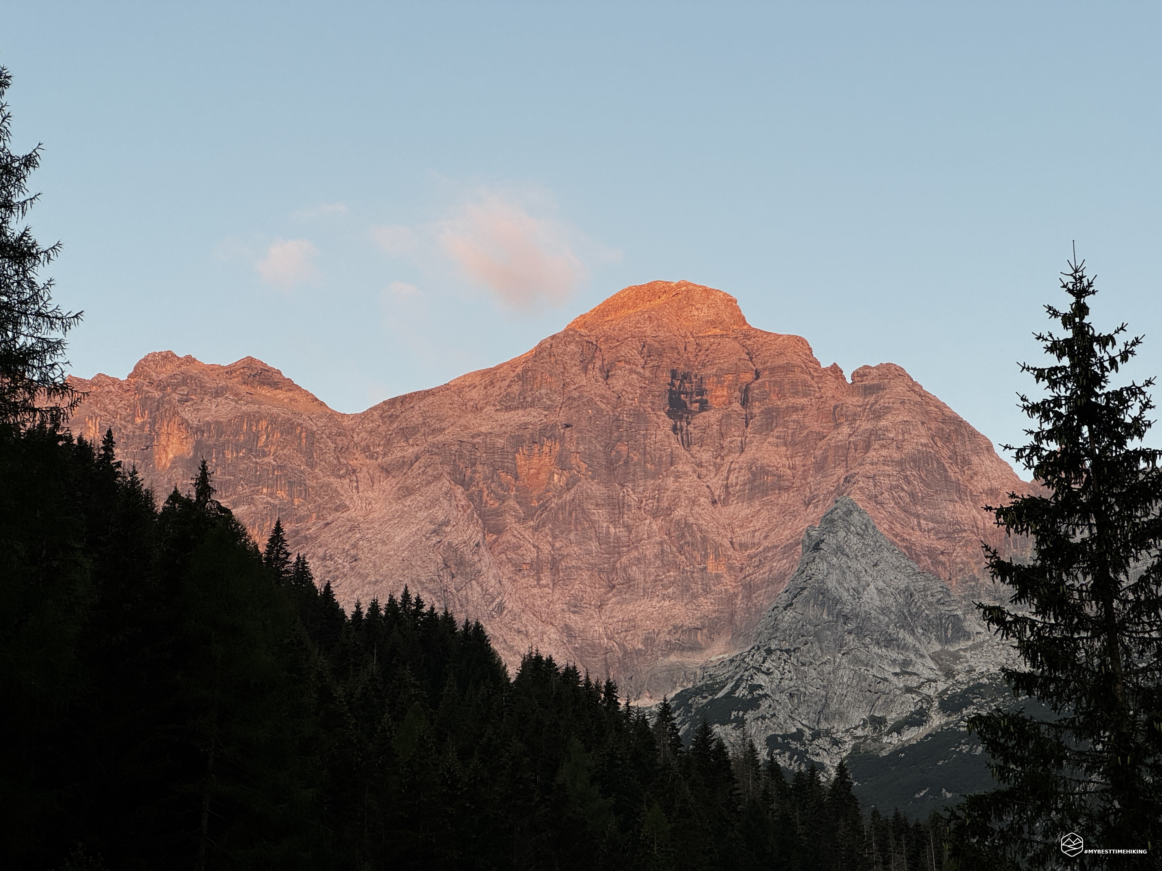
We reach the village of Pecol in the Zoldo Valley and leave the car in the ski lift parking lot. Civetta greets us with a fiery alpenglow at dawn. We lace up our hiking boots, check that we have the via ferrata kit, and set off on CAI trail 556. We cross the Maè stream and enter the undergrowth for about 300 meters of elevation gain until we reach the dirt road coming from Palafavera (CAI trail 564). We continue on a slight slope until we reach the Pioda mountain hut; from here, we take the uphill path towards the Coldai refuge, which I've described extensively in other adventures on my blog. With several zigzags of steady ascent, we reach the refuge about an hour and a half after setting off. We briefly admire the fantastic panorama that unfolds before us, with the majestic Pelmo and the Zoldana valley.
Behind the refuge, we choose CAI trail 557 with clear signage for the Tivan trail and the Alleghesi via ferrata. We continue slightly downhill, staying on the halfway path, past the Crodolon peak and overlooking the recognizable Torre di Alleghe. We cross the Val Masarè, and before us lies the equipped section of the Tivan trail. A succession of two equipped sections allows us to reach the Porta del Masarè and the rocky peak of Schenal del Bech. At 2300 meters, we take the right fork with the sign for the Alleghesi via ferrata. The approach is quick and leads to a wide plateau, where you can properly prepare with a safety kit and helmet.
In the "Guida dei monti d'Italia - Civetta" edited by Ivo Rabanser, the via ferrata is described as follows:
"Begun immediately after the war and completed in 1966, the Alleghesi via ferrata is one of the most interesting and complete equipped routes in the Dolomites. It initially runs along the ridge of the eastern spur of Punta Civetta, rejoining the Hamburger/Plaichinger route in the upper section, and then continues along the northern ridge to the summit of Civetta. It is significantly more challenging than the normal route and even than the Tissi via ferrata. This route is regularly used and highly recommended, especially in combination with the descent via the Tissi via ferrata, thus completing the traverse of the central massif. The route is very varied and exposed. Given its length, altitude, and the grandiose and severe environment, it requires mountaineering preparation and should be undertaken only in safe weather conditions. The route is marked and for the most part Partly equipped with a metal cable, except for a few ridge sections that in normal conditions do not present any particular difficulties. Elevation gain: 870 m; length: 1800 m. Difficulty: EEA, with some sections of II. Hours: 3.5 hours.".
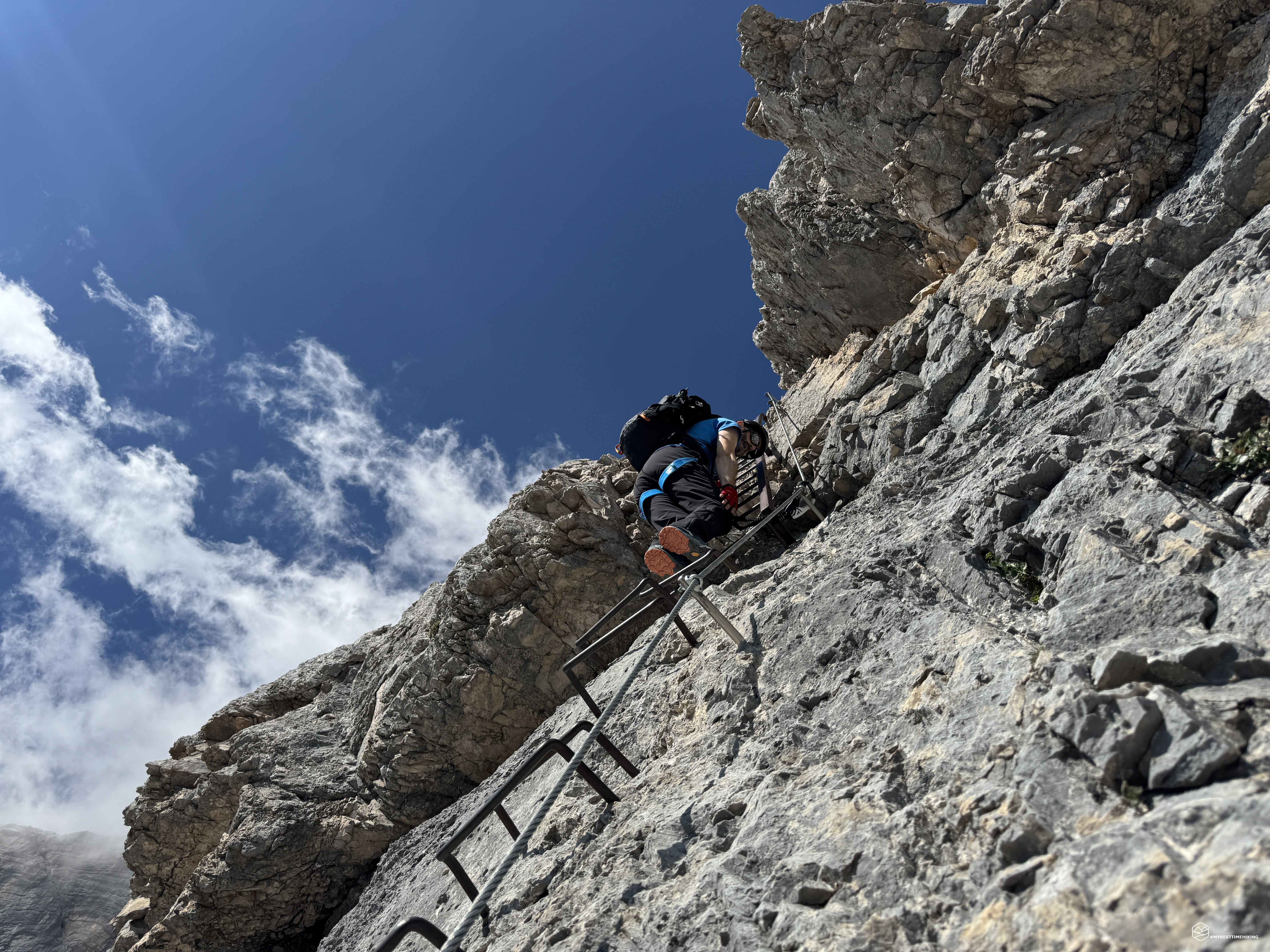
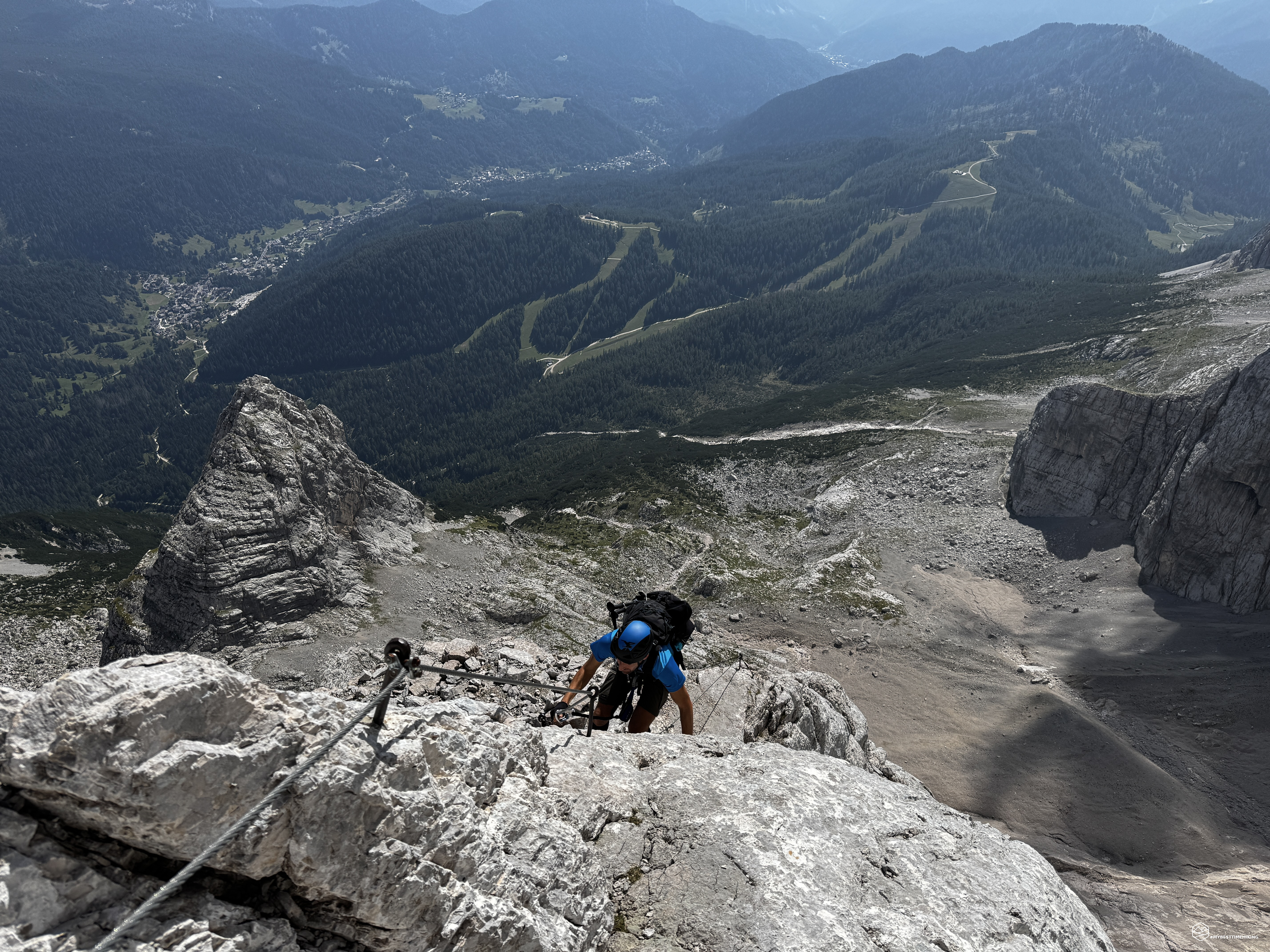
There is no metal plaque identifying the start of the Alleghesi via ferrata; a couple of metal segments allow you to gain altitude and reach the immediately vertical section, with old horizontal bolts embedded in the rock and a small iron ladder with closely spaced rungs. The verticality dominates at this point and allows for an exceptional view of the Val di Zoldo. Be careful of the sun, if present, as it heats up from the early hours of the morning and the wall becomes incandescent. The vertical and exposed section is rapid and gives way to a second, more fun section, where it is not even necessary to hold the metal cable and proceeds by easily scrambling among the rocks. The via ferrata continues with reduced verticality and progressions on sometimes smooth rock; From this point on, the severe exposure of the first section is gone.
You then reach a long chimney, a narrow, vertical passage that isn't exposed but is truly narrow. It consists of two ladders created by metal rungs driven into the rock. Pay close attention to your backpack when passing between the first and second ladders, as this is the narrowest point and requires a twist. Here, you're at an altitude of 2,550 meters. The chimney emerges onto a ledge that offers an exceptional view of Mount Pelmo and allows for a quick break. From here on, the rocks become more gentle and less vertical, but the progression continues toward the sky. A sky that continues to alternate, along with the abyss, between a clear blue and light, drifting clouds.
A series of secured sections and short sections without metal cables lead to a fork near Punta Civetta, at approximately 2,900 meters. A mist envelops us on this ledge, which descends slightly until reaching a large boulder, from which we ascend to reach the north ridge of Civetta. A series of secured steps leads to a scree summit that allows us to reach Punta Tissi. Here, the clouds divide sharply, obscuring the eastern slope of the Val di Zoldo, while on the western side, a fantastic view of Alleghe, Lake Coldai at our feet, and the legendary Tofane mountains can be admired.
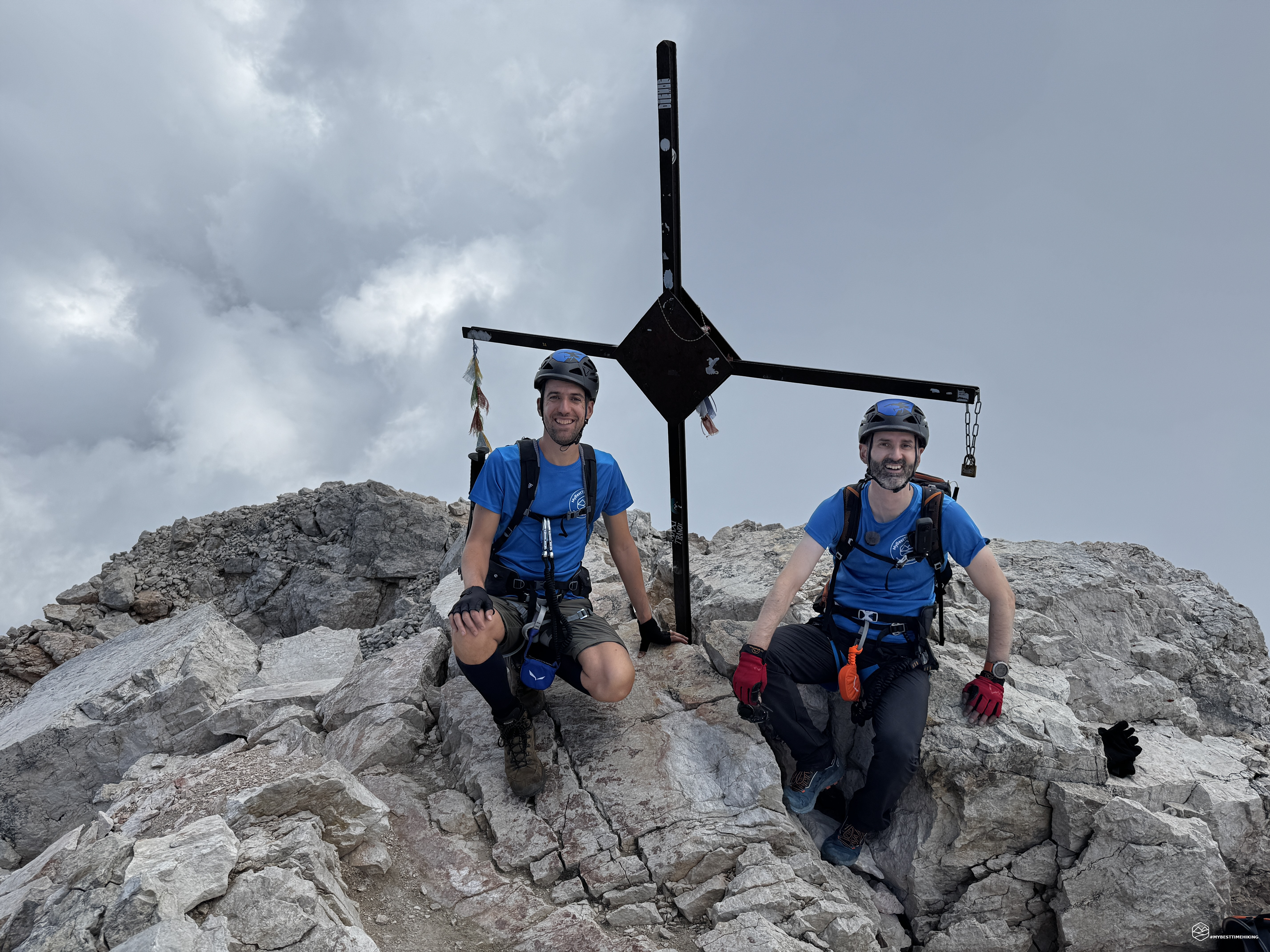
As we approach the vertical rock again, a clear arrow indicates a gully; we continue following the metal cables that lead to a series of steps on the left of the ridge. Here, there is no longer any protection; we proceed among grade I rocks in an airy environment that can cause vertigo. Pay close attention to your footing, as the rocks are sometimes unstable, though not difficult to negotiate. We quickly reach the summit ridge, composed of several smooth, supported slabs on which the final sections are equipped to facilitate progression in wet conditions. The final ridge offers a spectacular view of the Civetta Valley below and the Tissi refuge, which rises with its offshoot toward Lake Alleghe. We begin to see the distinctive summit cross. We carefully proceed, razor-sharp, until we can cling to the cross, pass underneath it, and thus reach the legendary Civetta summit at 3,220 meters!
Date
13-08-2026
Distance
18.20 KM
Hike type
Ferrata
Ascent
2014 mt
- Mountain
Monte Civetta
- Address
Pecol, Val di Zoldo, Veneto
- Altitude
3220.00 m
- Refuges
Rifugio Coldai, rifugio Torrani
- Information
Before us is the panorama (halfway between them...) from the summit: from the Pale di San Martino di Castrozza, past the Catinaccio, the Queen Marmolada, the Sella group with Piz Boè, the Alleghe Valley with Caprile and Col di Lana, the peaks of Alta Badia, Fanes, and all the way to the Tofane! An absolute spectacle, tempered only by the usual thick cloud on the east face obscuring the view of Zoldo, Pelmo, and Antelao above all.
We enjoy a well-deserved break before descending to the Torrani refuge via the Normal Route. The short descent is still quite technical due to the verticality and loose scree in the first section just below the summit. Once we reach 3,000 meters, we lose altitude more rapidly, until we reach the minimal equipped section behind the refuge. The heat and scorching heat of the day force us to refill our water supplies at Torrani, at 2,984 meters. A quick note of the traverse in the refuge's logbook and we descend again along the Normal Route. We soon reach Pian della Tenda and the fork. On the left, the Normal Route continues toward Coldai, while on the right, the Tissi via ferrata. We choose the latter and arrive at the rock face rising from the scree we need to climb. To reach it, we must actually complete the first section of the Tissi via ferrata. We descend vertically, and the final section is marked by a cord that facilitates the descent to the scree. This section is usually covered in a blanket of snow, even in August, but this year there wasn't even a trace of it.
We continue along the scree path southward until the actual start of the via ferrata, which extends along a beautiful ledge with a special view of the Van delle Sasse. In the "Guida dei monti d'Italia - Civetta" edited by Ivo Rabanser, the via ferrata is described as follows:
"Frequently used descent, especially during the traverse of the central Civetta massif, with ascent via the Alleghesi via ferrata. The route is well marked with red markers, while the section equipped with wire rope and bolts should not be underestimated. The descent is decidedly more challenging than the normal route on the east face. Difficulty: EEA, with sections of I."
After an initial easy segment, the route's critical points arrive: a vertical section on sometimes smooth rock with few holds, requiring even arm strength. The descent quickly follows further straight sections until reaching a bend in a rock ridge where there is a beautiful, fully secured section that allows you to bypass an overhanging boulder with your back to the void. A second noteworthy vertical section takes us to some sloping, truly smooth slabs. If there were any water here, the difficulty would increase dramatically. Even on a warm, dry day like today, we had trouble keeping our feet steady as we progressed. A tip: in the steepest and smoothest sections, lean on the bolts of the equipped sections.
This brings us to the last noteworthy section: a vertical descent with a deviation to the right, where it's difficult to find a foothold on an overhanging boulder that obscures a clear view. Gently descend your vertical line to find a properly installed bolt to aid your descent. Even if you don't see it, trust me and search for it with the tip of your boot; you'll find it! Once the Tissi via ferrata is complete, we dive onto the scree, staying at altitude towards the Forcella delle Sasse, skirting the walls of Civetta Bassa up to an altitude of 2,476 meters.
We descend the scree slope on CAI trail 558; be careful during the first few meters of descent, as the red markers and CAI signs aren't always clearly visible, and you may end up on less accessible alternative routes. Keep left at the end of the scree slope and take the left fork at 2,117 meters, which skirts the eastern prominence of Civetta Bassa. A final, fun scrambling section allows us to skirt the rocky ridge, and with a final, gentle climb of the day, we arrive back on the Tivan trail (CAI 557), almost reaching Sass del Non, a crossroads that leads to the Civetta Normal Route. From here, we descend to Col Grand and then reach the Civetta Valley on CAI trail 587. We make a short detour to Gravon Grant to admire some playful waterfalls and cool off a bit, before completing the loop and returning to the morning parking lot at Pecol!
This concludes the great Civetta crossing from north to south via two legendary via ferratas, with over 2,000 meters of elevation gain, a journey time of 11 hours and 30 minutes, and a maximum altitude of 3,220 meters in a unique environment.
Thus concludes the great Civetta crossing from north to south via two legendary via ferratas, with over 2,000 meters of elevation gain, an 11.5-hour journey, and a maximum altitude of 3,220 meters in an airy, dizzying setting that's hard to forget! An adventure for expert hikers with mountaineering experience; full via ferrata gear, including a helmet, is mandatory. Physical preparation is a must, and mental preparation should not be underestimated for the stamina required on such a long, demanding excursion due to exposure and concentration.
For MyBestTimeHiking, after last year's Via Normale, the TransCivetta in mid-July, and this adventure, the exploration of the Civetta massif has come to an end!
Click here and watch the exclusive video on YouTube for an even more immersive experience!
DifficultyExpert Hikers with Equipment - The equipped routes (or via ferrata) are indicated, they require the use of self-insurance devices. |