Details
-
 Hike type
Alpinism
-
 Difficulty
EEA
-
 Distance
14.01 KM
-
 Altitude MIN
1420.00 mt
-
 Altitude drop +
1800 mt
-
 Parking
-
 Landscape

-
 History

-
 Duration
10h
-
 Altitude MAX
3220.00 mt
-
 Altitude drop -
-1800 mt
-
Hike type
Alpinism
-
Difficulty
EEA
-
Distance
14.01 KM
-
Altitude MIN
1420.00 mt
-
Altitude MAX
3220.00 mt
-
Altitude drop +
1800 mt
-
Altitude drop -
-1800 mt
-
Duration
10h
-
Landscape
-
History
-
Parking
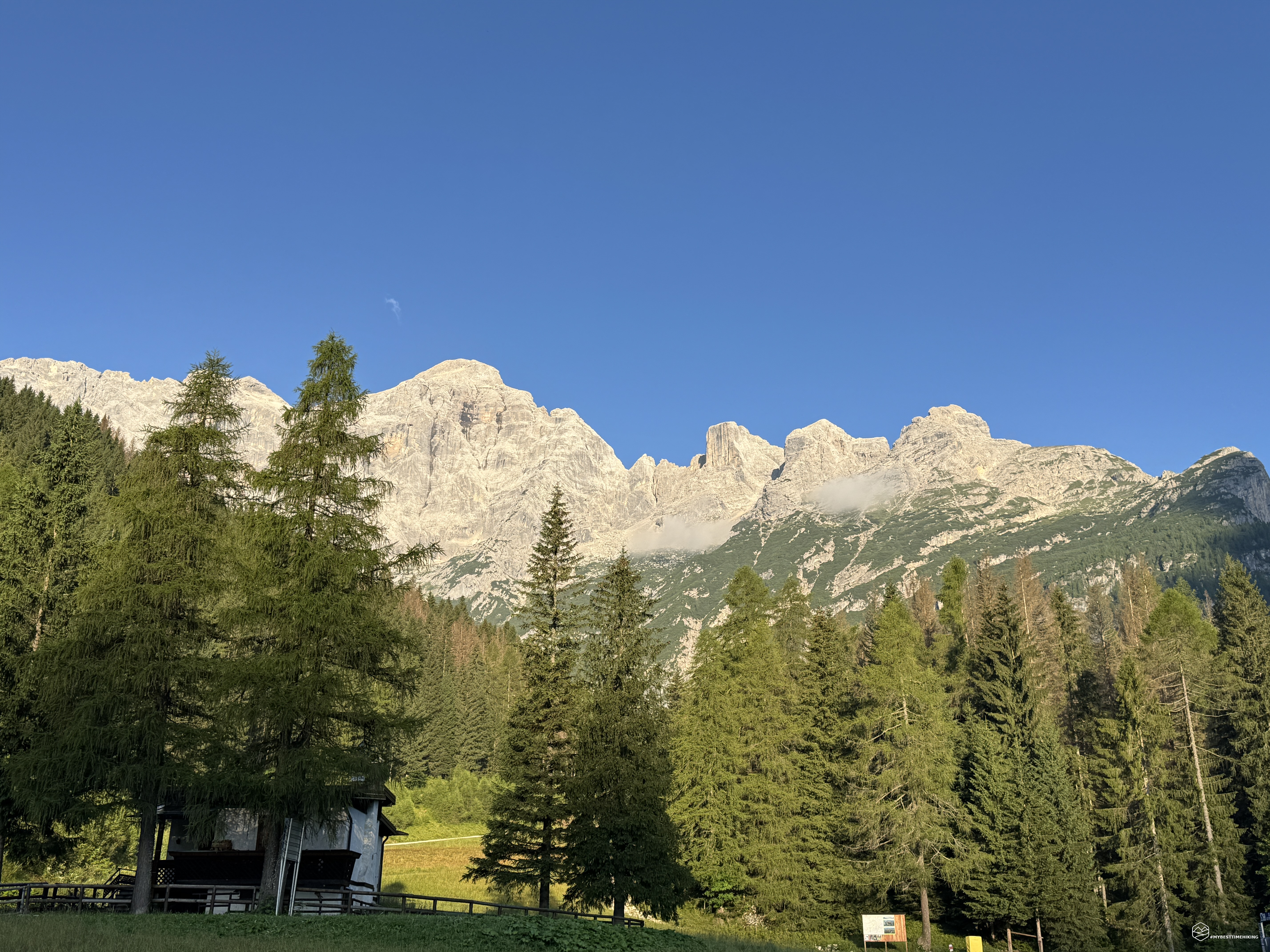
Wake up at 4:00. At 6:30 I reach the village of Pècol, in Val di Zoldo.
Today will be a solo adventure. Two years have passed since my accident at Forcella Antelao, and since then I haven't tackled the mountain alone. But this summit is an unfinished business. An unfinished business that now reaches its third attempt: the summit of Civetta via the Normal Route!
My first attempt dates back to 2017: I stopped just 100 meters from the summit. The second, four years ago, was interrupted at the start of the via ferrata.
Today is a challenge against myself.
I park near Casera del Zorzi, next to the ski lifts that go from Pècol to Palafavera. The day is cool and clear, but the already present humidity suggests possible cloud cover.
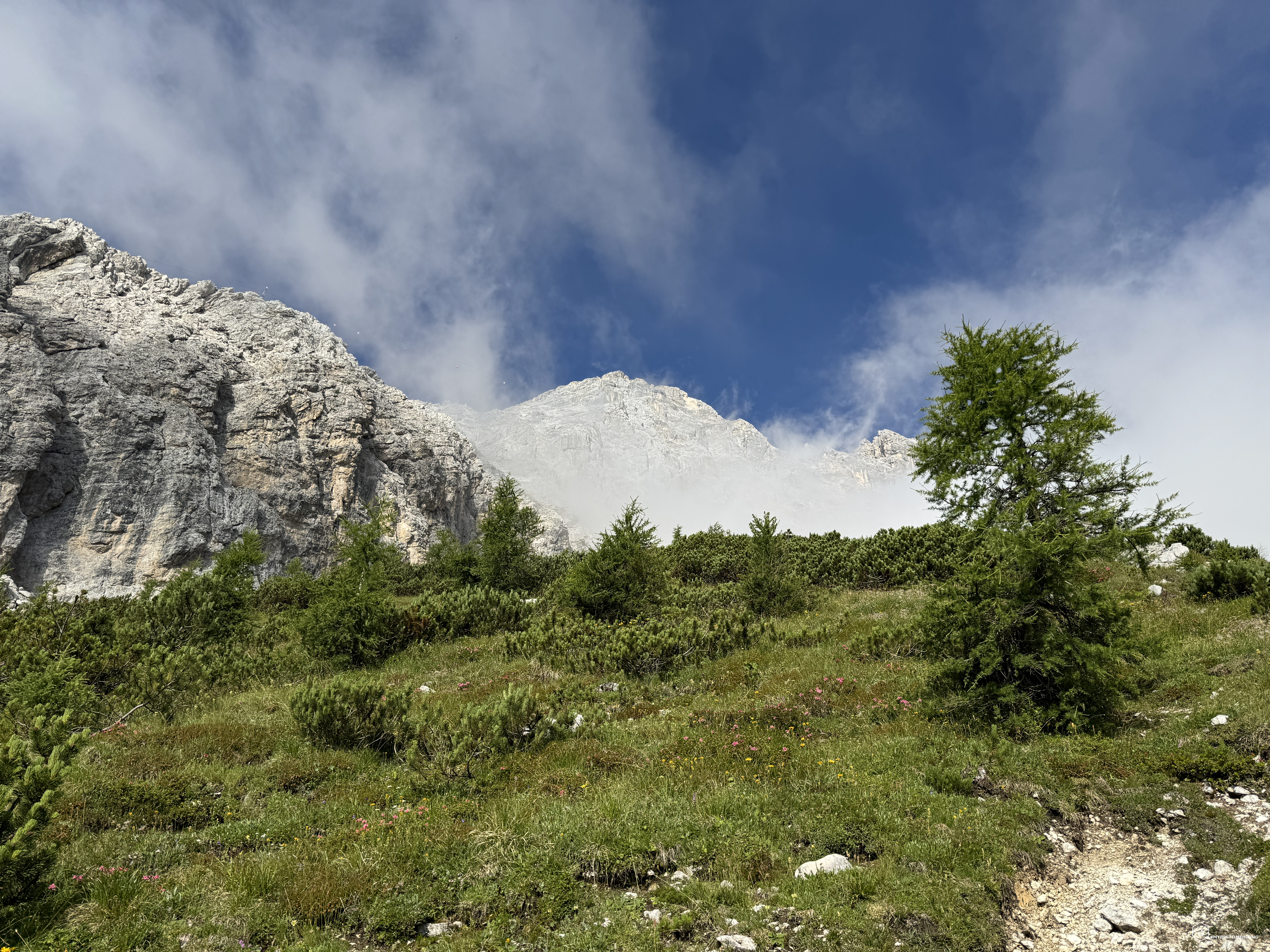
It's after 7:00 a.m. I carefully prepare myself and take CAI trail 587. The route runs alongside the ski slopes of Ski Civetta, crosses the Maè stream, and, with a short detour, also allows you to admire its source. The CAI signage is precise and guides you through meadows and scree slopes shaped by the water.
I soon leave Val di Pècol and enter Val Civetta, an area that has always fascinated me: an open clearing, marked by trees felled by avalanches, offers wonderful views of Civetta and Pelmo. A small forest leads me uphill for 500 meters to Col Grand (or Col Grant) at 1,927 meters, which I reach after about an hour.
Here, a break is a must before heading towards the rocky base of the Civetta group. I come across Mandra delle Grave, where CAI route 587 becomes route 557. Shortly after, Sass del Nin appears, a meeting point of several routes: the trail to the Vazzoler refuge, the Anello Zoldano that leads to Coldai via the Tivan trail, and—for me—the north/northwest direction, climbing the scree slope toward the start of the via ferrata.
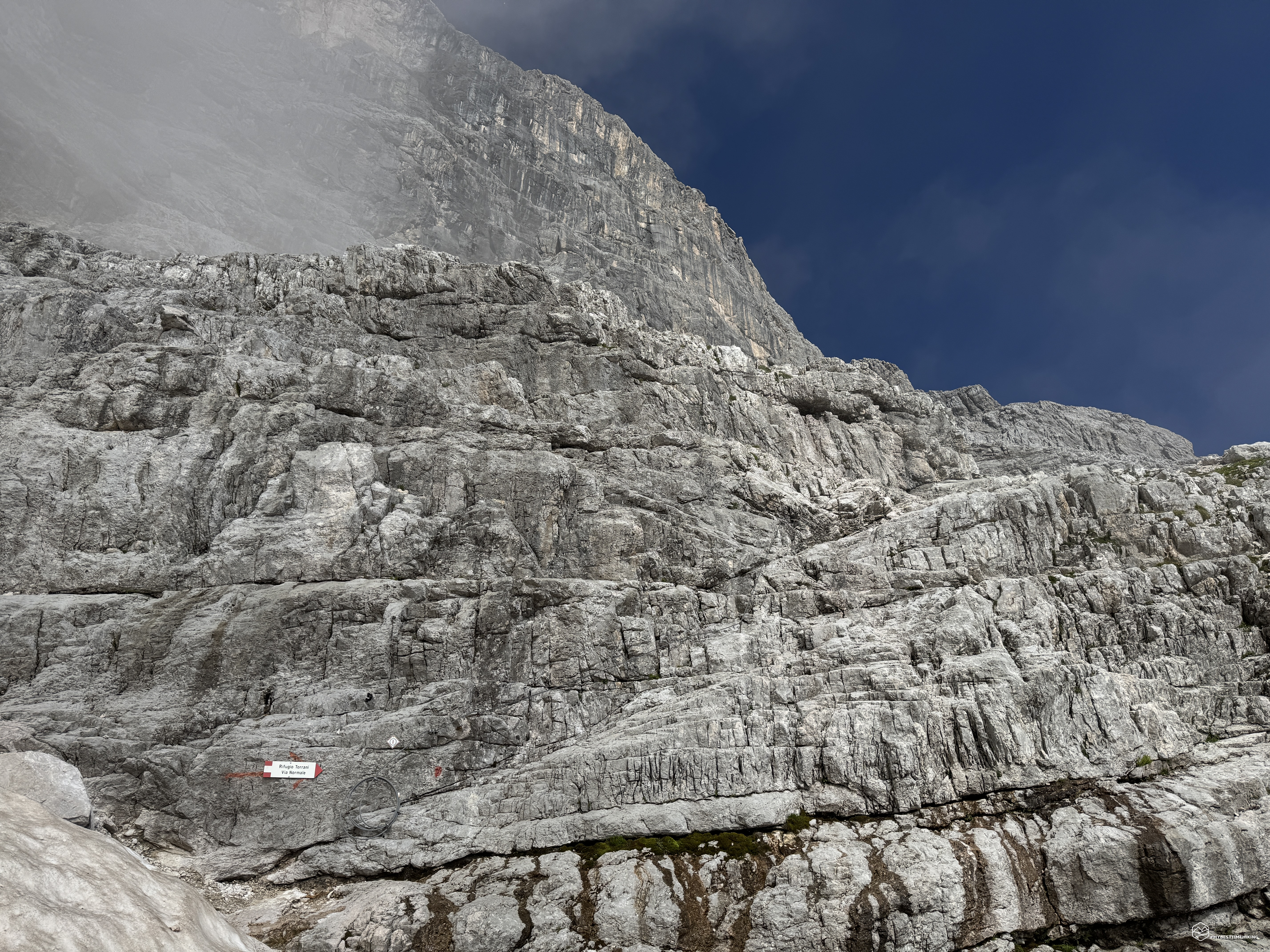
The trail becomes more unstable: first on compact scree, then through debris, until reaching the foot of the vertical walls. It's curious to note how the snow strips that covered the access to the via ferrata in 2017 have now almost disappeared. I manage to cross a trail of loose snow and directly reach the oblique slabs where the via ferrata begins. A CAI sign announces the start of the equipped trail; a numbered "1" stamp identifies the series of cables that will continue to the Torrani refuge.
I'm exactly where I arrived on my second attempt. These intermediate steps are crucial to my solo progression: they motivate me and help me stay focused on the goal. While I'm preparing my gear, I see several climbers descending the via ferrata: they've spent the night at Torrani and are returning to the valley.
To best describe this area, I consulted historical texts and found a passage in the "Historical Alpine Guide to Belluno-Feltre Primiero-Agordo-Zoldo" (1887) by Ottone Brentari, which in turn quotes the words of Professor Marinelli, from "La Patria del Friuli" (1885): "Before us stands a wall perhaps 25 meters high, almost vertical. But the wall has a crack, 15 or 30 centimeters wide here and there, which, twisting somewhat, cuts into it from top to bottom: a sort of enormous scar across the chest of a giant. We must take advantage of its ruggedness and, prudently, using our hands, feet, elbows, and knees, slowly, slowly surmount it. And that's what we did, under the expert advice of the guide, so that a few minutes later that wall too was beneath our feet."
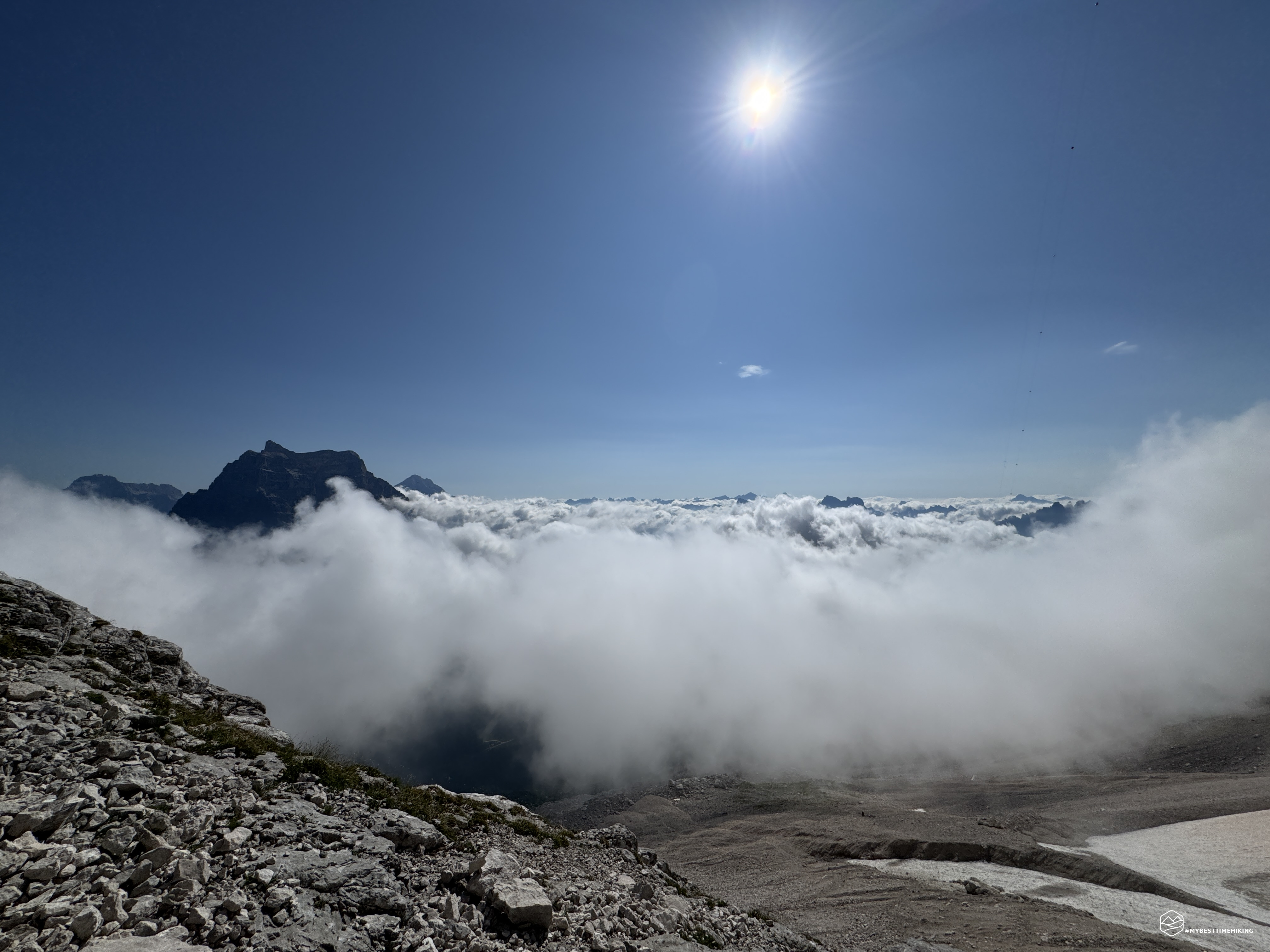
The first three sections of the via ferrata allow us to gain altitude rapidly. On my sides, increasingly vertical walls rise. The void opens up beneath me, while Pelmo, Cristallo, and Antelao tower all around: an unreal panorama, with peaks over 3,000 meters rising from a sea of white clouds.
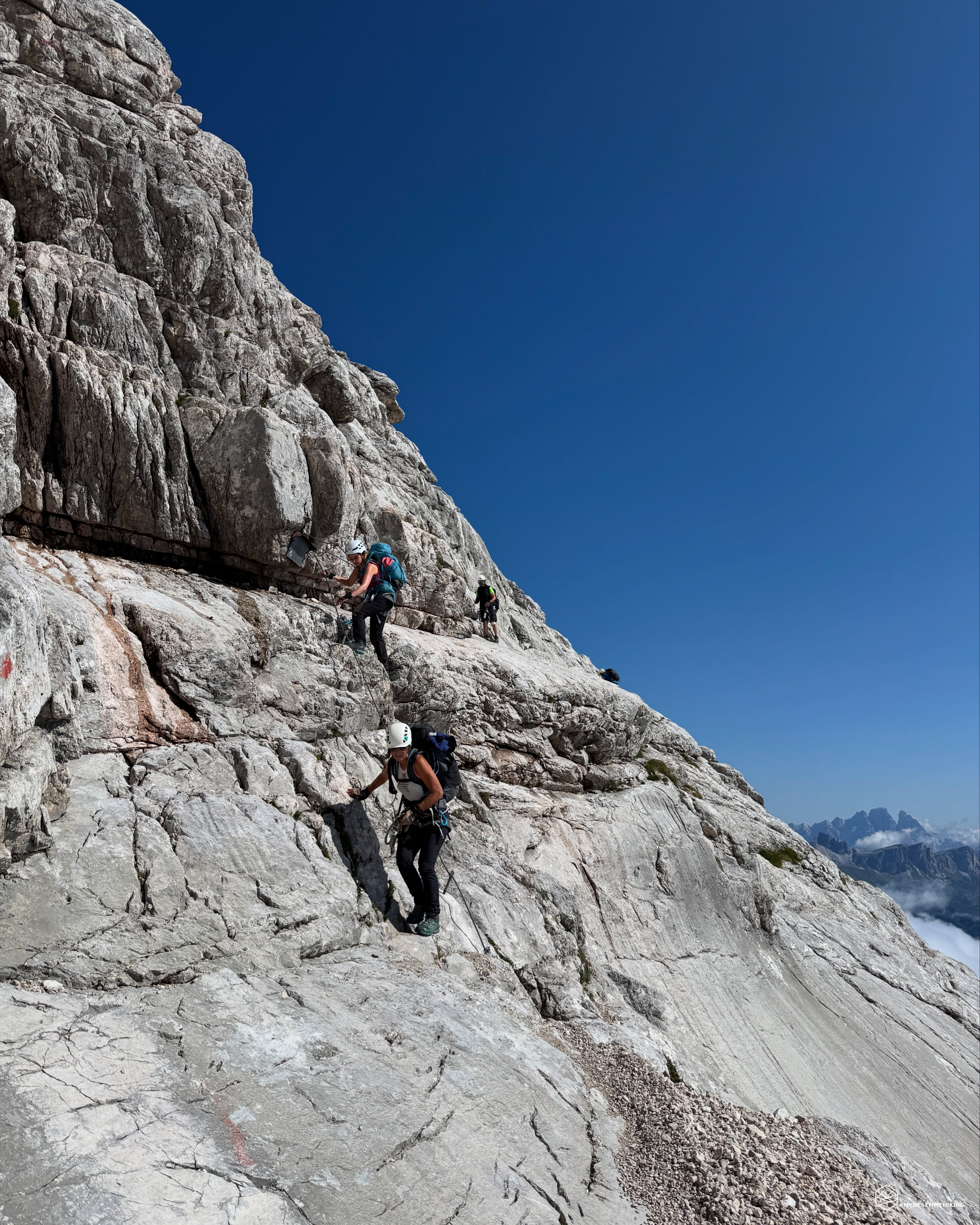
The route is easy, never truly difficult: vertical sections alternate with short hikes on scree and slabs. Some recent bolts offer secure footholds, even in otherwise smooth and treacherous spots in the damp. After a series of equipped sections and short scrambling, I reach sections 6 and 7 of the via ferrata: the famous Passo del Tenente.
A large clearing invites a break before the crux. Here, a sloping slab with an old handrail is now well-equipped with wire rope. Below, a slide of smooth rocks plunges into an abyss. A passage not for the faint of heart.
I am pleased to report the origin of the name "Passo del Tenente", as further explained by Prof. Marinelli:"This is the origin of the name. Perhaps 10 years ago, Piovanèl's son was given the chance to accompany an Alpine officer, I believe, to the summit of Civetta, who completed the trip without difficulty; but on the way back, having reached this difficult pass, he was seized by panic and, thrown into despair, he steadfastly refused to cross it, begging the guide to let him go even if he died of hunger. The matter was serious, especially as it was getting dark and the weather looked threatening. So the guide had a heroic resolution. Having crossed the pass again with a bottle of rum, he made the officer drink enough to get him drunk and thus, excited, he pulled him to safety across the abyss. In reality, the pass presents a very relative difficulty and danger: barefoot or simply wearing a stocking or shoe, it is a passage that anyone who does not suffer from vertigo can easily do; wearing shoes and especially bolted and iron-clad, the risk becomes extremely serious. Let us imagine a sort of stone ledge extending horizontally for a couple of meters, and which, just 40 centimeters or so wide, rounded, smooth, and perpetually wet with a trickle of water, overhangs a slab of rock inclined at an 80°, no less than 30 meters long, as we measured. This, in turn, overhangs an abyss, the depth of which we could neither measure nor estimate. Nor is that enough. Above the ledge rises a rough rock wall, rugged and protruding, so much so, however, that it offers more of an obstacle to the passage of even a frail body than one that can hold on to the fingers seeking support and assistance.
Everyone agrees: this is the key passage of the ascent. Marinelli describes the next section as follows: "However, it continues like a climb, with occasional alternations of snow and rockfall for about three hours, that is, up to the hollow (about 3,000 m) where the surveying team was camped in 1885." Personally, I think it deserves a few more words.
The via ferrata continues through gorges and vertical walls. Some sections of more technical scrambling (up to grade II) require caution, although not particularly exposed. The signage—closely spaced red dots—is all too clear: it makes it impossible to get lost, but it takes away some of the excitement of orienteering.
At about 2,700 meters, I reach a critical point: a small waterfall, the flow of which varies depending on the season. On the way up, it's manageable thanks to the handholds, but on the way down, it can prove slippery and treacherous, especially because it's not equipped. There's no ravine below, but a fall could still cause serious trouble... at over 2,700 meters above sea level.
I turn: the view behind me is breathtaking. Clouds envelop the peaks, while the rocky ridges of Civetta frame the view. I continue, zigzagging between equipped sections, until segment number 19, the most vertical, but never too exposed.
Here comes the end of the via ferrata. We're at 2,900 meters, in sight of the Torrani refuge. Above me, the cableway carrying supplies. The refuge appears a few minutes away. The last few meters are a pleasant climb, alternating with sections of trail.
And there it is, the Torrani refuge at 2,984 meters, nestled in the rock, just as Marinelli described it in 1885. The manager is eating lunch: it's 11:30. From the start of the via ferrata, it took me exactly two hours. I enjoy a Coca-Cola and set off again: the summit awaits me! The clouds from the Val Zoldana are becoming threatening.
Date
19-07-2025
Distance
14.01 KM
Hike type
Alpinism
Ascent
1800 mt
- Mountain
Monte Civetta
- Address
Pècol, Val di Zoldo, Veneto
- Altitude
3220.00 m
- Refuges
Rifugio Torrani
- Information
I'm approaching the point where I had to give up in 2017. A couple of newly equipped sections allow me to quickly reach the final pyramidal portion of Civetta. While up until this point the rock was beautifully compact and solid (though at times smooth and potentially slippery), the summit now resembles a classic scree slope. Majestic rocks, balanced in a seemingly unstable way, juxtapose fine-grained rocks with medium-grained rocks chipped over time, sharp as blades. Prof. Marinelli describes this final stretch thus: "Below the saddle we reached [Rifugio Torrani], the rock was good, to use a mountaineering phrase, that is, it was strong enough for hand and foot; but the upper ridge is made of a crumbling limestone, easily crumbling, rotten, as the mountaineers say. To put it briefly, that pyramid or that terminal ridge is a landslide, but a landslide made up of enormous boulders, leaning one on top of the other in an unstable balance due to the steep slope, and therefore very mobile, cracked, brecciated, and also crumbling in all the numerous angles, in all the numerous edges with which they are bristling. It is a horribly beautiful scene, that ruin; but also extremely painful and dangerous."
I couldn't describe it better.
I surpass the 3,100 meters of the first attempt. The summit is there, but it never arrives. A steady gradient, fatigue, and unstable terrain make every step a conquest.
Then, a final stretch of via ferrata, the final scree...
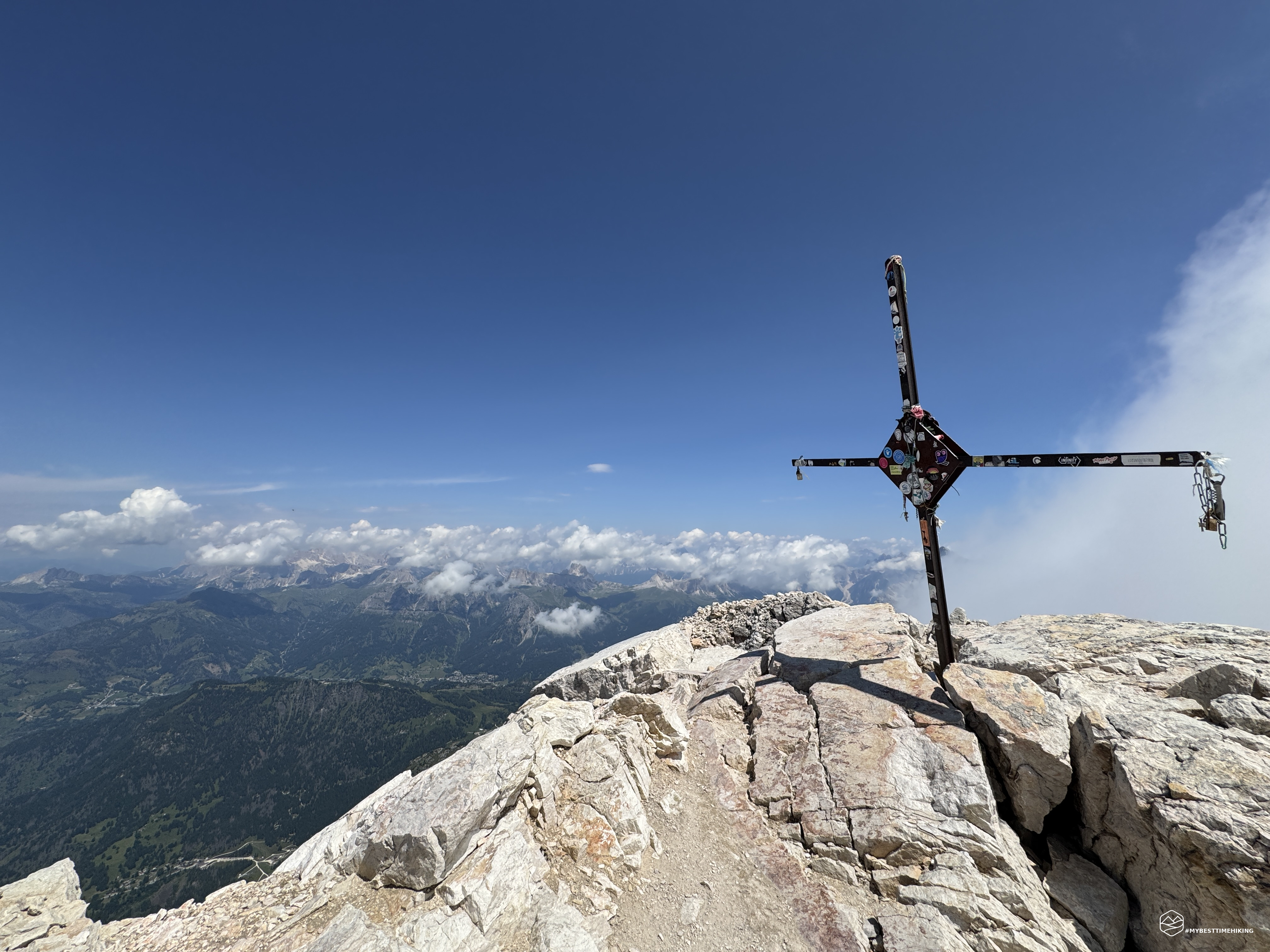
I glimpse the metal cross.
A last look down at my feet to choose the most stable footholds...
And then...
There it is! The summit of the Civetta!
I'm at the summit, finally! After eight years and on my third attempt, I made it!
The view from the Agordino side, with Lake Alleghe in the background, is simply splendid. From up here, the lake looks like a small pool of water, and for a moment I imagine I could dive in and hit it perfectly.
I can make out the Ampezzo Dolomites, with the Tofane, Cristallo, and Croda Rossa. Shifting my gaze toward Cadore, I glimpse Sorapiss and Antelao, before returning to the Zoldo area, where Pelmo stands majestically. On the opposite side, I can see the Moiazza, the Pale di San Martino, and the queen of the Marmolada, even though it's hidden by clouds today.
I'm 3,220 meters above sea level. 1,800 meters of elevation gain have brought me here, before a spectacle that repays all my efforts.
I feel moved to touch the distinctive summit cross and sit on the highest rock, leaving my signature in the summit book. I'm happy. I'm satisfied. Such beauty crowns a dream.
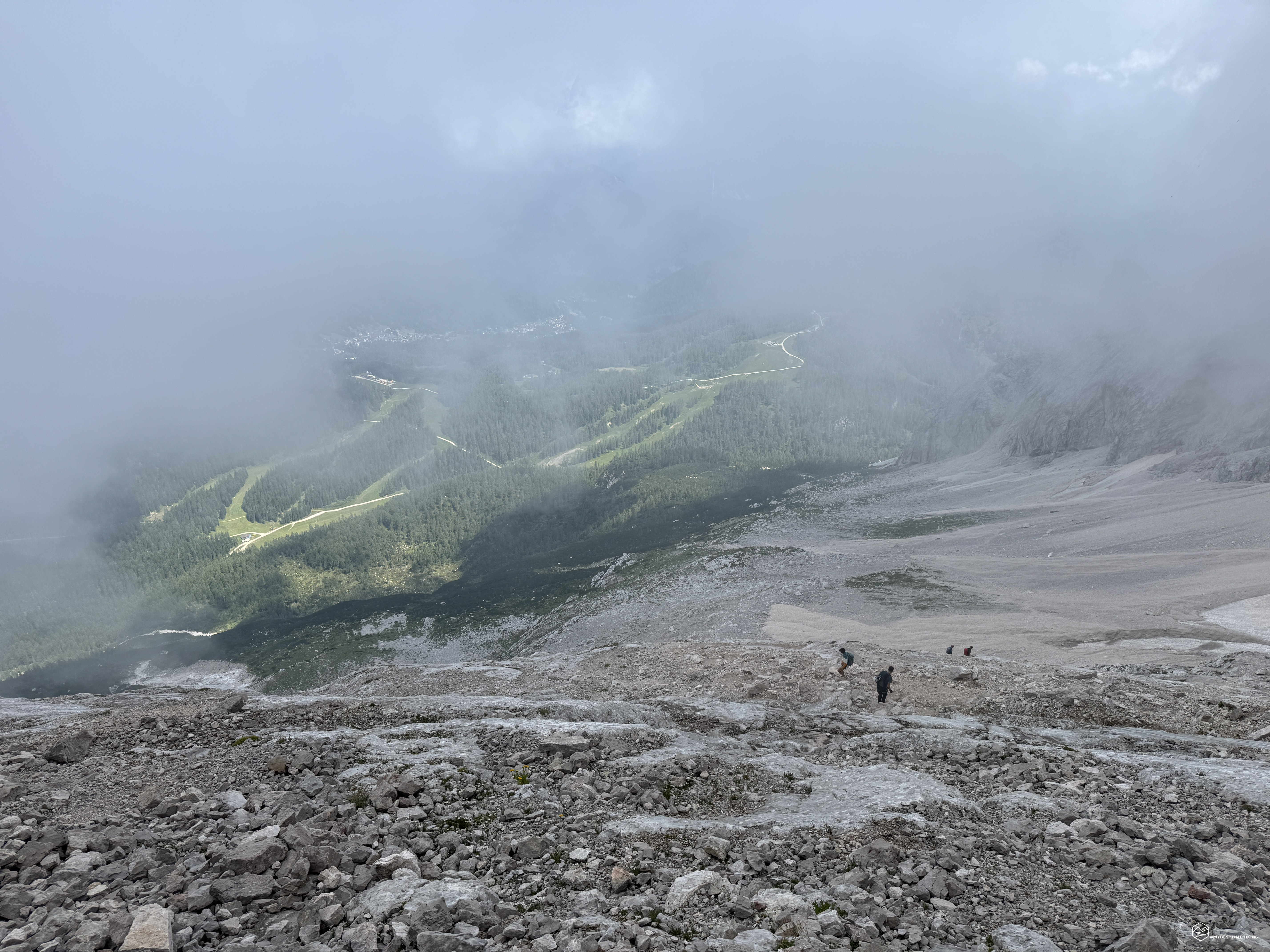
But the weather changes quickly. From the Zoldana Valley, increasingly thick clouds rise, soon completely enveloping Pelmo, Antelao, and all the Belluno peaks. After the ritual photos, I begin the descent, retracing the same route as the outward journey.
The first section is the most technical: the steep slope and loose rock require maximum attention. After losing about a hundred meters of altitude, the sun comes out again, and I can once again see the path that separates me from Torrani. Here I treat myself to another Coca-Cola: even though it's been just over an hour since my previous stop, I feel the need to recharge my batteries and recharge my batteries. I rest a little longer, but not too much: the clouds are getting thicker, turning into fog.
I wrap up and prepare to set off again. The fog, besides limiting visibility, significantly reduces the light. Fortunately, as I mentioned, the Via Normale trail is well marked: the red markers are very close together, and even in the fog, I can always spot the next one. This will be my strategy for the descent: follow the red markers.
The atmosphere is surreal, almost video game-like, and reminds me of Silent Hill. I recognize the same sections I walked uphill, the same via ferratas, but with the change in light and perspective, it seems like a completely new path.
On the way down, the progression changes completely. I reach the waterfall, now much larger than in the morning. The surrounding rocks are wet and slippery: I need to be extremely careful.
Here I am again at the Tenente Pass. Here I experience one of the strongest sensations of the return: the fog envelops everything below me. After the first rock drop of a couple of meters, in front of me... nothing. It feels like I'm looking out into the void. And indeed, that's exactly what it is. The smooth rocks are now wet, but thanks to the via ferrata, I manage to safely overcome them.
I retrace the "Civetta scar" (as Marinelli indicated) and find myself outside the via ferrata, at the last patch of snow still visible. I remove my gear while mentally retracing the entire route.
I'm quite exhausted: the descent seems never-ending.
Now Mount Civetta is completely shrouded in gray clouds, though fortunately they don't bring rain. In front of me, the Zoldo Valley is illuminated by the sun peeking through the clouds. Even Mount Pelmo is sporting its signature cloudy "hat."
An exceptional, thrilling adventure, full of variations in the ascent and studded with magical views. The summit is rewarding, even moving.
It's a peak that requires excellent physical fitness, altitude experience, and the ability to endure fatigue. It's reserved for experienced hikers, with mandatory via ferrata kit. A word of advice: don't venture out without proper preparation. We're talking about a 1,800-meter elevation gain in a 7-km climb. The total route is 14 km, which I completed in about 10 hours (including breaks).
Another essential tip: set off early in the morning so you can reach the summit around noon. This will guarantee you both a good view and enough time to return before sunset.
One of the most beautiful peaks I've ever reached: never boring, always varied, with equipped sections, scree slopes, and scrambling sections.
I'm truly happy to have succeeded, alone, in this undertaking.
And, considering my previous attempts, I can truly say: third time lucky!
Click here and watch the exclusive video on YouTube for an even more immersive experience!
DifficultyExpert Hikers with Equipment - The equipped routes (or via ferrata) are indicated, they require the use of self-insurance devices. |