Details
-
 Hike type
Ferrata
-
 Difficulty
EEA
-
 Distance
9.54 KM
-
 Altitude MIN
1849.00 mt
-
 Altitude drop +
800 mt
-
 Parking
-
 Landscape

-
 History
-
 Duration
5h 30m
-
 Altitude MAX
2649.00 mt
-
 Altitude drop -
-800 mt
-
Hike type
Ferrata
-
Difficulty
EEA
-
Distance
9.54 KM
-
Altitude MIN
1849.00 mt
-
Altitude MAX
2649.00 mt
-
Altitude drop +
800 mt
-
Altitude drop -
-800 mt
-
Duration
5h 30m
-
Landscape
-
History
-
Parking
Today's adventure is a mix of excitement, history, exploration, and technique. A comprehensive excursion that developed step by step and wasn't fully planned at the start. There was only one goal: to find the historic late-18th-century boundary marker between the sheer walls of Ra Gusela!
We set off from the Giau Pass with the legendary Marco (Julian Ross), a fellow explorer, his partner, and Angelo. We park the car at the top of the pass, in front of the restaurant/bar. The day is beautiful; there's not a cloud in the sky right now, even though the forecast predicts rain in the early afternoon. For this reason, today's adventure should be quick... it should be.
As I was saying, we have one goal: the historic boundary marker that marks the late-18th-century Giau border between the Venetian Republic and the Austro-Hungarian Empire. With our backpacks on, we set off on CAI trail 443 toward the Ra Gusela via ferrata, whose distinctive peak, named after us, delights us with its beauty and grandeur.
The trail is fast, weaving between rocks, mountain pines, and patches of grass. Slightly descending, we quickly reach the fork at 2,204 meters near a gigantic boulder. On the left, the trail leading to the via ferrata climbs. We leave it aside for now and continue straight on trail 443 for a few hundred meters.
At an orange-black peak that we see jutting out from Ra Gusela to the west, we also leave the CAI trail and, continuing west, we approach the foot of this pinnacle, known as Torre Luisa. There is no obvious path; we pass between rocks and patches of grass and mountain pines. The pinnacle is clearly visible, with a recent landslide to the right creating a scree slope inviting the climb. Two cracks, one more pronounced to the right and one more slender to the left, mark our objective. Angelo, with eagle eyes, immediately notices a white patch and a red point on the Dolomite face several hundred meters away: it's our license plate! At the smaller, slender crack, using the camera's zoom, we can truly see our destination!
On the right, there's a small scree slope formed by a recent landslide, inviting the climb. This is the best route to approach the walls, but at the first rocks that vertically block the path, I recommend keeping left and moving towards the obvious stands of mountain pines, which allow for a more comfortable and safer ascent. This leads to a sloping grassy patch where the traces of an old trail, or at least a route that was traveled in the past, are evident. A lone fir tree indicates the correct route up and announces, after a very short scramble on all fours, the arrival at the historic marker!
As reported in the 1905 book "Guide to the Ampezzo Valley": "Mount Giòu lies on the territory of the Kingdom of Italy and is a disputed wooded plateau with pastures, the disputes between the inhabitants of Ampezzo and San Vito were only resolved in 1753; and as a boundary line, a long wall (Marogna) was built in the same year from one cliff to the other. It is reached by the road to Pocol and Pezziè de Perù. Once there, continue in the same direction on a good path through the woods; then turn left of the valley and, after crossing the boundary wall, enter this extensive pasture. […]".
The border wall referred to is the Giau Wall, the Marogna Wall. I've already detailed this historical detail in the article in which Diego and I searched for the historic boundary stone at the foot of the Lastoi de Formin. For those who want to learn more and relive that adventure, here's the blog link: The Giau Wall and the Lastoi de Formin.
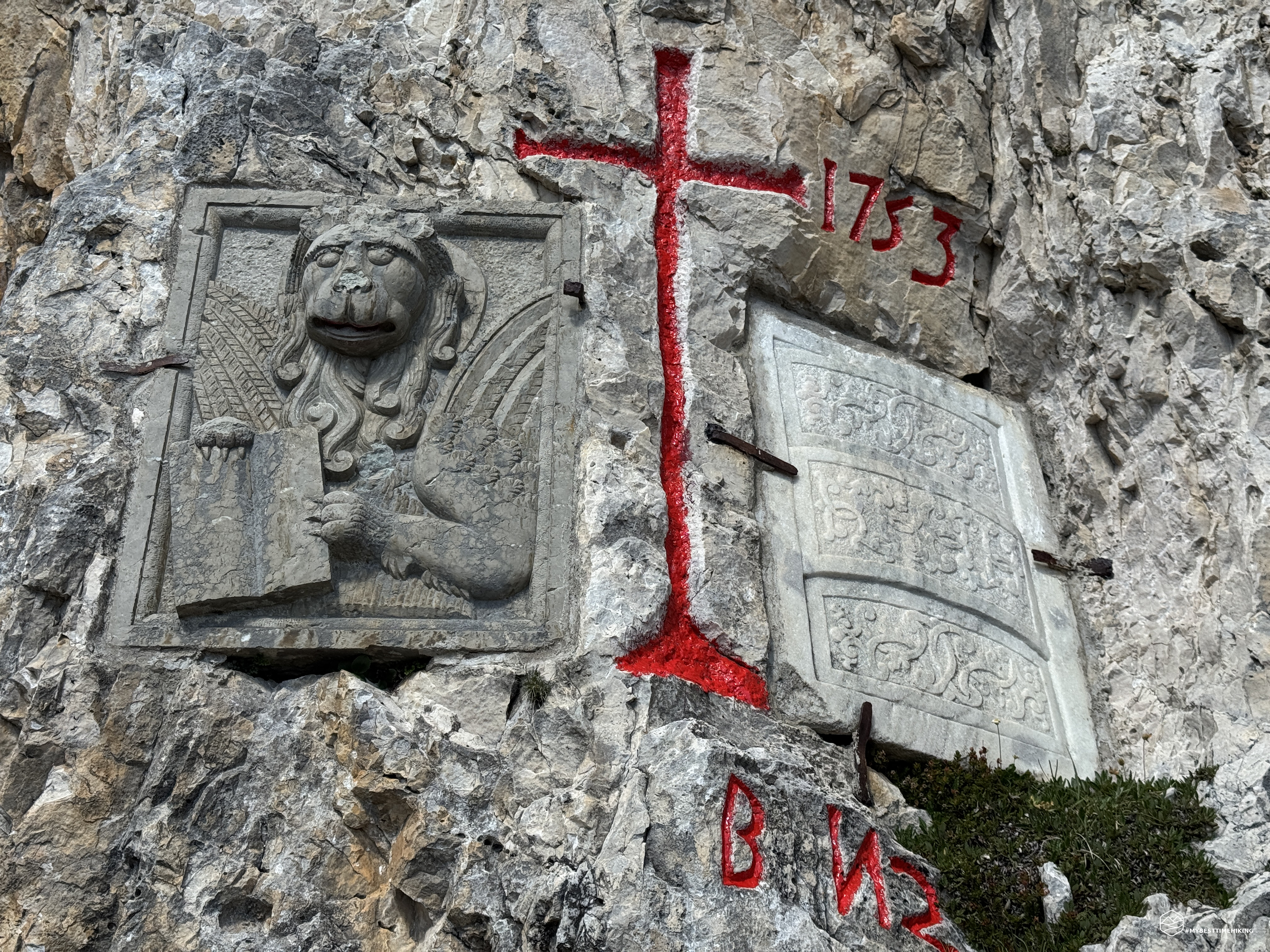
The plaque in question mirrors what we've already seen at the Lastoi de Formin: on the Ampezzo side, there's a white stone stele, almost marble-like, with stylized designs; on the left, there's a depiction of the Lion of St. Mark, symbolizing the Serenissima Republic of Venice. In the center is a majestic cross painted red with the year 1753. This work was created in 1753 by the inhabitants of San Vito di Cadore to demarcate their grazing area due to disputes that had been going on since 1300. The wall was originally 2 km long and 2 meters high. For those who wish to delve further into the subject, I refer you to the aforementioned article, which includes notes by Paul Grohmann and his 1862 book "The Discovery of the Dolomites," as well as a thesis by Dr. Annamaria Pozzan.
We savor the moment, turning around and admiring the spectacular view, searching for the boundary line of the wall that ran straight from Lastoi de Formin to Beco de Ra Marogna, before making a 90-degree turn to arrive exactly where we are now. A sight that sends shivers down our spines, thinking about the wealth of history we're reliving!
After the obvious ritual photos, we retrace our steps to rejoin the Ra Gusela via ferrata trail, CAI 438. We choose to cut across the mountainside, staying at an altitude of 2,300 meters and "digging" through grassy crags and loose rocks. The route is pleasant and never dangerous, almost certainly more convenient to use to reach the boundary stele, although more difficult to locate. Soon, at about 2,330 meters, we reach the CAI trail, where astonished hikers don't understand why we've come this arduous route.
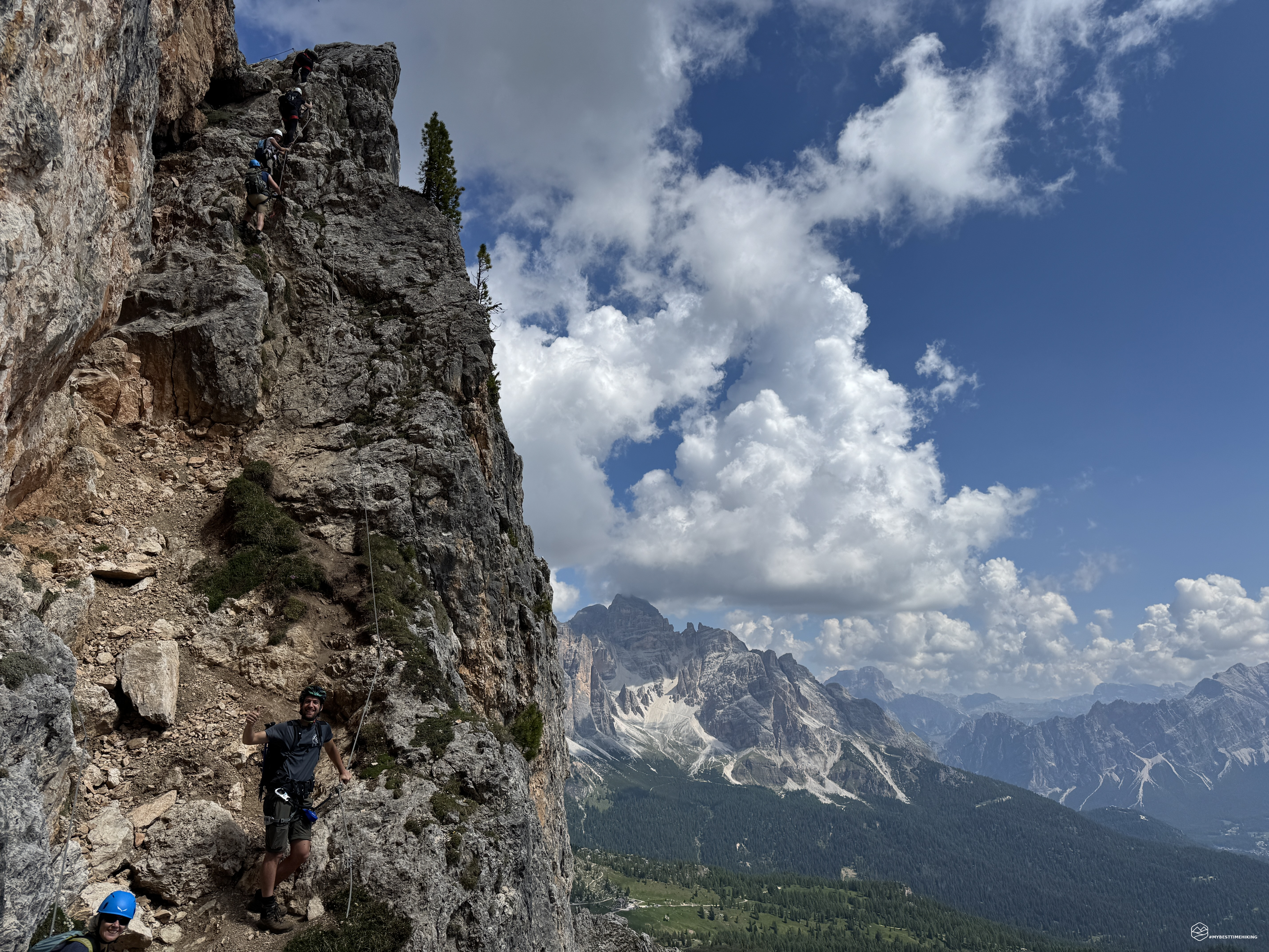
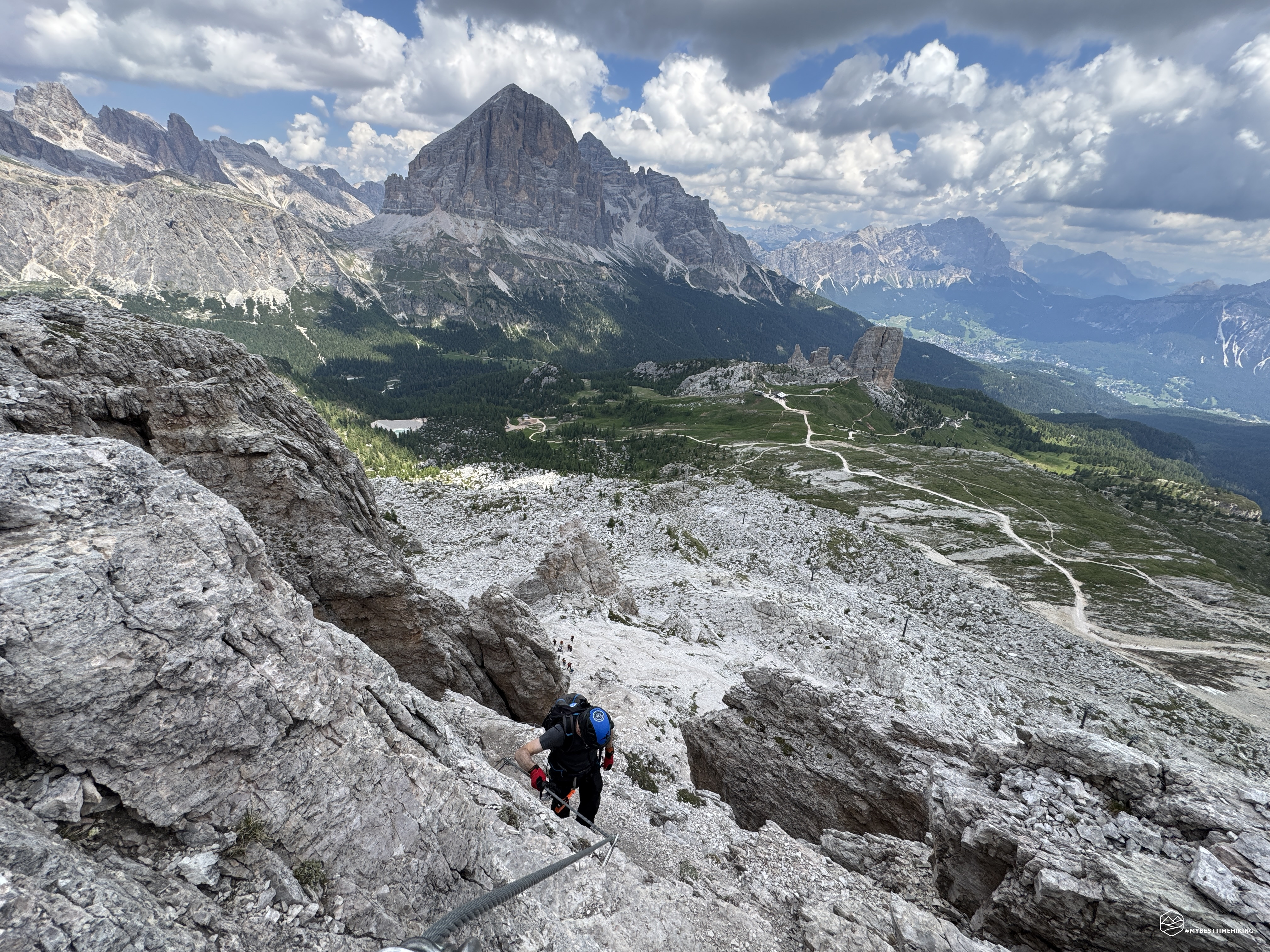
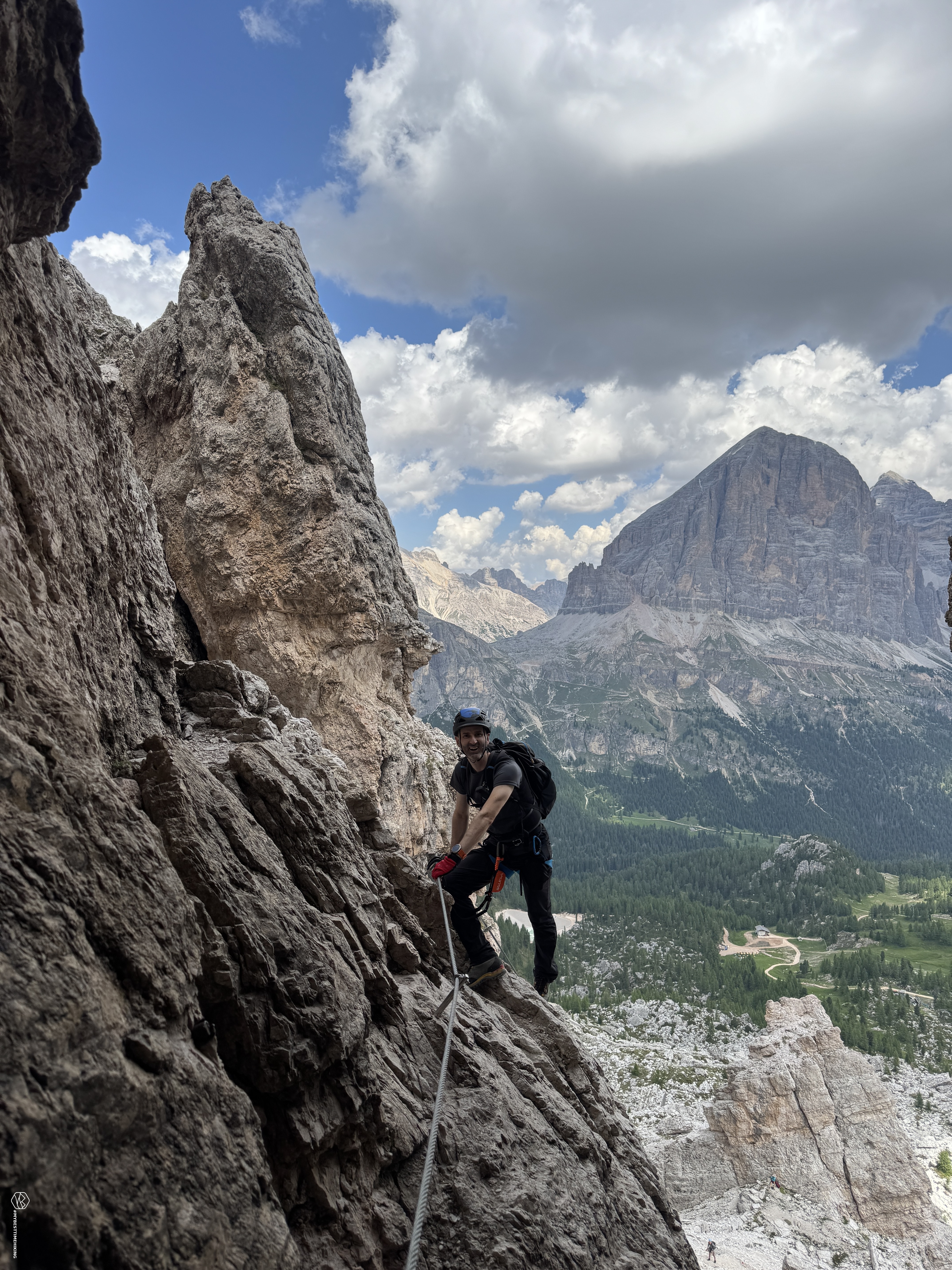
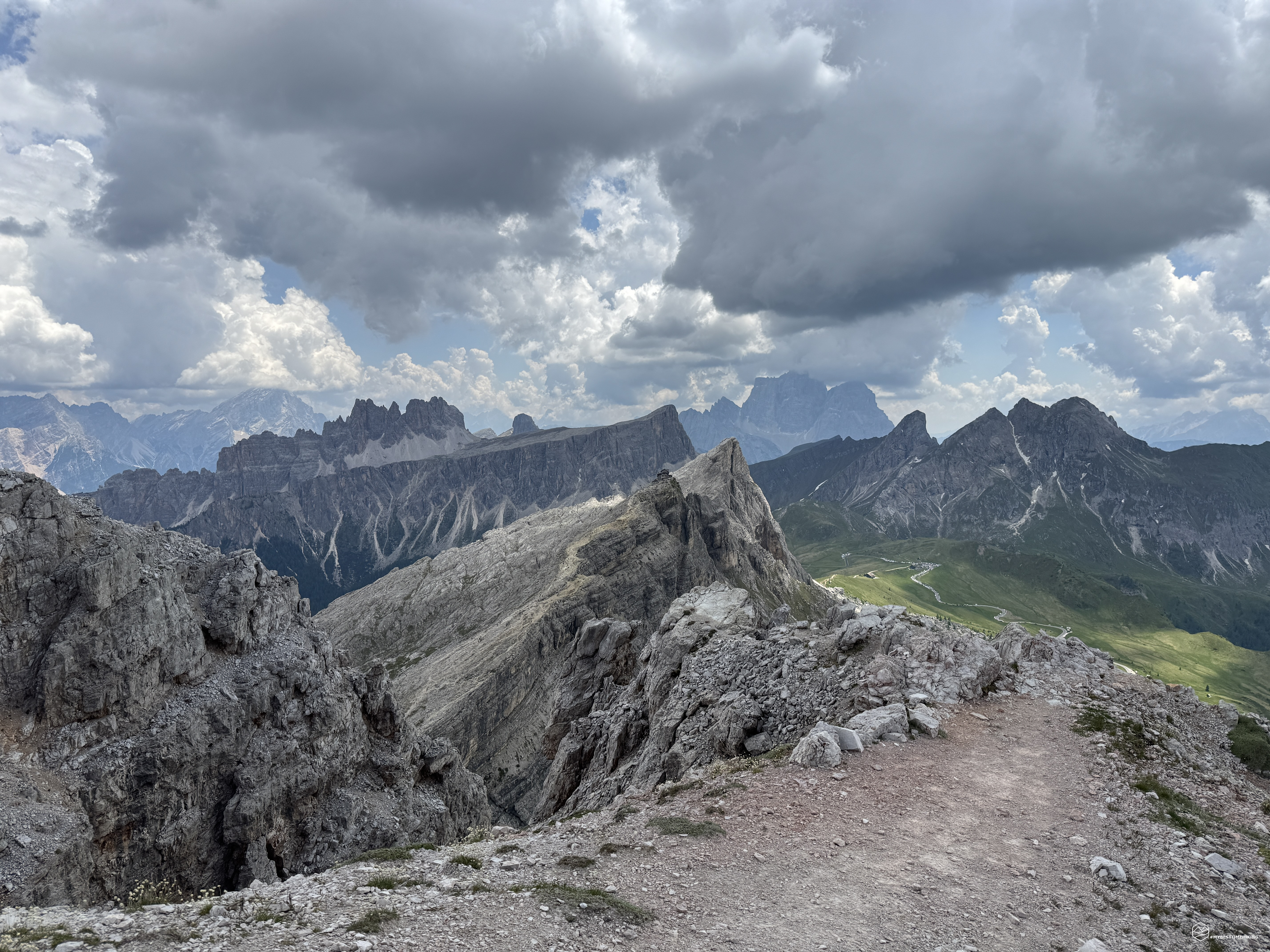
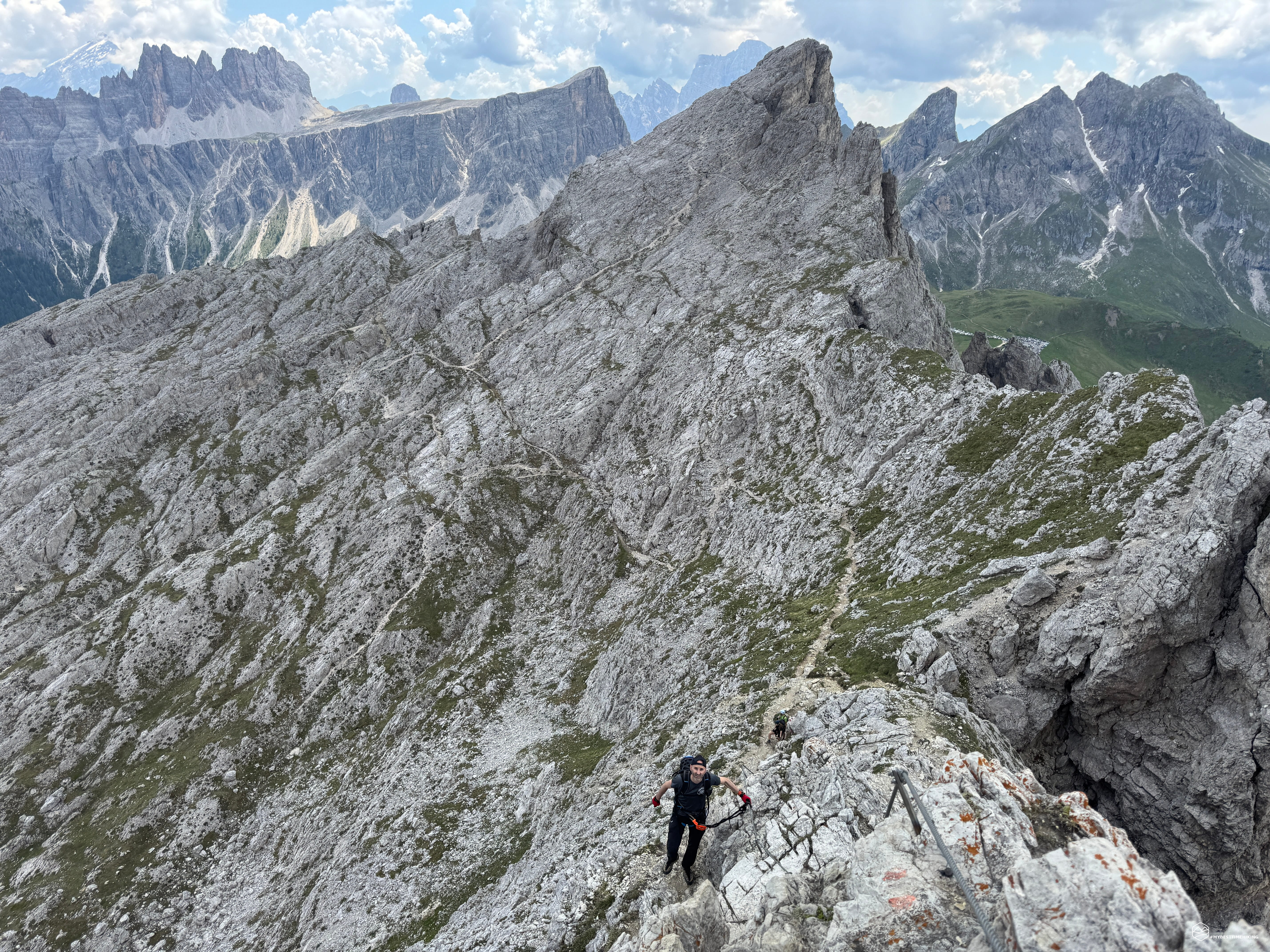
Now we continue along a comfortable uphill path until we reach the saddle behind the Torre Luisa, which we left earlier. A splendid view of the Tofane mountains is worth a souvenir photo. Here, you can don your harness, via ferrata kit, and helmet to be ready to access the equipped section that awaits us. In a few minutes, we reach the first metal handrail that leads us to the most vertical section of the Ra Gusela via ferrata: a sheer rock face with comfortable handholds that allows us to ascend about 30 meters in altitude thanks to the via ferrata section. This thrill lasts a very short time, less than 15 minutes, for a very easy via ferrata, suitable even for those new to this type of activity.
Date
20-06-2026
Distance
9.54 KM
Hike type
Ferrata
Ascent
800 mt
- Mountain
Ra Gusela, Nuvolau, Averau
- Address
Passo Giau, Veneto
- Altitude
2649.00 m
- Refuges
Rifugio Nuvolau, rifugio Averau
- Information
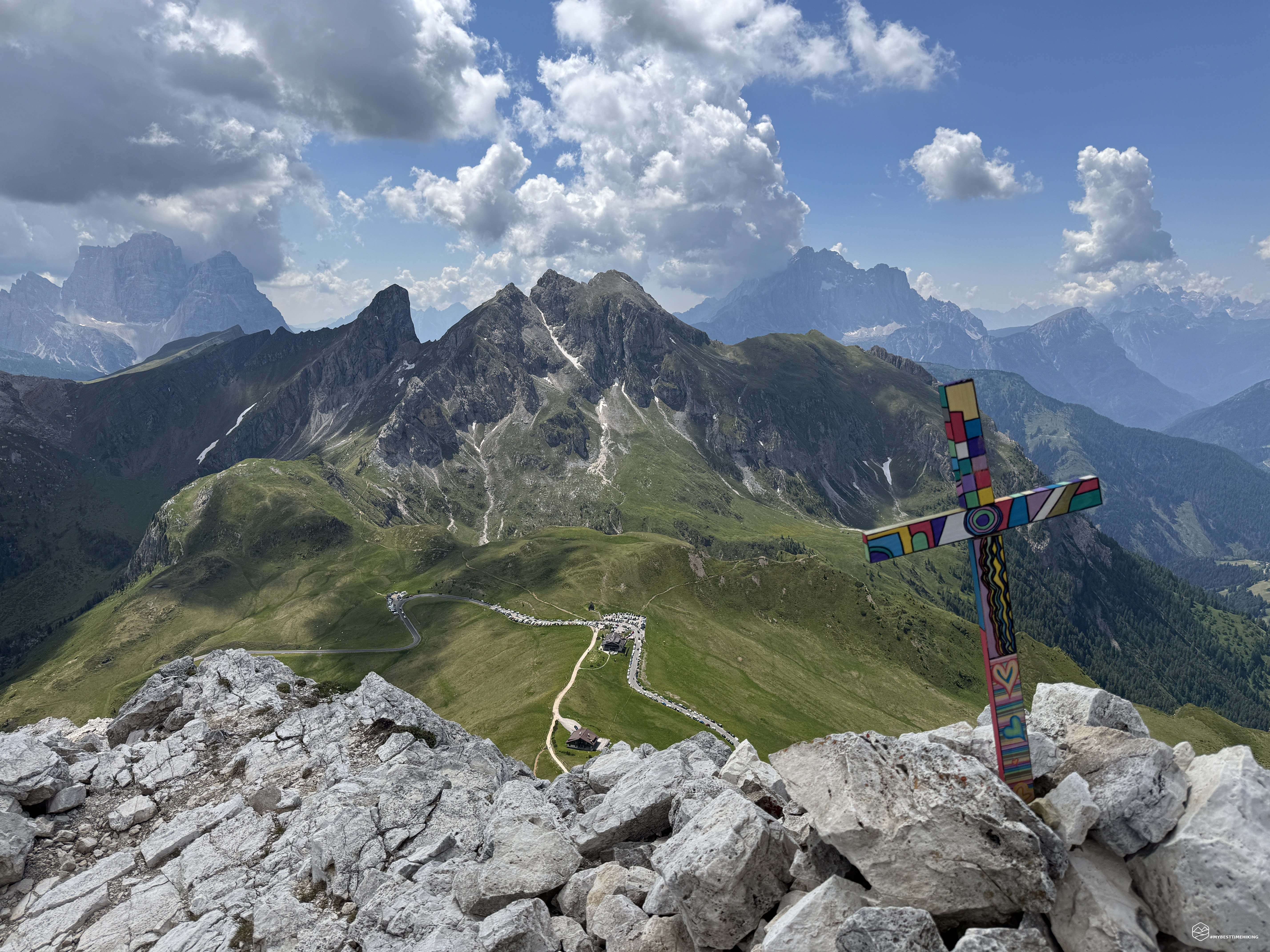
We reach an altitude of 2,450 meters on the Ra Gusela plateau, with a magnificent view of Mount Nuvolau and its refuge rising from the summit. A stroke of genius from Angelo allows us to make the first change to the day's itinerary: the summit of Ra Gusela! There's only a single black dotted section on the Tabacco map, but the mountain's shape and the sight of several people at the summit convince us to give it a try. The progression is very simple; the trail is well marked, although it doesn't have a specific CAI reference. In my opinion, it's not maintained, and for this reason, it's not marked as a trail on the Tabacco map. In just over 15 minutes at a brisk pace, we see the small, colorful summit cross. The final section has clearly recently collapsed, requiring a little caution to negotiate a tricky section. I recommend climbing the rocks easily to the summit to avoid this very short, uneven section.
Summit of Ra Gusela! Unexpectedly, we find ourselves at the highest point of the characteristic peak of the Giau Pass, looking down on us 350 meters below. Before us lies an exceptional, breathtaking panorama: from the Civetta face, past nearby Mount Cernera, Mount Pelmo nestled with the Lastoi de Formin and Croda da Lago, Mount Sorapiss, Cortina d'Ampezzo in the background, framed by Mount Cristallo and Mount Pomagagnon, the Croda Rossa d'Ampezzo, the Tofane, the 5 Torri, Mount Lagazuoi, Mount Averau, Mount Nuvolau, and, to round things off, the Queen of the Dolomites, the sun-kissed Marmolada! A panoramic viewpoint that repays any effort and a summit that can truly be reached by any hiker: a wonderful discovery!
The weather seems to be holding up as expected, and the second addition of the day is born: why not also reach the summit of Mount Averau? No sooner said than done, we defy the weather and continue to modify the adventure!
We then retrace our steps and choose the trail that remains high on the Ra Gusela slope towards Nuvolau. In a few minutes, we rejoin CAI trail 438 for the final stretch of the via ferrata. A metal ladder and a short climb along the ridge make this via ferrata truly enjoyable, offering magnificent views of the Dolomites. We reach the panoramic terrace of the Nuvolau refuge, at an altitude of 2,575 meters, crowded with tourists awaiting a sumptuous meal of polenta. The aroma almost discourages us from continuing, but, stronger than our appetites, we continue down the leaning rocks of Nuvolau, following CAI trail 439, to descend to the Forcella Nuvolau pass at an altitude of 2,413 meters. In front of us, the Averau refuge and the mountain massif of the same name await us with its own via ferrata.
The clear signage allows us to choose the path that climbs to the right, marked "Ferrata Averau." The trail remains virtually at altitude until it reaches the start of the via ferrata via two sharp bends. There are two routes: one for the ascent and one for the descent. This was an exceptional choice by the Cortina Guides, given the large influx of people who reach this peak in the summer. We then begin the ascent on this via ferrata, which is slightly more difficult than the one in the morning. The sections are vertical here, but never as challenging. The holds are always clearly visible and present. Only in a few places do the rocks, slightly smoother from wear and tear, make the ascent more difficult. After the first short section, the most distinctive part, in my opinion, appears: a narrow chimney with bolts that serve as a convenient ladder. The chimney is indeed a bit narrow, and you might rub your backpack against the rock, so be careful.
The final stretch of the route features a vertical progression and a small terrace with a beautiful view of the Ra Gusela we just reached. We thus reach the rocky plateau that heralds the summit. A series of snow patches persist on the trail. The trail is still clearly visible, with red markers. A very short ridge of a couple of meters blocks the way. This section is more difficult on the descent and requires a bit of attention, although it is not at all difficult. We glimpse a small cave at the bottom, undoubtedly a food shelter and warehouse during the Great War. The trail bends sharply south for the final segment. The summit cross begins to appear…
Summit of Mount Averau, 2,649 meters! Second summit of the day, allowing us to enjoy the same idyllic panorama we admired at Ra Gusela. The added bonus is the ability to retrace the entire route from the first summit to the current point, perfectly distinguishing the different sections of the trail. We notice that the weather is about to change, gray clouds are approaching from the Tofane: it's time to descend.
We retrace our steps to the start of the via ferrata, which turns left from the ascent. Pay particular attention to the first section, which drops a few meters vertically onto rocks with good holds but which, in some places, are not immediately visible. An easy traverse allows us to skirt the via ferrata we followed on the way up, before descending on the opposite side. For the less experienced: trust your hiking boots! There are some seemingly thin crimps and, in one spot, the presence of seemingly smooth rock, but which is easily downclimbed due to the grip.
We conclude the via ferrata and return to the Forcella Nuvolau, near the Averau refuge. We descend for a few meters along the wide road that corresponds to CAI trail 464, then take the wilder trail of trail 452, which allows us to remain at altitude and reach the Giau Pass with less effort. There's one caveat: one section of this route isn't easy. There are steep and rugged sections that require a steady step. These aren't technically difficult progressions, but for a less experienced hiker, they could compromise the entire hike, given the presence of some sections where you must physically hold onto the rocks to avoid slipping. It's a short section, but it's still worth anticipating.
As soon as the car appears at the Giau Pass, the first drops of rain appear: just in time before the adverse weather conditions.
This magnificent adventure, which was supposed to be a speed hike, ends: it turned out to be a blend of emotions and peaks that are hard to match. From the history, to the conquest of peaks with incredible views, to the two different via ferratas that, although of moderate difficulty, added a touch of technicality, enhancing the hike. The total elevation gain of the adventure is only 800 meters, and the distance isn't very impactful either, as it's less than 10 km long. The entire route, including scrambling to explore the historic marker, takes less than six hours to complete. It's an adventure that should be undertaken with caution and by hikers with some experience at high altitude.
Click here and watch the exclusive video on YouTube for an even more immersive experience!
DifficultyExpert Hikers with Equipment - The equipped routes (or via ferrata) are indicated, they require the use of self-insurance devices. |