After a long period of forced stop, here we are back with a new adventure in the Cortina d'Ampezzo area. Together with the inseparable Diego and the stubborn Riccardo, already a companion on the excursion to the Rauhkofel fork, we are leaving for a unique adventure to rediscover a route traveled more than 100 years ago during the Great War. A track at the foot of the Cristallo group, west side, and more precisely in the Forame area, place of bloody and bloody battles between the Italian and Austro-Hungarian armies. The path that we are going to rediscover and reopen was used during the First World War by a group of Cadore volunteers and by the Alpine regiment of the Fenestrelle Battalion.
We reach Ospitale, on Strada Statale 51, just before arriving in Carbonin. We park the car and observe from here the mountainous coast entirely covered in scrub and mountain pines that awaits us. In front of us, in fact, we have the beginning of the Foramen, still gently covered by vegetation, which hides the steep watercourses and rocky gullies. A few weeks ago Diego had already traveled part of this path from south to north and had to stop due to a rocky jump that was unmanageable at the time. Today, however, we are trying to do the reverse route, i.e. from North to South, to be able to find a more comfortable route and overcome the key point that made Diego give up on the first adventure.
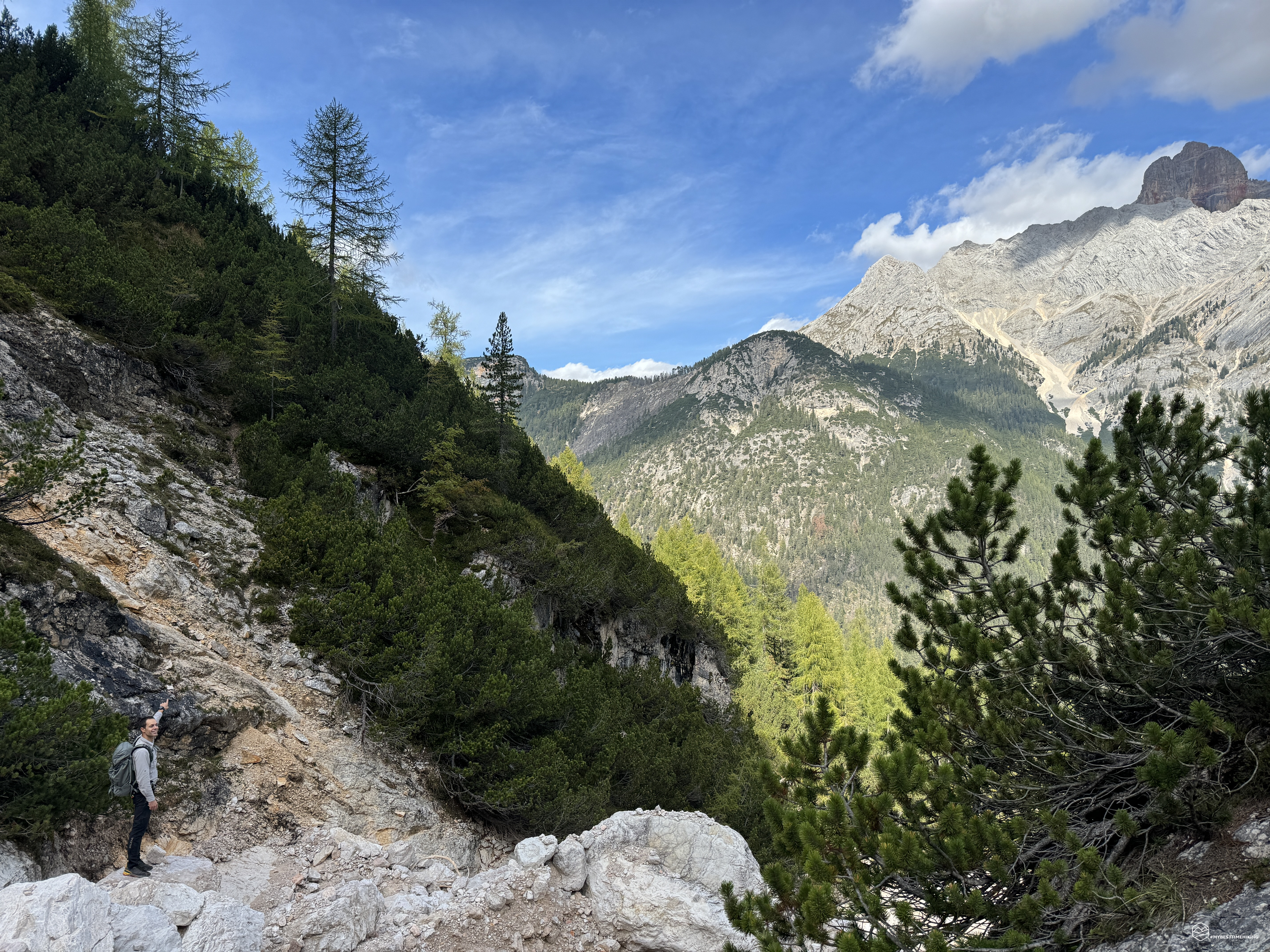
We get off the main road and head towards the San Biagio aqueduct (S. Blasius on maps from the First World War era), we briefly intersect the CAI 203 path and enter the woods, choosing a faint trail. At first it seems to get lost, then we find it accompanying furrows in the ground similar to small trenches. We gain altitude, some old cut of orange tells us that we are on the right path. We head towards the Rio Felizòn (Ru Felizòn), a natural barrier that divided the Italian army from the Austrian trenches positioned nearby. We find a route at an altitude of 1590-1600 meters which coincides with the path shown in the maps of the time and which actually runs alongside the gravelly valley created by the Felizòn. Surprisingly, we also notice some rocks with some red marks, most likely this small part of the old path was used a few decades ago to reach the Felizòn sources and the nearby waterfall. We perceive that we are on the edge of the gravelly gully, still too high to descend inside. We continue along the track and at an altitude of approximately 1660 meters we emerge on a small gravelly valley of a tributary of the Felizòn without any particular descent problems. The riverbed is completely dry. The path here has been swept away by floods and landslides and it is very difficult to identify the continuation of the same which heads towards Punta Ovest del Forame. Today's objective, however, is to go up this gully and return a little higher up, returning in the direction of Col dei Stonbe, thus covering the entire halfway itinerary used for the relay to the front.
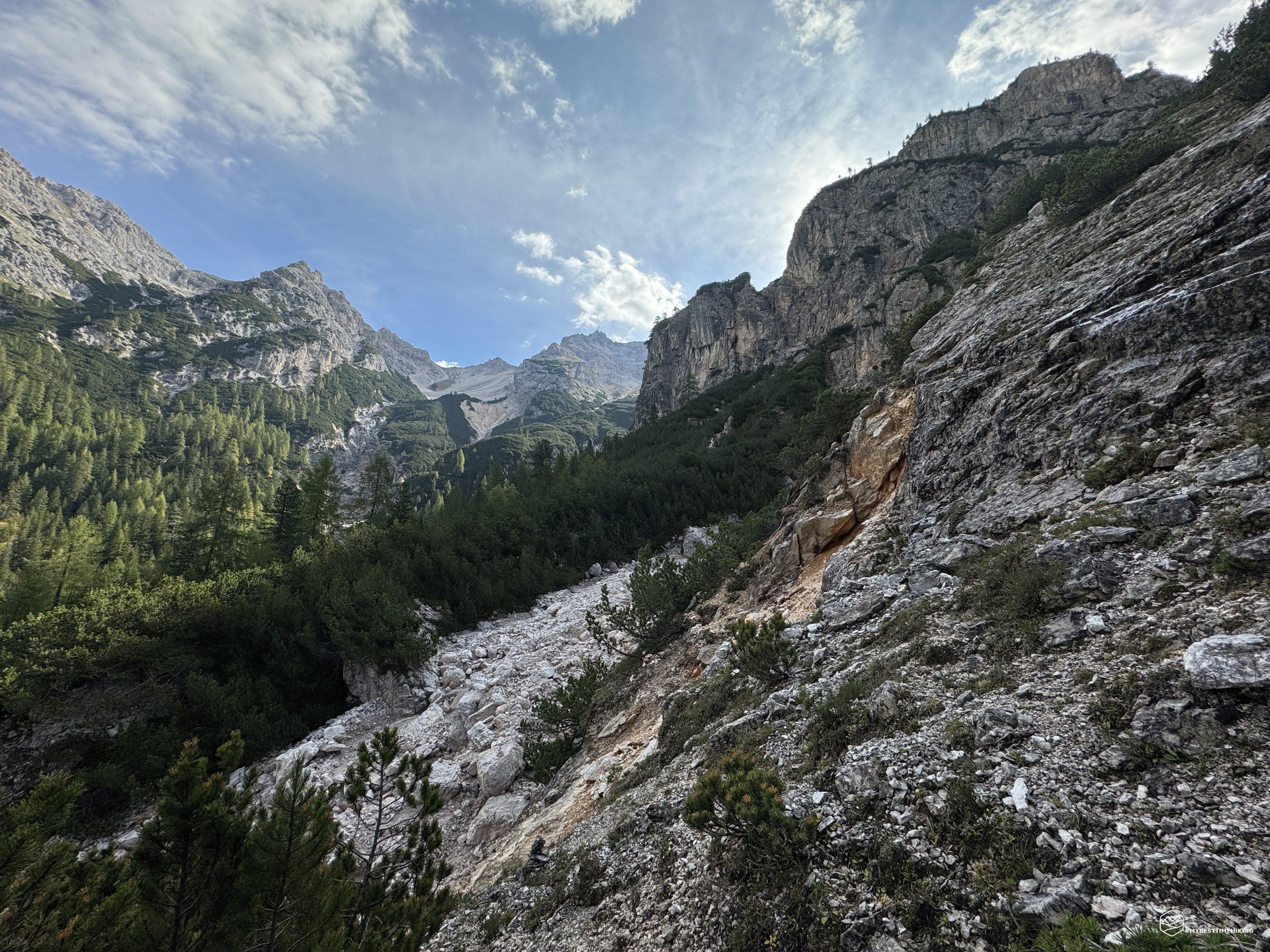
We then go up the riverbed, which is initially very comfortable for progression, then gradually more technical due to the presence of wet rocks. These gravelly watersheds were obligatory passages for the Italian volunteers and Alpine troops. As a result, they were constantly targeted by enemy artillery fire. It is no coincidence that after a few hundred meters of climbing, right on the right edge of the valley, we notice a mortar shot and, all around, shrapnel to remind us how unpredictable and destructive these projectiles could be for the soldiers. . In the book “Secret itineraries of the Great War in the Dolomites – Vol. 3”, Giorgio Tosato recalls an episode of the Volunteer Edgardo Rossaro and his companion Da Rin, precisely on the occasion of a night passage in one of these impluvi. Edgardo wanted to give some advice to his friend before crossing: «Be careful, now in this valley, because they are making a continuous barrage. Follow the line of stones that you can see more clearly, and leave running immediately after a grenade arrives. Let's go one at a time to offer fewer targets...". But the good Rossaro, blinded by the flash of the grenade that exploded immediately after Da Rin's passage, took the wrong route and found himself stuck with his heavy backpack in a rocky cleft, unable to move. The next grenade arrived: «I was pushing with the strength of desperation, pushing on my hands and knees, when I heard a terrible hiss, then a crash that made the stone tremble: I found myself enveloped in a flash and felt a terrible shock throughout my entire body...» . His companion quickly retrieved it. Rossaro had not suffered any injuries, but had lost his hearing due to the strong movement of air. They continued up the hill and rested. Da Rin later told Rossaro that in the meantime he had recovered the use of his right ear: «It's a good thing you can still hear. You can put a light on the Madonna. Tonight when I saw you in the midst of the riots, I thought I had to get you out with the spade."
We quickly realize that we have climbed too much, going above 1800 metres. The expanse of baranci has disappeared leaving only the bare rock. Let's then retrace our steps and expertly check for any clue that could move towards the South, returning to the mountain pines. At an altitude of 1720 we glimpse an unsafe trail in the first stony stretch, but clearly evident when the mountain pines appear. We go up and turning we see a splendid panorama of the Forame and in the background the Felizòn waterfall with the roar audible up to here. To our left stands the Croda Rossa d'Ampezzo with its bright colour.
From a first brief reconnaissance we highlight some very old cuts on the branches of the mountain pines and beaten ground. Some branches have repossessed the route, making it more intricate, dense and wild, but we are sure: this is the path of the Volunteers and Alpini of the Fenestrelle battalion in front of the Col dei Stonbe! In the book “War in Ampezzo and Cadore 1915-1917” Antonio Berti thus described the protagonists of this relay line dedicated to bringing the troops close to the front to gain the positions of the Forame and consequently Carbonin: In mid-August 1916 the Italian command decided to renew the attempt in order to open the road towards Carbonin. The task appears extremely arduous: it is necessary to maneuver on extraordinarily difficult terrain, attack positions that the adversary has carefully chosen due to their natural inaccessibility and has had the opportunity, during the months that have passed since the first attacks, to organize for defensive purposes. The undertaking requires practical mountain soldiers, capable of maneuvering in that terrain so rich in natural and man-made dangers. At the Italian command someone remembers the «Alpine Volunteers of Cadore», a company of authentic volunteers, recruited among the mountaineers of the Cadore valleys, originally destined for territorial service, but, since July 1915, deployed on the front line and already tested by harsh fighting on Peralba, at Passo Sesis, in Val Visdende. Captain Celso commands them Coletti, a pure son of the Cadore land.
Date
30-09-2023
Distance
7.31 KM
Hike type
Hike
Ascent
483 mt
- Mountain
Forame, Gruppo del Cristallo
- Address
Cortina d’Ampezzo, Veneto, Italy
- Altitude
1805.00 m
- Refuges
- Information
Our action to re-open the old path begins with the construction of cairns and the pruning of some minor branches to allow for better passage. Together with some completely cemented cuts, indicative of remote pruning, we also notice some more recent cuts (perhaps from a few decades ago). We thus enter the thick vegetation until we reach a sparse grove where we must be careful not to lose the trail. The trail sign is almost always clear, but still requires experience and orientation to avoid getting lost. The mountain pines now diminish until they disappear, giving way to the fir trees. Here you have to pay attention to a large boulder resting on a trunk from which you deviate sharply uphill onto the grassy coast: we are at an altitude of approximately 1700 metres. Now we gain about 100 meters altitude, we reach an isolated trunk on which there is a tangle of barbed wire. We go up on the left, always on a clear sheep track, and we reach the first watershed to cross. We are at the top of this gully, we leave a little man to indicate the way.
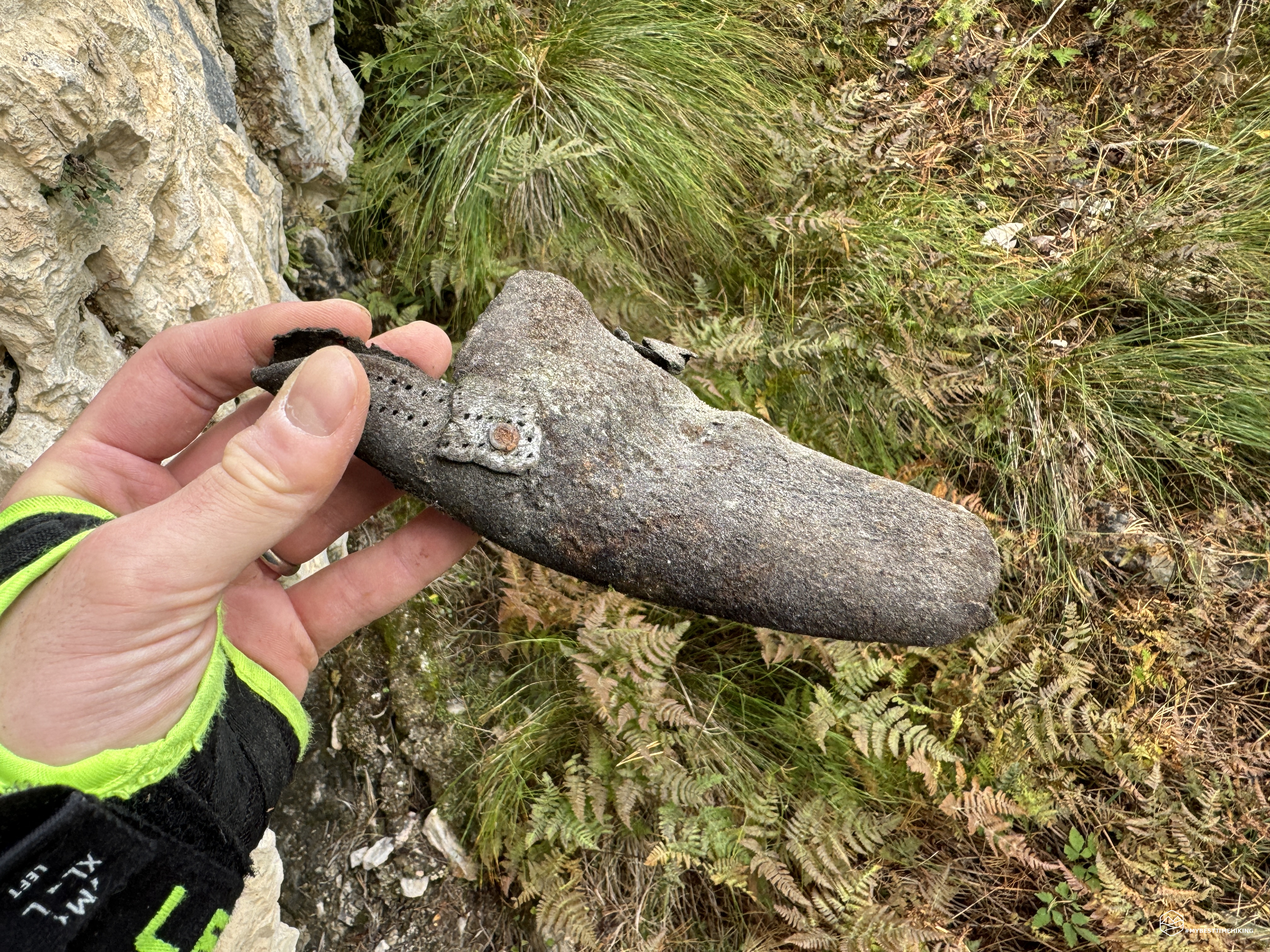
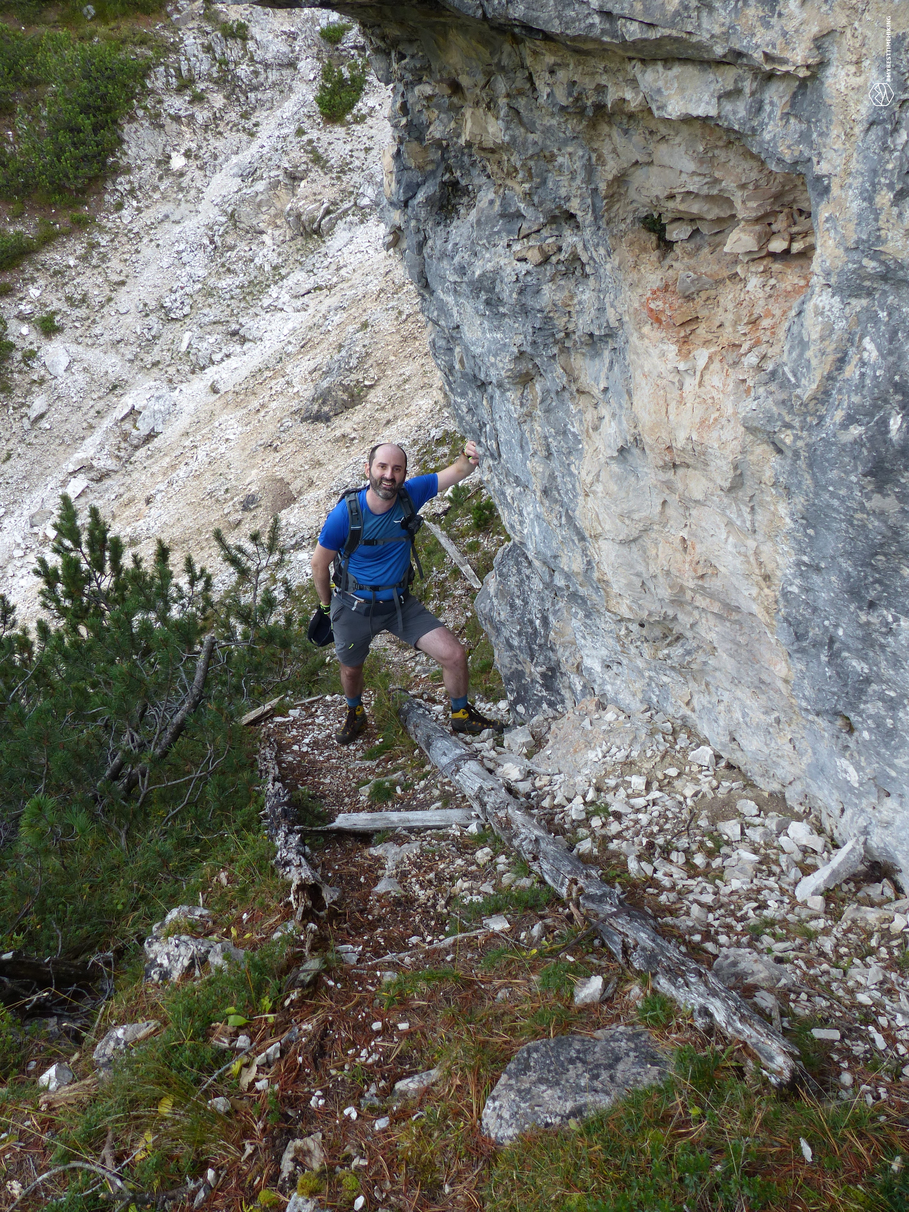
We continue again in the mountain pines in a constant slight climb. We continue like this up to an altitude of 1800 metres, effectively skirting the rocky crags that culminate in the Col dei Stonbe. The second gully we pass is much wider. Always convenient when passing by. The ascent runs alongside a rock where we find the remains of a wooden staircase. Right here we notice a series of remains that indicate the presence of a camp during the Great War: soles and uppers of shoes, ration cans and remains of ceramic plates. We proceed and leave a few boxes on an obvious boulder to form little men for the next visitors.
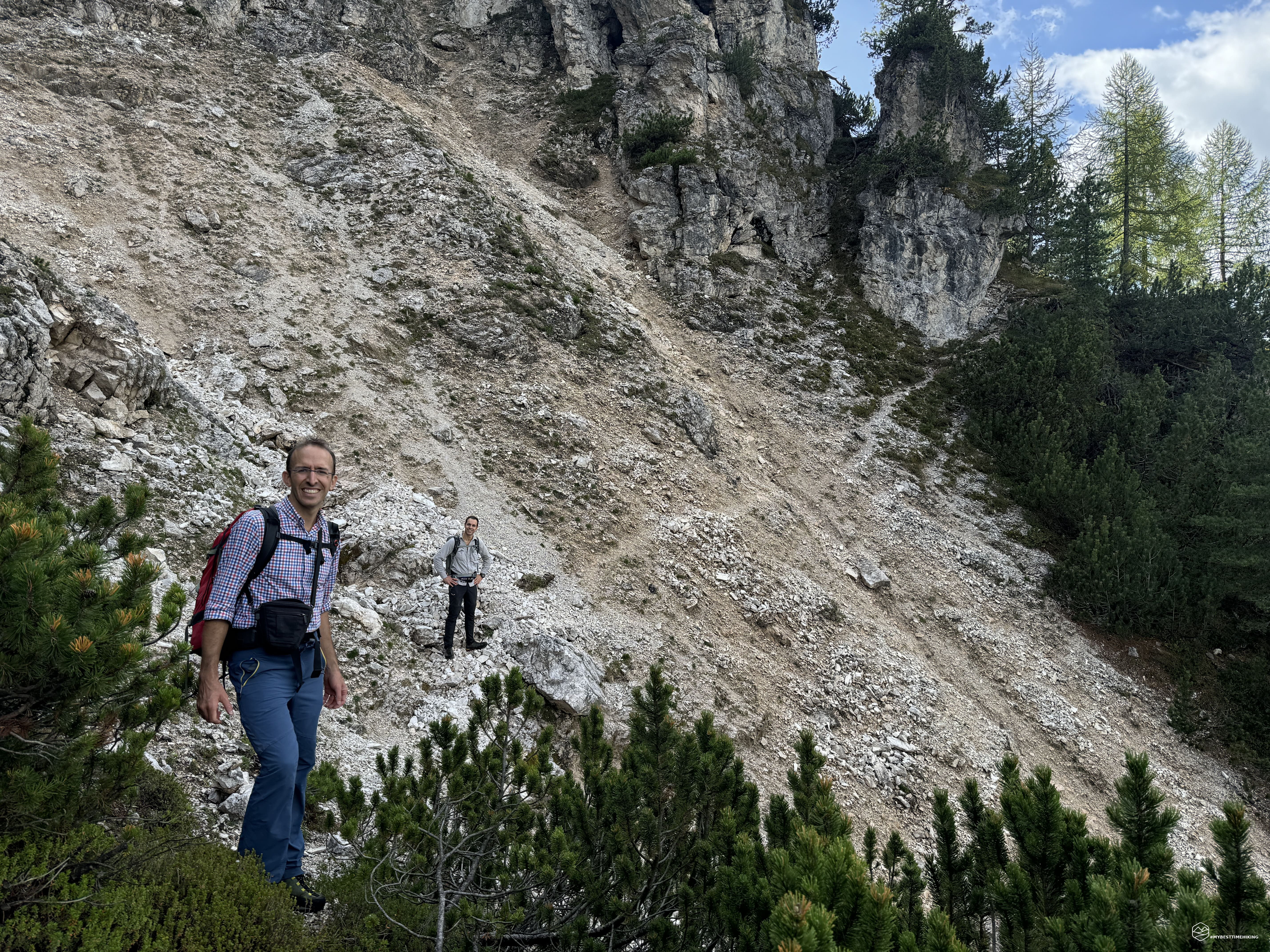
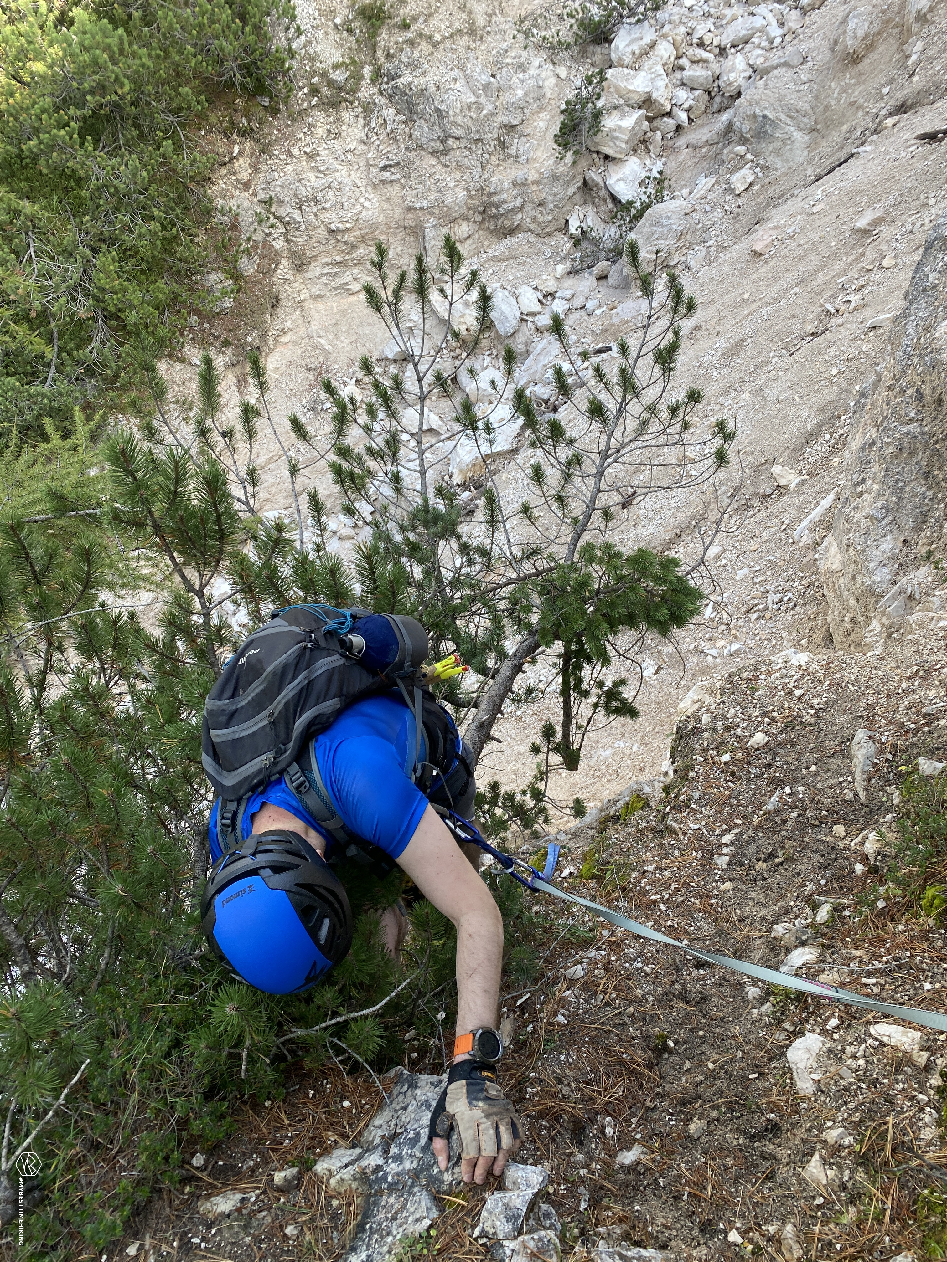
We arrive at the main gully, the one that made Diego give up on his first adventure. To our surprise, firmly attached to a safe trunk, we see an old rope that will have seen dozens of winters in that position. Thanks to this, we managed to descend into the impluvium safely on a non-vertical slope and with several comfortable rock terraces. Once we got down we carried out a search for the best way up. The opposite part of the gully, in fact, is almost vertical with cemented gravel which does not allow you to reach the edge easily. After some research, a short ascent route was identified (however arduous), a few dozen meters lower than the fixed rope used for the descent. Here Diego and Riccardo have prepared and left a series of ropes and ribbons useful for future explorers.
The ascent tested me considerably, I took a short break to recover my breath and clarity before tackling the rest of the adventure which shouldn't have any more unknowns. After another little extrication among the mountain pines we arrive again in the bush where there are many war artefacts. We also notice a stove chimney that indicates the right way to overcome the gully. It's lower than our ascent. Riccardo follows it, confirming it as the best way to descend into the impluvium coming from the South-North direction. In fact, from the route we took today in the opposite direction, it is difficult to find. A new survey will be needed to adequately indicate this variant with omit.
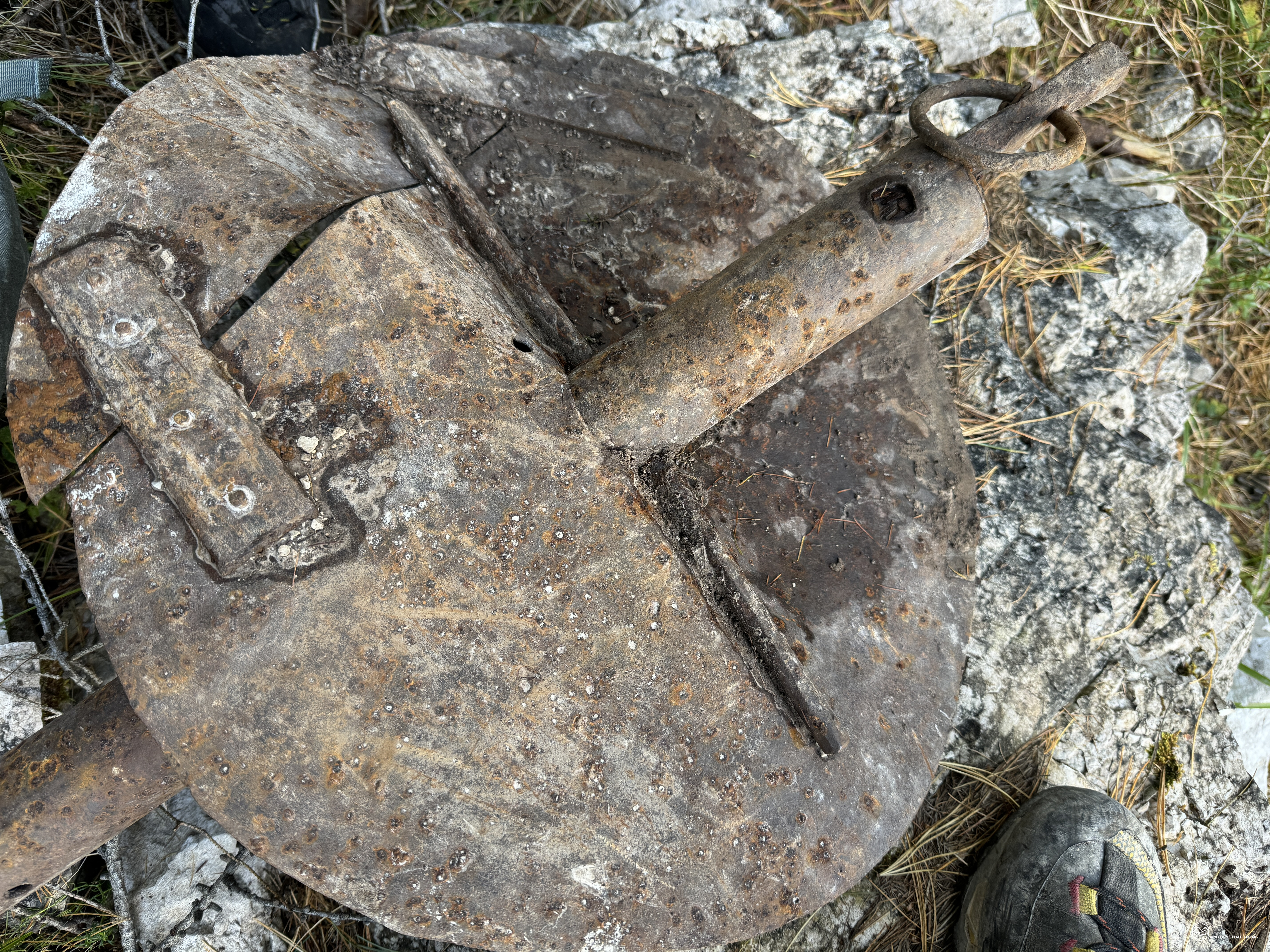
We give ourselves a refreshing break and observe how many finds are there in front of us: remains of stoves, spades, mess tins and one piece above all that resembles a mortar anchor. To date, no one has managed to decipher its use (see photo in the gallery). We continue into the woods, the path now constantly loses altitude even if slightly. Here the track is always clearly visible and runs halfway up the hill. At an altitude of 1780, right in the middle of the return itinerary, we find a rest stop where there is an artificial cave certainly used as a warehouse. Adjacent to the cave we notice a series of trenches and excavations in the ground with reinforced concrete blocks perhaps used for reinforcement or as a base for a small cableway hidden among the vegetation. Here too, several remains confirm the military barracks with the presence of iron pickets (some still with the wooden stick inside) used for the military tents set up here.
We proceed downhill and an emotion envelops me: this path was constantly crossed by groups of soldiers and simple volunteers in all weathers, with snow, heat, crushed by the weight of their voluminous backpacks. A path that saw heroes running towards the front, towards the place to be conquered to return free. A path that has known more lives than those who have managed to return home to tell these places. I end this reflection and we come across another trench dug into the ground in an area that tends to look towards the Podestagno Castle. We pass the last stony valley and, on a faint but still visible trail, we pass through the last part of the woods. We thus rejoin at an altitude of 1765 meters with the CAI path that leads to Col dei Stombe and subsequently to the Dibona via ferrata, right at a hairpin bend. We then go down the marked road until we join the dirt road marked CAI 203 and soon return to Ospitale.
Thus ends an adventure of exploration and historical rediscovery. A route that excites from the first step to the last. A re-opening of a path from the First World War where simple and daring Cadore volunteers, together with the Alpini of the Fenestrelle Battalion, successfully attempted offensives in 1916 on the Austro-Hungarian front at the foot of the Forame, in the Cristallo group. I am proud to have placed my boot on the same footsteps of the soldiers left more than a hundred years ago.
An adventure that deserves to be relived also thanks to the detailed report on Diego's blog “WINDCHILI”: click here to read the report.
DifficultyExpert Hikers with Equipment - The equipped routes (or via ferrata) are indicated, they require the use of self-insurance devices. |