
Today was a succession of idea changes, direction changes and goals. All the choices made have proved to be winners!
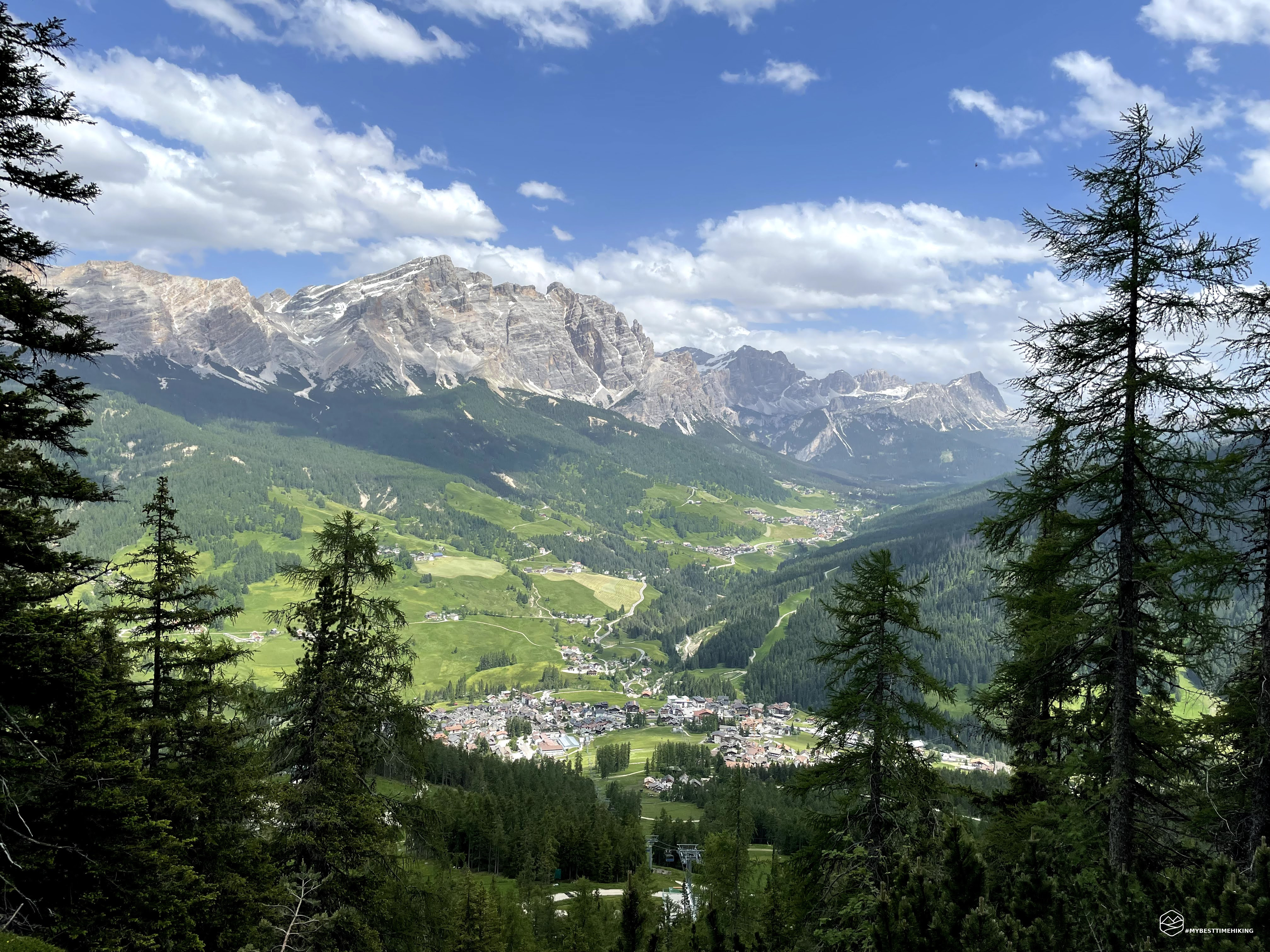
The sun is high in the sky, the day promises to be spectacular even today. Yesterday's excursion (Scopri qui) left us a bit of soreness to the calves for the long descent. For this reason today's adventure aims to lake the SomPunt lake between Villa and Badia. We take the car and in a few minutes we reach the parking lot. We bother the boots and leave ... already arrived! The lake is there. More than a lake a small lake, pretty, populated with two beautiful white swans (although enough aggressive towards our boots!). From here we are going to walk the path of the larch (Lec Tru), we start it but the initial part is really a tangle of branches and moist land. We fold around the lake and Giorgia, since the day seems to be outlined monotonously, suggests reaching the Gardenacia refuge over the villa.
The legs of her answers her well and we both talk about the change of destination. We resume the car and reach the center of La Villa where the Gardenacia chairlift starts. We take tickets and in a very short time we are at 1750m at the arrival station. Here I begin to see the various nomenclatures that identify the same place and the same refuge. Our goal is the Gardenacia refuge, but you can also call Gherdenacia refuge (from the topomima top that stands out above) and again Gardenaccia refuge (with two C, also name of the chairlift). Here you can really admire the facets of the Ladin language and the translations that are used for the Italian language. Little matter from this linguistic diversification, the refuge is that and is the main stage of the day. However, there are two paths to reach it: the CAI 11B on the left and the CAI 5 on the right. From the Tobacco map, we always carry with us, the path 11b should not have large criticalities, while on the 5 we note the "+" which indicate the presence of an equipped piece. We therefore choose the left way, also used by ferrata enthusiasts to reach the new "Les Cordes" route inaugurated in 2019.
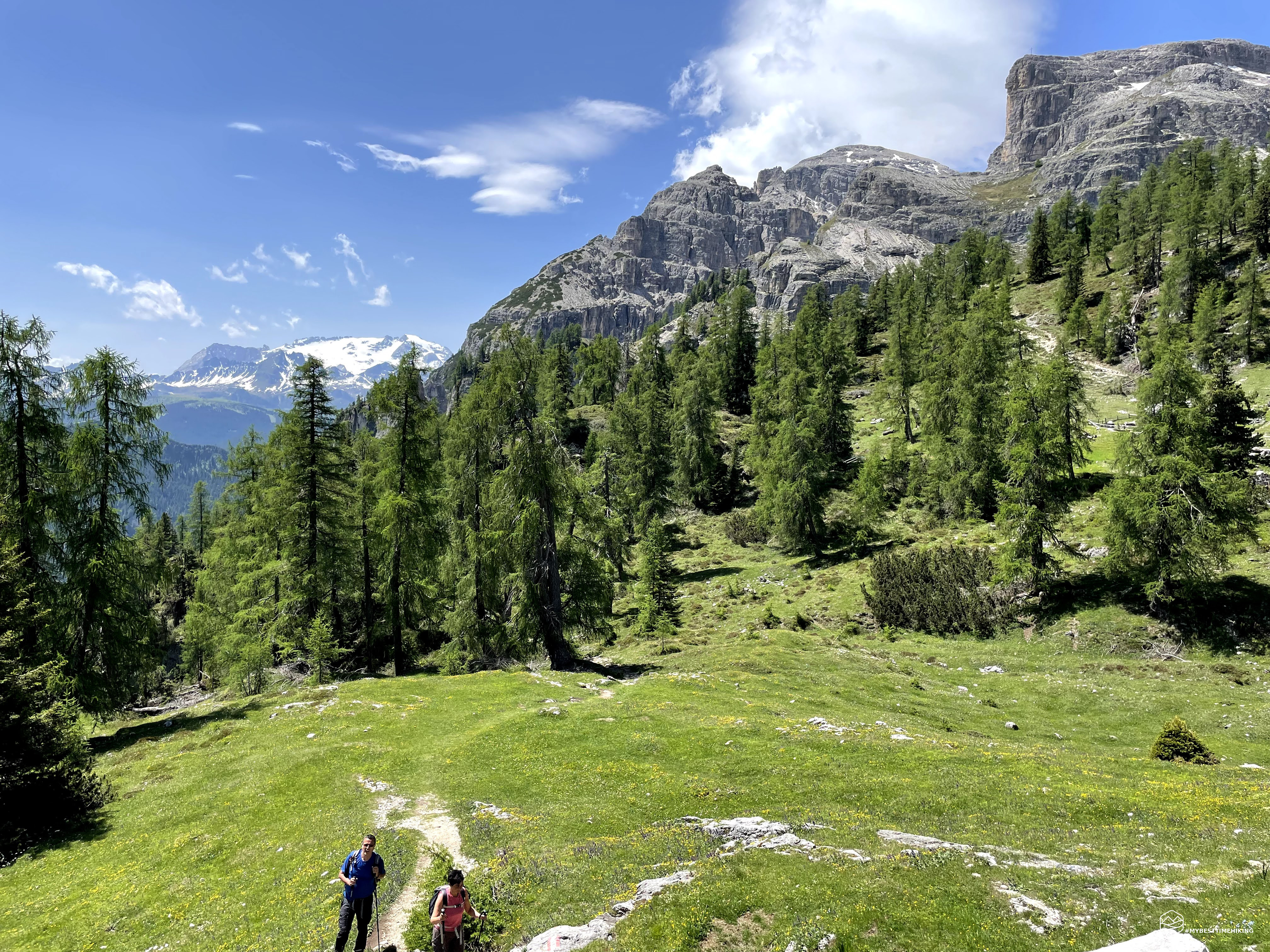
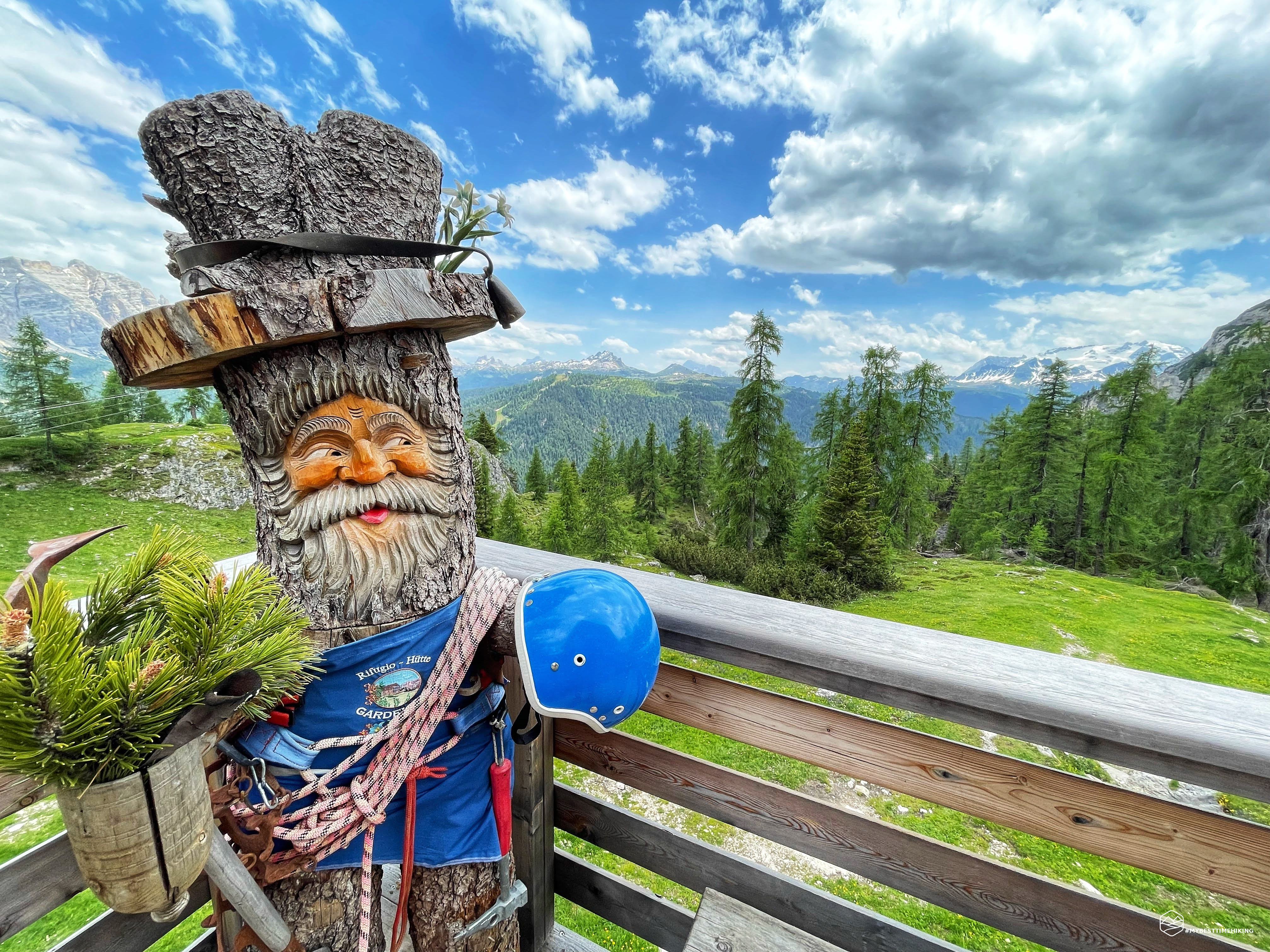
The path begins almost in the piano and losers with the presence of wooden sculptures for the first section. From owls perched to eagle, from the rabbit to the lone barn. A good choice to distract the little ones, and not only, from the fatigue of the path. The route runs along the rock overlooking the right, while to the left is composed of a series of fir trees that give a little shade and refreshment. In the glimpses without trees on the left you can admire a splendid panorama on the villa and the distant San Cassiano, with the splendid Sas de la Crusc massif and the Piz de Lavarola that they do it as a master. In the middle of the flat section the ferried section begins on the right wall. For those like us who continue the path to the path, on the other hand, there are yellow safety boundaries to repair from any discharges of stones derived from the first section of the ferrata. The helmets must be worn for a hundred meters where there is a collection point. From here the route becomes more challenging, and we begin to rise through Zig Zag on rocks and wood scaffolding art cutlery. This stretch is a bit exposed and a metal safety cable is also present at one point. Now the final stretch begins, always uphill constant and with a considerable slope. All this piece of route is inside a narrow and long throat, you can find refreshment only in the curves of the hairpin bends attached to the sloping rock. The height difference is gained quickly and in a short time we find the last part with the wood structure and well-called steps that the arrival on the plain of the refuge is announced. Find the encloset fence at the end where we need to open and close the wooden door and finally here it is there!
Date
23-06-2021
Distance
8.28 KM
Hike type
Hike
Ascent
428 mt
- Mountain
Gherdenacia (Puez)
- Address
La Villa, Trentino Alto Adige, Italy
- Altitude
2150.00 m
- Refuges
Rifugio Gardenacia
- Information
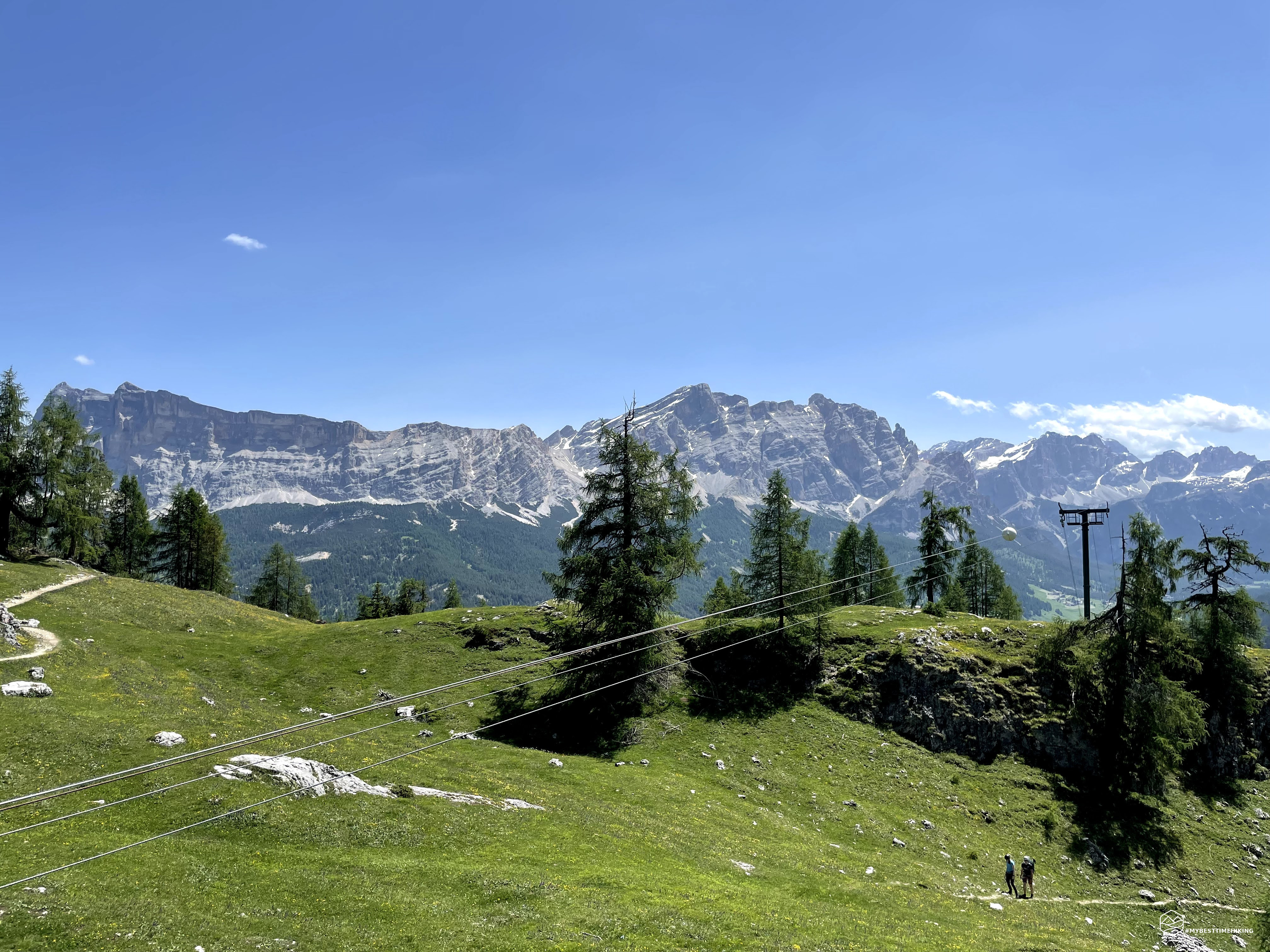
The refuge peeps behind the trees, immense! On multiple floors, a truly large retreat compared to the usual standards, altitude and streets that are to reach it. A clearing of rocks and flower meadows surrounds the refuge that opens ahead of us. The more we approach and the more the panorama relaxes: on the one hand we can almost touch the Sassongher, see the cross of the summit very well. Alongside the top para from the Giai also here with its clearly visible cross. On the left the Marmolada and continuing the track you can see the owl, the Pelmo, the Nuvolau, the Lagazui to return to the peaks in Alta Badia del Piz de Lavarlala and the Sas de la Crusc. The weather is perfect, there is no mistake of mist and we can enjoy every detail of the peaks just mentioned. The refuge welcomes us with a typical exceptional menu and, seen the time, we take the opportunity for a lunch to lick the mustache.
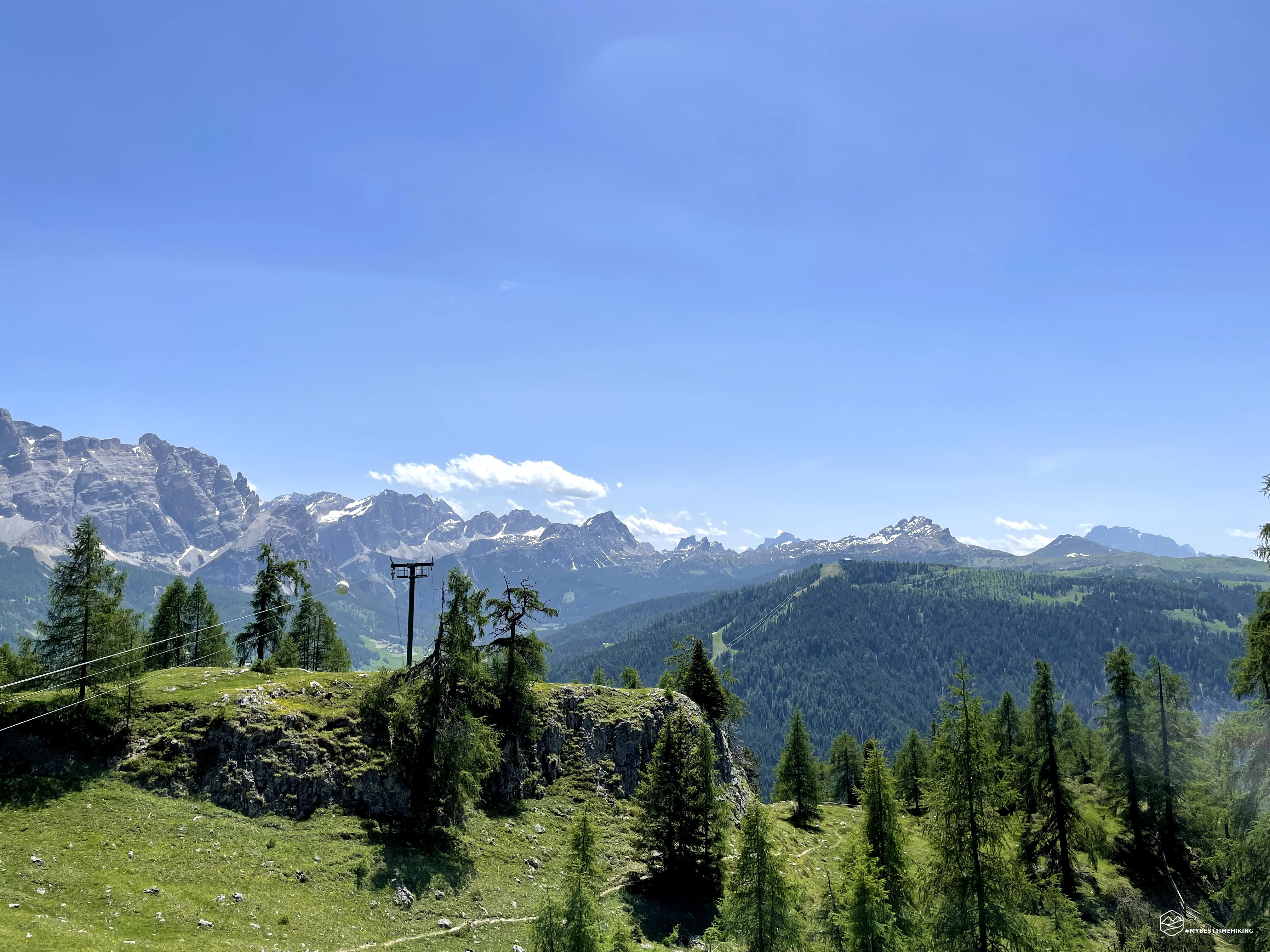
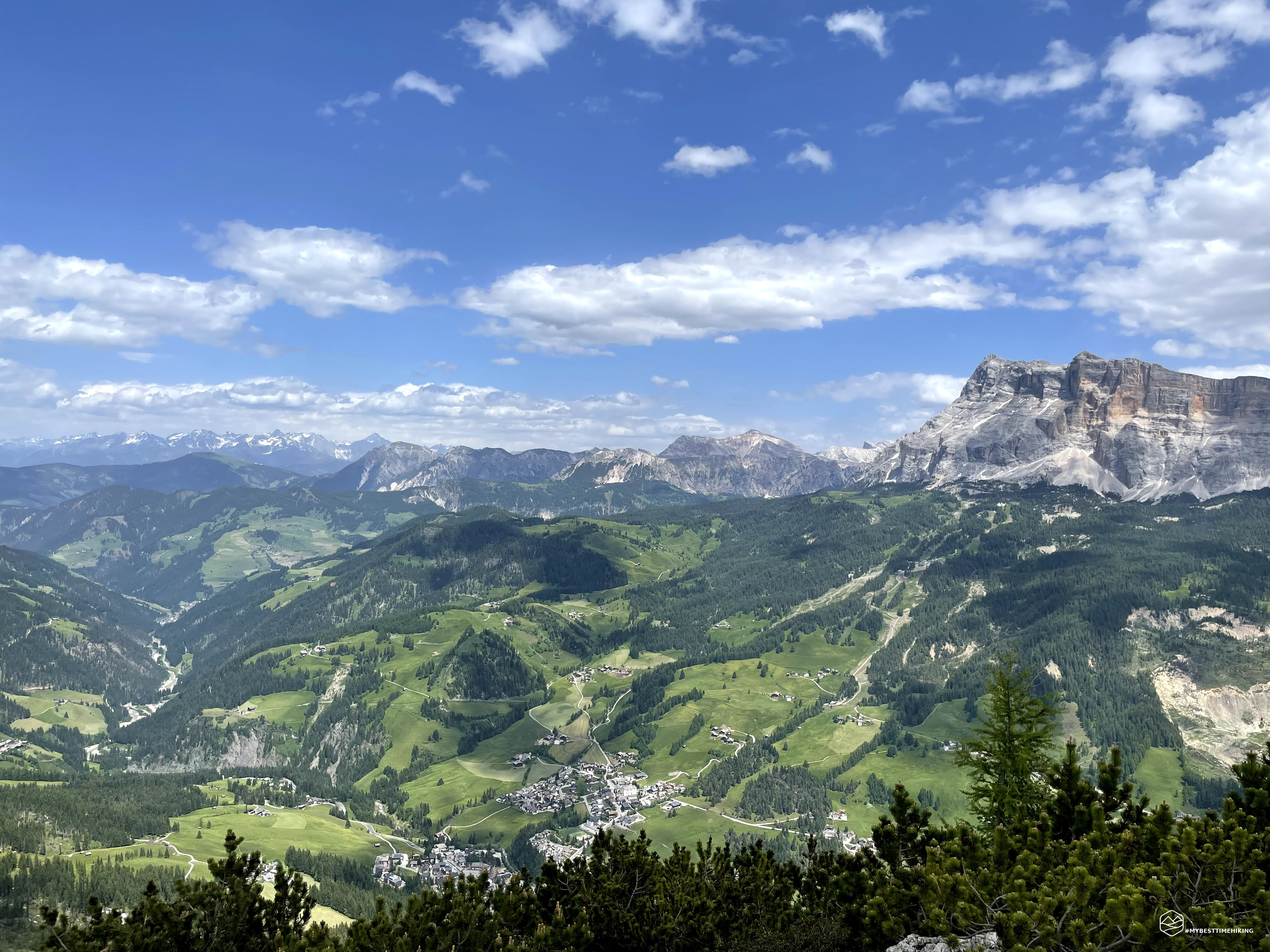
finished lunch, let me take a small extension on a small top far away: Pre Janin summit. Only one hundred meters of height difference, crossing meadows in bloom and pine pines, reach this small top marked by a dry twig impaled as an auction for an imaginary flag. From here you can admire the landscape to the north where you can see in the distance the Austrian peaks and below, the village of San Leonardo in Badia where the sanctuary of Santa Croce can be distinctly noticed. Photo of ritual and way to the refuge, and in the journey of the return a succession of postcards with Marmolada as the protagonist!
Back to the Gardenacia refuge is now to go back to the valley, but what path to undertake? We entrusted to some local guides and the number 5 path seems much simpler than the path 11b made on the first leg. The traces of the equipped trail on the map refer to a very short stretch no longer exposed. We trust and start the return that allows us to take a ring ride. Indeed the path is taken care of as the one of the first leg, indeed in some traits, precautions were adopted that make it affordable even for the little ones. Some points are a bit more pendant and there is the presence of a bit of gravel that makes the way a little more uncertain, but overall it is a well maintained path. We reach the short piece equipped and is very easy to overcome it even without the aid of the metal lanyard. Even here it seems that an adequate work of expansion and safety of the street has been made. The last piece is characterized by a series of zig zag tonnaps with a polished wooden parapet even to avoid wood splinters if you lean with your hands.
In no time from departure from the refuge we reach the Gardenaccia chairlift station and from there a little back to the parking lot where we turn around and admire the path done during the day. A wonderful excursion, with a beautiful ring ride. I recommend the Cai Number 5 path for everyone, even for the less trained and the children who love to walk. The 11b instead I would leave them a little more advanced for the final stretch. Finally, to prefer the ring clockwise as we chose us to get the most out of the two uphill and downhill paths. I recommend taking a break at the Gardenaccia shelter and prefer zero km dishes and / or with the "SouthTirol" sticker. For the next adventure maybe I could think of trying via ferrata "les cordes" to get a new point of view during ascension!
DifficultyHikers - Itineraries on paths or evident traces in various types of terrain (pastures, debris, stony ground ...). They are generally marked with paint or cairns (pyramid-shaped stacked stones that allow you to identify the route even from a distance). They can also take place in snowy but only slightly inclined environments. They require the equipment described in the part dedicated to hiking and sufficient orientation skills, walking training for a few hours. |