Details
-
 Hike type
Ferrata
-
 Difficulty
EEA
-
 Distance
22.98 KM
-
 Altitude MIN
1064.00 mt
-
 Altitude drop +
2000 mt
-
 Parking
-
 Landscape

-
 History

-
 Duration
12h
-
 Altitude MAX
3064.00 mt
-
 Altitude drop -
-2000 mt
-
Hike type
Ferrata
-
Difficulty
EEA
-
Distance
22.98 KM
-
Altitude MIN
1064.00 mt
-
Altitude MAX
3064.00 mt
-
Altitude drop +
2000 mt
-
Altitude drop -
-2000 mt
-
Duration
12h
-
Landscape
-
History
-
Parking
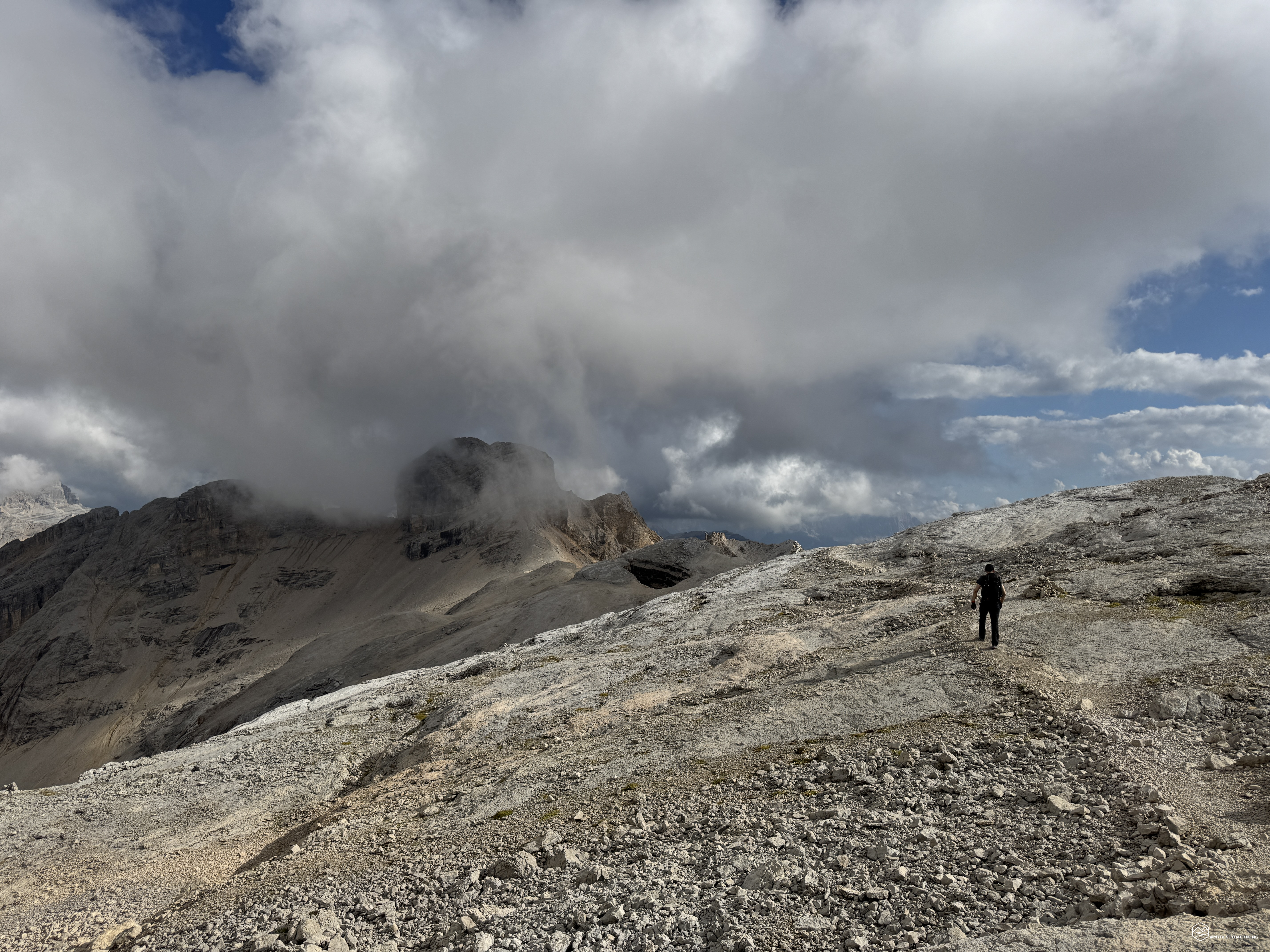

Today’s hike is a genuine technical and physical challenge a regulated event known as the "4 Peaks Alta Badia"!
Dubbed the "extreme challenge of the Dolomites," this route takes place in Alta Badia and involves linking four peaks over 3,000 meters high within the Conturines group (part of the Fanes Dolomites).
A dedicated website outlines the rules for this challenge and certifies its completion: 4 Peaks Alta Badia.
The driving force behind this and my adventure partner is the legendary Angelo; together, we chose Route No. 1—the shortest but most exposed path, highly recommended for experienced climbers!
We planned the logistics carefully: we left one car at the Capanna Alpina parking lot, just before San Cassiano—this would be our finish point. We then drove a second car to the Sas dla Crusc ski lifts.
We waited for the lifts to open at 8:30 AM and took the first ride up, allowing us to reach the Santa Croce (or La Crusc) mountain hut—situated at an altitude of 2,045 meters—at a leisurely pace.
From there, with backpacks on, the real work began!
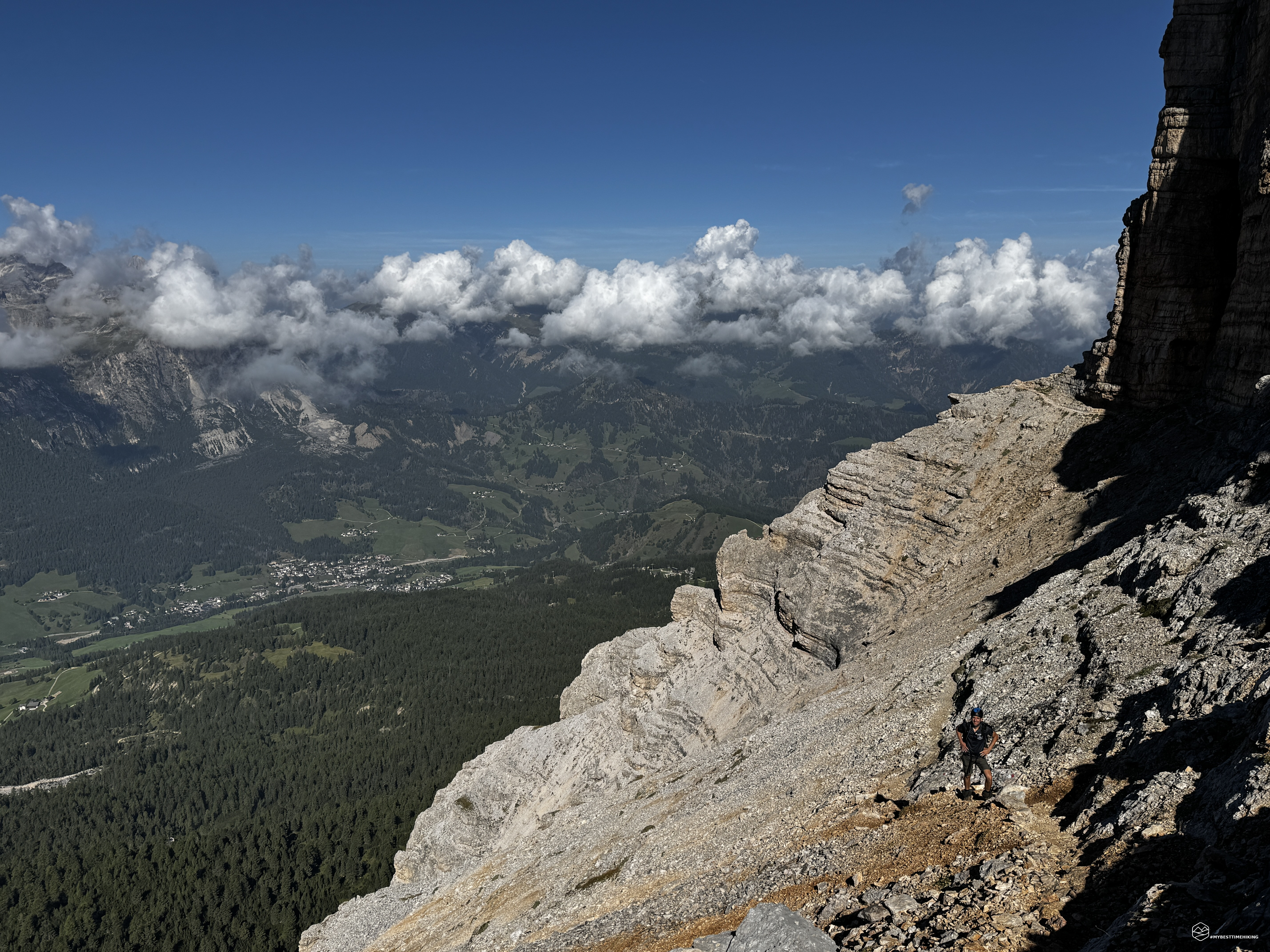
Just past the hut, we took CAI trail no. 7, with the towering vertical walls of Sas dla Crusc looming overhead. The first section of the route was relatively flat, leading us to the rocky base of the mountain massif. At a series of scree-filled gullies, the actual ascent began with some easy initial scrambling through a rocky cleft, bringing us to a viewpoint overlooking the beautiful Val Badia below. We then started gaining altitude. In the trickiest spots, a metal support cable aids our progress. Here, the Dolomite face of Sas dla Crusc becomes increasingly imposing and vertical, so we fasten our helmets to proceed safely.
A few very simple Grade I sections lead to a rocky step equipped with metal pegs and a cord to assist the ascent. There are no significant technical difficulties, and the terrain isn't exposed; these aids simply make the climb easier. We emerge onto a beautiful, wide ledge offering exceptional panoramic views of San Cassiano, Corvara, and Sassongher. We continue, surrounded by beauty in every direction; even a very short stretch across a narrow rock section doesn't slow us down (an easier alternative path is available at the base of the rock in wet or damp conditions).
We follow the ledge as it nears its end, allowing us to round the rocky ridge and head straight for the saddle. We can see it above us, with the sun already high, marking our approach. The final stretch features a few metal aids attached to the left side of the path. The climb is steep but short—be sure to turn around occasionally to admire the spectacular view of the ledge we just traversed and the valley below.
After about an hour and a half of hiking from the La Crusc refuge, we reach the beautiful Ju dla Crusc saddle at an altitude of 2,612 meters. We catch our breath, but the spectacle makes every effort worthwhile. A breathtaking view opens up over the Sas dla Crusc plateau, Val Badia, and—behind us—the peaks of Fanes! From here, we can clearly see the next part of the route: the summit of Sas dla Crusc (or Mount Ciaval) and the peak of Sasso delle Dieci. An enticing ridge awaits us.
We continue for about an hour along CAI trail no. 7B, following a stony path that is well-marked, clearly visible, and presents no technical difficulties. The route winds right along the edge of the precipice formed by the massif's vertical wall. The final stretch of the ascent to the summit is less clearly marked and crosses rocky terrain, though the way forward remains intuitive. There it is—our first conquest: Sas dla Crusc (Sasso Santa Croce or Mount Ciaval) at 2,907 meters! The first of the "4 Peaks"! We use the punch tool attached to the summit cross to mark our achievement and take a few minutes to enjoy the view, but there is no time to lose: the second peak awaits us nearby.
We continue northeast along a clear path. We reach some distinctive rocky ridges that resemble a mille-feuille pastry. Here, we must pay attention to cairns and rock markers to find the best route. We soon arrive at the base of the final rocky outcrop separating us from the next peak: a 20-to-30-meter-high rocky slab equipped with metal safety cables to make the ascent easier. A via ferrata kit and helmet are mandatory here due to the exposure and steepness. A daring ridge with a dizzying drop-off leads straight toward the Armentara meadows. After the short ridge, we squeeze through a narrow passage that opens onto another ridge section—equipped with a handrail—leading to the summit. We thus reach the 3,026-meter summit of Piz dales Diesc (also known as Cima Dieci or Sasso delle Dieci) about 45 minutes after leaving the previous peak. What an incredible view! From up here, the Dolomites look like a sea of rock.
At this point, we retrace our steps along trail no. 7B to return to the Ju dla Crusc saddle.
And this is where things get tough, and our "Itinerary 1" (the most difficult of the "4 Peaks" routes) really shows what it’s made of.
Date
30-08-2026
Distance
22.98 KM
Hike type
Ferrata
Ascent
2000 mt
- Mountain
Cunturines - Fanes
- Address
Alta Badia - Trentino Alto Adige
- Altitude
3064.00 m
- Refuges
La Crusc
- Information
From the saddle, we continue along CAI trails no. 7 and no. 12B, heading towards Forcela Medesc (2,533 meters). Here, we take in the view of the route we have just covered—including the first two peaks and the descent leading straight to San Cassiano and, shortly after, to Badia. I admit I’m starting to feel the fatigue, and that downhill escape route looks tempting. But we are undeterred and press on toward the most technical section—a route for true connoisseurs.
We stay on trail 12B until we reach a clear fork near Forcela Medesc. The entire route ahead is already visible: a magnificent ledge leading directly to Piz de Lavarela.
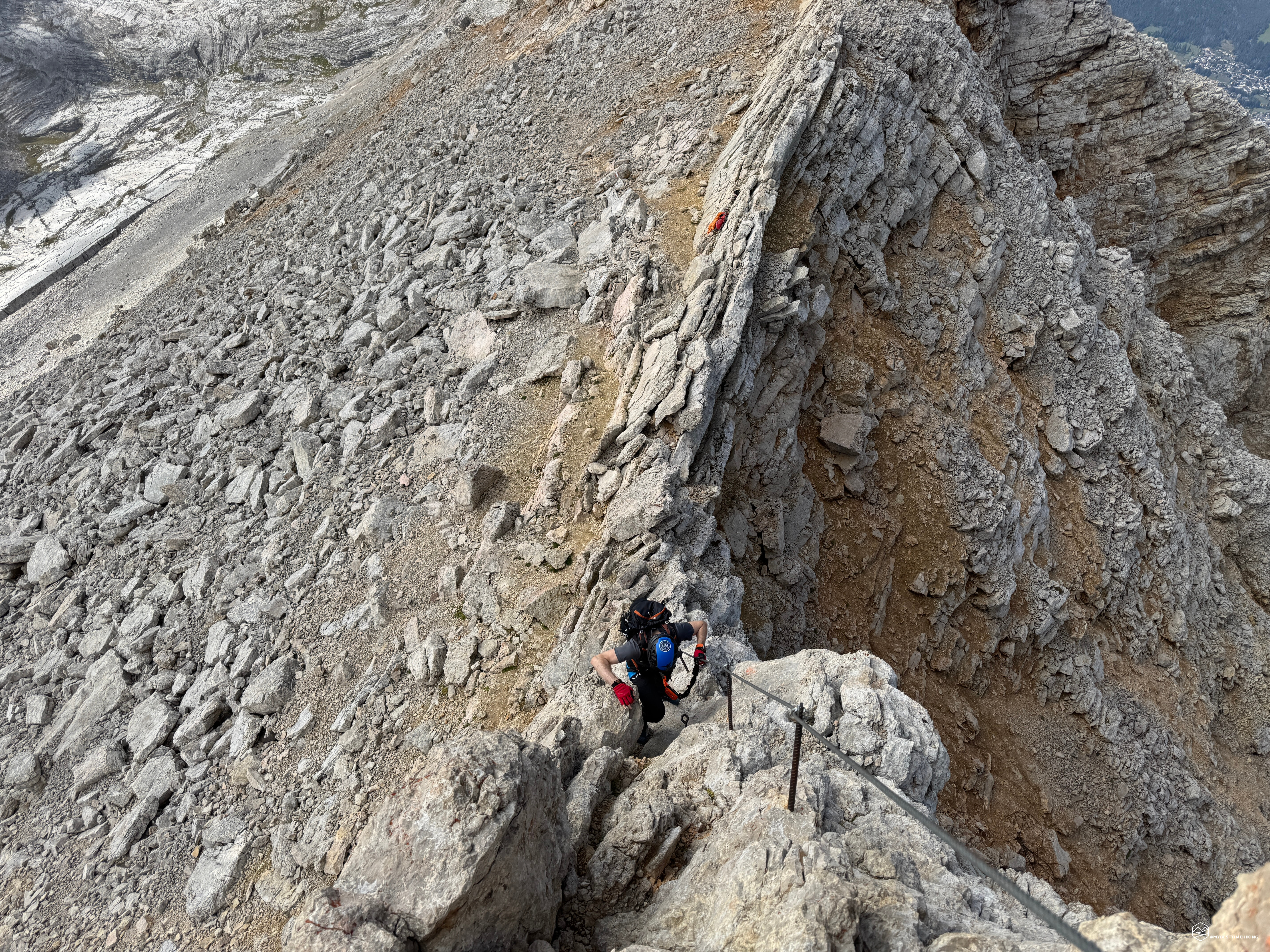
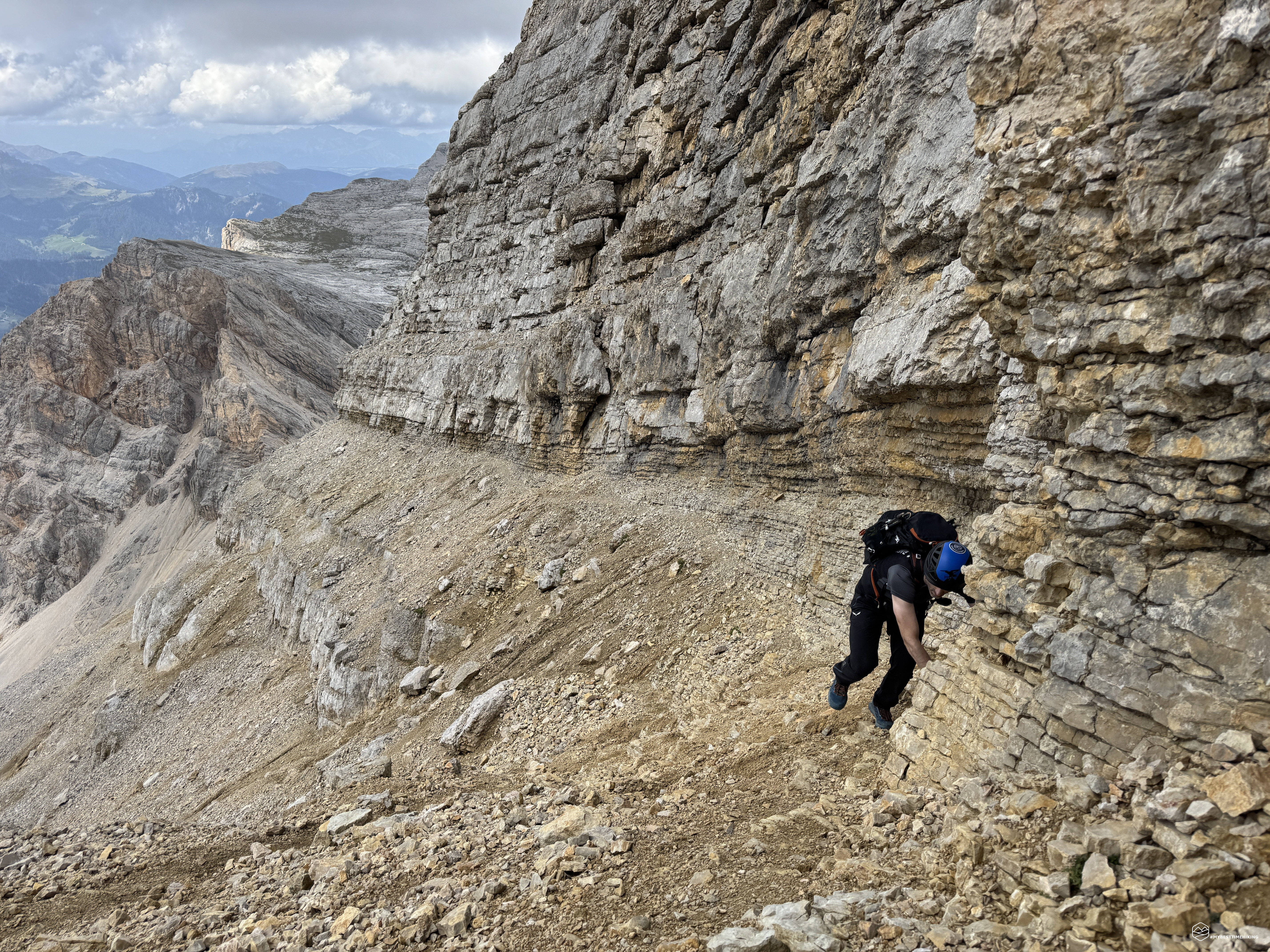
To reach the ledge, we first cross some easy scree slopes that soon give way to simple scrambling. The path is well-marked; after emerging onto a scenic opening—reached via reddish earth and gravel—we begin the first section involving Grade I climbing. We then step onto the first ledge, which is wide and not too strenuous. It is quite long and exposed in places, though never dangerous. I do recommend keeping your helmet securely fastened, however, due to the risk of falling rocks. We must climb up to the higher ledge for the final stretch to our destination. This is where we encounter the most exposed and tricky section, featuring Grade I and I+ moves on a 6-meter vertical wall with excellent handholds. We emerge onto the upper section and continue along this final stretch of ledge; it remains wide but is significantly steeper. The scree makes for hard going, causing us to slide backward in places.
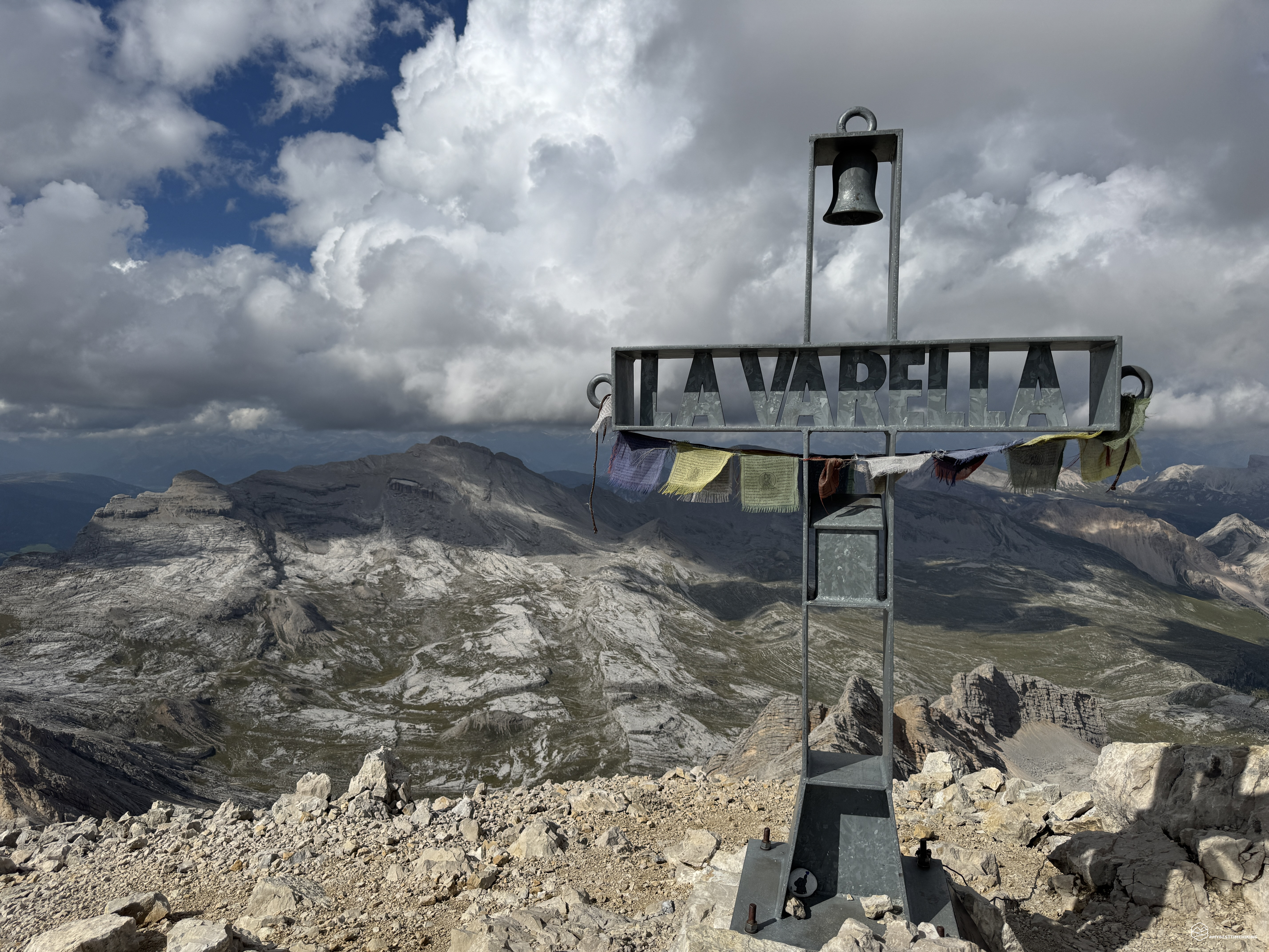
After a full three and a half hours of strenuous effort and challenging ups and downs, we reach the saddle, where we gaze out at Piz de Lavarela de Fora. However, we still have to climb the final peaklet to our left, tackling some easy scrambling. We soon reach the third summit: the mighty Lavarela (3,055 meters). Our legs are burning, but the adrenaline makes us feel like we’re flying! There is an incredible, sheer view of the Fanes peaks, Conturines, and Sas dla Crusc. It feels like being on top of the world!
A final, major effort is required for the last push. We take trail no. 12B again, this time descending via the standard route of the Piz de Lavarela we just summited. The final rounded peak awaiting us remains clearly visible. One last push!
We descend to the saddle separating Lavarela and Conturines; the path is obvious, but clouds are beginning to envelop the final summit. Ahead of us appears the first iron ladder, allowing us to tackle the rock face vertically.
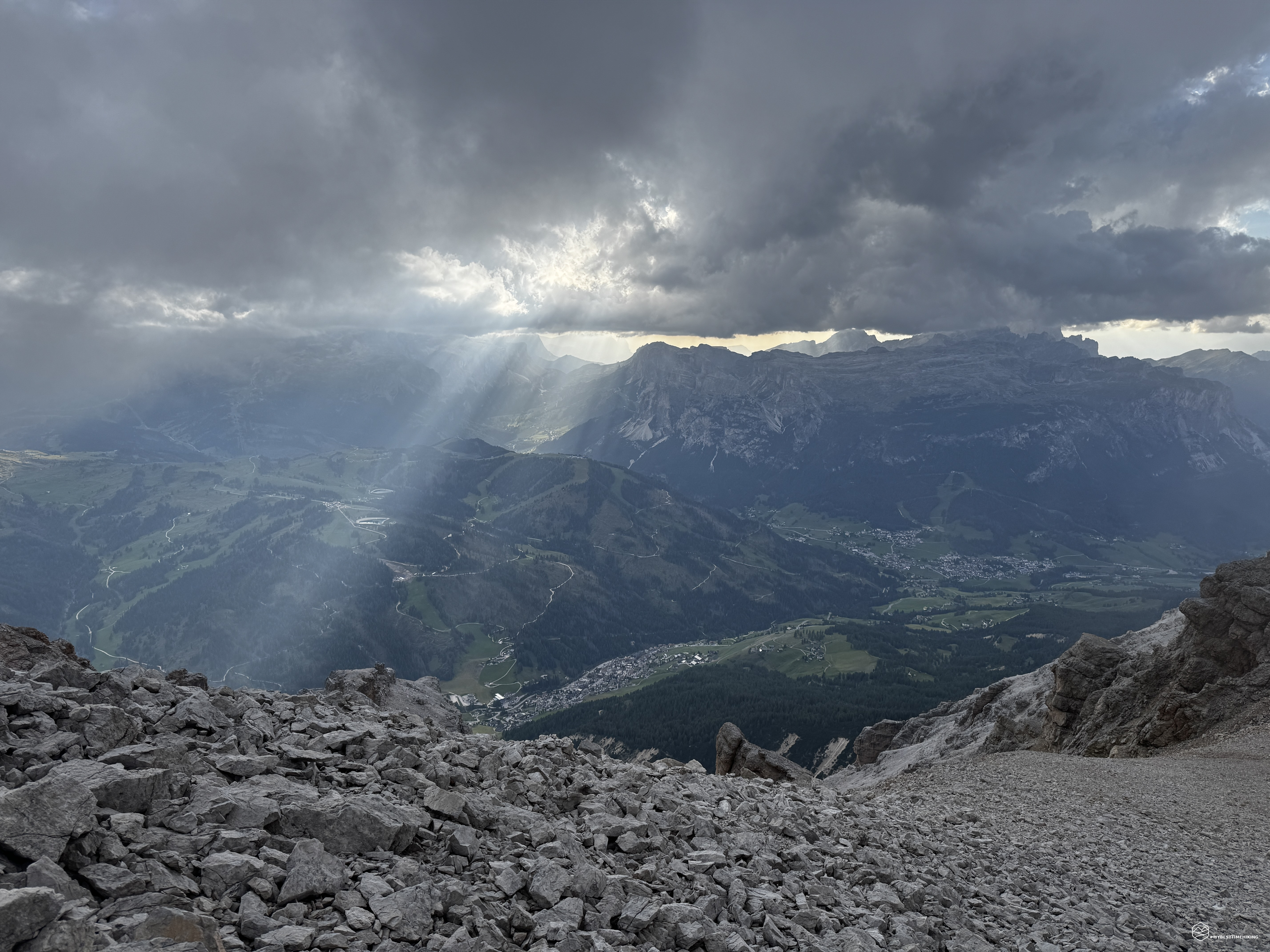
We are enveloped in fog as we climb a series of ladders—we count three distinct ones of moderate difficulty. A short traverse along a wide ledge brings us to the summit ridge. Utmost caution is needed here, as there are no paint marks or trail blazes on the rocks. The route can be intuited but is tricky to navigate in the foggy conditions we encountered. Watch out for the dip leading to the summit; the rock there is smooth, and the section is decidedly exposed. Don't be disheartened if you don't find a summit cross: the only proof that you’ve reached the top of Conturines is a tall stone cairn, which serves as the only clear marker on the summit section. For us, finding the "4 Peaks" challenge punch-card station just moments earlier prompted a shout of pure joy: we had completed the extreme Dolomites challenge! We bag the fourth peak of the day just before 6:00 PM. An immense and long-awaited achievement!
The weather wasn't on our side for this final summit, but our joy remains undiminished! After an hour's hike from Piz de Lavarela, we reach the summit of Conturines (3,064 meters)! This is the highest of the four peaks and demands—without compromise—great technical skill, grit, and immense stamina.
Mission accomplished? Almost!
The adventure isn't over yet; the descent is certainly not to be underestimated. Another three and a quarter hours lie ahead to cover the final 9 km and the significant drop in elevation. We follow CAI trail no. 12B towards Gran Plan de Fanes, then connect to trail no. 11 heading for the lush green Fanes meadows and Ju dal'Ega. We reach the junction for the Alta Via 1 at 8:00 PM, press on, and arrive—now in darkness—at Col de Locia (2,097 meters). Finally, we tackle the long, well-earned descent to our finish line: Capanna Alpina (1,720 meters). We arrive just after 9:00 PM to find the spacious parking lot and our car waiting for us like a mirage.
At the end of the day, the Garmin doesn't lie: a total duration of 11 hours covering 23 km, with a staggering 2,000 meters of total elevation gain.
An epic experience—the kind that leaves an indelible mark on the heart of any enthusiast. We did it! We conquered the Alta Badia 4 Peaks!
Click here and watch the exclusive video on YouTube for an even more immersive experience!
DifficultyExpert Hikers with Equipment - The equipped routes (or via ferrata) are indicated, they require the use of self-insurance devices. |