Details
-
 Hike type
Alpinism
-
 Difficulty
EEA
-
 Distance
13.72 KM
-
 Altitude MIN
1253.00 mt
-
 Altitude drop +
1500 mt
-
 Parking
-
 Landscape

-
 History

-
 Duration
8h 30m
-
 Altitude MAX
2753.00 mt
-
 Altitude drop -
-1500 mt
-
Hike type
Alpinism
-
Difficulty
EEA
-
Distance
13.72 KM
-
Altitude MIN
1253.00 mt
-
Altitude MAX
2753.00 mt
-
Altitude drop +
1500 mt
-
Altitude drop -
-1500 mt
-
Duration
8h 30m
-
Landscape
-
History
-
Parking

Beyond the Dolomites of Cortina, Val Badia, and the Belluno area, there's an area I rarely explore: Friuli! Here, there are pristine landscapes, majestic mountains, and a wild side. Today's adventure, thanks to my friend Marco and hiking companion Filippo, takes us to the summit of a picturesque bastion nestled in the Julian Alps: Jôf di Montasio!
Let me give you a quick historical overview to capture the beauty of this place. I refer to the book “The Dolomite Mountains” by Gilbert and Churchill from 1864, which describes the following: “[…] I must say something about this valley, now that everyone knows it. The Churchills had already traveled through it and maintained that no other valley in the region can equal it in beauty. It leads to the base of the Wischberg, but also to the foot of a mountain, known as the Balitza Spitzen or Jof di Montasio, not as well known as it deserves. We have often observed it from very distant points and it has always appeared proud and dominant among its neighbors, including the Mangert. Captain Holsmay, in the Proceedings of the recently founded Vienna Alpine Club, estimates the height of the Montasio at 8,736 English feet, but does not cite his sources of information. It is located at the junction of three valleys: the Val Seisera, mentioned above, the Raccolana, near which we passed further on, and the Canale di Dogna.".
We reach the Sella Nevea area, a winter tourist destination, and take the narrow uphill road that indicates the Malga Montasio and the Brazzà refuge as our destination. At the end of the climb, a comfortable plateau opens up, serving as a large parking lot. It's already very crowded early in the morning on nice days, so I recommend getting there early.
We're at about 1,500 meters; the morning isn't particularly cool, but the sky is still beautiful and almost cloudless. We prepare for this expedition with our ever-present helmets, boots tied, and backpacks on, and off we go!
We continue along the road until we almost reach the Malga Montasio. Here we turn right onto a clear track on a gravel road that disappears into the sparse vegetation. The route we're following on the Tabacco map is initially shown as a dirt road that merges into a black-dotted path. The aforementioned trail reaches the normal ascent path to Jôf di Montasio at an altitude of 1,850 meters, intersecting with CAI trail 663. The route we're following is essentially a "direttissima" that runs straight across the entire Montasio Plateau, burning off the initial 350 meters of elevation gain. We essentially follow the Rio Montasio for the initial stretch. At approximately 1,700 meters, the trail becomes intuitive: there are signposts, but the hiker's experience and imagination are left to their own devices to find the easiest route. In any case, we switch a couple of times from the left to the right orographic side of the stream, always maintaining a northerly progression.
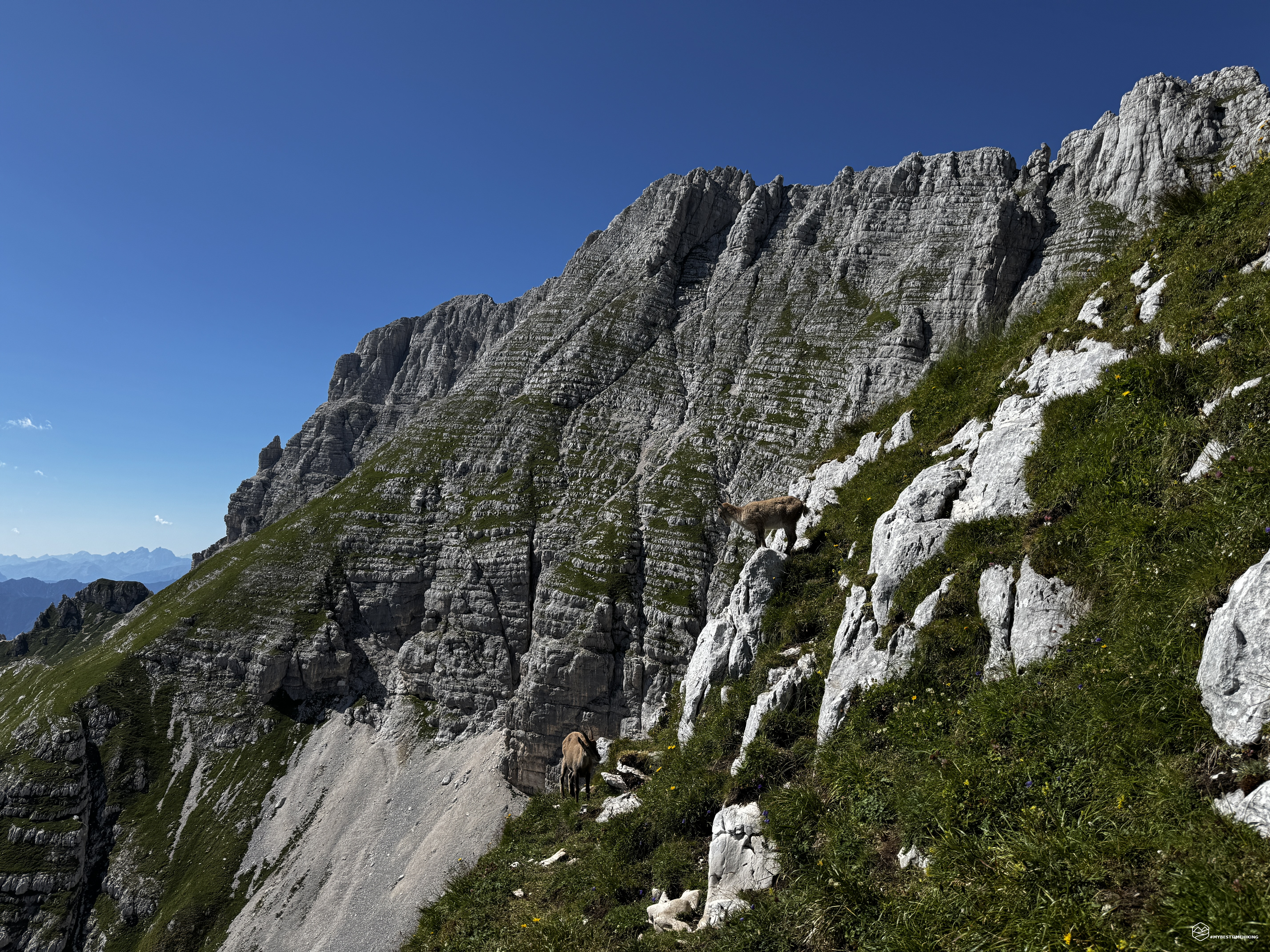
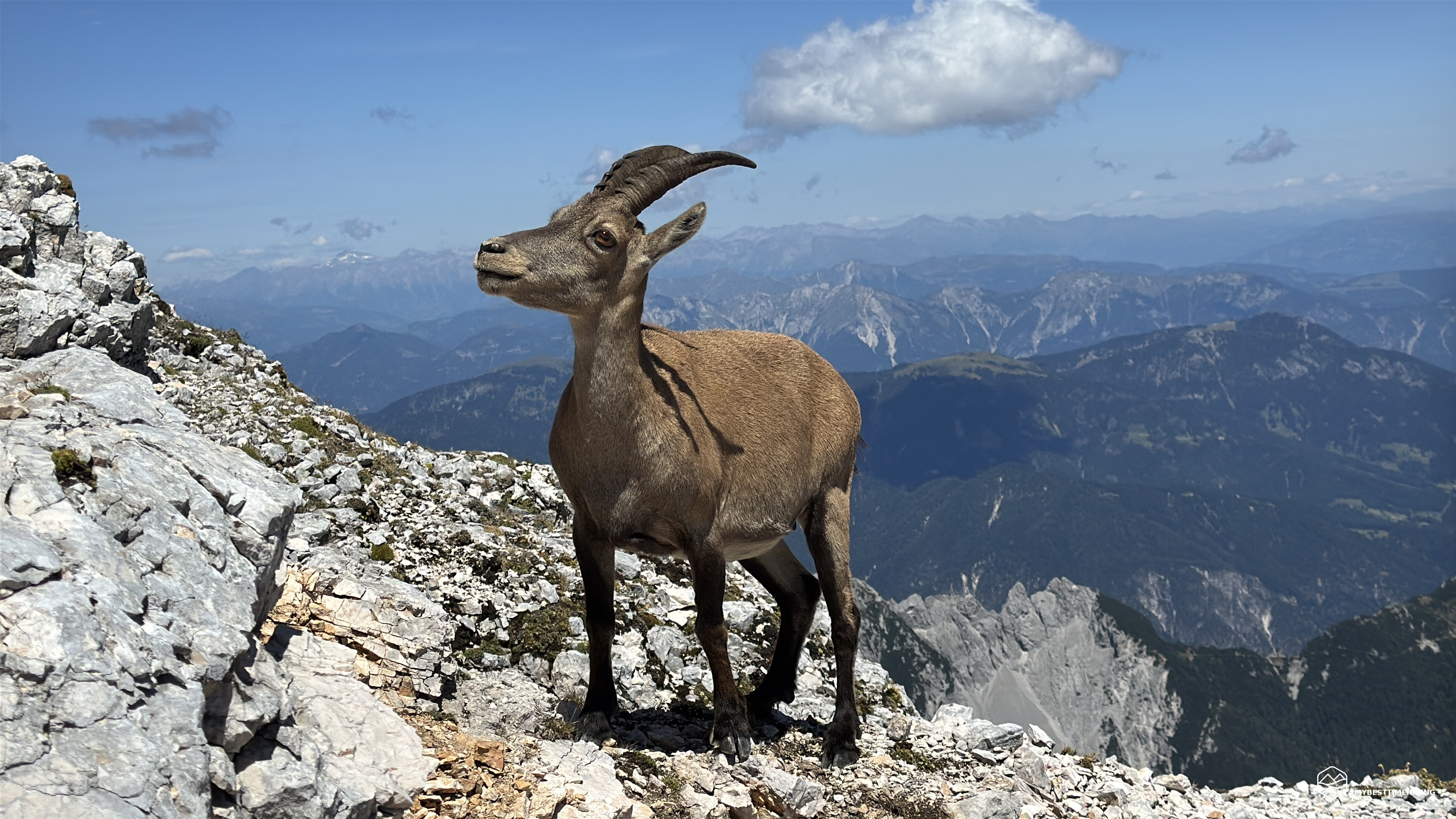
Once we reach CAI trail 663, the climb becomes gentler, and the panorama opens up with an incredible view of the Canin River to the south and the entire Montasio Plateau we've just crossed. We can also glimpse the Brazzà refuge, which will be our destination on our return. We continue zigzagging across hard terrain toward the Forca dei Disteis (2,201 meters). We reach it about 1.5 hours after setting off. Here we spot the prominent guests of these areas: ibex! We admire a few groups intent on licking the mineral-rich rocks. Others, more lazy, sitting or standing, watch us quizzically. From the pass, there is a beautiful view of the vertical cleft of the Jôf di Montasio toward the Val Dogna.
We now continue east on a trail that becomes rocky and climbs not far from the pass to an altitude of 2,250 meters. We find a fork indicating the Suringar Bivouac (663c) on the left and the normal route to the summit (663a) on the right. For today's adventure, we want to do a complete loop, enjoying the best this mountain has to offer. So, we choose the most daring, most alpine-oriented option: we take the Findenegg Route, first across the Grande Cengia and then through the gully that takes its name from the Findenegg Route.
A clear sign not far from the fork warns hikers that this is an alpine route for experts. We initially continue on loose rocks, some easy and fun scrambling sections in a northwesterly direction until we reach a scree gully with a safety cord that allows for a more relaxed approach on this unstable section. More easy rocks, and the Grande Cengia begins in all its splendor. Much of the route we are about to complete can be seen on this rocky strip that emerges from the vertical southwest face of Jôf di Montasio. An invisible route that seems impossible to navigate.
We continue along this rocky strip, which is easy, but still gives rise to some less than serene thoughts, as, to our left, the view is lost in a vertical cliff and the panorama is swallowed up by the unknown. In a section where the route is more slippery (though never extremely thin), there is a metal segment of questionable stability, which nevertheless provides greater psychological safety.
The trail is winding, following the contours of the mountain, revealing its rugged and still wild essence. Behind us, a sloping spire called "Pupo" stands alone, protecting the ledge we are walking. We proceed without difficulty until we reach the only noteworthy point: a very short section from which water evidently flows, having eroded and smoothed the rock. Extreme caution is required here; it is a very short section, but in unfavorable conditions, it can be problematic. There are good holds, but they must be assessed based on conditions.
We thus arrive at the fork in the road where the route to the summit is indicated, and, to the left, the road to the bivouac. We take a quick detour to admire this bivouac nestled in the rock. The trail is short, and the choice couldn't have been more perfect, as the final stretch toward the bivouac is occupied by a large group of ibex. This view makes us think we'll see many of them today! Beyond this unusual sight of animals that don't move and stay very close to the trail, the panorama unfolding before us is incredibly majestic. Mount Cimone in front, with its sheer rock face overlooking the valley below, creates a breathtaking aerial view. After the customary photos at the characteristic Suringar bivouac, behind which the Via Amalia begins, another climbing option for reaching the summit of Jôf di Montasio, we retrace our steps and take the summit route at the fork.
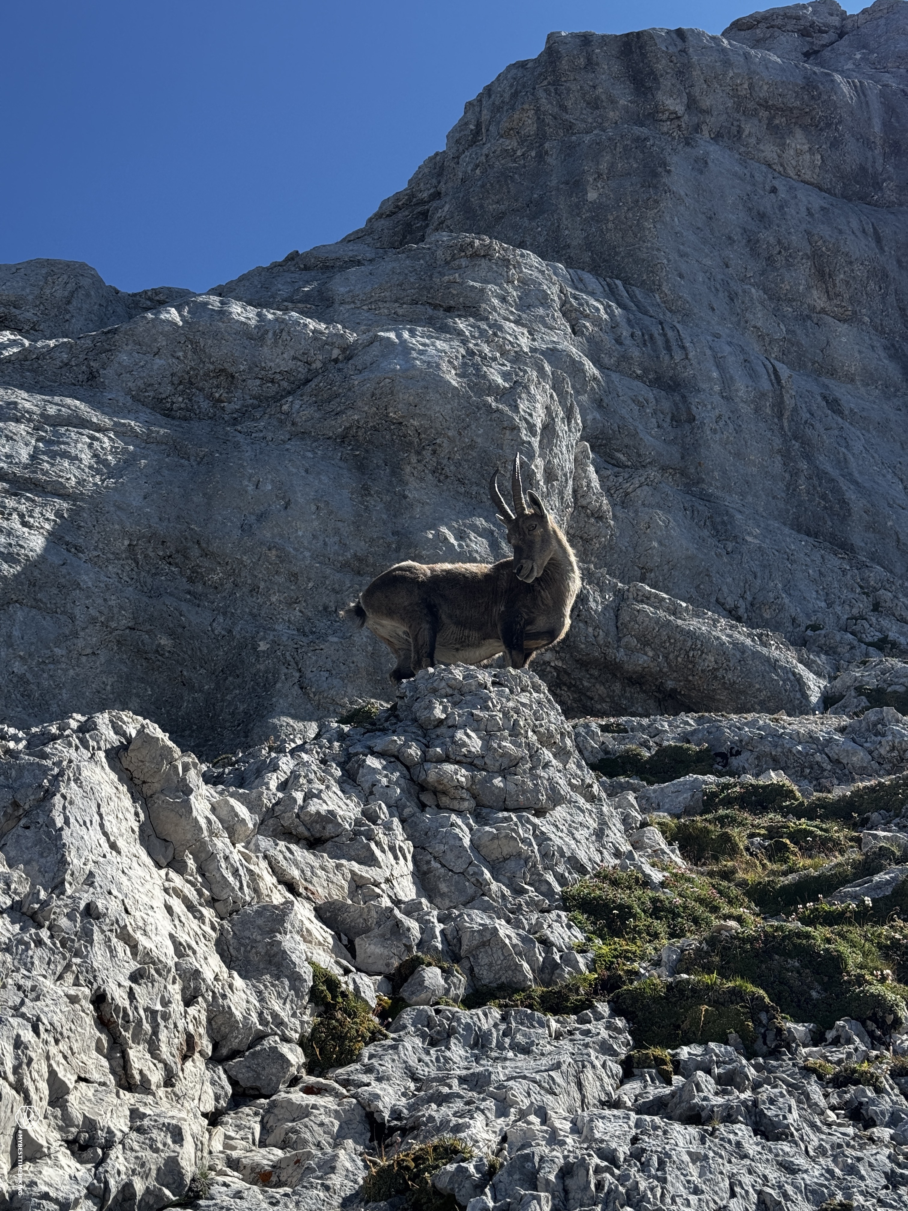
We continue scrambling with increasing intensity, with some grade I sections on grassy ledges that lead to a ledge that we briefly follow in a northeasterly direction. Be careful on one section where there's a rock overhang that juts out into the void. The passage allows us to bypass the ledge and access a second, slightly higher ledge that now heads northwest toward the gully. The grass disappears, giving way to unstable scree and narrow passages, but with difficulties ranging from grade I to I+. The greatest danger on this climb is the real possibility of falling rocks. This is partly due to the vertical and steep nature of the route, but also to the constant and persistent presence of our ibex friends. We count several above our heads and wait for them to finish their moves and their headlong rushes, which move a considerable amount of debris.
The trail is still clearly visible, with a red dot constantly visible. However, be careful in case of fog. We enter deeper into the Findenegg gully, still in the shade. We see the sun above us, and that is our destination. We continue the climb, with difficulties constantly varying between grades I and II. The further we advance, the deeper we wedge we find ourselves into the mountain, removing the sense of emptiness given by the ledges previously. The terrain becomes increasingly friable, but the holds and footholds remain well present in the more technical sections.
We reach the crux of the climb at a rocky constriction. Here, there's a marked grade II (II+) move. Holds are sparse here, and the rounded rock on the left makes it difficult to secure your hands and feet. The crack is narrow, and a backpack doesn't help. You have to push against the wall and trust the grip of your soles. Filippo easily negotiates the section, while Marco and I opt for a seemingly more daring solution: a narrow ledge extends to the left, which, with a maximum grade of II, on rock with good holds, allows for a bypass. Here, we're more exposed in the event of a fall, but with the right precautions, the move is technically easier. In the YouTube video attached to this article, you can see the crux and the alternative we took perfectly!
Date
24-07-2026
Distance
13.72 KM
Hike type
Alpinism
Ascent
1500 mt
- Mountain
Jôf di Montasio e Cima di Terrarossa
- Address
Sella Nevea, Friuli Venezia Giulia
- Altitude
2753.00 m
- Refuges
Rifugio di Brazzà, malga Montasio
- Information
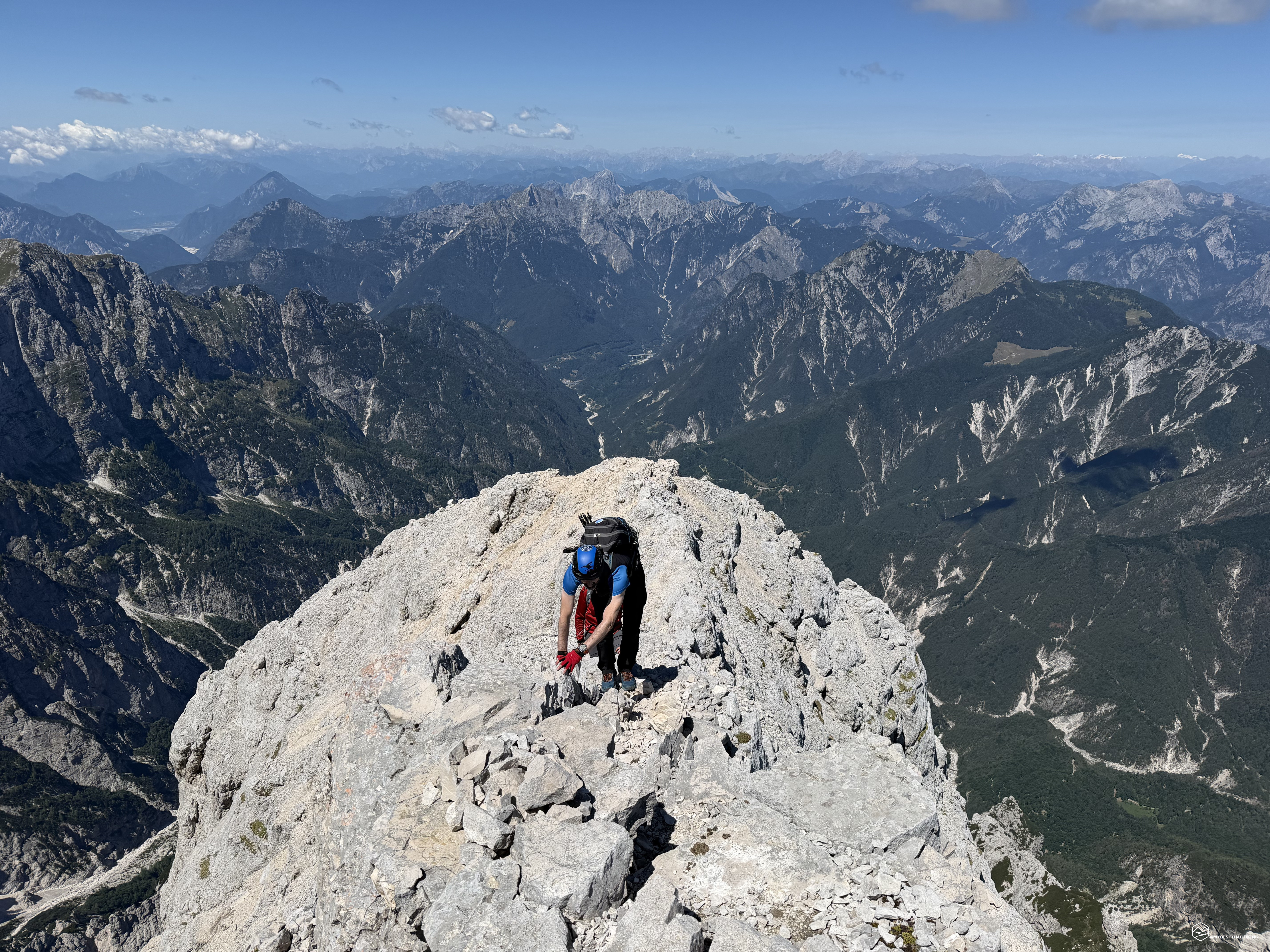
We continue with other less noteworthy sections of grade I and II and finally reach the sunlight: even on such a hot day, in the gully, our hands felt cold and numb for a long time! We reach the summit ridge. It's a very thin and airy ridge, resembling a blade of rock balanced over the void. Fortunately, it presents no difficulties, and there are easy rocks for a fun scrambling until we reach just below the summit. Here, a short scree climb takes us to the summit plateau.
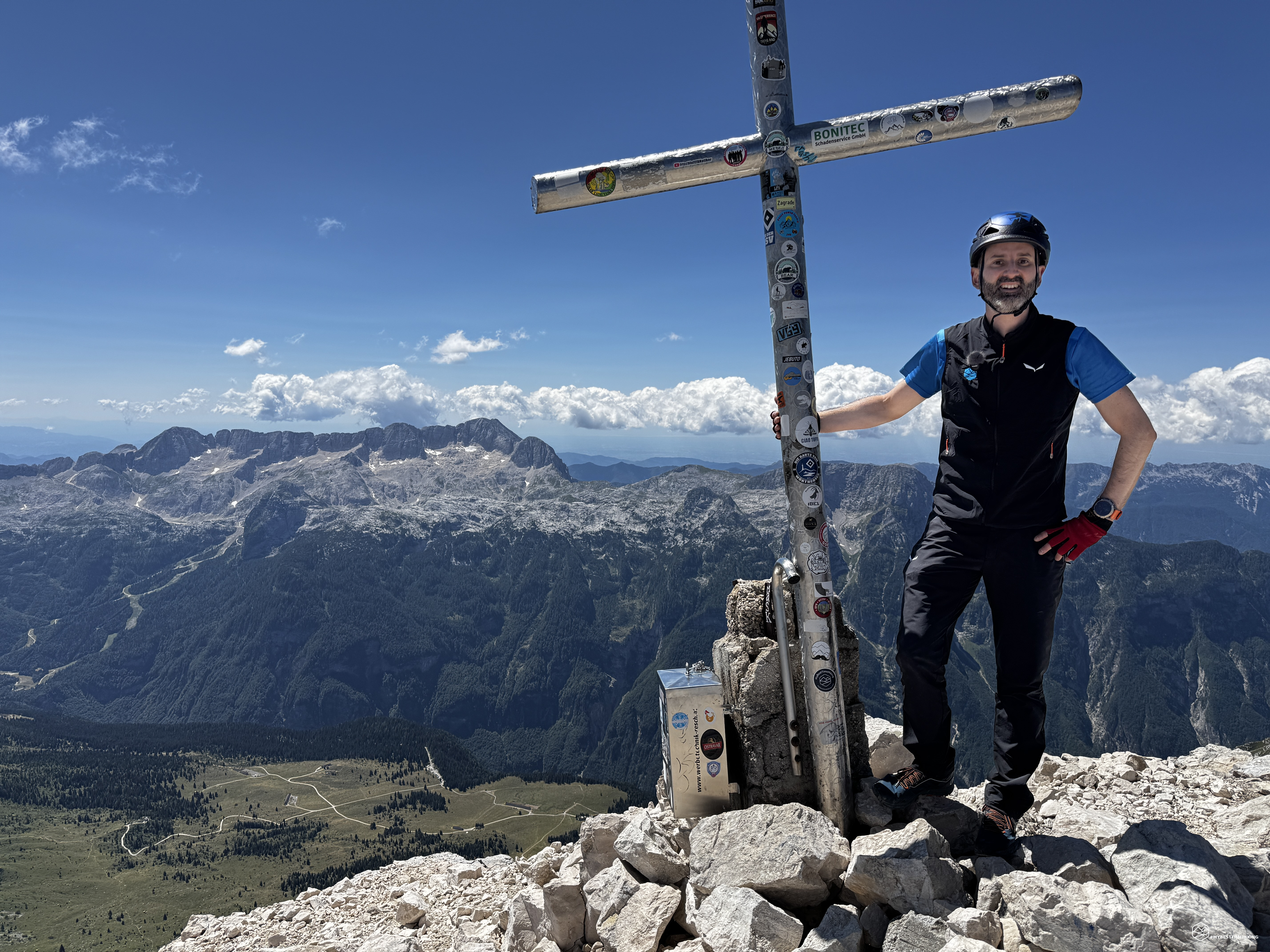
We're at the top of Jôf di Montasio at 2,753 meters above sea level! About 4 hours after setting off, we were able to admire one of the most beautiful views in the Julian Alps: from Mount Canin and Mount Cimone, which had accompanied us for much of the climb, to Mount Mangart, Slovenia's Triglav towering in the distance, and Mount Jôf Fuart and Mount Nabois nearby, until we finally turned our gaze to the Dolomites, where we could clearly distinguish Mount Civetta and Mount Antelao! A breathtaking view, on a par with our own Dolomites!
Marco rings the bell at the summit, and the sound echoes across the entire Montasio plateau. The cross holds the summit register. We enjoy a well-deserved break, admiring and enjoying the beauty that surrounds us, while already planning our next itineraries in the area.
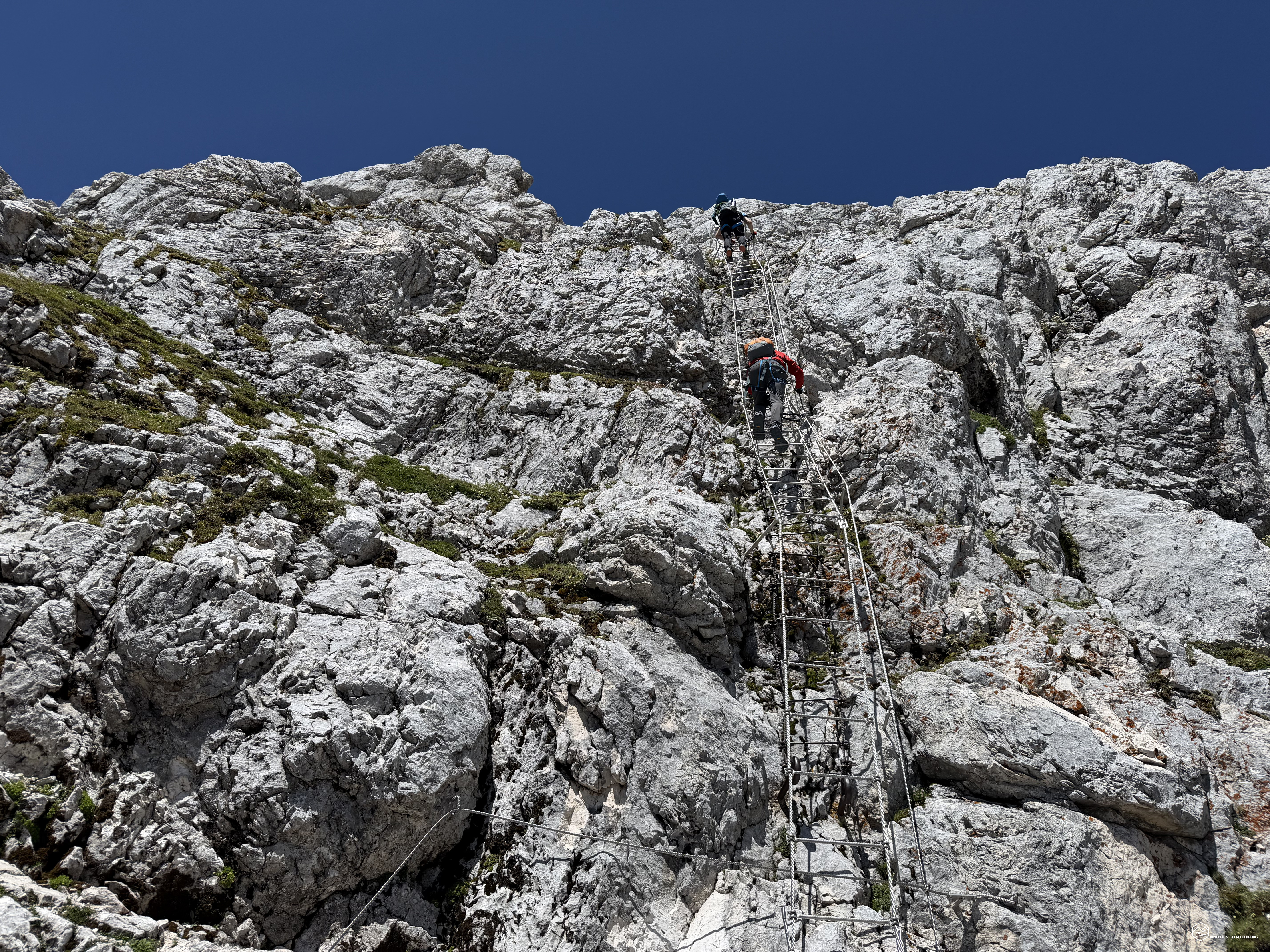
We leave the summit and follow the normal route (CAI 663a) to descend. We first follow another section of the ridge that quickly drops in altitude, first through easy rocks and then via equipped sections installed at the most critical points. The descent is safe and easy thanks to these equipped sections, until we reach Forca Verde at an altitude of 2,587 meters, where the most iconic and characteristic section of the Normal Route is located: the Pipan ladder!
A completely vertical ladder composed of three sections each tens of meters long, disappearing into the void. The three distinct sections were designed to mislead hikers traversing it in opposite directions. The first section, coming from the summit, is the longest and also unstable, with a slight sense of swaying. You never feel in danger, but it's not a fun feeling anyway. Ibex are always nearby, and in fact, at the top of the ladder, we see one with its neck upturned, looking at us funny hikers using this shiny tool... Who knows what it's thinking!
Continuing along via ferrata sections and then easy scree, we reach an altitude of approximately 2,400 meters, where we reach a fork. To the right, we continue along the normal route and rejoin trail 663 toward Forca dei Disteis, the outward journey's route. To the left, we continue along the Leva equipped trail (CAI 663b). Since it's not every day that one comes across such a beautiful and spectacular place, we indulge in this extension and take the Leva trail toward the second summit of the day: Cima di Terrarossa.
The Leva equipped trail proceeds along a ledge that follows the natural curve of the Modeon del Montasio. The entire route is fully equipped with over 50 metal segments that ensure progression. Some of these are even superfluous given the large portion of ledge and the ease of progress without danger. In my opinion, they were certainly installed for days when the weather is adverse and also to prevent potential pranks from our ibex friends. Indeed, even here, they are constantly present in small groups that could throw rocks over our heads. Be extremely careful.
We continue on a gentle and steady descent with a spectacular view of the Montasio Plateau and the Canin mountain range, until we reach the Forca del Palone. Before reaching the saddle, I'd like to point out two challenging sections of the via ferrata. Nestled between a rocky constriction, there are bolts that provide support for hands and feet, but in some cases they are difficult to see for those, like us, descending. The view from the saddle reminds us of the wild place we are in, with a cool, dark, and untouched gorge.
Continuing toward Terrarossa, we tackle the final equipped sections, climbing with more technical and slightly exposed sections, until we rejoin the CAI 664 trail that leads to the summit. Another 200 meters of elevation gain are added to the route. In this final stretch, we encounter a veritable family of ibex intent on enjoying the mineral salts among the rocks, and the younger ones admire these bipedal creatures clumsily attempting to reach the simple summit.
After about three hours from the summit of Jôf di Montasio, we reach the Terrarossa peak at 2,420 meters! An exceptional vantage point for admiring the sheer south faces of Jôf Fuart and Nabois Grande. The legendary Mangart still towers in the background. We turn to admire the view behind us: the entire Montasio opens up before us, revealing all its beauty and the difficulty we've just endured to reach its summit at Jôf di Montasio, before enjoying the digression along the Leva trail we followed on Modeon del Montasio. It's an absolute spectacle, as it truly seems impossible to have conquered those vertical heights!
We retrace our steps and descend along the normal trail 664 towards the Montasio plateau. The descent is pleasant, zigzagging continuously, allowing for a rapid and steady loss of elevation. We continue to encounter, admire, and photograph ibex, who remain undaunted on the main trail. We must have wasted over half an hour, considering all the photos we took of these friendly animals who happily accompanied us throughout the day.
At 1,900 meters, the rock ends and we continue across grassy ledges until we reach the long-awaited Brazzà refuge. Here, a cool, refreshing beer is a must, which we enjoy together after a hearty toast.
This concludes this sumptuous circular tour of the Jôf di Montasio. A peak in the Julian Alps that revealed itself in all its rocky beauty, in the majesty of the Findenegg route with its technical climbing difficulties, the Normal route with its characteristic Pipan ladder, and the Leva equipped route, which allowed us to traverse the entire Montasio mountain range! 1,500 meters of elevation gain in 8 hours and 30 minutes.
This is an alpine route that offers no compromises: it requires strong legs, stamina, and solid rock experience. Before starting your adventure, make sure the weather conditions are perfect: fog, rain, or glassy rock should force you to abandon your attempt without hesitation. Pay attention to the crux of the Findenegg described above. Don't underestimate the progression on the Grande Cengia either: always remember the thousand-meter drop that lies right at your side. A helmet and via ferrata kit are mandatory. Also, bring a piece of rope for safety if necessary.
A highly recommended adventure, one that I hope will inspire explorations in these rugged and authentic areas of Friuli!
Click here and watch the exclusive video on YouTube for an even more immersive experience!
DifficultyExpert Hikers with Equipment - The equipped routes (or via ferrata) are indicated, they require the use of self-insurance devices. |