Details
-
 Hike type
Hike
-
 Difficulty
E
-
 Distance
11.44 KM
-
 Altitude MIN
1582.00 mt
-
 Altitude drop +
880 mt
-
 Parking
-
 Landscape

-
 History
-
 Duration
5h
-
 Altitude MAX
2462.00 mt
-
 Altitude drop -
-880 mt
-
Hike type
Hike
-
Difficulty
E
-
Distance
11.44 KM
-
Altitude MIN
1582.00 mt
-
Altitude MAX
2462.00 mt
-
Altitude drop +
880 mt
-
Altitude drop -
-880 mt
-
Duration
5h
-
Landscape
-
History
-
Parking

Let's return to the sites of the Great War!
Enrico and Alessandro are accompanying me on today's adventure, eager to explore these places steeped in history from the First World War. We're near the Falzarego Pass, not far from Alleghe and Caprile. Today's destination is the ridge of Mount Sief and Col di Lana!
After Caprile, we reach the parking lot on the side of the main road leading to the Falzarego Pass, near the signs for Castello and Castello di Andraz. We shoulder our backpacks and follow the slightly downhill asphalt road toward Castello. After passing "la Malga," we stay to the right and, ignoring the signs for the "Sentiero del respiro," we climb straight up a trail that leads to the "Sas de Beita" cliff. We follow the trail until we reach a small bridge with a waterfall and then a wooden gate that we must carefully open and close. At a fork in the road, we choose the left path on CAI trail 35, clearly signposted for Col di Lana.
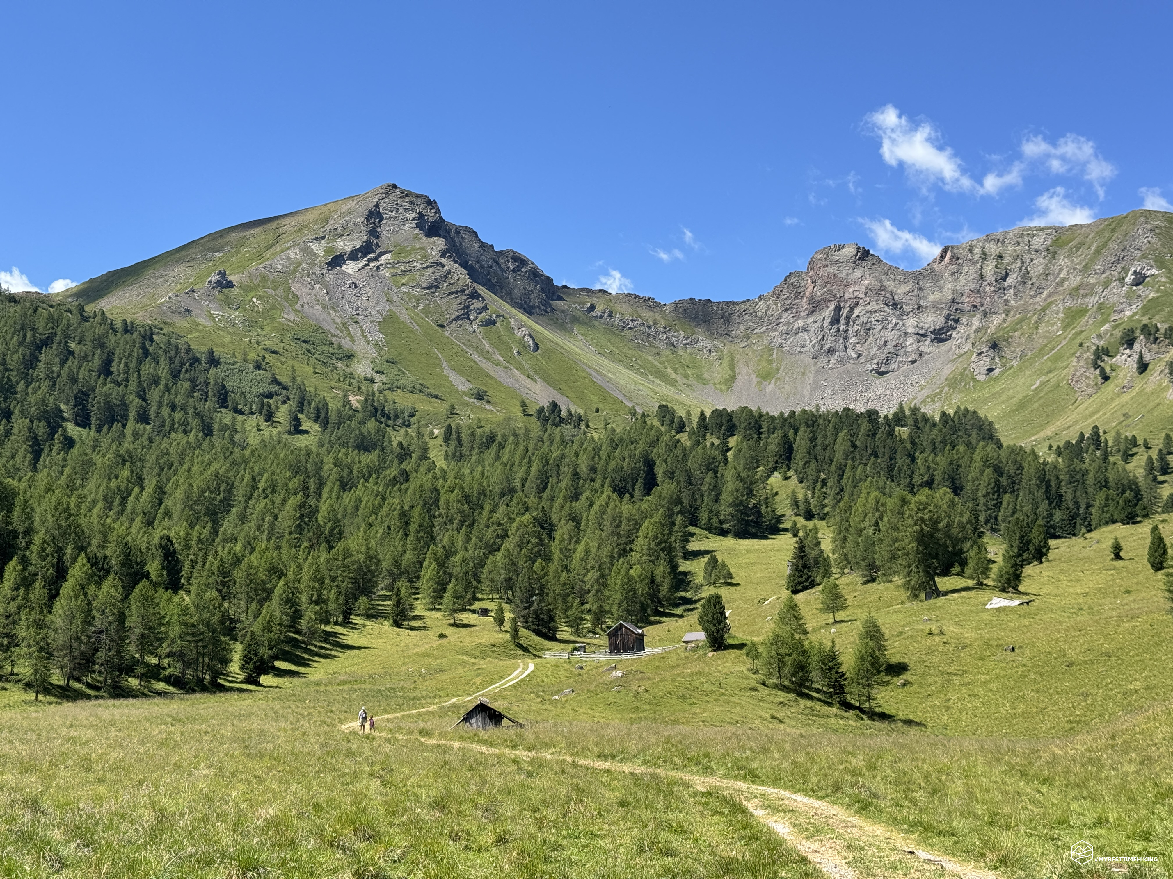
First, we pass through a thin undergrowth, then reach a stunning opening onto a grassy meadow dotted with huts and farmhouses, with a winding path leading through them. Today's route appears before us, with a view of Mount Sief, the ridge and crater that divide the Dente del Sief, and the final ridge that leads to the summit of Col di Lana.
From here, the historical reenactments that this place evokes and unleashes begin. I would like to point out that all the historical events I will mention in this article are taken from the book "Andare per i luoghi della Grande Guerra" (Walking through the Places of the Great War) by Marco Mondini, published by Il Mulino.
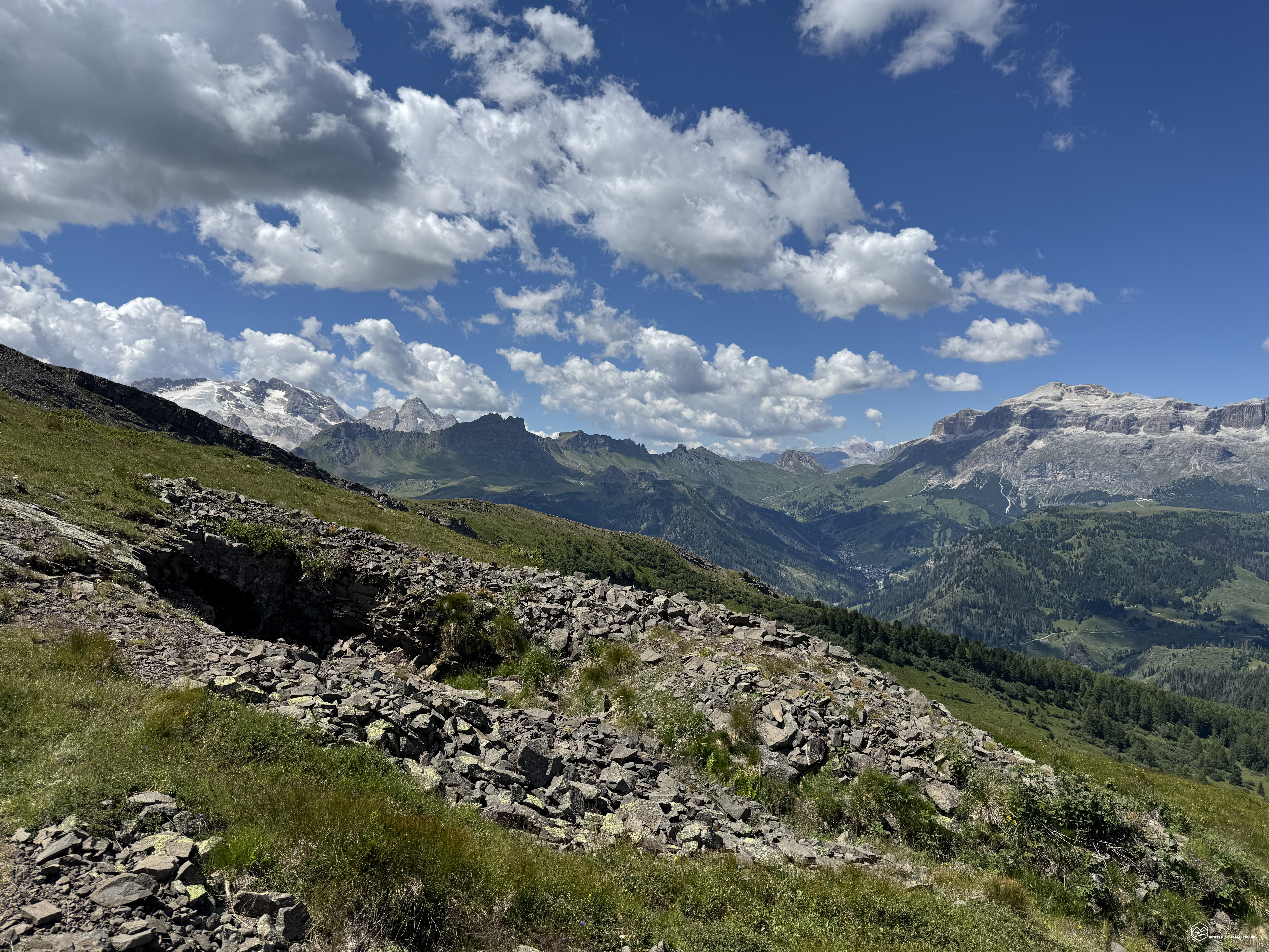
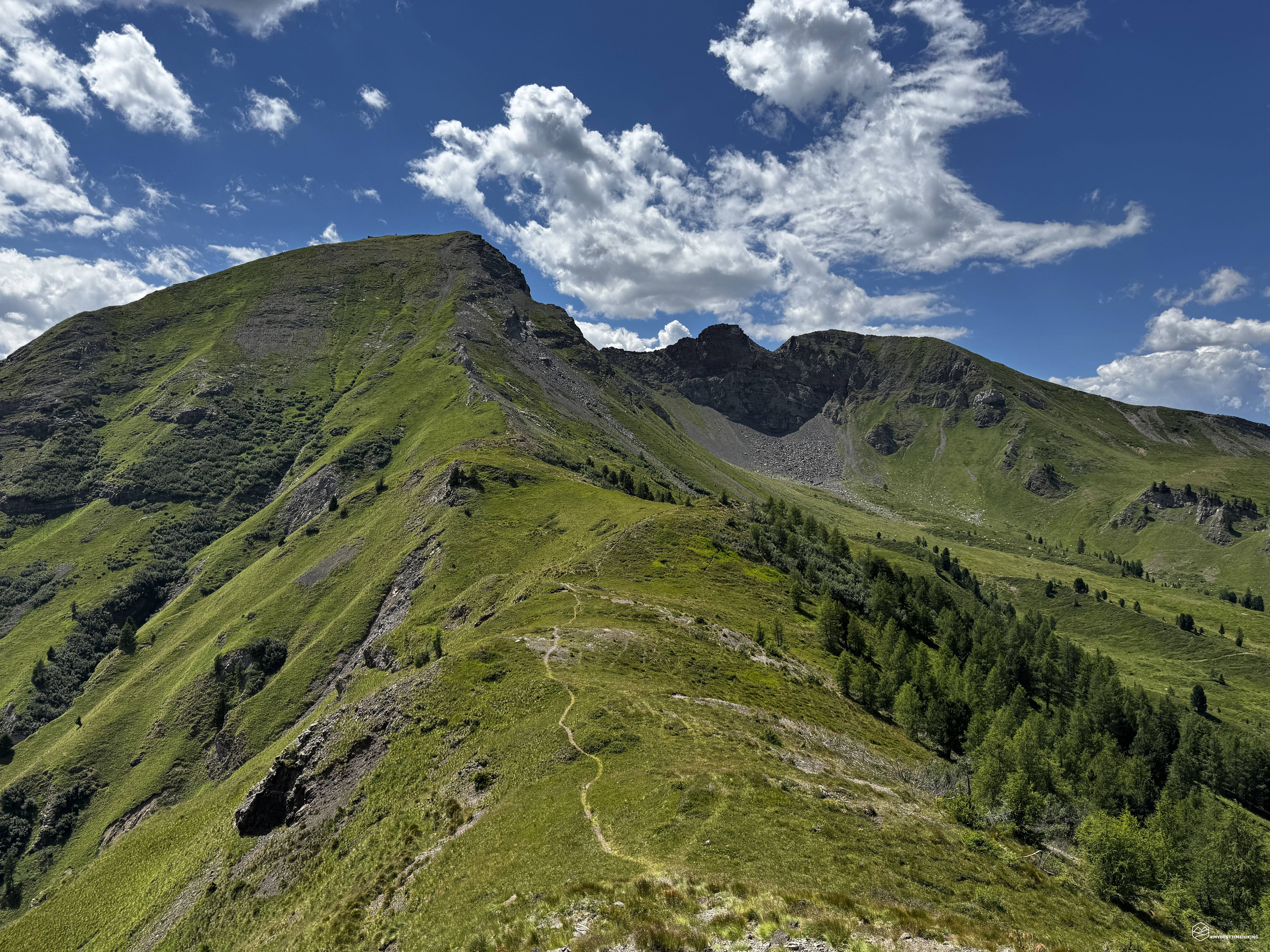
From here, we clearly see the anatomy of Col di Lana, made up of soft, grassy slopes that don't have the inaccessible appearance of the Dolomite walls. After a certain altitude, it's clear how the vegetation abruptly disappears, giving way to a lunar-like shape. This change isn't just the result of the volcanic nature of the terrain, but is the visible legacy of months of artillery bombardment and military excavations that have forever altered its topography.
We continue on a slight slope until about 2,050 meters above sea level, where a fork in the road leads us left, clearly marked. We are thus approaching the Sief Pass. The initially gravelly trail gives way to an improvised path in the grassy terrain with earthy ruts that make progress difficult. This section is also very steep and tiring, although the gradient isn't prohibitive, but also due to the terrain's conformation, it's not particularly relaxing to walk. About 1.5 hours after setting off, we intersect with CAI trail 21 and, among the first obvious trenches that crisscross the ridge, we reach the Sief Pass at an altitude of 2,211 meters.
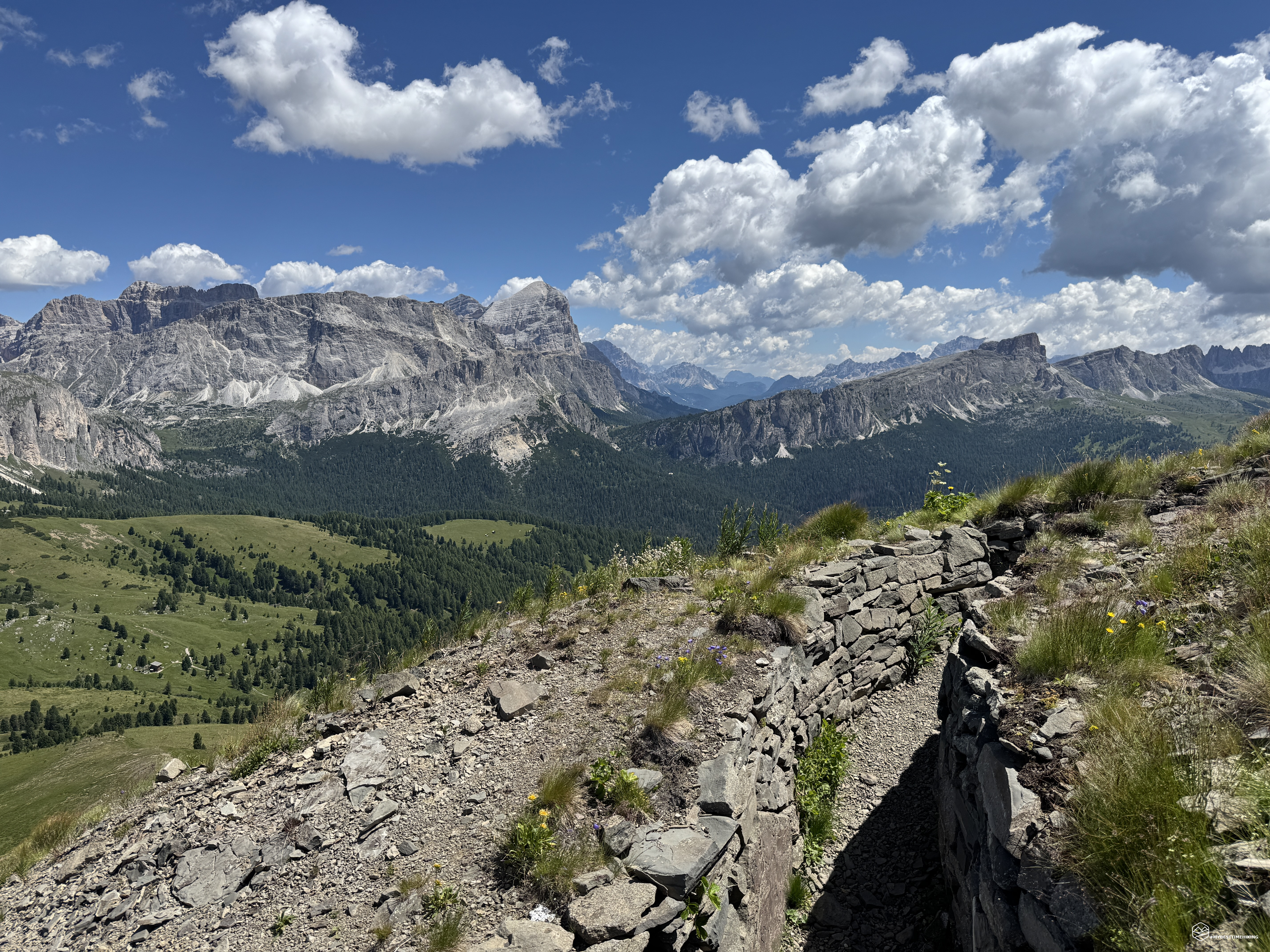
We observe the ridge ahead: the clear reference to the lunar terrain begins with the volcanic rocks lining the path to the summit. The landscape opens up more and more, and the first magnificent panoramas fill our eyes. As we advance along the ridge of Mount Sief, the first accessible trenches emerge, stretching along the entire length of the ridge. These are Austro-Hungarian trenches, lookout posts dug into the rock, and caves excavated as storage facilities for war materials. About halfway up the climb, a completely reconstructed trench appears, identical to what must have been the defensive solution during the war. The trench is completely passable: it takes several minutes to cross it completely, and I swear, it's breathtaking! The day is windy, with an ideal temperature, but inside you're gripped by dark rocks that almost crush you, the temperature is scorching, not a breath of air can pass... Perhaps it's the evocative nature of the historical site, but, in my opinion, it's the same state of mind of every soldier who lived in these places for years!
During the first summer of the war, the conquest of the mountain turned into a tragic sequence of frontal attacks. The Austrians had meticulously fortified the defensive line, exploiting every rugged terrain. Between June and the end of 1915 alone, infantry brigades such as the "Calabria" (59th and 60th Regiments) and the "Alpi" attempted around a hundred assaults, often without effective artillery support. The Calabria Brigade lost one in three men, with over 500 deaths: a toll so dramatic that it prompted the soldiers to rename the mountain "Bloody Hill." With the arrival of winter, living conditions in the trenches, in some places less than 80 meters from the enemy trenches, became unbearable. Extreme snowfalls destroyed the barbed wire, while the communication trenches were transformed into ravines of mud and ice. At night, the mud froze, while during the day it sank the infantrymen waist-deep, preventing even the arrival of hot rations and forcing the troops to wait in the freezing cold under fire from Austro-Hungarian snipers and machine guns.
We see the peak of Sief a few steps away from us, with its prominent summit cross. But our gaze falls on a tunnel emerging from the earth: this is one of the Austrian mine galleries. These tunnels have forever changed the appearance of this mountain, as they have on other Dolomite peaks.
It soon became clear that the Austrian defenses of Cima Lana could not be taken in the open. Thus it was decided to resort to mine warfare, an operation promoted by Gelasio Caetani, a renowned mining engineer and member of the Roman aristocracy who had volunteered as a second lieutenant in the Engineer Corps. Between January and April 1916, starting from the Italian command caverns, the engineers dug a 52-meter-long main tunnel, connected to blast chambers and assault shelters located directly beneath the Cima Est, the advanced point of the Austrian defense. To prevent the noise of the excavations from alerting the enemy, the use of any mechanical drilling equipment was prohibited: the entire tunnel was excavated in darkness and silence using only pickaxes and hammers, even thwarting an Austrian countermine detonated in an attempt to collapse the tunnel. On April 15, the underground chambers were loaded with 5,500 kilograms of explosive gelatin. On the night of April 17, 1916, shortly before midnight, the mine detonated with devastating consequences. The summit of Col di Lana opened, projecting tons of rock and debris. The Austrian garrison of the 2nd Kaiserjäger Regiment was instantly reduced in size by the explosion and the subsequent barrage of 140 Italian artillery pieces. The shock wave and landslide also destroyed the Grosse Kaverne, the large cave dug into the rock that the defenders used as an anti-artillery shelter, trapping the survivors under the rubble. The infantrymen of the 59th Italian Regiment occupied what remained of the summit with almost no resistance.
Date
10-07-2026
Distance
11.44 KM
Hike type
Hike
Ascent
880 mt
- Mountain
Col di Lana
- Address
Pieve di Livinallongo, Veneto
- Altitude
2462.00 m
- Refuges
- Information
From the summit of Sief, there's a spectacular 360-degree view, but we want to enjoy it from the highest point, Col di Lana. Looking toward this peak, we see a veritable crater on the mountain. A series of piled-up boulders force us to descend several dozen meters, with the aid of a metal cable and metal brackets, to the base of this man-made hole. The rocks are held in a seemingly unstable equilibrium. Stones as large as entire rooms, piled high, teetering. In some places, they seem blood-red, black rocks, rocks that exploded under entire regiments of soldiers who had seen death.
Despite the exceptional engineering effort and loss of human life, the fall of Col di Lana brought modest tactical results. The Austrians simply retreated to the twin peak of Mount Sief, a few hundred meters away and at a slightly lower altitude, continuing to dominate the area and denying the Italians a strategic opening to the north. The mountain became a siege stronghold for another year and a half, in a war of attrition waged with gas, artillery duels, and ever-deeper mines. The climax of this underground battle came on October 27, 1917, when the Austrians detonated a titanic countermine containing 45,000 kilograms of explosives. The blast pulverized an entire Italian outpost and engulfed the craters from previous explosions, creating a gigantic crater 80 meters in diameter and almost 40 meters deep. That impressive scar still divides the ridge between Col di Lana and Sief, visible to anyone walking the ridge trail.
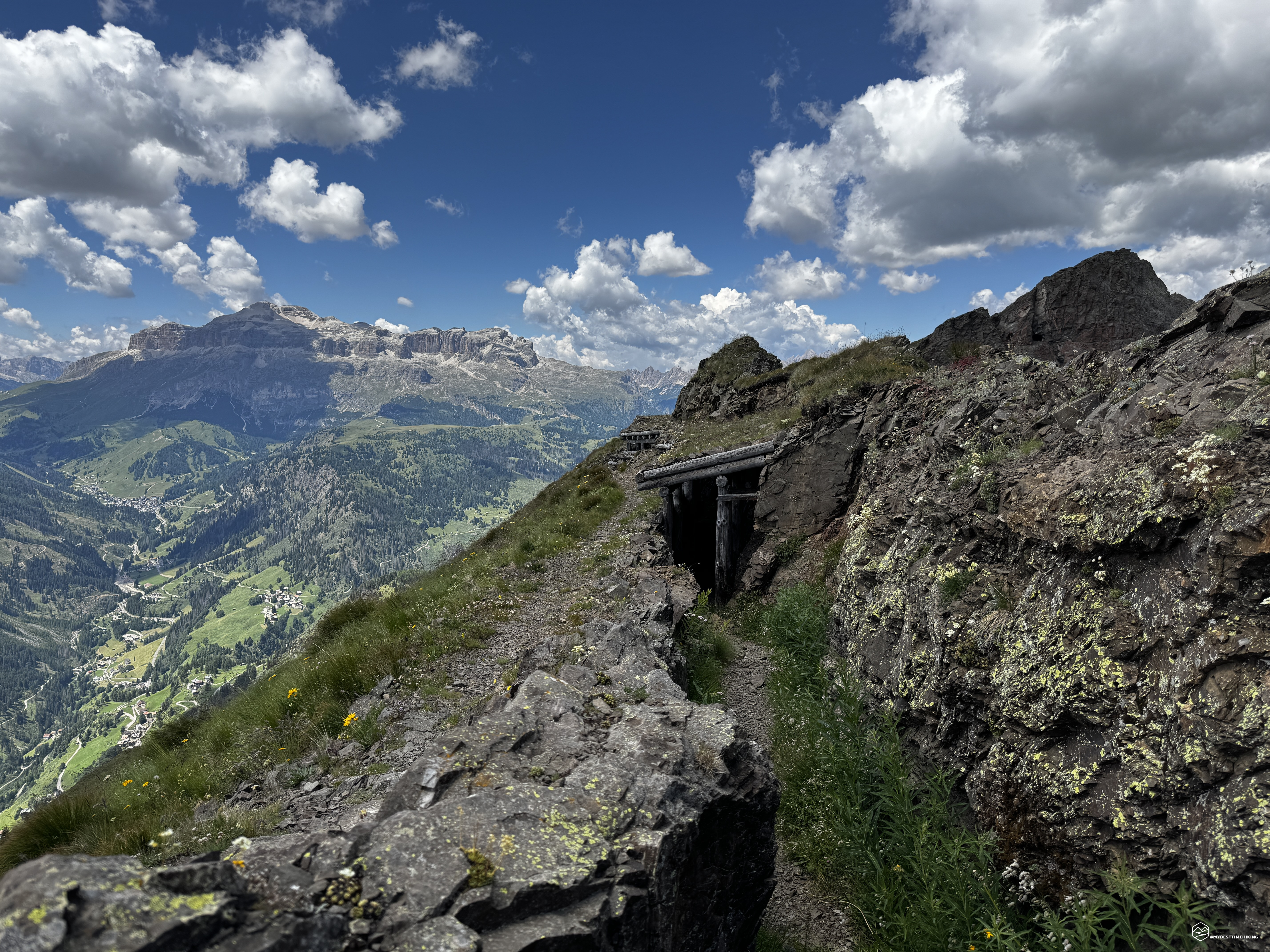
We continue along the ridge, passing the Dente del Sief, and skirt it, peering through several lookout tunnels. With the secure metal cable at our disposal, progress is never dangerous, although it requires a surefootedness, a head for heights, and open spaces. The trail is actually easy and suitable for hikers of average fitness, but the altitude and this secured section, which could be unstable, must be considered. After passing the Dente del Sief, we reach the final ridge that leads to Col di Lana. Here, there's a faithful reconstruction of a trench overlooking the Marmolada and Sella Massif: a structure made of logs for support, completely covered with slits overlooking the valley. There are embankments for storing materials and planks for slightly more comfortable sitting. The most beautiful undug trench I've ever seen!
Now we climb the final stretch, again as with the Sief Pass, on a very steep slope. Small terraces marked out by wooden planks create convenient steps that facilitate progress. We begin to see the end of the ridge. The trail curves to make reaching the destination easier. Here it is: the summit of Col di Lana, 2,462 meters! Just under three hours after setting off, we reach the summit amidst a dreamlike panorama!
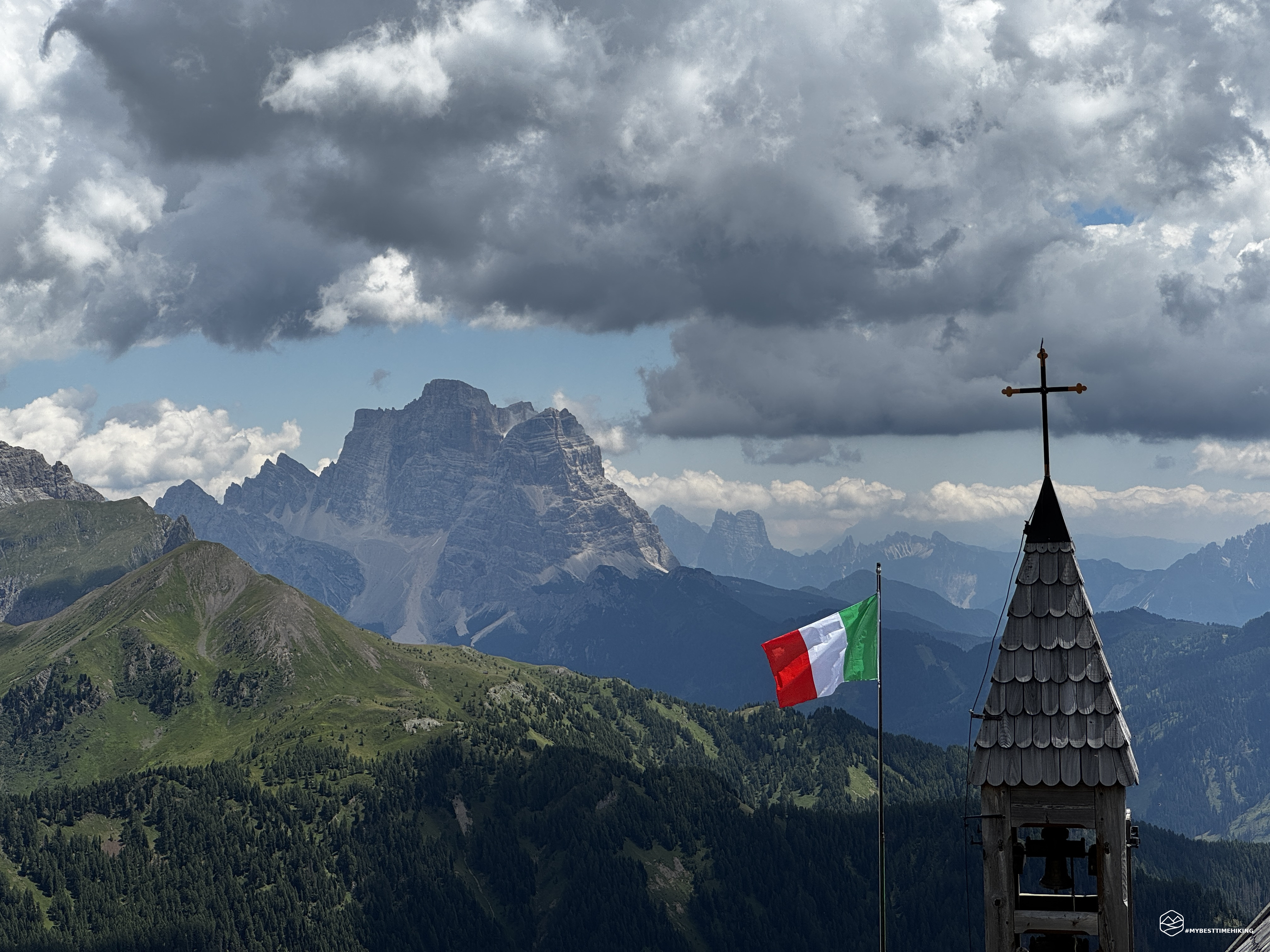
An exceptional 360-degree view of Pelmo, Sorapiss, Cristallo, Tofane, Lagazuoi, Piz de Laravela, Cima Dieci, the Sella Group, the Marmolada, and closing the circle on the Civetta. Nestled between the Falzarego Pass, the Cordevole Valley, and the Pordoi, Col di Lana appears almost unassuming compared to the aforementioned Dolomite rock giants. The characteristic little church facing the summit has a tall Italian flag waving on this windy day. A little further down, the Bivacco Brigata Alpina Cadore offers shelter from the elements in this legendary place. From a strip of land jutting eastward, slightly below the summit, you can clearly see the ridge you just traversed and the majestic crater formed by the detonation of the Austrian countermine in 1917.
Every step we take in this area traces the footprints of a soldier's boot, of a history that is no longer with us but remains vivid.
We leave the summit and head east on CAI trail 38. In the initial stretch, this route is decidedly steep and difficult. Maintaining balance on this unstable, sloping terrain is a feat and requires attention and surefootedness. We descend quickly, forced by the almost vertical terrain, and leave the summit cross behind us, opening our gaze onto the ridges that were once dotted with military outposts and terraces. At 2,207 meters, we rejoin CAI trail 43, which overlaps trail 38 until we reach the summit of Cenglei, another area of conquest and a tense standoff between the Italians and Austrians. We steadily lose altitude, choosing the path marked "Castello" through now pleasant zigzags over grassy ledges.
We gain vegetation again and, through the undergrowth, continue our descent until we glimpse the village of Castello. It is here that the trail encounters a historical testimony from a completely different era, yet intimately linked to the history of the mountain: Andraz Castle.
Spectacularly nestled on a huge boulder that fell into the valley millennia ago, this medieval fortress, built in the 11th century, controlled traffic along the ancient iron routes and the Tyrolean border for centuries. Although it represents a symbol of a distant feudal era, the castle was not spared by war: during the fighting on Col di Lana, its old walls were severely damaged and torn apart by artillery fire, located right in the line of fire. Concluding the hike in the shadow of the castle offers a perfect visual summary of the area: from the medieval valley fortresses to the trenches dug into the peaks, the entire conformation of these mountains represents a historical archive carved into the rock.
We leave this majestic bastion behind and, following CAI trail 37, rejoin "La Malga." After a final gentle climb, we return to the morning parking lot, completing the loop.
Today's adventure is a complete immersion in history: the Great War can be felt and sensed at every step along the entire route. The sight of these places only vaguely evokes the oppression our soldiers endured in every season. This hike, also from a landscape and panoramic perspective, is exceptional and highly recommended! Suitable for all hikers of average fitness, this adventure requires a head for heights and knowledge of navigating open spaces, except for the ridge between Sief and the summit of Col di Lana. I highly recommend this ring to all mountain and history enthusiasts because it is the most beautiful combination of these two passions!
Click here and watch the exclusive video on YouTube for an even more immersive experience!
DifficultyHikers - Itineraries on paths or evident traces in various types of terrain (pastures, debris, stony ground ...). They are generally marked with paint or cairns (pyramid-shaped stacked stones that allow you to identify the route even from a distance). They can also take place in snowy but only slightly inclined environments. They require the equipment described in the part dedicated to hiking and sufficient orientation skills, walking training for a few hours. |