Details
-
 Hike type
Hike
-
 Difficulty
E
-
 Distance
8.46 KM
-
 Altitude MIN
1586.00 mt
-
 Altitude drop +
700 mt
-
 Parking
-
 Landscape

-
 History
-
 Duration
4h
-
 Altitude MAX
2286.00 mt
-
 Altitude drop -
-700 mt
-
Hike type
Hike
-
Difficulty
E
-
Distance
8.46 KM
-
Altitude MIN
1586.00 mt
-
Altitude MAX
2286.00 mt
-
Altitude drop +
700 mt
-
Altitude drop -
-700 mt
-
Duration
4h
-
Landscape
-
History
-
Parking

Some adventures begin with a goal and then turn into explorations for new adventures with even more ambitious goals.
This is the case with today's hike with my buddy Tomaso in the Pale di Misurina!
We reach Misurina and park the car on the side of the road just before the climb to Malga Misurina. We admire the famous lake before us on the right, then turn our backs and continue along the road that leads to the malga. We immediately notice all the signs that tell us it's coming: cows grazing, goats grazing, and donkeys roaming freely in the undergrowth along the trail. We pass the malga, which will undoubtedly be our return stop, and continue across the meadow until we reach a CAI trail sign with a fork: to the right, we take the direct route to Monte Popéna (not to be confused with Piz Popéna), while to the left, we follow our CAI trail 224 towards Forcella Popéna.
We follow an easy trail through the undergrowth, climbing steadily but never strenuously. We soon reach an altitude of 2,000 meters, where there's another fork: Forcella Pale di Misurina to the right, and Forcella Popéna to the left. We choose this second option, and the trail marker becomes CAI 224b. We're essentially following part of the Italian Alpine Club's Sentiero Italia trail.
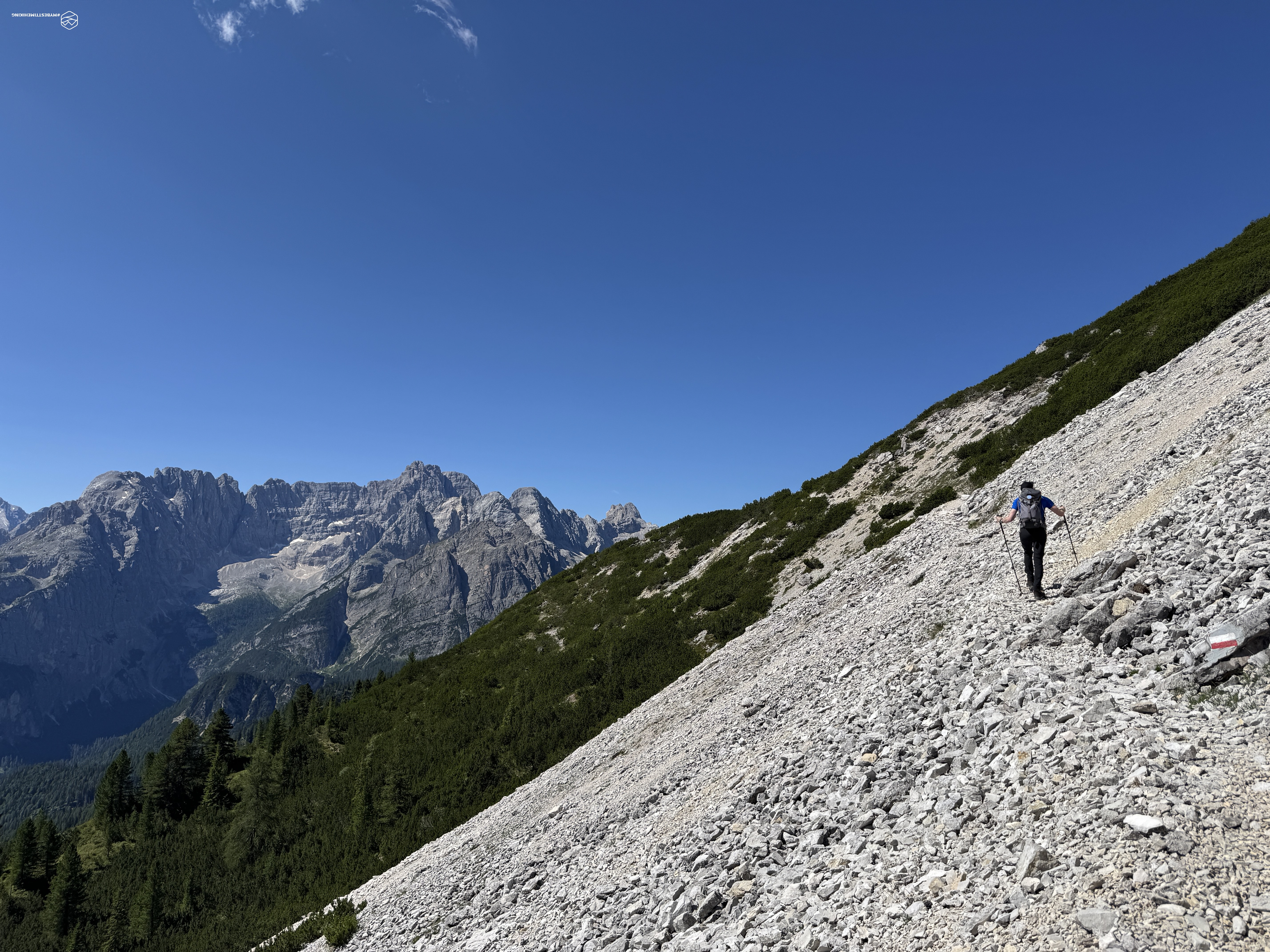
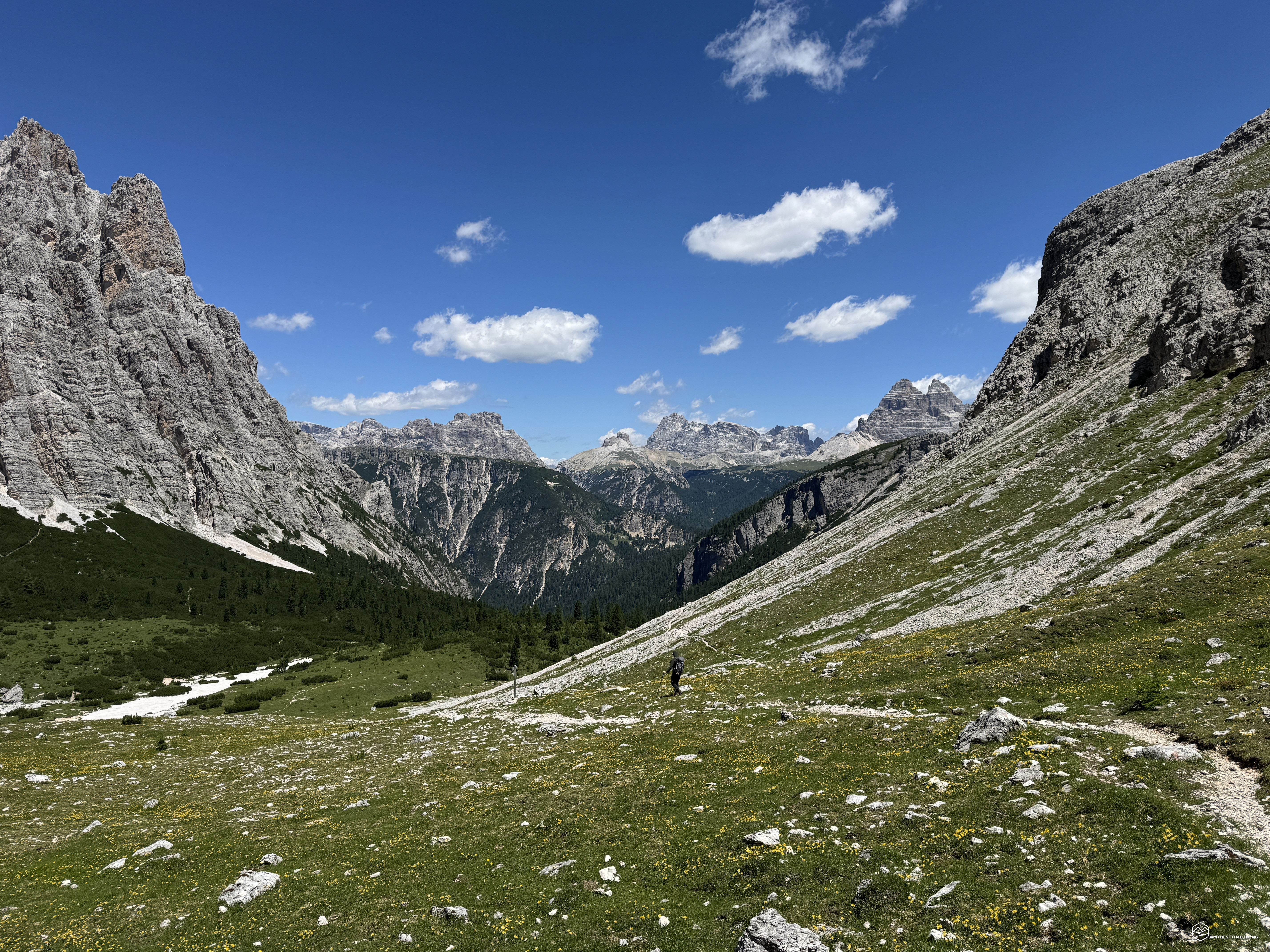
We climb gently through pines and firs to about 2,050 meters, where we emerge onto a wide scree slope with the Pale di Misurina to our right and a magnificent view of Sorapiss practically before us. The Pale di Misurina are peaks that few people know: everyone comes to Misurina for the lake and the Tre Cime di Lavaredo, but turning our gaze to the west, we see these imperious Dolomite walls towering over the town. Orange-black rocks create a barrier between Misurina and the Val Popéna. Almost like a curtain, heralding the spectacular peaks of the Cristallo massif right behind them. These are impressive peaks with a unique charm that deserve to be explored!
Now the trail runs steadily along the slope, the scree alternates with patches of mountain pine, and we notice some chamois happily leaping not far from us. We then reach a large boulder with, not far away, a weather-damaged CAI sign: this is a special place for those who want to explore! Look up at the patch of mountain pines near the walls of the Pale di Misurina. You'll notice a bright red dot. Memorize that dot and, through the scree ahead, try to reach it.
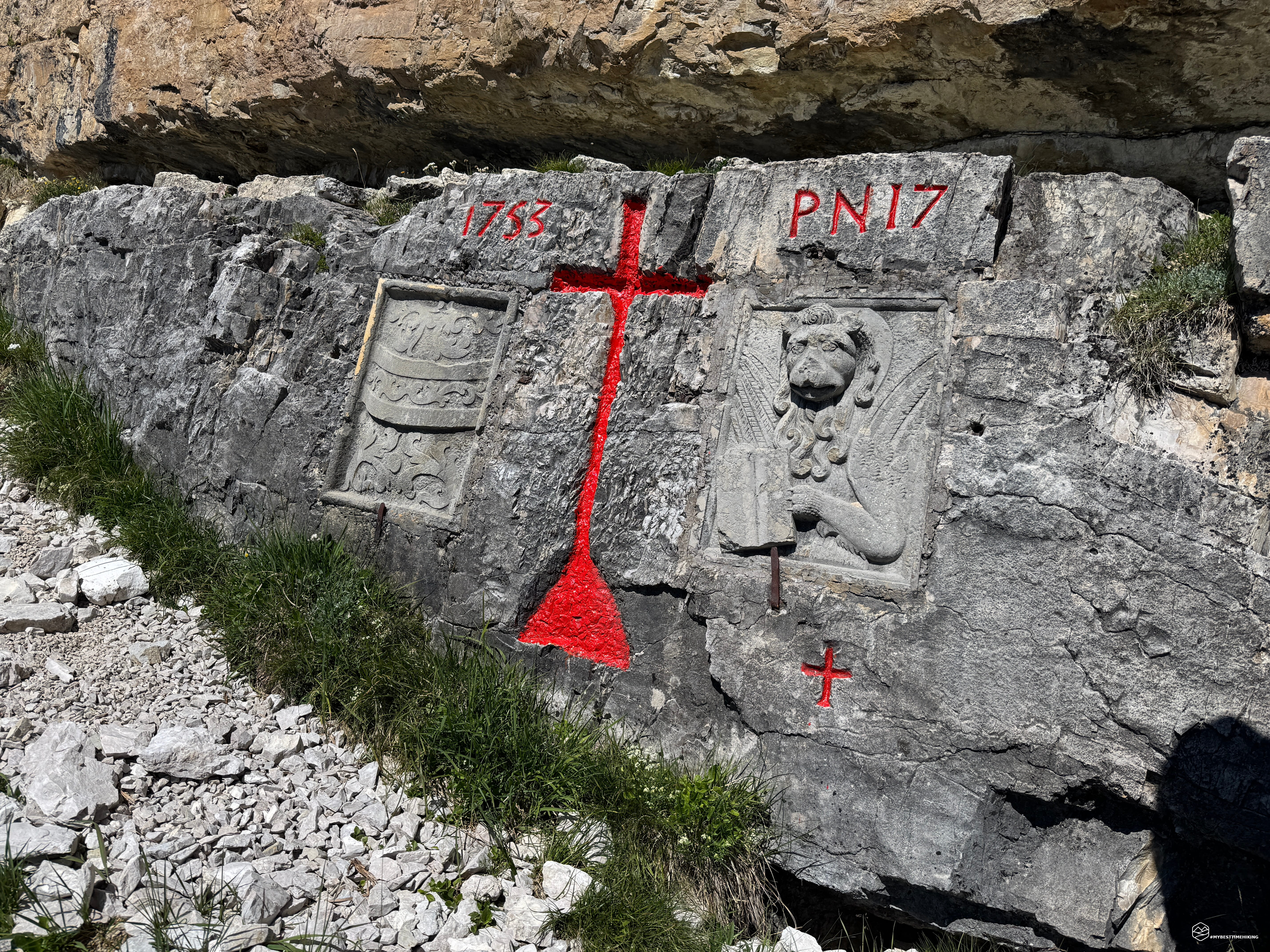
In a few minutes, you'll find yourself in front of an 18th-century relic: a boundary stone from 1753 with the effigy of the Austro-Hungarian Empire on the left and the Lion of Venice on the right! It's a sight to see this type of historical relic in a seemingly remote location, yet it represents a historic border that still marks the boundary of the Ampezzo Dolomites Natural Park. In our adventures, we've already seen two identical ones on the Muraglia del Giau (I discuss them in the articles “Muraglia del Giau e Lastoi de Formin” and “Ra Gusela, Nuvolau, and Averau”).
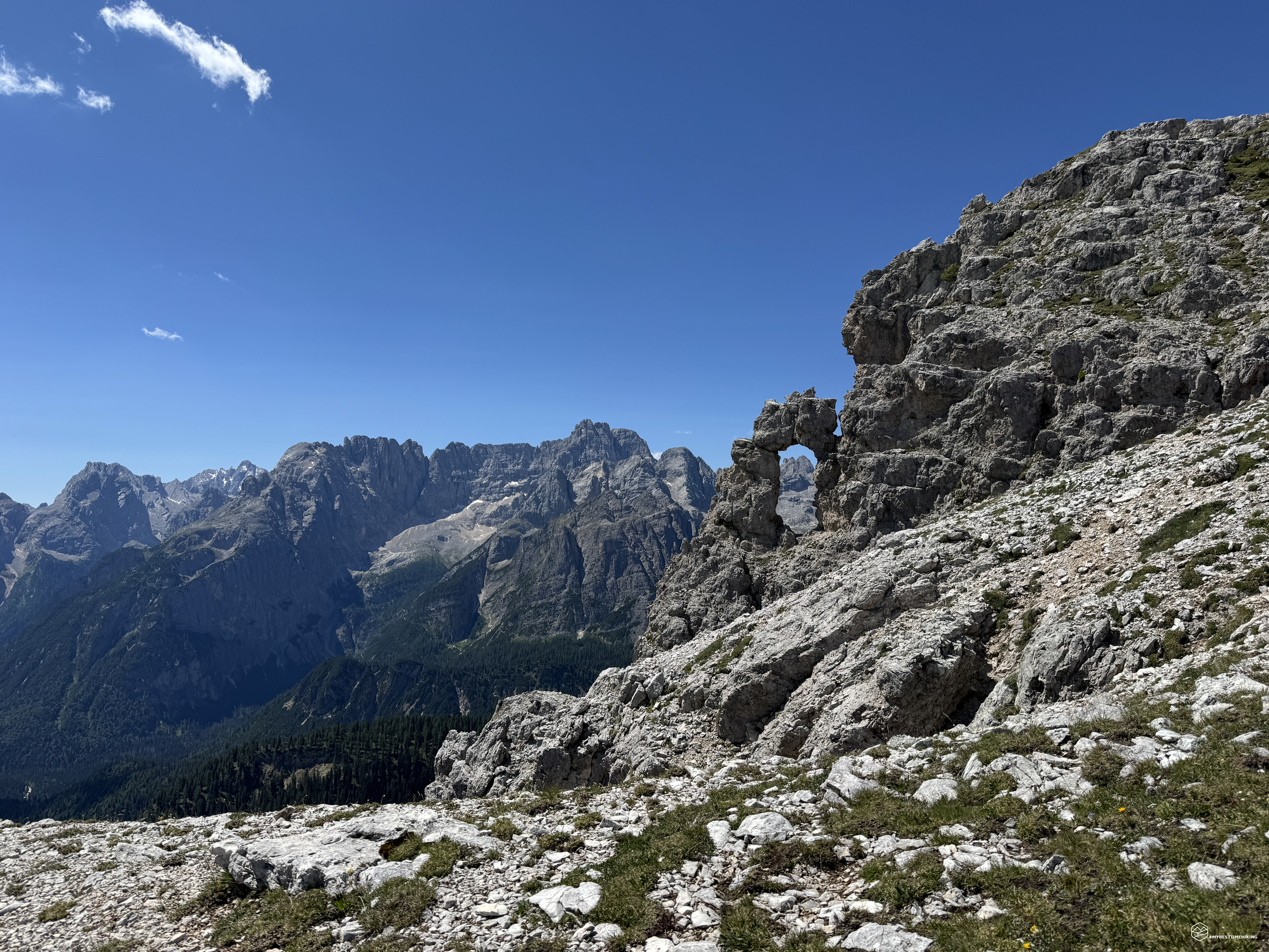
Once we've admired the historical stone, we continue towards the Forcella Popéna via a comfortable ledge that climbs southwest. The trail is clear and allows you to cross the ridge in a few minutes and rejoin the red-dotted trail, shown on the Tabacco map, to reach the pass. The stretch to get there is short but impressive: you walk along a very narrow path with a steep drop over a landslide to the side. Heavy rains shape this route year after year, forcing the installation of wooden bridges and steel frames to maintain access. Indeed, there are walkways with steep ladders that have no guardrails or handrails. For those without dexterity and experience with aerial views of the void, they could be somewhat uncomfortable. So be careful: a sure footing and a head for heights are essential.
We quickly reach the Popéna Pass at 2,214 meters, and before us opens a verdant plateau, with a fierce wind lashing us relentlessly. And here is what remains of the former Rifugio Popéna: four ruined walls that stand isolated on this land shielded by the incredible dolomite of Piz Popéna, the bell towers of Val Popéna and, more hidden to the right, the Cristallino di Misurina.
Date
04-07-2026
Distance
8.46 KM
Hike type
Hike
Ascent
700 mt
- Mountain
Pale di Misurina
- Address
Misurina, Veneto
- Altitude
2286.00 m
- Refuges
Malga Misurina
- Information
We notice some hikers trying to reach the modest, dome-shaped peak that lies to our side to the west. We mistakenly assume it might be the trail to Corno d'Angolo, and we attempt to reach its summit. In about ten minutes, we reach the summit with a beautiful view of the Val Popéna, but that's not the route we should follow. We descend back to the refuge and continue even further until we reach a clear trail that runs along the ridge to the west.
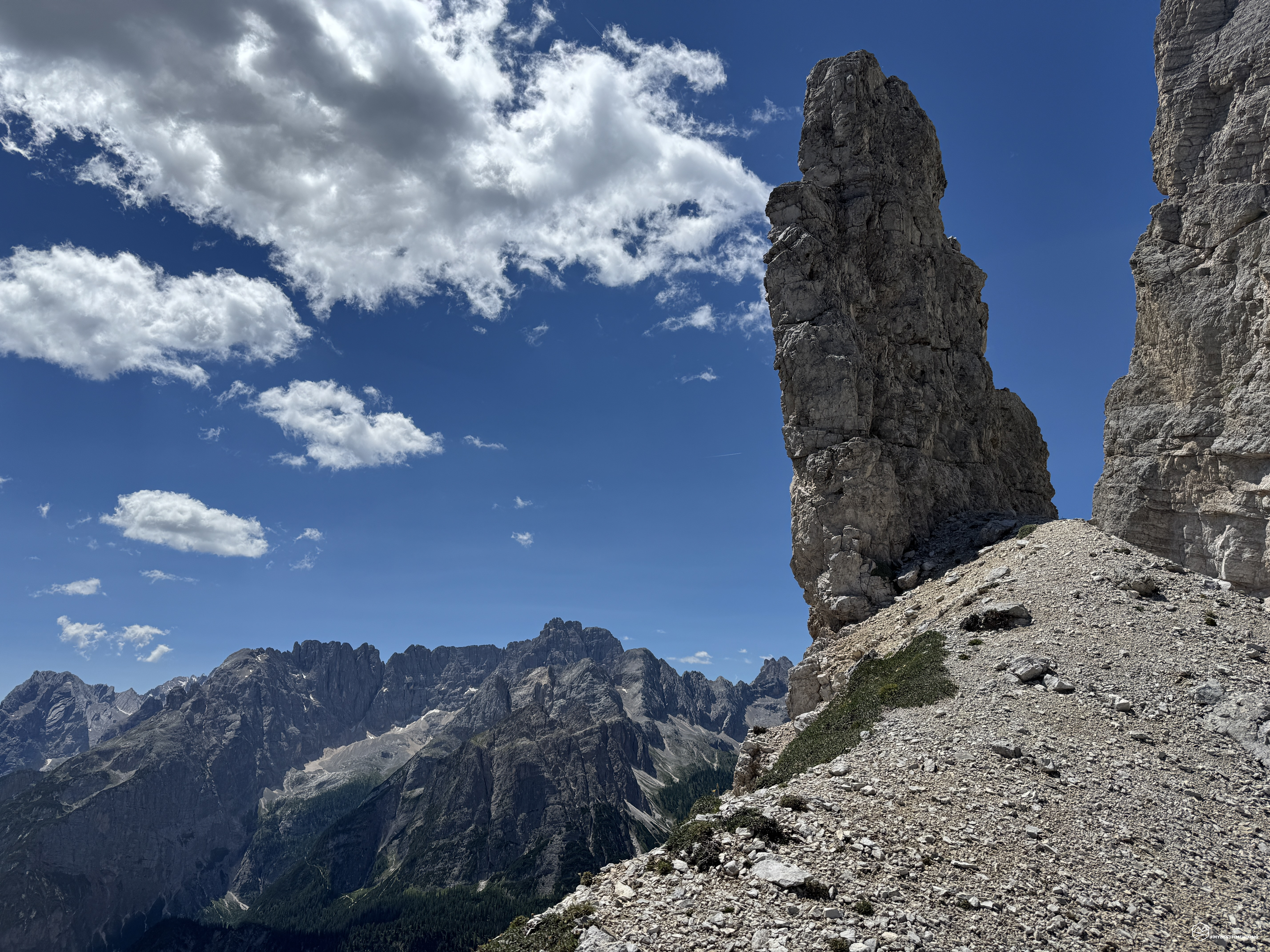
We follow it, now aiming for the obvious outline of Corno d'Angolo. Already noticing some difficulties we hadn't anticipated for the day, we decide to stop at an unnamed pass to our left, near a slender, solitary spire that looks as if it might fall at any moment. We enjoy a well-deserved lunch and an exceptional panoramic view.
Tomaso notices a stele on the series of ridges that lead from Corno d'Angolo toward the Pale di Misurina. Further research on some online guides reveals that there are two more historical boundary stones like the one discovered this morning! We must therefore organize a new exploratory expedition to find these two relics.
We retrace our steps and, once again following the path halfway up the mountainside, head toward the former Rifugio Popéna. We pass it and descend toward the lowest point of the Val Popéna. We intersect with CAI trail 222, and at about 2,150 meters, we find a CAI sign. Here, we continue along the trail that continues along the base of the Pale di Misurina. It is dotted in black on the CAI map and proceeds over scree, which is difficult at times and has very short, tricky sections, characterized by micro-landslides and challenging ledges. For less experienced hikers, I recommend continuing on trail 222 to a crossroads at 2,055 meters. Here, you can take trail 224 to ascend to the Forcella Pale di Misurina. The hike is a bit longer, but it makes it significantly easier.
We, however, as I mentioned, chose the more challenging route, but with the most authentic feel. The Pale di Misurina are majestic from here and rival the most famous Dolomites!
A half hour from the crossroads, we reach the second pass of the day: Forcella Pale di Misurina. Here you have a 360° view of Sorapiss, passing by Mount Antelao, the Marmarole, the Cadini di Misurina, the Tre Cime di Lavaredo, Monte Piana, Monte Rudo, the Val di Landro, the Cristallino di Misurina, the bell towers of Popéna, and Piz Popéna: a spectacle!
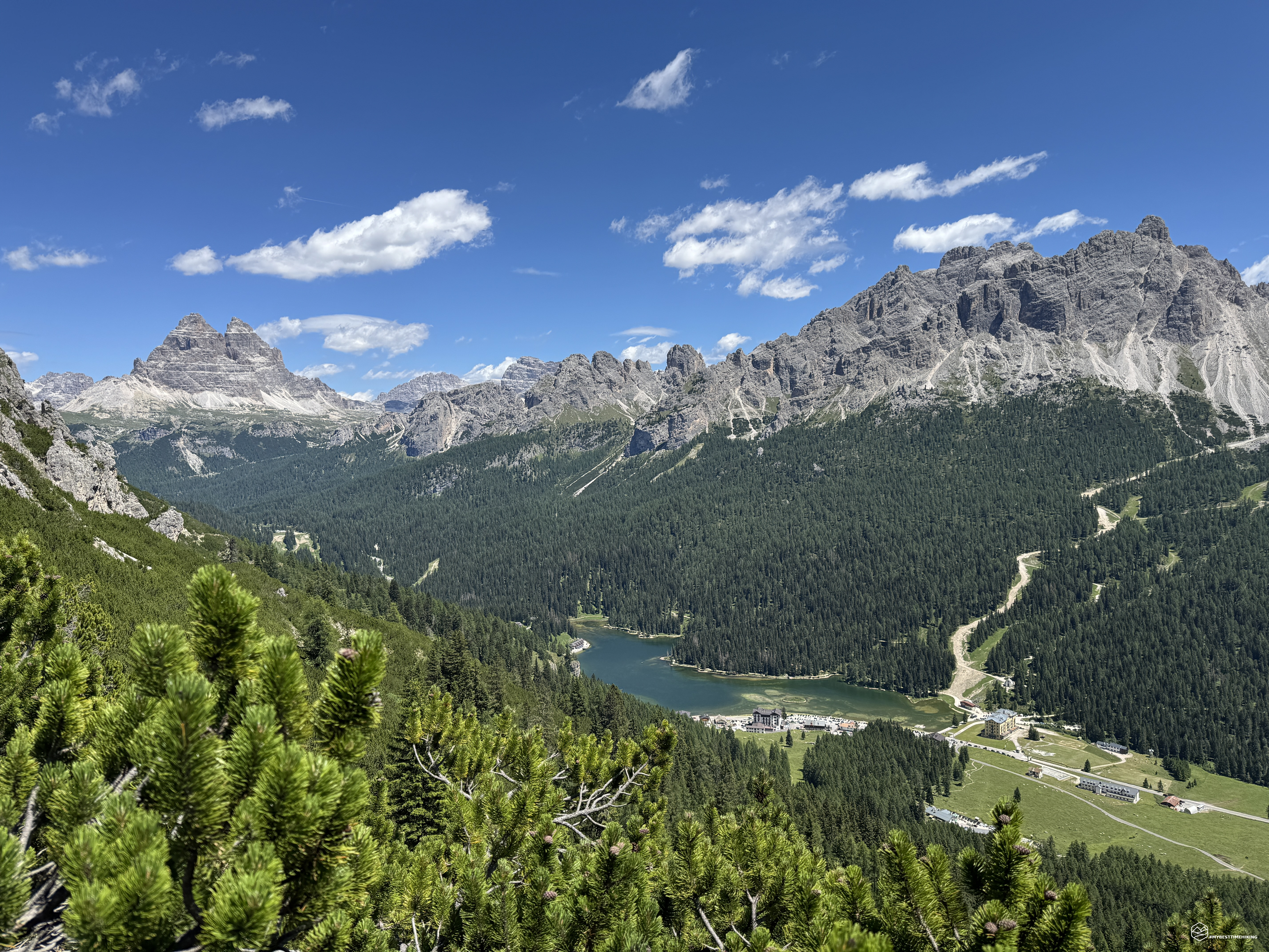
We continue on CAI trail 224 that descends towards Misurina, admiring the emerald lake. The trail winds through a series of switchbacks through a sea of mountain pines, until it rejoins the previously described junction at 2,000 meters.
We reach Malga Misurina, where a nice cold beer and a tasting of exceptional local products await us.
This concludes today's exploratory adventure. An intense half-day that has allowed us to discover historic sites and inspire future expeditions. Today's loop is suitable for hikers of average fitness: the elevation gain is moderate (about 700 meters), but some sections of the trail should be traversed by those with experience on Dolomite terrain. An adventure that won't disappoint, with its panoramic views and rare gems!
Click here and watch the exclusive video on YouTube for an even more immersive experience!
DifficultyHikers - Itineraries on paths or evident traces in various types of terrain (pastures, debris, stony ground ...). They are generally marked with paint or cairns (pyramid-shaped stacked stones that allow you to identify the route even from a distance). They can also take place in snowy but only slightly inclined environments. They require the equipment described in the part dedicated to hiking and sufficient orientation skills, walking training for a few hours. |