Details
-
 Hike type
Ferrata
-
 Difficulty
EEA
-
 Distance
15.60 KM
-
 Altitude MIN
935.00 mt
-
 Altitude drop +
817 mt
-
 Parking
-
 Landscape

-
 History
-
 Duration
6h 30m
-
 Altitude MAX
1752.00 mt
-
 Altitude drop -
-817 mt
-
Hike type
Ferrata
-
Difficulty
EEA
-
Distance
15.60 KM
-
Altitude MIN
935.00 mt
-
Altitude MAX
1752.00 mt
-
Altitude drop +
817 mt
-
Altitude drop -
-817 mt
-
Duration
6h 30m
-
Landscape
-
History
-
Parking
Have you ever heard of the Fanes Waterfalls?
In an enchanting location near Cortina d'Ampezzo, you can lose yourself immersed in the green forests, embraced (literally!) by rushing waterfalls and captivated by the Dolomites in all their splendor!
Accompanying me on this excursion are Tomaso and Giro, their first experience with via ferratas! Yes, the Fanes Waterfalls also contain equipped sections that allow you to reach incredible and breathtaking corners. I should point out that these via ferratas are very simple and accessible to everyone, suitable for learning this type of route and the technical skills needed to proceed and appreciate them safely.
We reach Cortina d'Ampezzo and continue towards Fiames, until we reach the hairpin bend that leads to the Sant'Uberto parking lot. We're actually the ideal starting point for reaching other famous Dolomite destinations, such as Malga Ra Stua, the Sennes refuges, and the Biella refuge. Today, however, we have just one goal: to complete a complete loop to see all the Fanes Waterfalls, including via ferratas and the evocative Canyon Trail!
We leave the car, strap on our hiking boots, and descend slightly toward the main road, then turn right onto the CAI 10 trail. A short downhill section through the undergrowth takes us to a small ladder made of wooden logs, and then we cross a first bridge over the Boite stream. We continue west, skirting the Pian de Lòa until we reach a fork (1,349 meters). We continue on the paved road toward Ponte Outo and leave the trail that climbs to the right, signposted "Sentiero dei Canyon e delle Cascate." Trust me: if you follow this comprehensive guide to the letter, you'll be able to complete a perfect loop, admiring all the waterfalls and iconic sites of these valleys!
As soon as we leave the crossroads, we cross the Ru de Fanes over a bridge, and the road changes from asphalt to gravel. We continue uphill on a wide dirt road, never tiring, until we reach Ponte Outo, where you can admire a mighty ravine over the Ru Travenanzes. To the right of the bridge, a delightful lookout point opens up with comfortable benches: an exceptional view of the Ru de Fanes nestled between vertical walls, with the majestic Croda de R'Ancona in the background.
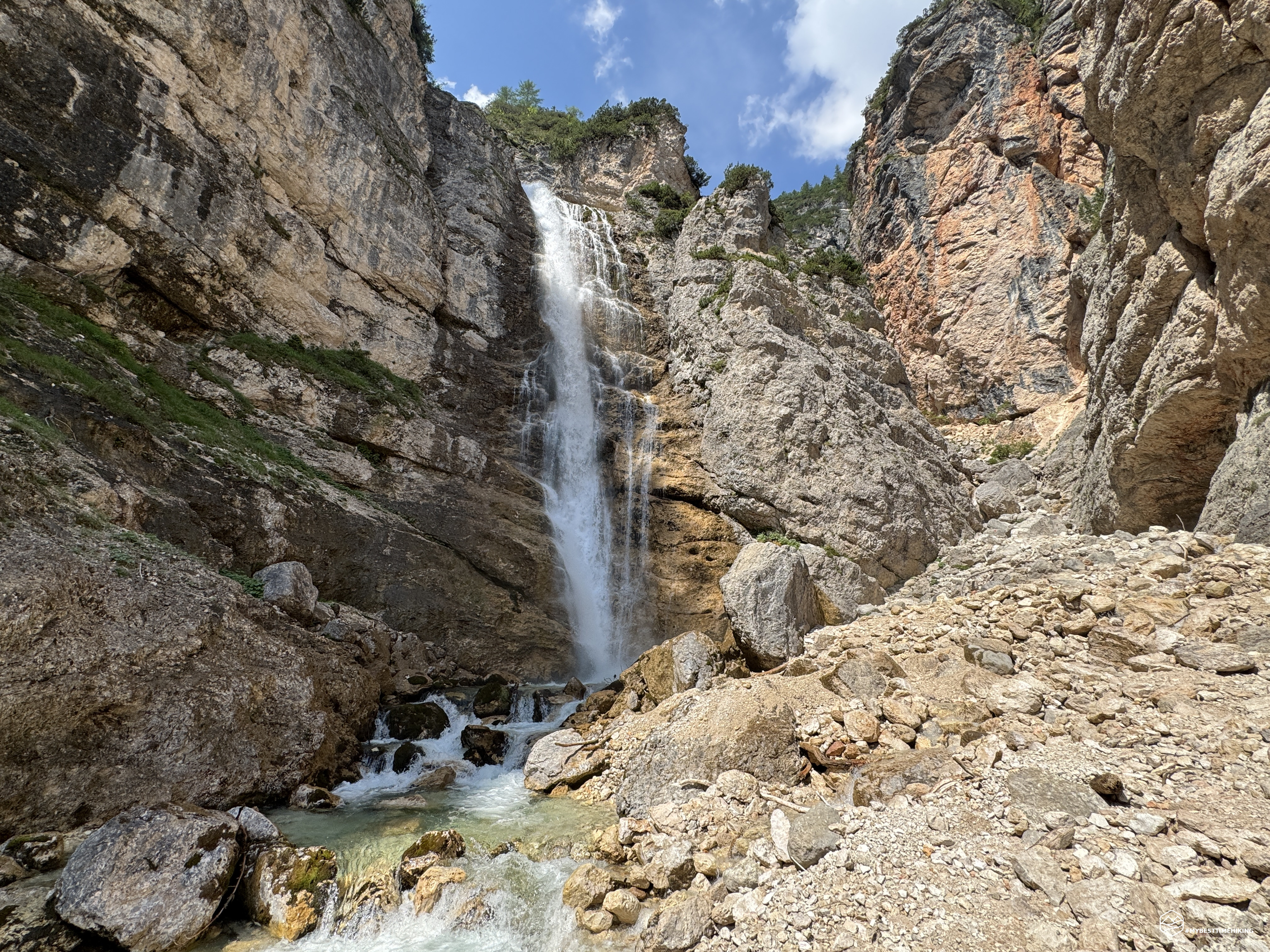
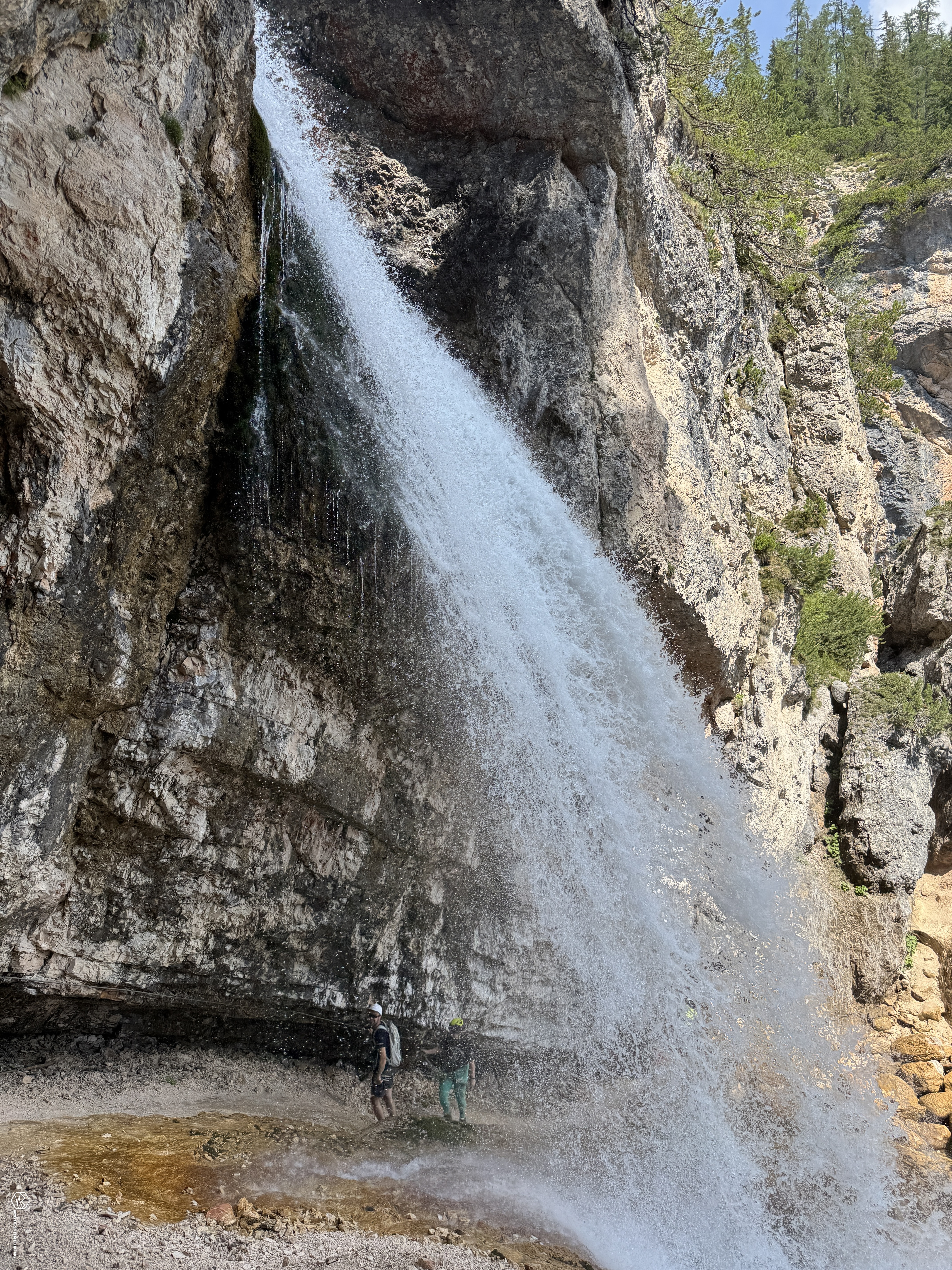
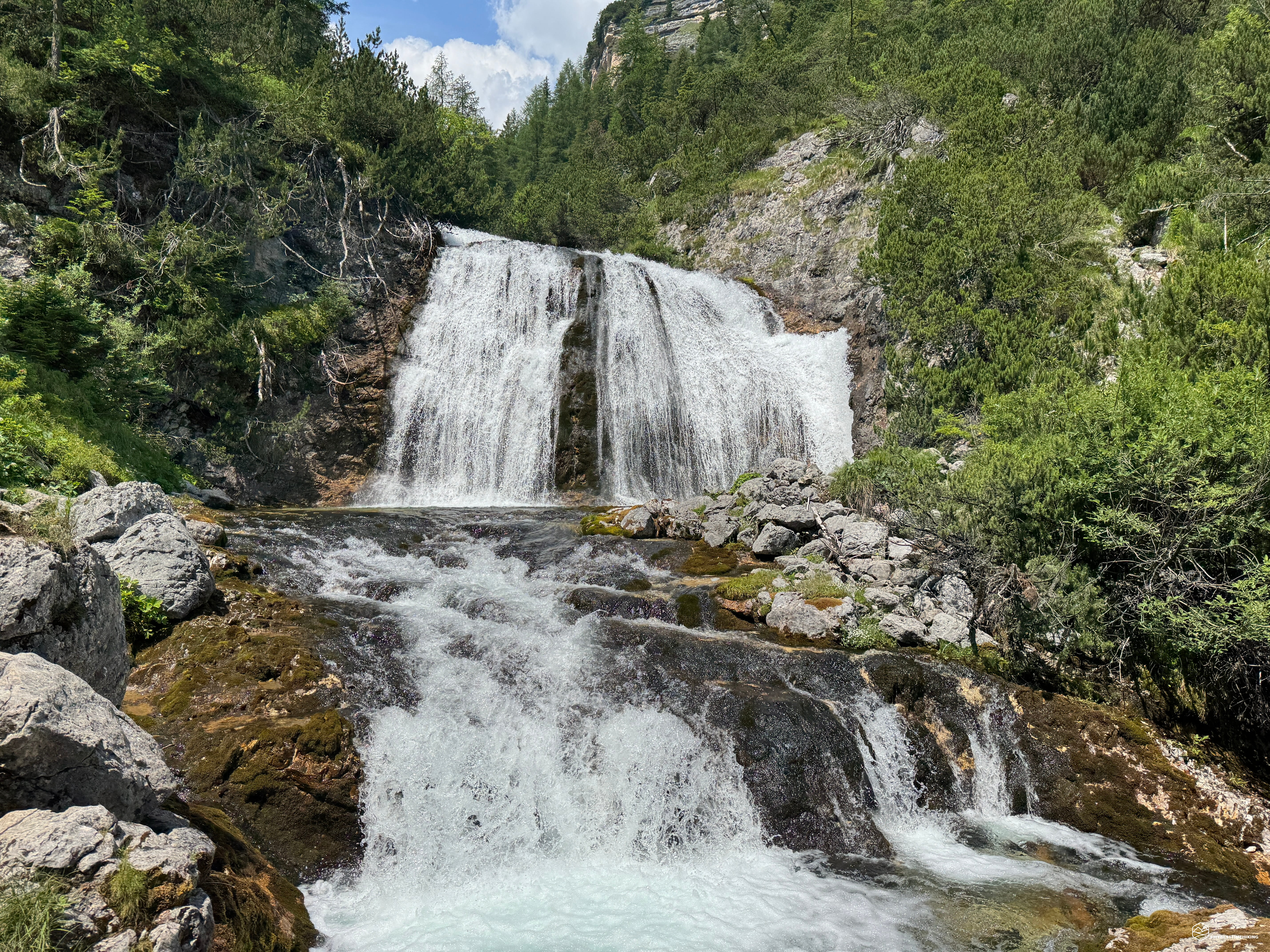
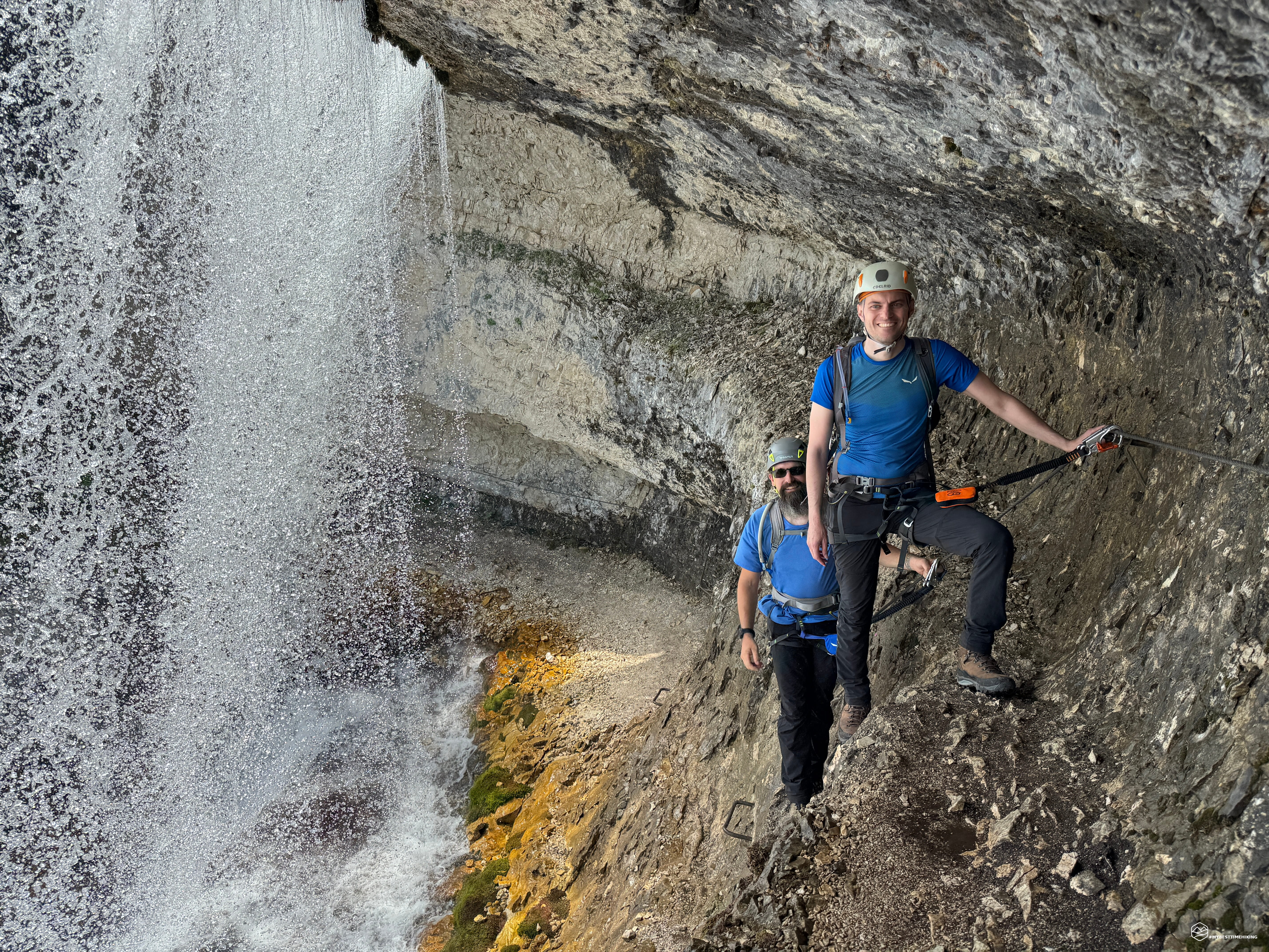
Here, you can take a short break and prepare, as we do, with everything you need for the via ferrata that awaits us: harness, via ferrata kit, helmet, and gloves. We leave the area and head uphill toward the start of the via ferrata. Here, too, there's another rest area with benches, slightly smaller. The trail begins on the right, skirting the mountain shoulder, then descends slightly. A bronze plaque from the Cortina Alpine Guides announces the Giovanni Barbara via ferrata's identifying emblem. We continue downhill on wide, easy paths, with the safety of the metal cable at our disposal. After passing a prominent rocky outcrop, the Cascata Bassa di Fanes appears before us: a powerful, immense waterfall that releases a refreshing, pleasant breeze! It's clear that the trail passes directly behind the waterfall, providing an additional refreshment and an unusual vantage point. The roar is powerful; the wet, slippery rocks behind the waterfall require securing ourselves to the metal cable and encourage careful tread.
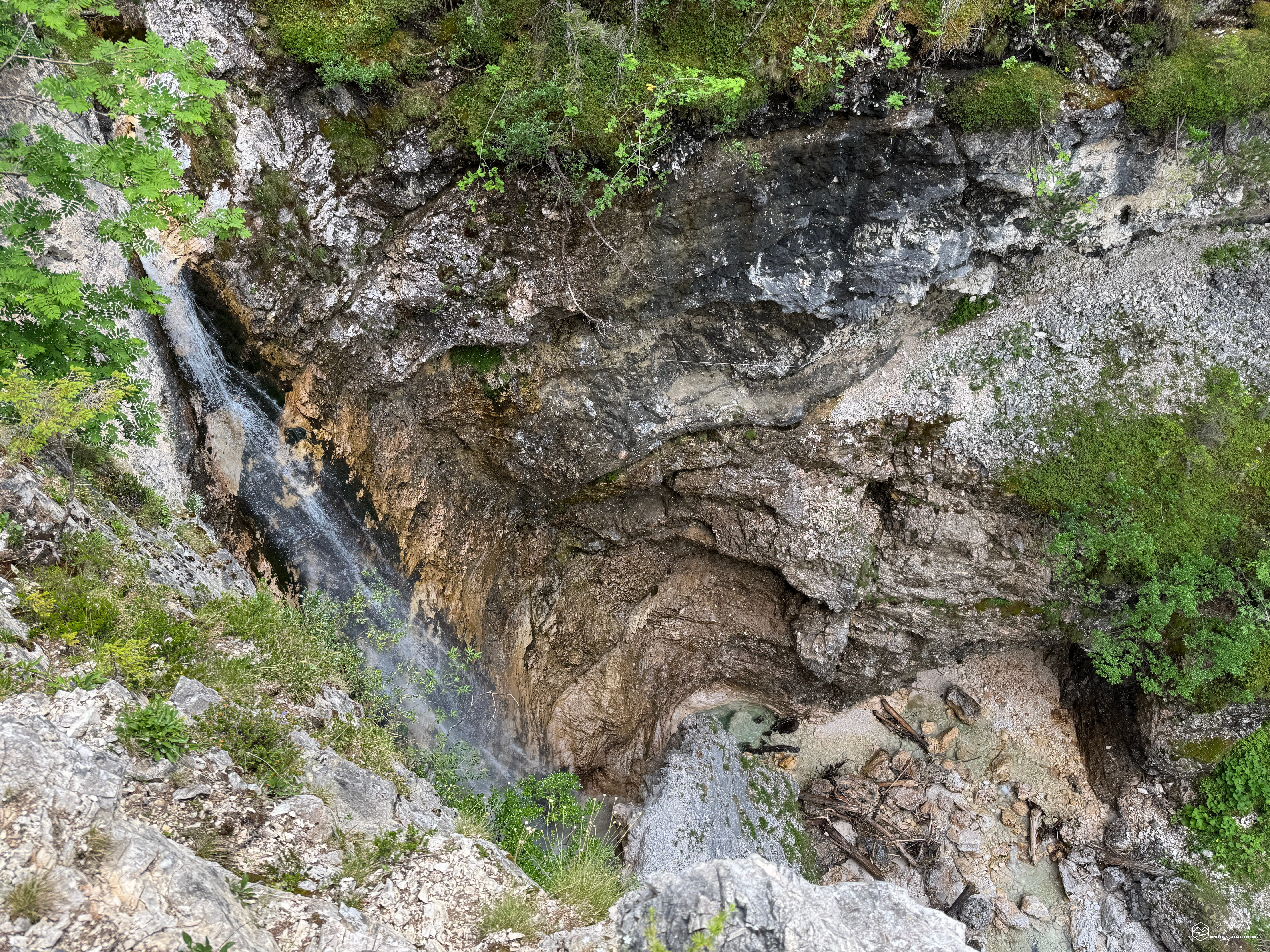
We pass the waterfall and climb up ochre-colored rocks in a crevice between vertical walls. The via ferrata is always equipped, and once you reach the top, you descend along a gravel path toward a drainage channel through which the stream flows from the Taburlo rocks. The presence of terraces with well-placed tree trunks allows for truly simple and safe progression. A recent walkway leads to the second equipped point, which you can use to descend onto nearly vertical rock into the gorge carved by water over the centuries. This section of the via ferrata features several metal brackets embedded in the rock to create an artificial ladder. The descent is pleasant and never difficult, although the sheer drop is quite impressive for beginners. In a few dozen minutes, you reach the base, greeted by a small waterfall formed by the stream you saw earlier. We are now in the gorge, surrounded by sheer walls, with the water navigating between the boulders, where you must find the best path to advance. The roar grows louder with every step until it materializes in the splendid Cascata Bassa di Fanes, which plummets for dozens of meters before our eyes. We're at the base of the canyon, at an altitude of 1,455 meters. Here we find signs for the next destination: the lookout.
We follow the clear signs to the left (northeast) on a path with hard gravel. At high altitude, we find a new section with a metal cable that leads to a trail among the Baranci mountains; after a couple of hairpin bends, we reach a steep and imposing gully (about 70 meters high) secured by a narrow serpentine path made of retaining logs. The climb is fun, characterized by an unusual progression that presents no difficulty. At the top of the gully, we rejoin the CAI trail that arrives from the described fork at Pian de Lòa. A fantastic protected balcony offers an exceptional view of the entire cliff from which the legendary Cascata Bassa di Fanes cascades, allowing us to review the entire via ferrata route we tackled at the beginning. It's fantastic to admire the immense canyon below and to note the route we will shortly follow: a path that climbs, cleaving the rock immediately below the Barbara via ferrata. We must therefore retrace our steps and retrace the gully with the serpentine path of logs. Be careful when descending, as there are several rocks between the terraces: proceed with caution to avoid dislodging them and letting them fall.
We return to the base of the canyon, near a small bridge suspended over the Ru de Fanes, right in front of the waterfall. We cross it and reach the new via ferrata that allows us to ascend towards Ponte Outo. We climb a stepped step in the rock with the help of the metal cable, and continue along a scree ramp that leads to a ledge: we are on the Lucio Dalaiti via ferrata. This short via ferrata offers some very unique technical features, ideal for teaching beginners to this type of excursion. The ledge, in fact, allows for a traverse over a truly exposed void. The section is very short, but there are three metal brackets where you find yourself suspended in the void, with the water of the Ru de Fanes flowing dozens of meters below. A head for heights is essential to comfortably negotiate this point. The ledge continues on a fairly comfortable, though narrow, footing, with some exposed sections (never extreme) and continuous ups and downs beneath high overhangs. Be careful of a vertical rock drop of about 3 meters, with a metal bracket fixed to it to aid climbing; in my opinion, it's slightly challenging for novice hikers. The via ferrata ends with a short section over a steep crevice, before ascending an easy path through the woods. You'll reach the via ferrata just past the Ponte Outo bridge, between the two areas equipped with benches described previously.
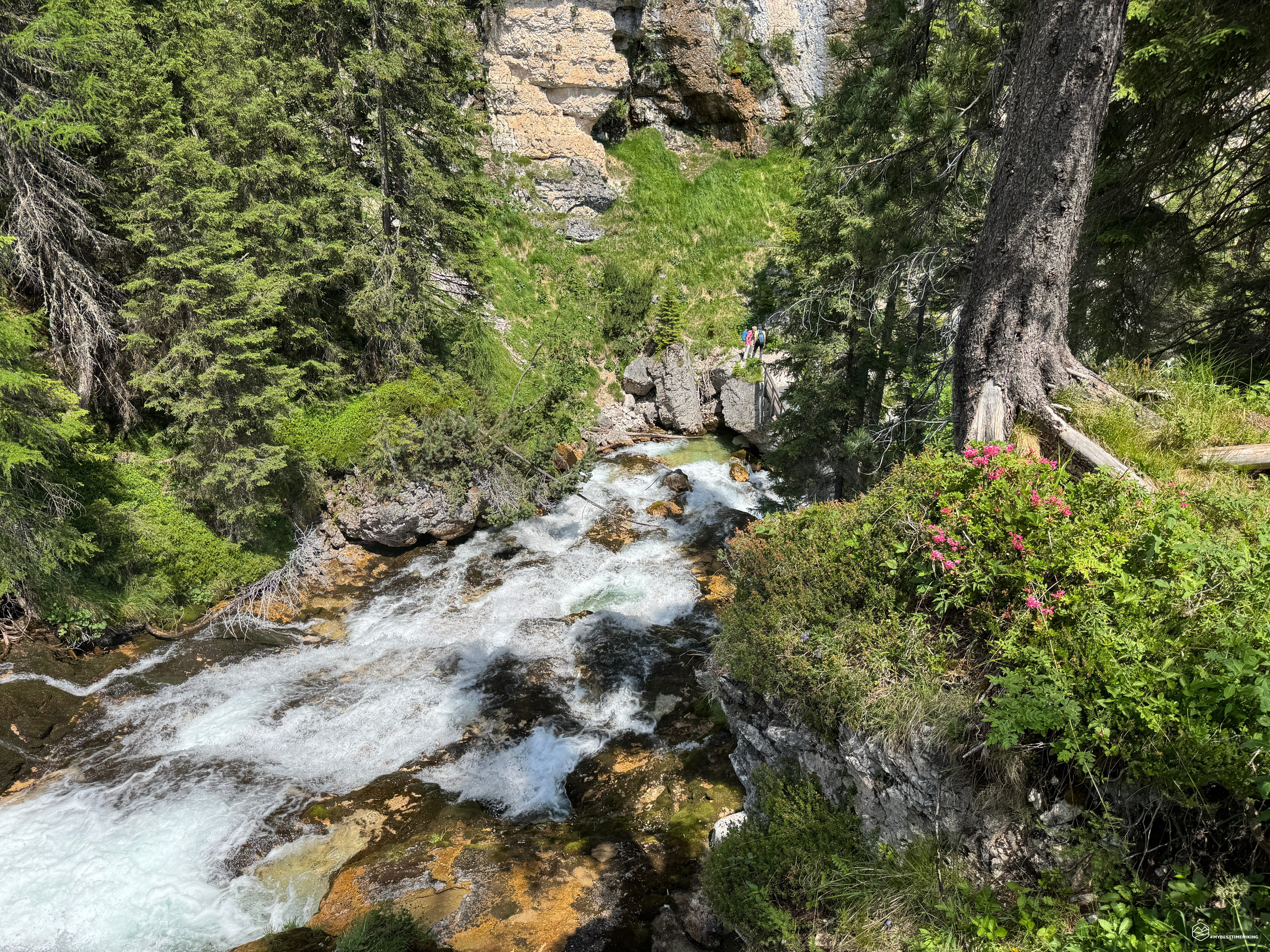
We climb again on CAI trail 10 until we reach a signpost where, this time, we choose the "Sentiero dei Canyon e delle Cascate" sign on a rocky path, which leads northwest toward the walls of Mount Taburlo. Once you enter the fir forest, pay attention to the turnoff that descends to the right: take it, and soon you'll cross a wooden bridge over the Ru de Fanes in a magical setting of greenery, mountains, and water. The roar becomes increasingly loud, heralding the arrival of the Cascate Alte di Fanes waterfalls. A metal ladder with an attached cable allows you to climb over a boulder and reach a higher-altitude path that continues slightly uphill, offering an exceptional view of a solitary waterfall on your left, cascading amidst the greenery. The trail continues zigzagging along a dirt path until it reaches a grassy saddle, from which it gently descends to meet the Ru de Fanes again. At this point, a picture-postcard view unfolds before your eyes: a very long waterfall with short but continuous ledges offers a cascade of foaming water, which you can admire in complete tranquility from a charming wooden bridge with a grill at the bottom, allowing you to fully observe the flow of the water (altitude 1,616 meters).
Date
27-06-2026
Distance
15.60 KM
Hike type
Ferrata
Ascent
817 mt
- Mountain
Cime di Fanes
- Address
Cortina d'Ampezzo, Veneto
- Altitude
1752.00 m
- Refuges
- Information
The path continues alongside this tumultuous and thunderous wonder. We immerse ourselves among hedges of rhododendrons and blueberries, always accompanied by the impetuous song of the water. We continue to climb until we reach, through the woods, the Ru de Fanes waterfall: a majestic fall resting on rock that forms crags of different heights and gives rise to the long cataract admired shortly before.
We leave the waterfall to immerse ourselves in the woods again and enjoy lunch in an isolated place, a few meters from the main path. Here we are surrounded by greenery with the usual Ru de Fanes which now flows slowly, calmly and calmly, unaware of the speed and power it will soon gain. Once refreshed, we set off again towards the next destination: the via ferrata Cengia di Mattia.
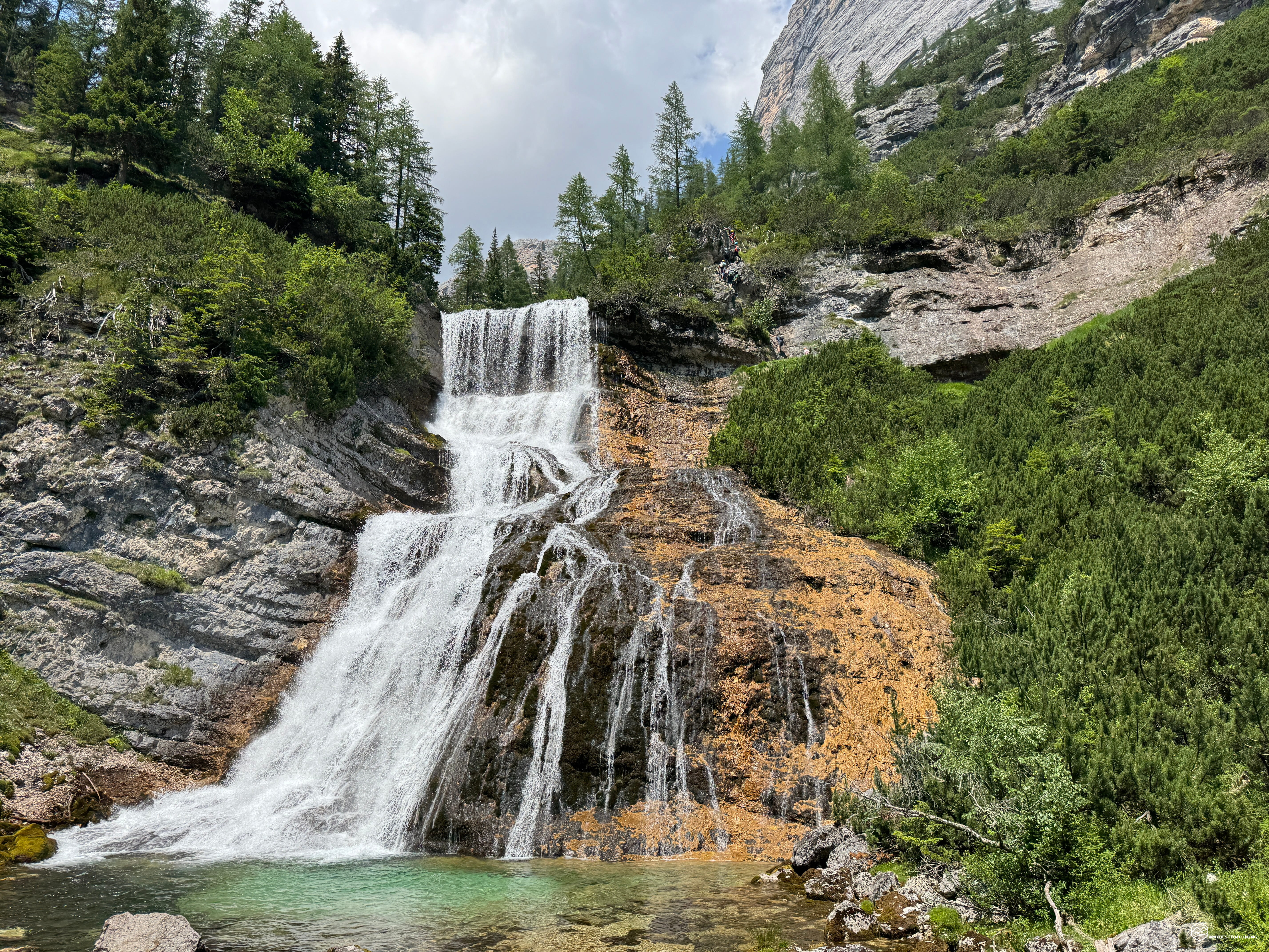
The roar of the water here becomes deafening again; from the path we notice some colorful spots of hikers who are walking along the via ferrata, side by side with the waterfall. We have to get closer to admire the majesty of what, in my opinion, is the most beautiful waterfall of the entire itinerary: a vertical drop of tens of metres, with a ledge that crosses the very back of the jet! The water breaks on a soft rock, creating a sort of white drape framing the outermost fringes which form continuous drips. It all flows into a turquoise lake, before flowing towards the valley. We have reached Sbarco de Fanes!
We follow the path leaving the waterfall on our right. The route arrives at a crossroads with a clear sign to the right which leads to the via ferrata and the waterfall. The bronze plaque identifies the "Cengia di Mattia" route and, slightly downhill, we proceed safely towards the fragore. An incredible scenario opens up before us: the ledge we are following is wedged on the back of the waterfall's leap, passing behind this barrier of water impenetrable to the eye. We have to go right behind there! We proceed euphoric and soon we are behind the jet: it is fantastic to see how the water creates a very fresh natural shutter. We pass a few steps away, deafened by the impetuous noise of the Sbarco de Fanes. This point offers the most beautiful series of photographs of the entire itinerary: it is a truly magical place to experience and enjoy! Pay maximum attention to the rocky bottom, which is made very slippery by the continuous presence of humidity. However, the metal cable and brackets affixed by the Alpine Guides of Cortina allow you to overcome the ledge in absolute safety. At the end of the traverse you can admire the waterfall and the creation of the lake below from a unique view. Now the last stretch of via ferrata awaits us, which climbs a vertical rock face: using some metal brackets and a well-tensioned cable, we proceed comfortably on large and safe steps, easily overcoming the verticality. In a few minutes you reach the apex of the via ferrata segment, which corresponds to the birth of the waterfall, from where you can see the Ru de Fanes gently arriving from the lake of the same name.
We cross the stream on a wooden walkway without railings and return to the woods to quickly rejoin the CAI path 10. We follow it downhill in a south-east direction. After a couple of hairpin bends, we reach the wooded area called "Progòito". Here you need to pay attention to the deviation which descends onto a less obvious track but with clear indications for "Ru de Ra Vàles" (1633 metres). We thus travel along a former mule track that passes through the woods, where several trenches from the Great War appear on both sides. The path narrows as it reaches the cliff edge of the Ru Travenanzes gorge, protected by a series of recently installed fences. We descend on steep hairpin bends passing on a characteristic ledge, always secured by fences. Thus we arrive at the Acquarone bridge, where it is possible to admire the ravine created by the gorge. From this point you go up a narrow path until you cross the CAI 401 path of Val Travenanzes, at the height of Ponte dei Cadoris (1586 metres). The stream that descends from Valon de Ra Ola allows you to cool off on its gravel before tackling the last climb of the day.
We follow the CAI 409 trail, which climbs steeply up the grassy slopes at the foot of the Tofane. Pay attention at 1,599 meters, where a wooden sign reads "In Po Ra Ola." Directly opposite the sign, you can see a path that enters the vegetation: this is the entrance to the last waterfall of the tour. You'll reach a natural terrace from which a narrow path zigzags down to the fork for the (unnamed) via ferrata. The trail also allows you to continue down into the valley below to admire the waterfall from below without taking the fixed-rope route (from there, you then rejoin the Ponte dei Cadoris). We, instead, choose to get as close as possible to the Ru de Ra Vàles waterfall with the aid of the metal cable. The route follows a fast and easy ledge, remaining at altitude at all times. The only precaution is the final stretch, where the damp, downward-sloping rocks require careful attention to ensure good footing. We thus arrive at the waterfall that drops about twenty meters into the valley, forming a stunning emerald-colored basin.
We retrace our steps to the trail marker and follow the sign for the "Sentiero dei Canyon e delle Cascate" (Canyon and Waterfall Trail) toward Forcella di Pospòrcora. In a few minutes, we reach the bridge over the Ru de Ra Vàles (Pospòrcora), a great spot for a refreshment. Immediately after the bridge, following the signs for "Ponte Outo, Pian de Lóa," we take a short detour on the left, slightly downhill, that leads to a small panoramic terrace, well protected by a sturdy wooden fence on the cliff. From here, you can admire from above the via ferrata you just followed to reach the waterfall. We continue our journey along the "Ria Longa" mule track (CAI 408), which cuts a steep descent through the wooded western slopes of Col Rosà until it intersects with the CAI 10 dirt road we took the outward journey, just before the Outo Bridge. This concludes the adventure, returning to the Sant'Uberto car park in about half an hour.
This is the end of a circular hike of exceptional scenic and historical interest, passing through magical places, ravines, canyons, sheer cliffs, streams, and Dolomite peaks, where the undisputed protagonists remain the Fanes Waterfalls. By completing this circular route in a clockwise direction, you'll have the opportunity to admire them all in one spectacular loop! The total hiking time is approximately 6 hours and 30 minutes (including breaks), with just over 800 meters of elevation gain for a total distance of almost 16 km. It's an adventure suitable for many hikers accustomed to walking, and also excellent for those who want to begin their experience with via ferratas. It's possible to turn back or shorten the route at any time if the weather turns bad. A highly recommended itinerary, definitely worth doing!
I conclude this report with a dutiful reference to the brochure "Sentiero delle Cascate e dei Canyons - Val di Fànes e Val Travenànzes" of the Ampezzo Dolomites Natural Park (tel. 0436 2206; E-mail: info@dolomitiparco.com; Internet: www.dolomitiparco.com). This is the best summary of the wonderful adventure just described:
"The highly panoramic and spectacular route, despite being nestled between deep ravines and valleys, leads to the confluence of the Fànes, Travenanzes, and Ra Vales Valleys, north of Cortina, connecting several sites of grandiose landscape and hydrogeological significance. The succession of pools, cataracts, and waterfalls that characterize the entire course of the Rio Fănes is extraordinarily beautiful, and the Fànes Waterfalls are among the highest and most abundant in the Dolomites, as is the Travenanzes Canyon. The route winds through the heart of the Ampezzo Dolomites, features sections of varying difficulty and challenge, can be tackled in sections or in a single pass, and is partly suitable for families with children. It features several panoramic points and sections equipped with wire ropes in the most exposed and delicate sections. The route can be done both clockwise and counterclockwise... The grandeur of the waters and the geomorphology are These are undoubtedly the main attractions of the route; however, the trail also offers good opportunities to closely observe the particular habitats of the gorges and dripping cliffs, as well as the torrent banks and avalanche-prone slopes, with the particular flora and fauna that characterize them... There are five short sections equipped with wire rope, which require appropriate via ferrata gear, three of which correspond to the crossing of the Cascate Basse, one of the Sbarco and one of the Cascata del Ru de Ra Vàles... Periods with heavy storms should be avoided, due to the possibility of sudden floods, and the winter periods, which present icy stretches precisely at some exposed points. Given that the route still has some exposed sections of trail, even with a wide section and non-slip surface, a fear of heights is required.
Click here and watch the exclusive video on YouTube for an even more immersive experience!
DifficultyExpert Hikers with Equipment - The equipped routes (or via ferrata) are indicated, they require the use of self-insurance devices. |