Details
-
 Hike type
Hike
-
 Difficulty
E
-
 Distance
14.23 KM
-
 Altitude MIN
993.00 mt
-
 Altitude drop +
675 mt
-
 Parking
-
 Landscape


-
 History
-
 Duration
4h
-
 Altitude MAX
1668.00 mt
-
 Altitude drop -
-675 mt
-
Hike type
Hike
-
Difficulty
E
-
Distance
14.23 KM
-
Altitude MIN
993.00 mt
-
Altitude MAX
1668.00 mt
-
Altitude drop +
675 mt
-
Altitude drop -
-675 mt
-
Duration
4h
-
Landscape
-
History
-
Parking
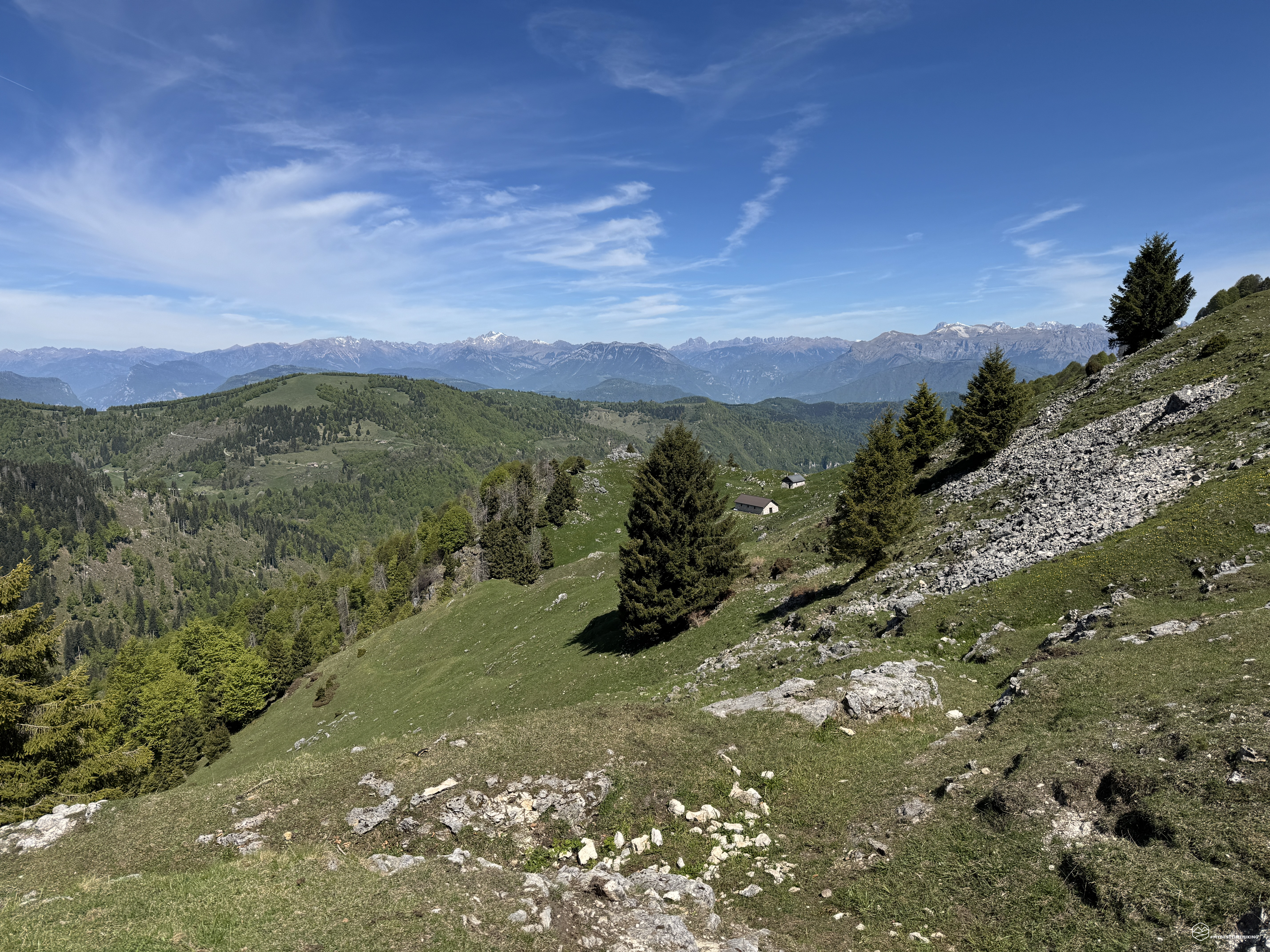
An adventure of significant historical interest in a place that still exudes tangible memories of the Great War.
Today's hike takes Enrico and I back in time over 100 years, to the mountain that has given rise to legends and was a cornerstone of our defensive front: Monte Grappa!
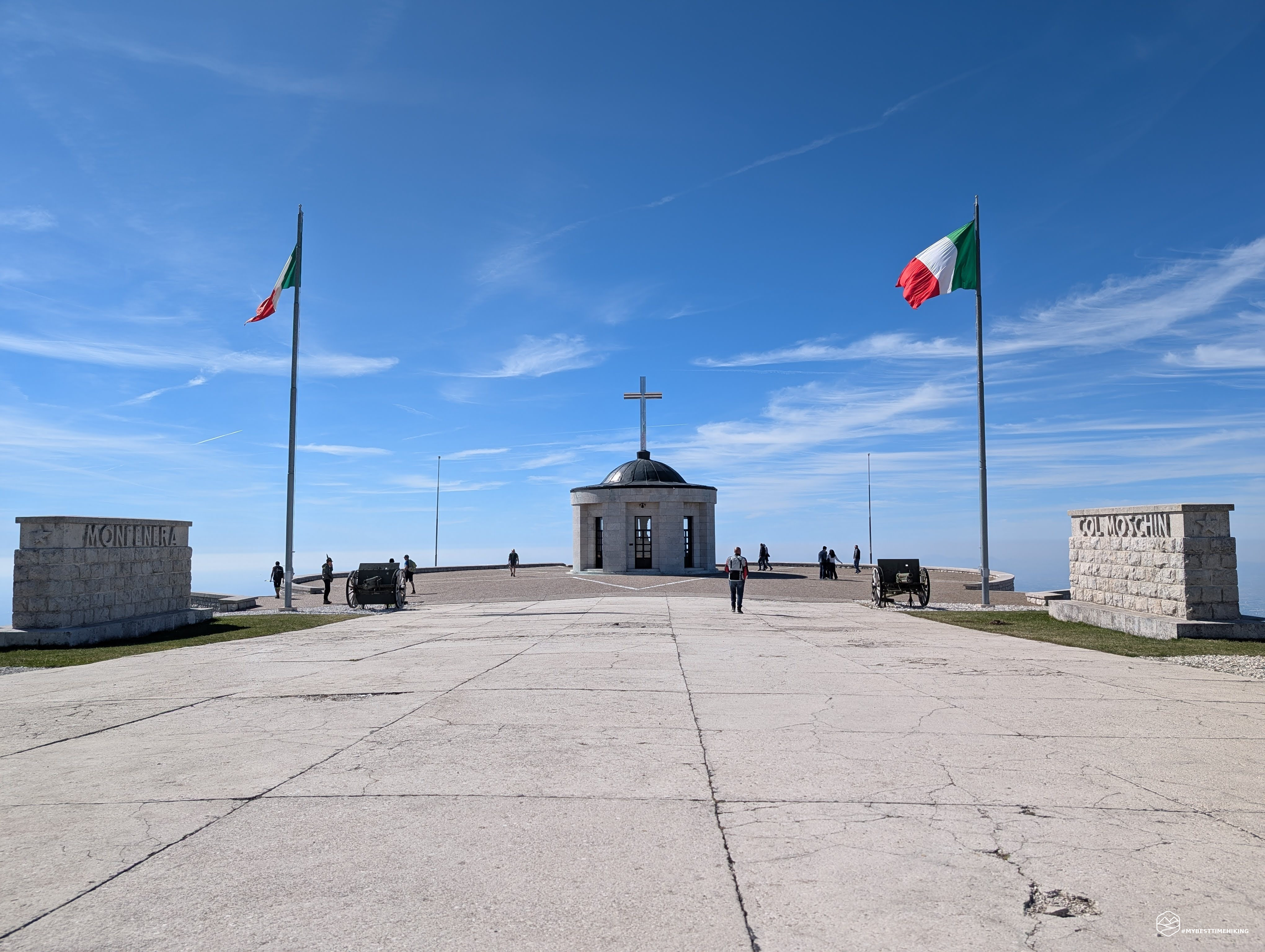
Along the road from Romano d'Ezzelino, we leisurely climb the more than 1,500 meters of elevation gain to reach the summit parking lot of Cima Grappa. The large, free parking lot is behind the Bassano Refuge, which dominates the plain below. On the other side, an imposing staircase leads to the Grappa Military Memorial. After gearing up and packing our backpacks, this is the first destination of the day: the imposing memorial spans the entire summit of the mountain and is divided into two sections. The Italian section faces south and offers spectacular views across the plain to the sea; The Austro-Hungarian side to the north overlooks the peaks of Cima d'Asta and, to the east, the Dolomites from the Pale di San Martino, passing Civetta, Antelao, and Schiara, all the way to Col Nudo.
We leave the Ossuary dedicated to Austria-Hungary and begin the CAI 156 trail, which will accompany us for the entire hike. An adventure that retraces historic, daring, and epic paths: we're about to tackle the crests of Mount Grappa on the Alta Via degli Eroi!
From the 1,775-meter summit of Cima Grappa, the elevation gain immediately disappears on an easy, slightly downhill hike that follows the slope overlooking the Val Vecchia. The parking lot at the bottom of the valley facilitates the climb to the Rifugio Val Venia, a few hundred meters below.
Walking along the Alta Via degli Eroi means stepping into one of the most dramatic chapters of the First World War. Between November 1917 and October 1918, this northeastern ridge of the Grappa Massif was the scene of fierce and bloody frontal clashes between the Italian army and the Austro-Hungarian and German imperial troops.
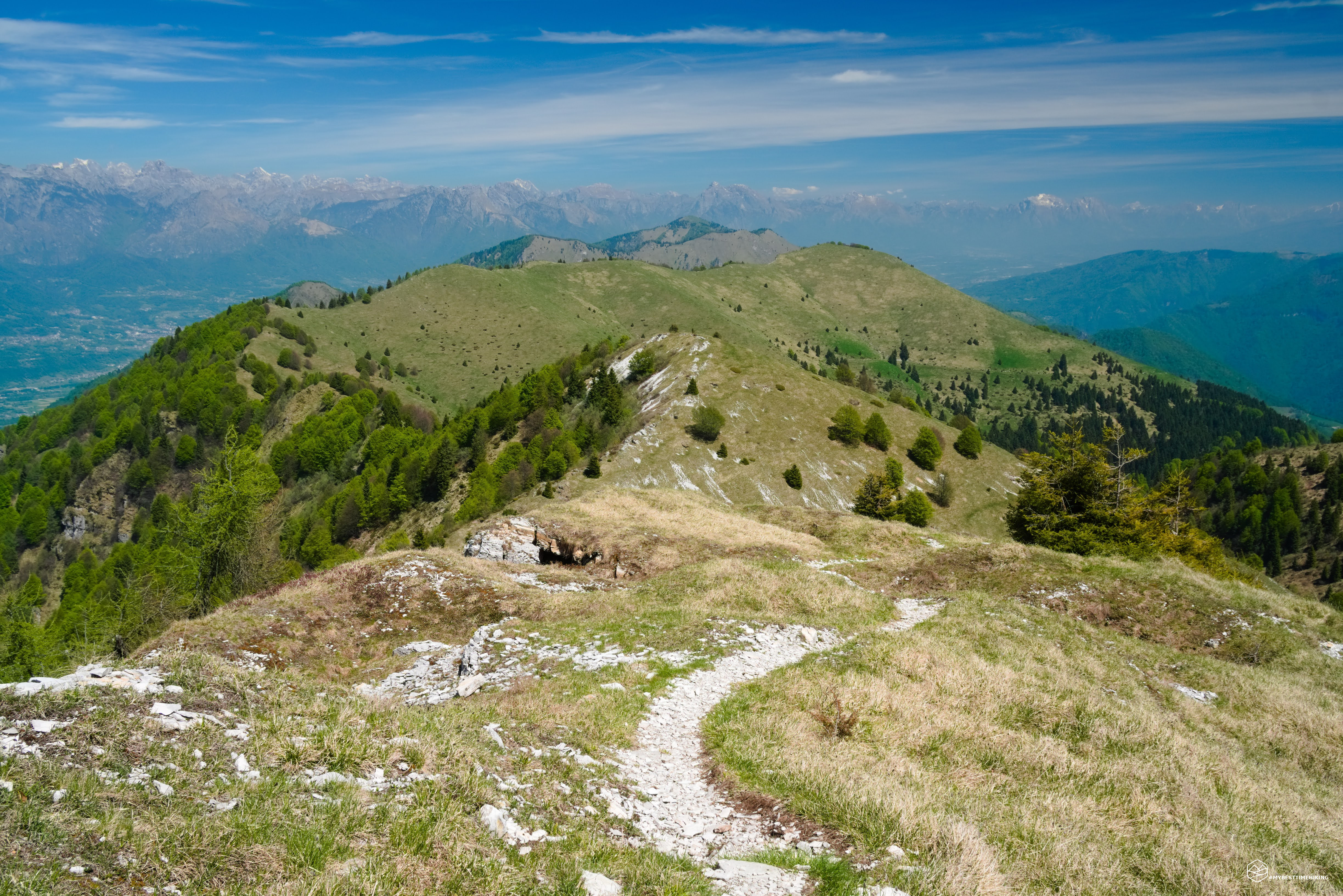
At approximately 1,625 meters, a fork in the road indicates our next destination: the Croce dei Lebi. We continue to lose elevation, the ridge becomes increasingly clear, and we begin to see the first furrows dug into the earth, winding through the grass and rocks: the trenches! Sinuous, they follow the contours of the terrain in a strategic zigzag, protecting the old border. It's incredible to see how Italian soldiers tried to defend the Mure Valley, and the rest of their homeland, from Austrian incursions from the Val dei Lebi and the more distant Valle di Seren. We reach the Croce dei Lebi, from which other clearly visible trenches crisscross the landscape. Looking west, we can see the Cason dei Lebi.
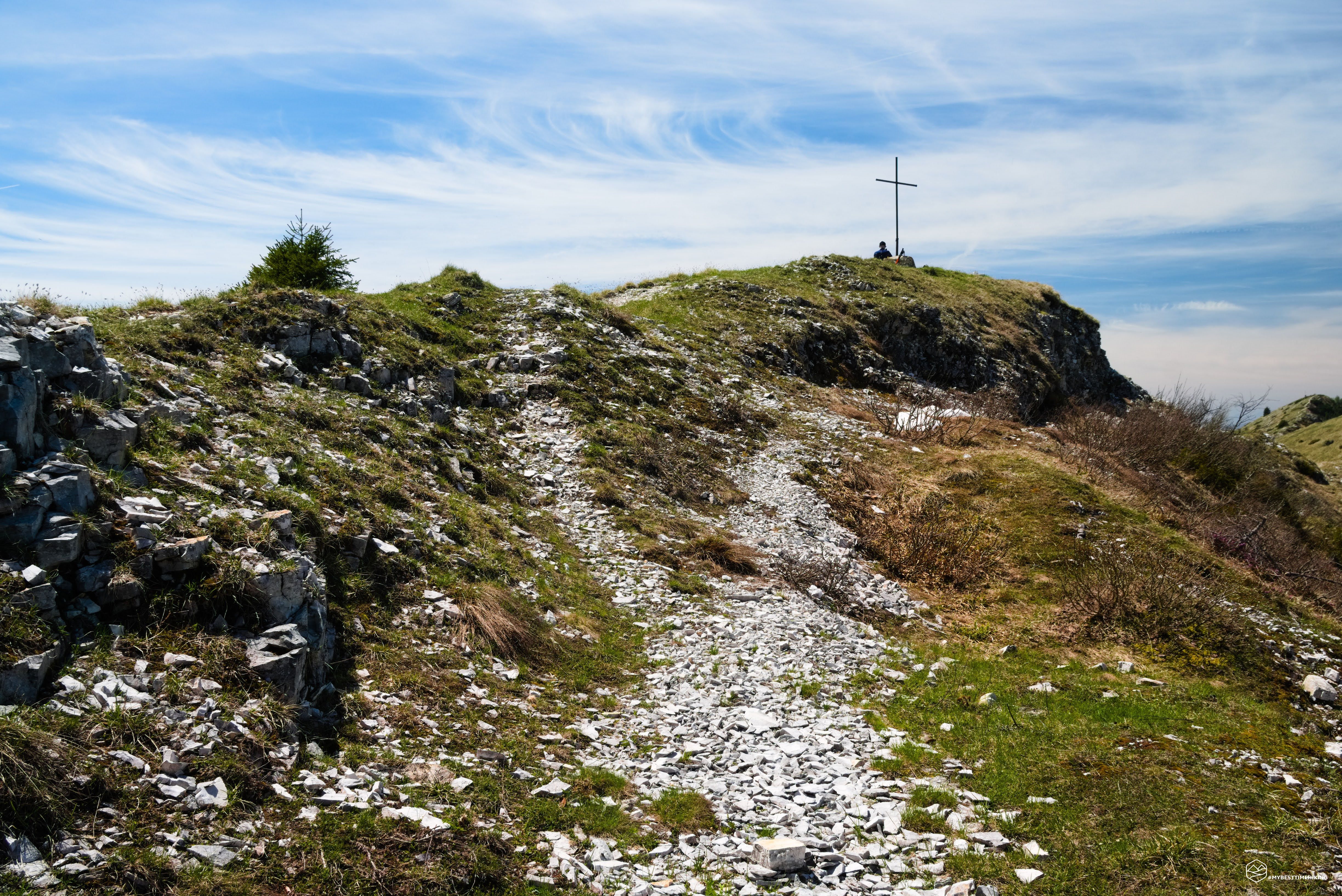
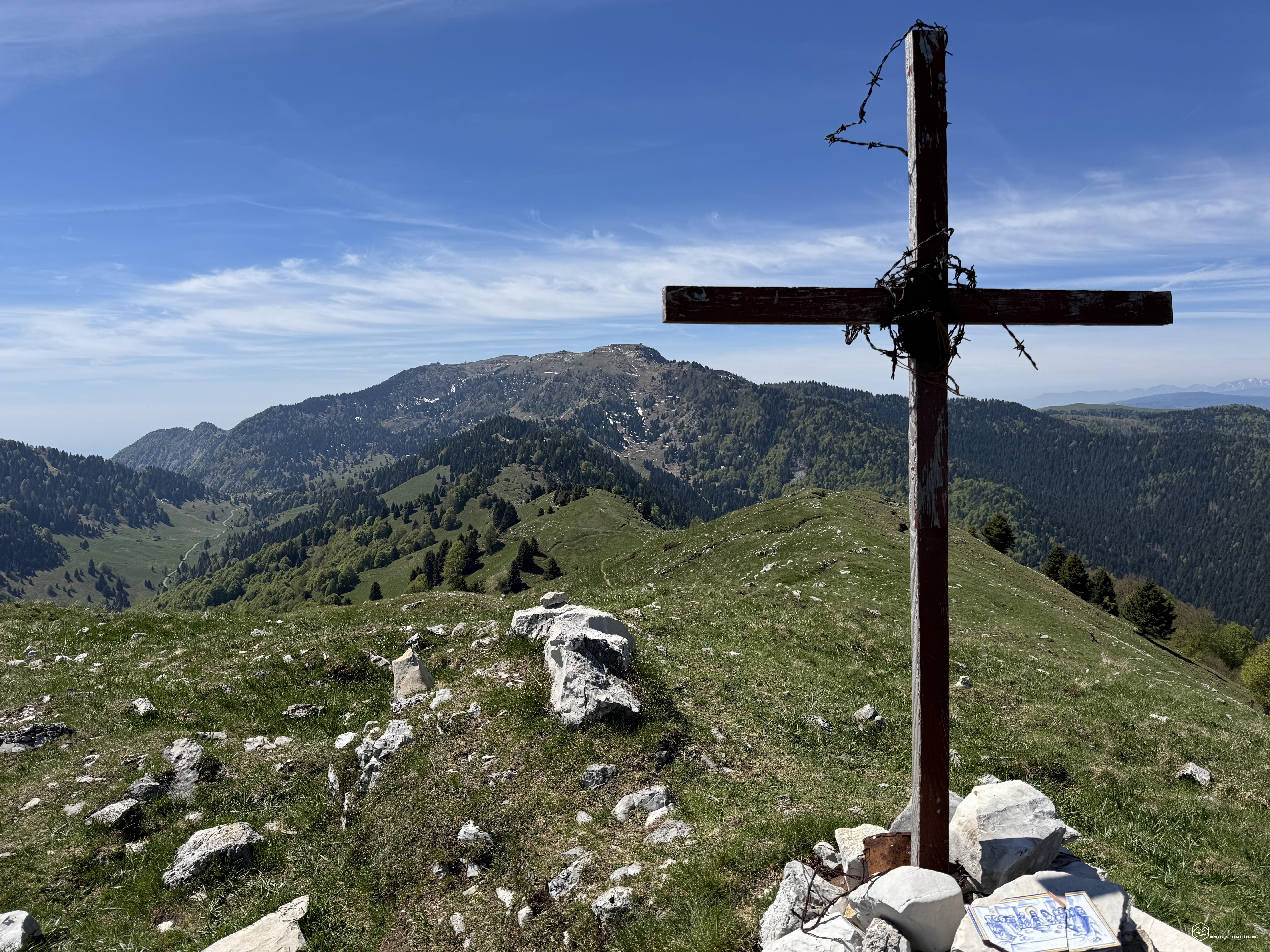
We continue on trail 156 through clearings, rocks, and wooded patches until we reach the Forcella Valpore. Here the "descent" ends, and we can finally begin climbing and gaining elevation. We thus reach Monte Casonet at 1,614 meters, with a summit cross and barbed wire that aren't exactly on the marked trail. It's still worth a short detour to the summit to enjoy the fantastic view.
Now, amidst a succession of trenches and large holes undoubtedly caused by mortar fire, the trail forks into several variants, always running along the ridge. The progression is truly evocative, never monotonous, with the wind always whipping fiercely.
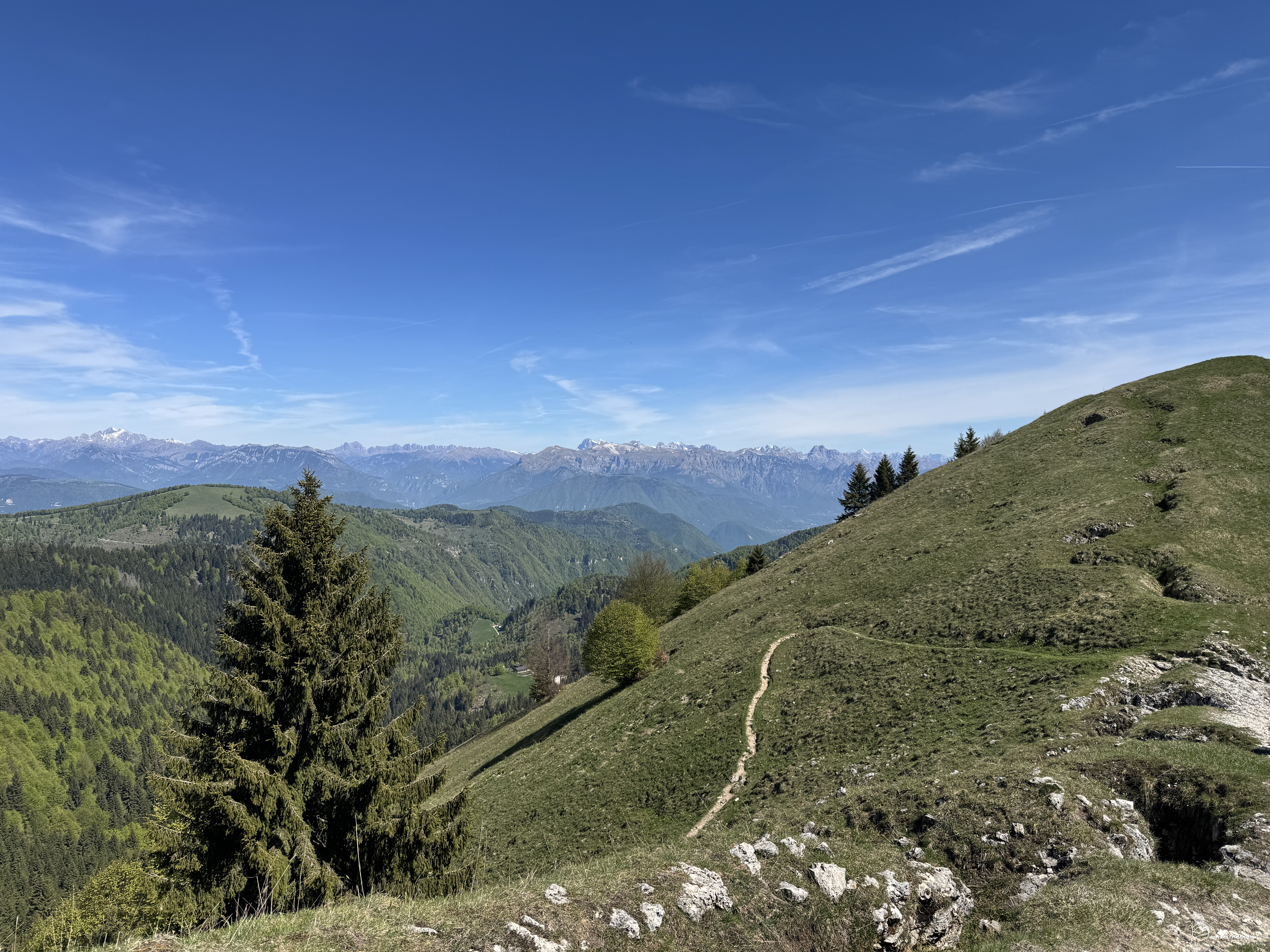
Soon, we reach the summit of the highest peak of the day: Col dell'Orso, at 1,668 meters. Here, a simple sign announces the name of the peak and the possible routes. The view from this point is fantastic: you can see the Solaroli ridge and fully understand how useful and strategic this natural barrier must have been for our soldiers.
On Col dell'Orso and Solaroli, the opposing front lines ran at minimal distances. It was trench warfare, often fought hand-to-hand or at a distance of a hand grenade, paying a very high price in human lives.
Date
03-05-2026
Distance
14.23 KM
Hike type
Hike
Ascent
675 mt
- Mountain
Monte Grappa
- Address
Romano d'Ezzelino, Veneto
- Altitude
1668.00 m
- Refuges
Rifugio Bassano
- Information
We then continue towards this natural barrier, ascending and descending steeply, where the final effort of the day awaits. This ridge is formed by a trident of peaks belonging to the same Solaroli (or Solarol, or Salarol) group. The first of these peaks is marked by a metal cross with a stone base, offering a splendid view of Cima d'Asta, Lake Corlo, and the Vette Feltrine. The second peak remains unmarked and unmarked, before we end our adventure on the last peak, also marked by a metal cross, and decidedly more imposing than the first. From here, the view sweeps across the plain below, encompassing the Valbelluna, and ascending the Belluno, Cadore, and San Martino di Castrozza Dolomites.
The ridge here descends to a peak below that slopes back toward the Valle delle Mure: Monte Valderoa (1,575 m). Renamed Sternkuppe (Star Peak) by the Germans, it was the scene of repeated reversals of front in December 1917, becoming a veritable "no man's land" for the remainder of the conflict. Since we would have to lose even more altitude to immediately retrace our steps, we'll end our adventure here and enjoy the splendid view while reflecting on the history of these places.
During the massive Battle of the Solstice (June 1918), the Austrians reached their point of maximum penetration precisely at these heights of the Solaroli, but were unable to completely break through. It is precisely on these ridges, on these peaks, that the saying "You shall not pass through here" was born. This famous motto, engraved today on a plaque near the Sella del Valderoa, sums up the desperate and decisive sacrifice of the Feltre, Pavione, and Val Cismon Alpine battalions to defend the Po Valley!
Let's retrace the entire trail, the entire Via degli Eroi that we too have experienced. Now we can see our destination, the Bassano Refuge, barely more than a dot in the distance. As an alternative route to complete a loop, you could reach the summit of Monte Valderoa and then descend along a dirt road to the Val delle Mure. Follow it all the way south and climb back up to the Croce dei Lebi.
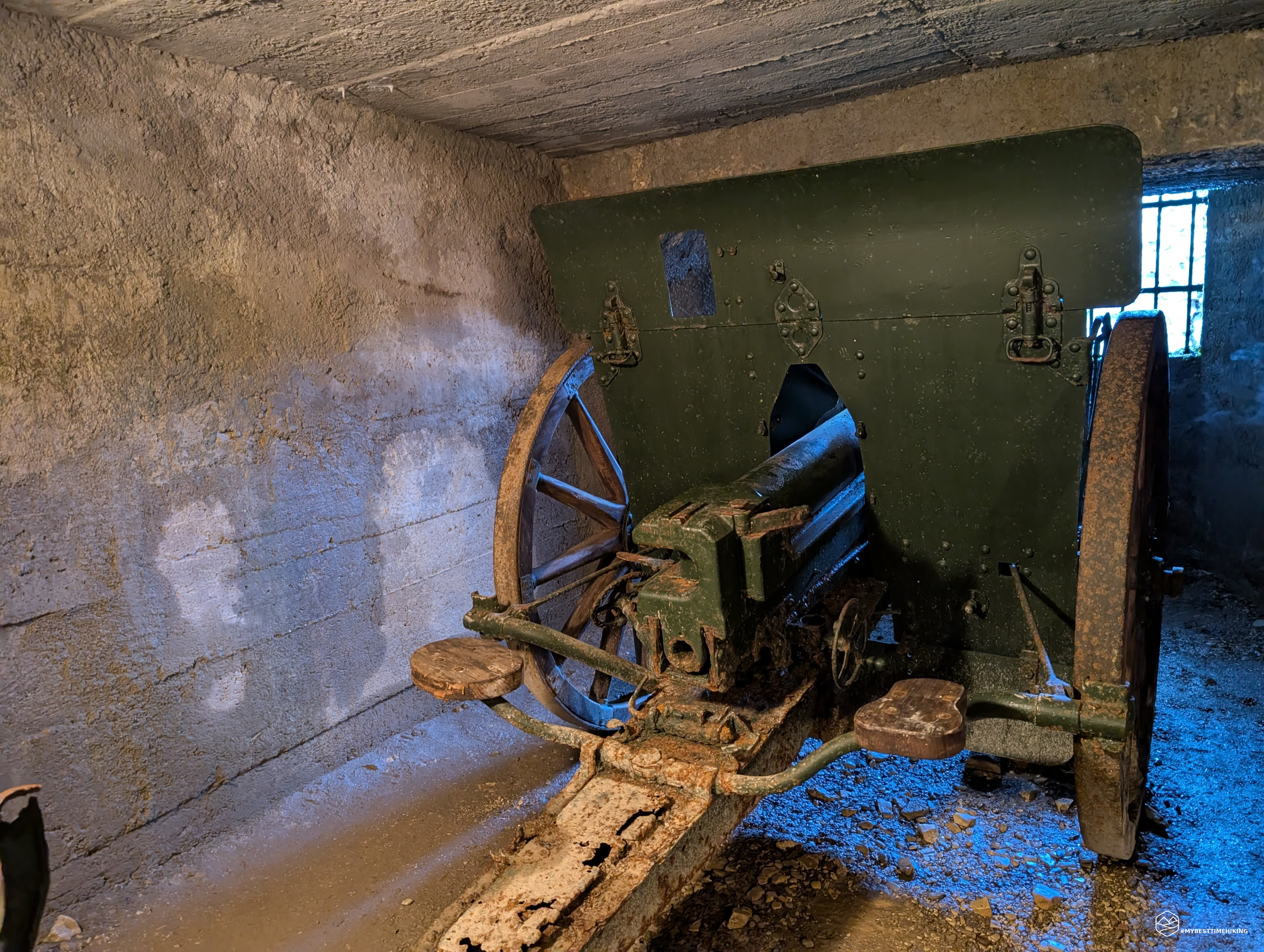
After about 1.5 hours, we return to the Ossuary and the parking lot. Refreshments at the comfortable refuge are a must, and if you've completed the loop by 4:30 PM, you can access the Vittorio Emanuele III galleries just below the Bassano Refuge. Simply ask permission to enter from the Alpine troops guarding the area and provide you with a protective helmet. You can then enter the bowels of the earth, a tunnel entirely dug into the rock, designed to spy on and strategically attack the enemy from a vantage point. Today, approximately 800 meters are accessible, but work is underway to recover the entire 1,500 meters of the original excavation. Three emplacements with attached cannons can be seen (depending on weather conditions, the deeper emplacements in the cave may be closed).
This concludes this splendid adventure with a truly historical feel. A 675-meter elevation gain with over 14 km of ridge-based hiking. A 4-hour hike, including breaks, suitable for all hikers with a minimum level of fitness. A must-do for history and Great War enthusiasts, it will be worth every effort. MyBestTimeHiking's first adventure in the Grappa area. I hope it's the first of many new historical-themed hikes!
Click here and watch the exclusive video on YouTube for an even more immersive experience!
DifficultyHikers - Itineraries on paths or evident traces in various types of terrain (pastures, debris, stony ground ...). They are generally marked with paint or cairns (pyramid-shaped stacked stones that allow you to identify the route even from a distance). They can also take place in snowy but only slightly inclined environments. They require the equipment described in the part dedicated to hiking and sufficient orientation skills, walking training for a few hours. |