Details
-
 Hike type
Snowshoe Trekking
-
 Difficulty
E
-
 Distance
7.45 KM
-
 Altitude MIN
595.00 mt
-
 Altitude drop +
780 mt
-
 Parking
-
 Landscape


-
 History
-
 Duration
5h
-
 Altitude MAX
1375.00 mt
-
 Altitude drop -
-780 mt
-
Hike type
Snowshoe Trekking
-
Difficulty
E
-
Distance
7.45 KM
-
Altitude MIN
595.00 mt
-
Altitude MAX
1375.00 mt
-
Altitude drop +
780 mt
-
Altitude drop -
-780 mt
-
Duration
5h
-
Landscape
-
History
-
Parking

Bivouac!
Almost a year after our last adventure of this kind, good old Enrico and I are trying again in a wild, little-known place in unspoiled Friuli: Casera Frate de Sora.
We're in the Claut area. After passing the Vajont area with Erto and Casso, passing through the Sant'Osvaldo Pass and Cimolais, we reach the hamlet of Mattan (or Matan). We park the car on the side of the road at an altitude of 615 meters. A little further back, the road, which descends slightly southward, allows us to begin our hike.
We have very heavy backpacks given the conditions the trail could bring: we have gaiters, snowshoes, crampons, as well as food, a sleeping bag, and all the essentials to enjoy the bivouac we want to reach. We're not discouraged, and the air, unusually cool but not bitter on this late February morning, allows us to set off with peace of mind. Below us, we can already hear the roar of the Cellina stream, which originates just a few kilometers ahead of the parking lot we found.
We cross the stream, which flows swiftly between rocks covered in a blanket of white. Ahead of us, the road begins to climb. The snow becomes deeper and more compact near the no-entry sign. We put on our snowshoes and hope we didn't bring them for nothing and that they'll be of use. We soon realize that not only were we right to bring them, but that they're essential for our progress: in fact, the snow soon turns white and pristine, forming almost sinuous dunes, half a meter to a meter deep!
We continue along the road until St. la Pinciadona, where there's a fork that leads to the Pradut refuge. We instead follow the trail that continues straight south and begins to increase in gradient. Behind us is the village of Claut with a view of Mount Zerten. We pass the St. La delle Pale, now in ruins, to effectively leave the road and begin the trail: CAI trail 960.
We've gained just over 100 meters of elevation, and it seemed endless... another 700 meters lie ahead, and our backpacks are already making themselves felt. The snow isn't helping, and there are still no tracks on our route: we're breaking trail! In normal hiking conditions, I like breaking trail; in fact, it adds that extra touch of exploration that never hurts. But here, with over 10 kg on our backs, a little help wouldn't have gone amiss. The good news is that we should be the only ones trying to reach the hut today, and given its small size and the presence of only two beds, I'd say it's better that way!
The trail continues at a constant incline, tiring but not excessive. It allows us to catch our breath and maintain steady progress. Be careful with a small up-and-down section of rock at 775 meters, where you'll need to find the right spot to proceed with snowshoes.
We continue through the fir and beech forest, only the sound of the snow crunching under our snowshoes breaking the deafening silence. At 900 meters, a fork in the road takes us to the nearby Pradut; we continue along the Cioi de Pinciadona, completely dry and covered in snow. A few meters further on, we cross it in a small depression and then return to a treeless slope that takes us to 1,000 meters.
Here the hard work begins. From this point, the slope becomes more arduous; the trail zigzags a few times and proceeds almost always straight ahead. We always keep heading south-southeast; the tree markings are always visible, although sometimes you have to look for them to follow the easiest recommended route. Our backpacks are becoming increasingly heavy. The sun is already hidden behind the mountain ridges of Col Grant, but the temperature is chilly, fortunately, given the effort we're making. Isolated deer tracks break the uninterrupted, pristine white.
The forest thins out slightly, revealing a narrow path between white dunes with large boulders on the left and a wall a few meters high to our right. We must be careful because near the boulders we could fall into holes covered by a thin layer of snow. We carefully negotiate the stretch and continue through the woodland flora once again. We see in the distance that we're about to reach the top, and there appears to be a clearing.
This isn't the case, and at about 1,300 meters above sea level, there's a wide gully that's far from easy. Initially, we walk along a narrow path that skirts a small, two-meter drop where we see piled-up tree trunks that hamper our progress. Leaving this section behind, we find ourselves in an open gully, with relatively steep banks and a vertical rock face to our right. The trail runs precisely along this rocky shoulder, which isn't exactly safe, as it constantly sheds snow, sometimes carried by the wind, sometimes dumped by the drifts. The signage here isn't clear, and in fact, on a couple of occasions, Enrico and I wondered if we were on the right track. Once we've crossed the ridge and reached the top of the gully, the CAI trail marker is clearly visible on a tree. We're close.
Date
21-02-2026
Distance
7.45 KM
Hike type
Snowshoe Trekking
Ascent
780 mt
- Mountain
Ressetùm - Monte Frate
- Address
Claut - Friuli Venezia Giulia
- Altitude
1375.00 m
- Refuges
- Information
The final few meters are immersed in a dense fir forest, their branches still heavy with snow. With every step, we are showered with heavy blocks of now-frozen snow breaking off from the trees. One last steep but short climb, and we reach the plateau that heralds the view of the Ressetùm mountain range and, more precisely, Mount Frate!
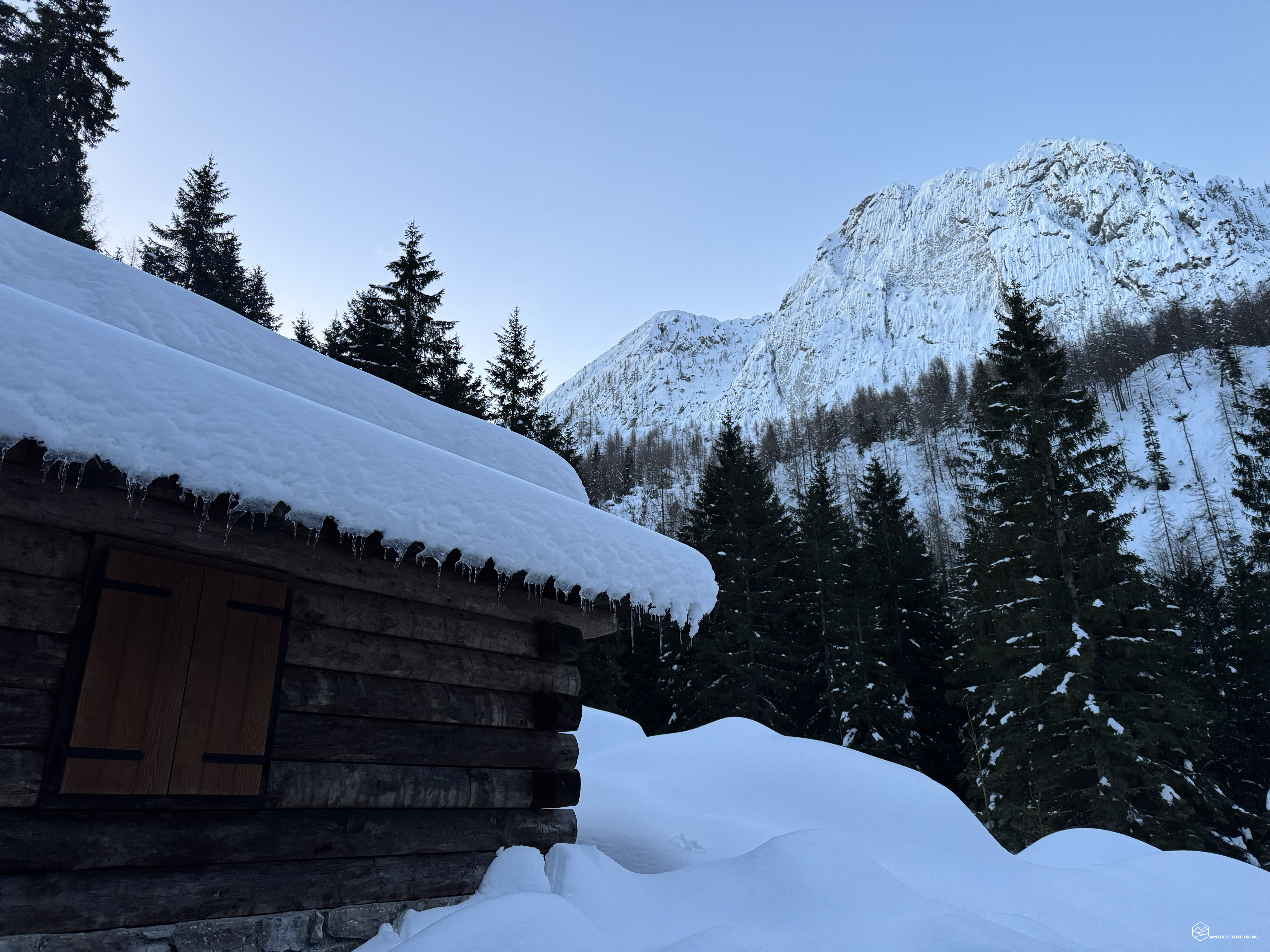
We turn our gaze east and there it is: Casera Frate de Sora! About three hours after setting off, we reach our destination. Surrounded by fir trees, at the foot of Mount Frate, immersed in the whiteness of the snow, dotted with lumps and rounded balls all around. Obviously, it is snow-covered rocks that give this unusual image to the area. We also break trail to reach the entrance of the bivouac. Clearly, we will be the only guests tonight.
The overhanging roof saved the entrance from a blanket of snow that would surely have blocked access. We enter and notice that everything is in order, but two details leave us with a bitter taste in our mouths: there is no wood, and the saw used to cut it is broken and unusable. Fortunately, Enrico has a portable saw with him, and without even resting, we set out to find bare, lifeless trees to gather firewood for the night.
For future hikers: leaving the hut, retrace your steps along the path for about ten meters, and head right into the woods, where you'll find several dead trees ready to provide the necessary wood.
We invested a couple of hours as lumberjacks and produced and cut a large amount of wood, ready for use. Satisfied, we finally deserved a rest, enlivened by a delicious aperitif.
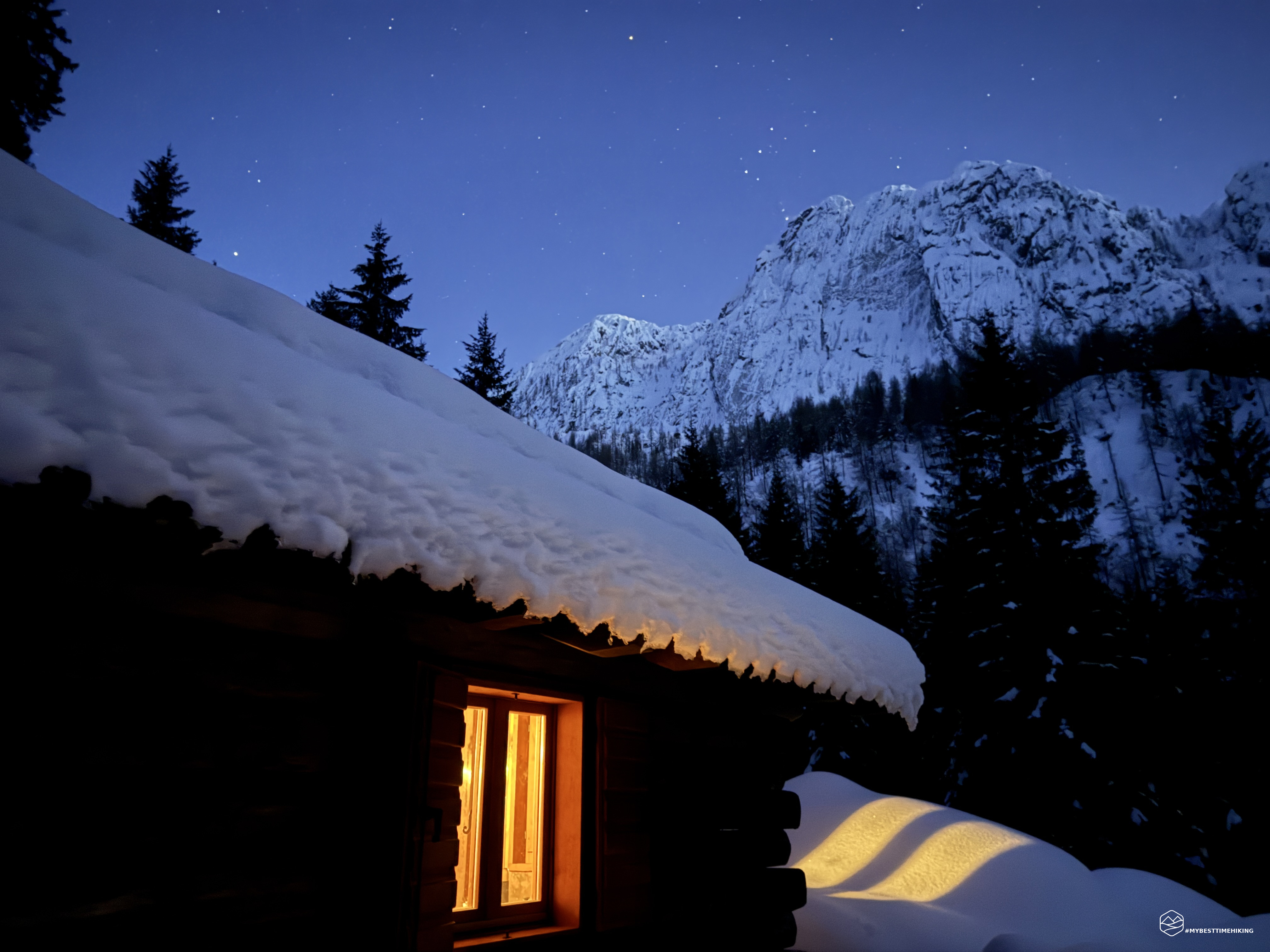
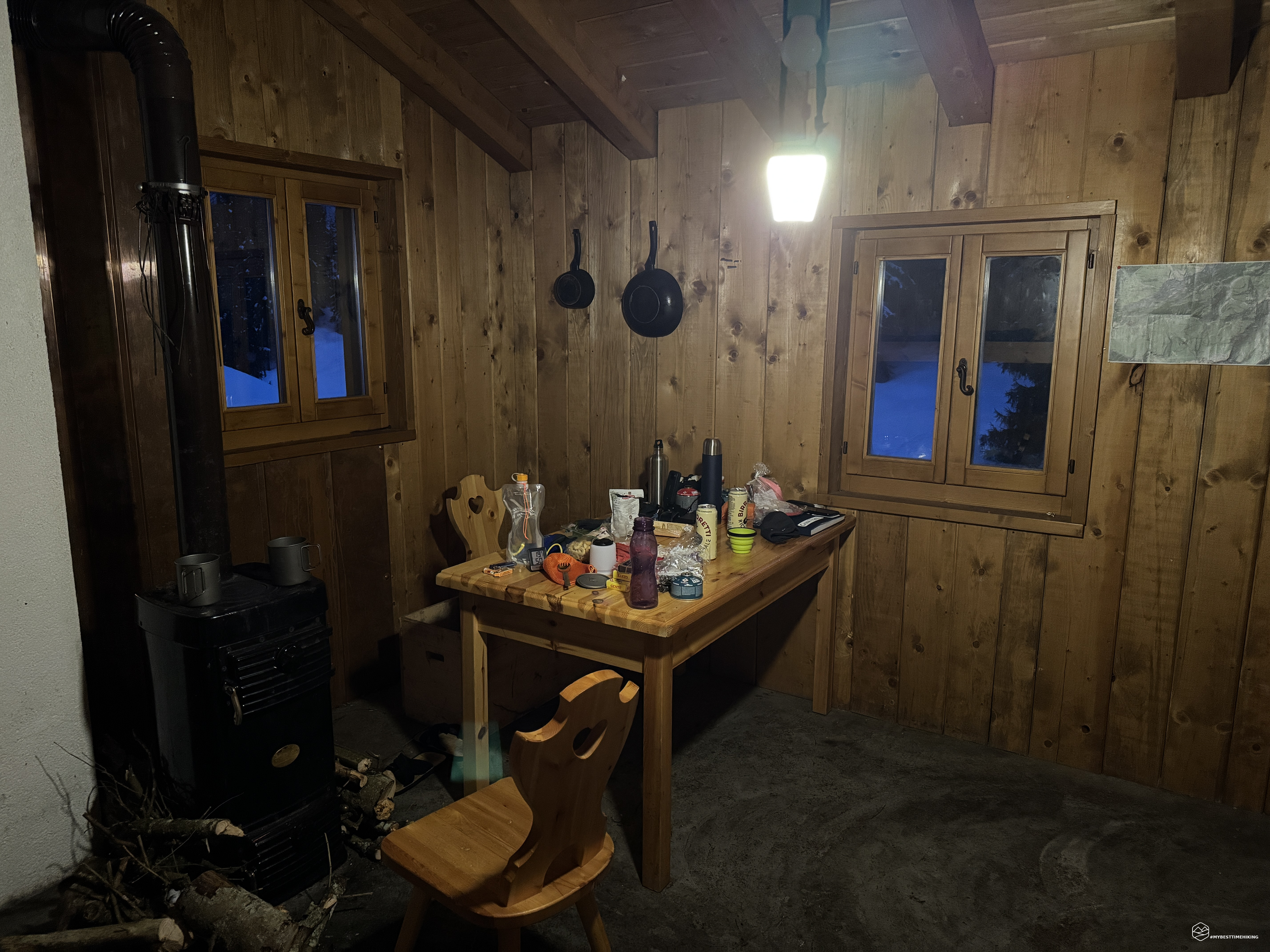
The stove is lit and is starting to heat the bivouac nicely: the hut is basic, with a table with a full-size chair and a legless one leaning against the wood bin, a Nordic stove that's guaranteed to produce an exceptional temperature, a shelf with a small fire pit and various emergency canned goods, and a bunk bed. There are even three windows with attached shutters facing north, west, and the most beautiful one facing south, with a view of Monte Frate! Evening falls, the fire reaches temperatures of over 24 degrees Celsius, we have plenty of wood (we've been good), and we can first enjoy a delicious dinner of saffron and porcini mushroom risotto. A game of cards is a must, and going out after dark is the last thing we have to do: the starry sky is hypnotic!
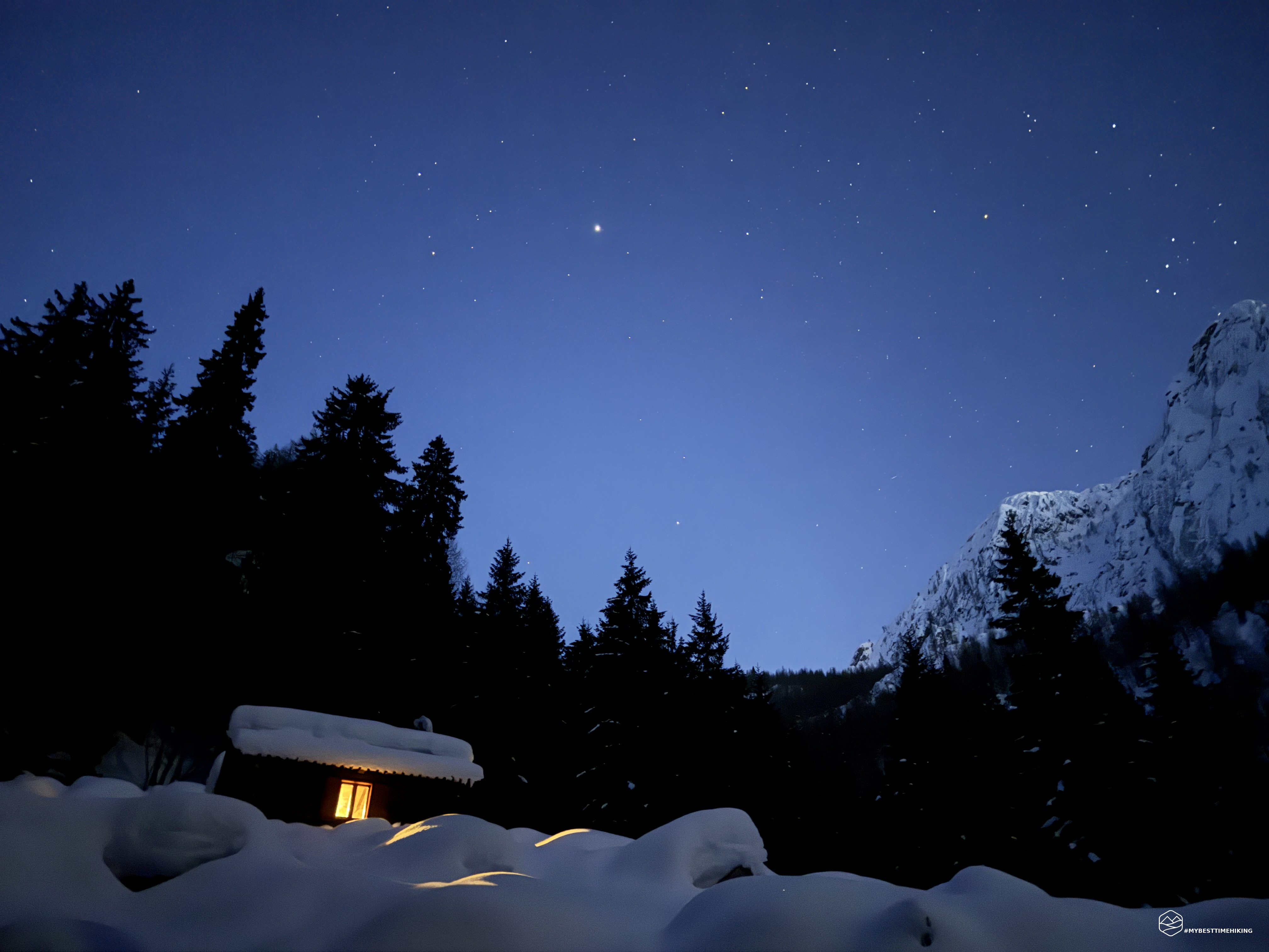
No glare interrupts this sky dotted with luminous pins that shine in a spectacular flash. The hut's windows offer a magical blend of light and shadow. All around us, the jagged shapes of the fir trees and the sinuous mountain ridges create contrasting black spots. We lose ourselves in this deafening silence and capture, as best we can, these infinite moments.
I leave the Insta360 X4 out to capture the nighttime starlapse and we return to the warmth, ready to go to bed. Ultralight sleeping bag (especially considering the temperature!) and goodnight.
At 4:00 a.m., we are awakened by unusual noises: it sounds like a mouse munching on something... our supplies! Obviously, we had packed all our food in an airtight bag, so it's impossible for it to be eating that... I point the flashlight in the direction of the noises and there it is, the little mouse leaping three times its height into the only hole in the wood on the northwest edge of the bivouac! It was making paper out of a glass left on the shelf away from the table with our belongings. So we try to sleep again, but nothing. At regular intervals, he comes back to nibble, and we can't get back to sleep.
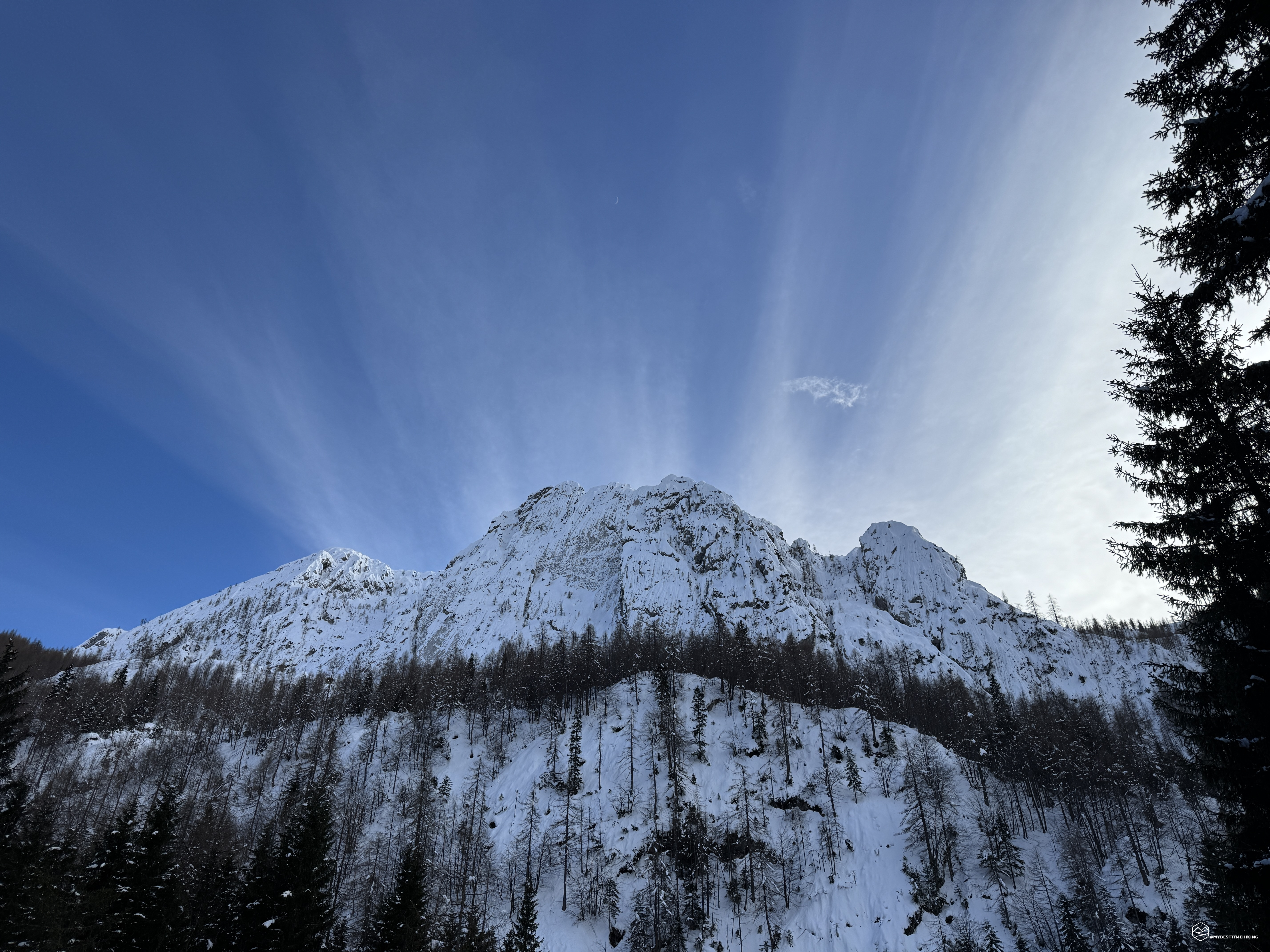
We wake up well before dawn, turn on the stove, and have breakfast. Dawn arrives, but it's not as spectacular as I imagined, as the first rays of the sun have filtered through the Cima Lastruta peak, which overlooks the hut to the east.
We tidy up everything, clean it thoroughly, and leave a large amount of wood for the next guests at the bivouac. We close the door tightly to prevent animals from accessing it and retrace our steps from the previous day. We retrace our steps back the way we came. The cold night has solidified the trail we'd beaten during the ascent. The view offers new details, and, paying close attention, we dive headlong into the descent, which takes us two hours to reach the village of Mattan again.
Thus concludes a wonderful adventure in a winter bivouac in the Friulian Dolomites, overlooking Mount Frate, in the Ressetùm mountain range. The Casera Frate de Sora is a true gem: small but comfortable, it's an ideal bivouac for two people (since it only sleeps two). It's a strategic point for reaching the peaks of Mount Frate or for a loop to the nearby Pradut refuge. It's an 800-meter elevation gain, so it's best for those who are very fit in the winter, where snowshoes are necessary if the snow is deep, as we were. With easier conditions, less snow, and milder temperatures, the bivouac is certainly a wild adventure, even for the less experienced!
Click here and watch the exclusive video on YouTube for an even more immersive experience!
DifficultyHikers - Itineraries on paths or evident traces in various types of terrain (pastures, debris, stony ground ...). They are generally marked with paint or cairns (pyramid-shaped stacked stones that allow you to identify the route even from a distance). They can also take place in snowy but only slightly inclined environments. They require the equipment described in the part dedicated to hiking and sufficient orientation skills, walking training for a few hours. |