Details
-
 Hike type
Hike
-
 Difficulty
E
-
 Distance
22.58 KM
-
 Altitude MIN
1260.00 mt
-
 Altitude drop +
1300 mt
-
 Parking
-
 Landscape

-
 History
-
 Duration
6h 30m
-
 Altitude MAX
2560.00 mt
-
 Altitude drop -
-1300 mt
-
Hike type
Hike
-
Difficulty
E
-
Distance
22.58 KM
-
Altitude MIN
1260.00 mt
-
Altitude MAX
2560.00 mt
-
Altitude drop +
1300 mt
-
Altitude drop -
-1300 mt
-
Duration
6h 30m
-
Landscape
-
History
-
Parking


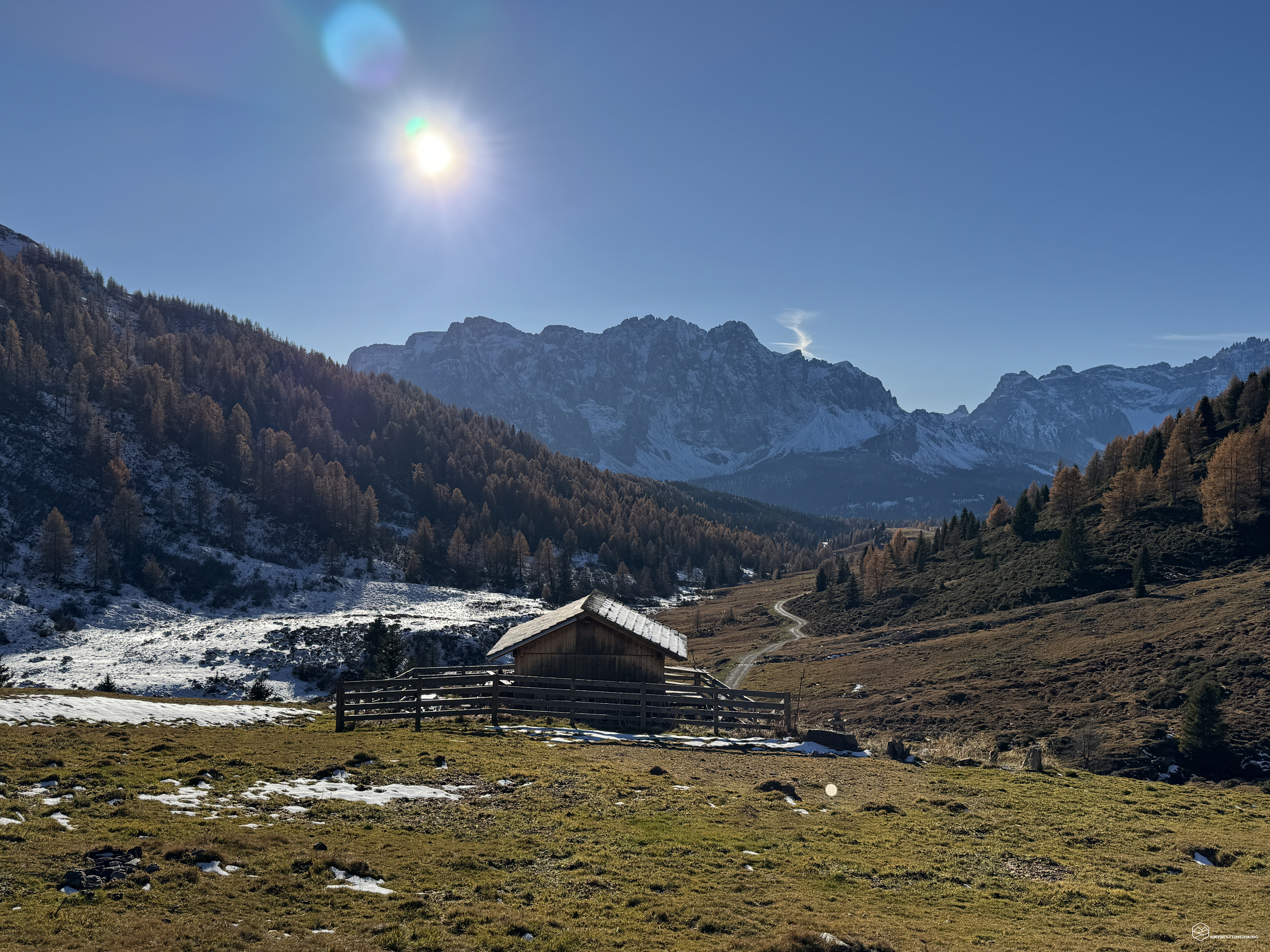
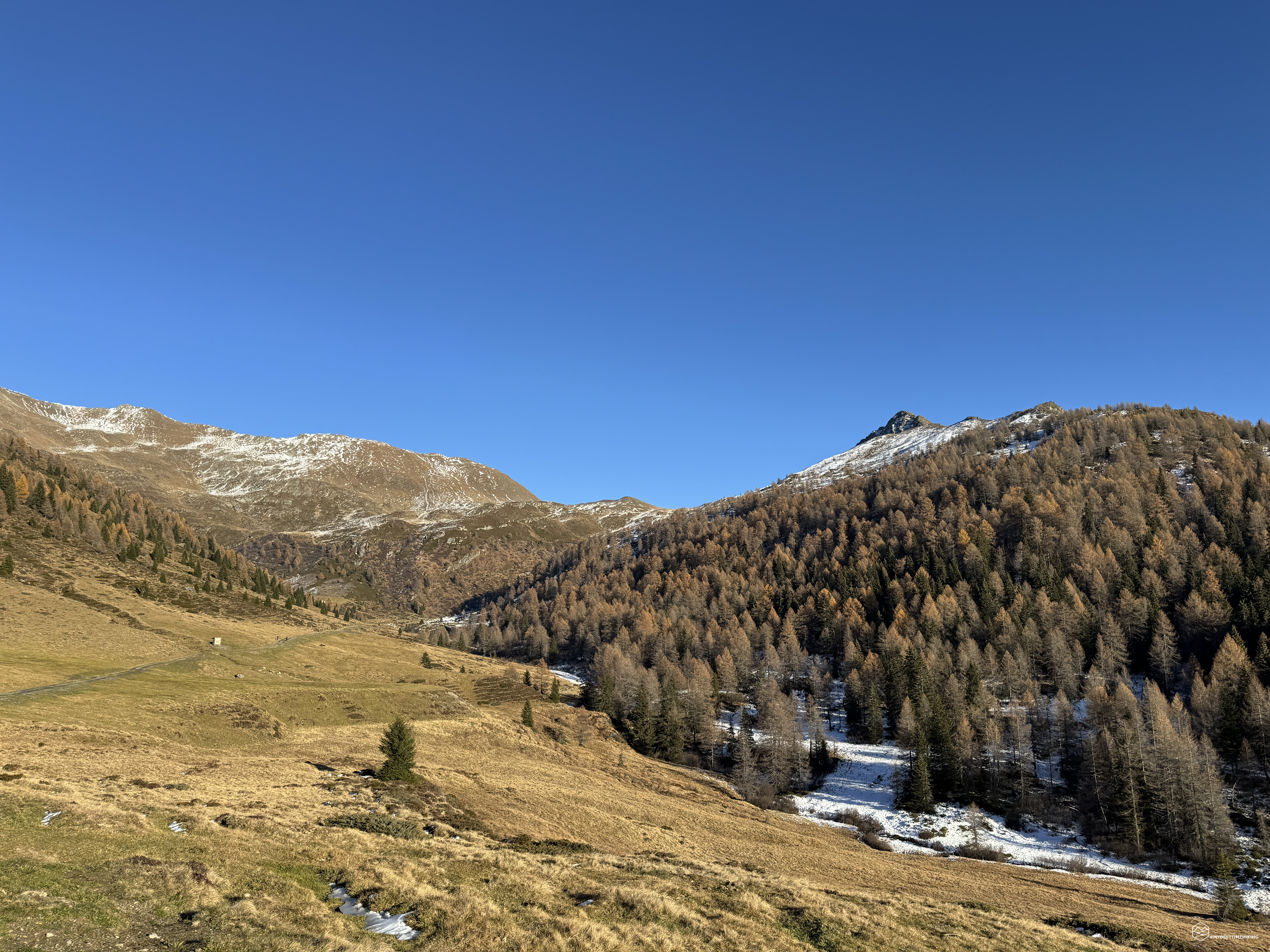

"Did you know that in the Dolomites there is the only volcano in the Alps? Col Quaternà". With these words my Tuscan friend Romolo made me want to learn something more about this peak: first its position, then its geology and finally its historical notes. All this immediately revealed itself to be an immense and attractive wealth of information.
Let the adventure begin!
Thermometer below zero upon arrival at Passo Monte Croce Comelico on the border between Veneto and Trentino Alto Adige. Enrico and Angelo are with me today to form an exploratory group on this new mountain. The objective of the day is Col Quaternà, an old volcanic chimney still easily recognizable today by its pointed shape. From here we still cannot admire it and therefore we take the uphill route on the CAI 131 track right next to the Passo car park.
The wide dirt road proceeds slightly uphill within a larch and fir forest, we pass the small church of St. Michel and proceed up to a crossroads with clear signs for Malga Coltrondo. Here we change track onto CAI 149 where we lose several tens of meters of altitude in an unexpected descent. After a hairpin bend to the right, the outline of Col Quaternà appears: it seems very distant, its tip seems unreachable given how sharp it is. We return to the woods fighting between cobwebs stretched between the fir trees, we cross a lovely wooden bridge made even more characteristic by the blanket of snow that is whitening the route and we soon arrive at the Toad Lake: a patch of water, now frozen, a typical meeting place for the toads that populate these streams that make up the surrounding area.
We continue on the path and, after a new descent, we enter the asphalt road that leads to the Malga. And here it is in brief right in front of us, closed during this period, but a convenient place in summer to get here by car and save yourself about 1 hour of walking and over 250 meters of altitude difference. Worthy of note are the typical Scottish "Highlander" cows which, still asleep from the torpor of sleep, with their long, thick and bristly fur, peer at us furtively, presenting us with their immense symmetrical horns. A photo with the Dolomite backdrop is a must.
We continue on the road and soon we are at the Rinfreddo refuge, which is also closed this season. An easy place to reach for anyone thanks to the possibility of parking at the pasture you have just left. The view from here begins to be truly appreciable with the Sesto Dolomites, the peaks of Auronzo (or rather of Padua from this side) and Popera.
We continue the climb until we reach an altitude of 2000 meters where we are evidently at the base of the Col Quaternà volcanic chimney. It is incredible how the conformation of this place is incredibly different compared to a look behind us: the sedimentary dolomite rock stands out on one side, while before our eyes there is a completely different conformation. We observe dark colored rocks, often crossed by veins of white flint and characterized by the typical "leaflet" appearance. From here onwards they can be found along much of the route and represent very ancient sands and silts deposited in a shallow sea, then consolidated over time until they transform into sandstone. They are much older rocks than our beloved Dolomites.
The rhododendrons, now faded, seem to support the summit pyramid of the peak: it is an ancient volcanic chimney (neck), made up of lava rock that is more resistant than that of the volcano that surrounded it. With the passage of time, the most friable rocks of the volcanic cone have eroded, leaving only the central nucleus to emerge: the chimney, which today reaches 2503 meters above sea level. It remained active for between two and three million years, about 290 million years ago. The activity, probably discontinuous, was of an andesitic type in the final phases, as demonstrated by the rocks that fill the volcanic conduit.
At an altitude of 2053, instead of climbing directly towards the summit through the Valle delle Pere, we follow the path traced by the CAI 173 sign which climbs in a zig-zag on a dirt track. We quickly rise in altitude and the cross at the top of the hill becomes more and more visible. The panorama becomes increasingly wider, more majestic and provides us with a preview of what awaits us at the summit. Having reached 2379 meters we are on the Sella de Quaternà, where we intersect the crest of the Costa della Spina. This characteristic route allows you to cross Monte Spina which overlooks Padua and Dosoledo and joins, with a succession of sharp peaks, to the position we are in at the moment. We're at the final stretch leading to the summit cross, and we can already glimpse it through the rocks. A small Madonna appears beside us, protecting these sacred places that witnessed countless soldiers and volunteers sacrifice themselves for their country during the Great War. It was here, on July 13, 1987, that Pope John Paul II walked this path to the summit. The statue of the Madonna, installed in 1967, is accompanied by the dedication: "To Mary, Queen of the Peaks and of Peace."
We embark on the final stretch of the clearly visible trail among the silent remains of fortifications and trenches dating back to the Great War. Stones worn by time and crumbling walls testify to the presence of the soldiers who fought and resisted here. The final section leading to the summit is characterized by small, landslide-prone and unstable sections, but never dangerous or difficult. And behold, before us is the majestic cross, the panorama stretches out before our eyes: the summit of Col Quaternà!
Date
08-11-2025
Distance
22.58 KM
Hike type
Hike
Ascent
1300 mt
- Mountain
Col Quaternà
- Address
Passo Monte croce di Comelico - Veneto, Alto Adige
- Altitude
2560.00 m
- Refuges
Malga Coltrondo, Rifugio Rinfreddo
- Information
The summit cross holds a plaque commemorating the fallen of the First World War, a discreet yet touching sign that invites reflection before the history and sacrifice of those who never returned. It's easy to imagine how this mountain played a strategic role during the First World War. From its summit, Italian troops could encompass the entire amphitheater of the Sesto Dolomites, observing enemy movements and coordinating military operations. This hill, suspended between silence and vastness, was then an exceptional natural observatory, from which the gaze stretched across the now peaceful peaks, once a theater of war. And here, these wonders lie before us: looking south, we recognize the peaks of Auronzo dell'Ajarnola and Croda da Campo, and we ascend with Cima di Padova, Cima Bagni, and Croda dei Toni, which emerges behind the walls of Popera, all the way to the majestic Croda Rossa di Sesto. Looking northwest, we see Monte Elmo, the Ferro mountain before us, and the Frugnoni. Continuing northeast, we see Monte Cavallino and the Carnic Alps, stretching out in an endless chain. The 360-degree view culminates in the characteristic Costa della Spina mentioned above. We enjoy this incredible view by focusing our gaze on the Frugnoni peak to the north: there lies the Italian-Austrian border, and we'd like to try to reach it.
We write a short dedication in the summit log to mark our passage and descend the same way we came up. Arriving at the Sella del Quaternà, we turn left and head north, skirting the slopes of Col Quaternà and skirting it until we quickly reach the Silvella Pass on CAI trail 148. We can see the uphill route leading to the Frugnoni along a zigzagging path covered in residual snow. Under a sun as warm as August, we continue along the CAI 160 trail toward the second summit of the day. Our goal is a simple jaunt along the national border. The descent and subsequent ascent require us to rack up another 200 meters of elevation gain, and after the 900 meters we've already climbed to reach Col Quaternà, they're making their impact. We reach the final hairpin bend leading to the Sella dei Frugnoni at 2,539 meters above sea level on a snow-covered plateau. We sink inexorably in some places where the snow has been displaced by the wind, which must be blowing quite strongly here. We therefore choose to take the ridge that takes us a few dozen meters higher, where we find a small trench overlooking Austria. From here, the view encompasses Italy and Austria, bringing to mind the Great War. Indeed, turning our gaze toward our native land, the legendary Col Quaternà we had just left reappears, and from here, the western ridge of the massif, known as the Vallorèra Ridge, is clearly visible. This was conquered on May 20, 1915, by the 68th Company of the Cadore Battalion. Two days later, another platoon reached the summit, where both units fortified themselves, digging trenches and consolidating their positions. Returning our gaze to the Habsburg homeland, we note the strategic and crucial body of water of Lake Obstanser, from which both sides drew water. In that area and on the Montagna del Ferro, which we see very close to our left, the Austrians strengthened their presence, followed by the Italians, who deployed along the Frugnoni–Vanscuro line, not far from where we are now. On May 31, 1915, the Standschützen attacked this front by surprise and, with a well-aimed strike, destroyed the Italian positions on Col Quaternà. The few survivors were forced to retreat. Fighting in the area continued for a long time, causing numerous casualties, with the Italians paying the heaviest price.
Retracing our steps, we retrace the rocky path we took until we reach the Silvella Pass. We then take CAI trail 146 to return to the Monte Croce Comelico Pass, completing a wide loop that encompasses Col Quaternà and exploring the Vallorera. After completing a series of eight hairpin bends, this valley reveals itself to be truly delightful: it delights the hiker with the lapping of the numerous streams that flow down from the Pale del Decano and all converge to form the Padula Torrent (or Grenzbach). We pass a charming farmhouse (Hirtenhutte) that, as the sun begins to set, offers a magical view. At 1938 meters above sea level, we find a clear divide that invites us to enter the nearby woodland, CAI trail 156, which we leave almost immediately to take CAI trail 1753, which cuts across the valley from northeast to southwest, effectively intersecting the Padola stream and the current border between Veneto and Alto Adige.
But why is this trail called 1753? It's easy to explain: the 1753 Trail is a cross-border project dedicated to the recovery of the ancient border between the Venetian Republic and the Habsburg Empire, established with the Treaty of Rovereto of 1753. Indeed, along the path we're following, we come across several historic boundary stones. Some are over a meter tall and feature distinctive carvings with the unmistakable number 1753.
Progressing through the forest also offers a fairytale setting, with some areas completely covered in ice crystals and tree branches completely blanketed in snow. In some places, on these frigid days, caution is required to avoid slipping, especially in the undergrowth.
But the surprises aren't over yet. Suddenly, as the clearing opens up before us, covered in a soft expanse of snow, our gaze is captured by a massive masonry structure emerging from the white silence: imposing, perfectly camouflaged among the rocks and slopes, so much so that it seems part of the mountain itself. Before us lies the Vallo Alpino Littorio bunker, a monumental fortification part of the vast defensive system built by the fascist regime on the eve of World War II to protect Italy's borders. Made of reinforced concrete, partly buried or dug into the rock, the bunker housed machine gun emplacements, troop quarters, and warehouses, a now silent and abandoned testimony to an era when the mountains were not, again after the Great War (!), just a place of peace and silence, but also of strategy and resistance.
We rejoin the road that took us to Malga Coltrondo in the morning and retrace our steps, enjoying a special alpenglow that allows us to greet Col Quaternà with an unusual and characteristic reddish brushstroke in a perfect, cloudless sunset. We return to the car at the Monte Croce Comelico pass, now without sunlight, where the thermometer already reads -4 degrees Celsius.
Thus ends this endless adventure, which has seen us as protagonists and witnesses of volcanic geology from millions of years ago, alongside a more recent and immediately distinguishable rock formation of the famous dolomite. We have traveled through history spanning from the Venetian Republic, through the Great War, to the Second World War, ending our journey in the present. This excursion has brought together a myriad of historical and naturalistic knowledge, compressed into a loop of approximately 22 km. The complete circuit has an elevation gain of approximately 1,300 meters, making it suitable for well-trained hikers. There are no technical difficulties, and the route qualifies as an E (hiking) itinerary, but don't be fooled by the length and elevation gain. Those who still want to enjoy the main attraction, Col Quaternà, can start from Malga Coltrondo, covering only 600 meters of elevation gain and allowing even less experienced hikers to discover these fascinating historical and natural sites.
An adventure unmatched in beauty, quantity, and variety of places to admire, rediscover, and take home with you in your personal Dolomite exploration journey!
Click here and watch the exclusive video on YouTube for an even more immersive experience!
DifficultyHikers - Itineraries on paths or evident traces in various types of terrain (pastures, debris, stony ground ...). They are generally marked with paint or cairns (pyramid-shaped stacked stones that allow you to identify the route even from a distance). They can also take place in snowy but only slightly inclined environments. They require the equipment described in the part dedicated to hiking and sufficient orientation skills, walking training for a few hours. |