Details
-
 Hike type
Hike
-
 Difficulty
E
-
 Distance
7.89 KM
-
 Altitude MIN
760.00 mt
-
 Altitude drop +
700 mt
-
 Parking
-
 Landscape


-
 History
-
 Duration
4h 30m
-
 Altitude MAX
1460.00 mt
-
 Altitude drop -
-700 mt
-
Hike type
Hike
-
Difficulty
E
-
Distance
7.89 KM
-
Altitude MIN
760.00 mt
-
Altitude MAX
1460.00 mt
-
Altitude drop +
700 mt
-
Altitude drop -
-700 mt
-
Duration
4h 30m
-
Landscape
-
History
-
Parking

Summer is coming to an end (and a year is passing...). This Val di Zoldo adventure unfolds to the tune of Righeira on a warm, clear day, a summer that doesn't seem to end so easily!
Today's hiking companions are Tomaso and newcomer Giro! The goal of the day is a peaceful and rewarding adventure to the Bosconero refuge.
We reach the large parking lot in Pontesei near the lake of the same name. Simply cross the main road (watch out for cars approaching from a blind curve) and you'll find a clear sign with the word "Bosconero" written on it, along with a small plaque indicating whether the refuge is open or not.
We begin the wide, rocky path, continuing steadily uphill, and soon reach a fork in the road. We choose the right path on CAI trail 485 toward the area known as "Le Susinere." This leads us into the Val di Bosconero. The trail becomes more earthy, narrow, but still clearly visible and well-maintained. We're following the stream that flows into Lake Pontesei from above. We're on a grassy ledge, never dangerous, but still distinctive because we can feel the drop toward the end of the valley.
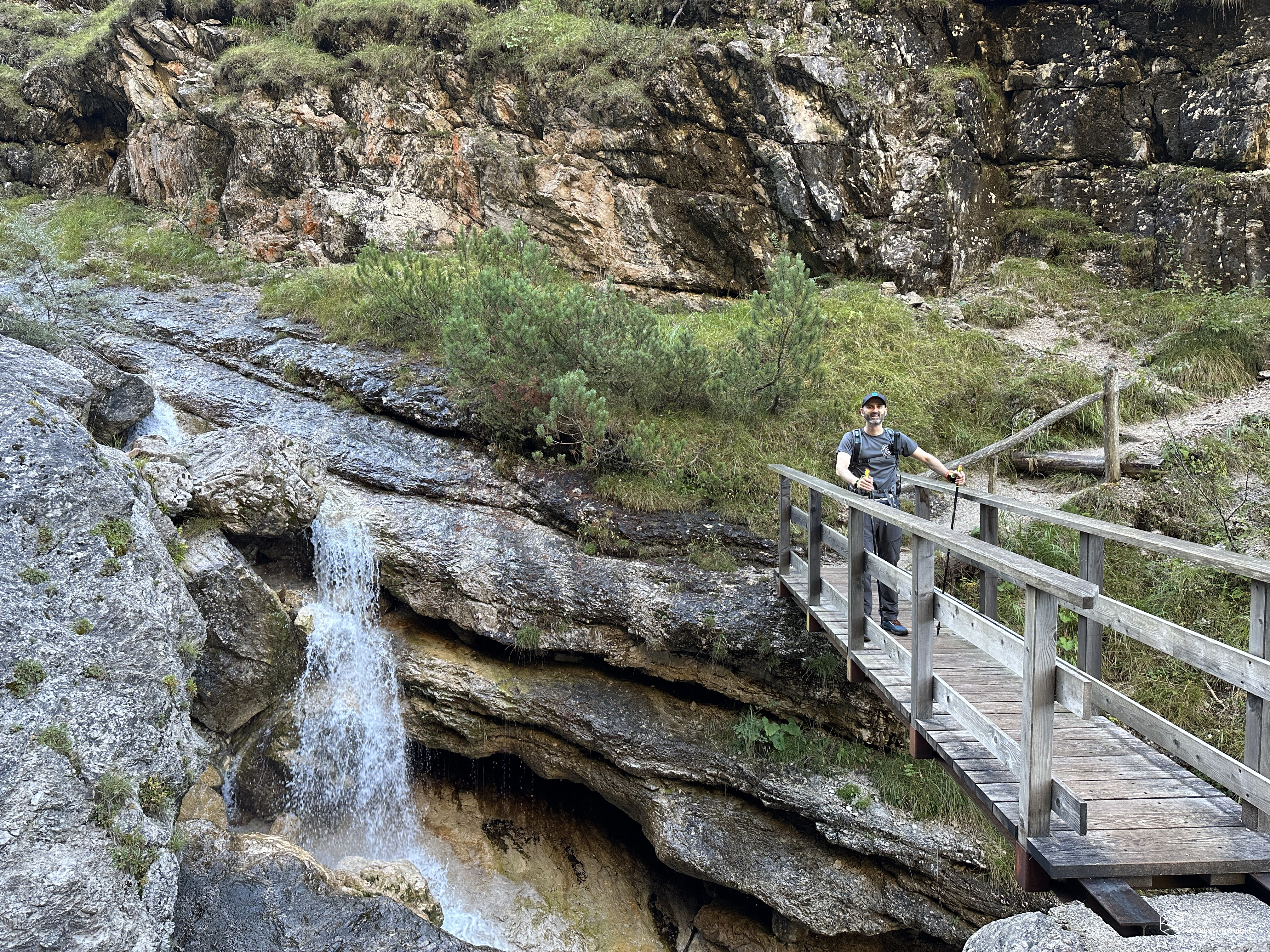
After 900 meters, we come to a very unique passage with a wooden bridge secured to enormous boulders, suspended over the roaring stream that over the years continues to erode and smooth the rocks along its path. Beautiful waterfalls brighten the passage over the bridge and offer the first photo opportunity.
We cross to the left side of the valley, where a challenging section awaits. Here, a wooden ladder, almost dilapidated, allows us to ascend to the upper part of the trail. To make the ascent easier, we can secure ourselves to a large chain along the ledge that also forms on this side of the valley. Unfortunately, the beautiful route lasts only a short time: we're already on the switchbacks that quickly lead away from the stream, quickly gaining altitude until we enter the forest.
A beech forest welcomes us, so much so that it resembles Cansiglio. We climb to over 1,000 meters, reaching the peak of "le susinere" (spoiler alert: we didn't find any plum trees), also known as "Pian de le Manze." From here, the trail bends northeast on a slight slope. The forest changes, predominantly fir, until we reach an altitude of 1,150 meters, where we come across the Casera di Zot. A seemingly ruined building, but upon closer inspection, there's the option of bivouacking in a two-story cabin: the ground floor is used as a fireplace/dining room. The first floor, with an entrance through a window overlooking the trail, is a comfortable shelter for the night.
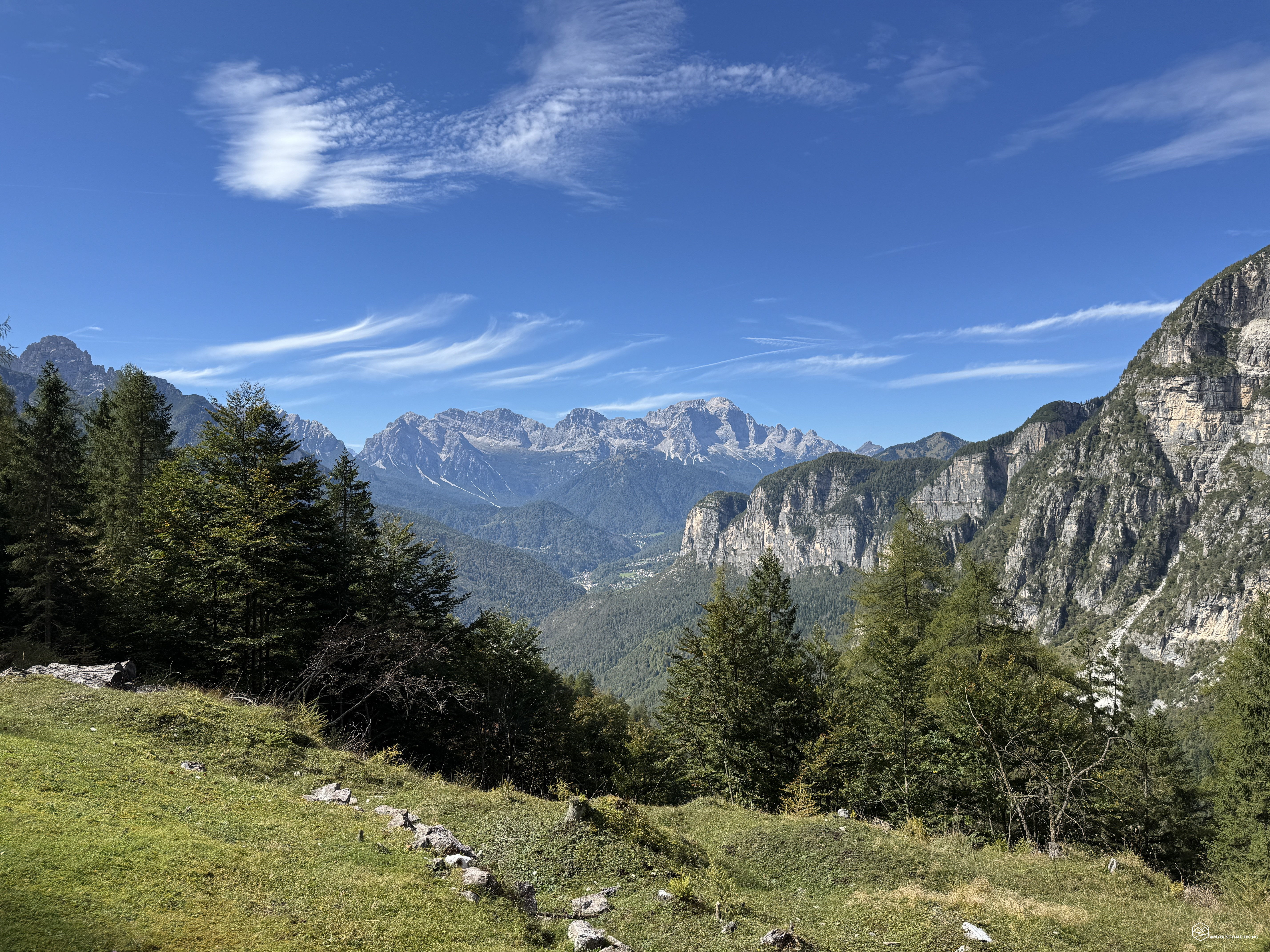
From here, the steady climb begins, never strenuous, allowing for rapid elevation gain. This section winds through the forest, offering panoramic terraces overlooking the Civetta and Moiazza mountains. The walls of Sasso di Bosconero also begin to peek through the vegetation. At 1,425 meters, we ignore the turnoff for Colàz and Croda Bianca, continuing instead on the obvious trail marked by a recent rock painting and a wooden plaque. The trail now remains practically at altitude, crossing a dry drainage basin that offers a refreshing welcome thanks to a pleasant current of fresh air coming from the high passes.
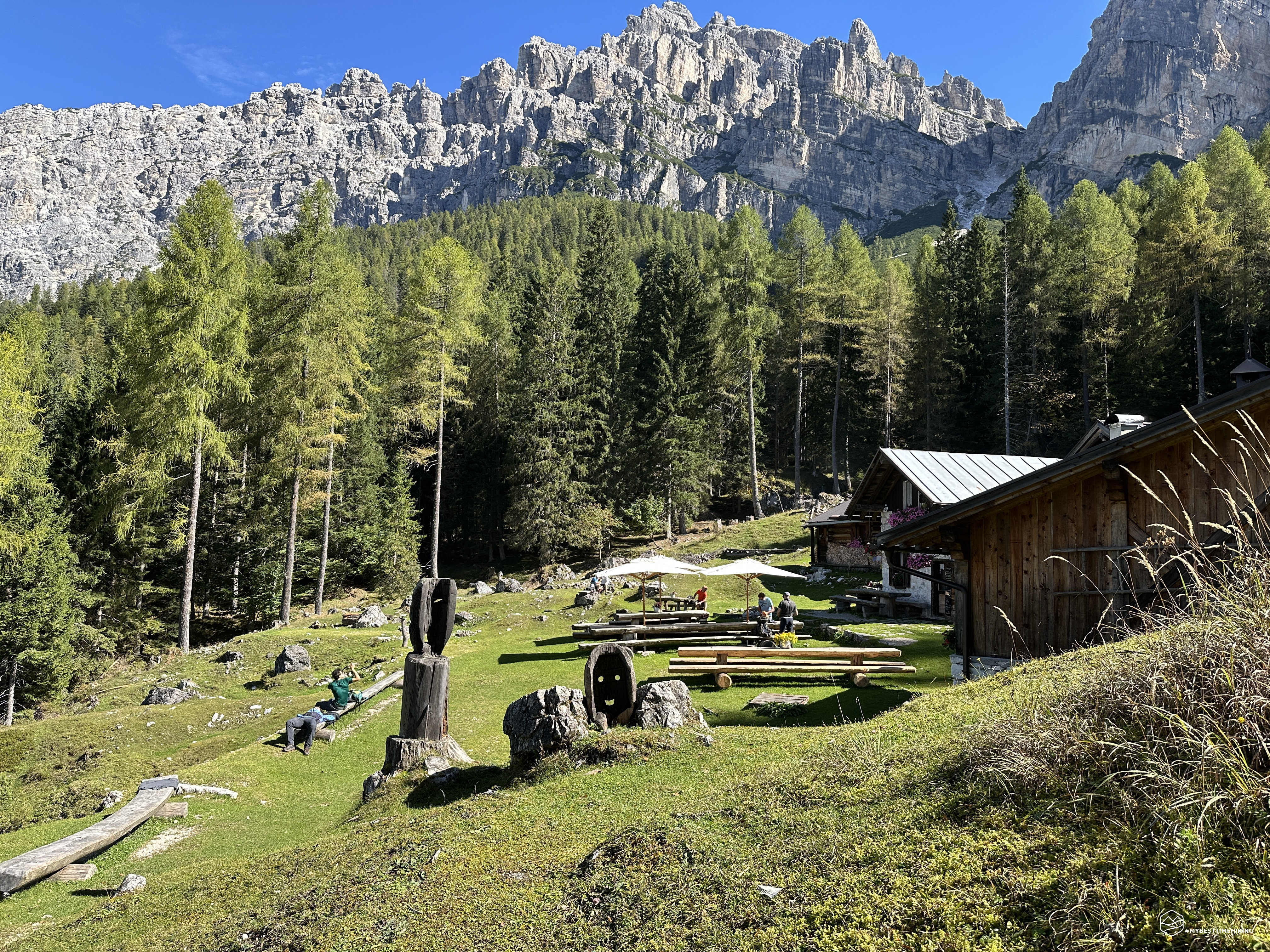
We quickly reach the turnoff that reconnects with CAI trail 490, and the CAI signage indicates that we've almost reached our destination. Another right turn and we reach the plateau with the Bosconero refuge rising above, surrounded by wooden tables and white umbrellas to protect us from the strong sun. The view is exceptional: a deep green meadow, a priceless view of the Sasso di Bosconero, the Dolomite walls of the Sfornioi, the crevices that identify the famous Ciavazole passes, the Matt pass, and the hidden Toanella pass. On the other side, the incredible panorama of the Moiazza and Civetta peaks, all the way to the Spiz de San Piero right in front of us.
Date
20-09-2025
Distance
7.89 KM
Hike type
Hike
Ascent
700 mt
- Mountain
Sasso di Bosconero
- Address
Val di Zoldo, Veneto
- Altitude
1460.00 m
- Refuges
Rifugio Bosconero
- Information
The Bosconero refuge sits at the center of the plateau, a well-maintained Alpine lodge with colorful flowers adorning both the building and each of the refreshment benches. A large menu at the entrance invites us to choose from a selection of delicacies, all strictly homemade. The extraordinary thing is that we are surrounded by greenery, at about 1,500 meters above sea level, and the only way to resupply the refuge is via the only two CAI trails, 485 and 490 (which we will take on the return journey). The refuge, in fact, is not served by any cable car. This means that every single provision, from food to gas cylinders, must be carried on shoulders along the path that ascends from Lake Pontesei. This choice, or perhaps necessity, has shaped the character of the place and of those who manage it, creating an unbreakable bond between the effort of the climb and the joy of arriving. Characteristics we found in Denise and Riccardo, who welcomed us with a kindness and attentiveness that is difficult to find at this level.
Once we'd chosen our dishes, we delighted in the nuances of flavor: the intense flavor of the barley soup, the delicate beetroot gnocchi, and the signature dishes of sage pastin with polenta and currywurst with sauerkraut. One delicacy after another, culminating in a series of desserts: from panna cotta to the highly recommended Bosconero cake! Of course, we finished with the homemade raisins, which we enjoyed sharing with Denise while chatting.
The sun began to set, and, refreshed by the sumptuous lunch, we continued our journey to the crossroads we'd left a few hours earlier. Now we descended directly onto the CAI 490 road, towards Pontesei.
Retracing our steps, we came across watersheds with enchanted streams that looked like Ireland: a series of bright green moss-covered boulders were submerged by fairy-tale waterfalls. We know that on this side of the valley there are two unmissable attractions that are worth our detours.
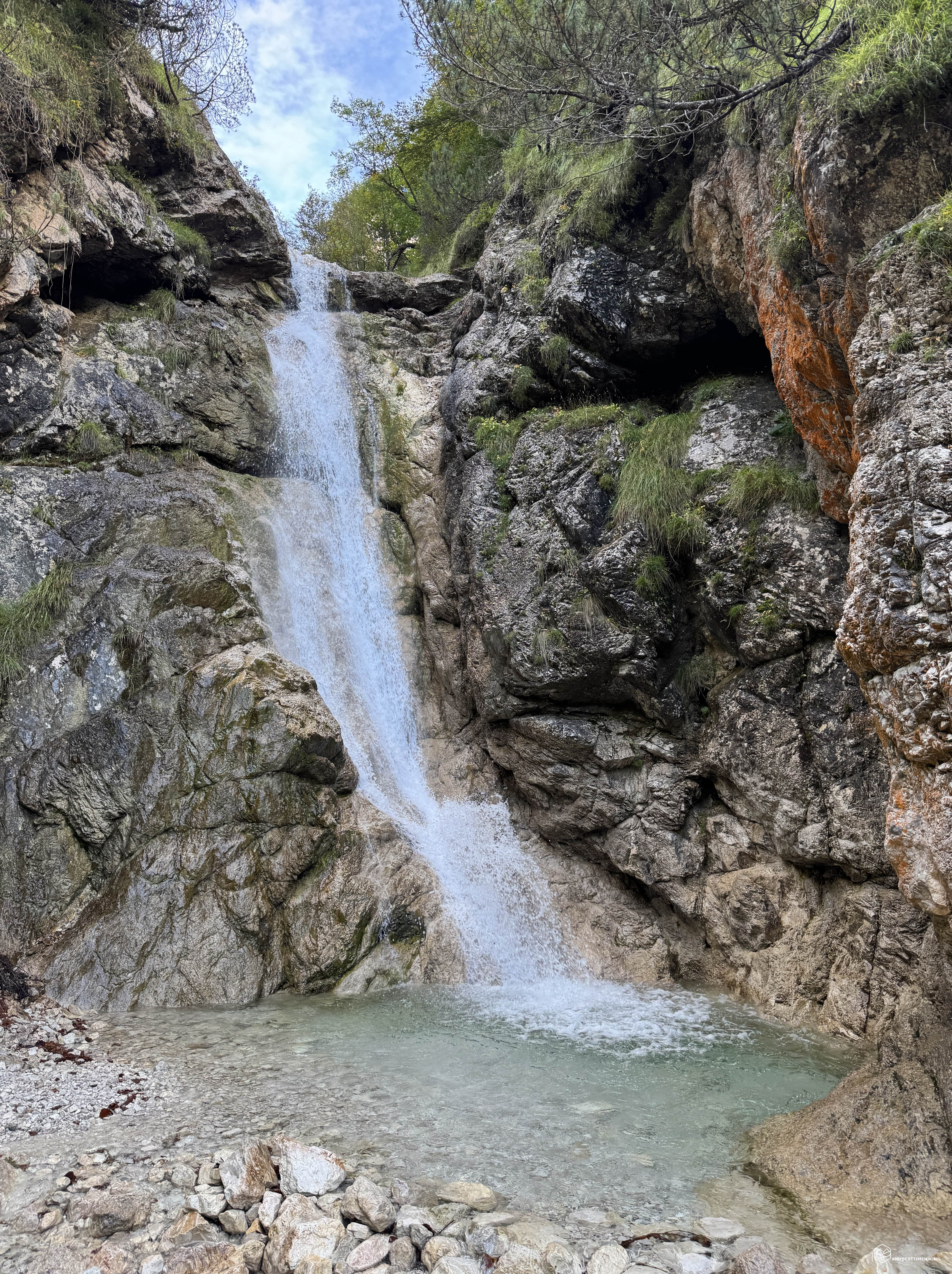
At around 1100 meters above sea level, after passing a landslide-prone scree slope, shortly after re-entering the forest, there is a turnoff to the left with clear signs on trees that takes us straight to the Zot Waterfall. We are, in fact, at the Casera di Zot, which overlooks us on the opposite orographic side of the valley. The trail leads us to the stream bed, which is shallow and easy to ford over easy rocks. We ascend it briefly and there's no mistaking the great roar we hear: there is the magnificent waterfall, cascading several meters into a turquoise basin, forming an image worthy of being immortalized. Another name for this waterfall is the "Fountain of Eternal Youth," which ignites hikers' imaginations.
Retracing our steps and, instead of returning to CAI trail 490, we follow other clear signs westward that point to the second place to visit: the Witches' Pond.
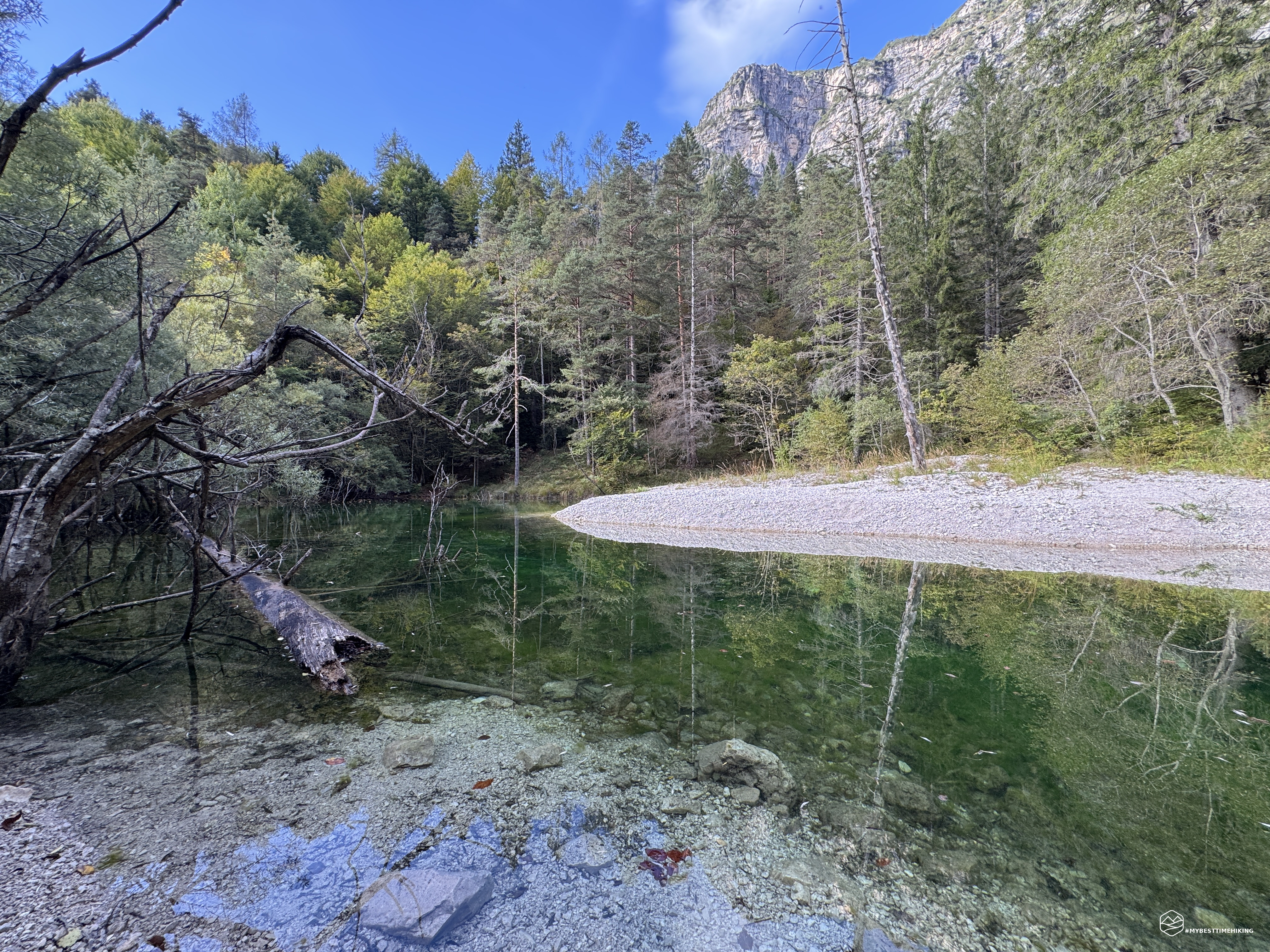
We soon reach a rocky clearing with sparse branches where we can glimpse a pool of dark water: there is the gloomy but characteristic pond! It is said that "witches," figures in local folklore often associated with wise women and healers, gathered in this small, intensely colored body of water. As we get closer, the color changes from dark to a deep emerald green, and we notice that the pond is so clean, it's even home to several medium-sized fish!
Once we've skirted the pond to enjoy its every nuance, we return to the trail we left previously. A gentle climb leads us back to CAI trail 490 just before the junction with Pian del Mugón. We continue our steady descent through the woods until we reach the junction with CAI trail 485 and, shortly after, the Pontesei parking lot.
This concludes the circular hike that has seen us explore the Bosconero, including legendary sites, trails immersed in the greenery of the forest, and, above all, the fantastic Bosconero refuge, which captivated us with its beauty and incredible delicacies! A special thanks goes to the hospitality and expertise of Riccardo and Denise, who made us feel their commitment and desire to work in synergy with these places to offer quality products at more than fair prices! Considering that provisions must be carried on one's back... it's further proof of professionalism, love for the mountains, and for those who know how to appreciate them properly!
A medium-difficulty hike with a 700-meter elevation gain. For those less fit, I recommend taking the CAI trail 490 for the outward and return journey, as it's more popular and easier. A short adventure, but one that will certainly provide the thrills that, as always, only the Dolomites can provide!
Click here and watch the exclusive video on YouTube for an even more immersive experience!
DifficultyHikers - Itineraries on paths or evident traces in various types of terrain (pastures, debris, stony ground ...). They are generally marked with paint or cairns (pyramid-shaped stacked stones that allow you to identify the route even from a distance). They can also take place in snowy but only slightly inclined environments. They require the equipment described in the part dedicated to hiking and sufficient orientation skills, walking training for a few hours. |