Details
-
 Hike type
Hike
-
 Difficulty
E
-
 Distance
21.27 KM
-
 Altitude MIN
1370.00 mt
-
 Altitude drop +
1400 mt
-
 Parking
-
 Landscape

-
 History

-
 Duration
7h
-
 Altitude MAX
2770.00 mt
-
 Altitude drop -
-1400 mt
-
Hike type
Hike
-
Difficulty
E
-
Distance
21.27 KM
-
Altitude MIN
1370.00 mt
-
Altitude MAX
2770.00 mt
-
Altitude drop +
1400 mt
-
Altitude drop -
-1400 mt
-
Duration
7h
-
Landscape
-
History
-
Parking
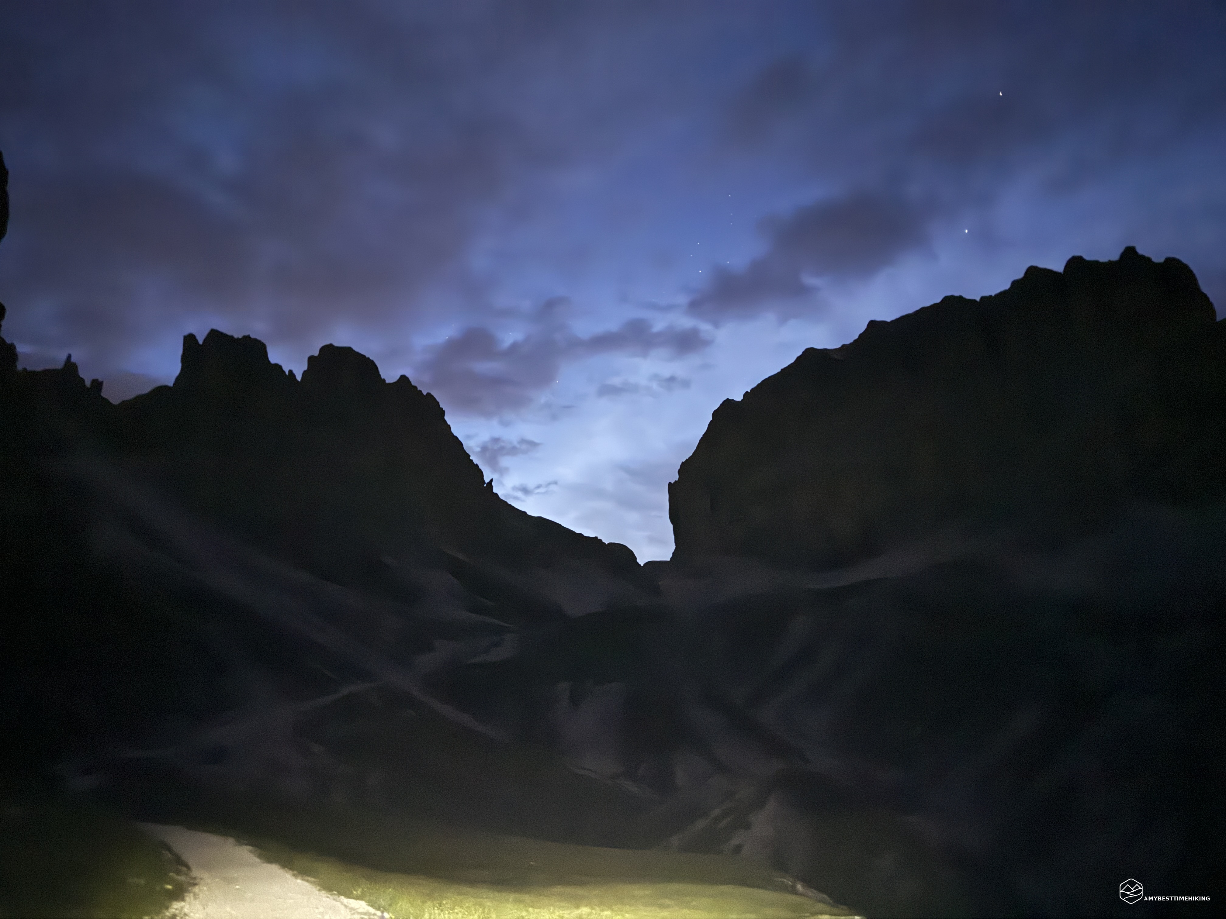
It's midnight on August 3rd, and I'm leaving for Val di Fassa. It's not a smart departure, as you might imagine, but it's the perfect time to reach the starting point in time for the night hike to Catinaccio!
Shortly before 3:00 a.m., I'm in Muncion, Pera di Fassa, and I get ready in total darkness. I turn on my headlamp and head towards the paved dirt road marked with CAI trail 43.
Today has a twofold goal: my first night hike, to enjoy the sunrise in the presence of the mountain that gave rise to the Enrosadira, Catinaccio; and to reunite with the group of Enrico, Mattia, and Federico, who are sleeping at the Passo Principe refuge and waiting for my alarm to continue towards Antermoia.
It's starting to drip, even though no rain was forecast. The temperature is 46 degrees, and with the faint light of my headlamp, I continue in the darkness. I can glimpse vegetation on either side, and the asphalt road ahead. Walking in total darkness, with no reference points, is a bit disconcerting. Fortunately, the road is wide, and there's no way around it.
After about half an hour of uninterrupted walking, maintaining a brisk pace, I look to the left between the trees and notice two bright yellow dots that look like headlights! Those small, beady eyes follow me: I search for my phone to immortalize the moment, and as I record, I see that the animal is no longer in the woods but already on the road, behind me, and continues to stare at me... I imagine it's a fox or some small animal, but I don't feel like getting to know it, so I quicken my pace: this situation has given me a real jolt.
In about an hour from the parking lot, I reach the Gardeccia refuge. Plunged in darkness, everyone is asleep; I continue without stopping to avoid getting cold, since it's still drizzling. An anecdote: the refuge has been the finish line of the Giro d'Italia twice, in 1976 and 2011, respectively, in the Longarone-Gardeccia (victory for Gandarias) and the Conegliano-Gardeccia (stage in Nieve, pink jersey for Contador/M. Scarponi).
The climb now becomes steeper, on a road that has become gravel and has been slightly reduced to a trail, though still very wide. I round a couple of hairpin bends, my only point of reference being the circle of light on my headlamp: there are no longer any trees on either side, but I notice a landslide-prone ravine to my right, carved out by the waters of the Ruf de Soal. Finally, the rain stops, and I'm already starting to dry off the slight dampness.
With good energy, I reach the Vajolet and Preuss refuges in about 30 minutes. The imposing Vajolet refuge looms before me; I shine my headlamp on it and think I've woken someone inside... I don't dwell on it, already well-known and renowned; I focus instead on the Preuss refuge: built in the 1920s by Tita Piaz (the famous "Devil of the Dolomites") in memory of his friend, the Austrian mountaineer Paul Preuss. It stands in a spectacular location, on a rocky spur just meters from the Vajolet, and served as a base for climbs led by Piaz. An anecdote: the SAT (Società Alpinisti Tridentini) attempted to thwart the project by blocking the water supply and telephone connection, but Piaz completed the project despite the difficulties.
I change the batteries in my headlamp so as not to be left in the dark at the most exciting moment, and set off again. A little further ahead, a series of CAI signs points to the Re Alberto refuge, above me, in the direction of the Vajolet Towers, whose spires I can make out even in the dark. Indeed, the first glimmers of light begin to appear, at just after 4:30. I leave the CAI 546 signpost and take CAI 584 toward my destination.
The trail narrows, but presents no dangers and is easy to follow even in the darkness. Next to me opens the wide, rising valley of the Val de Vaiolet with its scree slopes.
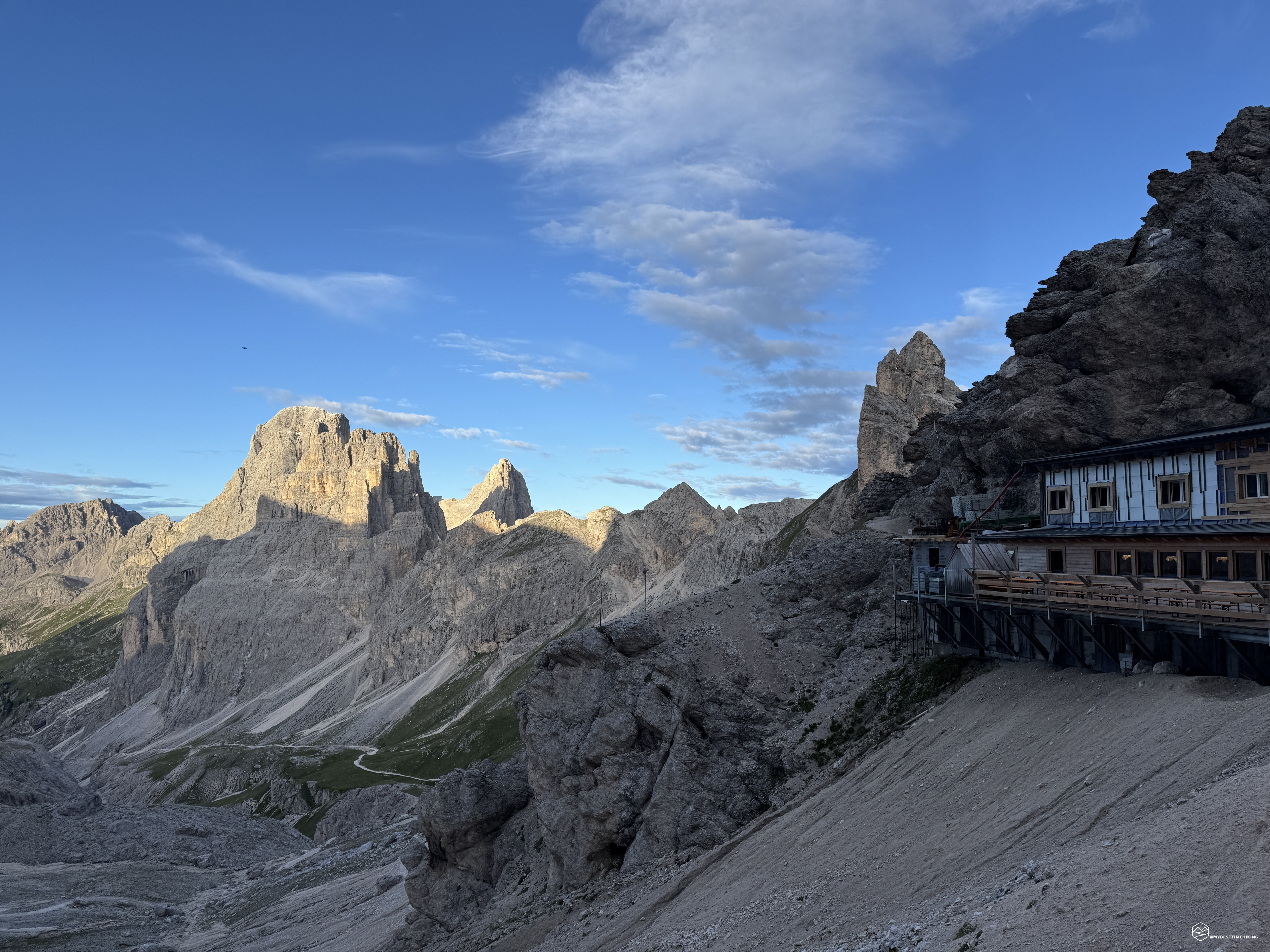
At 5:00 sharp, I arrive in front of the Passo Principe refuge, still shrouded in darkness. In exactly two hours, I've covered the 1,070 meters of elevation gain from the parking lot. I find a comfortable, sheltered spot among the rocks to prepare for the sunrise. It's very windy here, and the thermometer reads 1°C! Luckily, I have a nice, warm down jacket, gloves, and a wool hat with me.
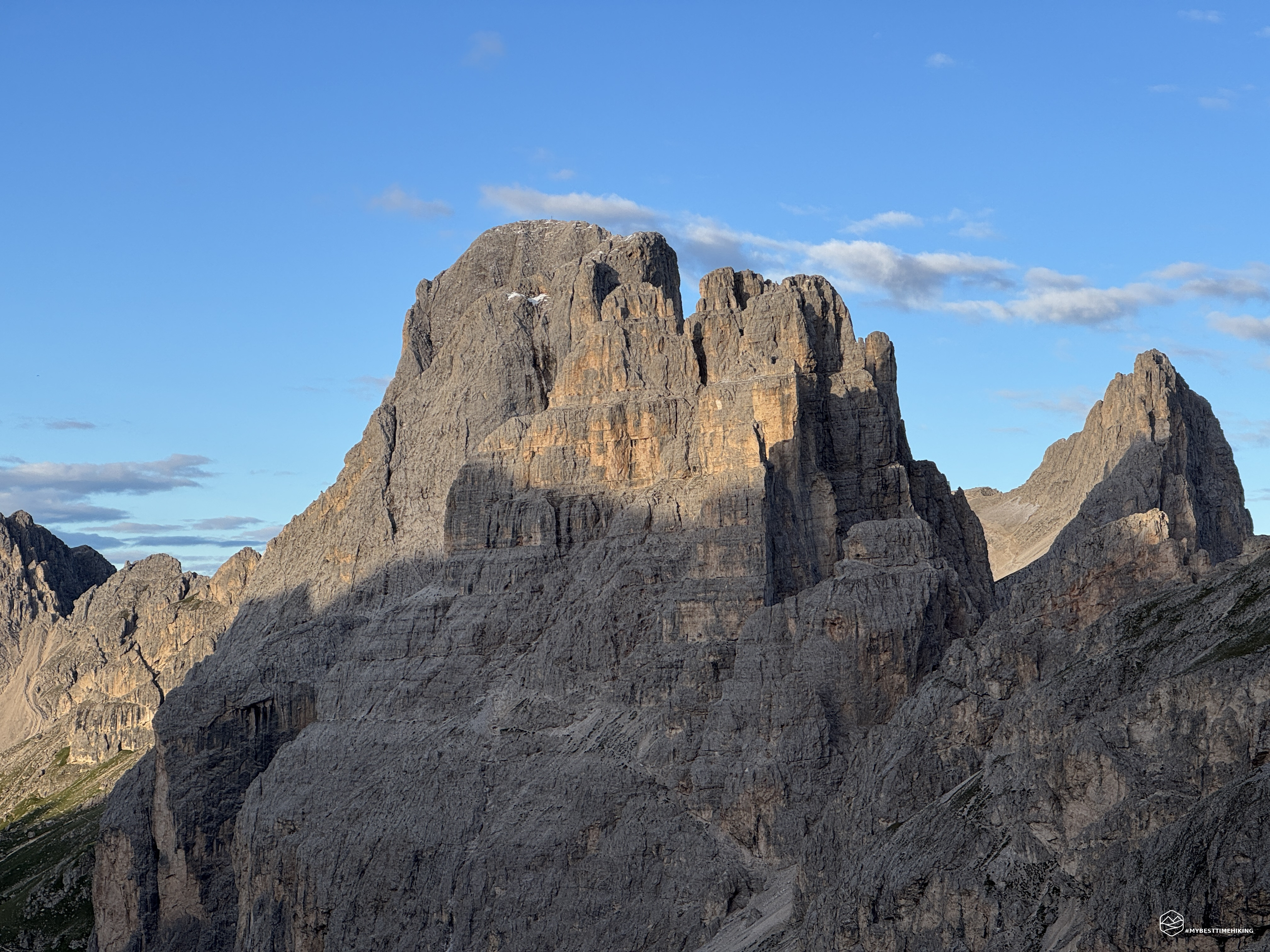
The twilight grows, coloring the Catinaccio Dolomites first gray and then, gradually, pale pink. I'm happy to enjoy the sunrise in this iconic place in the Dolomites, which combines beauty and magic thanks to the legend of King Laurin.
It's one of the most famous legends of the Dolomites: King Laurin, ruler of a people of dwarves who lived among the rocks of the Catinaccio, owned a magnificent rose garden and two magical weapons: a belt that gave him the strength of twelve men and a cloak that made him invisible.
Excluded from a tournament to which the Prince of Latemar had been invited, Laurin disguised himself as an invisible man and, driven by a love quarrel, kidnapped Princess Similde (or Ladina, in some versions). The knights chased him to the garden and captured him, revealing his invisibility thanks to the roses that moved beneath his feet.
In a rage, Laurin cursed the garden so that it could not be seen day or night, forgetting, however, sunrise and sunset. From then on, at sunrise and sunset, the Catinaccio mountain range is illuminated by a splendid rosy light: the alpenglow!
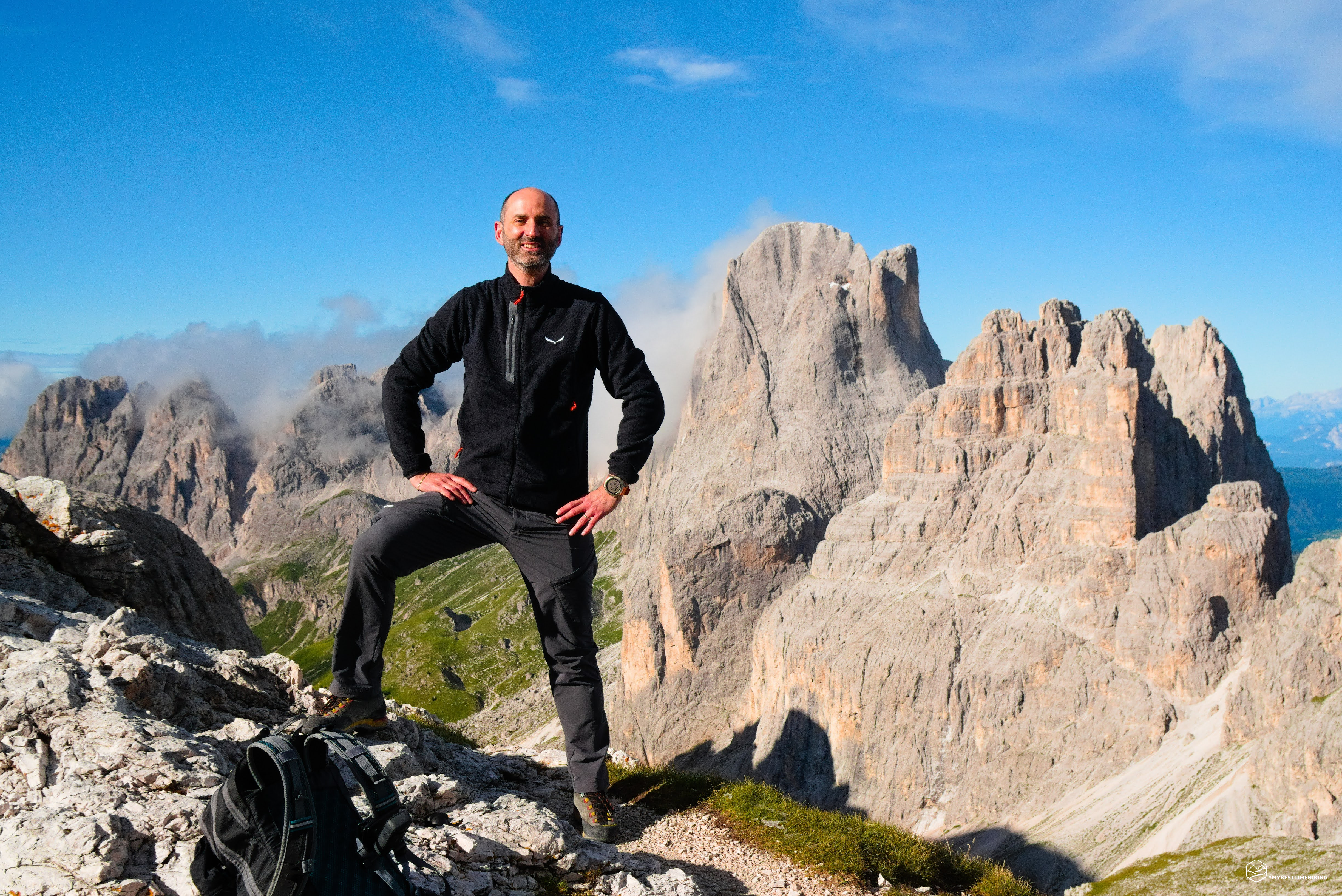
After an hour in the cold, the sky turns a bright blue; the last clouds of the night thin out. The choughs awaken, call to each other, and circle between the Rosengarten and the Catinaccio di Antermoia behind me. In this dance of birds, wind, and colors, the first rays of the sun strike the Catinaccio, revealing King Laurin's roses: a timid enrosadira that offers a postcard that makes all the night's hard work worthwhile.
Around 6:30, the group wakes up; we meet at the refuge for breakfast, and I enjoy a nice hot tea after an hour and a half in the freezing cold.
Date
03-08-2025
Distance
21.27 KM
Hike type
Hike
Ascent
1400 mt
- Mountain
Gruppo del Catinaccio
- Address
Muncion, Val di Fassa, Trentino Alto Adige
- Altitude
2770.00 m
- Refuges
Rifugio Gardeccia, rifugio Vajolet, rifugio Preuss, rifugio Passo Principe, rifugio Antermoia
- Information
We regroup and begin the second part of the hike toward the Antermoia Pass, following CAI trail 584. We skirt the Catinaccio d'Antermoia, passing right beneath its vertical yellow-black walls. Above us runs the via ferrata that crosses the Catinaccio from west to east and rejoins the trail we're following.
The route leading to the Antermoia Pass (or Pas de Antermoa) follows a landslide, crossing a couple of valleys where the path has been carefully constructed. While not technically difficult, it does require faithfully following the marked trail to avoid unstable sections. We soon reach a saddle that, while not yet the pass, already offers a magnificent view of the Catinaccio-Rosengarten, the Vajolet Towers, the Cima Vajolet, and, in the distance, the snow-capped peaks of Cevedale.
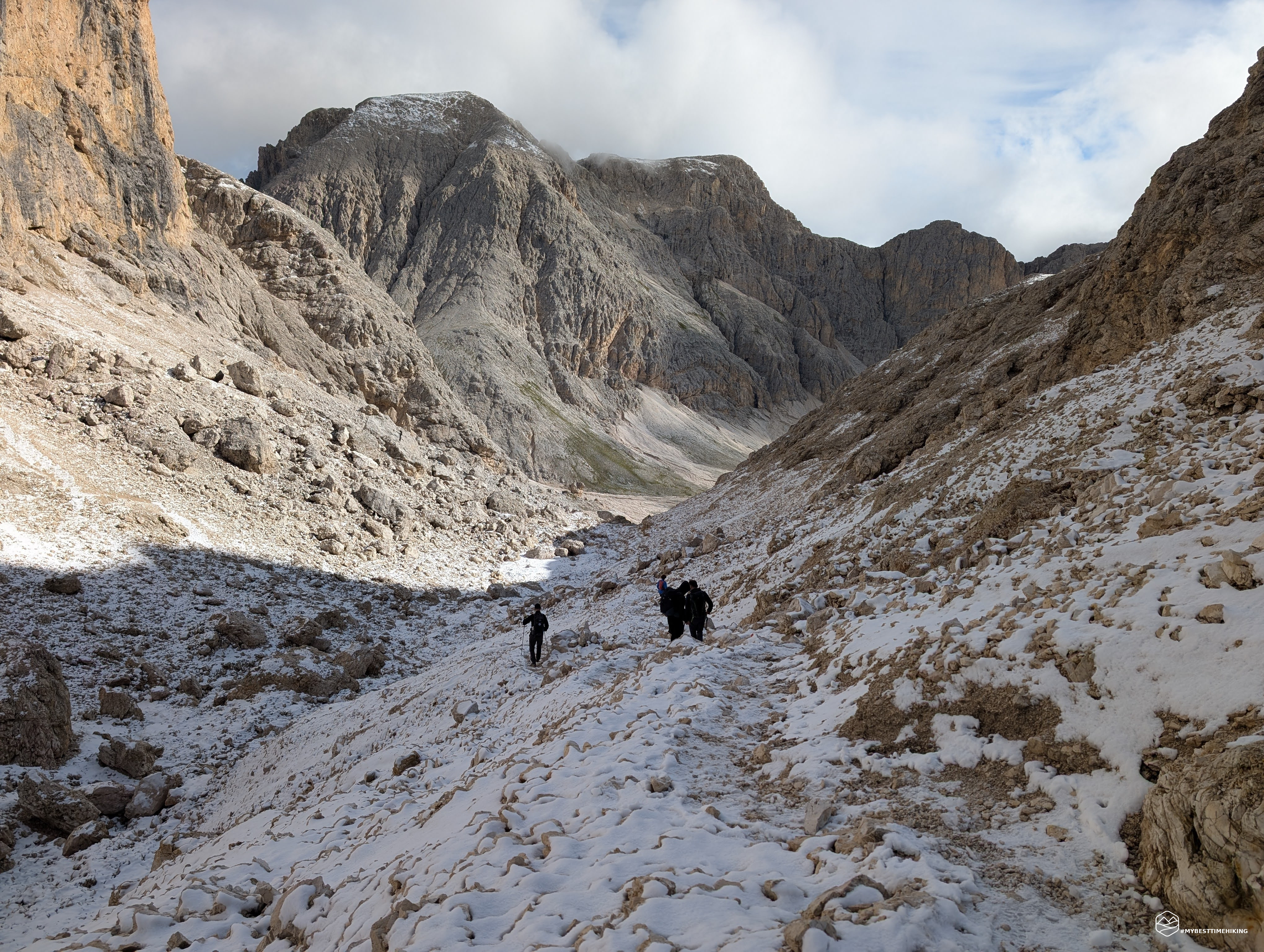
In just a few minutes from the saddle, and about 40 minutes from the Passo Principe Refuge, we reach the highest point of the day: the 2,770-meter Antermoia Pass, where an icy wind whips rocks and trails whitened by the previous evening's snowfall.
We continue downhill on CAI trail 584, on a trail made treacherous by a thin layer of snow that, with the cold wind, has frozen, making some spots slippery and unpredictable. In about half an hour, we enter the wide and majestic Valon de Antermoia, a picture-postcard Dolomite landscape where we feel tiny.
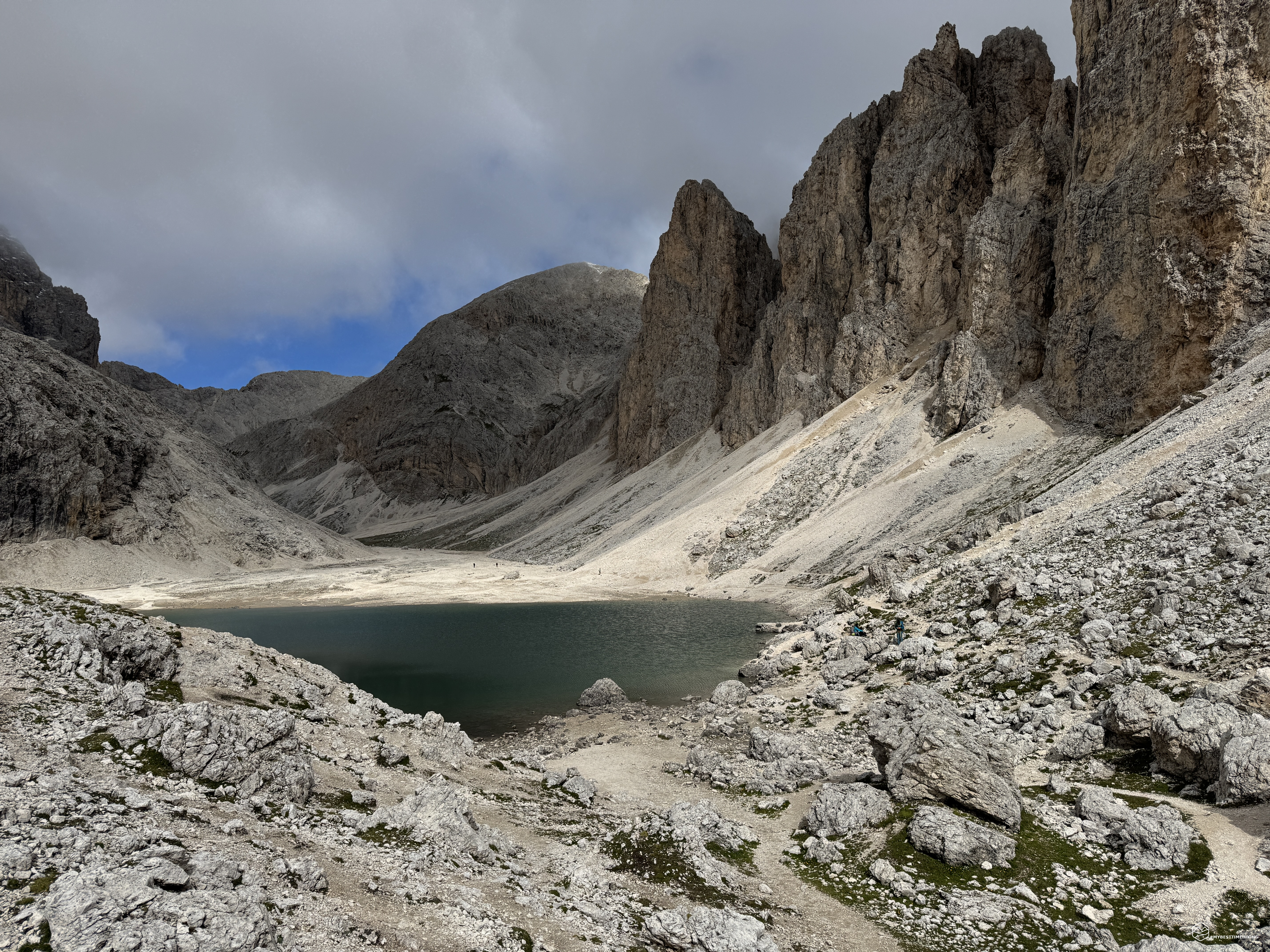
The first peaks appear: Torre del Lago, Croda del Lago, and Cresta del Lago, signs that Lake Antermoia is now close. And indeed, there it is: crystal-clear waters of a captivating aquamarine. Although smaller than its maximum capacity, the lake still offers an enchanting view, a must-see for any mountain lover.
We follow the trail east to the nearby Rifugio Antermoia, which stands out in a unique Dolomite amphitheater. A mandatory stop for an exceptional tiramisu, then we continue the descent towards Pera di Fassa. From Rifugio Passo Principe, we took just over two hours. The trail to follow now is CAI 580, towards Passo de Dona.
The Ruf de Antermoia seems to flow from the refuge, offering an almost fairytale panorama. In a few minutes, we reach Pas de Dona (or Mantello) at 2,516 meters. A brisk breeze blows here too, and we decide to climb the grassy knoll in front of us: Monte Mantel (or Mantello). There's no real trail, but the path is clear and leads up a grassy ridge dotted with light-colored rocks.
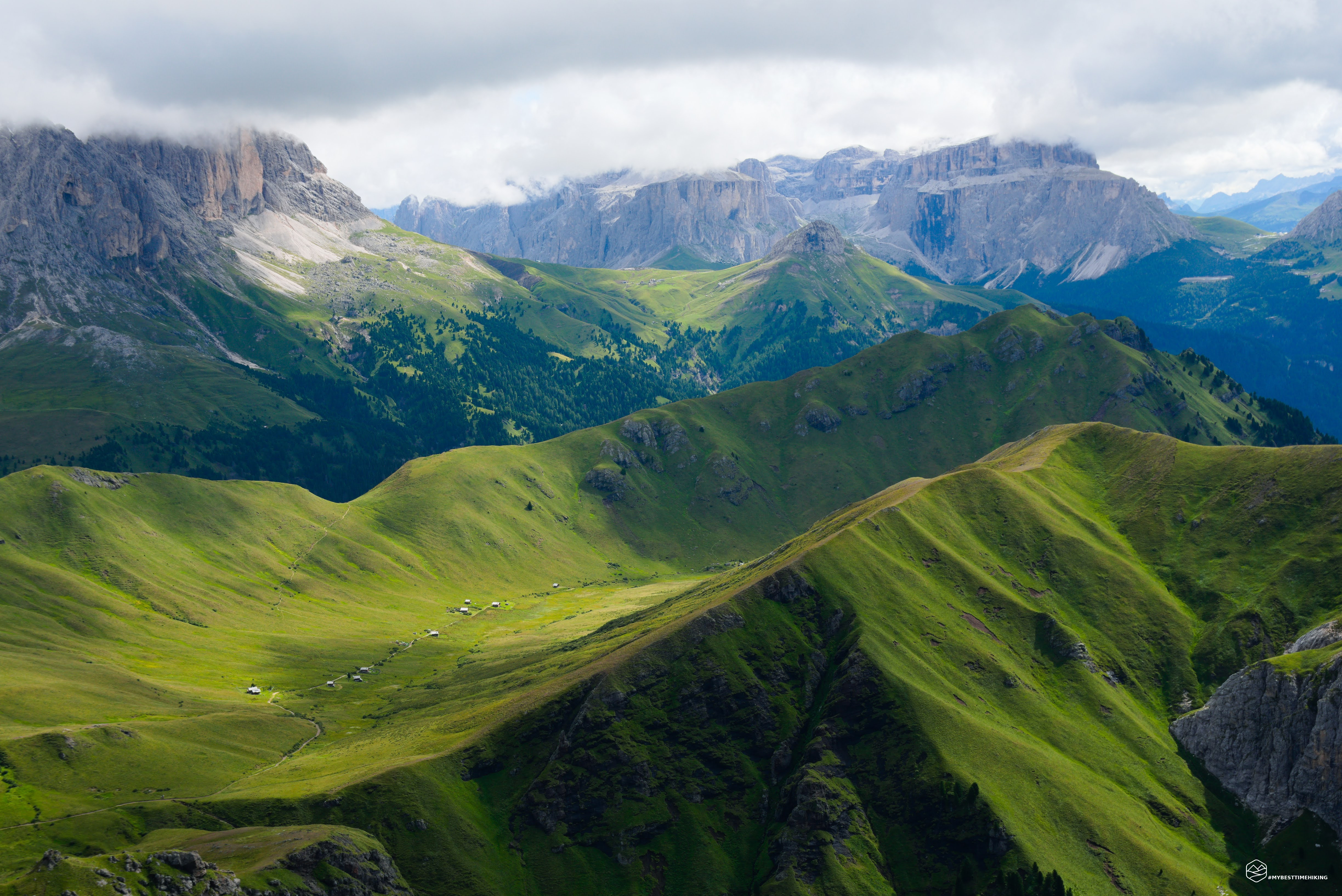
The effort is rewarded with a spectacular view: Sassolungo, Sasso Piatto, the Sella group with Piz Boè, the Marmolada opposite, and, in the distance, the Pale di San Martino di Castrozza. At our feet, the green Val de Dona opens up, dotted with small, charming huts. At the summit, a pyramid of stones marks the summit of this little-known peak, but for me, an essential stop. The increasingly rocky ridge extends toward the Val di Fassa, offering a unique view below.
We retrace our steps and descend on an easy, gravelly trail to the fork at 2,300 meters, where we turn toward Mazzin, reaching Pian da le Gialine. At the end of the plateau, a new detour takes us south into the Valle de Udal, already stunning from here, with a natural window onto the village of Mazzin.
The trail descends steeply along an earthy groove flanked by grassy crags, with the Ruf de Udal stream flowing briskly alongside us. It's a pleasant and varied route, never monotonous, with views worthy of the most renowned Alpine valleys: waterfalls, streams, colorful flowers, caves, and sheer rock faces comparable, in miniature, to the American Yosemite.
At an altitude of 1,650 meters, after about two hours from the Antermoia Refuge, we reach the last fork of the day: we take CAI 579 towards Muncion and, in about 30 minutes, return to the parking lot from which we set out the previous night.
This unusual adventure, my first night hike, concludes: a "Catinaccio by night" that allowed me to experience the legendary alpenglow on the Rosengarten. This itinerary in the heart of the Val di Fassa Dolomites is suitable for hikers with a minimum level of fitness. The presence of numerous refuges at different altitudes allows you to plan intermediate stops without having to complete the entire loop in a single day. A regenerating experience for heart and mind, amidst rocks, streams, lakes, refuges, and relaxing green meadows.
Click here and watch the exclusive video on YouTube for an even more immersive experience!
DifficultyHikers - Itineraries on paths or evident traces in various types of terrain (pastures, debris, stony ground ...). They are generally marked with paint or cairns (pyramid-shaped stacked stones that allow you to identify the route even from a distance). They can also take place in snowy but only slightly inclined environments. They require the equipment described in the part dedicated to hiking and sufficient orientation skills, walking training for a few hours. |