Details
-
 Hike type
Hike
-
 Difficulty
E
-
 Distance
16.51 KM
-
 Altitude MIN
770.00 mt
-
 Altitude drop +
1200 mt
-
 Parking
-
 Landscape


-
 History
-
 Duration
5h 30m
-
 Altitude MAX
1970.00 mt
-
 Altitude drop -
-1200 mt
-
Hike type
Hike
-
Difficulty
E
-
Distance
16.51 KM
-
Altitude MIN
770.00 mt
-
Altitude MAX
1970.00 mt
-
Altitude drop +
1200 mt
-
Altitude drop -
-1200 mt
-
Duration
5h 30m
-
Landscape
-
History
-
Parking
Today's adventure begins in La Muda, Canale d'Agordo. The initial goal was ambitious: to reach the top of Mount Celo (or Zelo). We park the car in a large clearing, a few meters below the main road, in the direction of Cordevole. With me is the legendary Enrico, a trusted companion on many excursions.
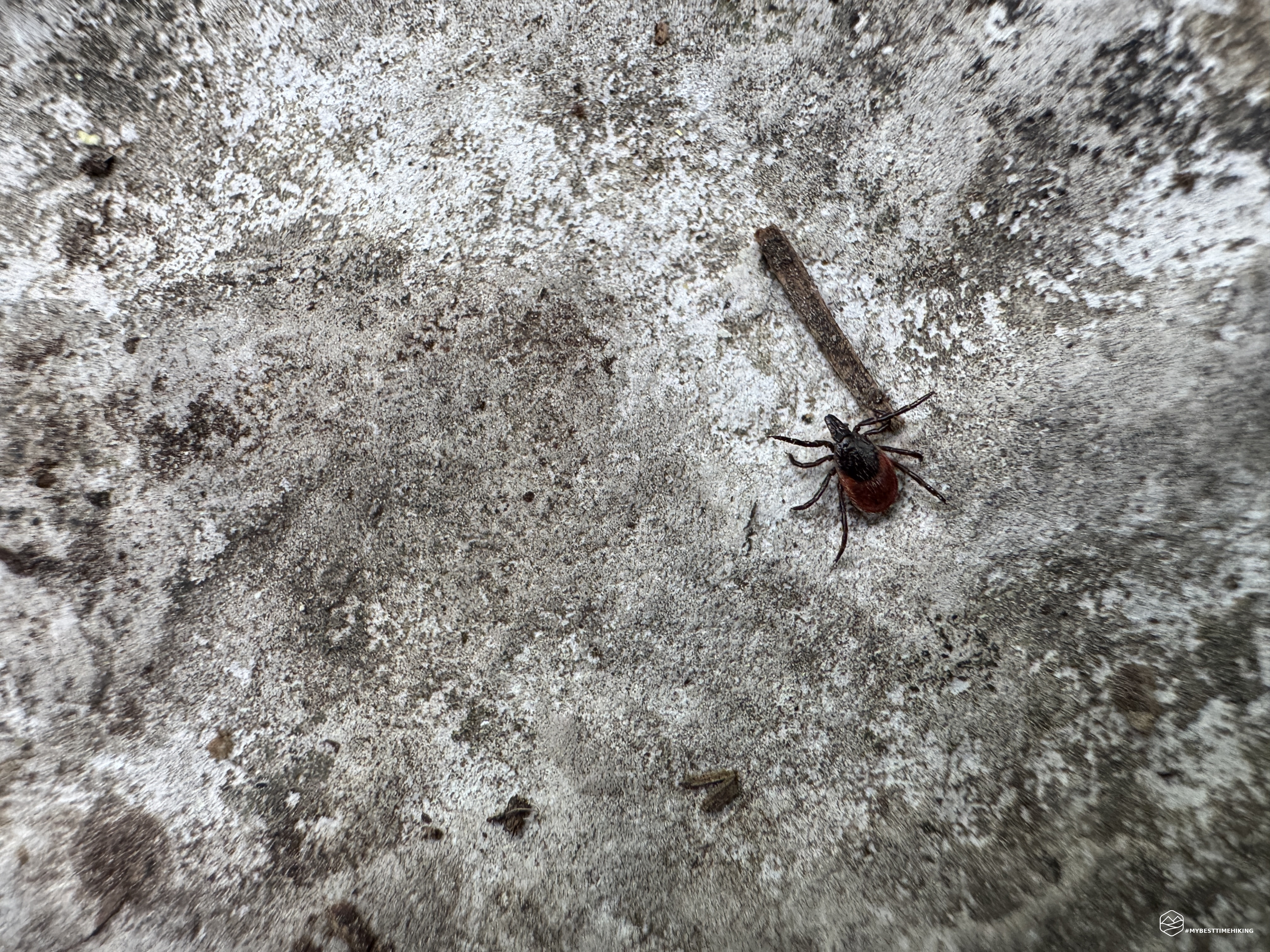
We set off towards the CAI 546 path and immediately we are greeted by a not very reassuring sign: the CAI 545, which leads to the summit, is marked as impassable. We are not discouraged and we start the walk anyway. But as soon as we take the first step, Enrico stops: he has spotted a tick. Small, black, with its little legs stretched out on the grass, ready to cling. Luckily we have generously covered ourselves in repellent before leaving, so we are confident.
We decide to continue, even if the initial encounter has put us on alert. Every few steps we check our legs and arms. After climbing just a few meters, Enrico sees two or three more, larger, with a reddish body. Then again, and again. Ticks everywhere: on blades of grass, on boots, even on trousers. They seem stunned by the repellent and try to move away, but their presence is truly massive. In less than 75 meters of altitude difference we count dozens of them.
We reluctantly decide to turn back. Once we return to the parking lot, we carefully inspect each other - fortunately no ticks on us. So we change plans and head towards La Valle Agordina, where a more peaceful route awaits us: the La Foca and Moschesin huts, up to the suggestive Forcella Moschesin.
Before getting to the heart of the excursion, I recommend reading the in-depth article dedicated to the problem - unfortunately increasingly current - of ticks in the mountains, especially in this period. In the article you will also find the link to the repellent that, in my experience, is the most effective one around.
Read the full article here: Ticks and hiking: an "almost" invisible risk
We reach La Valle Agordina and park comfortably near the sports field. From here we take the CAI 542 path, which initially coincides with a wide dirt road. We are at a higher altitude than La Muda, and this gives us hope: here the ticks should not bother us!
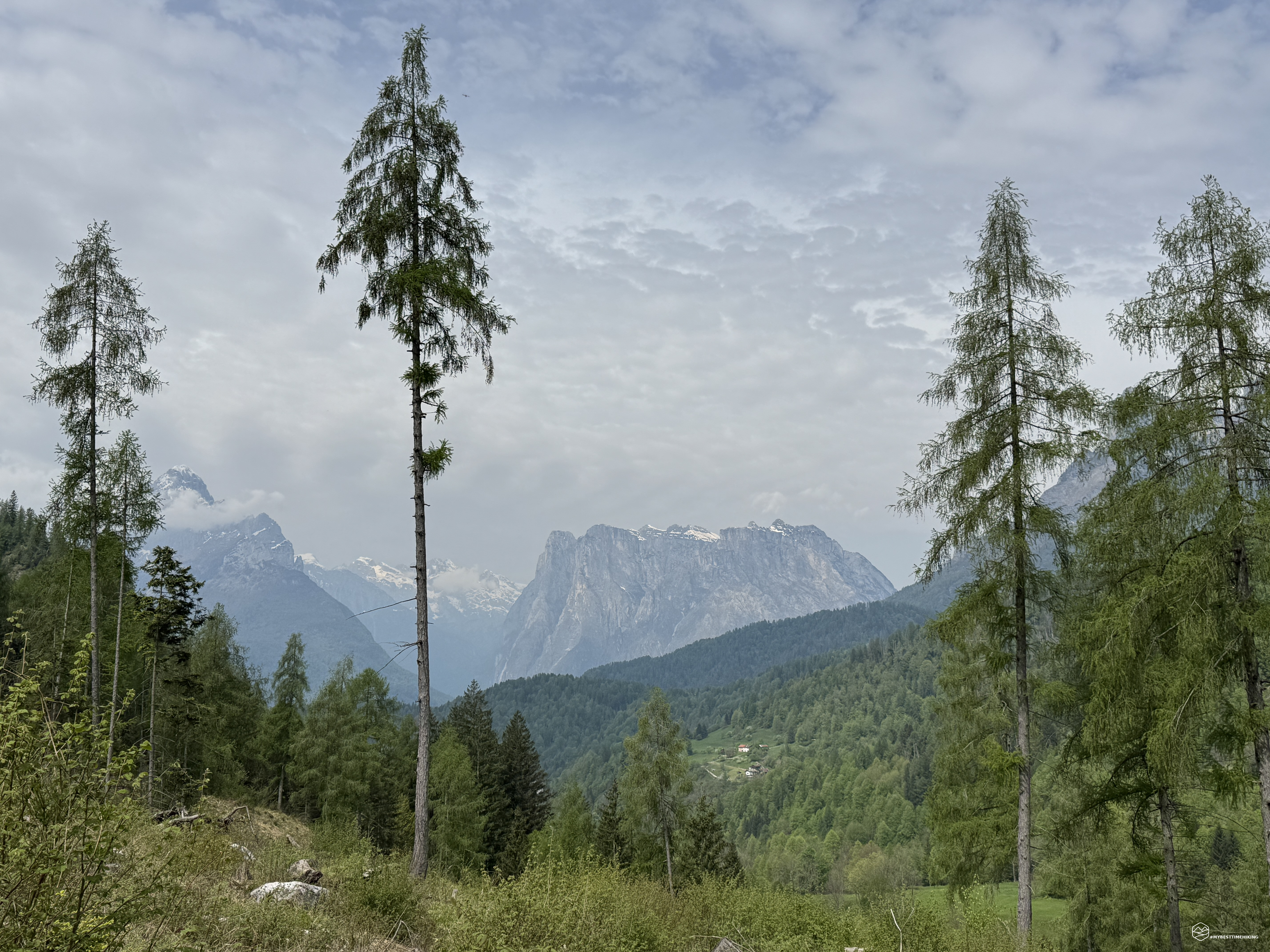
The path, similar to a small "highway", climbs gently towards the east along the Bordina stream. We follow the signs for Malga Foca and, around 950 meters above sea level, the climb becomes more marked: the road becomes asphalted and the trees on the sides begin to become thicker, offering a welcome relief from the sun. In the distance the first Dolomite peaks begin to appear.
We arrive at the Madonna del S’ciar, at an altitude of 1185 meters where a short stop is a must.
We continue along a less interesting stretch from a landscape point of view: the road remains wide and straight, and the trees, in this section, have been completely cut down, leaving a large open clearing on the sides. After overcoming the last few meters of altitude, we finally begin to glimpse the plateau where the Foca mountain hut stands.
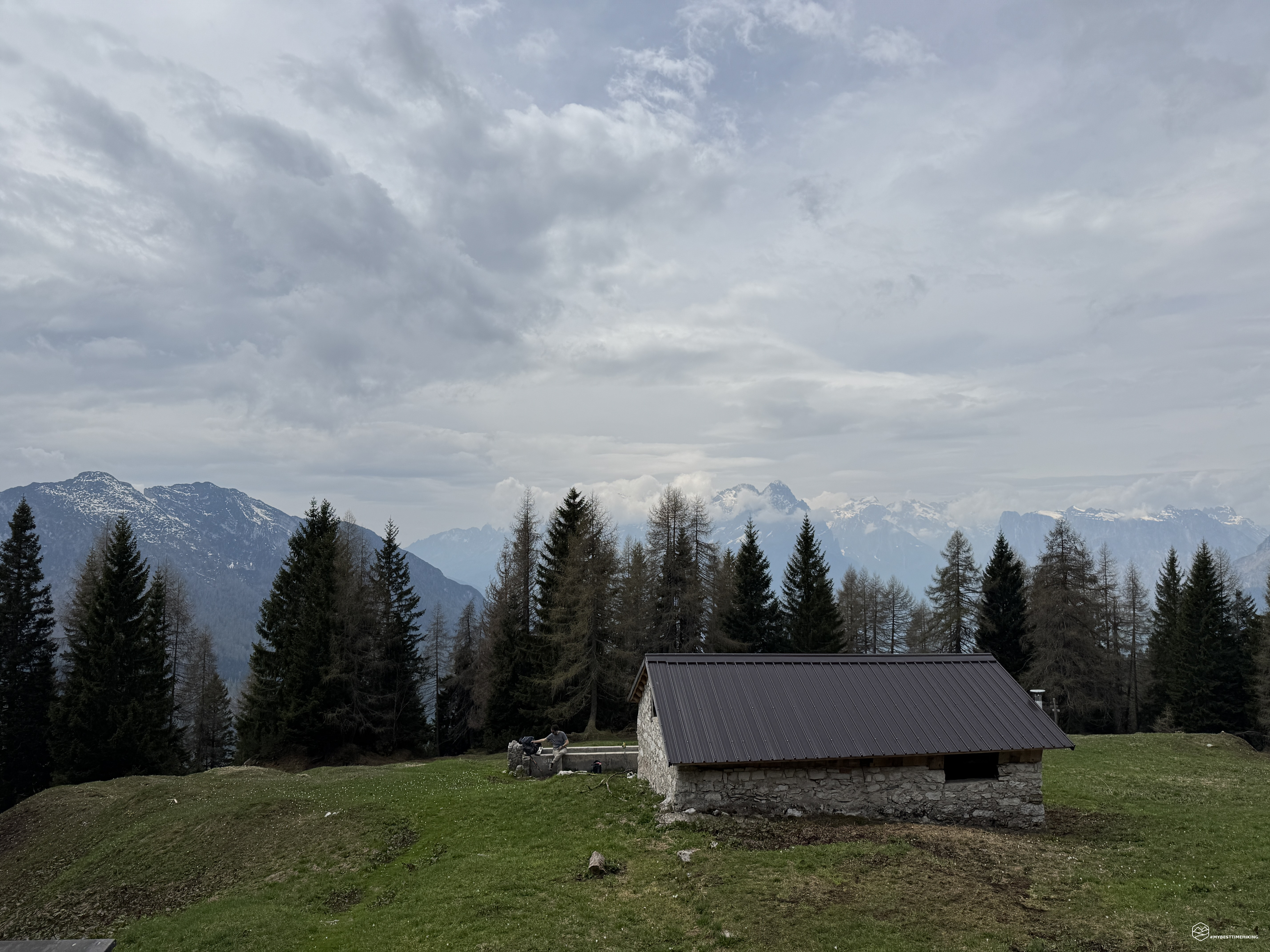
At an altitude of 1495 meters, the mountain hut stands on a large grassy hill. Its elevated position with respect to the road gives us the first real panorama of the day: on our left we recognize Mount Celo (or Zelo), the missed destination of the morning, then the Agner wrapped in a thick blanket of clouds, the spectacular Pale di San Lucano with their vertical lines, and finally the Moiazza, the Tamer Grande and the characteristic Castello di Moschesin.
After a short break to admire the horizon, we resume the climb along the CAI 542 path towards Malga Moschesin. The trail continues on an asphalt road with grassy stretches up to an altitude of 1630 meters, where an obvious and well-marked fork finally invites us to leave the asphalt and enter the woods.
Date
03-05-2025
Distance
16.51 KM
Hike type
Hike
Ascent
1200 mt
- Mountain
Castello di Moschesin
- Address
La Valle Agordina, Veneto
- Altitude
1970.00 m
- Refuges
Malga Foca, Malga Moschesin
- Information
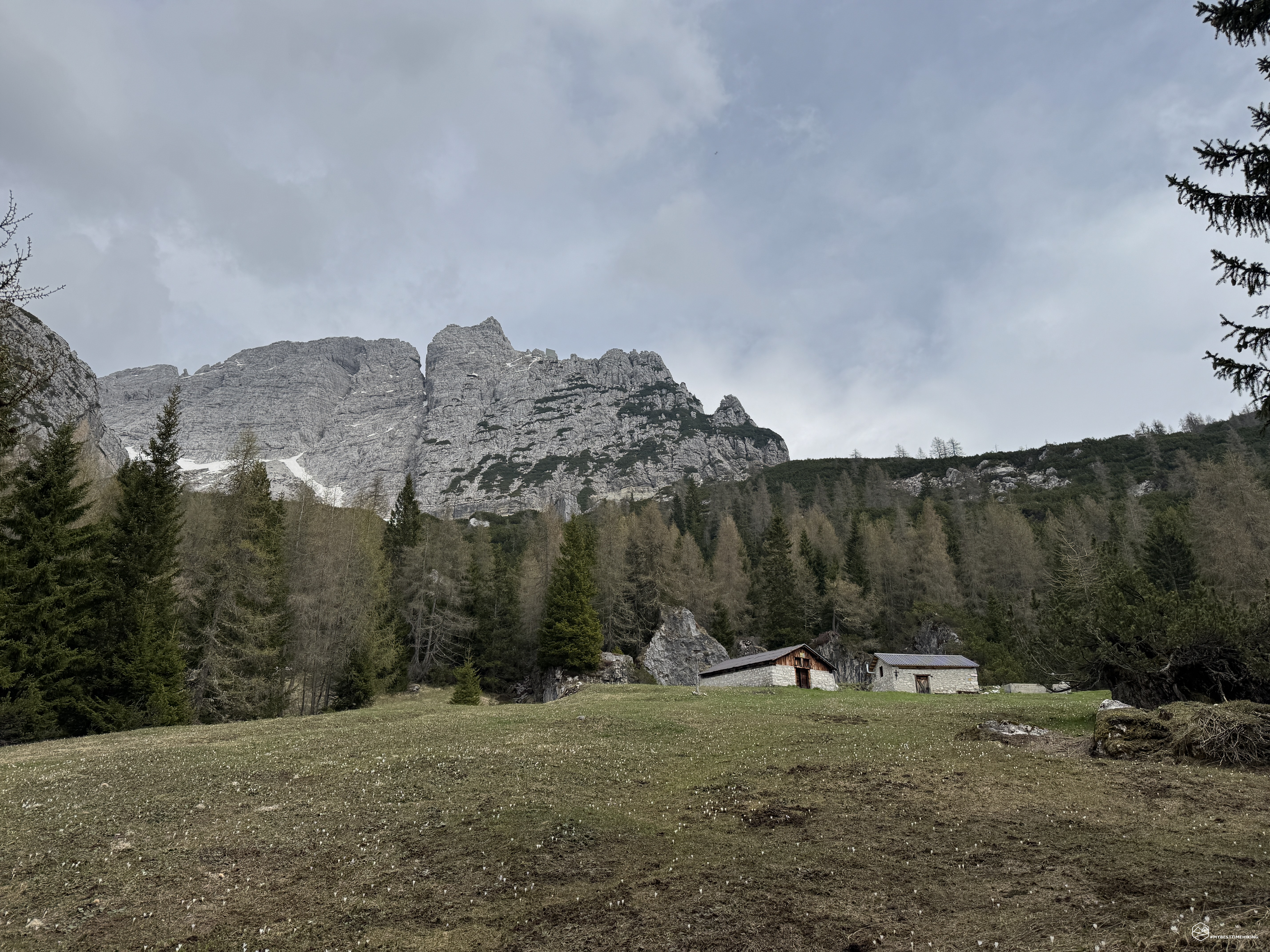
From here the path winds in pleasant hairpin bends between fir trees and the first crocuses that timidly emerge from the still dry grass. The vegetation gradually thins out and, in front of us, a stretch of brightly colored crocuses opens up, from white to deep purple, announcing the arrival at the clearing where Malga Moschesin stands, at an altitude of 1800 meters.
The panorama that welcomes us is similar to that of Malga Foca, but with a notable difference: Moschesin Castle appears right in front of us, so close that it seems within reach. Here we allow ourselves a longer stop. The weather begins to change, the sky becomes more overcast and the air becomes charged with instability, but we still decide to continue towards our final destination: the Moschesin fork, with the remains of the old military fort.
For a short stretch we follow the evocative path of “The forgotten mountain”, which would continue towards the crests of Valaraz and Mount Celo. Instead, we deviate onto CAI 543. The tall firs give way to sturdy mountain pines, and around 1850 meters the snow appears: it is not compact, rather heavy, and makes the journey more tiring.
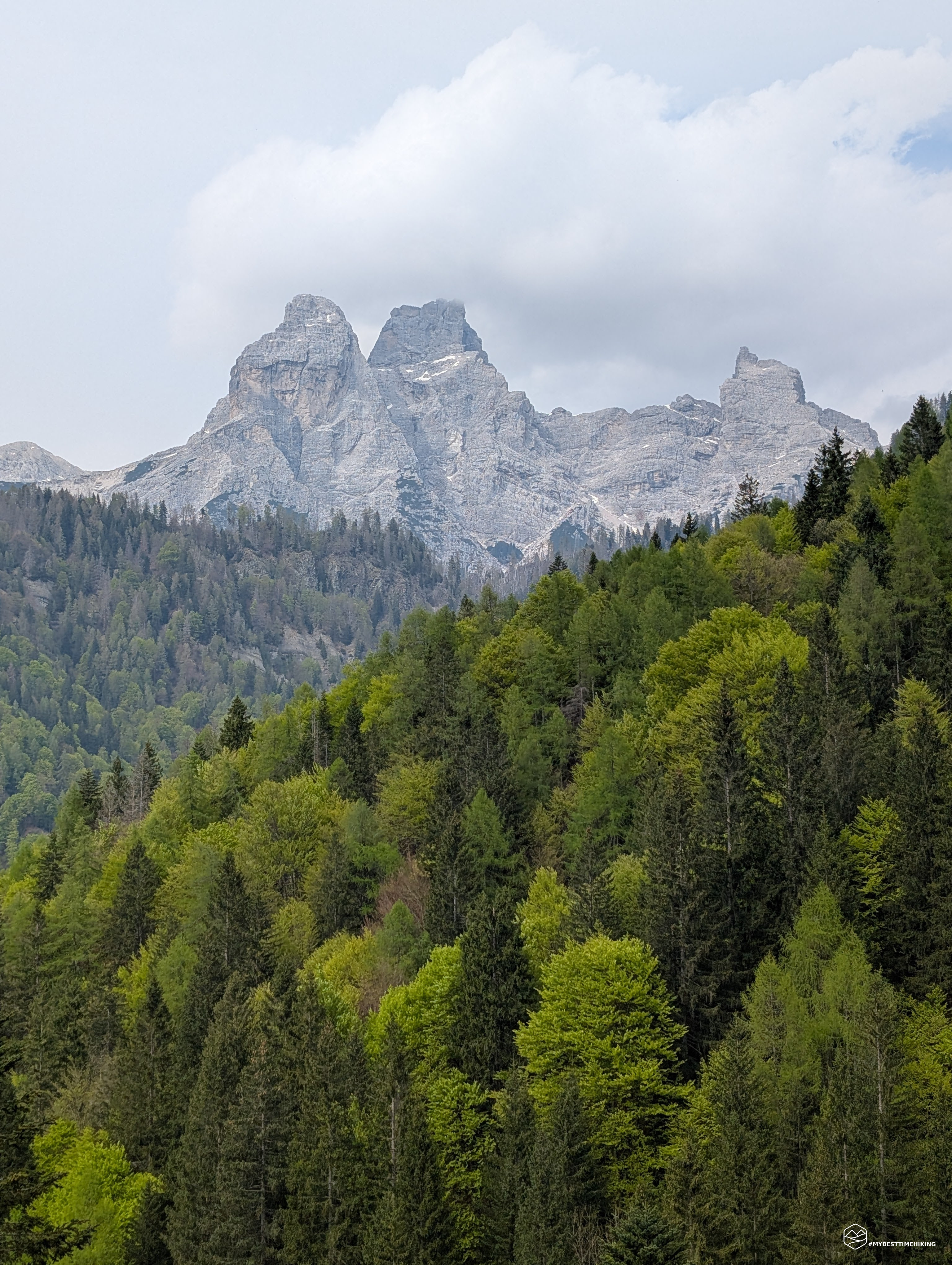
We skirt the Moschesin Castle, thus being able to observe up close its characteristic spires and the deep cracks that sculpt its profile, typical of the Dolomites. We continue up to an altitude of 1966 meters, where a curve among the mountain pines gives us a breathtaking view: the peaks of Zita and Mount Talvena stand out covered in snow in front of us. The northern exposure still preserves a large blanket of snow, which shines under the moving clouds, offering a silent and majestic spectacle.
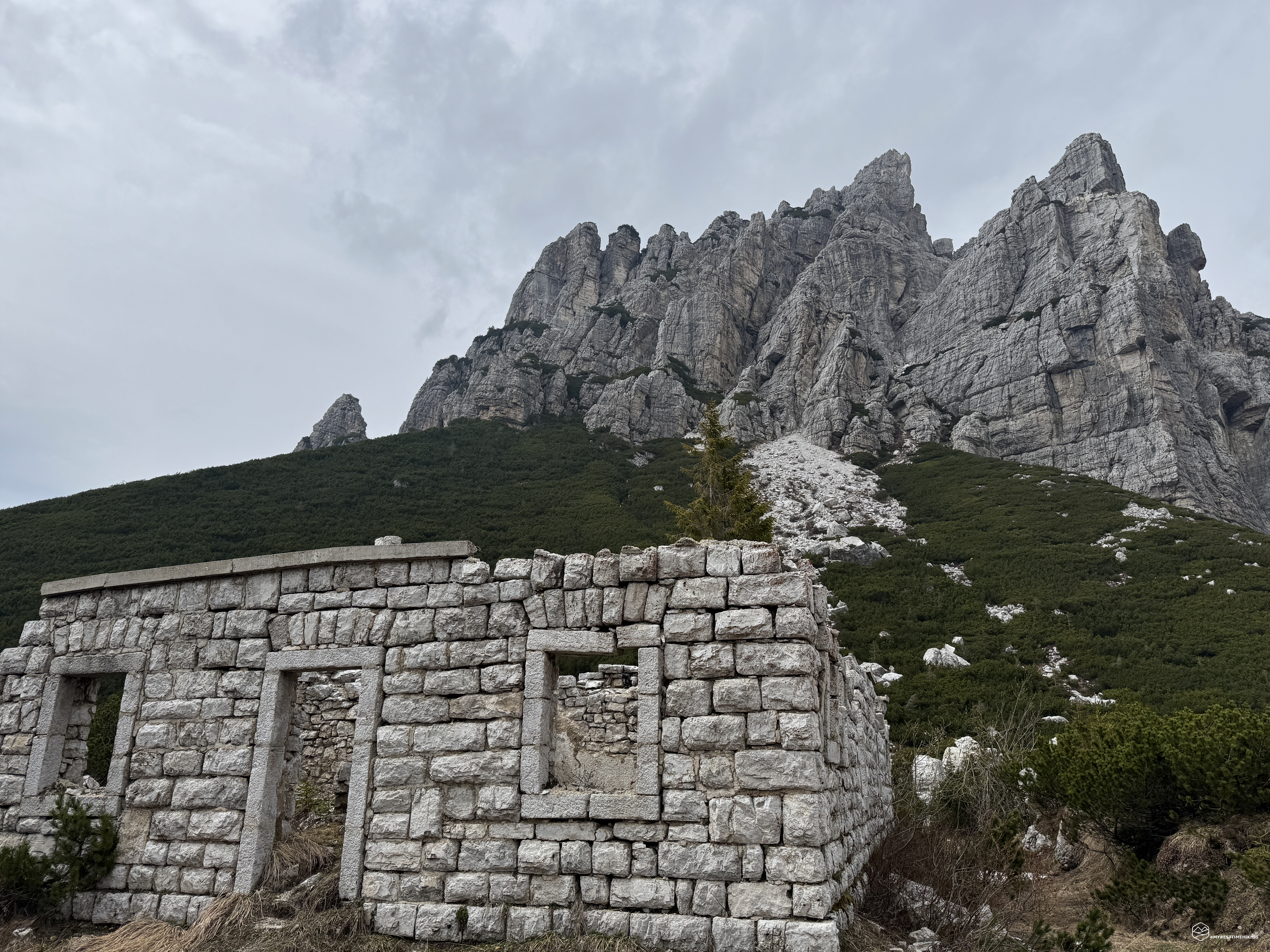
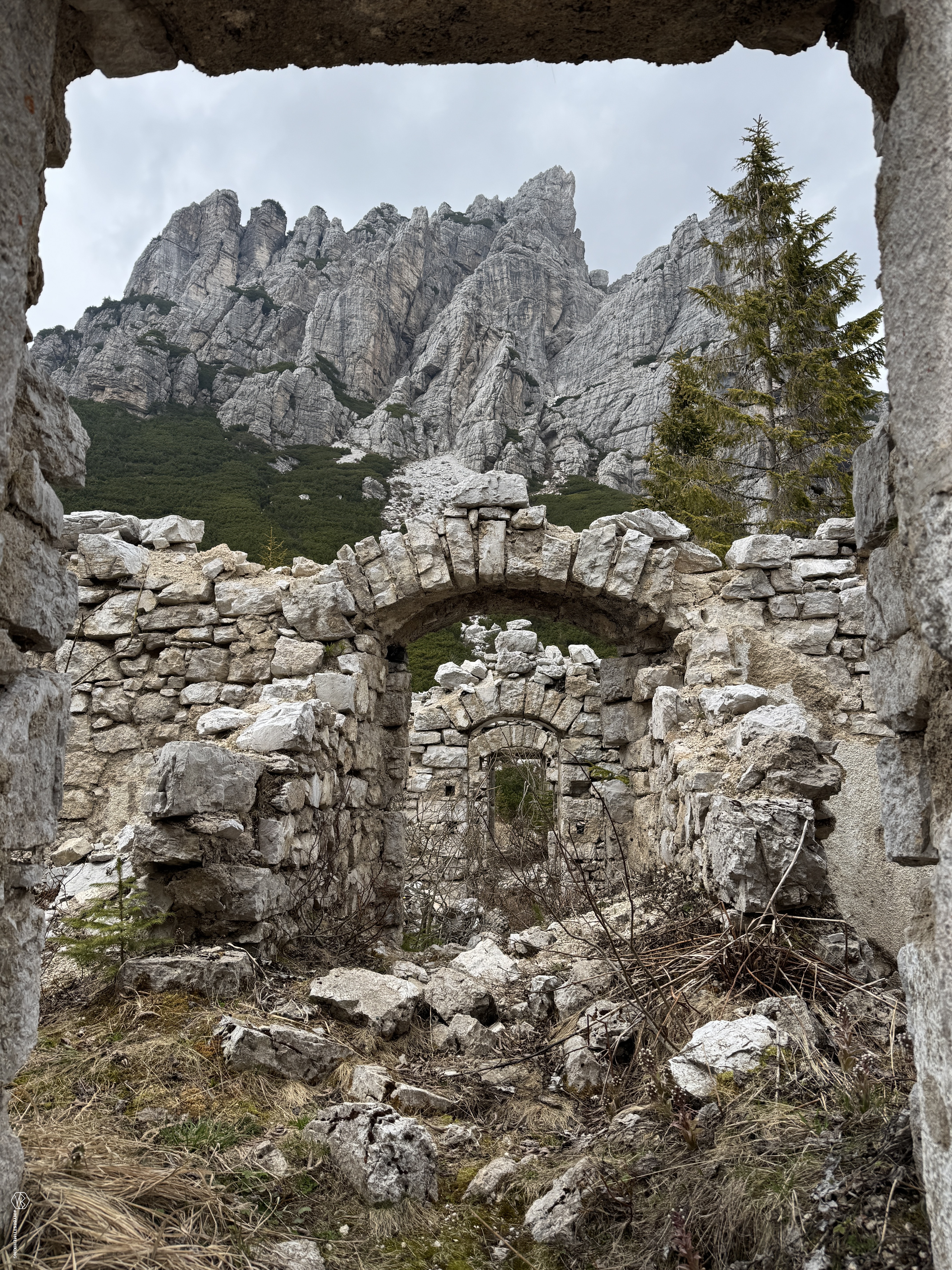
We descend gently, losing just twenty meters of altitude, and soon reach the Moschesin fork. Here, surrounded by a swathe of mountain pines, Moschesin Castle appears imposing, almost as if it wanted to come towards us. On the other side, the remains of the old military fort stand out, now in ruins but still open to visitors.
It is possible to enter and walk through the various rooms that once made up the brick structure, allowing yourself to be fascinated by the silence and history that can still be felt between its walls. At the end of the route, exiting the fort and turning towards Moschesin Castle, you are rewarded with a postcard view: a spectacular panorama that alone is worth the entire excursion.
The Moschesin Barracks, built between the end of the 19th century and 1912, was part of the so-called “Yellow Line”, a defensive system built by the Kingdom of Italy to protect itself from possible invasions from the north. Strategically positioned at the Moschesin fork, between Agordino and Val di Zoldo, the structure was never directly involved in the fighting of the First World War. However, it was destroyed in 1917, during the retreat of Caporetto, to prevent its use by the enemy. Despite this, much of the ground floor is still intact and can be visited.
Immersed in an extraordinary naturalistic context, crossed by the Alta Via n.1 of the Dolomites, the fort represents a suggestive historical testimony set in a landscape dominated by the imposing Monte Moschesin. Reachable only on foot, it is today an unmissable destination for those who love to combine hiking, nature and history.
The clouds are getting darker and a cold wind starts to blow decisively. At that point we decide that it is better not to risk it and we begin the return journey, retracing the paths of the outward journey. The stretch from Malga Foca to La Valle Agordina, in particular, seems rather monotonous and interminable, due to its length and accumulated tiredness.
In the end, however, the alternative chosen to Mount Celo turned out to be really spot on! We explored extraordinary places from a naturalistic point of view, immersed in the unmistakable Dolomites, and experienced an authentic dive into history with a visit to the Moschesin fort, which completely fascinated us.
I recommend this excursion to those who are well trained: you tackle about 1200 meters of altitude difference distributed over almost 17 km. Personally, I did not know this area of the Agordo basin and I must say that it surprised me: it is still not very busy - during the entire route we only met three people - and this allows you to enjoy the landscapes with the tranquility and silence they deserve.
Click here and watch the exclusive video on YouTube for an even more immersive experience!
DifficultyHikers - Itineraries on paths or evident traces in various types of terrain (pastures, debris, stony ground ...). They are generally marked with paint or cairns (pyramid-shaped stacked stones that allow you to identify the route even from a distance). They can also take place in snowy but only slightly inclined environments. They require the equipment described in the part dedicated to hiking and sufficient orientation skills, walking training for a few hours. |