Details
-
 Hike type
Hike
-
 Difficulty
E
-
 Distance
8.09 KM
-
 Altitude MIN
1760.00 mt
-
 Altitude drop +
550 mt
-
 Parking
-
 Landscape

-
 History

-
 Duration
3h 30m
-
 Altitude MAX
2310.00 mt
-
 Altitude drop -
-550 mt
-
Hike type
Hike
-
Difficulty
E
-
Distance
8.09 KM
-
Altitude MIN
1760.00 mt
-
Altitude MAX
2310.00 mt
-
Altitude drop +
550 mt
-
Altitude drop -
-550 mt
-
Duration
3h 30m
-
Landscape
-
History
-
Parking
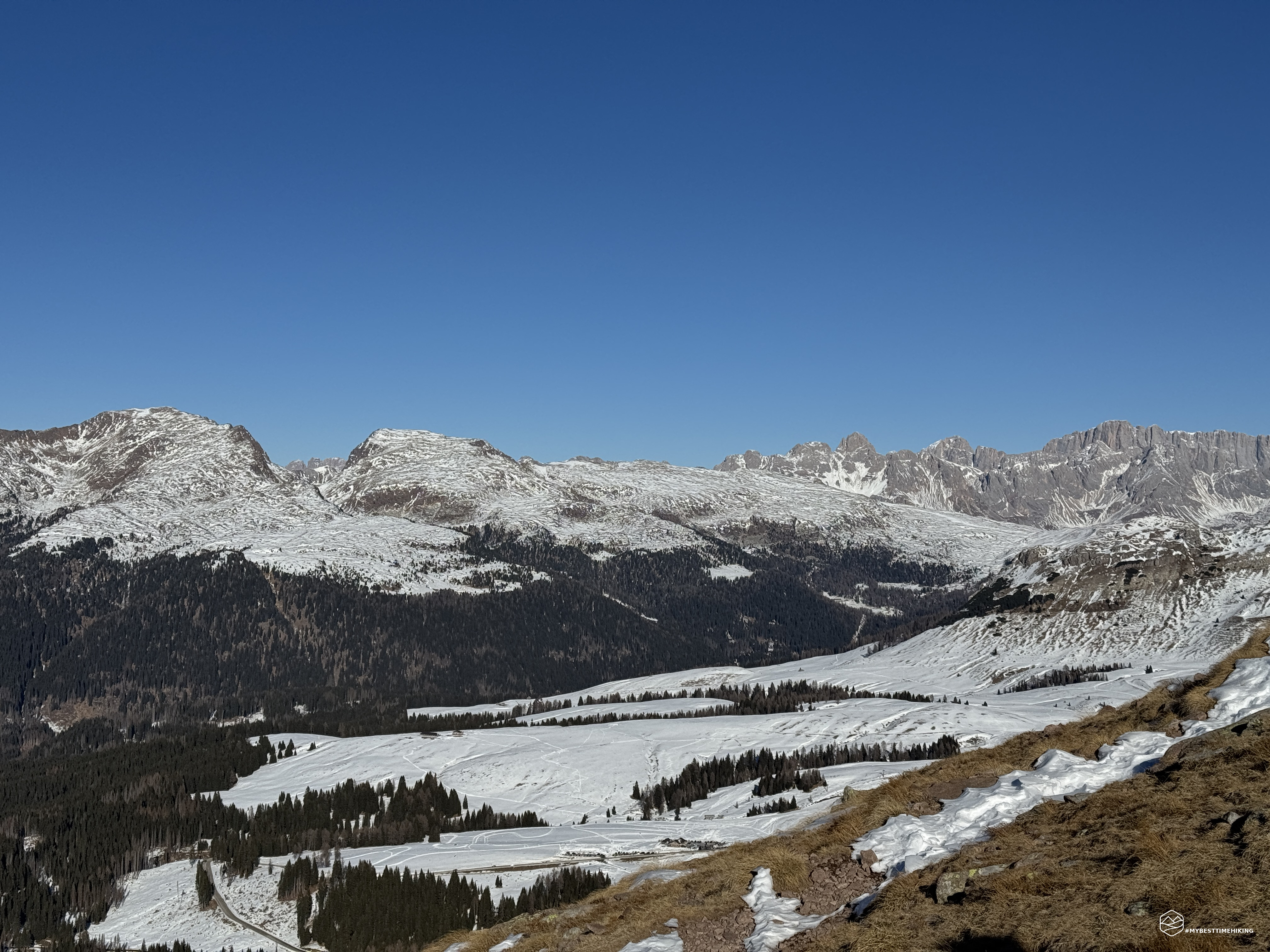
We have reached the end of 2024 and we want to say goodbye in the best way with a fantastic excursion in the Dolomites of Primiero-San Martino di Castrozza. Our friend Enrico is our companion in our adventures, ready to share the climb to today's summit.
We reach San Martino di Castrozza early in the morning and then Passo Rolle where I recommend taking a couple of hairpin bends downhill and leaving the car in the Malga Rolle car park. The day is splendidly clear, a full sun that warms, on a day that promises to be almost spring-like. The snow cover is clearly visible on the slopes, while everywhere there is an almost autumnal setting with the barren brown-orange colour. The ice, however, is widely present in the shaded areas and right in the car park where we have to be careful where we put our feet. This could be the cause of the possible renunciation of the summit. Let's not be sad, let's remain optimistic and let's go!
We cross the state road and immediately join the Translagorai trail, or rather identified with the CAI 348 trail. The first stop is clearly indicated on the trail sign: the Colbricon lakes.
We pass a first stretch that takes us to the ski lift that is fully operational on today's splendid day. Bold skiers take the chairlift to have fun descending on the white and packed snow specifically for the only slope present. We, however, follow the clear indication "Laghi" that allows us to take the path of the forest.
We thus enter the Paneveggio forest, a wonderful forest of red firs. Tradition has it that the violin maker Antonio Stradivari himself walked in this place in search of the most suitable fir for building his famous violins! The white snow completely covers the path through the trees, the streams are harnessed by the ice and the whole thing gives a fairytale nuance.
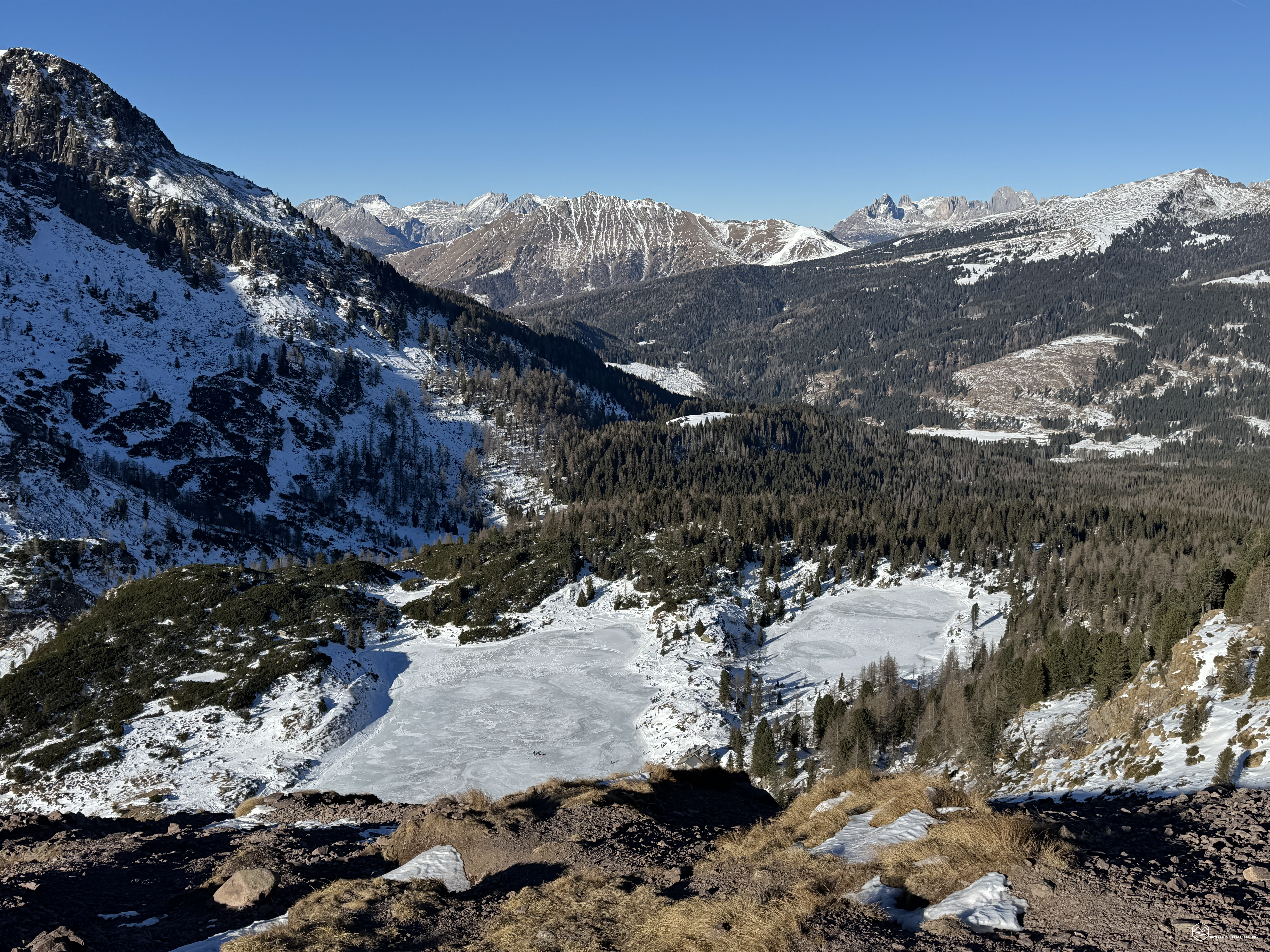
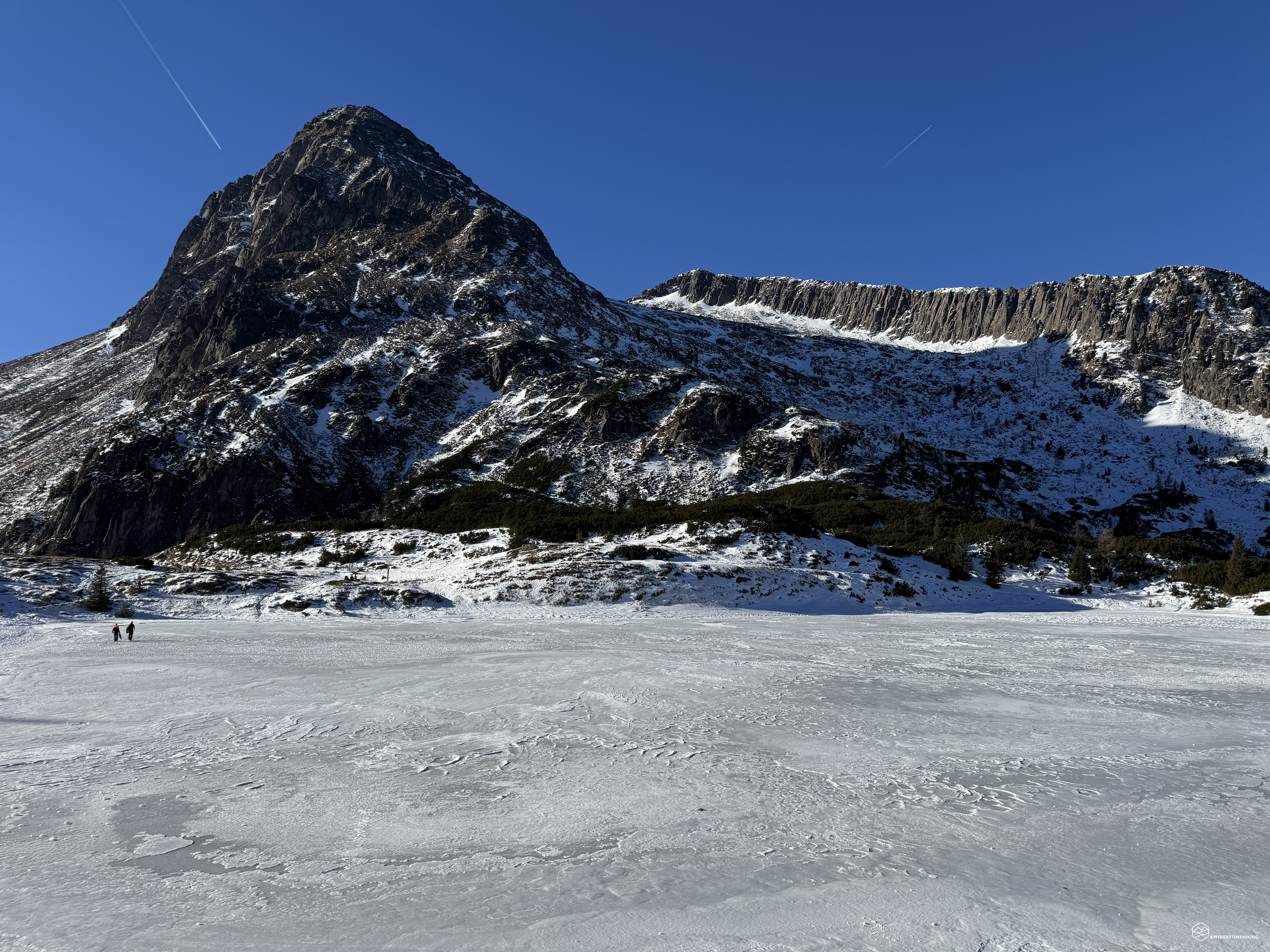
A continuous false flat allows us, in about 30 minutes, to reach the Colbricon refuge, at an altitude of 1930 meters, with the imposing pyramid-shaped mountain of the same name behind it. On the right, the precious Colbricon lakes appear, now frozen. They are lakes of glacial origin and the mountain ridge that we see behind them is in fact the beginning of the Lagorai group. From right to left, we can see the Stradon peak with its characteristic crest that leads to the Colbricon Piccolo, then the bigger brother Colbricon makes room and the view closes towards the crest that leads to the Cavallazza. The lakes are small in size but as a whole and in the environment in which they are set, they give an exceptional panorama to the view.
We continue on the marked path, approaching and passing the refuge until we find a signpost that indicates the way to the summit. On our right, we could continue to the Colbricon pass and then arrive at Malga Ces and Punta Ces. Instead, we choose the left path, indicated with R02 on the Tabacco map, in the direction of the Cavallazza peak.
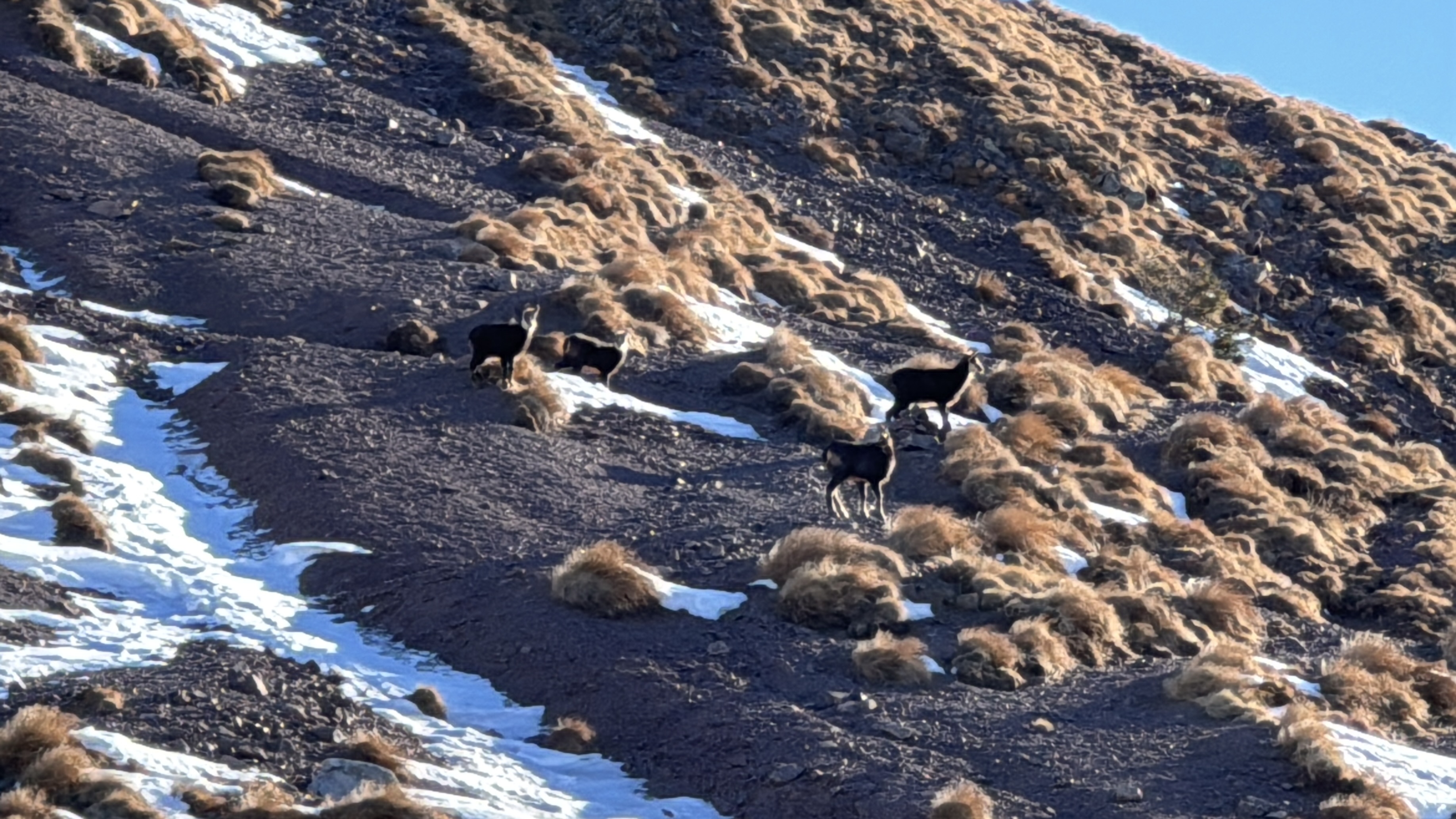
After an initial stretch marked by residual snow, we immediately realize that today's destination can be reached without great difficulty. The snow does not seem to be a problem and only sporadic patches remain to indicate that we are still in the winter season. Another detail that is immediately noticeable is the particularity of the rock. We are in a Dolomite area, but here there is no Dolomite rock. The Lagorai is a mountain range of volcanic origin and the compact and dark rock characterizes its nature. The difference in altitude finally begins to be felt and the climb proceeds with a continuous but never tiring slope. We begin to observe the Colbricon lakes from a new aerial perspective which, surrounded by the Lagorai peaks, determine a first skyline to print on smartphones. So we begin to see on one side the snowy slopes of Malga Ces and, on the other, the Marmolada and further down the Rolle pass from which we started. First a couple, then a group of four beautiful chamois appear a few dozen meters from us. They proceed cautiously, checking our every single step and then getting lost among the jagged sheer walls that we discover on the southern side of Cavallazza. The central part of the climb is identified in a playful and never dangerous crest that gives unique sensations.
Date
30-12-2024
Distance
8.09 KM
Hike type
Hike
Ascent
550 mt
- Mountain
Cima Cavallazza
- Address
Passo Rolle, Trentino Alto Adige, Italy
- Altitude
2310.00 m
- Refuges
Malga Rolle, Rifugio Colbricon
- Information
We are about to reach the summit of a peak that was a protagonist of the Great War, an Austro-Hungarian outpost of considerable interest and importance given its strategic position in the Primiero area, Val Cismon and Val Travignolo. It is also mentioned in General Luigi Cadorna's book "The War on the Italian Front" of 1921, in the chapter on "Military operations in the autumn of 1916": […] Of singular interest, […], were the operations conducted by the 56th division on the left wing of the 4th army, in the mountainous area of the Fassa Alps which, like a steep barrier, lies between the Travignolo and Avisio valleys to the north, and the heads of Cismon and Vanoi to the south. This rugged chain of Dolomite rocks rises from the bottom of the wooded valleys like an imposing wall with a fantastically serrated crest of pinnacles, peaks, and deep, narrow notches, called forks, which are the only passes on the relief, all of which are above 2,000 metres in altitude. Its northern slope descends into Val Travignolo on sloping, thickly wooded ridges; the southern slope instead drops into the high basin of Vanoi-Cismon with steep gullies and bare slopes of debris that, with incessant work, the frost and winds detach from above and the waters and avalanches carry down. All the accesses that lead to the forks from the south, except the road from the Rolle pass and the subsidiary mule track from the Colbricon pass, are nothing more than difficult paths that insinuate themselves through piles of rocks and climb up the changing mass of debris. Already in July and August we had occupied here: the Cavallazza and the adjacent Rolle and Colbricon passes, at the head of Cismon; the height of 2354, south of Cima di Cece; the Cauriol at the head of Vanoi. […]
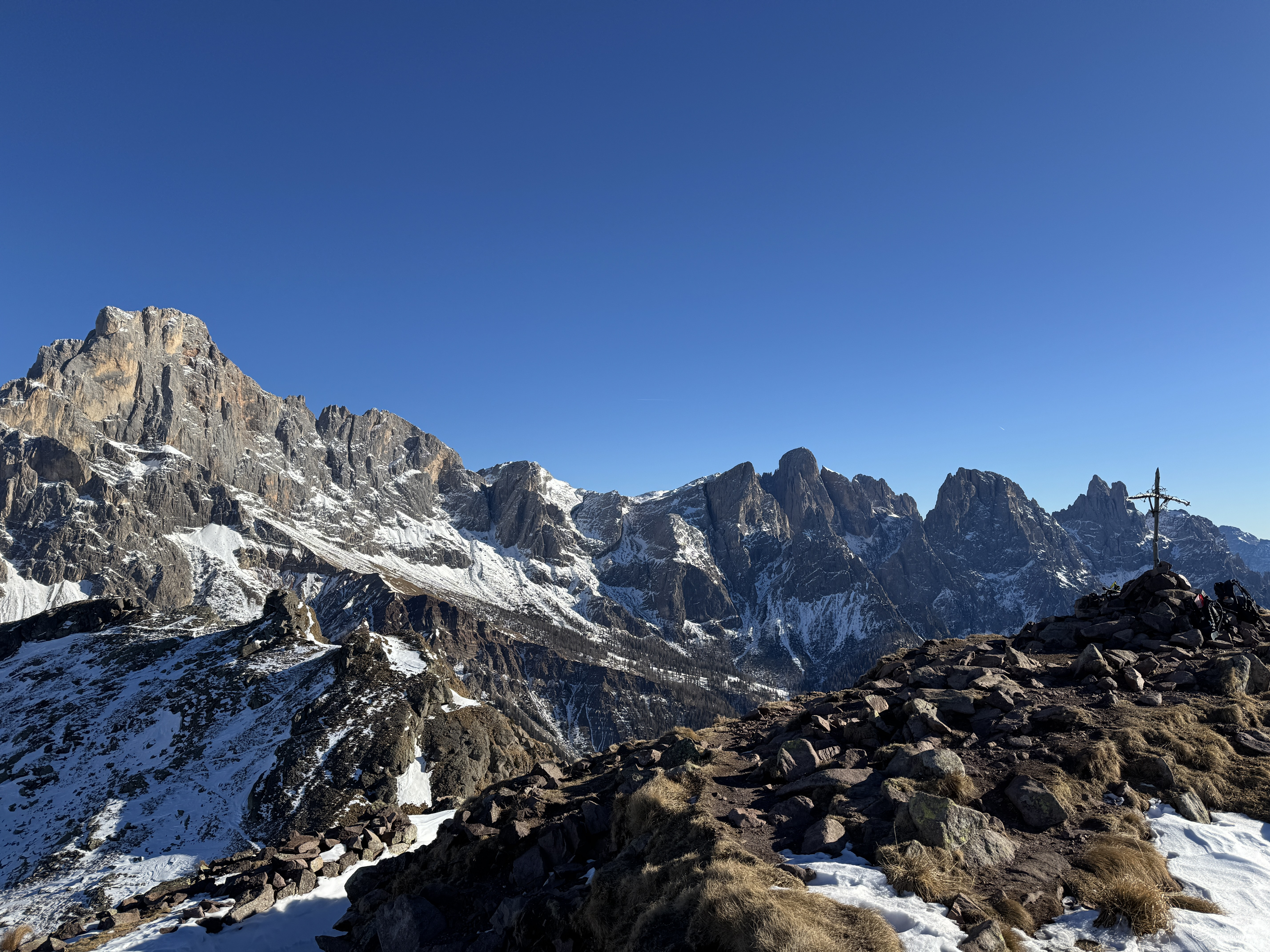
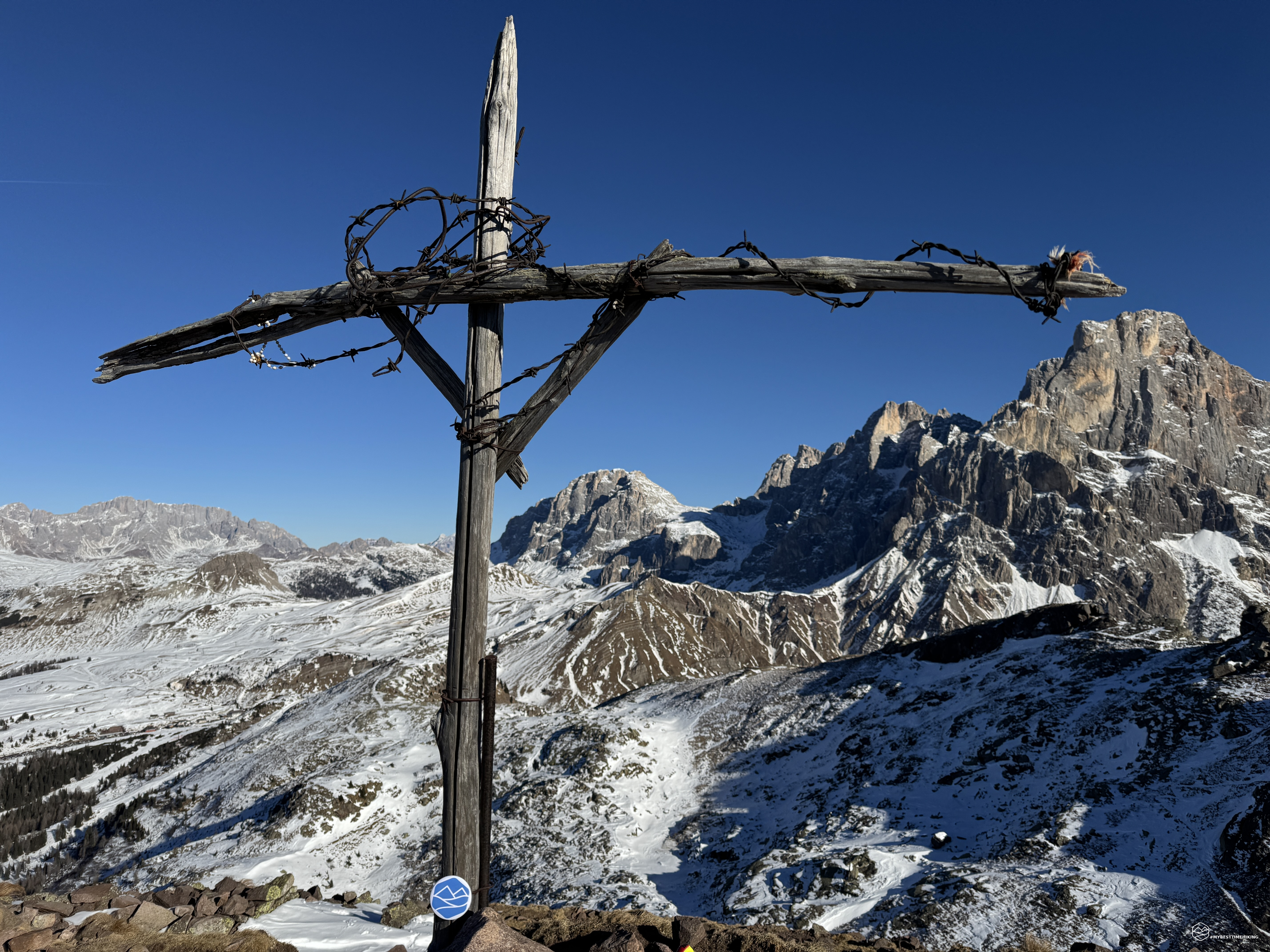
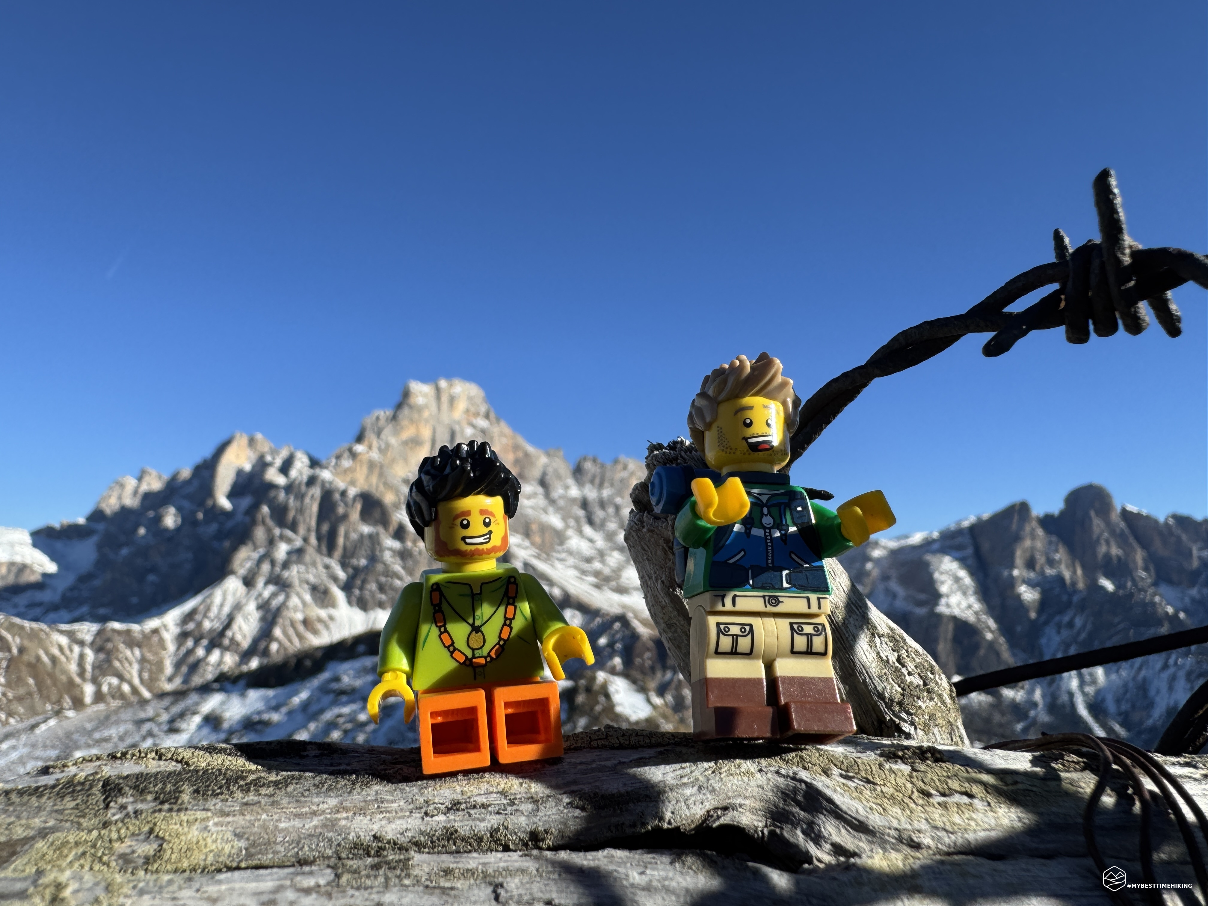
It is always exciting to rediscover these historical traces and retrace the same paths; to lay the boots on the rocks that have made history. With this happiness in our hearts we reach the top of the peak, we go around it to access the summit from the South and admire the wooden cross woven from barbed wire: Cima Cavallazza, altitude 2310 meters! In less than 2 hours from the start we reach this place nestled between a whirlwind of valleys and mountains that make you dream. The Pale di San Martino with the Cimon della Pala, the Vezzana peak and the Rosetta capture you first, continuing with your gaze we identify Mount Mulaz, the majestic South face of the Marmolada, between Mount Viezzena and the Bocche peak you can glimpse the Sassolungo, then continue towards the Catinaccio with the Roda di Vaèl; you can see up to the white peaks of the Ortles and then return to the closer Colbricon and the Primiero plain. A breathtaking view, a clear sky free of clouds that allows us to admire the peaks until we can almost touch them! We remain in admiration for a long time and with every glance we perceive new and fascinating details.
After a well-deserved snack, we sign the summit book and start the way back. We could do a circular tour following the ridge towards the East but in this season we will get stuck between the slopes and ski lifts that we saw at the start. We therefore choose to retrace our steps backwards. The descent allows us to enjoy the view with carefreeness. We thus return to the Colbricon lakes and decide to circumnavigate them on the western shores. We thus enter among mountain pine bushes and, at the height of the second lake, the smallest, we return to the woods. The lakes reflect the last gleams of the sun that is about to hide behind the Colbricon. We arrive at Malga Rolle greeted by the last ray of the day. The kiosk of the malga is our last destination where a sandwich with the characteristic Tosela also satisfies our stomachs.
An adventure between myth and history, between the Dolomites, Dolomia and volcanic rock. In the presence of the Pale di San Martino di Castrozza, in a fabulous environment. I recommend to everyone, including families with little budding mountaineers, the route up to the Colbricon lakes. From there to the top of Cavallzza I would indicate the path suitable for hikers with a bit of training. An excursion that is well worth the effort and will certainly be a starting point for exploring the nearby peaks that will capture your attention.
Click here and watch the exclusive video on YouTube for an even more immersive experience!
DifficultyHikers - Itineraries on paths or evident traces in various types of terrain (pastures, debris, stony ground ...). They are generally marked with paint or cairns (pyramid-shaped stacked stones that allow you to identify the route even from a distance). They can also take place in snowy but only slightly inclined environments. They require the equipment described in the part dedicated to hiking and sufficient orientation skills, walking training for a few hours. |