If someone told you something like: "The stony mule track turns into a difficult, exposed and scary path that runs along the dark and steep sides of Mount Fernazza, a frightening mountain, whose black walls have collapsed more than once, covering the bare ridges with debris and purple boulders that time has stained with moss and lichen.". Surely you would stay away from that peak, right?
But no, today's adventure takes place on this very peak, Mount Fertazza (or Fernazza) between Agordino and Zoldo.
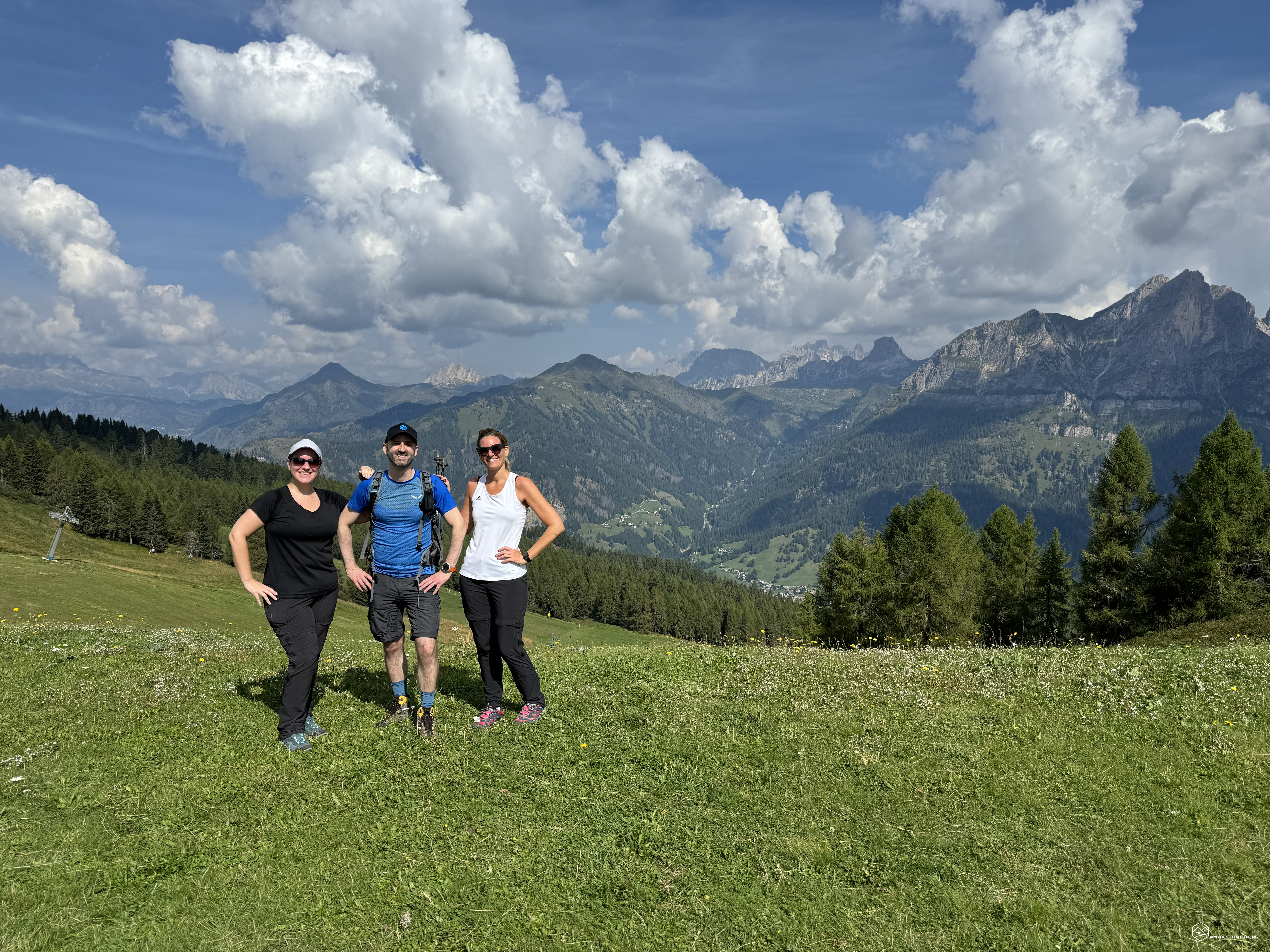
On the excursion I am accompanied by my Giorgia and a friend, Giorgia, eager to discover what this unusual mountain expedition has in store for us. The phrase I reported above, in fact, is by an English explorer from the late 1800s, Amelia Edwards, who in her book "Untouched Peaks and Unknown Valleys" reports all the details of the journey she made in the Dolomites back in 1857.
We reach Zoldo Alto by car and then the Fontanafreda mountain hut, where the convenient nearby parking lot has recently been expanded. The day is cool in this August that has only given us scorching days so far. We lace up our boots and off we go!
We take the dirt road towards the Pécol pass and immediately reach a herd of grazing cows that, in a surprising Indian line that would make any supermarket queue envious, proceed calmly and orderly, watched over by the limping farmer at the end and the proud sheepdogs at the sides. At the height of the fork, we choose to climb the track that leads west, CAI path 568, towards the Belvedere refreshment point.
It is a wide mule track, with a gentle slope that first runs alongside wooded patches and then large, finely manicured grassy meadows. On our right, the walls of the Crepa delle Salere appear and practically accompany us to the Forcella dei Giai.
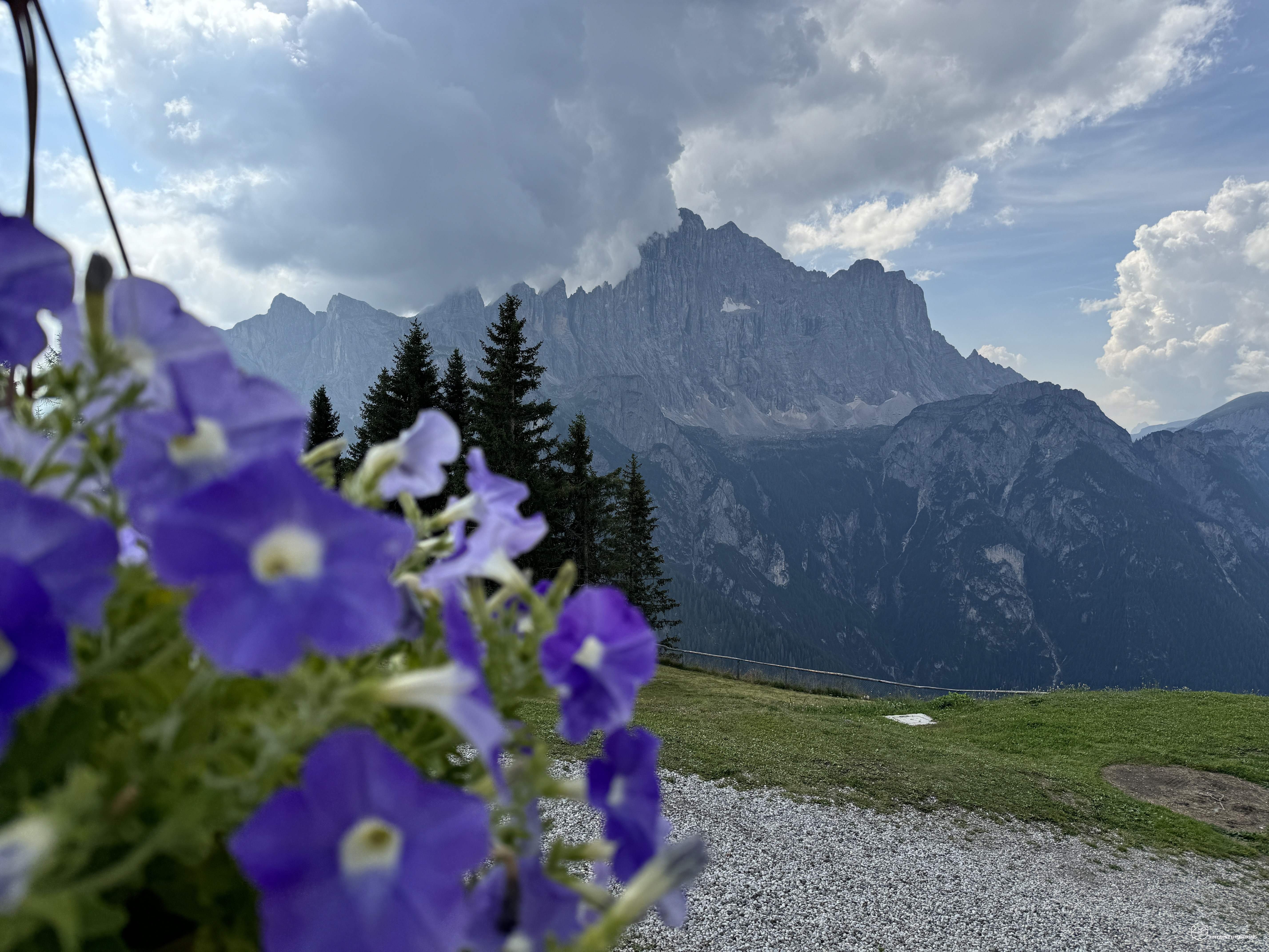
In front of us, the first panorama of the day near the Madonnina del Vaccaro: a natural window to the north with a view of Selva di Cadore, Mount Cernera and the sun-kissed peak of Lastoi de Formin. To the west, however, the track continues uphill, now a little more accentuated in the ridge called Costa del Conte.
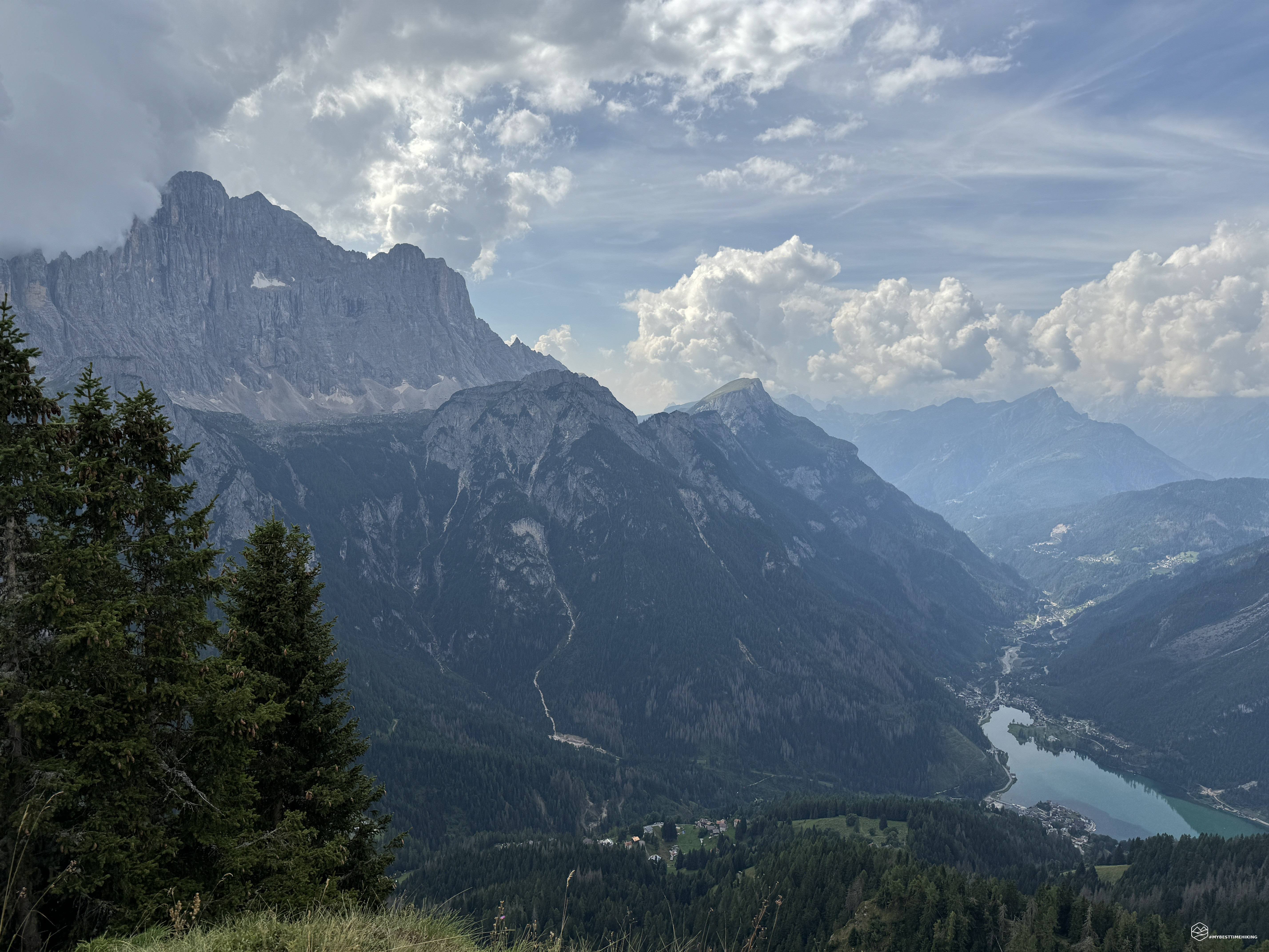
We continue to climb until we reach a new refreshment point, La Ciasera, where you can enjoy a fantastic 360-degree panorama. Pelmo dominates and, looking at it, the words of the explorer Edwards come to mind: "[…] Pelmo rises, similar to an imposing throne with a canopy of clouds and a gigantic staircase, each step of which is formed by sheer rocks, covered with eternal snow, trampled only by chamois hunters.".
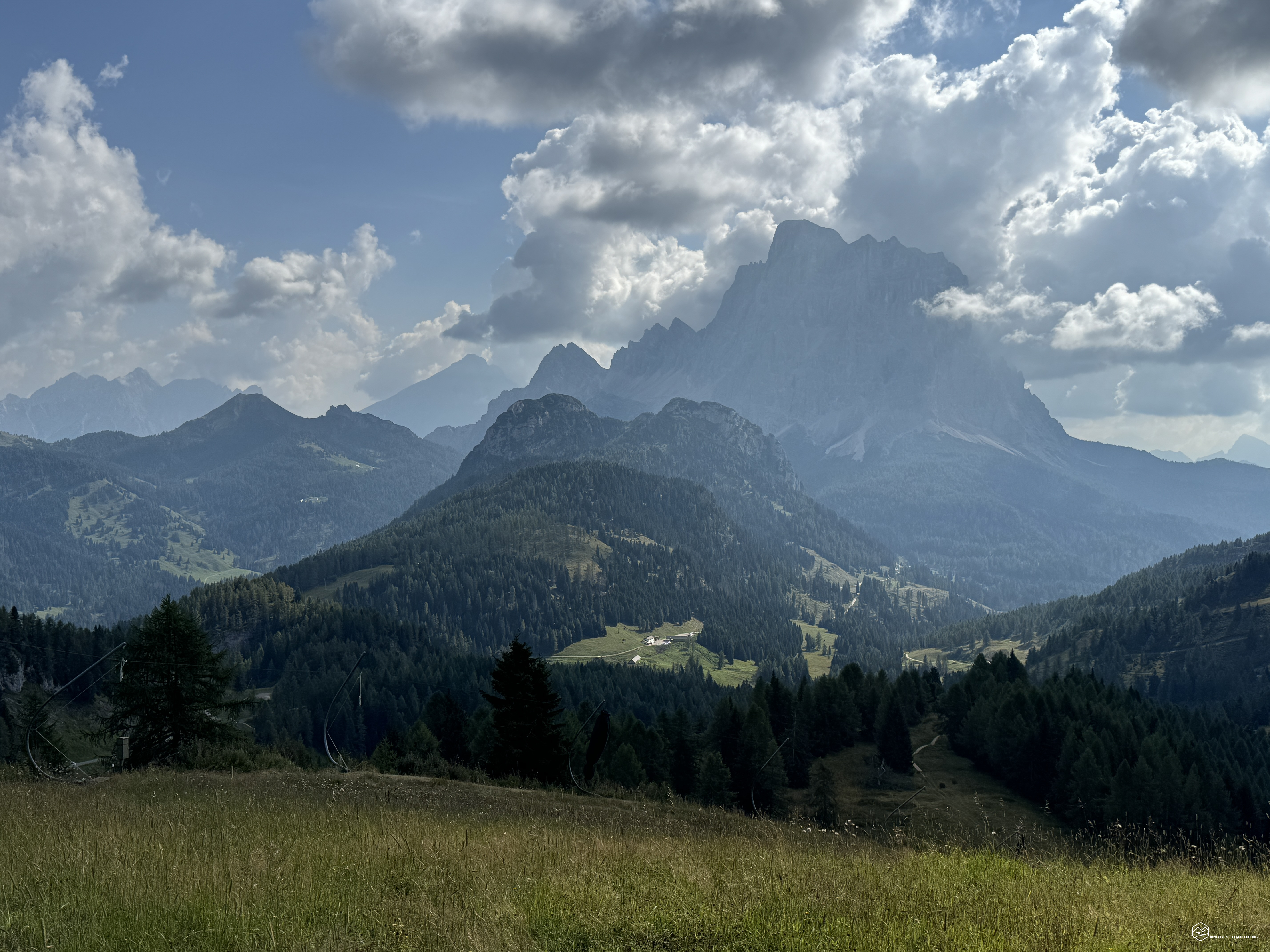
The last steep ramp and here we are on the summit plateau of the Belvedere. You can see the ski lifts that from the Fertazza restaurant, further down, allow you to reach this pretty plateau where a small playground acts as a backdrop. The undisputed protagonist, however, remains the immense vertical wall of the Civetta!
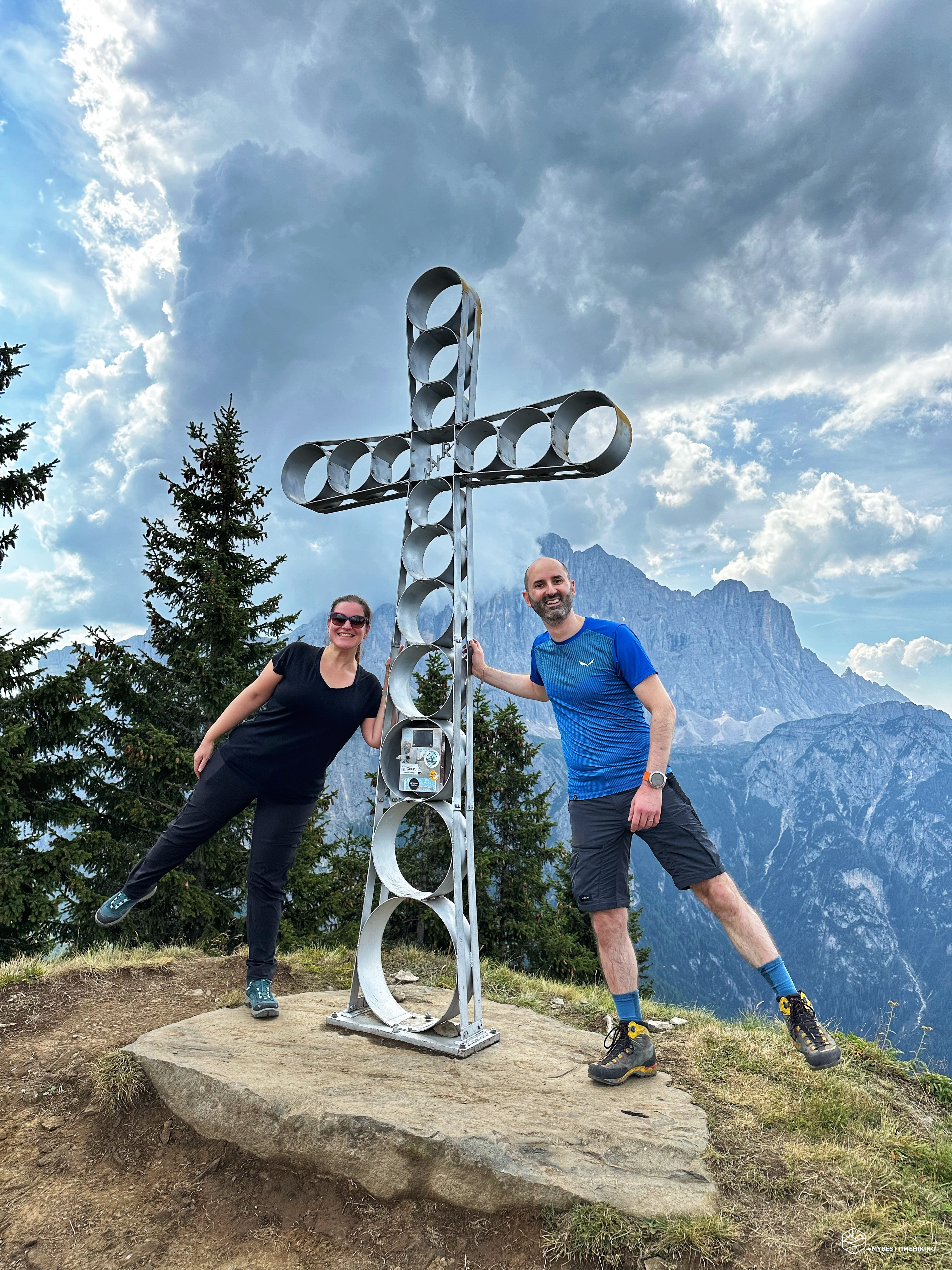
We remain focused on the goal of the day and continue along the path just behind the restaurant and aim for the summit. Here it is possible to see the steep ridge of the southern side of Fertazza and which explorer Edwards precisely described. And here we are: the top of Mount Fertazza, 2101 metres above sea level!
Date
31-08-2024
Distance
8.01 KM
Hike type
Hike
Ascent
400 mt
- Mountain
Cima Fertazza
- Address
Val di Zoldo, Veneto, Italy
- Altitude
2101.00 m
- Refuges
Ristoro Belvedere
- Information
A cross composed of circles of different circumferences welcomes us on this thin plane that falls into the void in a southerly direction. Below us a spectacular view of the mirror of Lake Alleghe that reflects the Civetta, in the background the Agordino, passing the peak of Sasso Bianco from which you can imagine invisible Caprile at its feet, until arriving at a cloudy Queen of the Dolomites, the Marmolada! From the opposite side the view ranges from Alta Badia, to Col di Lana, passing through Lagazuoi, the imposing Cernera above the town of Selva di Cadore, Mondeval with its archaeological site, the Becco di Mezzodì, concluding on Pelmo and its slopes that point out the Ciittò di Fiume refuge at the end of the Val Fiorentina.
We retrace our steps and make an obligatory stop at the Belvedere restaurant enjoying some real local delicacies, truly highly recommended. Once we have had a good meal, surrounded by the panoramic beauty all around, we set off again towards the Fertazza restaurant.
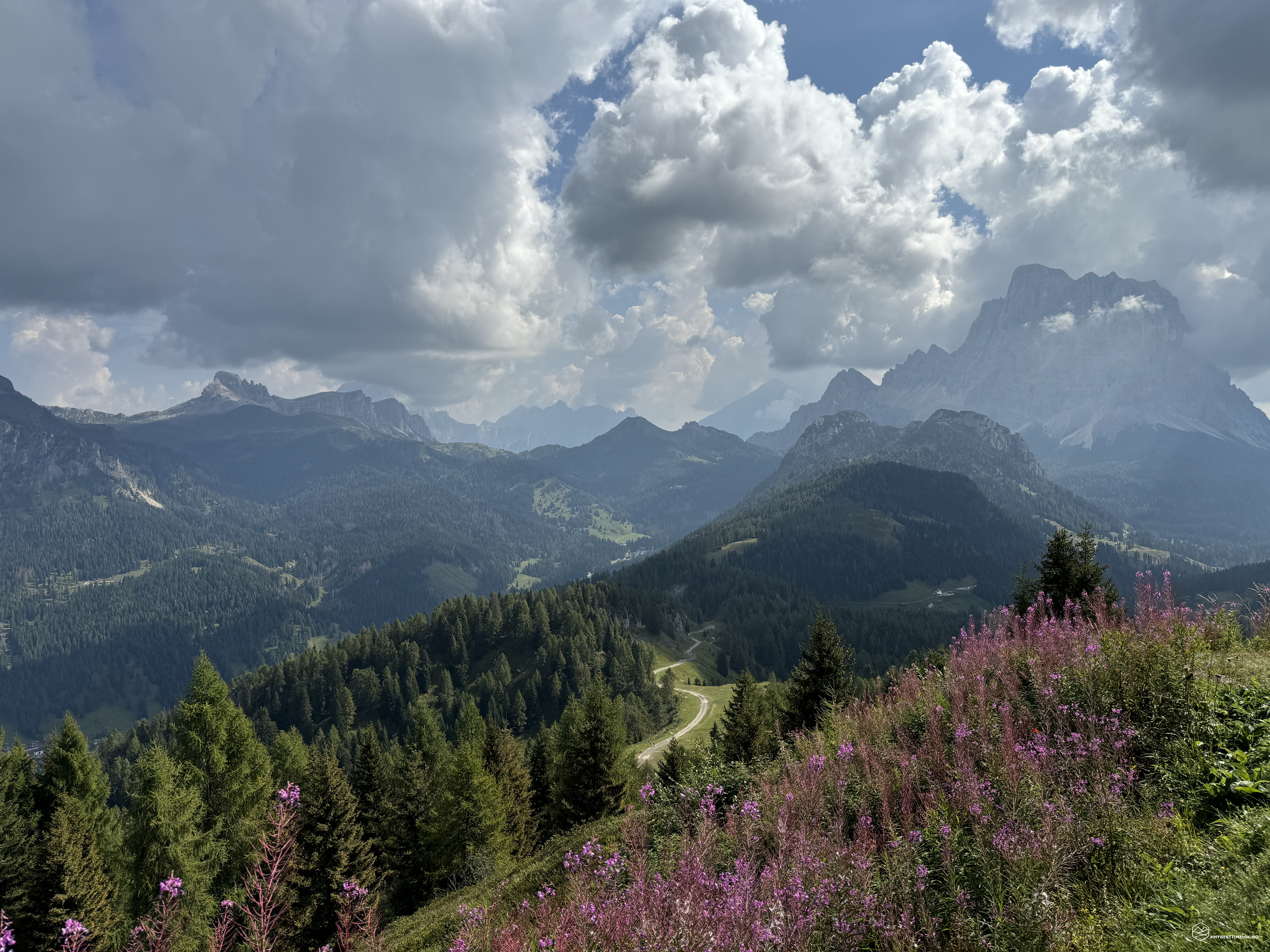
We then descend to the Giai fork and take the dirt road towards the north, towards the restaurant. The sunny road is flanked by lush raspberry plants, and we soon reach the restaurant with a gentle slope. We don't stop too long and continue downhill on CAI trail 569, towards the Pécol fork.
Up to this point, the adventure is suitable for everyone, young and old. I recommend retracing your steps and going back along the road. We, however, try a loop as usual. What better opportunity to also explore the Crepa delle Salere area. Even more so since we are retracing the footsteps of an explorer: we must immerse ourselves in the adventure.
A little further on we find a clear CAI sign indicating the fork and directing us down a ski slope that has been transformed into a gravel road this season. At an altitude of 1780 metres, a trail with dark grey rocks that enters the woods is clearly visible. An obvious pole with CAI signs confirms the correct direction. We are thus following path 561. We are immersed in thick vegetation in a place that evidently not many people travel. A pleasant path but one that requires some attention in some places with protruding and smooth rocks on which due attention is required. Also the presence of a large tree adequately cleaned of the thickest branches allows us to advance among the remaining dangling branches. We emerge into a clearing (ski slope) that would lead downhill to the Salander refuge, but we continue to re-enter the woods and here we find a truly important water meadow. A land full of water that in some places gives the appearance of "quicksand". Here my adventure companions give their best. While I cling to the usual pine branches to get out of the mess, they dance on thin tree trunks arranged in the center of this thicket! Almost with disarming ease they quickly overcome this non-trivial stretch, emerging unscathed and feeling a bit like explorers themselves. Who knows if Amelia Edwards would have walked this stretch of path…
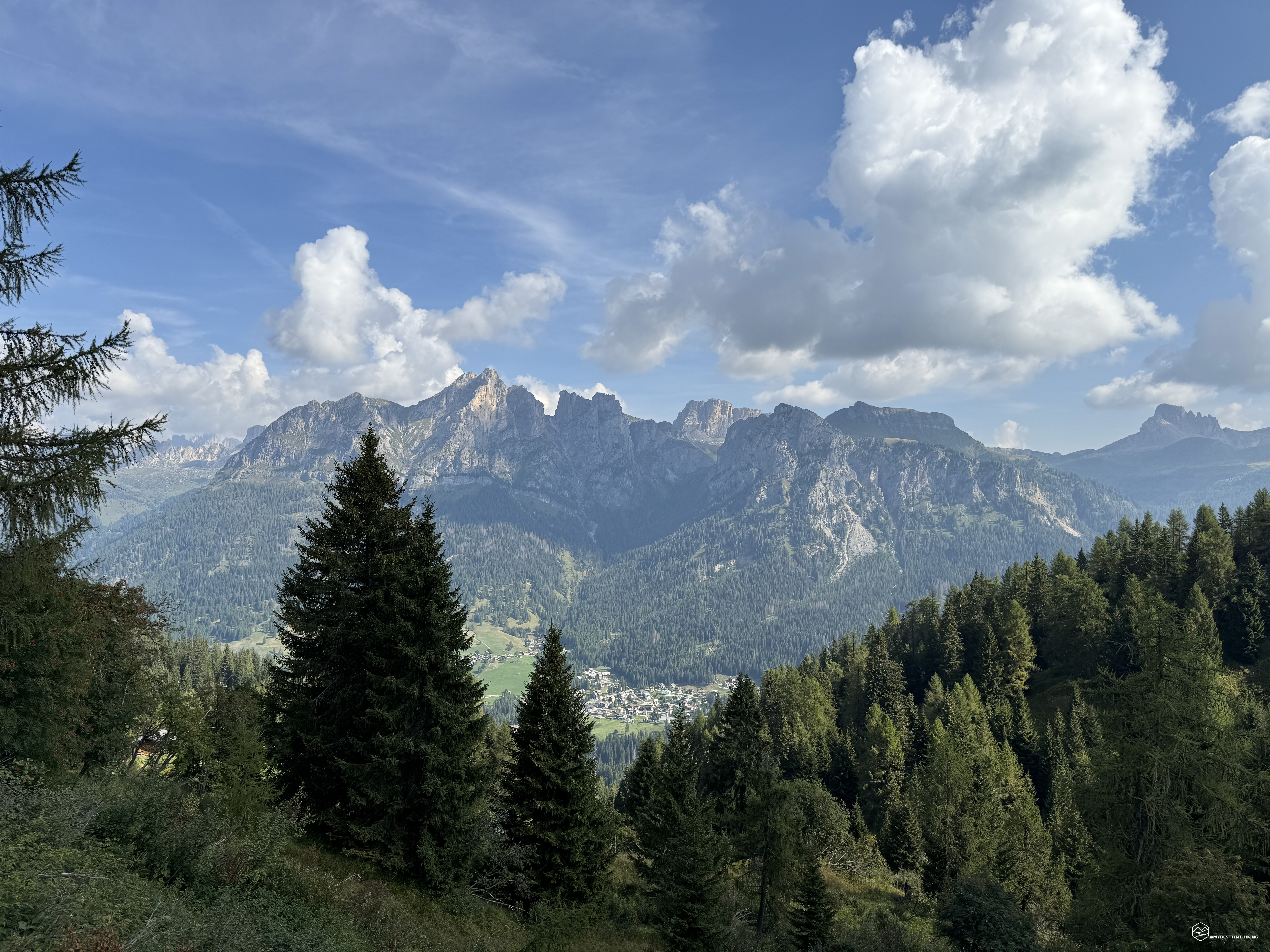
The trail becomes more earthy, climbs steadily until reaching the Pécol fork where we rejoin the point of the morning where we left the herd of cows grazing. We return to the Fontanafreda hut greeted by the Civetta at the end of this beautiful loop.
An excursion that I recommend to everyone for the ease of progression, the beauty of the views, the convenience and goodness of the Belvedere refreshment point. About 400 meters of altitude difference that can be covered with the necessary breaks in a total of 4 hours. Zoldo always gives magical emotions, this time enriched by the history that has come down to us from the late 19th century thanks to the English explorer.
DifficultyTourist - Itinerary on narrow streets, mule tracks or wide paths. The routes are generally not long, do not present any orientation problems and do not require specific training if not the typical one of the walk. |