Summer is at its peak, the heat is exhausting in the big cities and, like every weekend, I seek relief in the mountains. Together with my friend Leonardo, today I reach with great pleasure, and a bit of nostalgia for childhood holidays, the legendary and unmistakable Carnia. Today's goal is a double peak, on the border between Italy and Austria.
I reach the valley called Canale di San Pietro formed by the Bût torrent that from Timau passes Paluzza, Arta Terme and Tolmezzo before flowing into the Tagliamento river. By car we pass the town of Laipacco and take the dirt road with signs for Malga Pramosio. With a wide and comfortable dirt road we quickly reach the car park at 1521 metres.
We get ready to go, backpack on and off for the first stage: Lake Avostanis.
We take the 402 signpost which includes several other tracks. In fact, this part of the route is also called the Pastor's Path and is also part of a piece of the famous Carnic Crossing, a High Route that runs along the mountain ridge of the Carnic Alps on the border between Austria and Italy, retracing for many stretches the Italian-Austrian trenches of the Great War.
We continue in constant ascent observing the sinuous lines of Mount Scarniz and following with our gaze the clouds that run at an unusual speed. We soon reach a small niche where Maria Plozner Mentil is remembered, one of the Carnic porters during the Great War who with their heavy panniers (filled with provisions, weapons and ammunition) every day climbed on foot along the slopes of Pal Piccolo, Pal Grande, Freikofel, Cima Avostanis and Passo Pramosio. On February 15, 1916, Maria Plozner Mentil was hit by an Austro-Hungarian sniper near Passo Pramosio. Transported down to the Paluzza field hospital, she died the following day due to the severity of her wounds.
We follow track 402, passing the old Morgante refuge, now abandoned. The path is a comfortable route made up of rough asphalt and allows you to proceed quickly. From an altitude of about 1700 meters you have a splendid view of the grassy ridges facing the Pramosio mountain hut, now almost invisible.
At an altitude of 1820 meters we reach the Casera delle Manze with a powerful adjacent fountain. The name is not accidental and we see several cows grazing not far away. In front of us we notice the path that climbs in a zig-zag, now completely stony and without asphalt. We continue on the climb which is now more decisive. The clouds begin to envelop us in a continuous chase to reach the nearby peaks that surround us. Here we also notice the indication of the Sentiero Italia of the CAI: the track we are on is a crossroads of infinite paths!
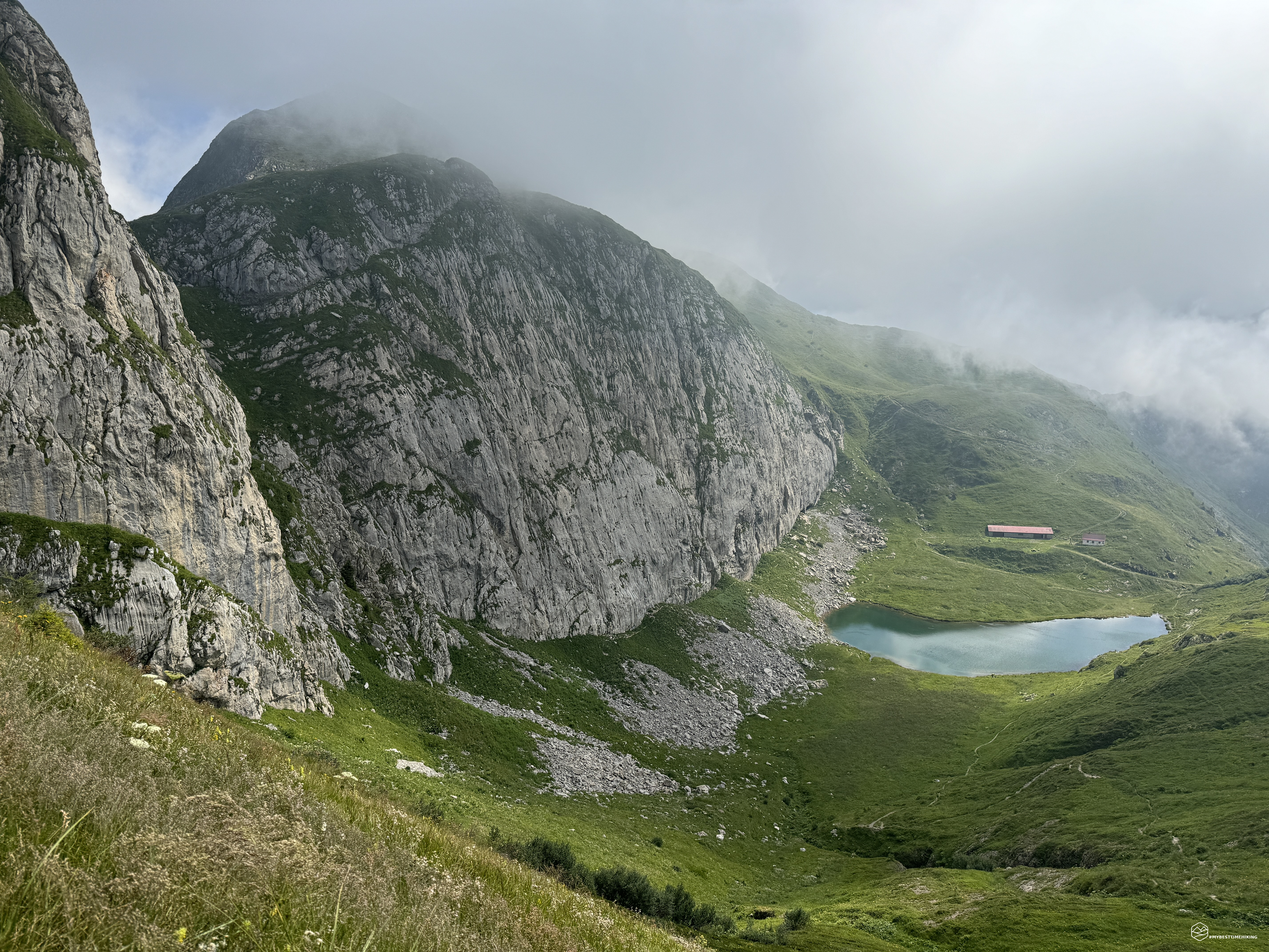
We arrive at a crossroads at about 1930 meters, we choose the left path and we find ourselves in front of the first beauty of the day: Lake Avostanis!
Turquoise water, surrounded by flowering meadows with a rock face used as training for climbers behind it. Not far away is the Casera Pramosio Alta shelter that remains on watch above the body of water. We continue on the path observing the splendid lake. The path now becomes grassy, narrow, and proceeds decisively on the ridge that heralds the Creta di Timau, our next objective.
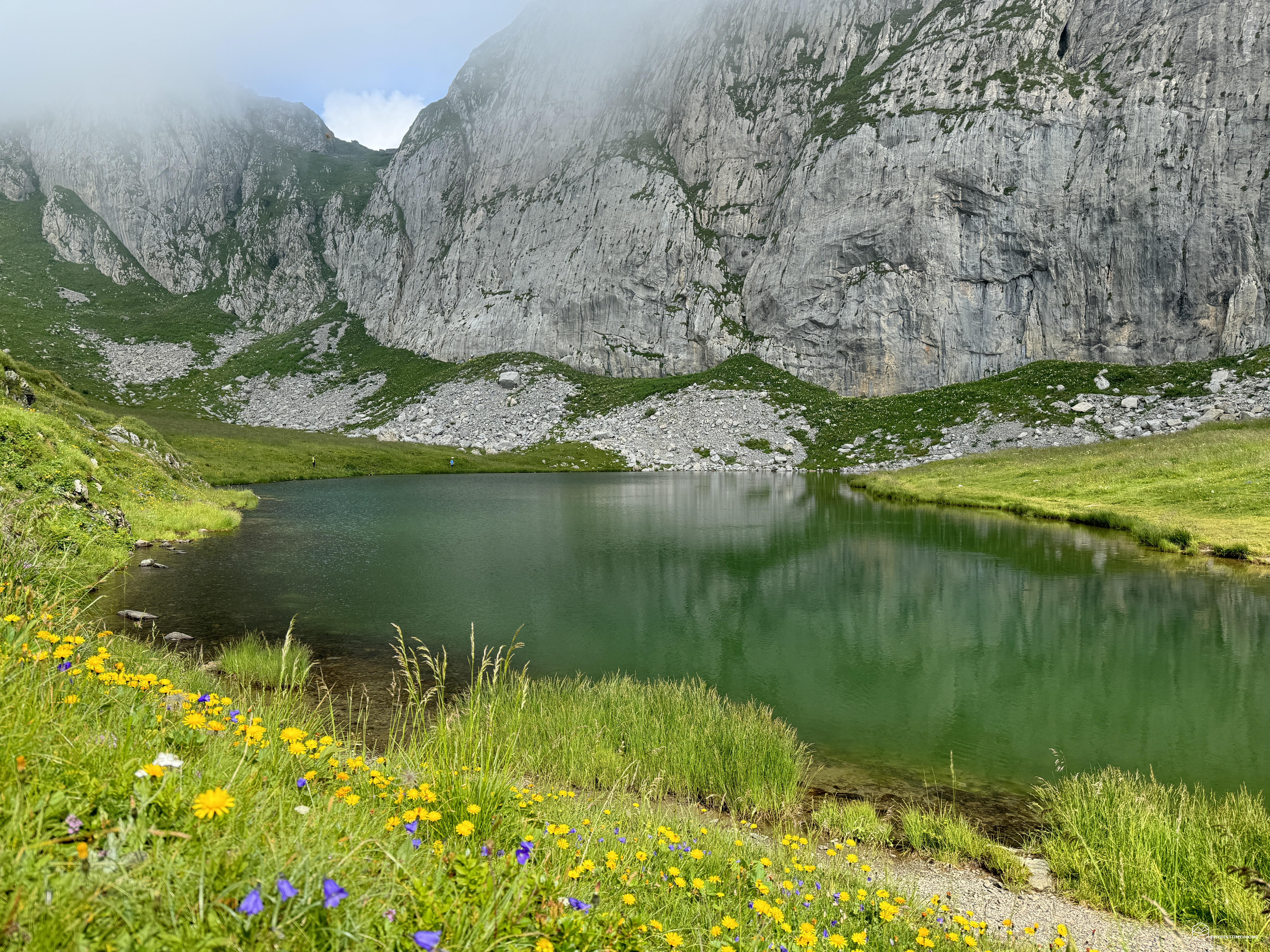
We skirt a landslide area with several unstable rocks that seem ready to fall into the lake. Right in this place we spot two young marmots climbing on the large white rocks. We continue zigzagging until the deviation that leads to the crest. Here, be careful to choose the left path to get to the grassy saddle, with an adjoining blade of water, which allows you to reach the path that leads to the summit.
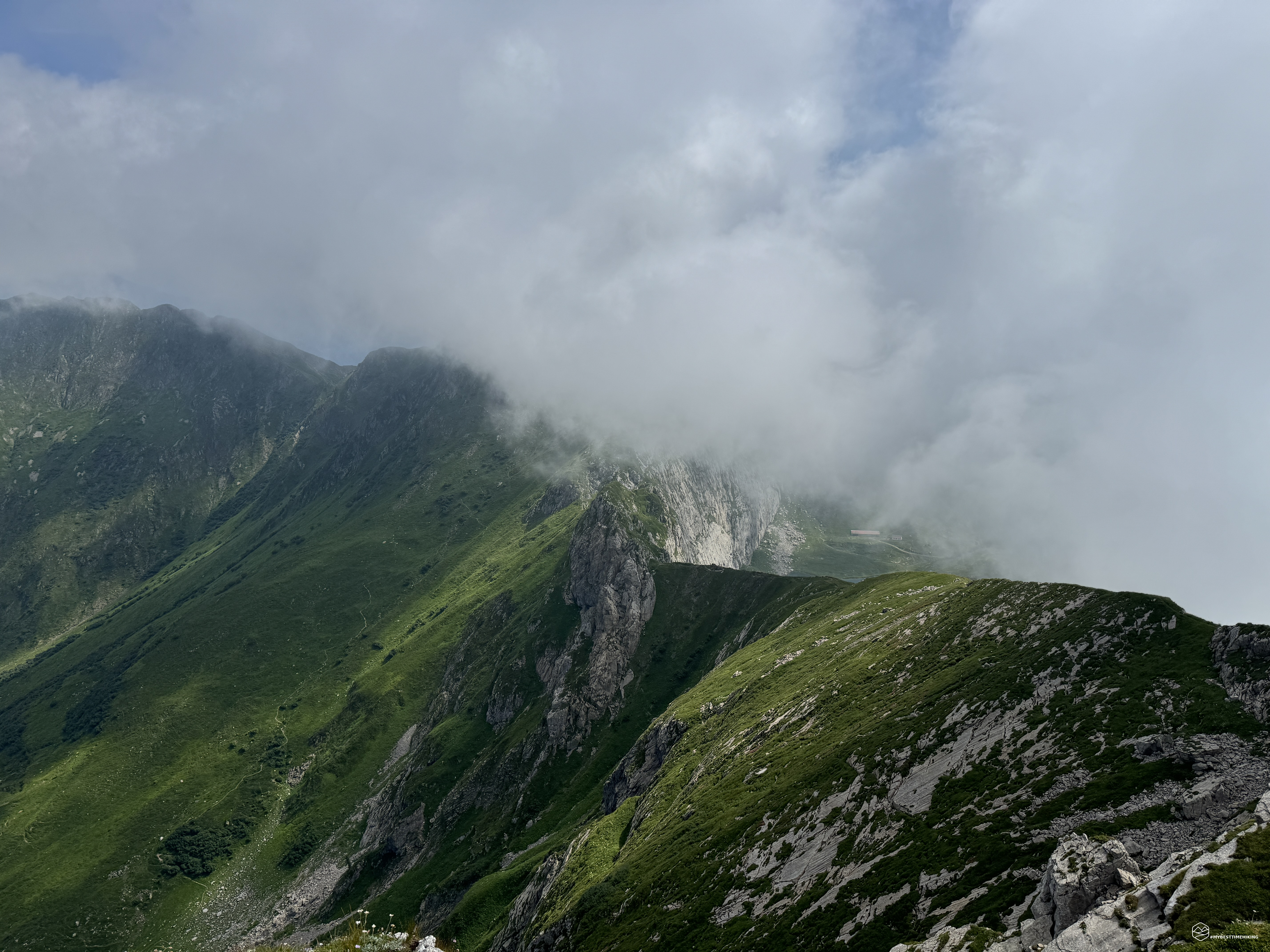
Once past the saddle, the trail climbs up the rocky ridge of the mountain. Never dangerous, but characteristic for the progression with a view towards the town of Timau. We were unlucky because we only had a taste of this panorama, then only fog and reduced visibility that allows us to see only a few dozen meters ahead of us. The situation is almost surreal, we are inside a cloud. It seems like we are suspended in the void to reach a peak that we cannot yet see.
At about 2150 meters above sea level, there the summit cross peeps out, only a small equipped section divides it from the summit. A metal rope, loose in some places, together with steps created with iron pegs, allow us to reach the last stretch on easy rocks. And here we are at an altitude of 2217 meters, about 2 hours from the start: the summit of Creta di Timau!
Date
27-07-2024
Distance
10.94 KM
Hike type
Hike
Ascent
923 mt
- Mountain
Alpi Carniche
- Address
Paluzza, Friuli Venezia Giulia, Italy
- Altitude
2221.00 m
- Refuges
Rifugio Malga Pramosio
- Information
The view to the South is obscured by a cloud cover that continues to puff towards us, on the opposite side instead there is a splendid panorama of the verdant Austria and the crest that will allow us to reach Mount Avostanis. We study the surrounding environment to understand if there is a track that allows us to proceed on the crest directly from the top, but the unstable rock formation and the poor visibility at the moment, force us to retrace our steps and try an alternative. Immediately after the equipped section, a CAI sign is evident on a very high rock that invites us to climb on easy rocks. We travel this short section, we are in fact on the crest but here too the unstable rocks and the poor visibility make us desist and we go back again. We reach the first hairpin bend downhill and here we take a timid track that on comfortable grass takes us to the sought-after crest.
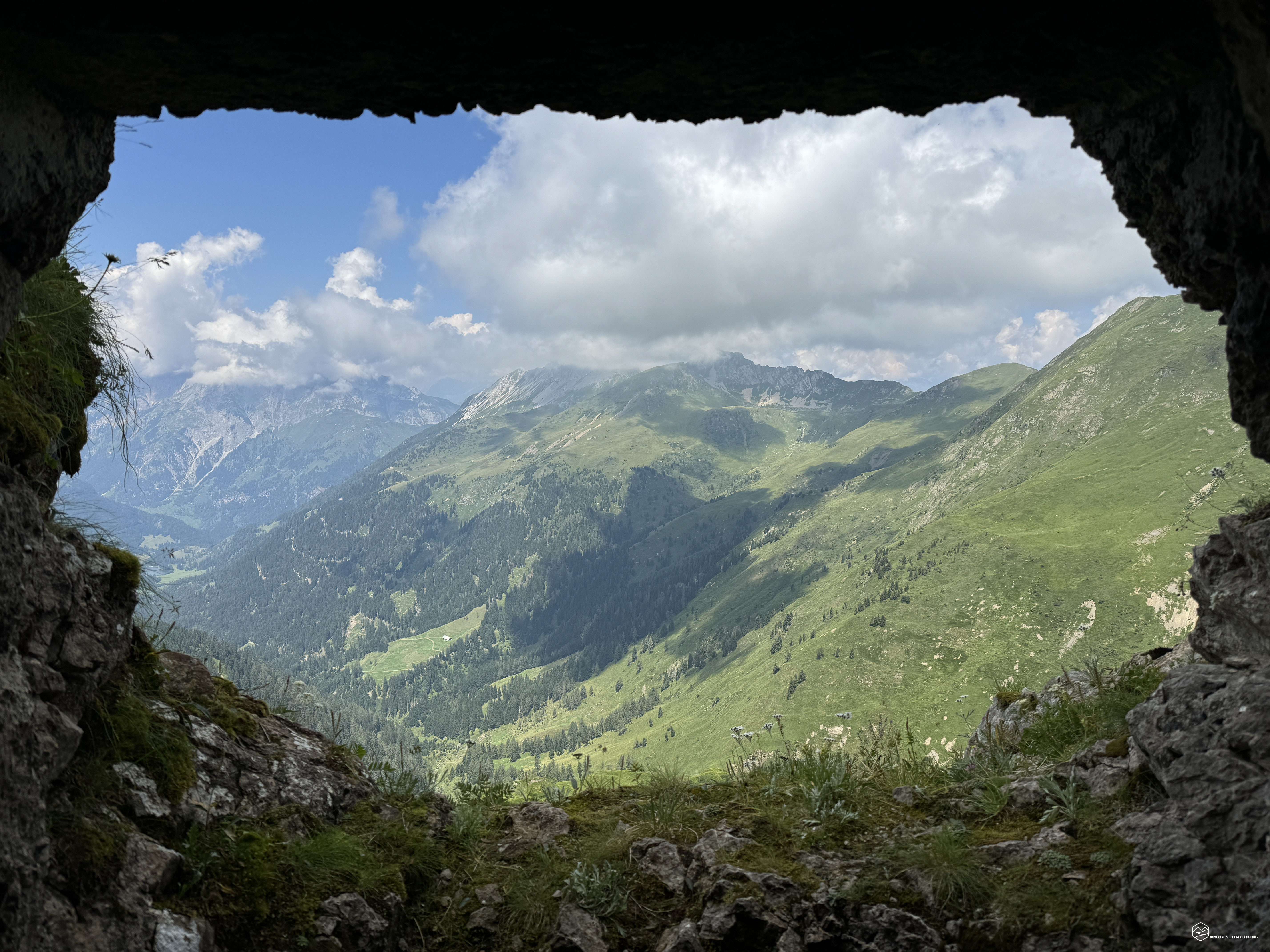
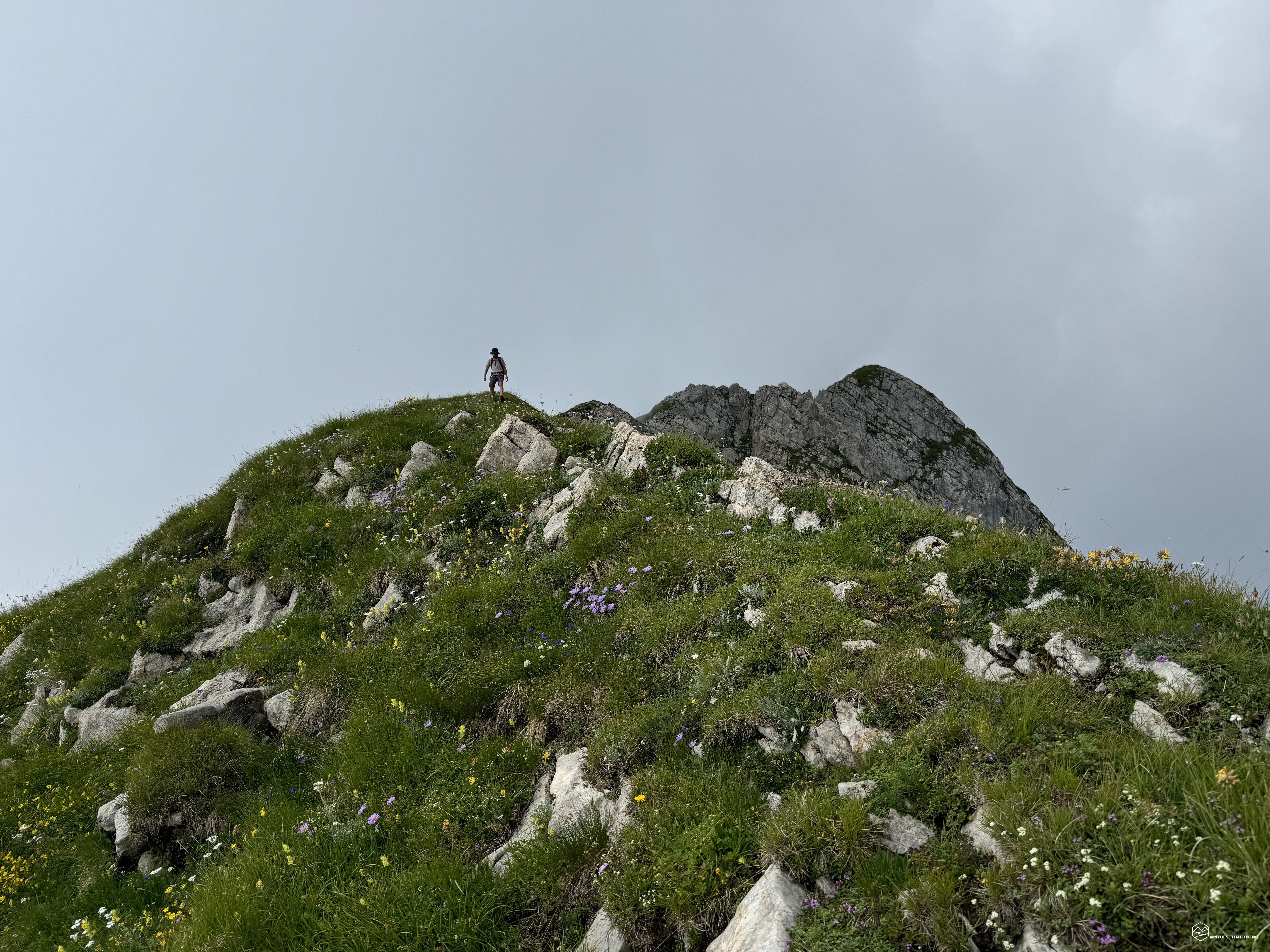
We are on a razor blade, on one side the nothingness made invisible by the thick white clouds that as on an oiled plane escape upwards, lapping us. On the other, the abyss towards Austria and its endless meadows. The crest is pleasant, fun, and in a short time we reach some tunnels from the First World War from which we can observe the Casera di Palgrande, the top of Pal Piccolo and the still closed Passo di Monte Croce Carnico. We go around the first tunnel, on an almost invisible track and we find ourselves on the path that was certainly used by soldiers to move between these passes. The various tunnels, brick outposts and barbed wire are proof of this. We are suspended above the lake that creates a wonderful panorama. The timid track is recommended for hikers with a sure step given the particularity of where it unravels. A single exposed passage also requires a certain experience and firmness in an aerial environment. We have arrived in front of a now uncovered stone house near a small fork.
We choose the path on the left that descends slightly. From here, going around the brick hut, you can proceed between the old military outposts in an environment that is not very easy and difficult. We go down and we are in fact on the ridge of Mount Avostanis. At a well-marked crossroads, we go back up until we reach a large saddle. Here we notice a first boundary stone dated 1920 in which there is the double indication "I" (Italy) and "Ö" (Austria). The peak of Avostanis is in front of us. A last grassy peak separates us from the second summit cross that we reach in about ten minutes from the saddle.
Here we are, after about 3 hours and 45 minutes from the start: the top of Mount Avostanis!
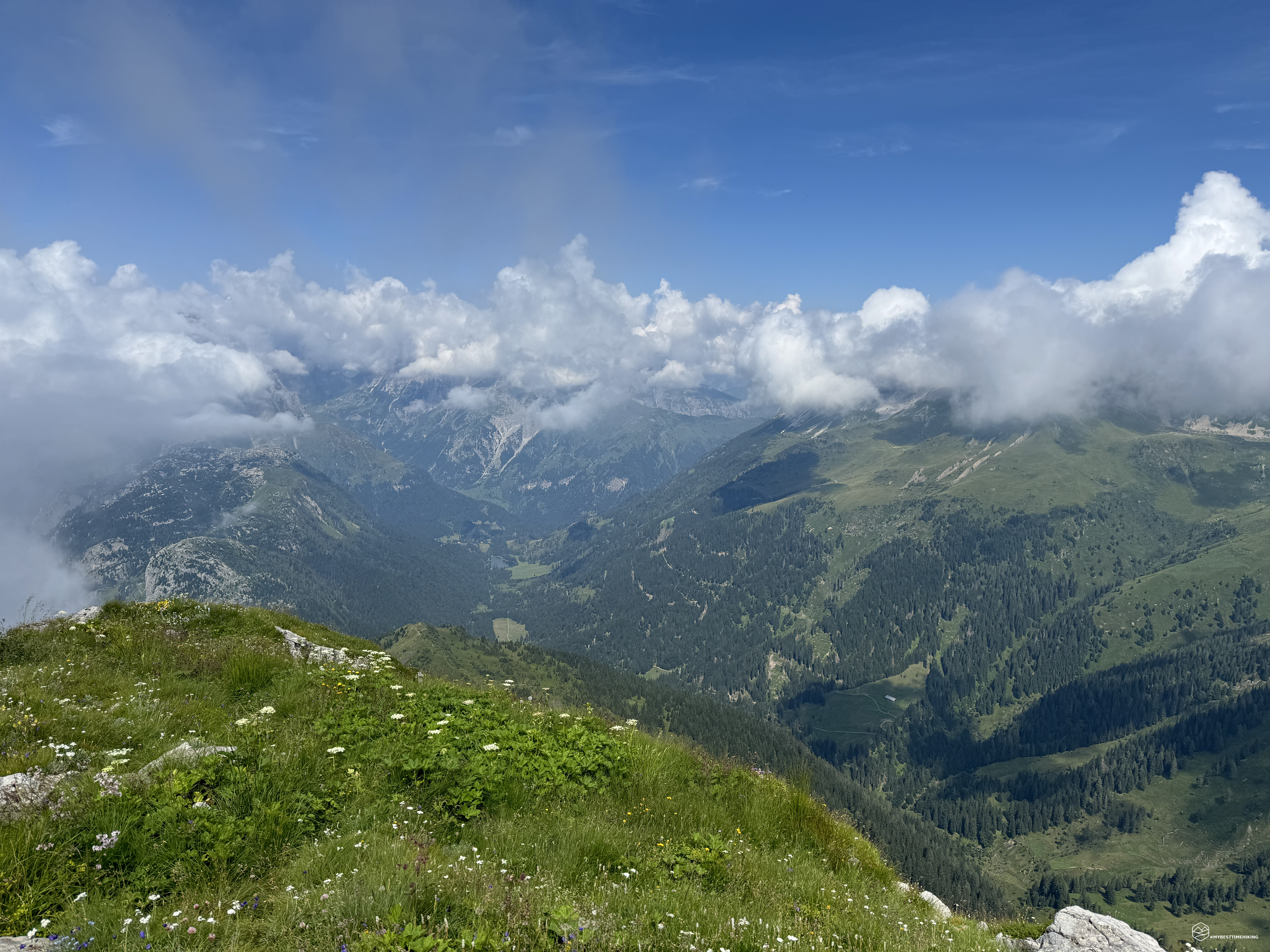
Just below the summit, a military outpost welcomes us for a well-deserved break with a view of the Austrian peaks: the ridge continues towards the peaks of the Koderkopf and the Koderhöe and the distant Obergailtal valley. Austria remains free of clouds, while the Italian side is still shrouded in fog. The wait pays off and after the well-deserved break, retracing our steps, we enjoy the view also from the Italian side that shows itself in all its splendor towards Timau and Paluzza.
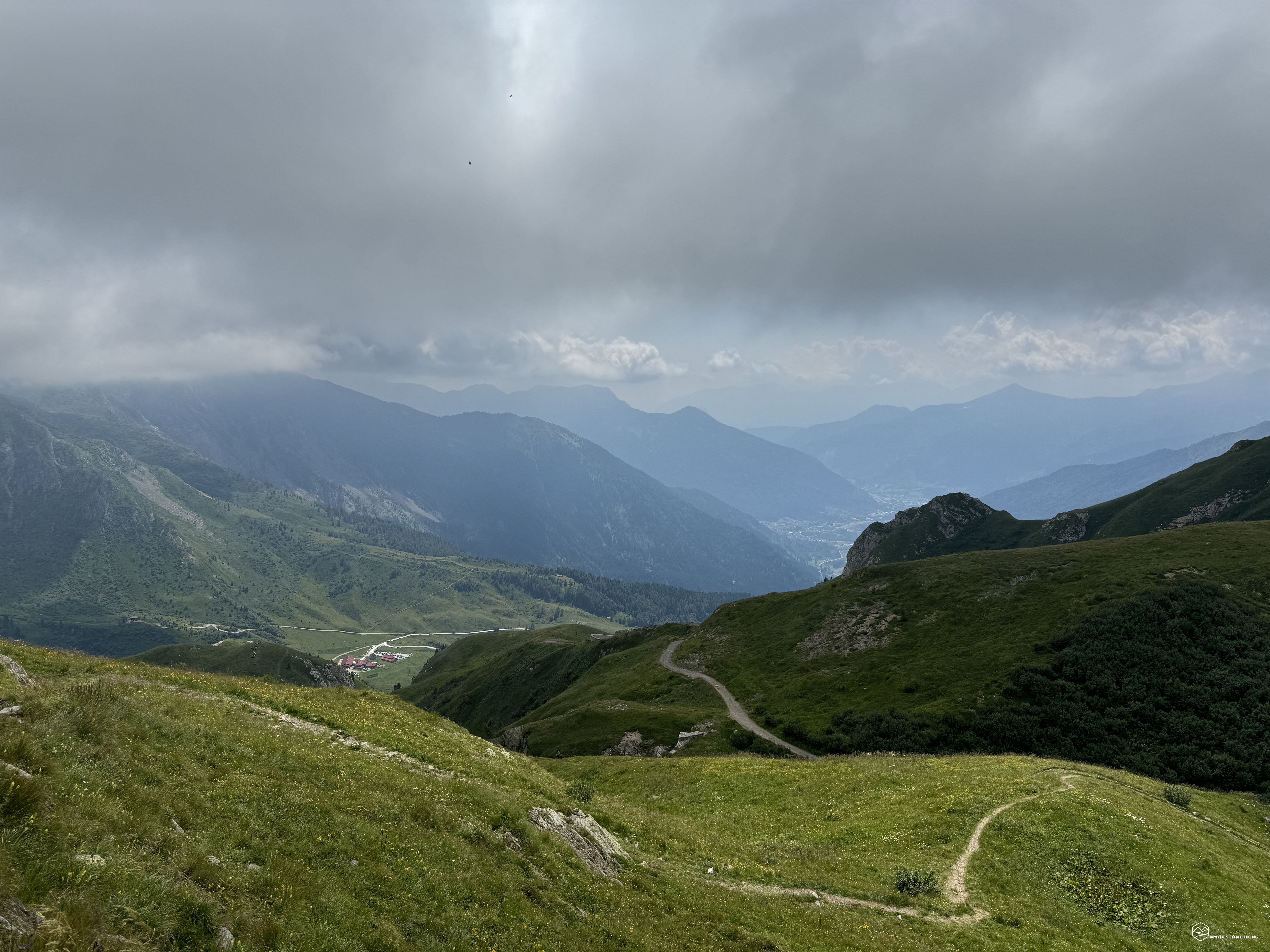
Back at the grassy saddle, we choose the variant towards the East, still marked 402, which allows us to complete a complete loop until we reach the Casera Pramosio Alta refuge in front of Lake Avostanis. We then continue on the Sentiero dei Pastori to return to Malga Pramosio (or Promosio). The return offers us different views: the clouds have thinned out and leave room for a warm sun that tinges everything around us with a golden light. After about 5 hours we reach the starting point where a hearty lunch of homemade gnocchi seasoned with a delicious game sauce awaits us!
This concludes the exciting excursion in the heart of the Carnic Alps, in the most real, authentic and preserved part of Friuli Venezia Giulia. An adventure for trained hikers. Only the ridge between the two peaks is recommended for people with mountain experience. However, it is possible to reach Avostanis even without the ridge path on an easier track. Recommended especially for those looking for less chaotic places, immersed in nature that is not very anthropized and of considerable historical value!
DifficultyExpert hikers - are generally signposted itineraries but with some difficulties: the terrain can consist of slippery slopes of grass, mixed rocks and grass, stony ground, slight snowy slopes or even single easy-to-climb rocky passages (use of hands in some places) . Although they are routes that do not require particular equipment, equipped sections can be presented even if they are not demanding. They require a good knowledge of the alpine environment, a safe step and the absence of vertigo. Physical preparation must be adequate for a fairly continuous day of walking. |