Mid-July, summer is in full swing and the best solution to the heat is a nice hike in the mountains with the right company. With me on today's adventure is my friend Enrico and a new acquaintance, Mattia.
The goal is the Giaf refuge and, higher up, the Scodavacca (or Giaf) fork. A crossing from Friuli to the border with Veneto.
From the Mauria pass we reach the free parking lot before arriving in Forni di Sopra, more precisely from the town of Chiandarens via a bridge over the "newborn" Tagliamento river. The space is not very large, so I recommend arriving early in the morning to be able to secure a spot.
Backpack on your shoulders and off on the CAI 346 path, immediately crossing the tumultuous Giaf stream on a comfortable asphalt bridge. The mule track becomes stony and enters thick coniferous vegetation up to an altitude of 1100 meters. We leave the wide road for a more suitable path that is still very easy. We leave the conifers and come out into an opening on the Giaf torrent that already offers a postcard for its beauty and the numerous waterfalls it creates. We cross it twice on characteristic wooden bridges and enter a thick forest, now of young fir trees. We continue uphill with a steeper but never tiring slope. Arriving at a third passage of the Giaf torrent, the path becomes gentler, we proceed quickly until we reach the winter shelter of the Giaf refuge at an altitude of 1370 meters. The Giaf is not yet visible, we have to walk a few hundred meters more to first reach a beautiful little church and, through the comfortable stone steps that run alongside it, we reach the first stop of the day: Giaf refuge 1400 meters! In less than 1 hour from the start, here we are on a splendid clearing with hundreds of seats with a view of the Monfalconi group.
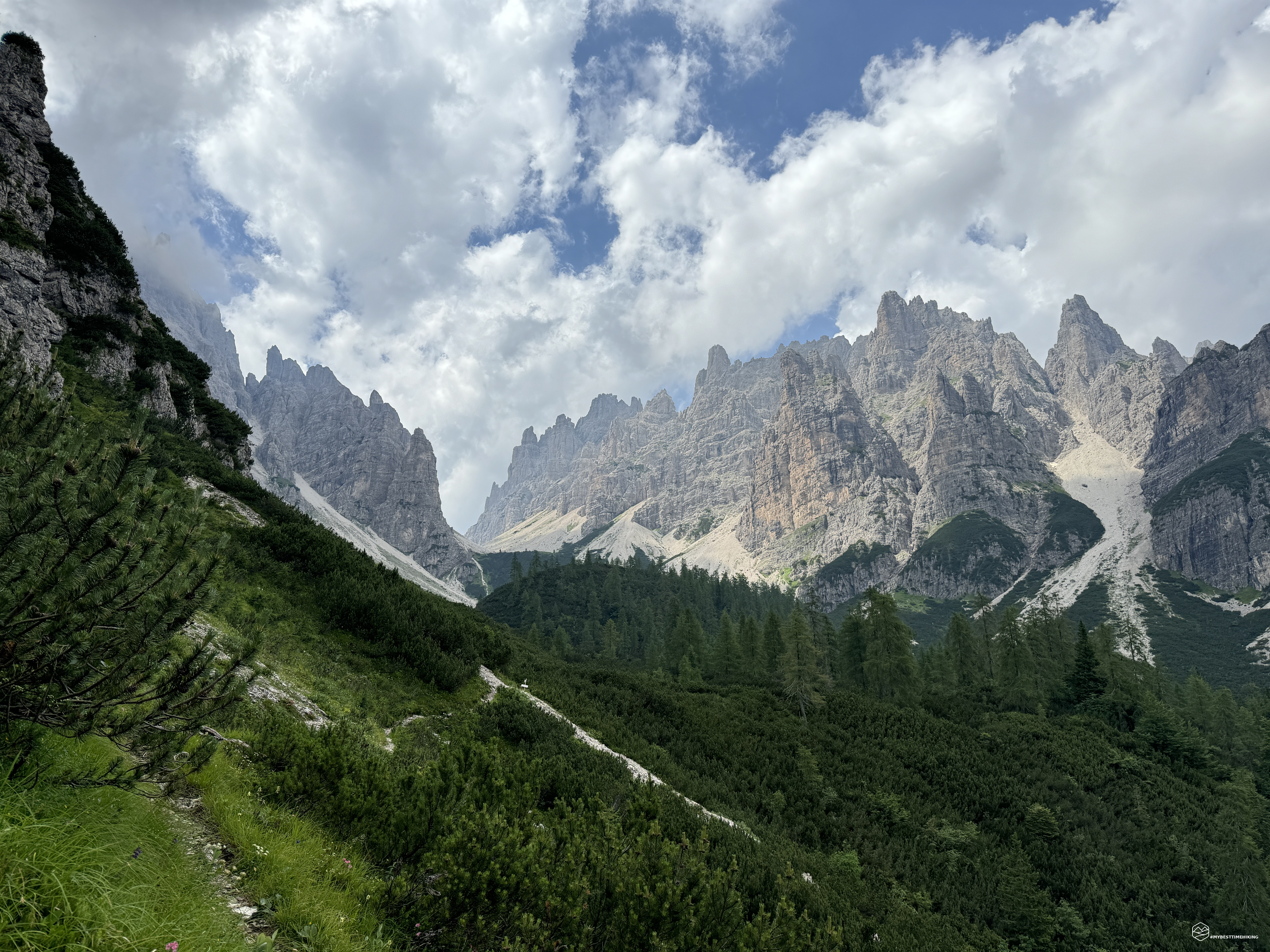
We leave the refuge behind us, we continue on path 346 on the stretch of the Alta Via number 6. We thus travel along the Coston di Giaf, a coast that is initially wooded with a decidedly steep climb. The heat begins to be felt. The thick flora opens up giving space to larches, and lower shrubs: the legendary mountain pines. We pass a detour that indicates “Anello di Bianchi”, a route that we will follow on the way back.
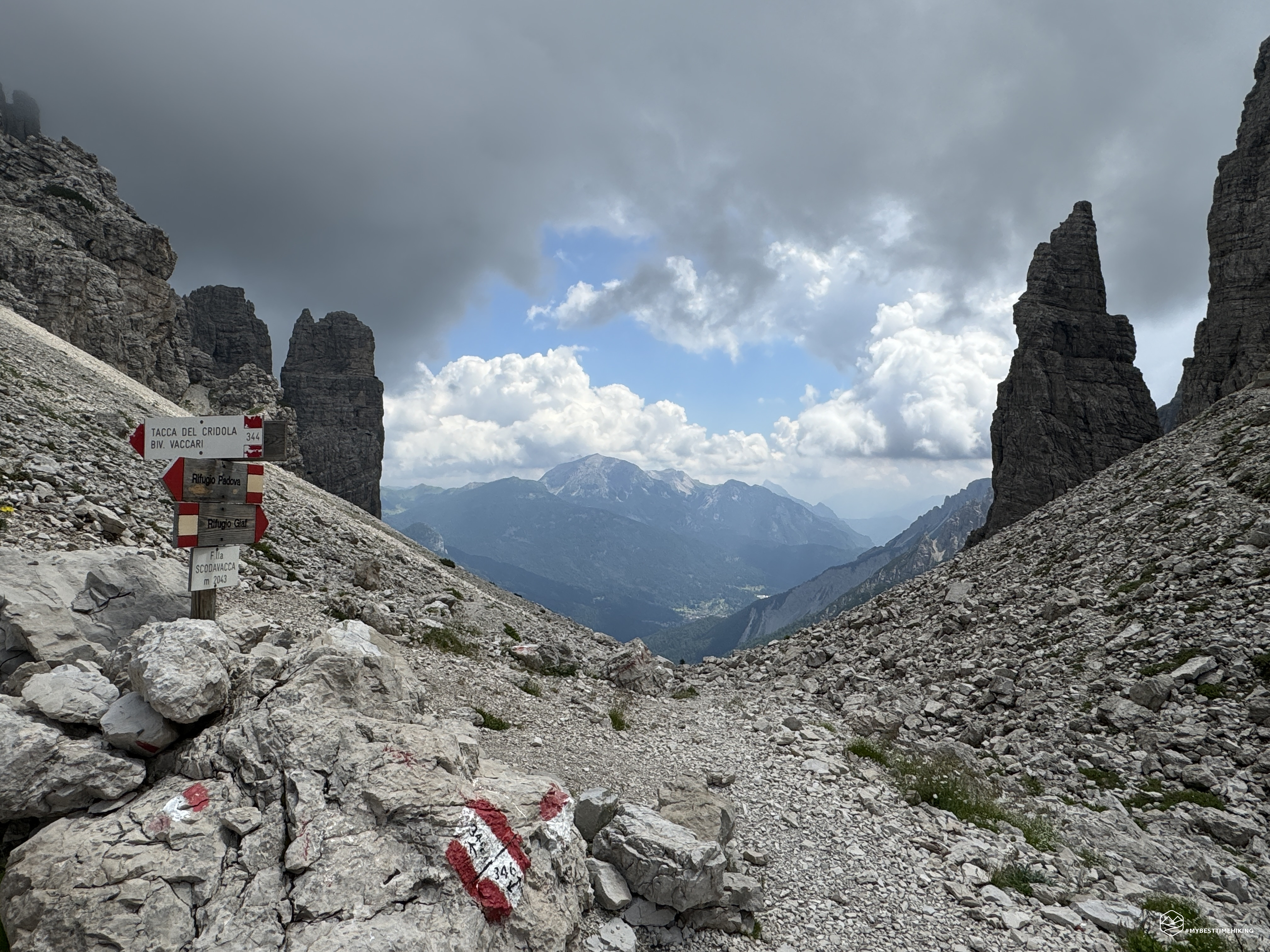
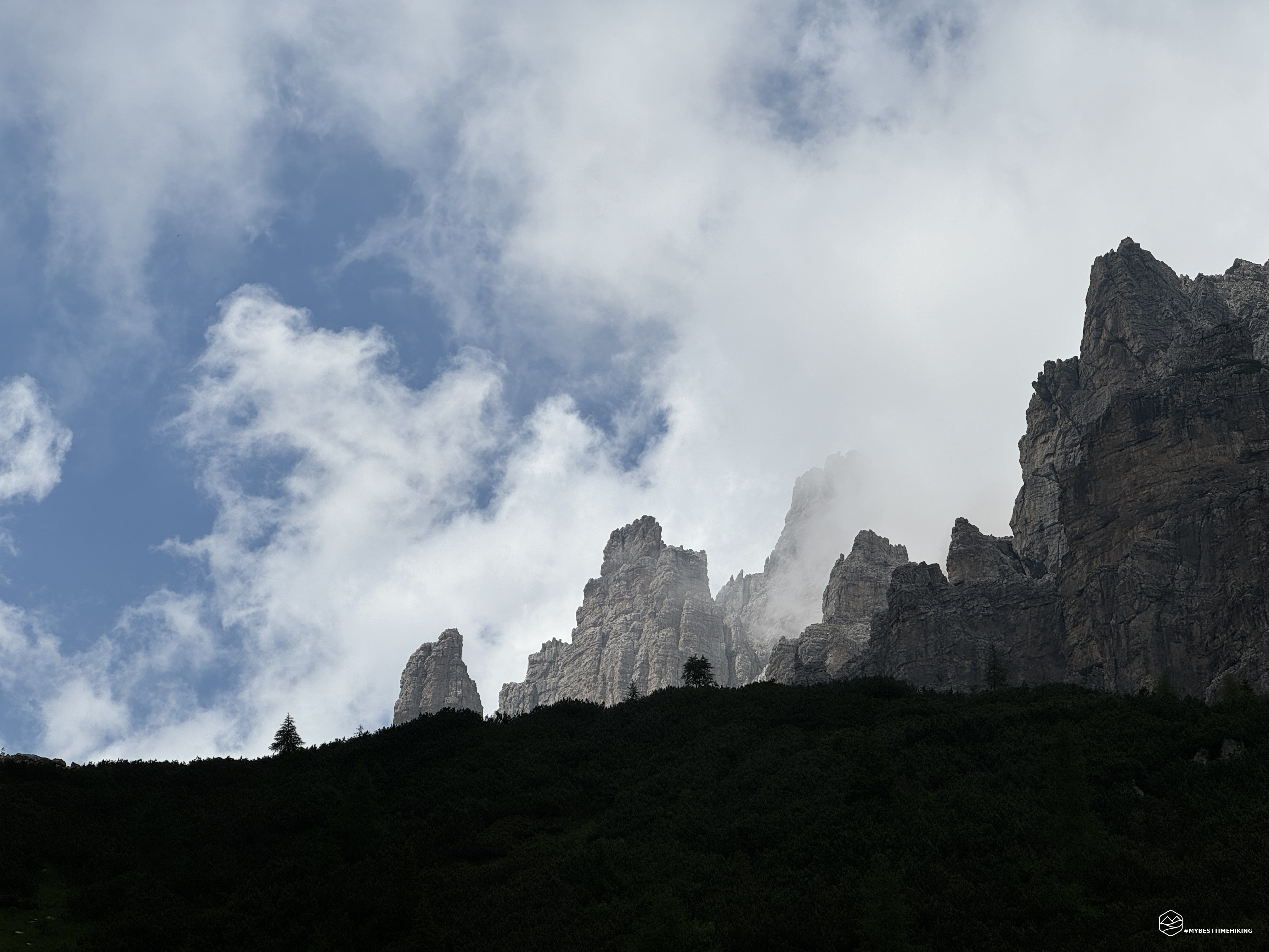
We arrive at an altitude of about 1925 meters at the height of the last detour in the presence of a large boulder. From here we see the last strip of vegetation and the gray of the final scree at the fork begins to predominate. In front of us, heading south, we have the imposing towers of Crodon di Giaf, the Monfalcon di Forni with the legendary scree of its fork, made in a fantastic adventure 18 years ago (a cue for a future excursion to retrace the same route and recall emotions never forgotten!). The view to the south ends with the Torrione and the Torre di Forni which with its unmistakable silhouette stands out on the town of Forni di Sopra which, from this altitude, we can already see emerging in an eastward direction. To the north, the rocky protuberances of Mount Vallonut herald the Torre Criodola and the homonymous Mount Cridola still partially hidden from our view. We continue in a rapid zigzag on easy scree, we pass the last bastion of mountain flora. More rocks, more scree up to an altitude of 2043 meters: Forcella Scodavacca!
Date
14-07-2024
Distance
10.36 KM
Hike type
Hike
Ascent
1010 mt
- Mountain
Monfalconi
- Address
Forni di Sopra, Friuli Venezia Giulia, Italy
- Altitude
2054.00 m
- Refuges
Rifugio Giaf
- Information
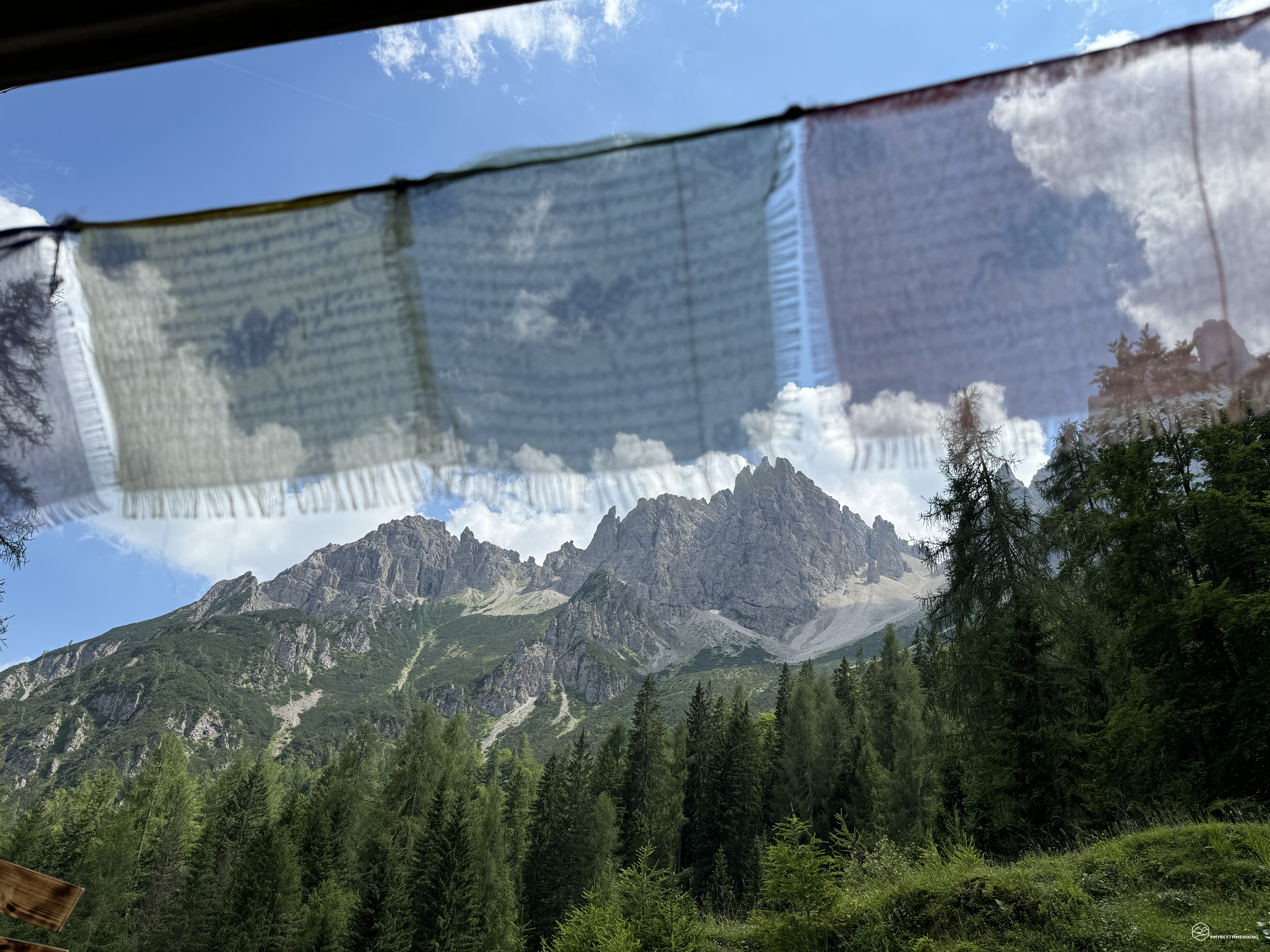
We are at the pass, 2 hours and 40 minutes after departure. To the West, Cadore and the Padova refuge a few hundred meters below us. The legendary Torre Berti that stands out in a southerly direction seems to almost fall towards us. On the opposite side, the Tacca del Cridola and the immense dolomitic mass of Mount Cridola, a wall that seems to protect an enchanted world behind it. In the middle, the view towards Friuli and Forni di Sopra. The Scodavacca pass is a pass that holds a particular charm. Easy to reach, it is a crossroads for numerous excursions that range from the simple daily crossing to the Alta Via number 6, passing through more mountaineering adventures such as the summit of Cridola. A pass also appreciated by chamois, which we see in the distance in the impervious valley between Vallonut and Cridola. A break is a must to enjoy this wonder. The clouds add magic to the moment by hiding and showing the characteristic spires that surround us.
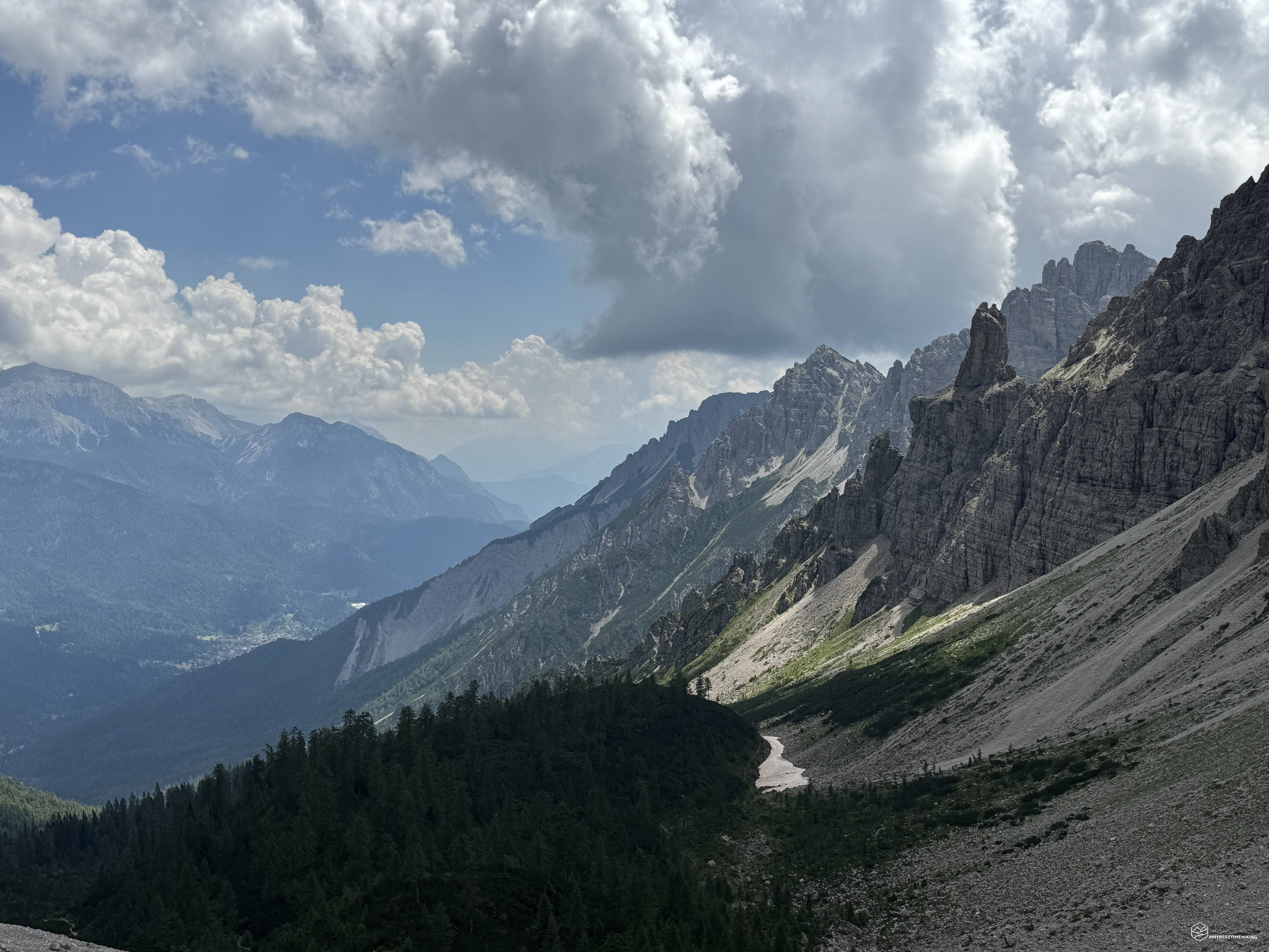
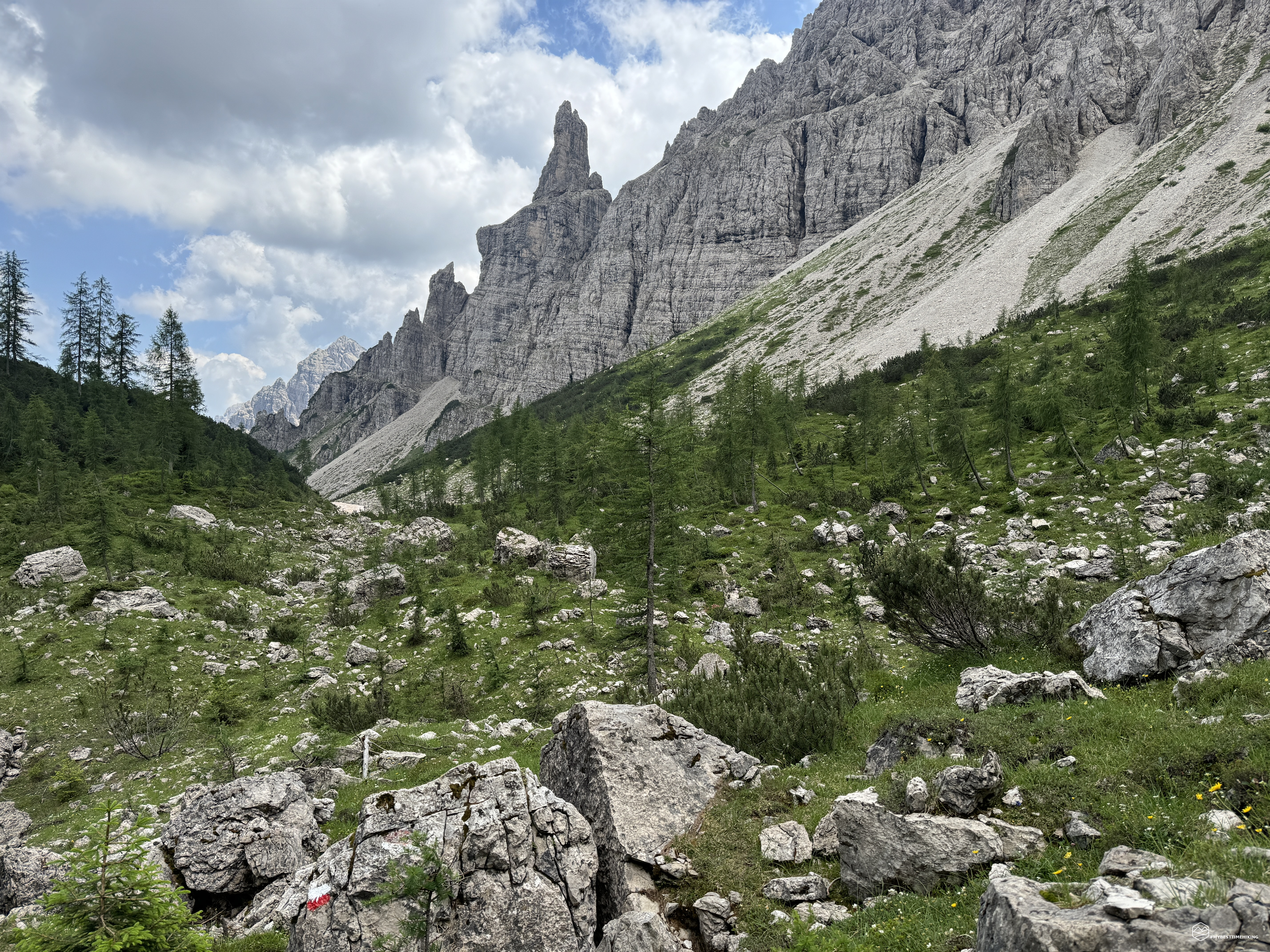
We retrace our steps to the boulder with the deviation described previously. Here we take the CAI 354 path that crosses the end of the scree of the Monfalcon di Forni fork and the subsequent fork from Las Busas. The trail continues practically at altitude at about 1750 meters, skirting the scree and allowing us to walk on the very easy beaten earth. We arrive in an area with a characteristic shape that seems lunar between boulders arranged in a disorderly manner and a small snowfield covered with Saharan sand that resists undaunted by the great heat of these days. At about 1725 meters we reach the deviation of the path set for the return: the Anello di Bianchi.
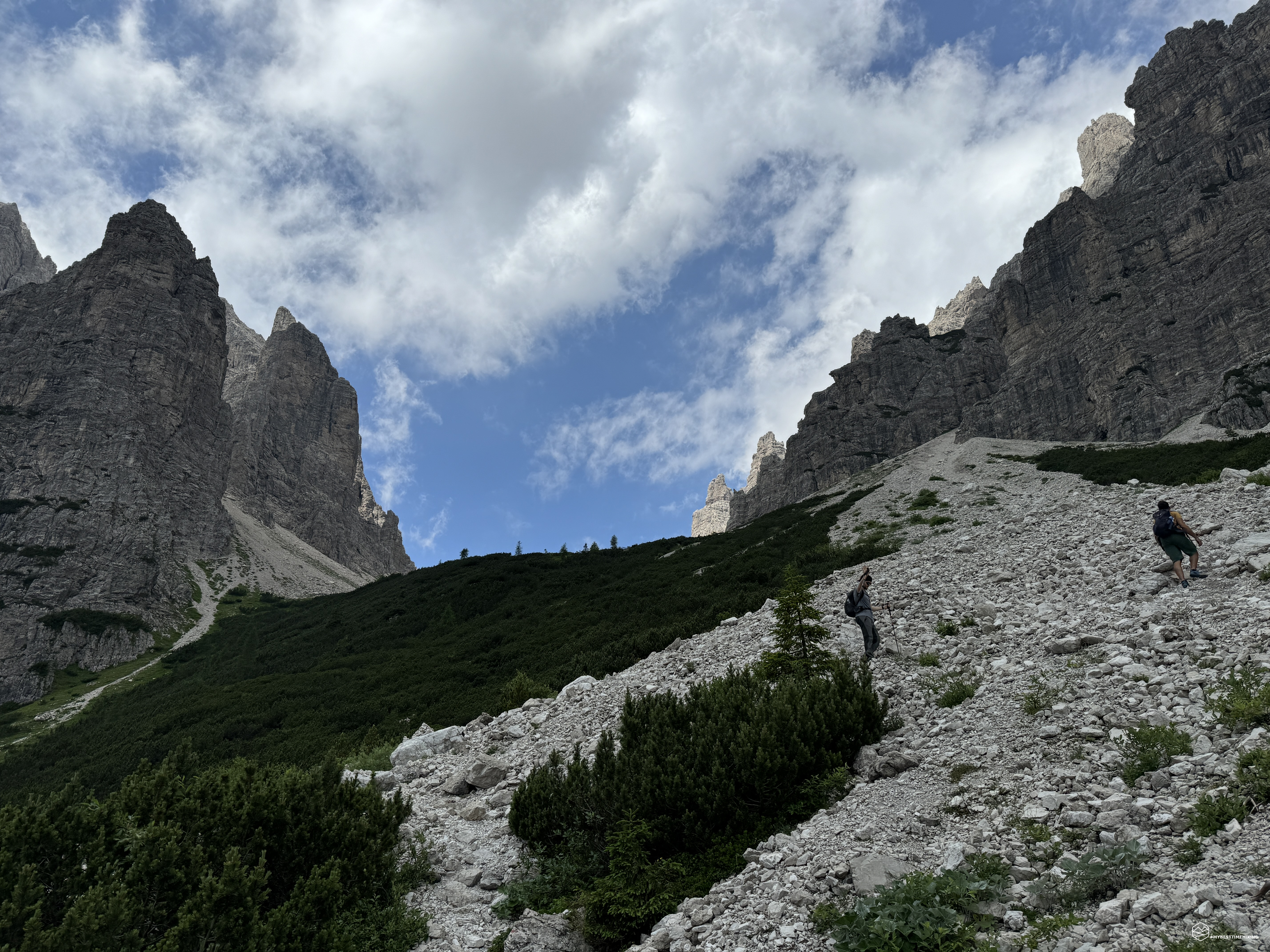
We chose this stretch of path to complete a small ring and enjoy a splendid view of the Costone di Giaf from another angle. But, more importantly, to walk a path in front of the legendary Torre di Forni. Just below the spires of this peak, immersed in the scree, we notice a couple of chamois that stop their progression to observe these oblong and strange individuals that are disturbing their peace ... We continue on a path practically at altitude on a path covered with mountain pines towards the mountain and almost steep on the side of the Costone di Giaf. The route is never dangerous but still requires a steady step. You quickly arrive at a pass, or fork, that actually goes around the Forni tower, with a small summit attached from which it is possible to admire the entire route done on this excursion. In the background, the crack between the Dolomites formed by the Scodavacca fork recently left. At this point there is also a plaque indicating "Pure high altitude lariceto". We leave the pass and thus begin the descent encountering the most particular passage of the day: a couple of meters on rock and landslide terrain accompanied by a safe rope for safety. Not difficult at all and very short, it is a passage that should not be taken lightly.
We thus arrive at the last crossroads of the day and we hook onto the path that descends from the Cason fork becoming a CAI 361-342 signpost (always Anello di Bianchi). This last stretch turns out to be the hottest for the actual immersion in the mountain pines! Over 2 meters high, they create an infernal blanket that invites us to travel the path as quickly as possible. We quickly reach the dirt road that, with a couple of hairpin bends, plunges us back into the conifer forest and then to the Giaf refuge where a long-awaited cold beer awaits us.
The return to the car park takes place along the same path as the ascent, alongside the Giaf stream, which always offers original views not noticed on the outward journey.
This fantastic adventure between Friuli Venezia Giulia and Veneto ends, among the most authentic and wild Dolomite peaks. Less famous places, little known and, for this reason, rich in authentic details, still uncontaminated: identity of a still true mountain. An adventure for hikers of average training. I consider only the part related to the Anello di Bianchi for hikers a little more expert.
DifficultyExpert hikers - are generally signposted itineraries but with some difficulties: the terrain can consist of slippery slopes of grass, mixed rocks and grass, stony ground, slight snowy slopes or even single easy-to-climb rocky passages (use of hands in some places) . Although they are routes that do not require particular equipment, equipped sections can be presented even if they are not demanding. They require a good knowledge of the alpine environment, a safe step and the absence of vertigo. Physical preparation must be adequate for a fairly continuous day of walking. |