


It is a day at the end of June in Alta Badia, in San Cassiano, with full sun and a perfect temperature. Today's adventure will take us to a magical amphitheater in the Fanes-Sennes-Braies Dolomite park.
We reach the Capanna Alpina, in the Artmentarola area, where a convenient and large paid car park allows you to park in complete tranquility. The cost is €10 for the whole day. A few meters away is the Capanna Alpina, a characteristic restaurant from which you can already enjoy a splendid view of the nearby Conturines and the Sella Group in the distance.
We prepare properly, backpack on our shoulders and begin today's excursion with the aim of reaching Malga de Gran Fanes!
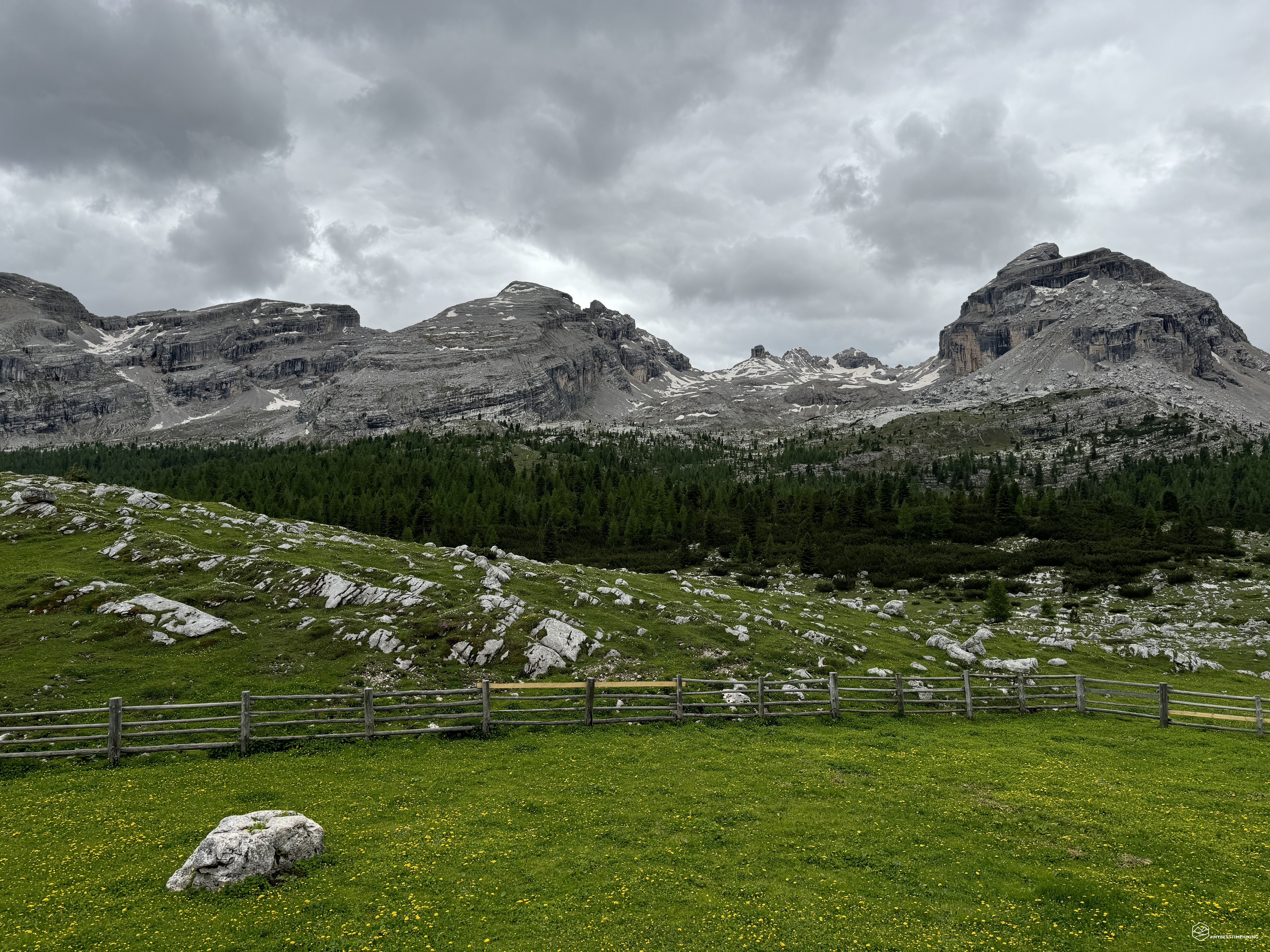
We are in Val Scairè where Pian dal'Ega presents itself to us in all its splendor after a row of fir trees that hide it. In front of us the sun peeks out behind the majestic Piz da Lech in the direction of the Scotoni refuge and imagining the Lagazuoi behind it. The plateau is dotted with fir trees, playful streams and grazing cows. At the obvious crossroads with CAI signs, we take path number 11 which goes into the heart of Val Sciarè towards Col de Locia.
After crossing a first wooden bridge over the tumultuous Ru Sciarè, we continue on a small collapsed stretch with gravels carried by the force of the water until we reach a well-trodden and clear path that insinuates itself into the thick vegetation. Several wooden planks placed tactically between the rocks allow you to proceed in a constant but never tiring climb until you reach a plateau surrounded by greenery called Plan de Furcia, where fir trees and rhododendrons cheer up the view with the sun peeking through the branches.
Once out of this green spot we find ourselves open to a stony section at an altitude of 1955 meters where we climb decisively until we reach an obvious tortuous staircase with wooden parapets. It seems like a very long and endless staircase, very comfortable due to these large steps for easy access and progression. On one side, the rocky wall of a terminal tongue of the Piz da Lech from which jets of water shine. On the left side, however, a continuous evolving panorama between the majestic Sella group in the distance and the imposing pink wall of the Piz de Conturines.
A couple of characteristic hairpin bends protected by high rock walls on both sides allow us to exit into a green area: we have arrived at Col de Locia! After about an hour's walk we reach an altitude of approximately 2070 metres, on this splendid panoramic plateau. From Piz de Lech to Conturines which frame the Sella group "supported" by the pleasant green meadows of Piz Sorega. The whole of Alta Badia seems at our feet. Continuing the panorama you can see the pinnacles of Cima Scotoni and the rocky agglomerations that herald the Lagazuoi. The first Zimes de Fanes appear and on the opposite side Piz Taibun. In the center is the route we must take now which introduces us to the Val di Fanes.
We always follow path number 11 where a new pretty wooden bridge over a stream welcomes us. The fir trees give way to mountain pines which almost create a protection for the route we are following. Suddenly, at a fossilized centuries-old trunk on the path, a fabulous view opens up on the Conturines group with the Ru Sciarè at its base which is colored a golden yellow ocher which offers an incredible postcard. Continuing the path of the stream with your eyes you can also glimpse the Queen of the Dolomites in the distance: the Marmolada and its shining glacier.
Date
27-06-2024
Distance
13.78 KM
Hike type
Hike
Ascent
605 mt
- Mountain
Zime de Fanes
- Address
Val di Fanes, Veneto-Trentino, Italy
- Altitude
2161.00 m
- Refuges
Malga Ütia de Gran Fanes
- Information
Between gentle ups and downs we reach the heart of the Val di Fanes surrounded by an almost magical environment, among golden streams, the Zimes de Fanes on one side and the Conturines on the other. The eye has no way of getting bored, it is a continuous discovery of ravines, incredible glimpses between water, earth and sky. Cows grazing near the deviation towards the Forcella dl Lech make this place a real fairy tale. We soon reach Le Gran Plan where an expanse of small yellow flowers dot this bright green meadow where a thin earthy trace crosses it in the center allowing us to pass it while remaining enchanted.
The landscape changes again and takes on a "lunar" shape with an expanse of large and small boulders that quilt the grassy and irregular bumps of a new spectacular plateau. Almost immediately I identified the area as a possible metropolis for marmots and, in fact, if we looked carefully we saw plenty of them close to us. Some in the distance scrutinize us, follow our steps to understand our movements. They return to their burrows and emerge a little further on, checking our moves. The closest one is a few meters from the path, I can move furtively and, without disturbance, I stand next to the lookout hole to immortalise this splendid animal in photos.
Accompanying us in this dream is always the sound of the streams that change from tumultuous to gentle streams bordering the grass. A combination of mountain and water that opens the heart. Truly indescribable landscapes that characterize the Val di Fanes as a pearl of different colours.
We see the Malga de Gran Fanes in the distance, we cross the last wooden bridge and, less than 3 hours after departure, we have reached the destination: Ütia de Gran Fanes!
A lovely refuge surrounded by greenery with a large outdoor terrace where we can enjoy local delicacies sitting comfortably with the splendid view of Monte Ciaval, the Pizes de Furcia Rossa, the Croda del Valon Bianco and, in the background, the segment of the unmistakable mountain Crystal! The Ru de Fanes flows protected by these peaks on the orographic right side, while on the other the majestic panettone of Col Bechei delimit this splendid Val di Fanes which converges towards Cortina d'Ampezzo. From here a myriad of paths and routes also suitable for MTBs allow you to reach the nearby Fanes refuge, or continue to the Sennes refuge, the Biella refuge and climb the Croda del Becco to descend back to Lake Braies.
A barley soup and a plate of eggs, speck and potatoes refresh us with the energy needed to undertake the journey back. We remain to admire these splendid mountains for some time, the spiers formed over the centuries and the stratifications of the various geological eras when the Dolomite peaks were formed, little by little, below sea level.
We carry out the return along the same route as the outward journey, identifying details that we had missed or were hidden during the morning's progression. The excursion always reveals new emotions and views even without necessarily completing a circular tour as we usually tend to organise. In less than 2 hours from the mountain hut we return to Col de Locia, an obligatory stop to give a new postcard to our eyes. We descend through Val Sciarè and return in just over 30 minutes to the Capanna Alpina where this fantastic and wonderful adventure ends!
A long excursion (14km) although with a limited difference in altitude (600 metres) which I recommend to those with a minimum of physical preparation. The long distance and the constant ups and downs could be tiring if you don't have some training. I truly invite everyone to walk these streets and get lost in their imagination among the film settings that the Fanes valley offers. The mind also travels unconsciously during trekking in these places: the thought touches the surrounding peaks and the only moment of total relaxation is at Malga de Gran Fanes. The rest of the day you will waste yourself chasing emotions to save them as much as possible in your memory.
DifficultyHikers - Itineraries on paths or evident traces in various types of terrain (pastures, debris, stony ground ...). They are generally marked with paint or cairns (pyramid-shaped stacked stones that allow you to identify the route even from a distance). They can also take place in snowy but only slightly inclined environments. They require the equipment described in the part dedicated to hiking and sufficient orientation skills, walking training for a few hours. |