


After copious days of rain, together with our friend Tomaso, we decide to reach the Belluno Prealps to enjoy a day of splendid sunshine. We pass the Cansiglio plain and reach the town of Tambre, more precisely the Cate mountain hut, at the end of an asphalt road. The car park already has a magnificent view of the "garden of Belluno": the Alpago. The eye already ranges from Lake Santa Croce to the top of Mount Dolada.
Today's objective is Mount Caulana, across the ridge that forms between the Sestier fork. The preparation is slower than usual given the care with which we cover ourselves with anti-tick repellent. The Alpago area, like all pre-Alpine areas, is infested by this hateful parasite.
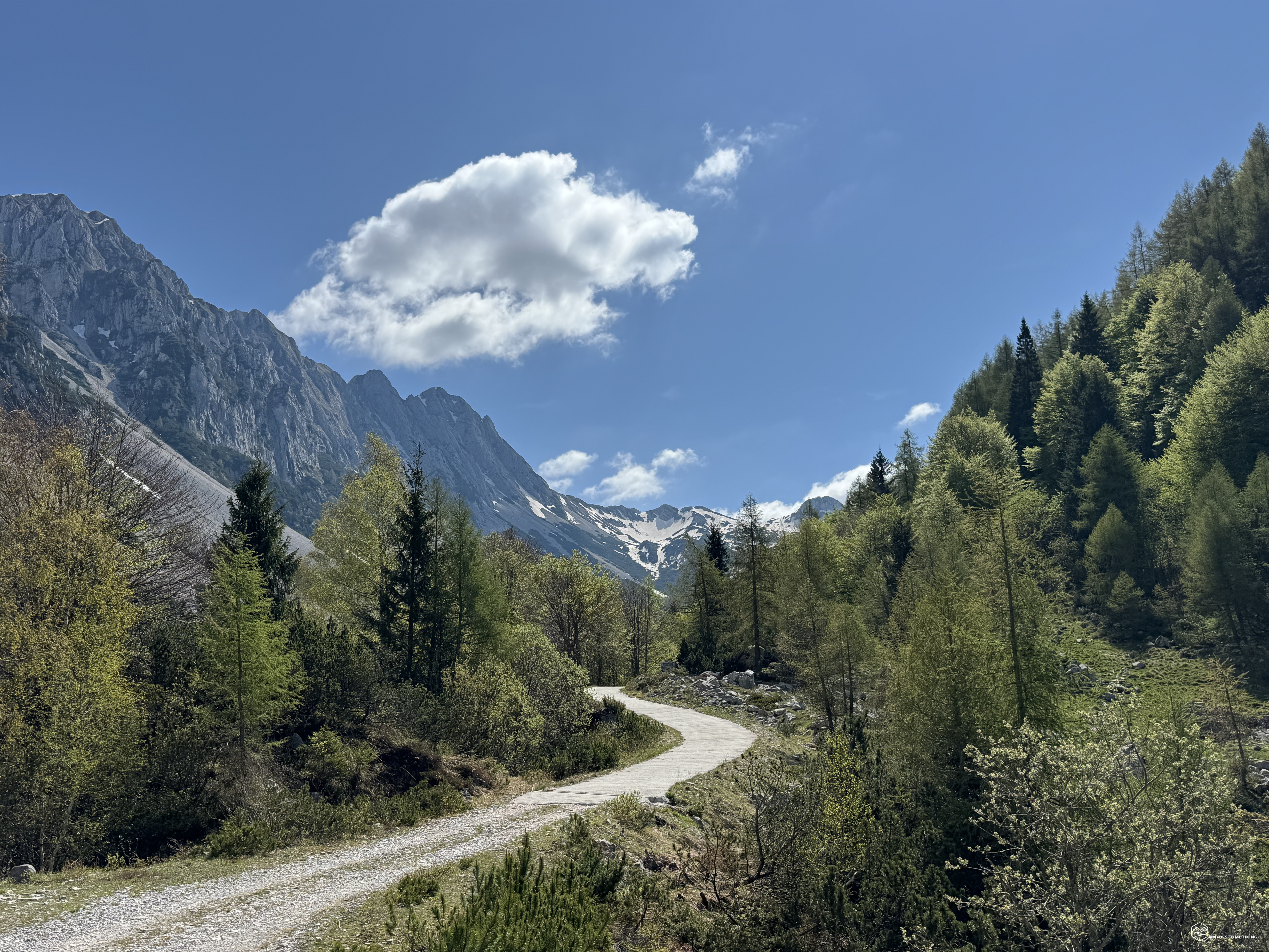
Backpack on our shoulders and we take the comfortable asphalt road that runs alongside the mountain hut. Clear indications point out the valley that we will explore in its entirety: Val Salatis. We then proceed on CAI path 924 and head towards the North-East.
The road is a constant but never excessive climb, it has a couple of hairpin bends allowing you to gain some altitude quickly. Soon you arrive at an open space where there is a wooden bench from where you can enjoy a splendid view of the entire Alpago and Lake Santa Croce.
We continue on a wide asphalt track up to approximately 1300 metres. From here the road remains wide but becomes stony. We leave the beech and conifer grove to emerge into the actual Salatis valley. In front of us the Dolomite chain of the Messer, of Monte i Muri and the Sestier at the bottom. With their steep forks reachable only by stony screes that seem inviolable. On the other side, however, the imposing Guslon chain where we immediately notice a beautiful blanket of snow.
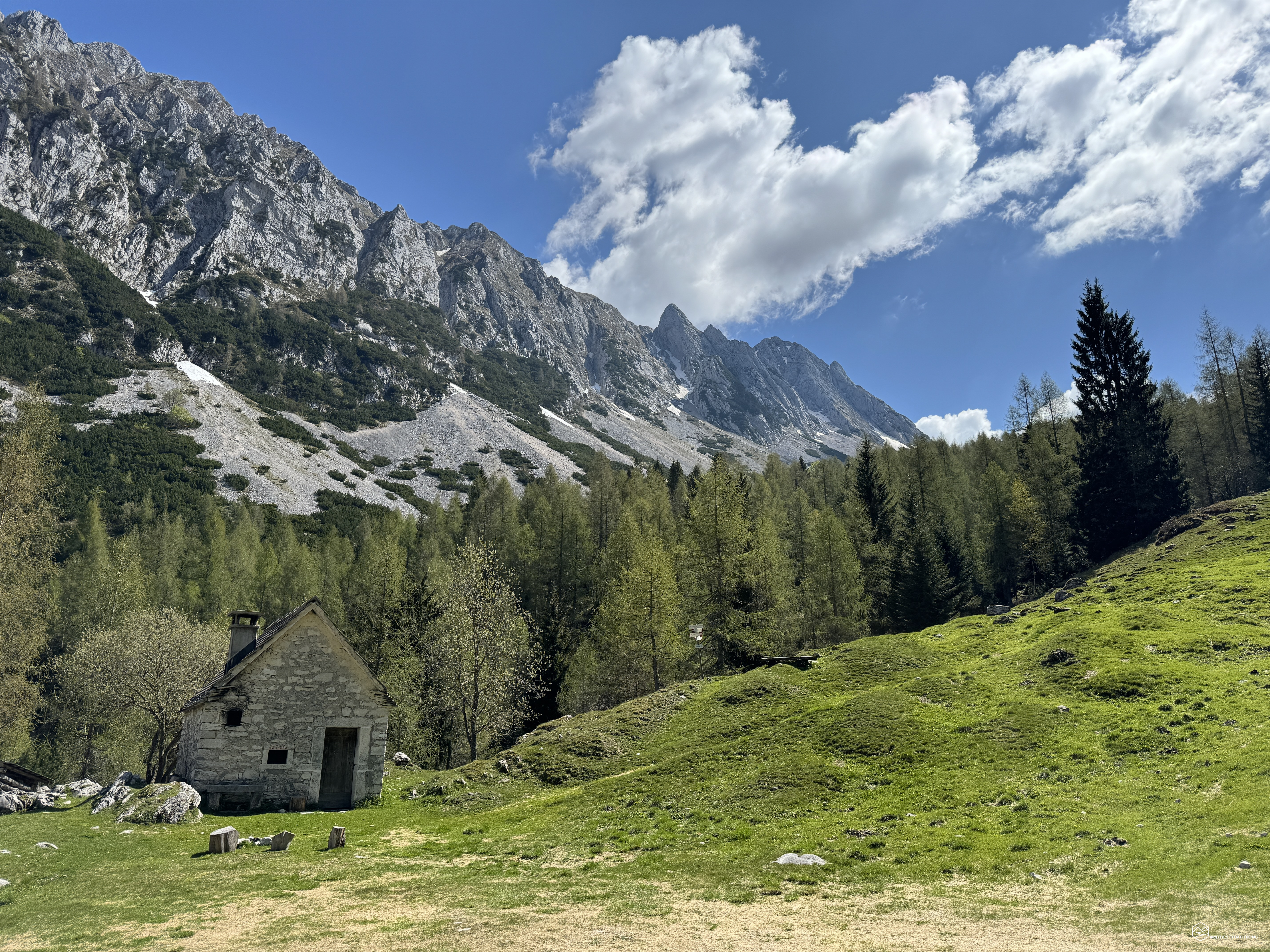
We continue on the road which becomes asphalted again until we reach the Stalla Campitello at 1392 meters. A renovated and well-kept early 20th century complex. During the mountain pasture period, the cows were herded here during the night. Not far away it is possible to notice a series of stones that almost form a circle: the Moltrin. Circular in shape, it consisted of a stone wall with a large opening that allowed access for the animals gathered to be milked; after their entry the enclosure was closed with a wooden fence (doors). At the opposite end there were three thin openings, called Moldidor, where, three by three, the animals to be milked were pushed. Behind them the shepherds sat on three large stones that served as stools. Once milked, the sheep left the pen across the Moldidor. The milk was transported on shoulders to Malga Cate where the "Casel del lat" was located where it was processed.
Date
11-05-2024
Distance
10.73 KM
Hike type
Hike
Ascent
741 mt
- Mountain
Sestier
- Address
Alpago, Veneto, Italy
- Altitude
1800.00 m
- Refuges
- Information
We leave the stable and soon arrive at a gem of Val Salatis: the Casera Pian de le Stele (1492 metres). Isolated at the end of a grassy plateau, this bivouac is a combination of mountain rurality and a strategic position in the valley. In the center of Val Salatis, from here you can leave for the most diverse destinations: the Semenza refuge, the Lastè peak, the Cimon del Cavallo (Cima Manera), the Sestier and the Caulana. The interior is clean and there is a comfortable attic for sleeping.
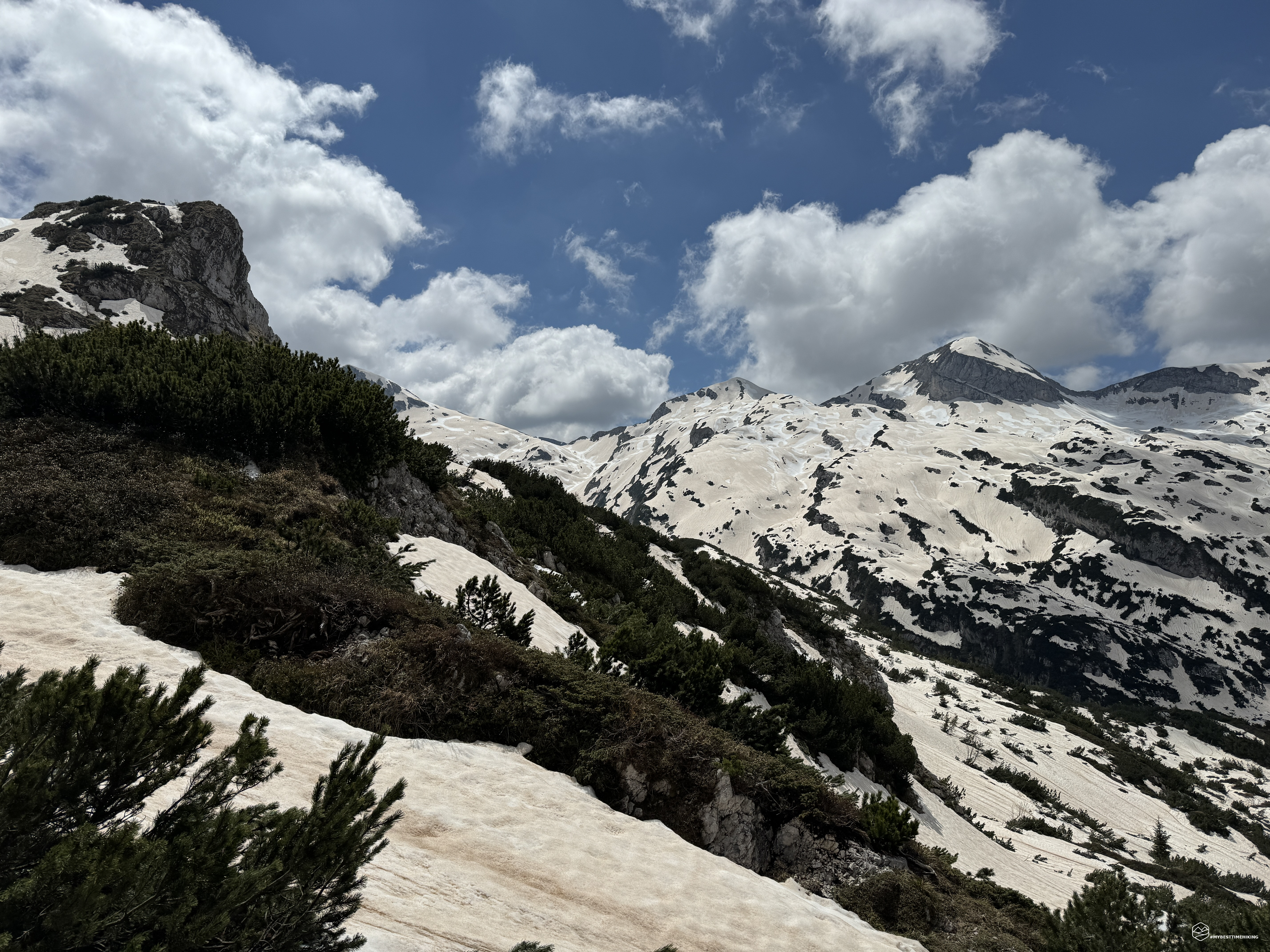
We continue on path 924, always towards the North-East in the direction of the Setier fork. The track increases the percentage of the climb but does not yet become excessive. We enter a beech and conifer forest and, already at an altitude of 1550 metres, we notice the first patches of snow. The grove immediately gives way to a stony ridge that we must cross, paying close attention to the tongues of snow still present. Snow is a particular state: it doesn't melt because temperatures are mitigated by a cold wind that keeps them low, but it isn't compact either. It's a mushy, rotten concoction that doesn't allow for rapid progression.
We arrive at the Forcella delle Federe, a fundamental crossroads for reaching the surrounding destinations. In front of us the corolla of mountains which already offer a splendid panorama. The thing that worries us is the abundance of snow cover!
We take the track that will rejoin the Sestier fork and the CAI 928 path. The track is not clearly visible, the red dots only peek out on some rocks on which the snow has already melted. The snow here is not immaculate white, but has brownish veins, residues of the Sahara sand brought in by various precipitations in recent months. Also for this reason the snow is unstable and unsafe. With every step we don't feel steady on our feet and the worry of sinking without knowing what's underneath arises.
We now proceed on the track where the path should be, now on the rocky ridges that make up Val Salatis. There is no snow on the ridge, but climbing these steep and orange ridges does not improve our safety. At an altitude of 1800 meters we therefore decide to give up. We stop 3/4 of the way through the planned adventure, 100 meters from the Sestier fork which stands out in front of us. The panorama that offers us from this position is also memorable: from Cima Val Grande, Cima lastè, the fork of the same name, the Guslon, the Messer towards the West and, in the center of the valley, almost like a vanishing point of our eyes , the legendary Alpago and Lake Santa Croce. In the background the Dolada, the Cime de Zita and the Talvena.
We refresh ourselves and enjoy this magnificent view anyway.
Let's retrace our steps, gradually choosing the best track among the pines and less dangerous rocks. On the snow, then, Tomaso enjoys going down as if he had skis on his feet. I, however, confirm my inability to ski and sink disastrously into the snow, breaking a ski pole, but without suffering any physical damage. We return with considerable speed to the Casera Pian de le Stelle, to the Campitello stable and, finally, to the Cate mountain hut.
An exploratory adventure that was only a reconnaissance for the next adventures and to try to finally reach the Caulana and, who knows, also the Sestier sima with its sharp crest. A very simple excursion suitable for everyone up to the Casera Pian de le Stele thanks to the wide, gentle and comfortable path. For slightly more trained hikers to reach the amphitheater heart of Val Salatis and breathe in its uncontaminated nature.
DifficultyHikers - Itineraries on paths or evident traces in various types of terrain (pastures, debris, stony ground ...). They are generally marked with paint or cairns (pyramid-shaped stacked stones that allow you to identify the route even from a distance). They can also take place in snowy but only slightly inclined environments. They require the equipment described in the part dedicated to hiking and sufficient orientation skills, walking training for a few hours. |