Early February, the days are finally starting to get longer. The unhealthy idea comes to me to retrace a path mentioned by Mauro Corona in his book "Le Cinque Porte". What better companion could I have chosen than Diego for this exploration that tastes wild just at the thought of it. Today's goal is to access the remote Val Vajont!
Not to be confused with the Vajont Valley where the towns of Erto and Casso overlook. The Vajont Valley where a timid lake still remains in the presence of the fateful Mount Toc is the, unfortunately, famous valley that has imprinted in our minds the tragedy of 9 October 1963. Further north, before arriving at the S. Osvaldo pass, as soon as you pass Erto, a narrow valley winds up on the right, where the Vajont stream rises between narrow and sinister canyons: this is our destination today!
While we are in the car to reach the valley, Diego, after having informed himself as usual about the itinerary we would like to undertake, makes me feel a little anxious by labeling this valley as "The Devil's Valley" due to its sheer walls visible from the street. I can't wait to leave, well aware that we could retrace our steps even before we begin...
We reach Longarone, we go up the tortuous hairpin bends in the direction of the Vajont dam. Casso and then Erto, up to the hamlet of San Martino with a modern church on the side of the road. A little further on, on a curve to the left you can notice a narrow road that goes down. At this crossroads, a roadside clearing becomes our car park.
While we prepare we can already take a look towards the shady Val Vajont in front of us. I already label it "shady" because the sun comes to warm us in this morning which is just below zero, but towards the narrow valley you can still see darkness and darkness. We go down the asphalt road which is in fact the parallel to the state road that runs along the left orographic side of Lake Vajont. The further we go down, the lower the temperature becomes, real ice waterfalls begin to be seen on the side of the road. Now a thin layer of frozen frost completely covers the asphalt surface before the entrance to a short tunnel. It is right here that on our left, a narrow and steep staircase (completely frozen) climbs up which indicates the CAI 903 path towards the top of Mount Cornet and the hut of the same name. No mention of Val Vajont or Casera Carniar.
I fasten my crampons and we proceed up the stairs which immediately make us gain some height difference. Even at the end of the stairs, the dry grass that proceeds in a beech forest maintains a slippery layer due to the thick frost that covers it. We soon arrive at the small church of S. Antonio in Therenton on a splendid natural balcony overlooking Erto. Here the crossroads with clear CAI signs indicating the old path 901 which leads to the now disappeared Casera Feron. The route is clearly marked as unusable, so this report is in no way intended to be an invitation to retrace this itinerary.
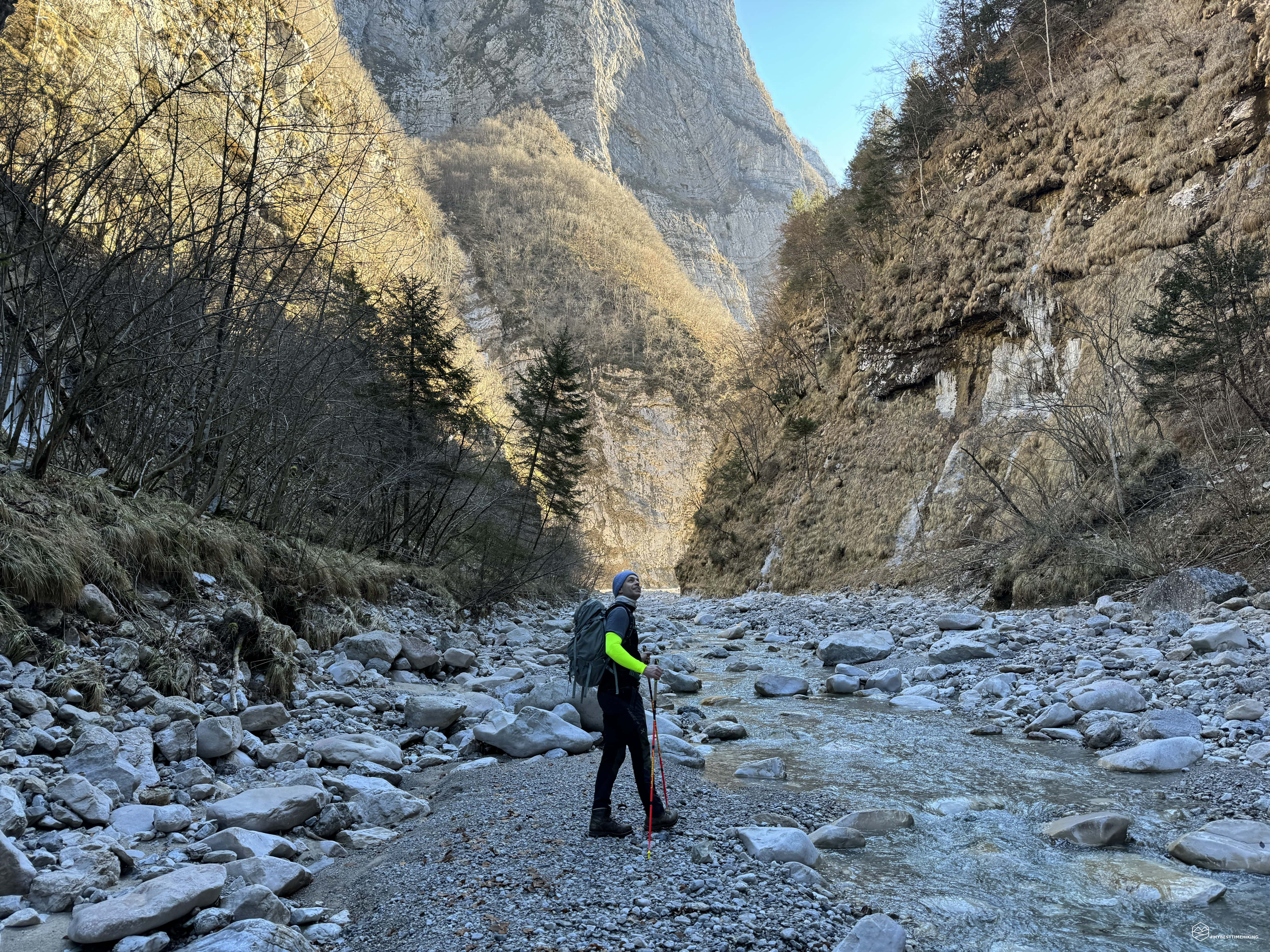
The strong and clear signs immediately warn us of the difficulties we might encounter and reinforce the definition of "Devil's Valley" coined by Diego. We proceed along a path that becomes increasingly narrower with unstable foliage that does not allow us to clearly understand where we are putting our feet. The beech trees thin out. We are at the entrance to Val Vajont, we can almost touch the vertical wall on our right at the base of Mount Zerten. The rushing torrent below us is almost silent 200 meters below. The path changes its face and becomes a grassy, thin, thin, dangerous ledge. To our left a straight wall runs towards the top of Mount Cornet, our feet follow a track no more than a meter wide, alongside... nothingness: a leap into the void without handholds towards the swirling Vajont torrent visible even without the need for lean over. We proceed quickly but pay attention to every step.
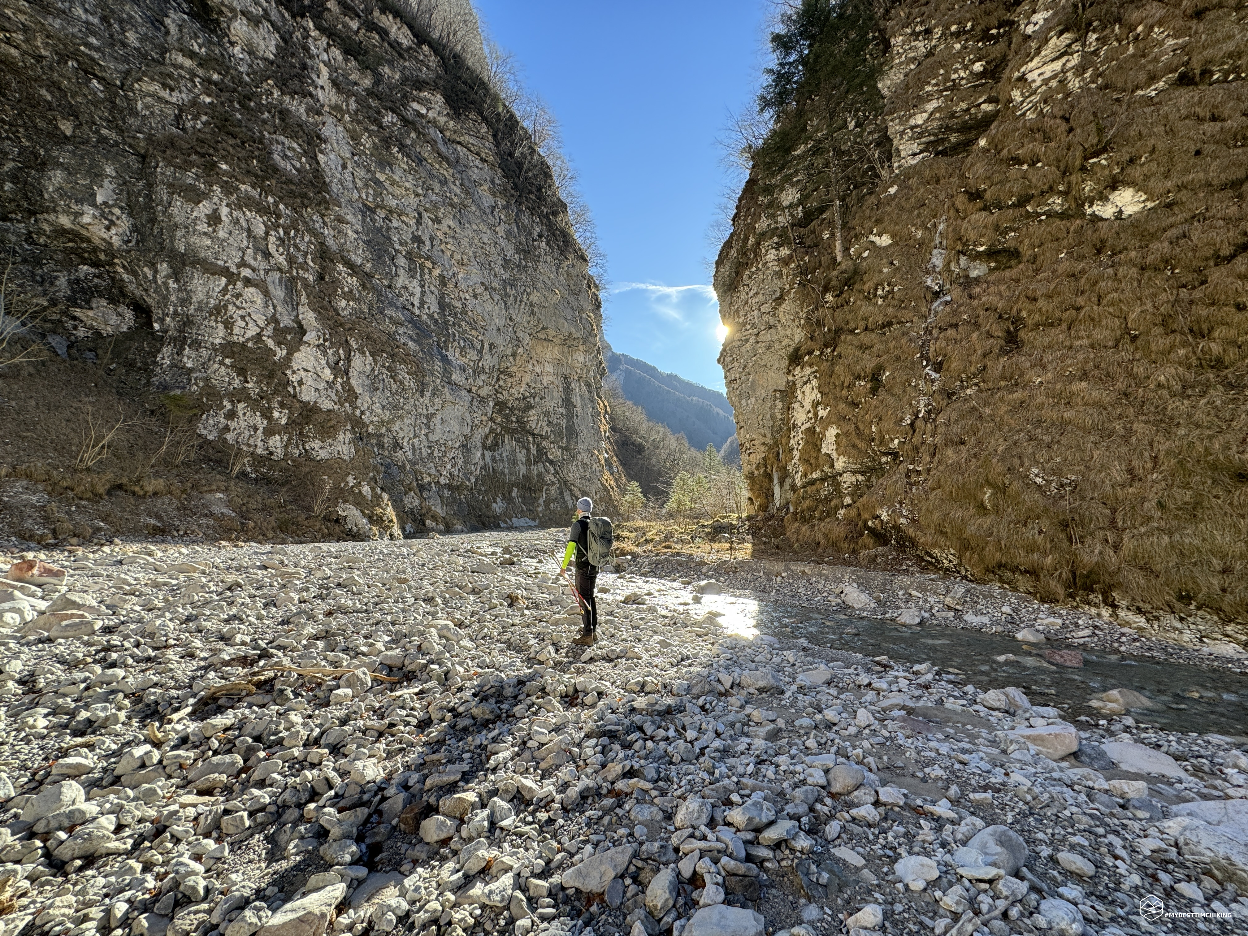
We emerge on a rocky slab that extends towards a large and steep landslide also facing in the direction of the stream. On the rock, before the stony landslide, there is a red writing "Gefahr", "Danger" in German. This is most likely the difficulty and criticality that led to the closure of the entire itinerary by the Italian Alpine Club. The scree is very inclined, no more difficult than many others already traveled. The only perplexity is in front of us and it is a practically vertical landslide wall of 2-3 meters which does not allow us to verify how the track is proceeding. As we get closer, I see a tape and a rope hooked to a tree at the top of the earthy wall. With these supports we can easily overcome the problem. The path now continues easily, downhill towards the river bed.
Thus we arrive on the banks of the Vajont stream, at this calm point and with a flow rate that occupies only a third of the bed. We are about to enter the imaginary "Red Door" that Mauro Corona describes in his book "The Five Doors". Right here he recalls a childhood memory where, as a child, on this riverbed he went in search of liver-coloured stones, the ones where the frost did not stick. They were the best rocks for sharpening knives. Even today, on this very cold day, these particular stones are easily distinguishable. We proceed in a southerly direction in front of the verticalities of Zerten and Cornetto.
We are astonished when we find in front of us a large block of dark gray tufts of fur torn to almost form a carpet. The tufts of hair are torn cleanly and visibly extracted with a very powerful surgical bite. Not far away is a real crime scene with streams of congealed blood, pieces of bones, entrails and the same gray fur. We don't find the carcass, so we imagine that the prey was transported to be consumed at a later time. The blood appears recent, almost fresh, but we don't know if it was preserved that well by the cold temperatures in this gorge.
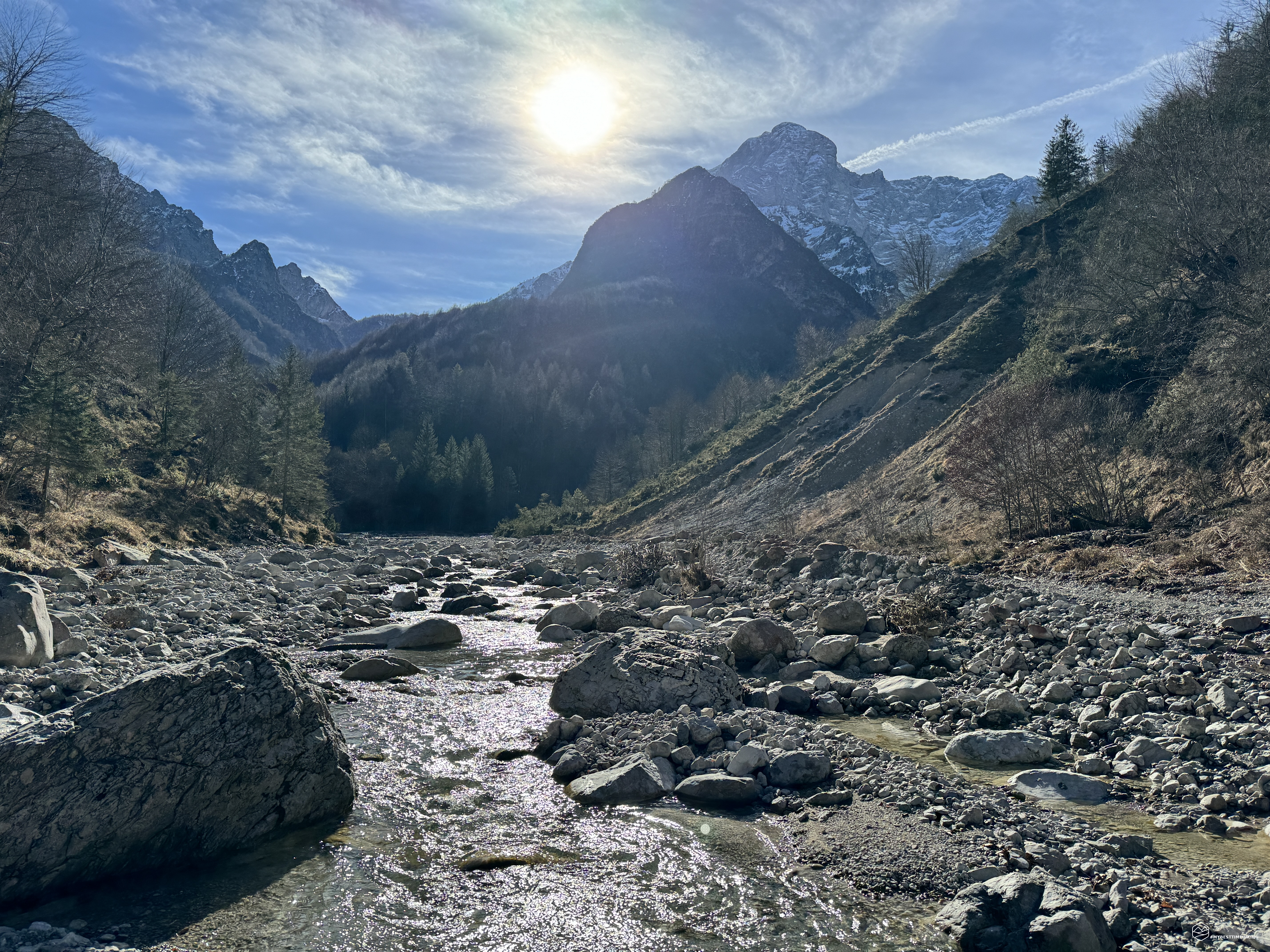
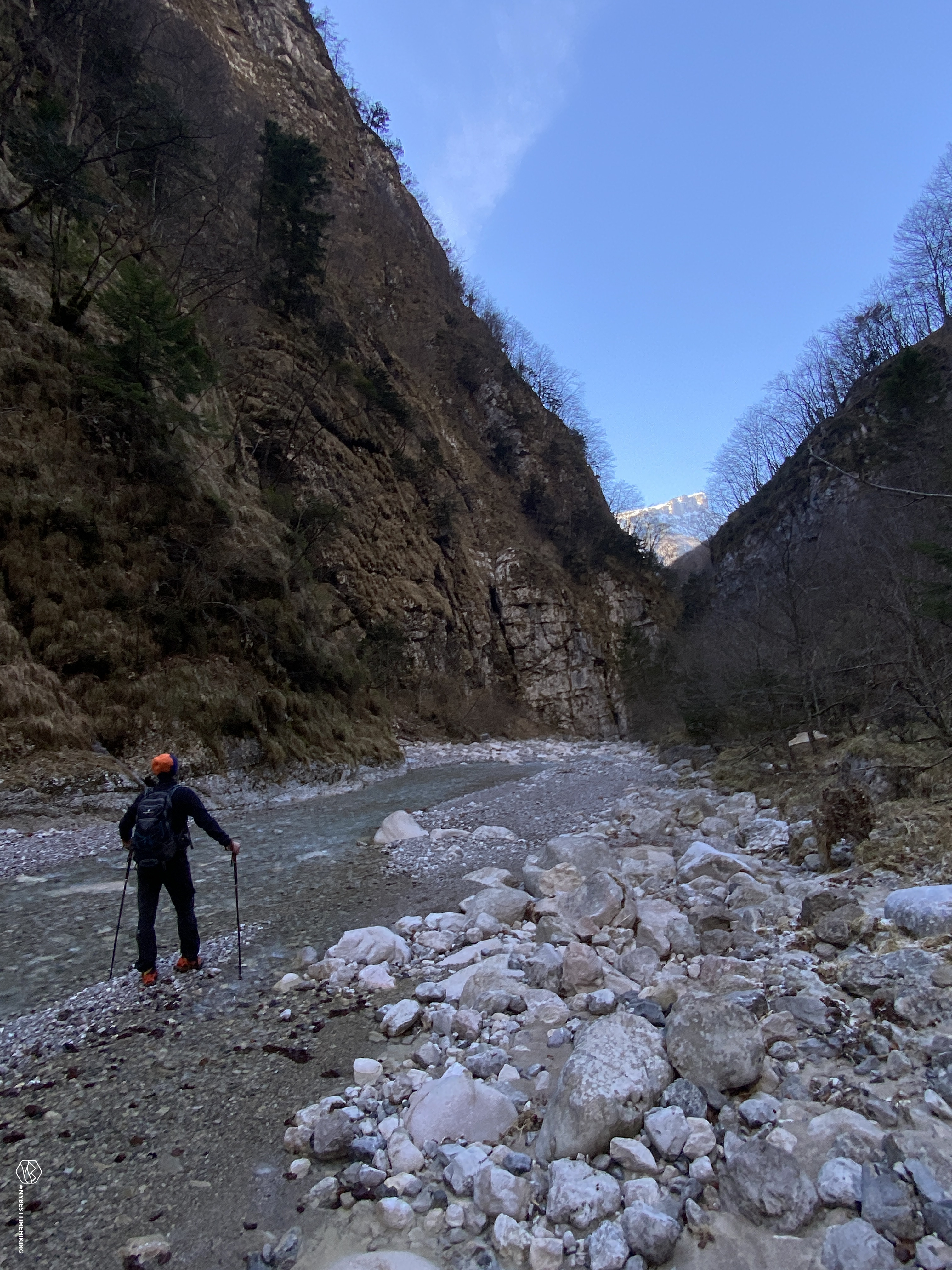
We continue in what increasingly turns out to be a gorge, the sun is still a distant mirage. Cold and damp always reign supreme. Further ahead we glimpse some warm rays, and we increase our pace to reach them. The ice between the rock interstices forms timid still waterfalls and the thinnest unstable stalactites. A large bend to the right hosts a small fork in the stream, the light filters and bathes the brown vegetation on the banks with a straw yellow. The heat envelops us for the first time of the day and gives us a regenerating warmth. We move to the left orographic side of the stream and proceed now on the riverbed, now on the grassy crag that welcomes us with a trace of the old path now almost completely erased.
Date
04-02-2024
Distance
14.13 KM
Hike type
Hike
Ascent
373 mt
- Mountain
Monte Cornet
- Address
Val Vajont, Friuli Venezia Giulia, Italy
- Altitude
873.00 m
- Refuges
- Information
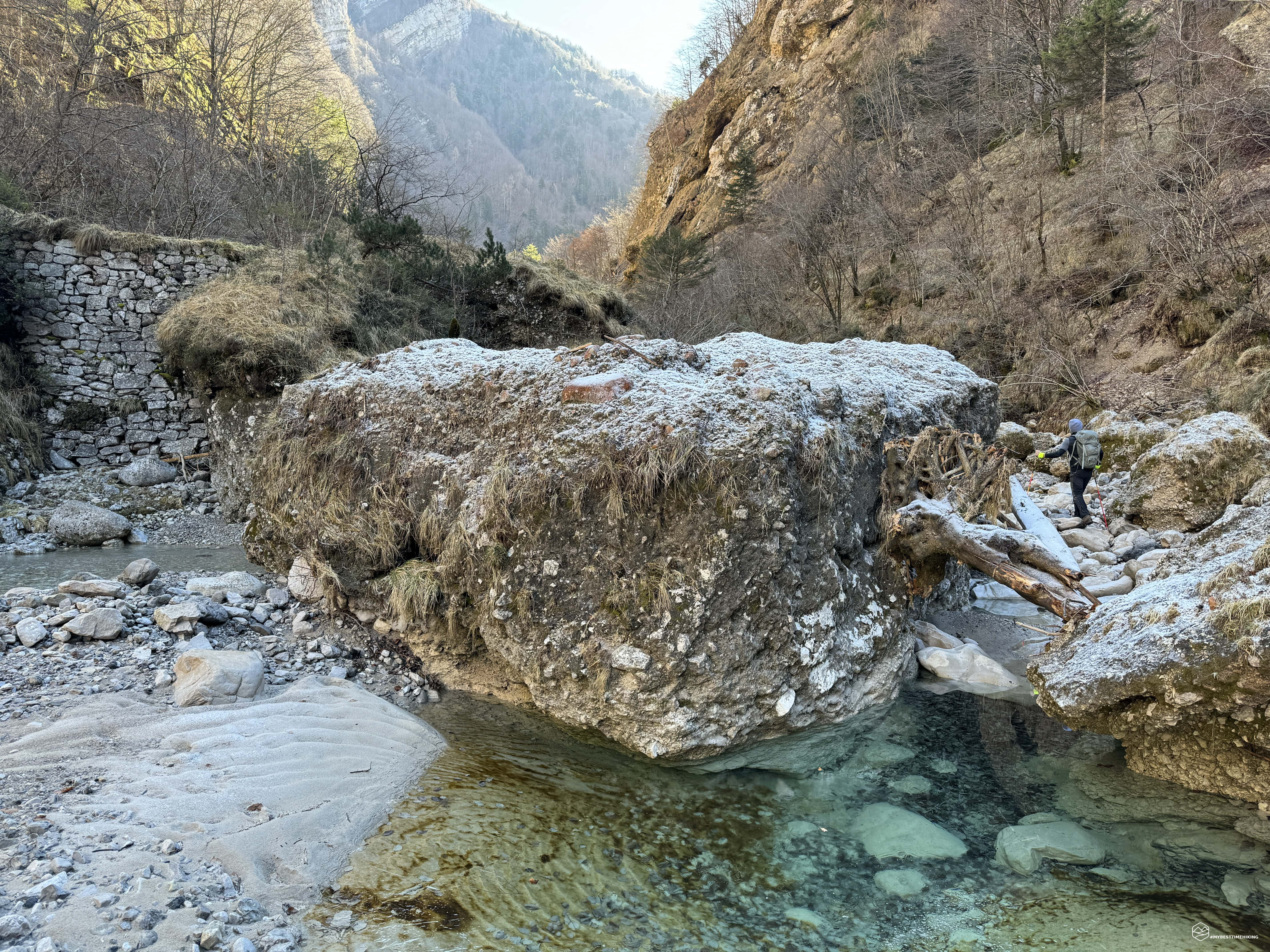
We find ourselves wandering between the two sides of the stream having fun fording it in sometimes easier places, other times instead we sink with our entire boot in the cool rushing waters. In correspondence with a large boulder in the center of the riverbed, a cubic-shaped Saxon three meters by three, behind which we notice a dry stone wall that supports a steep grassy wall. Even from the map at our disposal we do not notice any stretch or passage at that point. Most likely it was built to facilitate the passage of the stream and in the past perhaps allow logs to slide down to the valley. Consulting the map for this detail, we see that the original path passes from one slope to the other, touching the riverbed in only a couple of places. We therefore aim to rediscover the old track. We find some hints of the old route, although on the left side it seems to have been irremediably erased also by recent landslides that followed one another. Near one of these, a singular frightening footprint appears which seems to identify the rear footprint of a bear. No other traces, just a single isolated footprint but that's enough to make us jump.
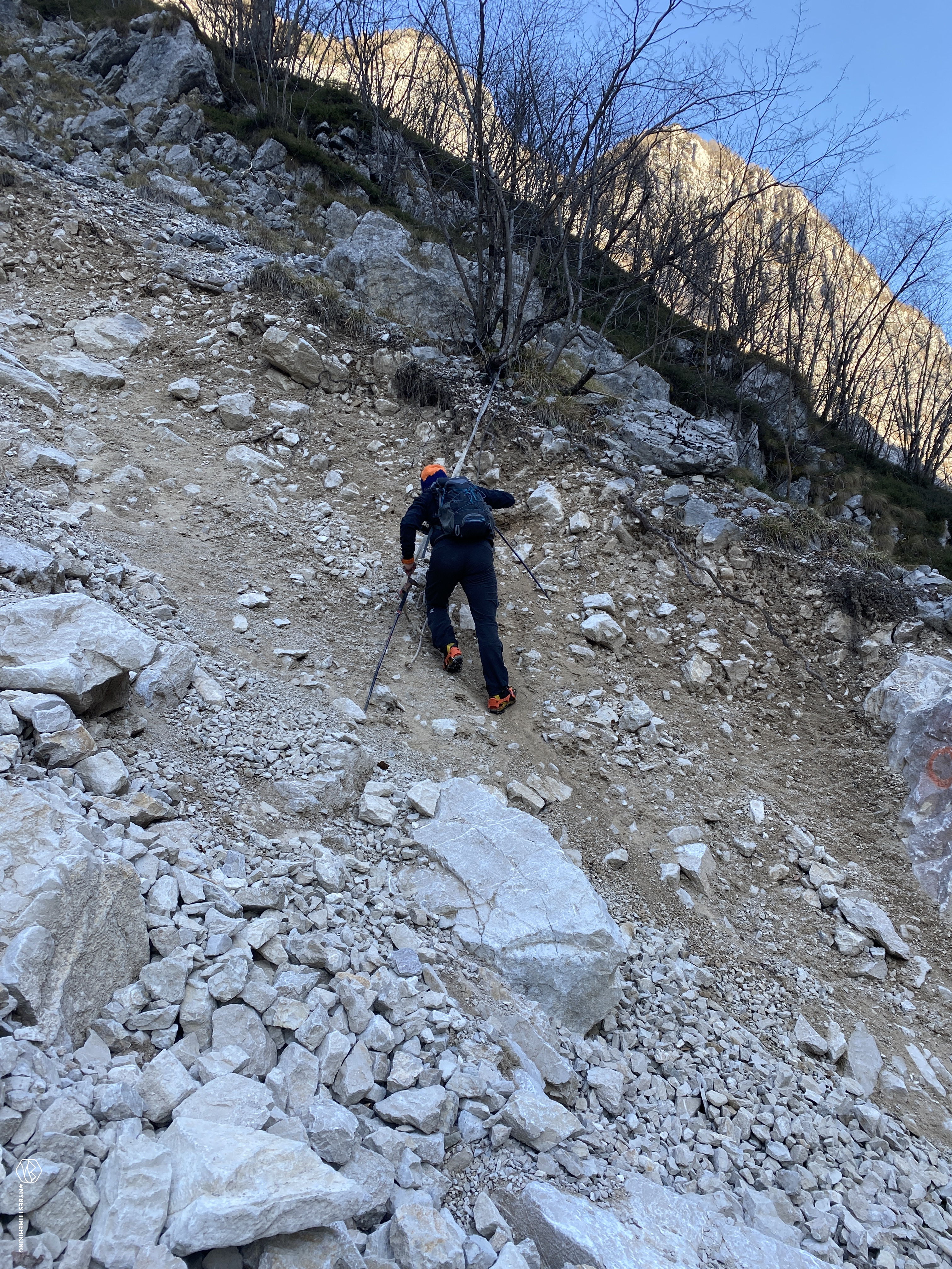
Moving on to the right orographic side, however, we find clear traces of the old path that lead us up and out of the riverbed. The red dots can still be seen on the bark of the trees, a little faded but they are there. The track is clear, comfortable and proceeds through the larch bush, making us gain a slight difference in altitude. Now we look at the stream from above, we maneuver between grassy slag and dry foliage. Landslide watercourses occasionally appear to interrupt a certain monotony. Even rocky cracks, covered by a thin layer of ice that are fortunately easily surmountable, allow us to have fun in this non-trivial but enjoyable progression. The forest gives way to a grassy portion on a sloping slope. We arrive at a block of ice that blocks our way. An imposing single block that was formed on two wooden trunks that should help overcome a collapsed section of the path with a void a few dozen meters below. We see that inside the mighty block of ice there is also a cord, but it is incorporated into the mass and effectively unusable. We therefore decide to stop our adventure here without risking overcoming this dangerous obstacle.
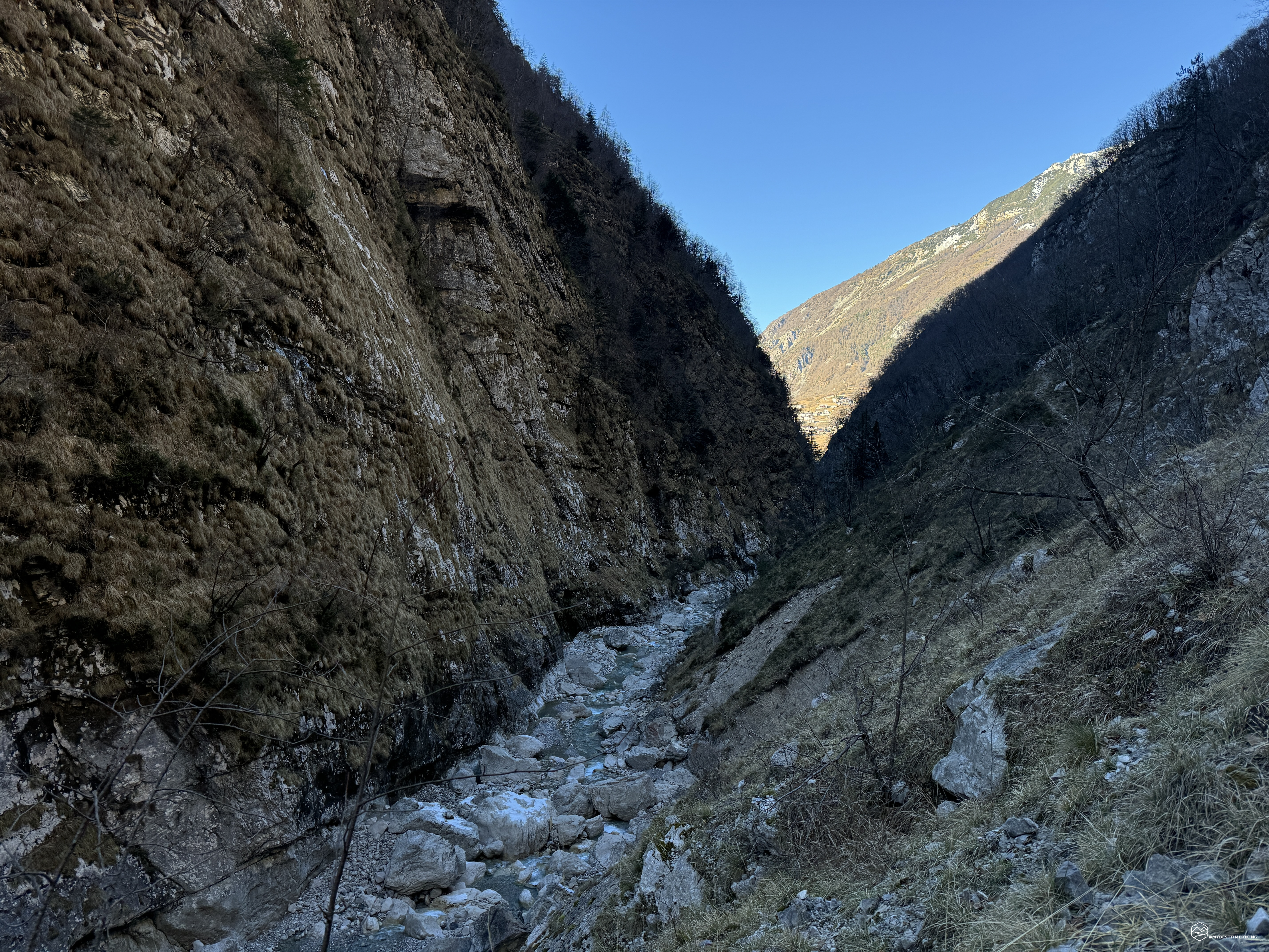
We retrace our steps and, glancing to the left, we notice a barely visible track that descends to a point where numerous trees with slender trunks create a descent route very well marked by red dots, which leads towards the stream. We then go down into the riverbed like this, again, and we notice that the signs continue on large rocks that flank the watercourse. We continue southwards towards the Carniar dairy on an easy riverbed. On the sides we observe the most impressive ice falls of the day: high, thick and fragile where in a few minutes we saw small blocks detach from above without, fortunately, hitting us.
It's half past one in the afternoon, but in the gorge we find ourselves in, it seems like late afternoon. The light is about to disappear behind Col Nudo. We look at the map and see that we have a few hundred meters to go to reach the Carniar dairy, but there may be little light on the way back. So we stop for a break that we hadn't taken since the beginning of the excursion, and we admire this lost paradise.
We go back the same way, looking for the remaining traces of signs of the old CAI path. In the woods, once we leave the riverbed, we come across a mighty rock where at its highest point, there is a very old wrought iron cross. Maybe even from the beginning of the century. The cross is so particular that it looks like a sword in the stone: perfectly inserted into the rock. There are no visible signs of chipping or punctures. The rocky block is a few steps from an expanse of mossy stones arranged in a regular manner, as if to form a rectangular perimeter. We are most likely in front of an old dairy with the memory of its owner.
We find many traces that highlight different fords of the watercourse from side to side. Our last objective of the day is a spring marked on the Tabacco maps: "The source of the Blessed water". We should find it on the right orographic side that we have just taken leaving the stream. The area is very humid, moss completely covers all the tree trunks. There is a lot of water surfacing. From the map we should be close to the destination, also certified by the presence of a capital, according to the legend. We are exactly on the spot, confirmed by GPS, but we find no source. We proceed on a fun up-and-down route through the undergrowth. And suddenly here is a white rock, marked by an iron cross on the top. A CAI sign and an "X" at the base highlight that this is precisely the source we are looking for. A trickle of very fresh water emerges almost magically from the rock. A pair of steel plates stuck in the earth facilitate the flow of this newborn water. Clearly moved compared to the Tabacco map, the source is decidedly further north than indicated. We quench our thirst with this blessed spring which gives us new strength with a sweet and fresh flavour.
We continue past a recent landslide where surprisingly we find some stamps on some boulders. We return to the riverbed again (by now I have lost count of the times we change the exploration by going from undergrowth to the stream). Going backwards it is much easier to identify the faint signs that remain and in fact we find new alternative routes compared to the way out. Just before returning to the wide final bend, we find a new cluster of torn hairs on the ground, from the same prey found in the morning. The peculiarity is that these tufts are hundreds of meters away from the "crime site", proving that the victim was transported.
The light is starting to run out even though it's not even 3pm. We leave the bed of the Vajont torrent definitively and are about to reach the landslide. Going down into the watershed with the tape and rope anchored to the tree is almost easy. The progression on the unstable landslide, however, is the most characteristic part that requires a certain type of attention. We retrace the slender ledge suspended in the void for the last time, renamed by Diego the "ledge of death", not surprisingly given the tombstone of a young man who left his life here. We see the sun again, we return to the small church of S. Antonio. Thus we leave Mauro Corona's ideal “Porta Rossa”. We close the door behind us contemplating these natural obstacles that protect the treasure we have just explored.
Thus ends a magical adventure in this remote place that Mauro Corona himself describes in his book “The Five Doors”: “They entered a fairy-tale and silent world where the only voice was the whispering of the stream” and again “The valley had been abandoned for many years. Woodcutters, charcoal burners and hunters no longer went there. Too far away, impervious, uncomfortable”. A mysterious place that must keep its secrets intact. An adventure that allowed us to observe, on tiptoe, only part of these hidden treasures. Treasures that must certainly be preserved by mass tourism to give back to Nature the space that we too often take away without asking permission.
DifficultyExpert Hikers with Equipment - The equipped routes (or via ferrata) are indicated, they require the use of self-insurance devices. |