
Mid-January, the temperature drops below the freezing mark. With our friend Enrico we reach the end of Val Canzoi in the Belluno area, more precisely after passing Cesiomaggiore. At the end of the valley the old Albergo Boz offers a large space to park the car and begin the adventure: today's objective is the famous Piani Eterni! A place etched in my memory when, over 20 years ago, together with my mountain mentor, Ugo, we climbed to Piani Eterni and continued the itinerary towards Forcella dell'Omo and Casera Cimonega. A route that cannot be easily followed in winter but which will be one of the next summer desires.
We prepare ourselves fully, even bringing our crampons with us. At the moment we don't see any trace of snow, but the difference in altitude is high and we could find surprises. We proceed on the path that cuts the first asphalt curve that goes up from the hotel. A couple of wooden ladders and we immediately arrive at the first show. Lake Stua remains motionless as a mirror reflecting the Cimonega group kissed by the first morning sun.
We leave the lake on our right and proceed on the path that runs alongside it with the indication Erera-Brandol, CAI 802. We cross the Caorame stream, an tributary to the lake, on a large and comfortable bridge. Soon we arrive at the crossroads with the path that leads to the Feltre Bodo bivouac. We keep to the right and from here path 802 begins the steep climb.
At first in a dense beech forest which is now bare, the trail goes deeper and deeper into this shady valley. We pass the Campedel dairy which is now only shown on the Tabacco map. We continue on the mule track which at times becomes cemented with large stones which allow us to have a better grip on this steep climb. We pass the crooked staircase: a series of nearby hairpin bends formed by protective dry stone walls. The sun is peeking out and giving us a bit of warmth on this cool day. At an altitude of 1300 metres, there were some patches of snow. From one of these we notice traces of ungulates proceeding towards a nearby ledge overlooking the beech forest.
In about 2 hours we reach the crossroads at an altitude of approximately 1400 metres. On the right we continue towards the blades of the sheet and the sheet. Then towards Casera Pinea and the following Forzelon. We, however, opt for the more characteristic Porzil path (Porzìl)
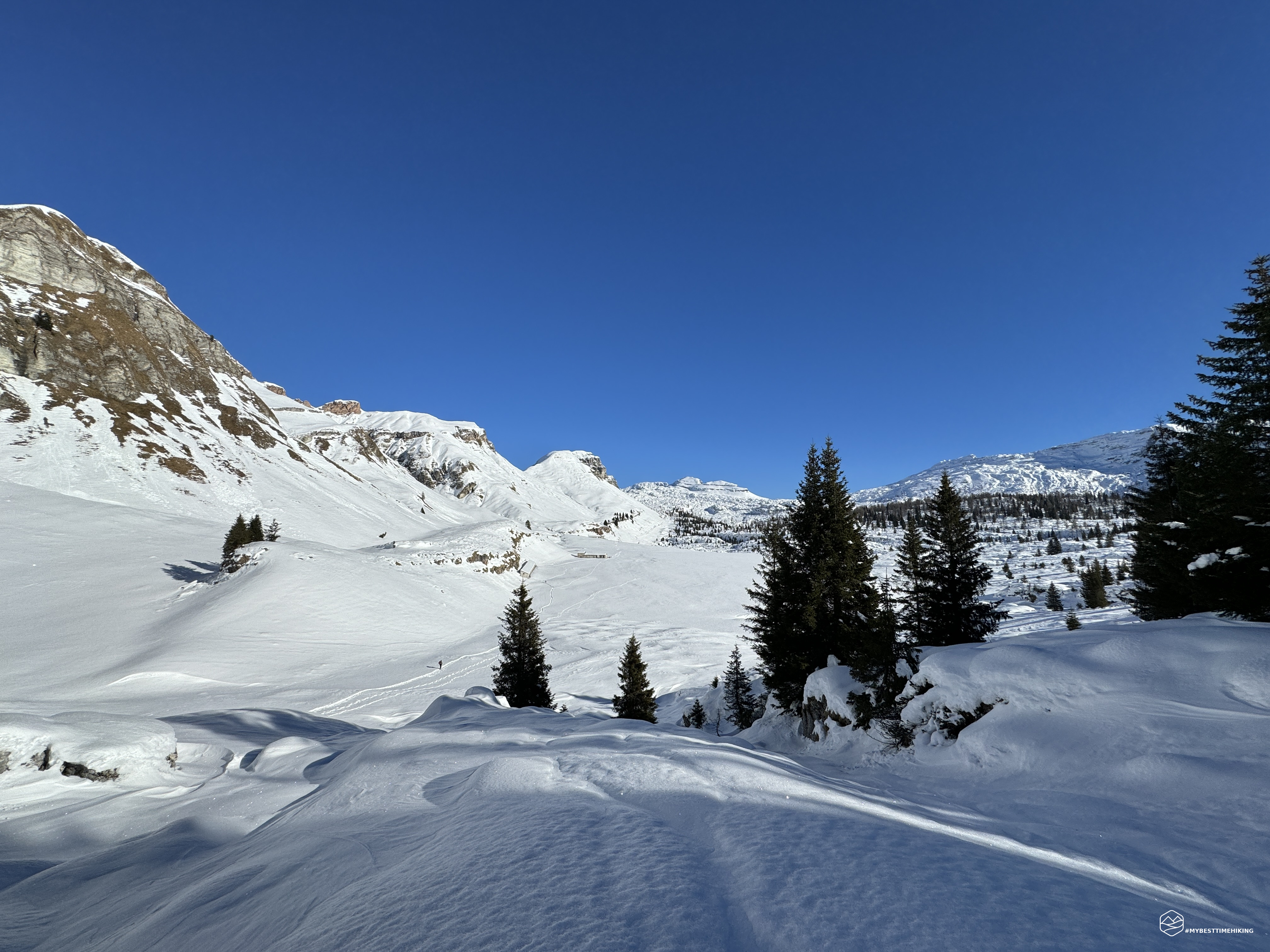
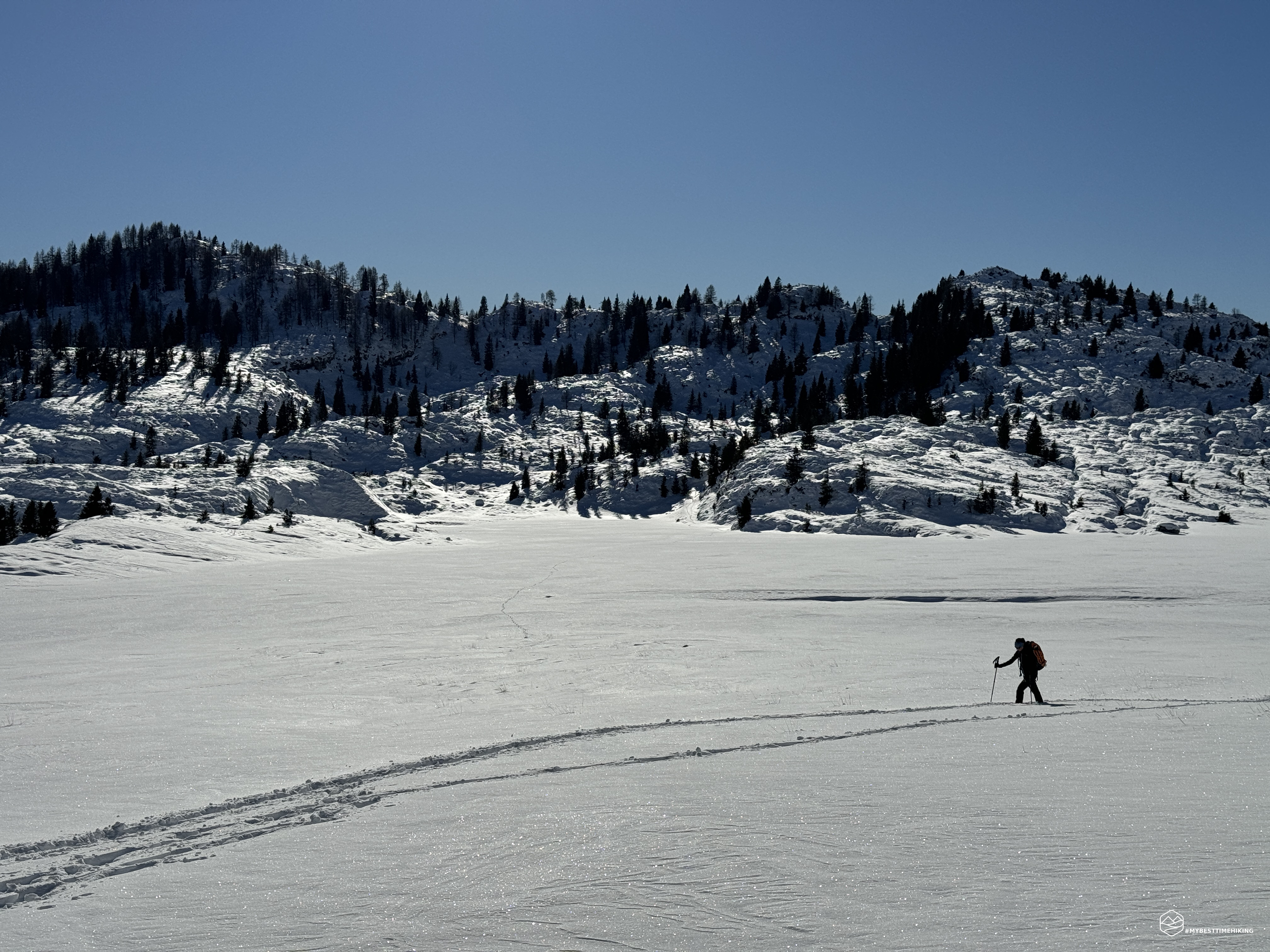
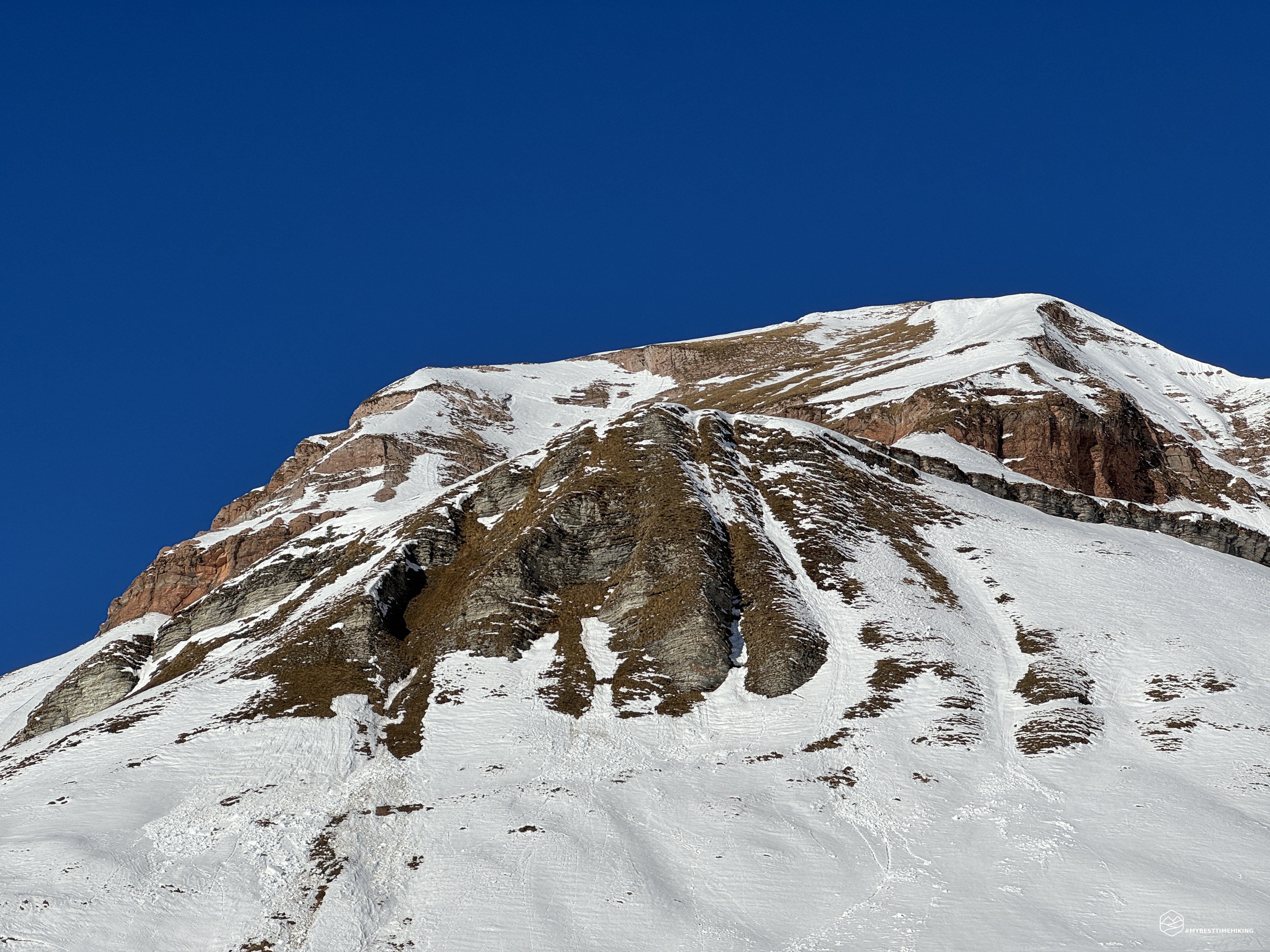
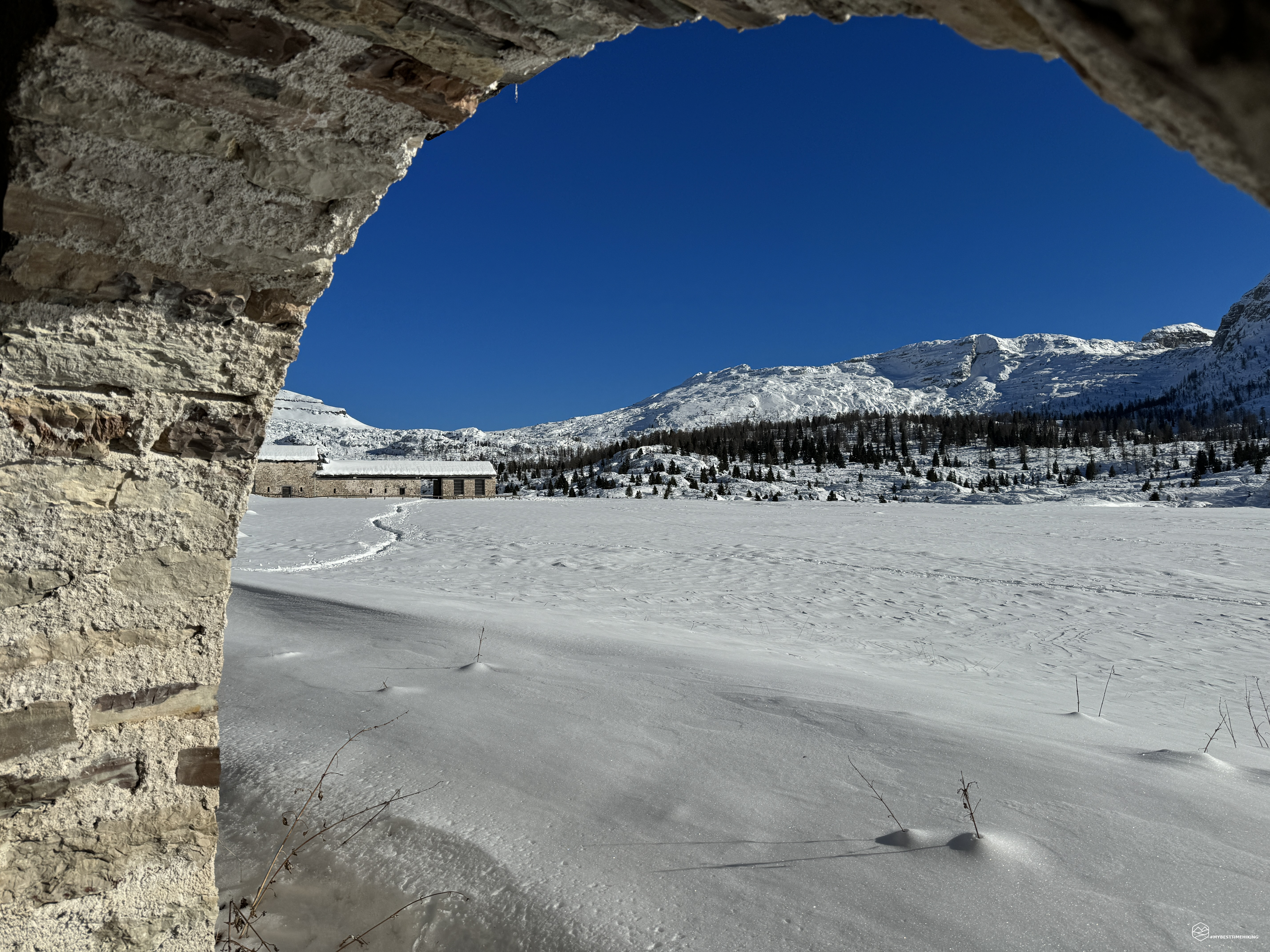
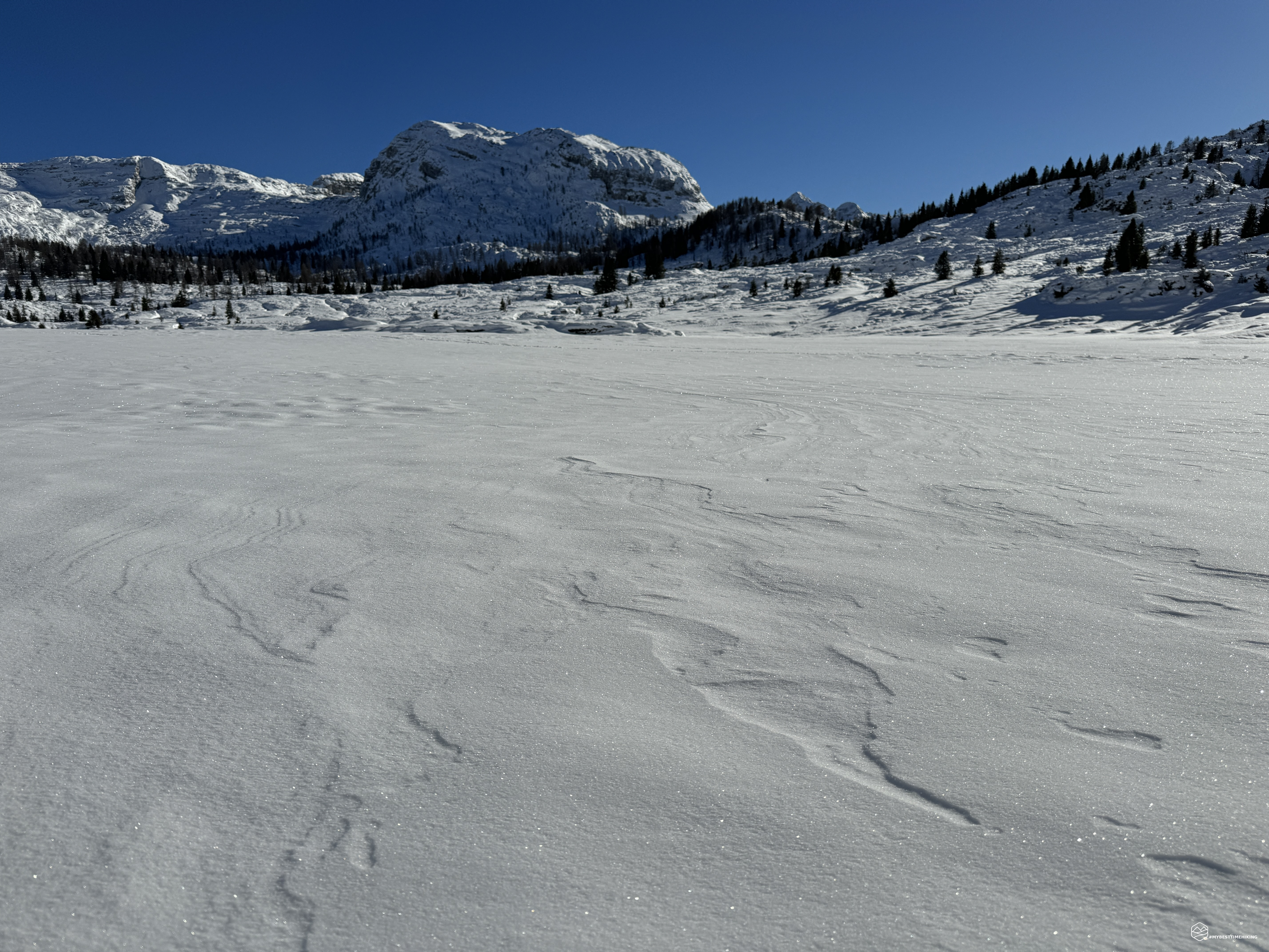
We now enter a colder and more closed gorge where the snow becomes the regularity on the trail. The beech trees give way to larches and spruces forming a small fairytale grove. A light breeze blows gently but brings an icy blast that lowers the temperature by several degrees. First of all, a ladder appears before us made up of steel plates driven into the rock with an attached metal cord to overcome a detachment of rock that interrupted the path. We pass it easily, it is also very characteristic and deserves a slow progression to fully enjoy its beauty. The nearby ice stalactites formed on the rock face also provide a splendid image. The snow is hard and allows you not to sink. A convenient trail has been plowed by previous hikers. From this point onwards I can recommend crampons to proceed with greater safety and speed. The climb here is gentle and never tiring, the ever thicker fir trees give peace to the chickadees of the tits. A final series of hairpin bends allows you to gain the last tens of altitude differences to emerge on the pass, called the Porzil pass. Turning back you have a splendid view of the completely snow-capped Mount Scarnia. In front, the last level meters herald an unusual view. We proceed quickly and... here we are on the window that the pass offers on today's destination: the Eternal Plans! A panorama as far as the eye can see starting on the left with the Agnelezze Brendol peaks, the Pale Rosse, the Campotorondo peaks, descending towards the Brendol dairy and the Malga Erera which interrupt the white expanse of snow on the Piani Eterni plateau bordered to the South-East by Mount Cimia and Colsent. A spectacle that satisfies the over 1000 meters of altitude difference to reach it!
Date
13-01-2024
Distance
15.81 KM
Hike type
Hike
Ascent
1182 mt
- Mountain
Piani Eterni
- Address
Val Canzoi, Veneto, Italy
- Altitude
1724.00 m
- Refuges
- Information
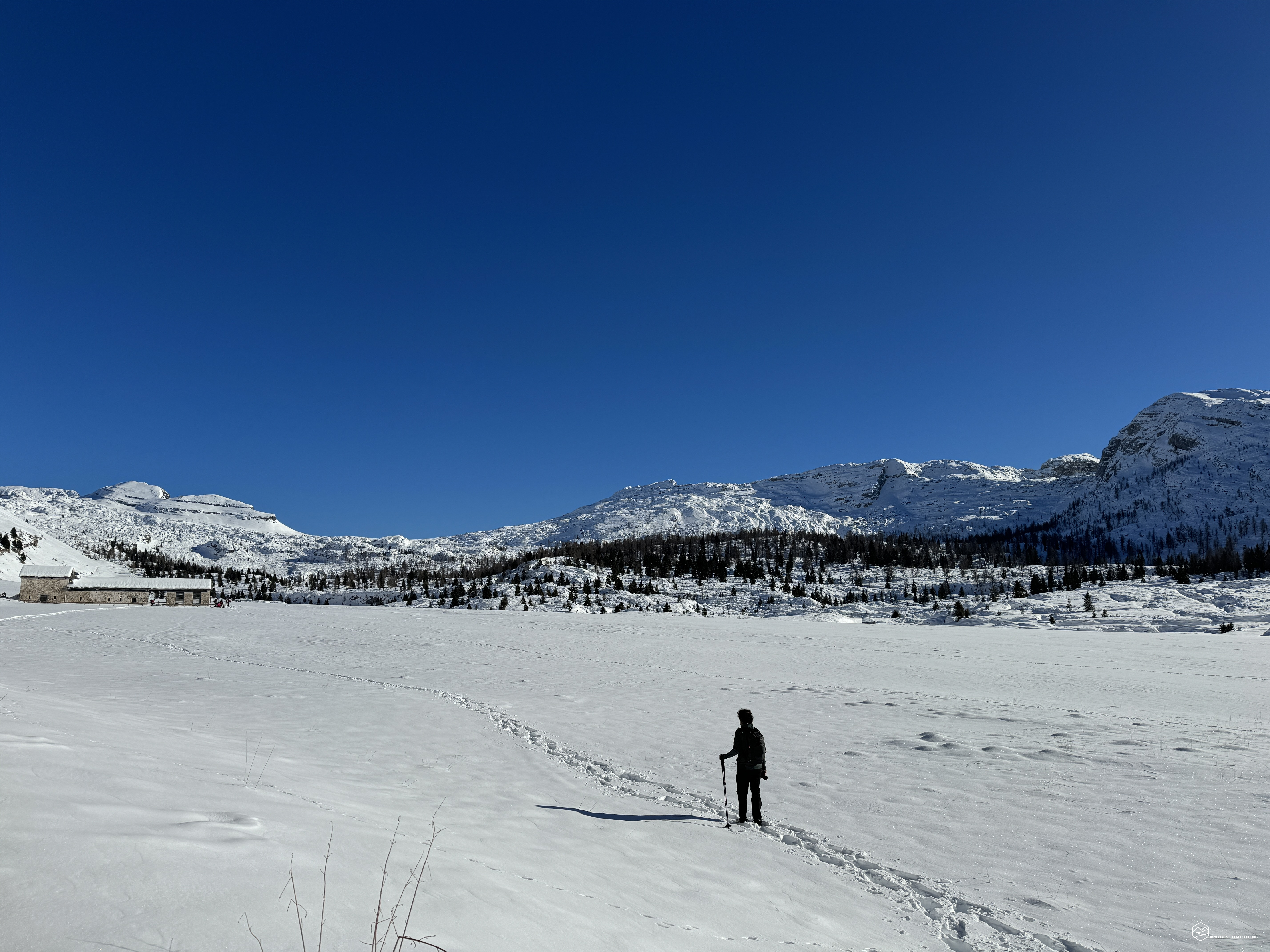
We descend gently on a well-furrowed track in the snow and soon reach the Brendol dairy with an adjoining open shelter. A break to enjoy this magical, timeless place, immersed in silence. A place of important geological interest, which Teddy Soppelsa in his book "Excursions in the National Park of the Belluno Dolomites" describes thus: Morphologically the Erèra-Brendòl and Piani Eterni plateau corresponds to a large karst polje. From a geological point of view, we highlight the opportunity to observe, in excellent exposure conditions, the entire Jurassic-Cretaceous stratigraphic series: Gray limestones, Lower ammonitic red (Campotorondo limestones), Fonzaso Formation, Upper ammonitic red, Biancone, Red scale. The outcrop area of the Gray Limestones is essentially identified with that affected by karst, which includes the Piani Eterni and the southern sectors towards the Colsént (2086 m) and the Forca pass. Easily recognizable is the formation of Upper ammonitic red which originates a characteristic small wall, immediately behind Casèra Erèra and the Brendòl pendàna, with reddish nodular rock layers, rich in ammonites. The grassy slopes of the Brendol, Mondo and Prabello mountains are made up of the Biancone and, at the top, the calcareous-marly lithotypes of the Scaglia rossa (hence the name Pale Rosse).
After an obligatory passage to Malga Erera with an adjoining break, we retrace our steps by retracing the path of the outward journey. Not having brought snowshoes with us, we were unable to do the circular route towards Frorzelon as we would have sunk in the snow without any beaten track. The karst terrain of the plateau, then, would not have been a guarantee...
Returning towards Val Canzoi, we tried to do a circular tour of Lake Stua, without success given the conditions of the path and after having ascertained that the trail would not reach the Boz hotel.
This splendid adventure ends at first dusk in a spectacular place suitable for expert and trained hikers given the over 1100 meters of overall difference in altitude. The Eternal Plans summarize the best flora and fauna characteristics of the Belluno Dolomites National Park, and I find no better way to conclude this adventure with the quote from the mountaineer and author of the first ascent of the Campanile di Val Montanaia in 1925, who thus describes the Plans Eterni: "...this magnificent plateau seems like a mirage. Nature often loves to create such contrasts in the most unexpected places, making his masterpieces stand out more. "
DifficultyExpert hikers - are generally signposted itineraries but with some difficulties: the terrain can consist of slippery slopes of grass, mixed rocks and grass, stony ground, slight snowy slopes or even single easy-to-climb rocky passages (use of hands in some places) . Although they are routes that do not require particular equipment, equipped sections can be presented even if they are not demanding. They require a good knowledge of the alpine environment, a safe step and the absence of vertigo. Physical preparation must be adequate for a fairly continuous day of walking. |