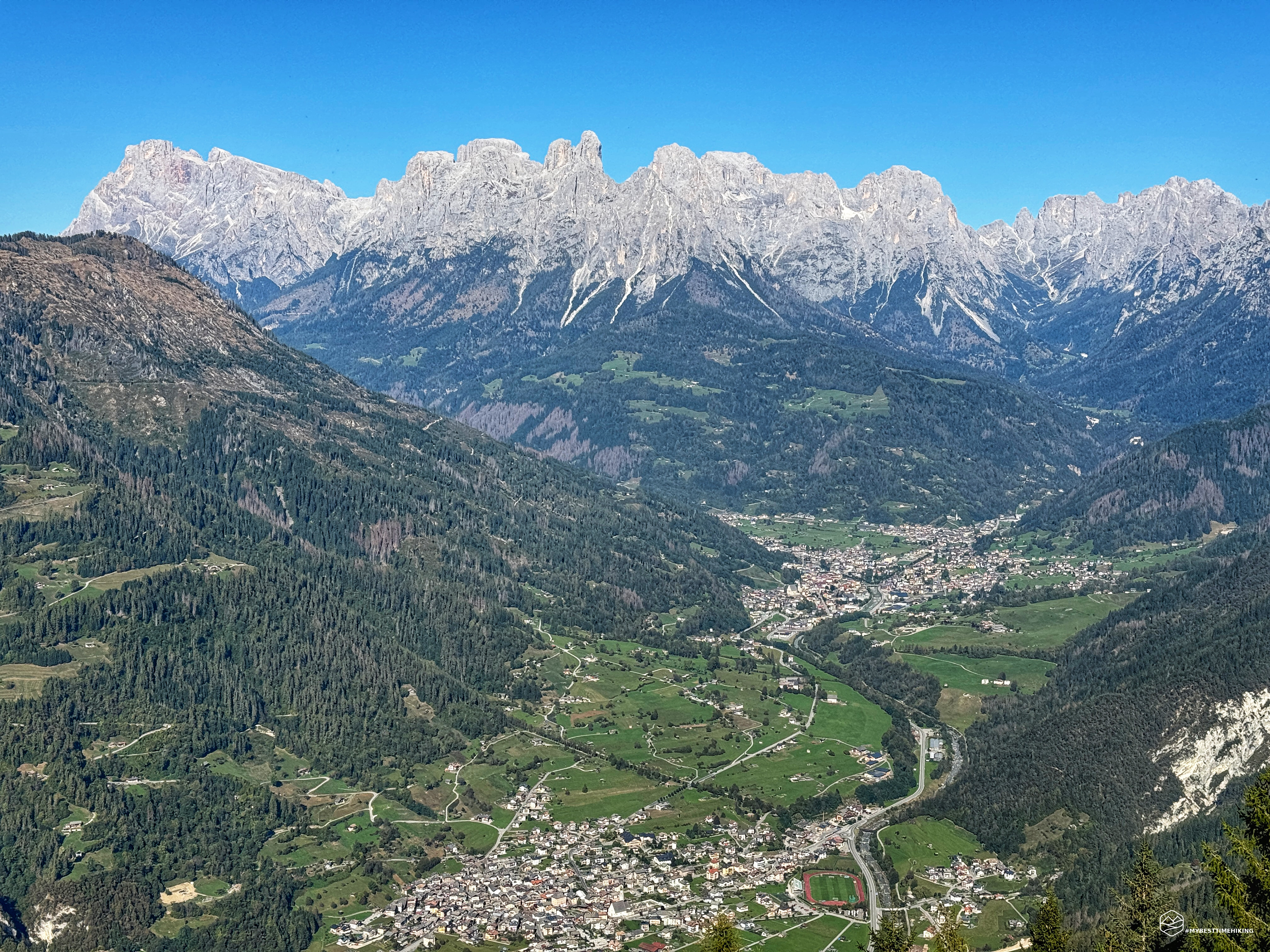
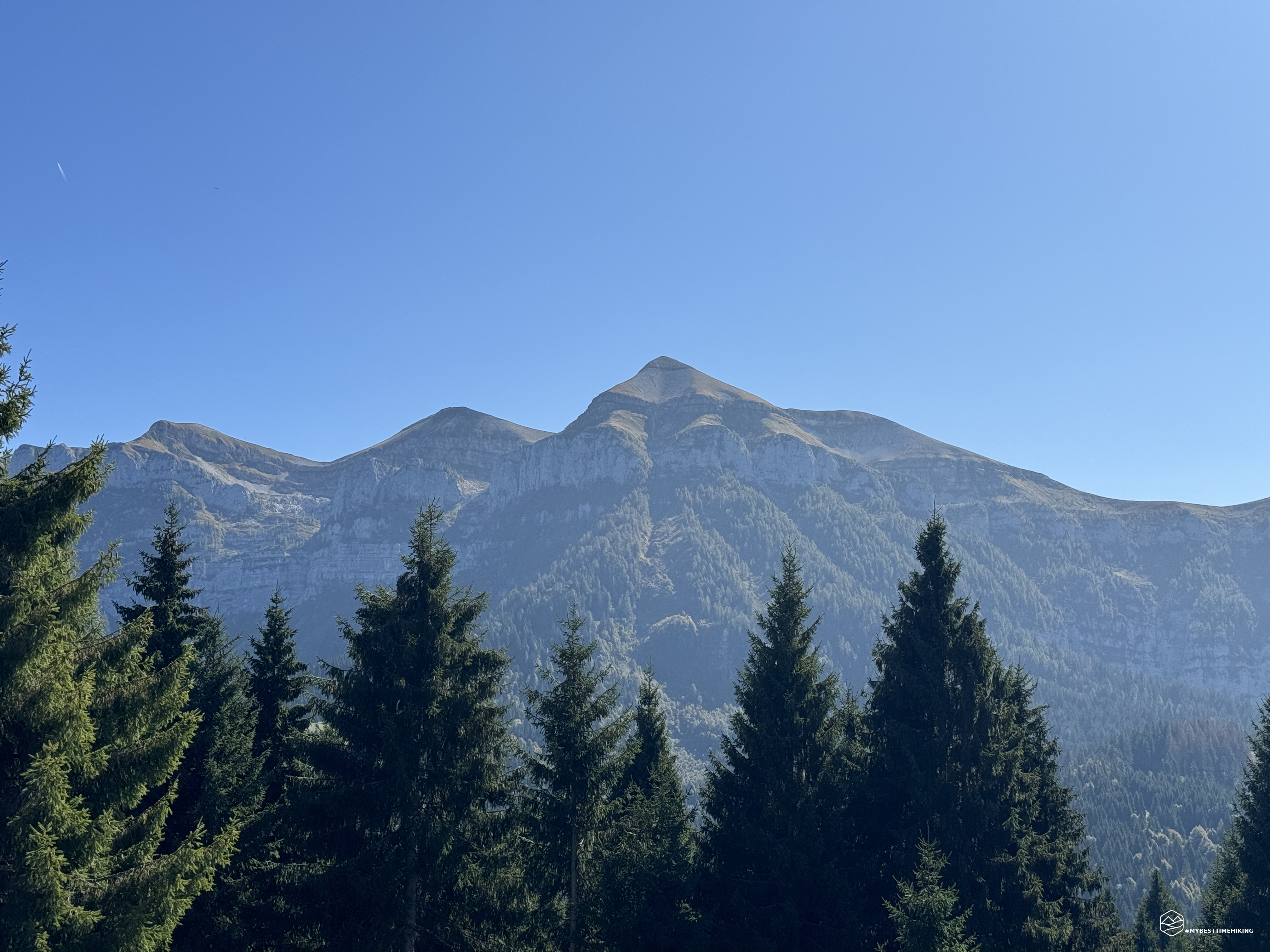
Today's excursion takes us to the border between two magnificent regions: Veneto and Trentino Alto Adige. At the foot of the Feltrine peaks, looking towards the splendid Pale di San Martino.
The adventure companion is a new friend, Andrea, whom you will surely have already heard of thanks to his splendid blog Montagna di Viaggi!
Today's objective is to reach the top of Monte Vederna or "Viderna" starting from the town of Imèr. A less famous peak than the others immediately nearby, but also important from a historical point of view. It is no coincidence that it was indicated as a defense rear area by General Luigi Cadorna during the First World War. In his book “The War on the Italian Front” of 1921, Cadorna, in Chapter reported the possible retreat to the Tagliamento and reports the following provisions: ”… It was agreed that in the event (considered only as a necessary forecast) that the 2nd and 3rd armies had to fall back to the Tagliamento, the XII Corps would fall back to the Carnic Prealps. In this case the 4th Army would have to withdraw to the line of resistance to the bitter end (from the Casera di Razzo, to Monte Tudaio, with Vidal, the Val Boite barrier downstream of Borca, the head of Val Maè, the Duran pass, the Cordevole narrows at the Sasso di San Martino, Piz Sagron, Viderna, Totoga, Remitte, Monte Levre). …”.
With all these magnificent expectations, let's go! We reach the town of Imèr, just before Mezzano and Fiera di Primiero, more precisely in the car park located on the roadside of the Sass Maor Village, before the "Le Peze" pizzeria (with adjoining camping site). From here you immediately have a beautiful view of the village of Imer and behind us the rocky coast of Mount Vederna.
Near the car park there are CAI signs indicating the route towards the summit and the refuge in the direction of the campsite, to the east. We checked, but this track is abandoned and swallowed up by vegetation. It seems like a route that leads to the nearby Val Noana and then rejoins a variant that leads to the summit. We choose the asphalt road that climbs steeply into the village that the Tabacco map indicates with “Little Red Riding Hood”. We are actually following the route shown on the map that identifies the CAI 736 path.
We are in fact on a comfortable mule track, which at the moment seems to be undergoing maintenance. A cart track made up of cobblestones and walls delimits the route. The climb is constant, never excessive. You enter a thick forest. The track is delimited on one side by the rock of the mountain and on the other by some wooden protective barriers. We soon arrive at the Capitel de la Pausa, where some benches allow you to enjoy a view of Fiera di Primiero and the first magnificent glimpse of the Pale di San Martino.
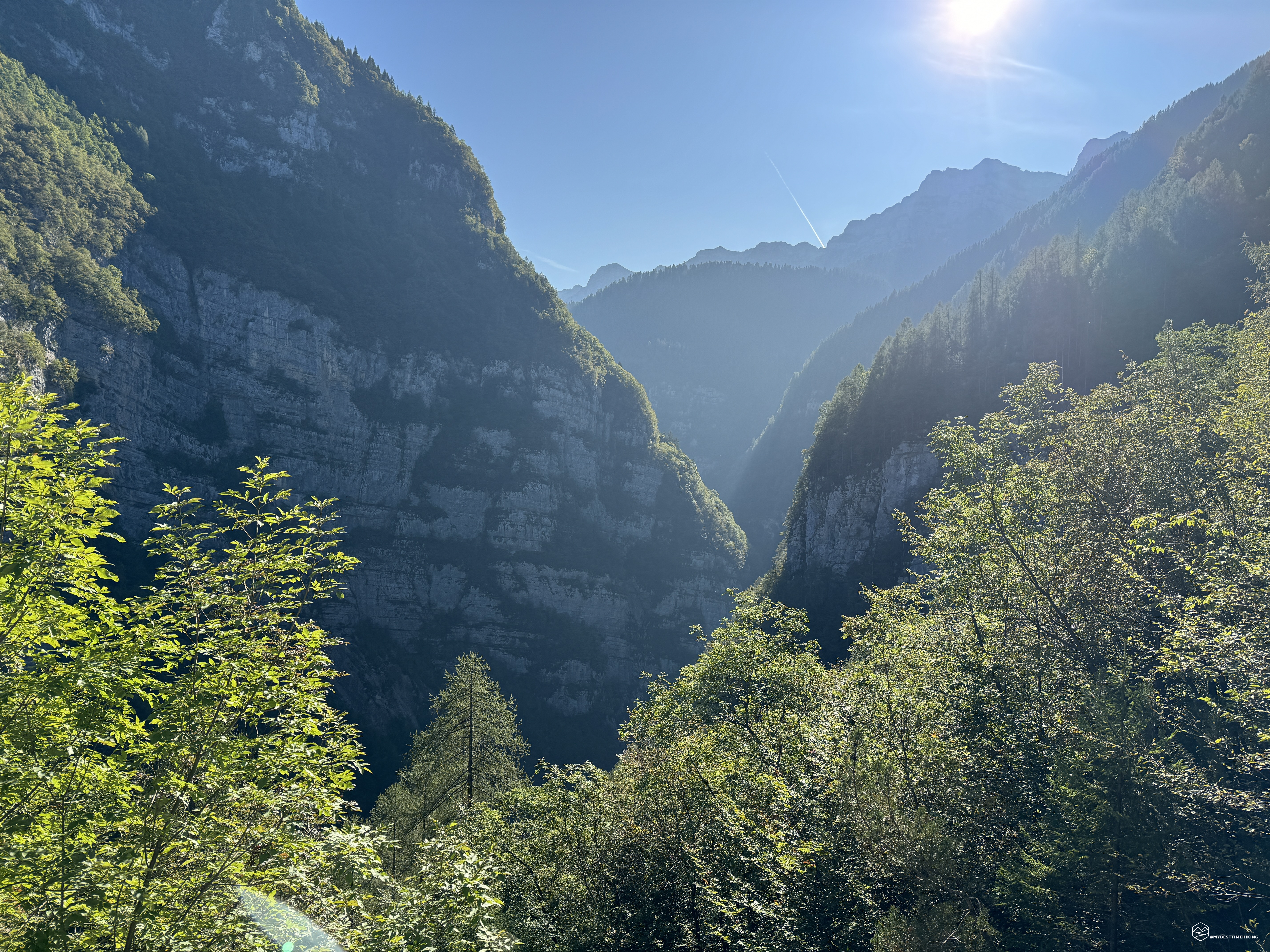
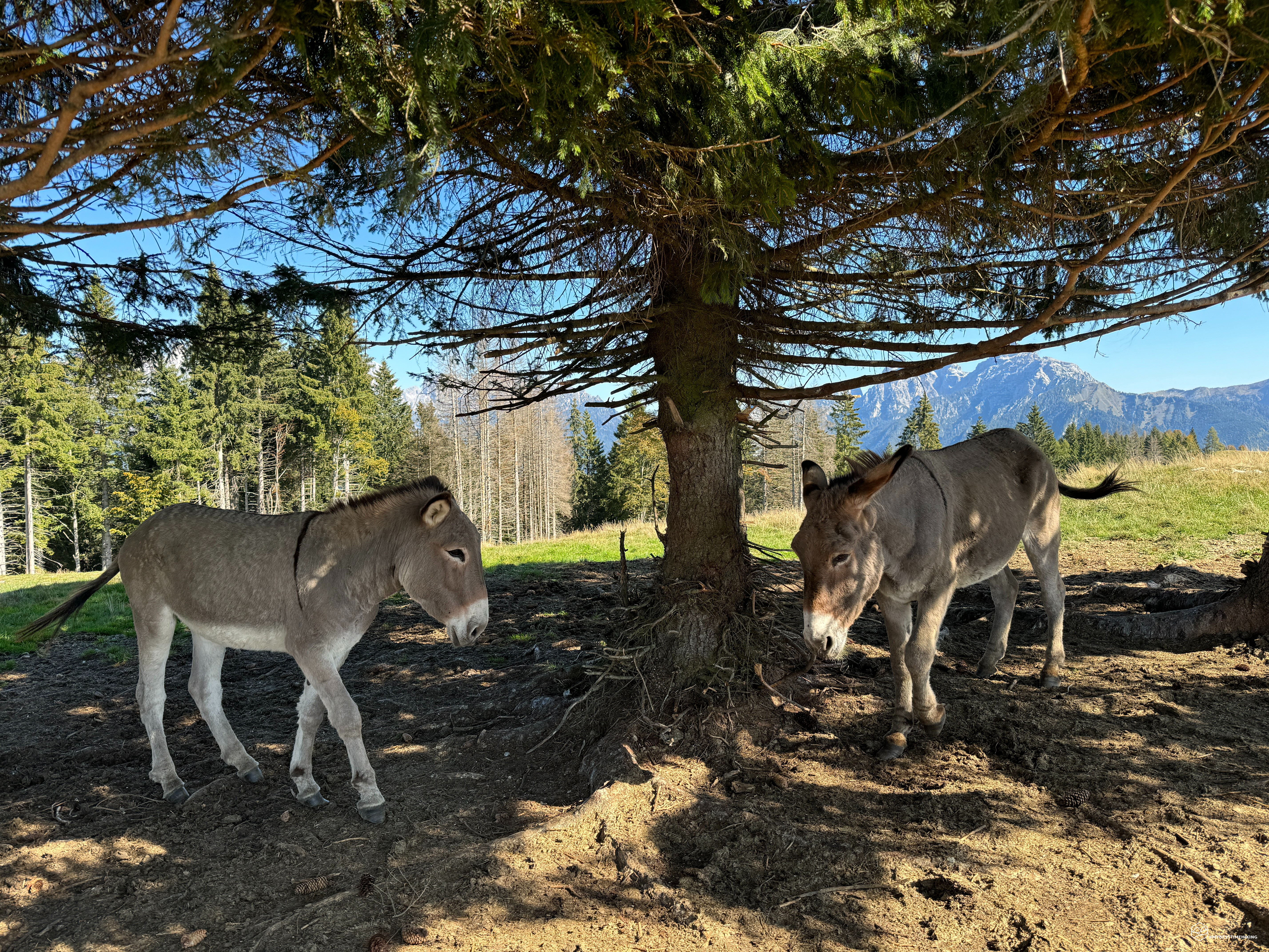
We continue along the Val Noana which proves to be an austere and wild valley. We cannot see the bottom because thick vegetation prevents us from doing so. We reach the Cristo dei Noni, a capital with a crucifix just above the path. Here comes the variant that can be followed starting from Val Noana: an interesting alternative for a solution that is certainly more demanding than the one we are following. A little further on we are kidnapped by a small transhumance of donkeys led by shy but strong children.
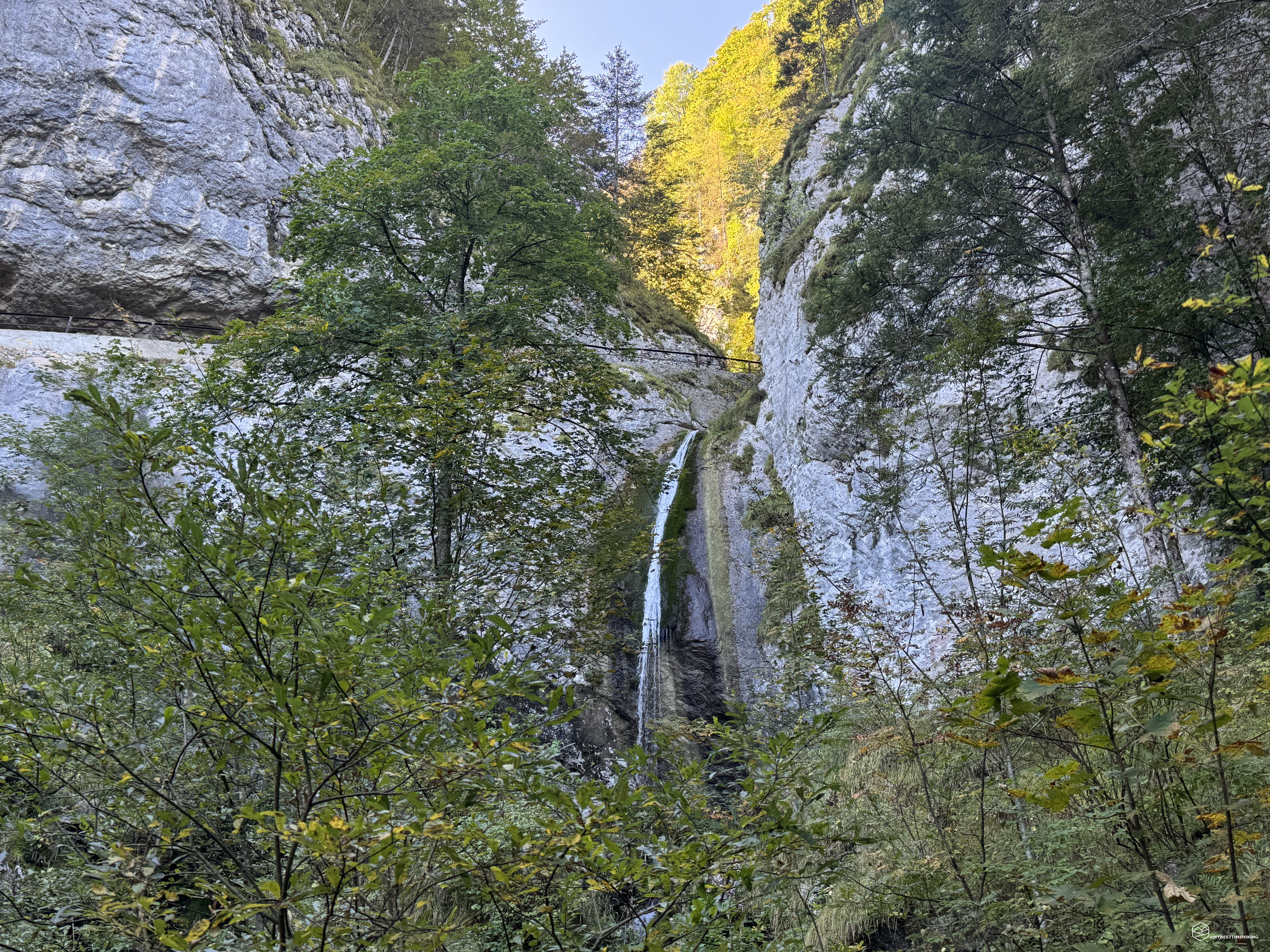
We hear an increasingly louder gurgling and arrive in front of a splendid waterfall: the Salton Falls! Set among the rocks that the Rio Val Caora has been inexorably digging for years, creating the valley of the same name and then flowing into the Noana Torrent further down. A drop of tens of meters that offers a splendid view. From here there are two roads: one to the left which allows you to travel the entire tunnel in the rock that crosses the rocky coast, or a shortcut which enters halfway through the tunnel from which you have a splendid view of the entire waterfall just a few steps away . In this way we climb above the Salton and we can observe the birth of the waterfall.
Date
07-10-2023
Distance
19.20 KM
Hike type
Hike
Ascent
998 mt
- Mountain
Monte Vederna
- Address
Imèr, Trentino Alto Adige, Italy
- Altitude
1584.00 m
- Refuges
Rifugio Vederna
- Information
We leave the Rio Val Caora in a really cold and humid environment, practically always in the shade, and we take the route again which now insinuates itself into a canyon dug by several streams which contribute to the creation of the waterfall. A characteristic place that offers beautiful views especially in this autumn period.
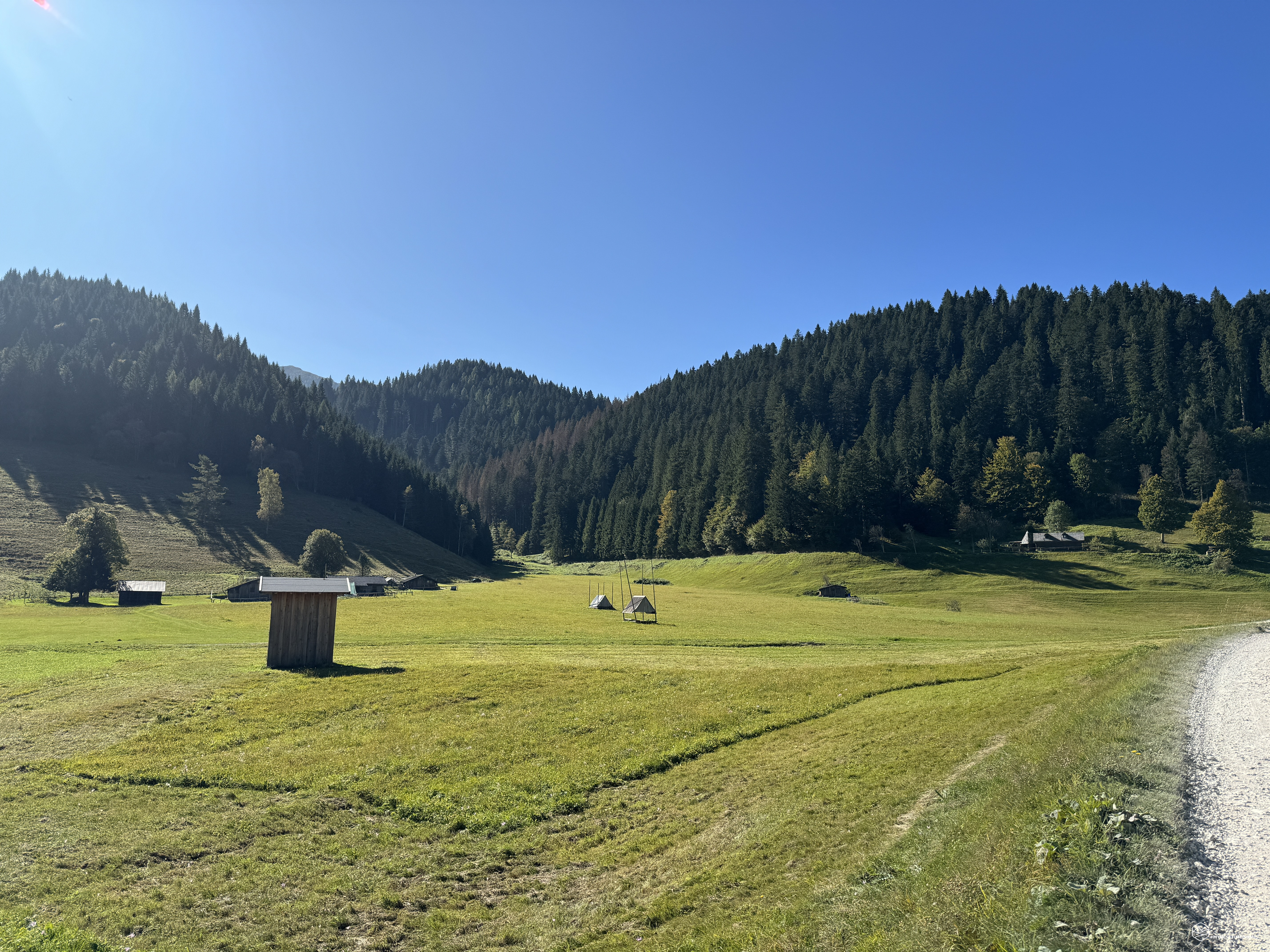
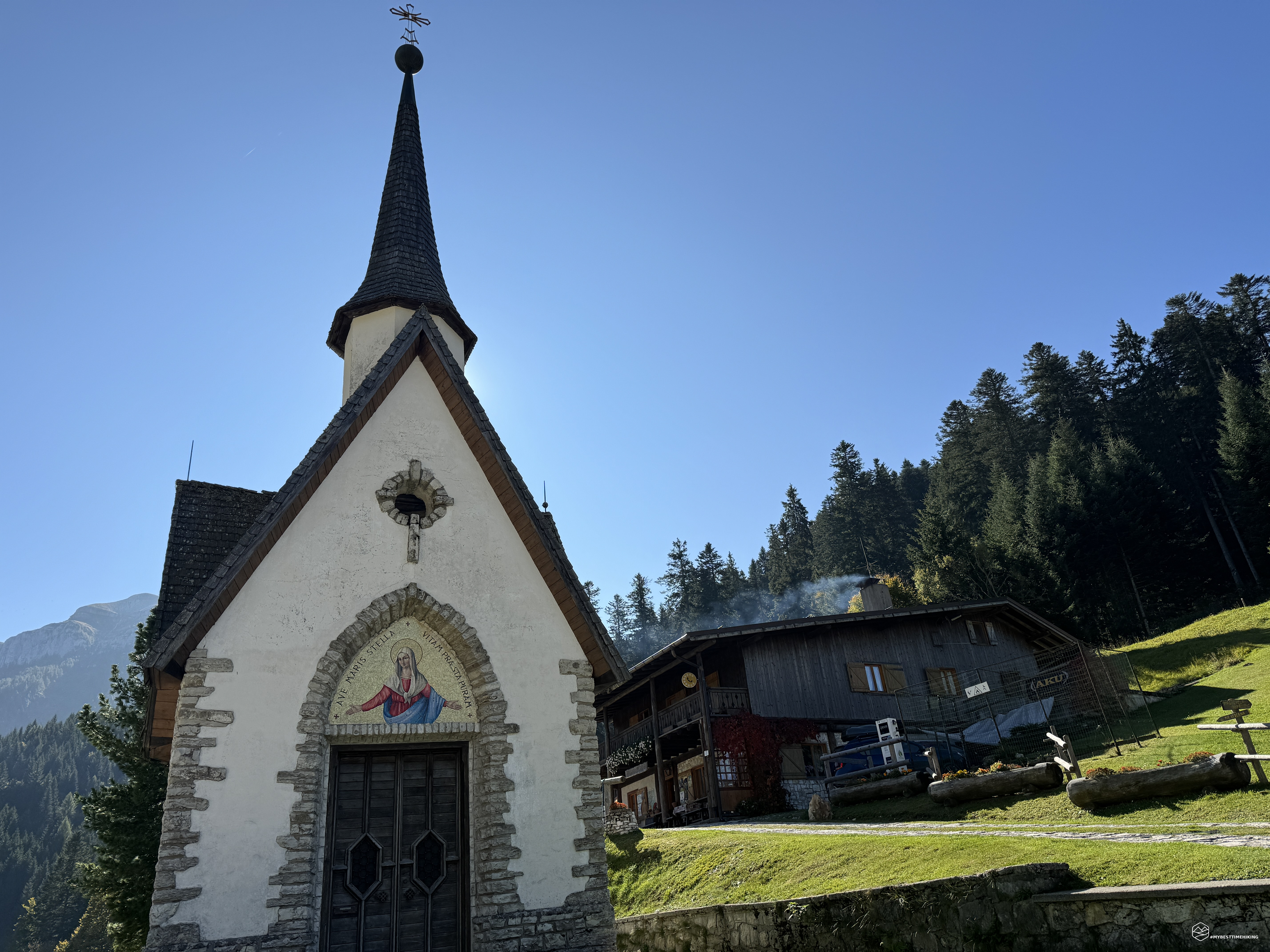
Soon we emerge into a more open clearing, finally kissed by the sun. In front of us a small bridge and a small crucifix. A clear indication shows us the way to the nearby refuge. A couple of gentle uphill curves and here we are on the large green clearing called “Pian Grande” (or Pian Grant)! A large flat area dotted with small wooden huts. In front of us the road which has now become wide and gravel invites us to a small and charming church announced by an imposing solitary birch. In front of the church we can see the Vederna refuge peeking out behind it.
The refuge is large and welcoming with several tables inside and also outside with a view of the Pian Grande. We tasted some delicious homemade desserts! We go out and head towards the large open space in front of the small church which can be reached from a winding road that should start from Pontet at the beginning of Lake Schener, which gives its name to the valley. From the comments of some visitors that we have heard, it is not a road to travel by car lightly…
We take the large dirt road that tends to climb gently where the routes to the Croce degli Alpini and the peak of Vederna are indicated. The road is pleasant, alternating sun and shade thanks to the trees which create very beautiful plays of light. We arrive at a crossroads where on the left you can continue to visit war positions, “Stoli” Morosna, and walk along long tunnels from the Great War. It will be the starting point for a new adventure! Instead, we proceed to the right, still immersed in the bush, until we reach the summit of Vederna. Here the fir trees are sparse and the grass that distinguishes this dome is starting to turn brown.
We leave the track, veering to the left, to follow the last short climb but we cannot see the destination. Altitude 1584 meters, we are at the top of Mount Vederna! The view is splendid 360 degrees over the Vette Feltrine mountains and the magnificent Mount Pavione. Continuing towards the South we can distinguish Mount Coppolo, Mount Agaro, while moving towards the East we come to the Sass de Mura, the Piz de Sagron, the Sass d'Ortiga from which the unmistakable peaks of the Pale di San Martino begin. But it is not from here that we can observe them in their maximum splendor, we must continue the adventure. Not before having cuddled a little the two donkeys who rest on the top in the shade of two isolated trees that create the desired shade. The two donkeys seem to want caresses, in reality they are inviting us to give them something good to eat. Since we have nothing, they invite us to "musate" to leave. In fact, as soon as we go down the top, we see them watching us to make sure we leave them alone.
We return to the main road from where we came and, just before the detour to the summit, there is an arrow indicating "Alla Croce". Be careful because the arrow has detached from the pole and may not be visible. In any case, the path to take is in the opposite direction to the summit, towards the East. We proceed on the plateau until we reach a large tree in which there is another arrow. From here we descend a few meters until we see this immense metal cross that stands out in front of us: the Alpine Cross! A spectacular view of the Primiero valley with Imèr, Mezzano and Fiera. In the background, surrounded by a clear blue sky, the magnificent Pale di San Martino which hypnotize with their beauty and grandeur. A photo is a must before taking the path indicating “Stoli” Morosna. Instead of following the Alpini path that leads to the tunnels, we undertook a variant that follows the trench walkways still visible in the undergrowth. A maze of streets dug into the earth that actually run along the top of Vederna. We follow them by making a ring at the base of the peak and we emerge right on the top where the donkeys await us while they graze on the last few fresh tufts of grass.
We retrace our steps and retrace the ascent route back until we reach the refuge again. Through Pian Grant then through the shady canyon (be careful going down here as you risk slipping!). We say goodbye to the Salton and this time we travel the entire tunnel dug into the rock. The descent is pleasant but decidedly long to return to Imèr and the morning car park. Thus ends the adventure on Vederna in an exceptional place both from a historical but above all environmental point of view. The views that the adventure gave us are worth these approximately 6 hours of walking (in total) and the refuge repays the effort with splendid homemade dishes. A route for moderately trained hikers given the difference in altitude (around 1000 metres) over a long distance (over 19 km). Here, below the article, I remind you that you can download the GPX track of the route. Recommended to everyone!
A heartfelt thank you to Andrea who invited me for this magnificent adventure, hoping it will be the first of a long series. Don't forget to also read his beautiful article full of beautiful images.
DifficultyHikers - Itineraries on paths or evident traces in various types of terrain (pastures, debris, stony ground ...). They are generally marked with paint or cairns (pyramid-shaped stacked stones that allow you to identify the route even from a distance). They can also take place in snowy but only slightly inclined environments. They require the equipment described in the part dedicated to hiking and sufficient orientation skills, walking training for a few hours. |