Val di Zoldo is a Dolomite valley located in the province of Belluno, full of breathtaking landscapes and hiking trails that leave you breathless. To better understand the area we are in, I report the detailed description by Ottone Brentari in his book "Guida Storico-Alpina del Cadore" of 1886: Between Longurone and Perarolo (see p. 84 and 88) on the right side of the Piave which flows to the E., of the Boite and the Rite which flow N. and W., and on the left of the Maê also to the W., extends a long mountainous ridge which separates the Piave Canal from the Zoldo Valley. In it, from S. to N., Mount Campello to the N. W. of Castellavazzo, Col di Serra, M. Rocchetta and Sasso di Bosco Nero (m. 2509) to W. of Ospitale stand out. Then the hump, N. E. of Col di S. Pietro and Valle di Campestrin continues with M. Sfornioi (m. 2409), Croda Cus and M. Dubbiea, S. W. of Perarolo. The Sasso di Bosco Nero, which has three peaks and is the highest mountain in the range, was climbed for the first time on 19 September 1879 by the Italian Cesare Tomè and the German Goffredo Merzbacher.
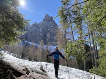
On a beautiful sunny day, my friend Leonardo and I decided to explore this magnificent region. Our excursion started at Lago di Pontesei, an artificial basin located in the heart of the Val di Zoldo. We got ready, put on our backpacks and started walking along the CAI 490 path which meandered through fir and larch woods, accompanied by birdsong and the scent of nature.
Date
11-03-2023
Distance
12.90 KM
Hike type
Hike
Ascent
915 mt
- Mountain
Sasso di Bosconero
- Address
Forno di Zoldo, Veneto, Italy
- Altitude
1632.00 m
- Refuges
Rifugio Casera Bosconero
- Information
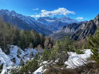
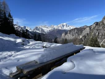
After a couple of hours of walking, we reached the Casera Bosconero refuge, located at an altitude of 1,450 metres. Here we stopped to refresh ourselves and enjoy the view of the Civetta, the Moiazza and the valley below. The sunny day and the blue sky made the atmosphere even more magical. The refuge is a point of reference for hikers who wish to discover the wonders of the Val di Zoldo and offers excellent local cuisine (unfortunately it is still closed this season).
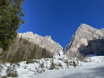
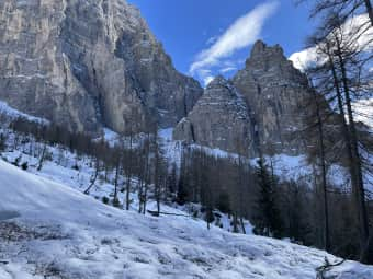
After leaving the refuge, we headed towards Forcella Ciavazole, a mountain pass at an altitude of 2,235 metres. However, as we proceeded, the snow on the trail became more abundant and deeper. The slopes were loaded with fresh snow, making the route increasingly difficult. The impluvia laden with snow forced us to stop and give up on our objective.
When we realized that it would have been too dangerous to continue towards Forcella Ciavazole, we decided to stop and look for an alternative to go back towards Casera Bosconero. After carefully studying the map, we identified a track in the woods that would take us to our destination in a sort of loop.
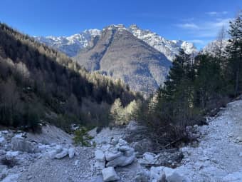
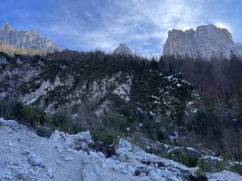
Despite the difficulties, the arduous alternative route proved to be an unexpected surprise. We came across wild and unspoiled landscapes, with streams, small ice falls and rocks emerging from the snow. Our adventure turned into a real exploration, which allowed us to discover hidden corners of the Val di Zoldo that otherwise we would never have known.
Our excursion to Val di Zoldo was an unforgettable experience full of emotions. Although the final destination, the Forcella Ciavazole, remained unreachable due to the impluvia full of snow, the day spent was still an adventure that we will remember for a long time. He left us indelible memories and a strong desire to continue exploring the wonders that the Dolomites have to offer.
DifficultyExpert hikers - are generally signposted itineraries but with some difficulties: the terrain can consist of slippery slopes of grass, mixed rocks and grass, stony ground, slight snowy slopes or even single easy-to-climb rocky passages (use of hands in some places) . Although they are routes that do not require particular equipment, equipped sections can be presented even if they are not demanding. They require a good knowledge of the alpine environment, a safe step and the absence of vertigo. Physical preparation must be adequate for a fairly continuous day of walking. |
