Starting below zero. The condominium meeting of the choughs. The village of Ronch and the view of the "Queen" and "King" of the Dolomites. The monoliths. The real Sass of Ronch and the legend of him. The lady who walks on ice.
New adventure in a new place. After Caprile, I head towards Rocca Pietore where I find a large isolated car park near the start of the CAI path that I want to take. The temperature is well below zero: the thermometer shows -7.5 degrees and the biting cold begins to pervade me as soon as I start to tie my boots. Let's go!
I leave the car in the street under the village cemetery and I quickly reach the town of Troi. Here the path seems to enter directly into the villagers' house. I follow a bristling stretch of rough asphalt road and, having passed a hut with an adjoining fountain, I enter the shady wood. During the week the snow fell abundantly and although the altitude is relatively low (about 1200 meters), the white mantle is always present both in the sunny areas and within the woodland. In this first section, floury sections alternate, where the boot sinks slightly, never disappearing completely, with other more icy ones where the crystals crunch under the sole.
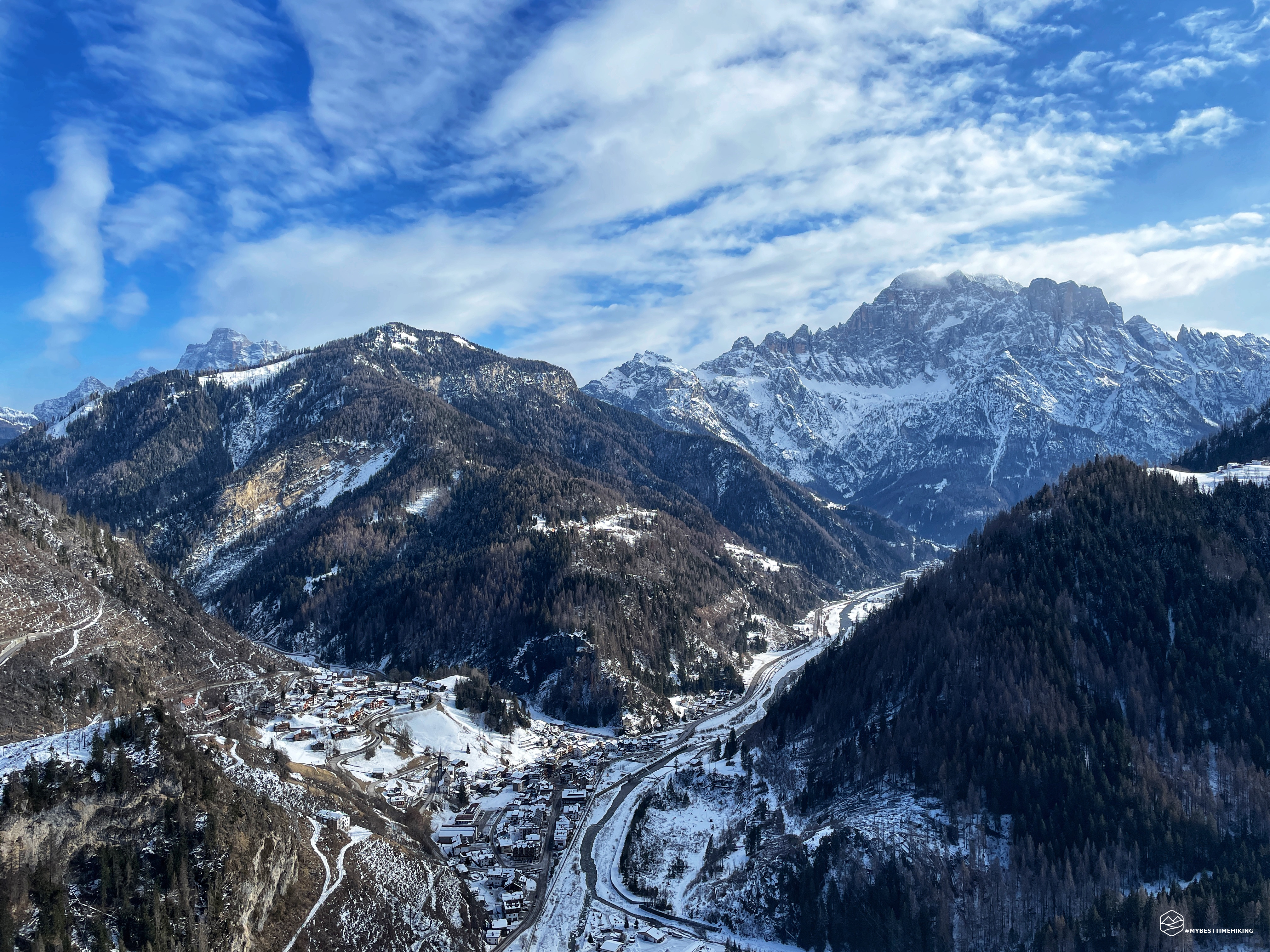
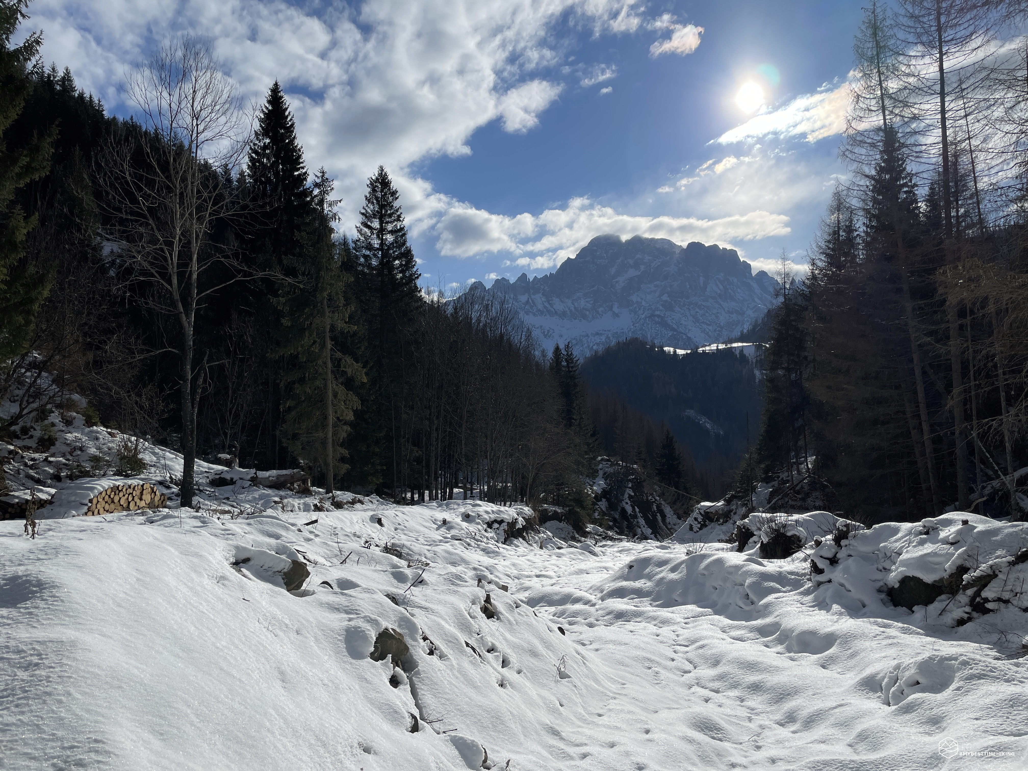
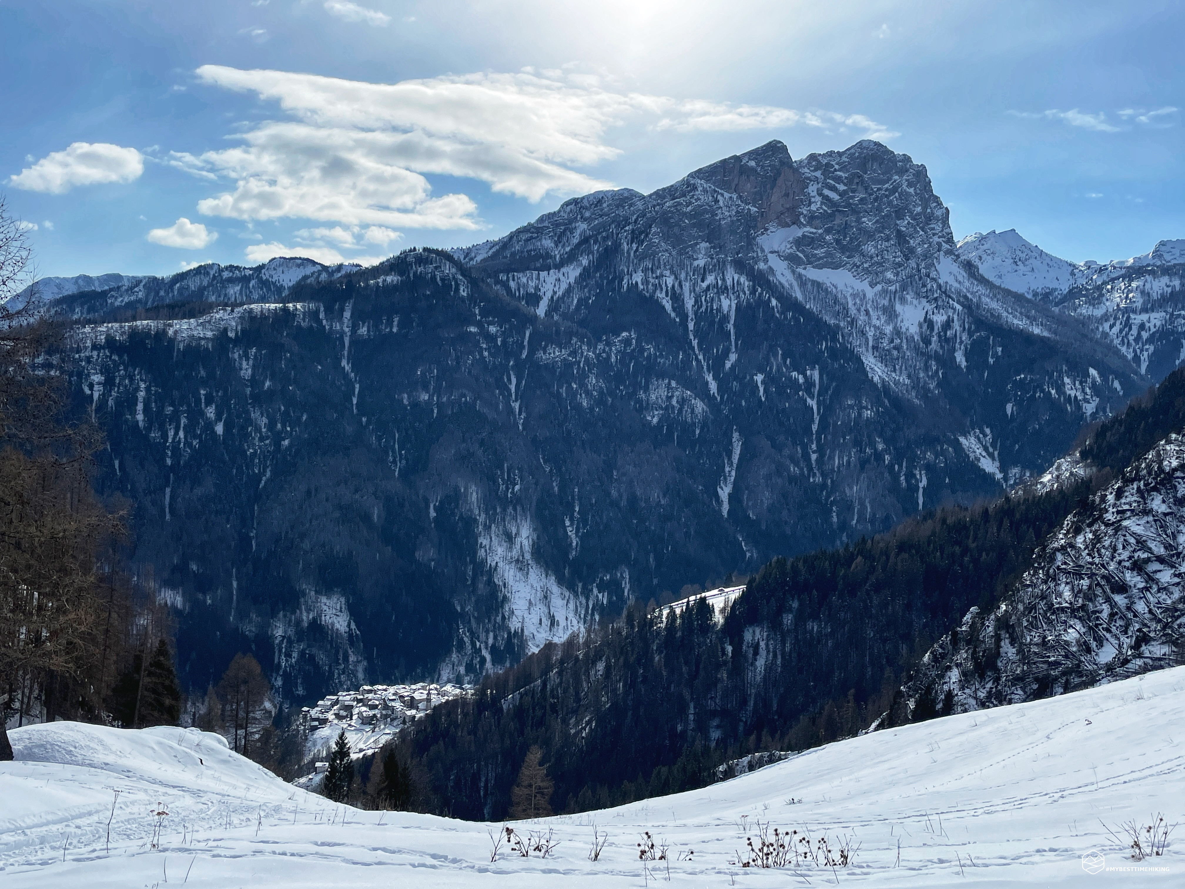
I continue on a beaten and very wide track which is represented by a black dotted line on the Tobacco map. Most likely Vaia of 2018 has considerably changed the geography of the paths and this, which was supposed to be a simple track, has become the main road. Throughout the journey it is noted that the Vaia storm is still unpleasantly current with many trees broken and piled up by the fury of that night. I pass the area called Valacia on a slightly sloping track, very pleasant for progression. I ford a small stream and the first special panorama of the majestic Civetta presented itself to me. In a short time I reach the Busa dei Cervi where I find stacks of wood neatly stacked. So I'm on the main road correctly reported by Tobacco.
Suddenly a call of a caw catches my attention. I turn my gaze towards the rocky crags that complete Mount Migogn and I am struck by a spectacular dance: a flock of choughs begins to circle in the sky, fluctuating sinuously from left to right, a timid pause and then upwards, in a group, a call to order and the return to the rocks. This graceful dance continues for a full minute and appears to my eyes like an assembly in which all the choughs of the area discuss which is the best place to go to rest in the biting cold.
After this BBC documentary parenthesis, I proceed towards Laste on the path marked by a CAI trail marker which allows you to "cut" some small hairpin bends. Thus you reach the panoramic land of Col dei Pioge: a large window on the Cordevole with a magnificent view of the Civetta, Caprile and Rocca Pietore. On the left the silhouette of Pelmo begins to emerge! Precisely on this hill there was a cross (now there is a capital) and Amelia Edwards wrote as follows: “… a cross that rises above a crest of perpendicular rocks, in a panoramic point where there is a wide view towards south. The wall overhangs down to the valley for a thousand feet and perhaps more: Clementi [companion of the explorer] tells us that the Cross was placed in that point certainly not to indicate the panorama to « Messieurs les Etrangers », but to commemorate the death of a very young shepherd who at the age of only eleven, going in search of a lost kid, fell from that endless precipice and was smashed before even reaching the bottom."
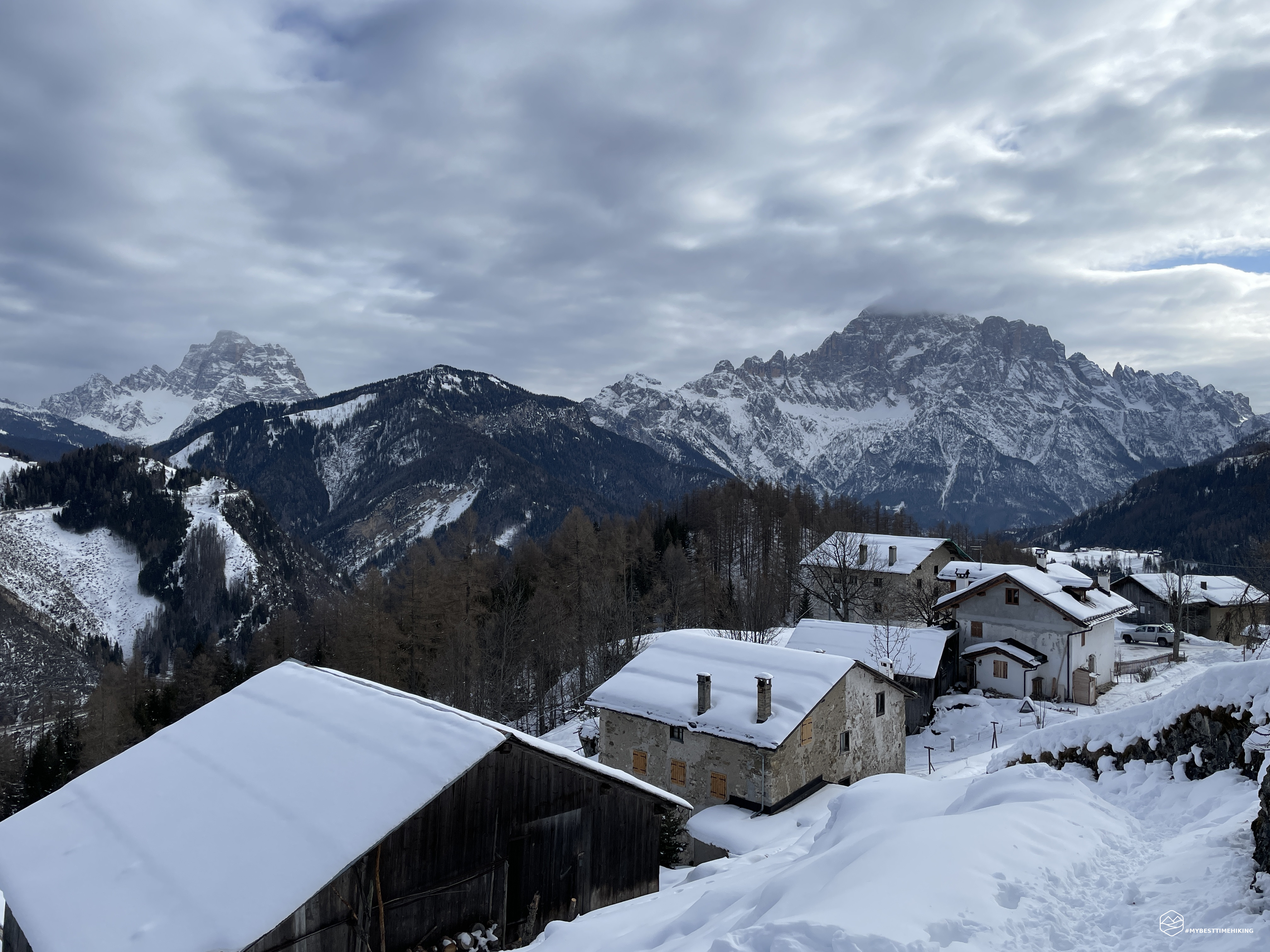
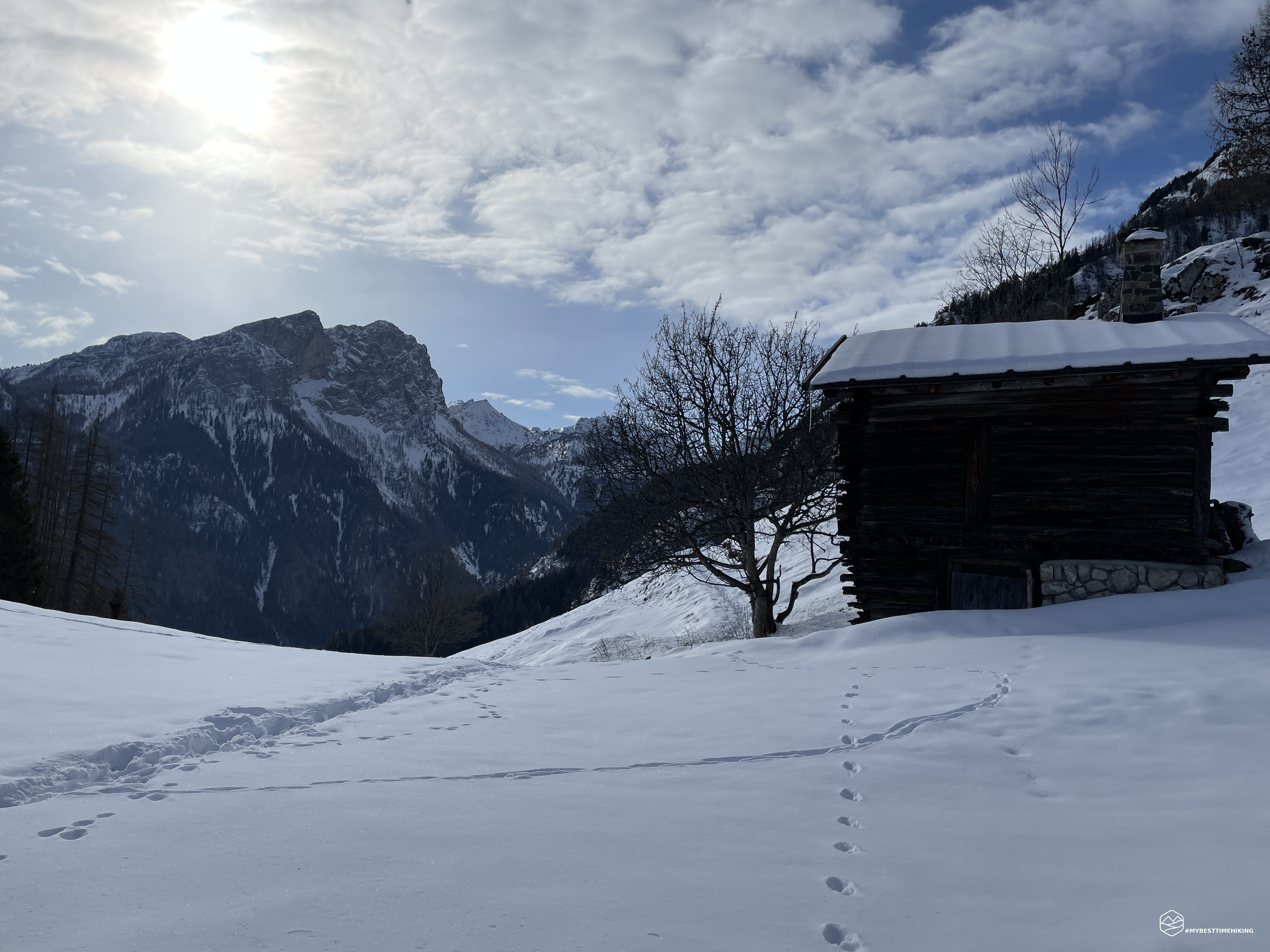
I continue the climb reaching the Pian de Fesura from which a clear indication for the various excursion solutions in this area starts. I follow the track for the monoliths of Ronch and, thanks to a track of a roe deer, I pass this short ungroomed section on almost fresh snow. Having passed a wooded tongue, I go out near an isolated hut from which there is a splendid view of the Sasso Bianco. I continue along a track that now rises sharply in a northerly direction, until it crosses the paved road at the foot of the town of Ronch. This small village perched on the top enjoys a splendid view of Rocca Pietore. A wooden crib in the square next to a frozen fountain introduces me to the path with the sign "Ferrata Sass de Rocia". So I understand that I am close to the goal.
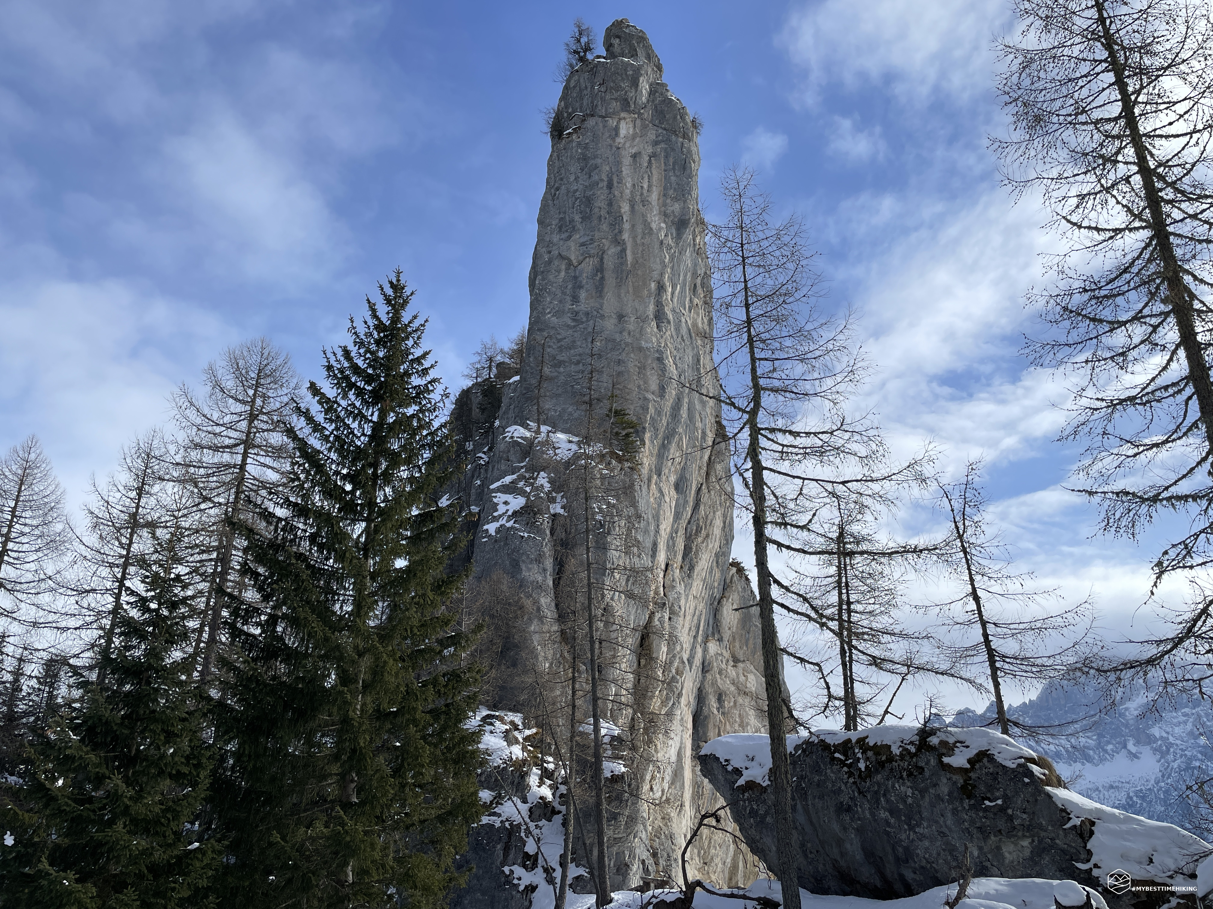
Sass de Rocia is the current name of one of Ronch's monoliths, the most famous. On this rock today there is an easy via ferrata that allows you to reach the summit also thanks to a metal bridge. From where I am, I can already glimpse the monolith among the branches of the fir trees. I quickly reach the base of the rock which appears decidedly more imminent: an almost absolute verticality and a width that didn't seem so extensive. An imposing boulder that annihilates the spectator with its upturned nose. I proceed to walk the perimeter of the menhir to look for the perspective seen by Amelia Edwards in the sketch in the novel. Looking from different angles I can't find the right image that I had memorized in my head. Was it possible that Amelia had drawn a rock in such an imaginative way?
During this search I come across the entrance to the via ferrata between a very thin crack in the rocky block. I get ready with the right equipment and start the aided section. I arrive at the vertical ladder with the iron pegs driven into the rock and proceed to the top of the first section. At the top there is a compact layer of snow, most likely no one has ventured up here in recent days. I see that another small vertical stretch awaits me ahead. Unfortunately, however, the fingers of the hands begin to be frozen, the iron pegs are frozen and, although he has gloves, the bitter cold passes through until it reaches the skin. I decide to go down and postpone the via ferrata in the summer. I go down the ladder and arrive at the base not feeling my fingers anymore: I confirm that I have made the right choice!
Date
28-01-2023
Distance
11.45 KM
Hike type
Snowshoe Trekking
Ascent
650 mt
- Mountain
Monoliti di Ronch
- Address
Rocca Pietore, Veneto, Italy
- Altitude
1651.00 m
- Refuges
- Information
I go back to the village of Ronch and take the road that leads in a West-North-West direction. I find myself on the CAI 636 path which leads to Monte Migogn (or Migion) and the Migon refuge. Next to it is a second monolith as imposing as Sass de Rocia. I find an indication posted on the same boulder that indicates "Sass de la Murada". I continue until I reach the north apex of the base of the menhir and notice that this stone is slimmer and more tapered. Here I find a cabin, built with decidedly very old timber... and if this were the Sass di Ronch indicated by the English explorer? I keep walking around it and looking at it from different points. Maybe yes, I found the right perspective! I walk into the woods with the snow almost reaching my waist. I reach a large boulder and I turn around: it's really him! I see a dolomite "stalagmite" that rises pointed towards the blue sky as if it were a letter opener stuck in the ground! I finally found it! Amelia Edwards described it thus: […] And there, on the crest, secluded, solitary as the ruin of a felled glacis, the Sasso rises to a height of at least 250 feet above the turf that serves as its base . Looking at its profile now, I found it hard to believe that it was the same Sasso di Ronch that we had observed from below. It looked like a needle, a spire, disproportionately thin for its height, curved at the top as if about to fall. Someone has compared the Matterhorn to a horse's head peeking out from behind the Zermatt Valley; in the same way, we can compare the Sasso di Ronch, seen from this perspective, to the head of a giraffe.
An authentic emotion! Being able to find the figure of the mountain described 150 years ago and which still stands there undisturbed in its slender mass. From this point the Owl also peeps out to crown an almost fairytale-like panorama. Delighted with the exploration, I retraced my steps and set out to search for one last detail that struck me in Edwards' story: the legend of the castle of Sass di Ronch.
In Amelia Edwards' account, on her way back, she met an elderly farmer who asked if he had noticed the ruins of the Castle. Dismayed, Amelia, who had not seen any ruins, asked the old man to tell her more: “The Castle, he began, was built by the Visconti, the cruel Visconti of Milan, towards the end of the fourteenth century with the aim of intimidating «the Republic» of Rocca [Rocca Pietore] over which they exercised only nominal sovereignty. But when the power of the Visconti ended, the «brava Comune», fearing that the nobles of Belluno would take over the fortress to the detriment of the people, demolished it, leaving barely two stones on top of each other. This was four or five centuries ago. Later, the nobles of Belluno, who were prevented from accessing the mountains, managed to build the Castle of Andraz, up there in the Buchenstein Valley, terrifying the whole country. [...] As for the «ancient castle» on the ramparts of the Sasso, it was like an old tree whose trunk had been cut and of which only the roots remained. In fact, nothing else had been spared except the foundations which, being made of rock, blend in with the rock itself and it can happen that you step on them a hundred times without noticing them. In fact, there aren't many locals anymore who know where to look for them. In his youth, the old man continued, peasants often climbed up there and dug in the hope of unearthing hidden treasure, but they were always chased away by fearsome lemurs. Because in fact, in the basement of the castle, access to which had been lost, terrible demons were still locked up who appeared in the form of snakes, causing overwhelming wind and lightning storms to keep away those who tried to discover the secrets of the ruins.
But had he ever seen these demons? No, he really thought not, for he had never provoked the devil by going after the treasure, but many, many times he had seen and heard the storm raging on the mountaintop while down in the valley the weather was clear. A long time ago he had known a villager who, at midnight on St. John's Eve, had climbed the mountain to dig in a certain spot where, according to a dream, the gold was buried. When he had opened a deep hole, five black snakes came out, no bigger than his fingers: disappointed and frightened, he raised his sword and cut one of those reptiles in two. And behold, in an instant the hole was full of snakes: they emerged towards him by the thousands, in a horrendous throng, large, black, venomous, writhing and hissing. And if he, running headlong, escaped death, it was a true miracle."
Intrigued by this story, I most likely found the place described by the farmer. Just above the last houses of Ronch, in the direction of Sass de la Murada, you can see a series of well-arranged boulders. I climbed up to take a closer look and you really notice an almost rectangular shape on the arrangement of the few remaining stones. Even the strategic position suggests that this could really be a suitable place for a castle.
After this feast of history, natural beauty and the mountains, I return to the track of the center of Ronch and take the CAI path which brings me back to the outward route. I pass the Col dei Pioge again where the blue sky allows me to capture an even more pleasant panorama. I choose to take the longer downhill route to make a sort of loop. I then take the official road that leads to the dam on the Ru de Rocia. Here I can't find the path shown on the Tobacco map and I have to wade the frozen stream a little further downstream from the dam. On the other bank of the stream, a wild ravanata awaits me in the middle of the bush. A track of a roe deer allows me to easily reach, apart from a few sinking knee-deep in super frozen snow, the outward road near the Troi huts.
I go down the very steep paved road and reach the paved road of Rocca Pietore. I see the parking lot and the car in the distance. The last few meters are a complete ice sheet. The idea of wearing crampons comes into my mind, but the short distance makes me give up. So slowly, I proceed walking on the eggs being careful where I put my feet so as not to slip. Almost at the parking lot, I cross an elderly local lady, with her shopping bag in her hand, who proceeds quickly on the icy road with a pair of cobalt blue Crocs on her feet! At this moment all my certainties of being a decent mountaineer are shattered and I can only admire this lady who literally "flies" on the ice: mountaineers are of another level!
Thus concludes a splendid exploratory adventure in the footsteps of Amelia Edwards. An excursion that I will certainly retrace to learn more about the via ferrata at Sass de Rocia. The walk is suitable for all hikers with a minimum of training. The difference in altitude is around 650 meters of ascent. You reach a maximum of 1650 meters above sea level and for this reason it is a destination that can be chosen in all seasons of the year. Furthermore, it can be undertaken as an exit in the event of uncertain weather: the entire itinerary described is completed in just over 4 hours.
DifficultyHikers - Itineraries on paths or evident traces in various types of terrain (pastures, debris, stony ground ...). They are generally marked with paint or cairns (pyramid-shaped stacked stones that allow you to identify the route even from a distance). They can also take place in snowy but only slightly inclined environments. They require the equipment described in the part dedicated to hiking and sufficient orientation skills, walking training for a few hours. |