
Late October, roasted chestnuts and the bright colors of autumn should be the normal company of this period, however, the hot late summer sun is still present. A sun that today is alone in a clear blue sky that would be the envy of any August day.
The usual Diego and I are climbing, on an unusual working day, to the parking lot of the Auronzo refuge at the foot of the Tre Cime di Lavaredo. Once in Misurina, past the lake towards Carbonin, we meet on the left the Hotel Dolomiti Des Alpes, a comfortable and strategic hotel for excursions in the upper Cadore area, and we proceed on the road to the right, right in front of the hotel, towards Tre Tops.
Going up, you can take a short break at the beautiful lake of Antorno where the "Three Sisters" are reflected in a fairytale setting. A little further on, the toll booth, with an adjoining queue lasting several minutes, forces us to wait for precious time before paying the fateful € 30 toll. This is the cost of saving an abundant hour of walking and positive elevation gain to the Auronzo refuge.
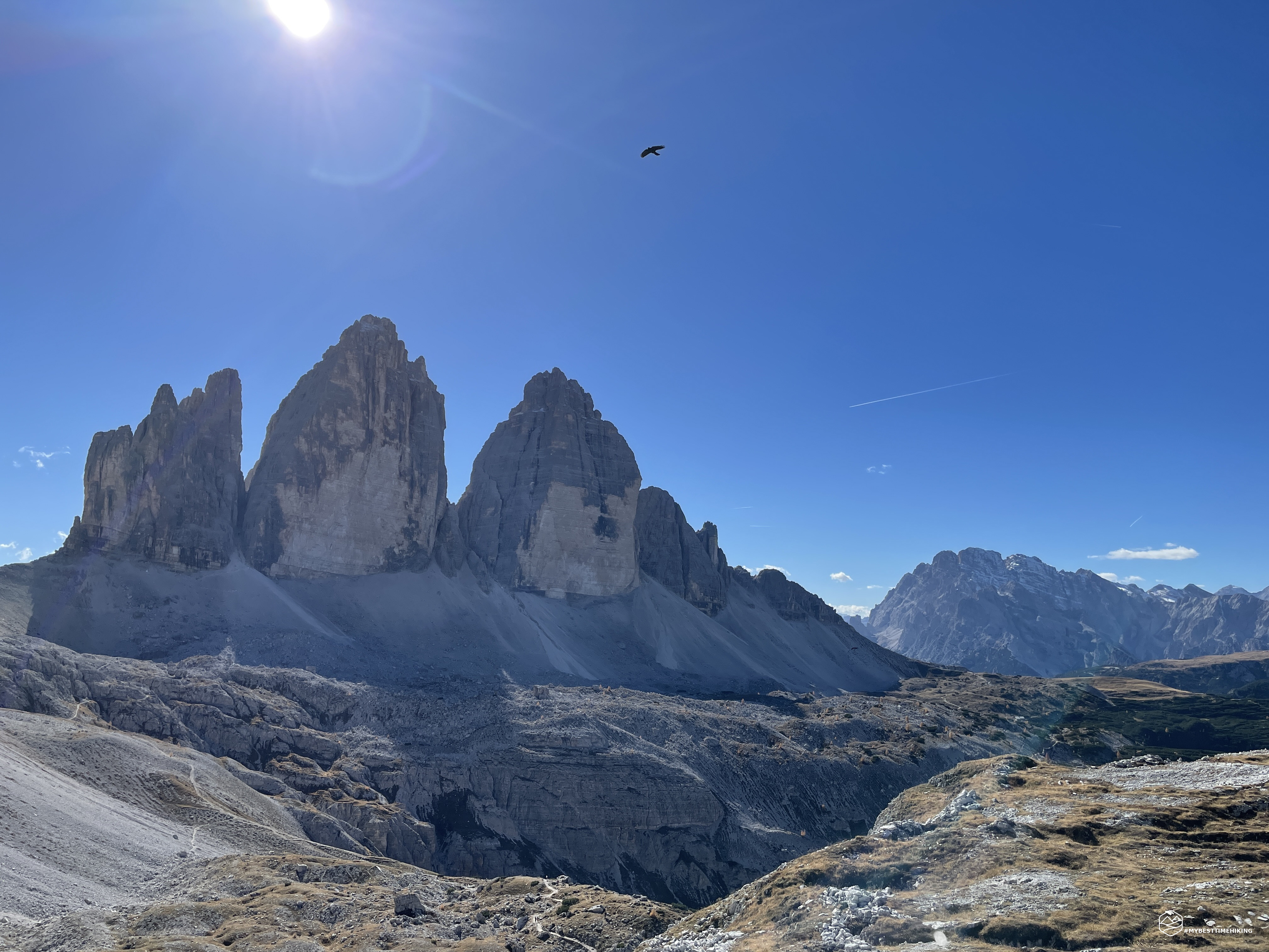
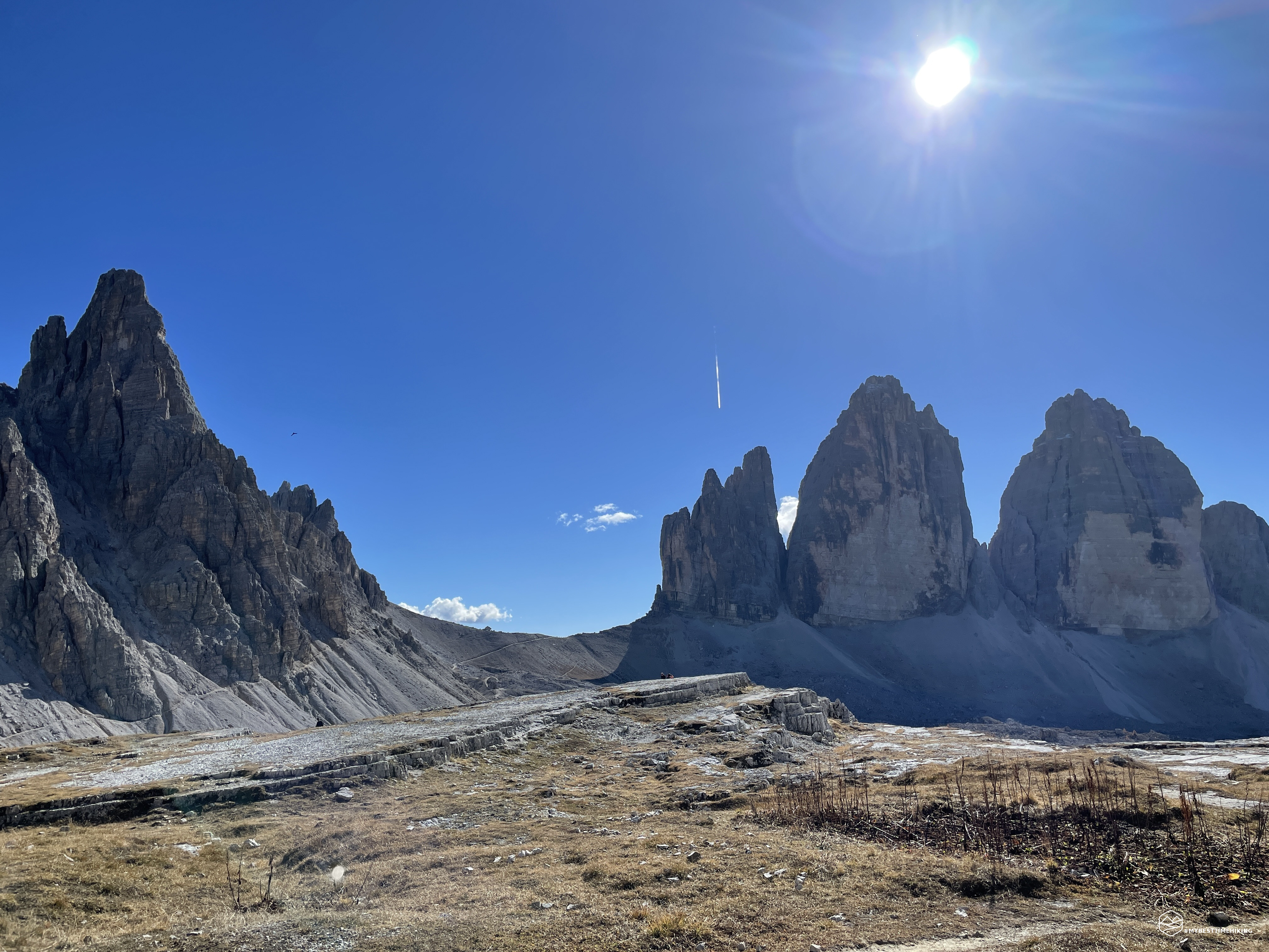
The car park, although very large and capacious, seems saturated as in the most classic summer weekends. We reach the Auronzo refuge where we have the first spectacular view in front of us: the Cadini di Misurina, the lake that shines at the bottom right and the legendary Cristallo group with the slightly whitewashed N side. From here on, for the entire circular route, the views you will encounter will be magical, unforgettable, almost poetic: no set of words can ever express the complete emotion you feel!
Backpack on our shoulders and proceed on the CAI 101 path leaving the Auronzo refuge, closed in this autumn period. The route consists of a wide stony road, almost flat, which runs along the scree at the base of the Cima Ovest and Cima Grande. The colors of the rock, of an unmistakable pink-orange, leave you bewitched in the presence of these “Three fingers of Dolomia”.
The road remains constant at the altitude of 2300mt, in a short time we reach the Chiesetta degli Alpini from where you can see the war memorial not far away. From here you can even see the Marmarole.
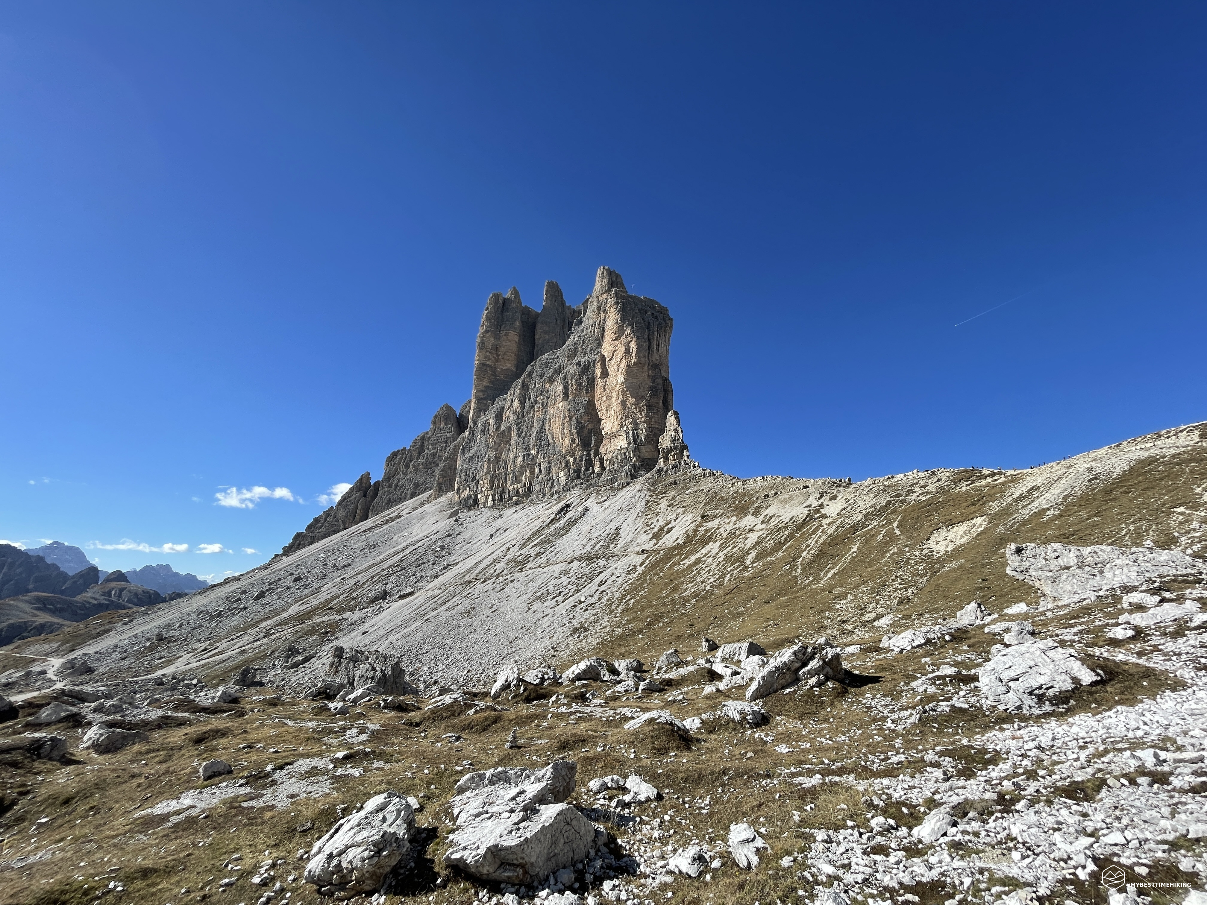
Continue further towards the NE and in less than an hour you will reach the Lavaredo refuge, always visible from the Chiesetta degli Alpini. A break is a must to observe the fantastic panorama offered. Here the massive that dominates is the Croda dei Toni which with its tonnage and elevation over 3000m dominates the landscape. We always follow the CAI 101 track and a gentle but constant slope allows us to reach the clearly visible apex: the Lavaredo fork. A couple of loops between the river of rocks invite you to the final straight to reach an altitude of 2454m where the saddle, next to the Cima Piccola delle Tre Cime, offers the view from the highest point of the excursion, just over an hour after departure . From here you have a spectacular view of Mount Rudo, the Torre dei Scarperi, up to Mount Paterno. Looking down, however, you can see Pian da Rin. Following the clearly visible road at the foot of Mount Paterno, you come to see the Locatelli refuge, the next stop on the ring.
Date
19-10-2022
Distance
11.38 KM
Hike type
Hike
Ascent
482 mt
- Mountain
Tre Cime di Lavaredo
- Address
Misurina, Veneto, Italy
- Altitude
2454.00 m
- Refuges
Rifugio Auronzo, Rifugio Locatelli
- Information
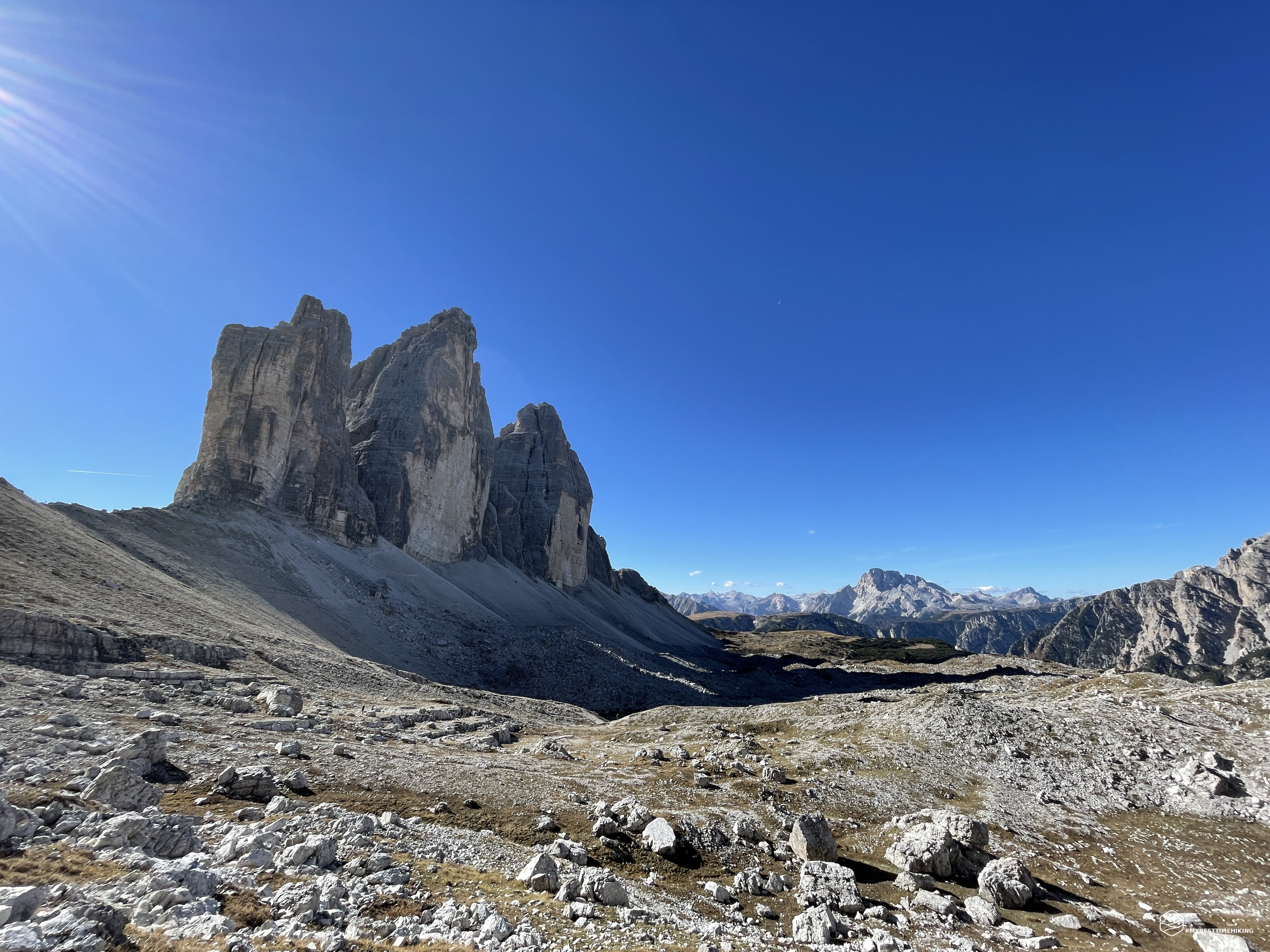
We leave the Three Peaks behind us and continue slightly downhill, skirting the scree that descends from Mount Paterno. Tracks sink into the clear stones and rise towards the compact rock of the Paterno in the direction of the via ferrata that allows you to reach the summit. We remain on the main path and, from time to time, we turn to observe the magnificent image that the silhouettes of the Tre Cime di Lavaredo form. In about twenty minutes from the Lavaredo fork you reach a crossroads where it is possible to descend towards Pian da Rin on the left, continue on the gentle dirt road keeping the direction towards the NW, or gain the 50 meters that separate from the Locatelli refuge on comfortable stairs dug into the rock with wooden planks that ensure the passage. We choose the latter option, go up in a zigzag and quickly reach the Toblin saddle. Here the view is spectacular: towards the N the Scarperi group and, closer, the Torre di Toblin with the Sasso di Sesto, towards the E the mount Rudo and the Torre dei Scarperi, towards the W mount Paterno up to turn towards the S where the view of the Three Peaks is the most viewed photograph in all mountain books!
We thus reach the Locatelli refuge, closed today, in less than two hours, and we deserve a little break in the company of the choughs that hover over our heads and glide close to us waiting for some crumbs. After the rest, we descend from the CAI path 102, with a wide curve that takes us back to the crossroads a little while ago. Here we choose to descend towards Pian da Rin on the CAI 105 track. Wide cart tracks with reinforcing wooden pillars allow us to descend in tranquility from an altitude of 2300m to 2170m of Pian da Rin. A precise and always present signage allows us to never make a mistake on the ring road we intend to take. At the center of Pian da Rin we find ourselves in a basin, we only see the tips of the Tre Cime as we have moved decidedly in the S-SW direction. In front of us we see the track that cuts a gravelly ridge, climbs with a steep slope and then disappears a little higher. This is the most important climb of the entire excursion, you gain about 100m of elevation gain, without difficulty, but for the less trained it may take a few breaks to catch your breath. You quickly cross the ridge reaching a small saddle surrounded by mountain pines.
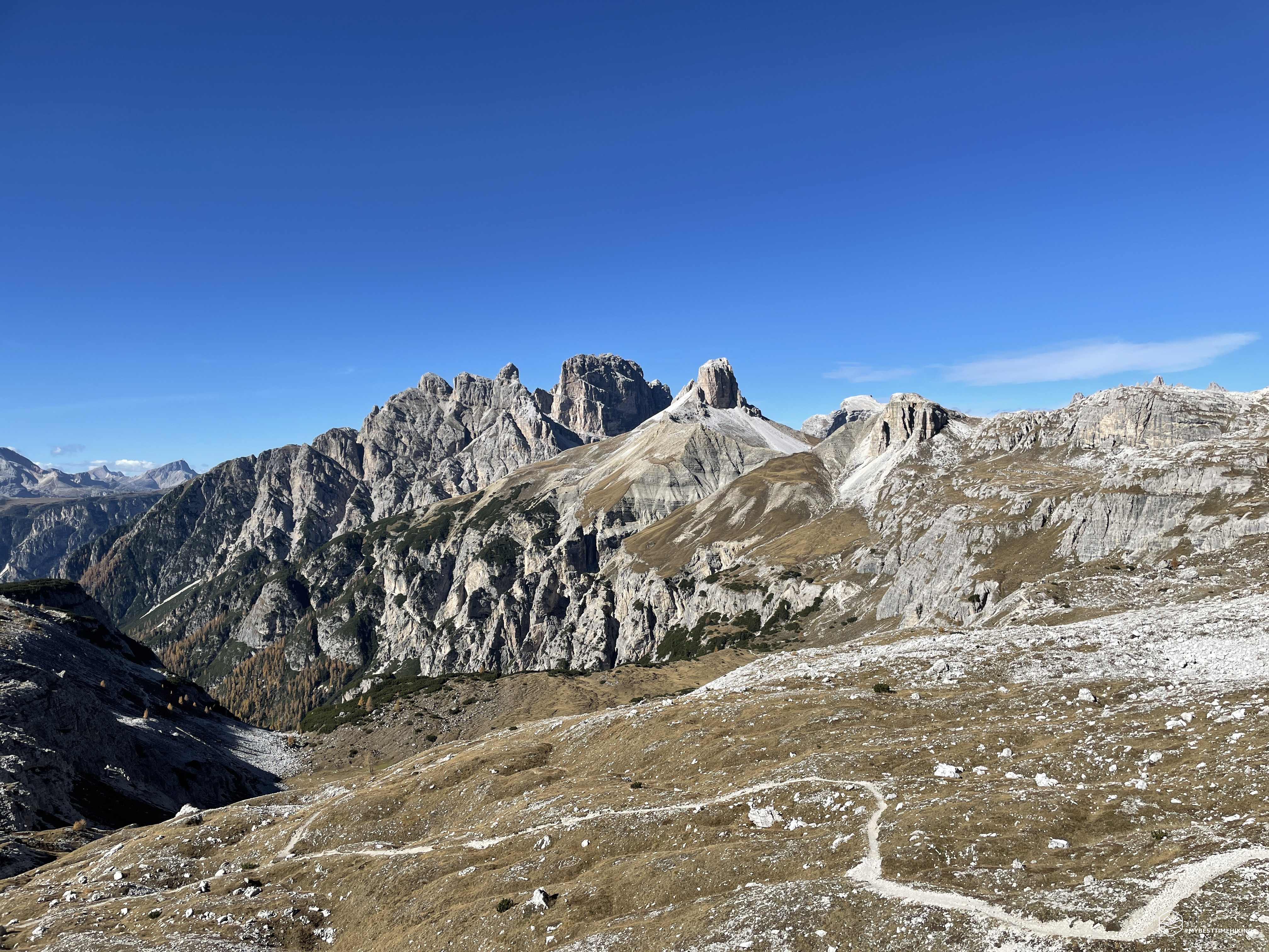
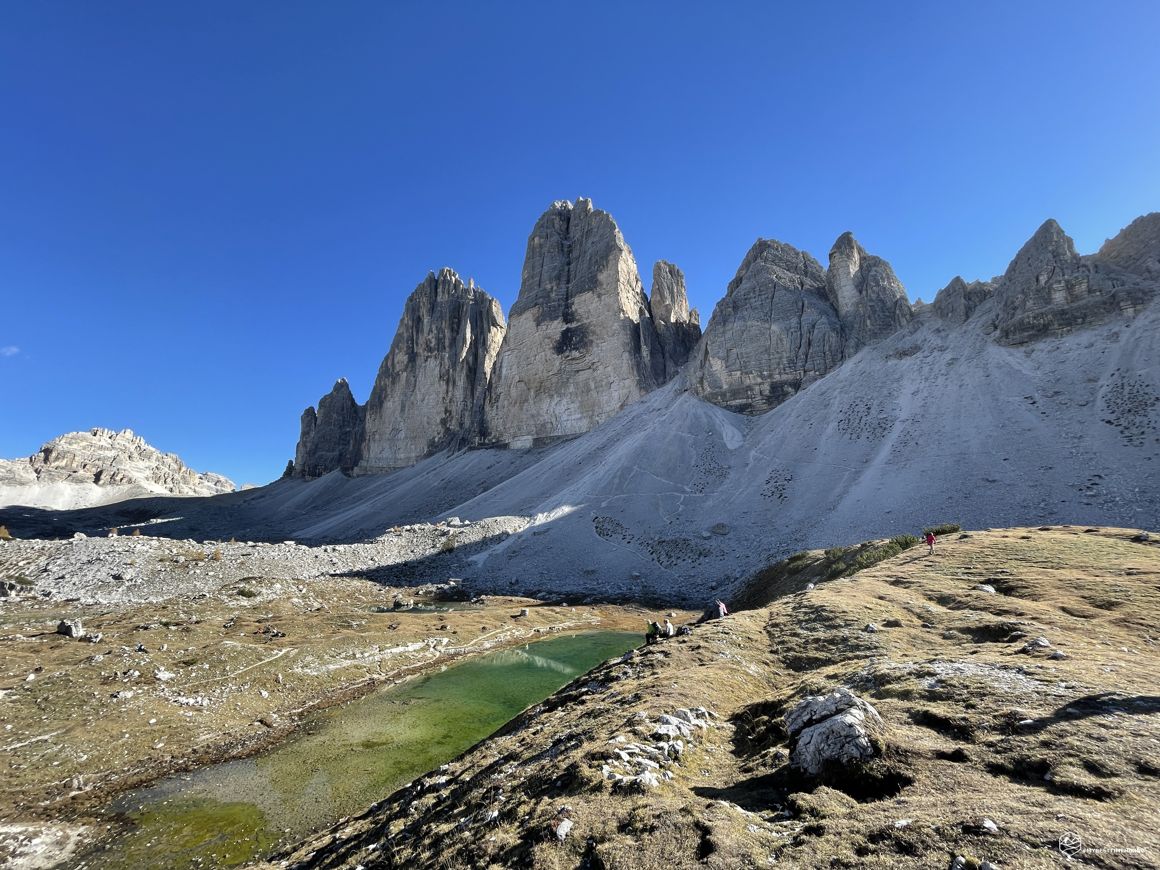
We are always on the CAI 105 track, among the ups and downs in the company of colored larches we see the "Three Sisters" appearing in the direction of Col Forcellina. We reach it without effort (less than 3 hours from departure). On the hill there is a small hut, the "Langalm" (or Shepherd's hut) which is also closed. Here, a small detour is a must where you can see small lakes, usually 3, in which the wonderful Three Peaks are reflected. Today, given the lack of water throughout the year, there is only one of these very, very limited.
We leave the Col Forcellina and pass a gravelly coast that descends from the Sasso di Landro, an unusual view of the Three Peaks in a row is the sign of their greeting before reaching the last fork of the day: the Col de Medo fork (or Col de Mezo). The stretch of path to reach it is slightly uphill with a steep scree to the right that points straight towards Val Rimbon. Original lamellar rock conformations invite you to the saddle from which you have a splendid view, starting from the right, on Mount Rudo, the Cristallo group, Misurina with its lake, up to Cadini.
We head straight towards the Auronzo refuge which peeps out a little higher than our position towards the SE. A last effort of about 15 minutes allows us to reach the refuge not before having enjoyed a splendid field of stone "cairns", typical markers of the right way to go. After about 3 and a half hours of actual walking, the Tre Cime di Lavaredo ring closes. An excursion suitable for everyone, even for families with trekking strollers. An experience to be granted at least once in a lifetime to enjoy unique emotions in the presence of these iconic mountains between Veneto and Trentino Alto Adige.
DifficultyTourist - Itinerary on narrow streets, mule tracks or wide paths. The routes are generally not long, do not present any orientation problems and do not require specific training if not the typical one of the walk. |