Late June, a beautiful and cloudless day in the early morning. Giorgia and I are ready for an adventure starting from the Falzarego Pass. Today we try to reach a real summit: the Lagazuoi! For Giorgia the highest peak she has ever reached only with her own strength without mechanical aids!
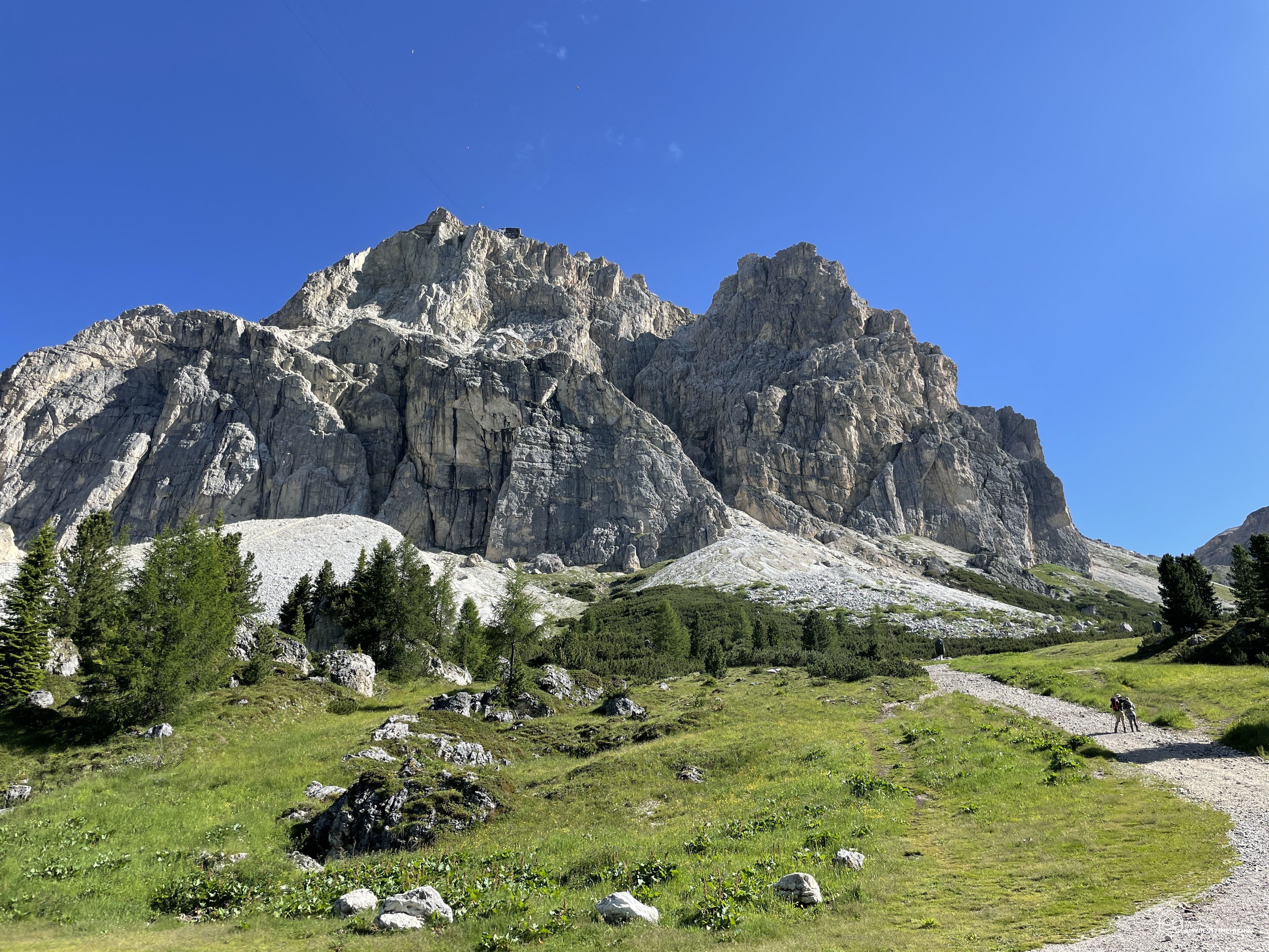
We reach the Passo Falzarego car park, in front of the cable car departure. We won't need it today, because we intend to reach the summit cross entirely on foot. In front of us, majestic, stands the Piccolo Lagazuoi. It almost seems to come at us from how vertical it is. We fasten our boots, backpacks on our shoulders, a last look at the distant destination that awaits us. Giorgia is charged: she goes!
We leave the cable car behind and take the dirt road that climbs towards the NE. In the beginning, the road coincides with the CAI 402 path and forks after a hundred meters to reach the Lagazuoi Tunnel which penetrates the heart of the mountain. We proceed on the track that in winter represents the Lagazuoi ski slope. Beautiful wide, but with a decidedly marked and constant slope. Absolutely preferable uphill because the fine gravel on a compact layer could reserve unpleasant falls.
We always advance in sunny weather, there are no trees or shrubs to enjoy a little shade. Already after a hundred meters in altitude, at the first bend to the left, when you turn, you have an exceptional view of the Averau, the Lastoi de Formin, the Civetta that peeps out and, on the right, the legendary Marmolada. We continue along the orographic right of the Rio Lagazuoi of which we see only a timid waterfall that emerges from a rocky drain. On our left we can already see the Forcella Lagazuoi, while straight ahead the track that allows us to reach Forcella Travenanzes and the homonymous valley.
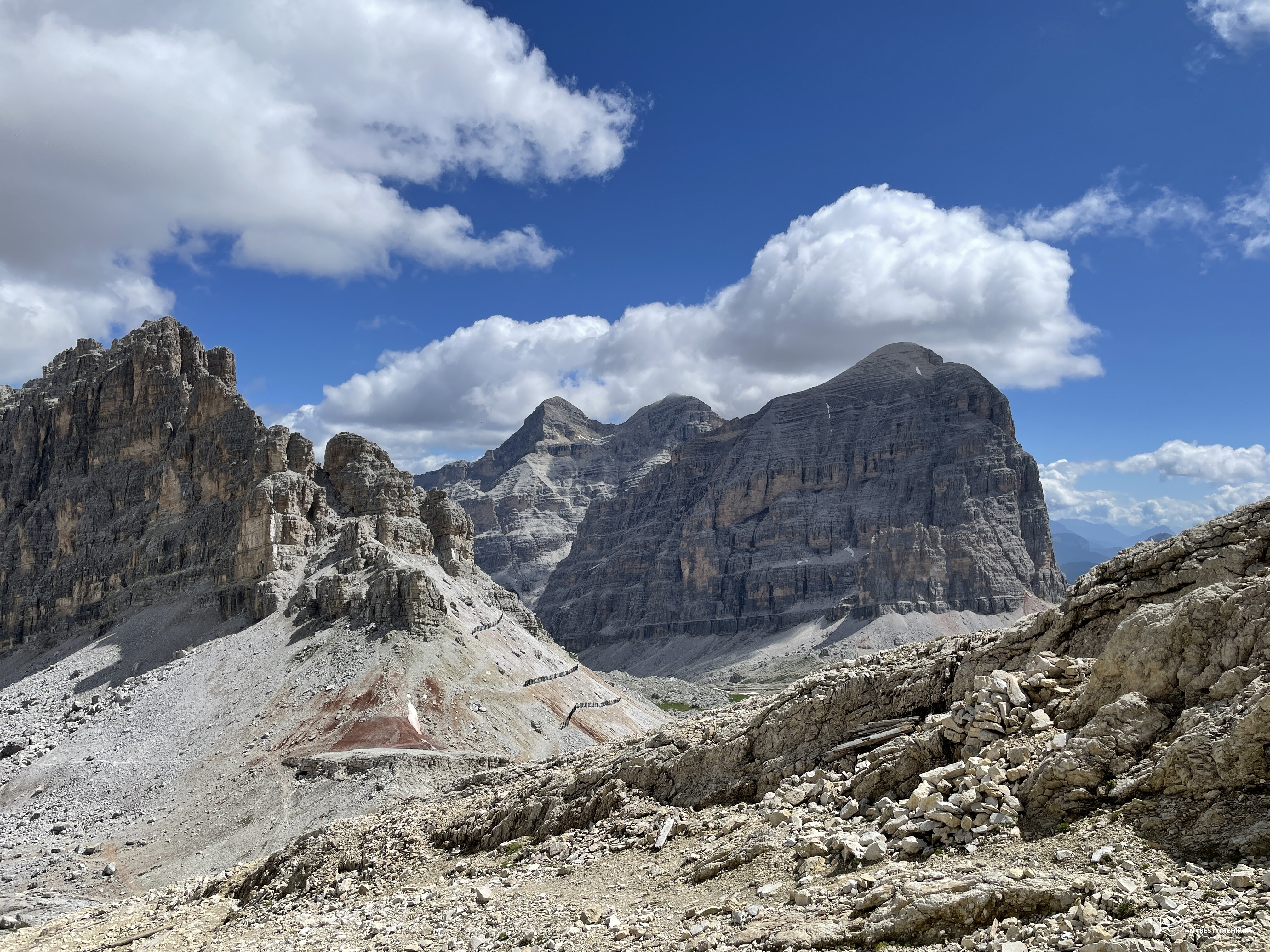
New deviation to the left and we head straight to Forcella Lagazuoi. We proceed quickly, uphill we make a good grip on the ground. We see the saddle closer and closer, the last stretch is a bit more challenging on fine gravel. Altitude 2573 meters, arrived in the saddle! The wind whips impetuously, we are in the middle between the base of the Lagazuoi Grande and the Piccolo Lagazuoi. Towards the north we can observe the characteristic lunar landscape of the Lagazuoi until we see the Cima Scotoni. Towards the south, on the other hand, we have an exceptional view of the 5 Torri, Averau and Nuvolau as if set in a jewel. We note the CAI path 401 which leads first to the saddle and then to Val Travenanzes. This route had certainly been traveled by Italian soldiers in the vanguard front at the base of the Tofane. We look towards the top and notice the path set in the rock that zigzags up towards the summit.
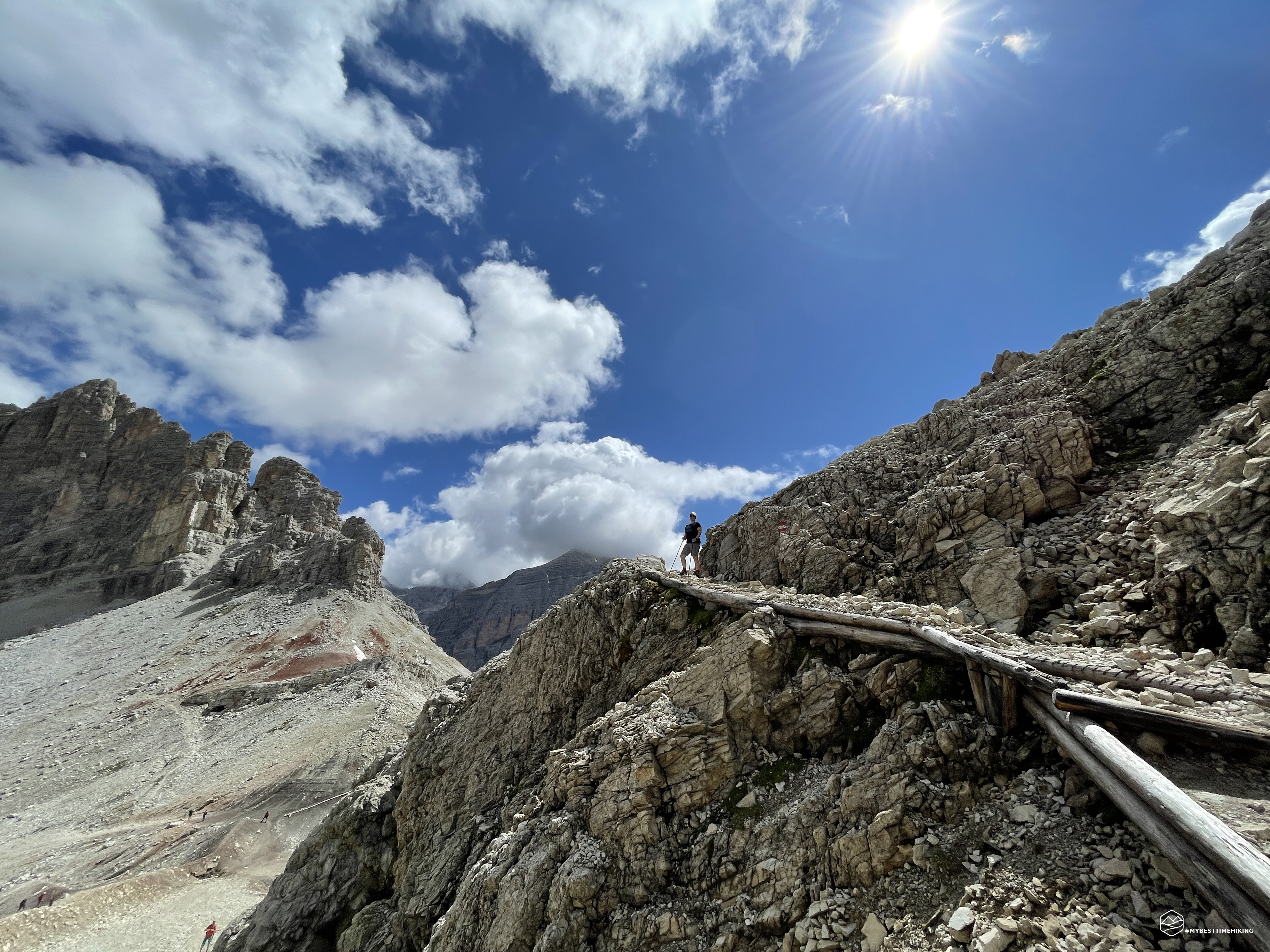
We are looking at the ridge that faces east of the Piccolo Lagazuoi. We leave the saddle and reach the path, very comfortable on rocks and wooden poles that rise alongside this rocky wall bristling with caves open towards the Falzarego Towers. This ridge, called during the war the "Great Wall" (or "Rocky Wall") was the ideal lookout for the Austrians towards Col dei Bos and the immense stony ground of the upper Val Travenanzes and the base of Castelletto. Here, excavated in the rock, we could also observe the shelters and the real offices of the Austrian officers.
Date
23-06-2022
Distance
8.74 KM
Hike type
Hike
Ascent
680 mt
- Mountain
Lagazuoi
- Address
Passo Falzarego, Veneto, Italy
- Altitude
2792.00 m
- Refuges
Rifugio Falzarego
- Information
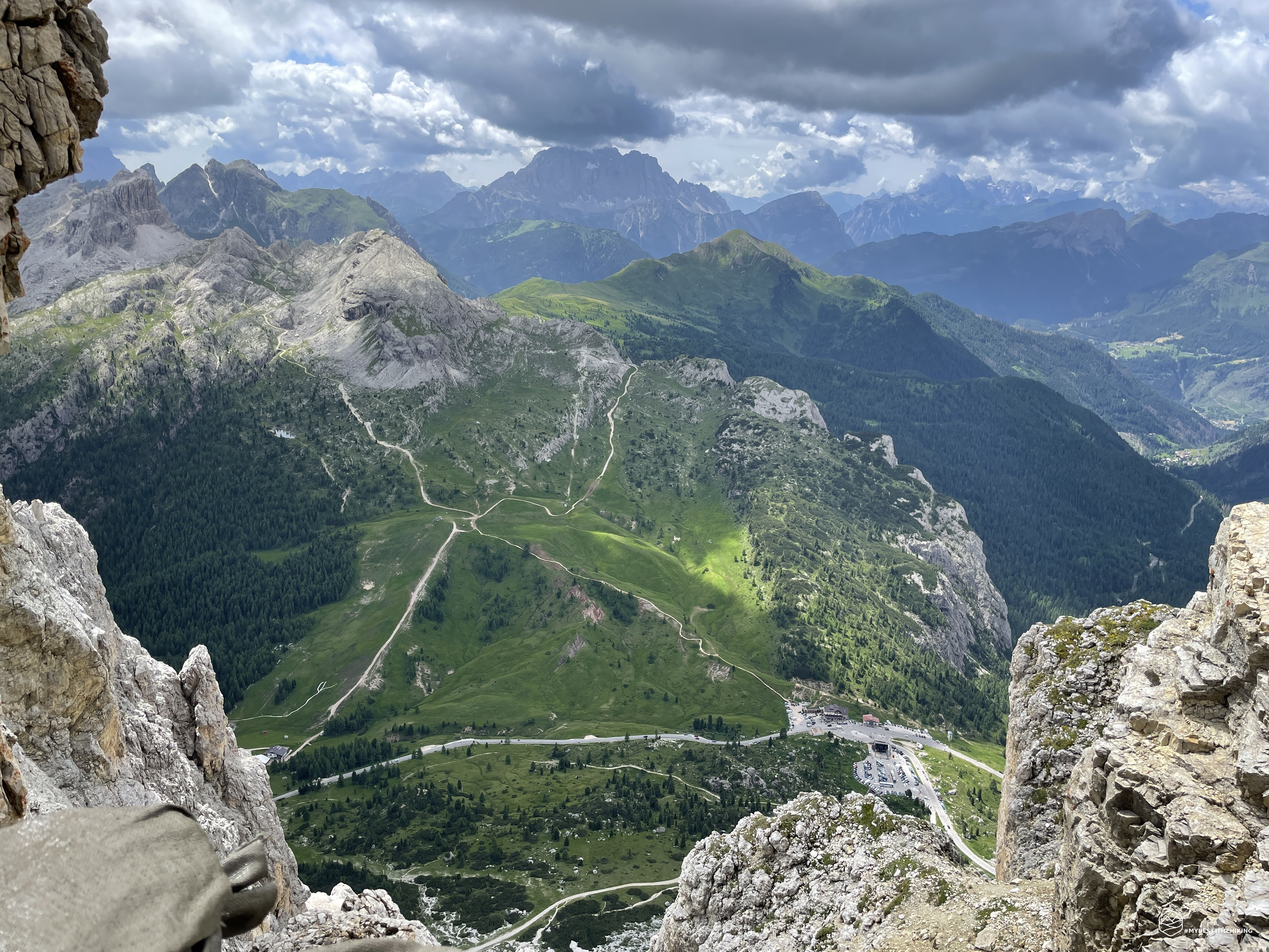
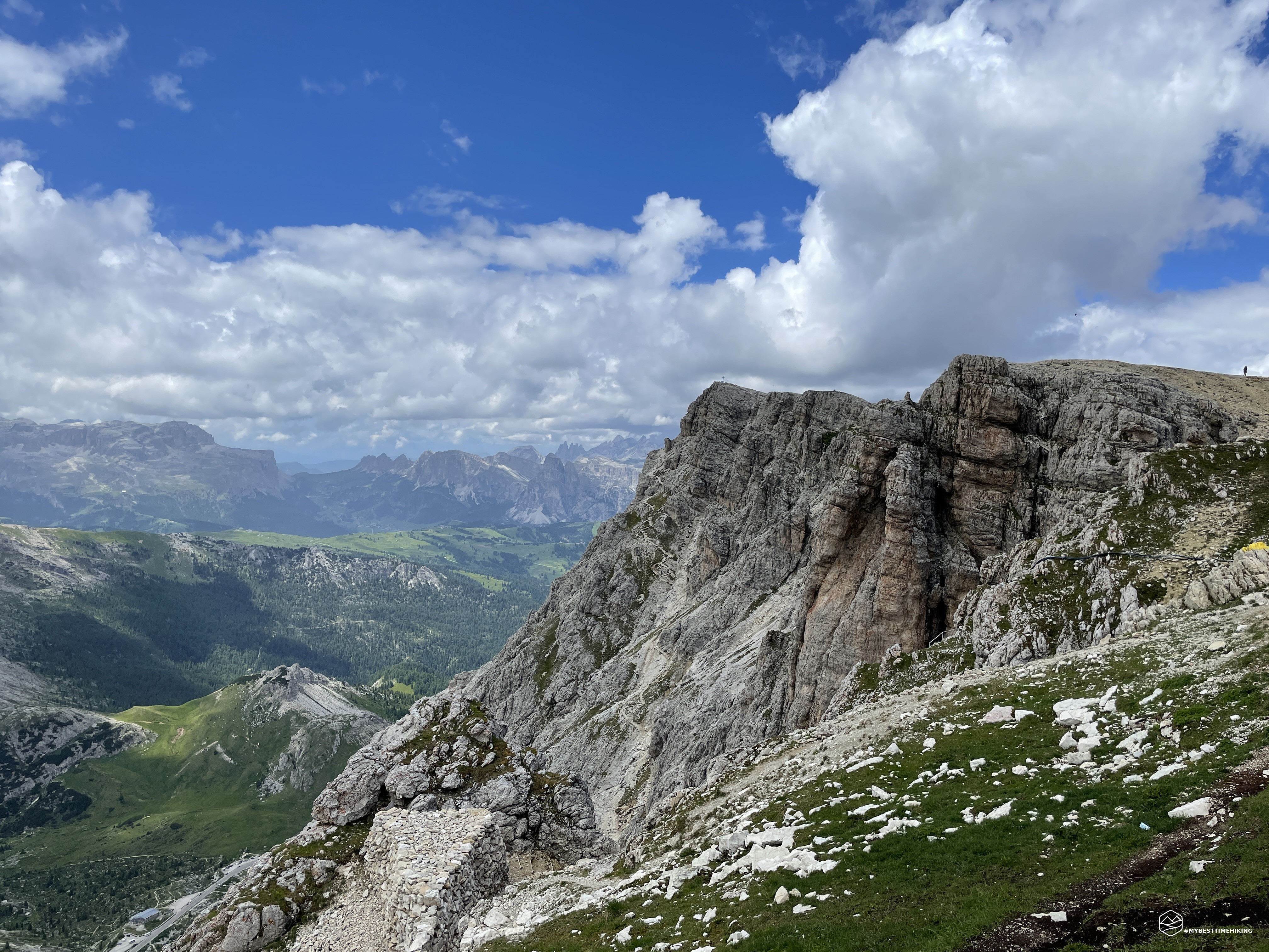
We also find a small snowfield, we are at 2700mt. It is very close to the summit. We reach the summit ridge of the rocky wall and have a breathtaking view of the Falzarego pass, the Civettta and the amphitheater of the Ampezzo peaks. To protect the chasm there is a dry stone wall with a series of sandbags to evoke a real trench of the Great War. Once inebriated by such great beauty and scent of history, we turn our gaze to the right where we see the Lagazuoi Refuge soaring! We soon reach it and admire the view from the large terrace of the refuge. A succession of peaks ranging between Veneto and Trentino Alto Adige. In fact, we are on the peak of the Lagazuoi at an altitude of 2752m.
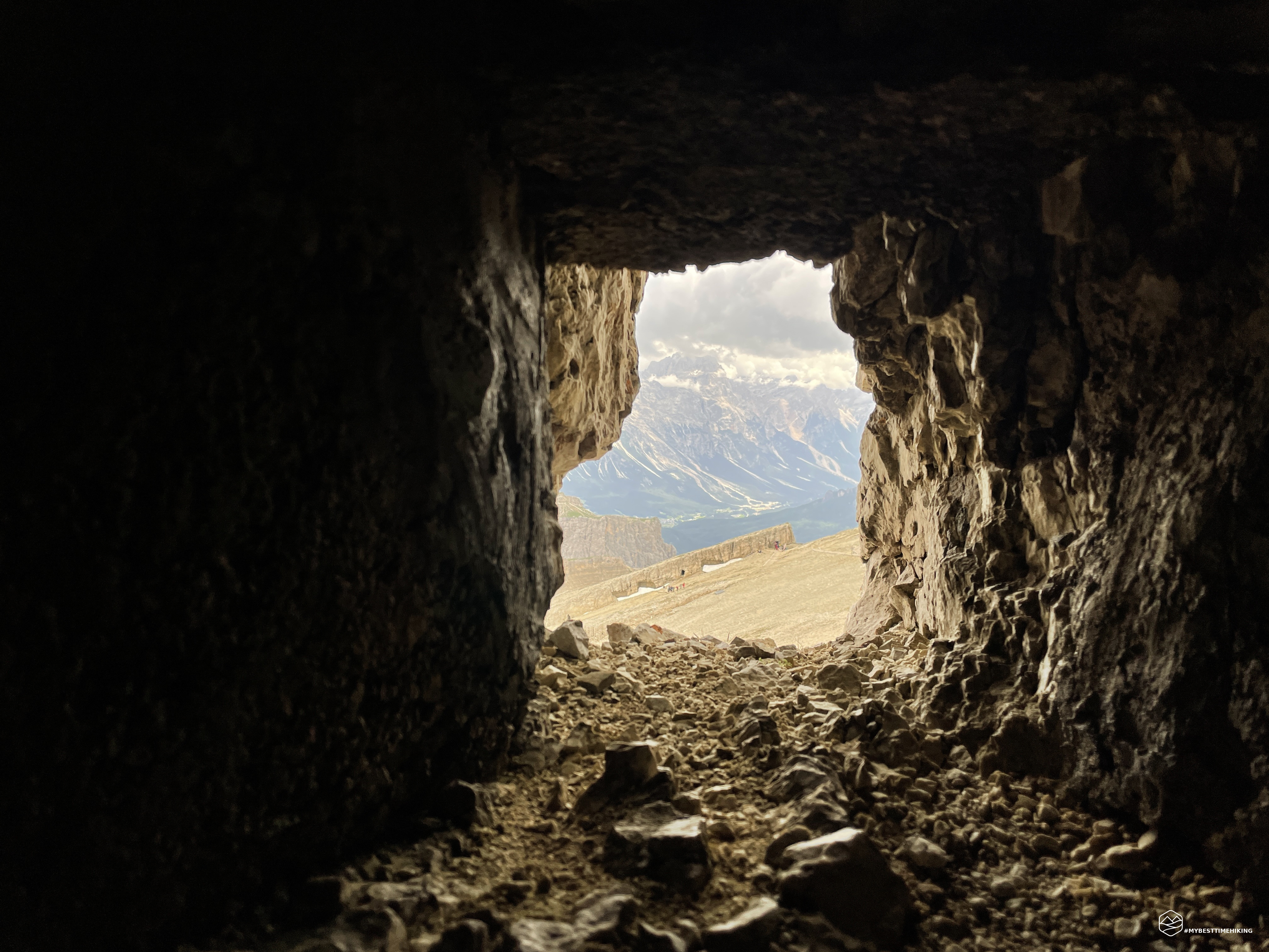
Here we find a sentry from Lagazuoi wearing the clothes of a military sergeant from the First World War who is guiding a group of hikers and explains in detail the history of these places. So I take a little historical note. We are on the Austrian front line. Most of the Piccolo Lagazuoi complex has always been in Austrian hands. The type of war that was fought here, a mine war, has never definitively clarified who attacked or defended the positions on this peak. The continuous digging of tunnels to surprise the enemy beyond one's front was a continuous listening, waiting and predicting where the enemy would emerge. The Italians, then, with the "discovery" and the defense of the Cengia Martini were a thorn in the side for the Austrians. The famous ledge is just below the forerunner, slightly shifted towards the SE. Invisible both from above (protected by a rock roof) and from the Falzarego Pass, it was a perfect stopping point to ward off the Austrian advance and attempt some attacks.
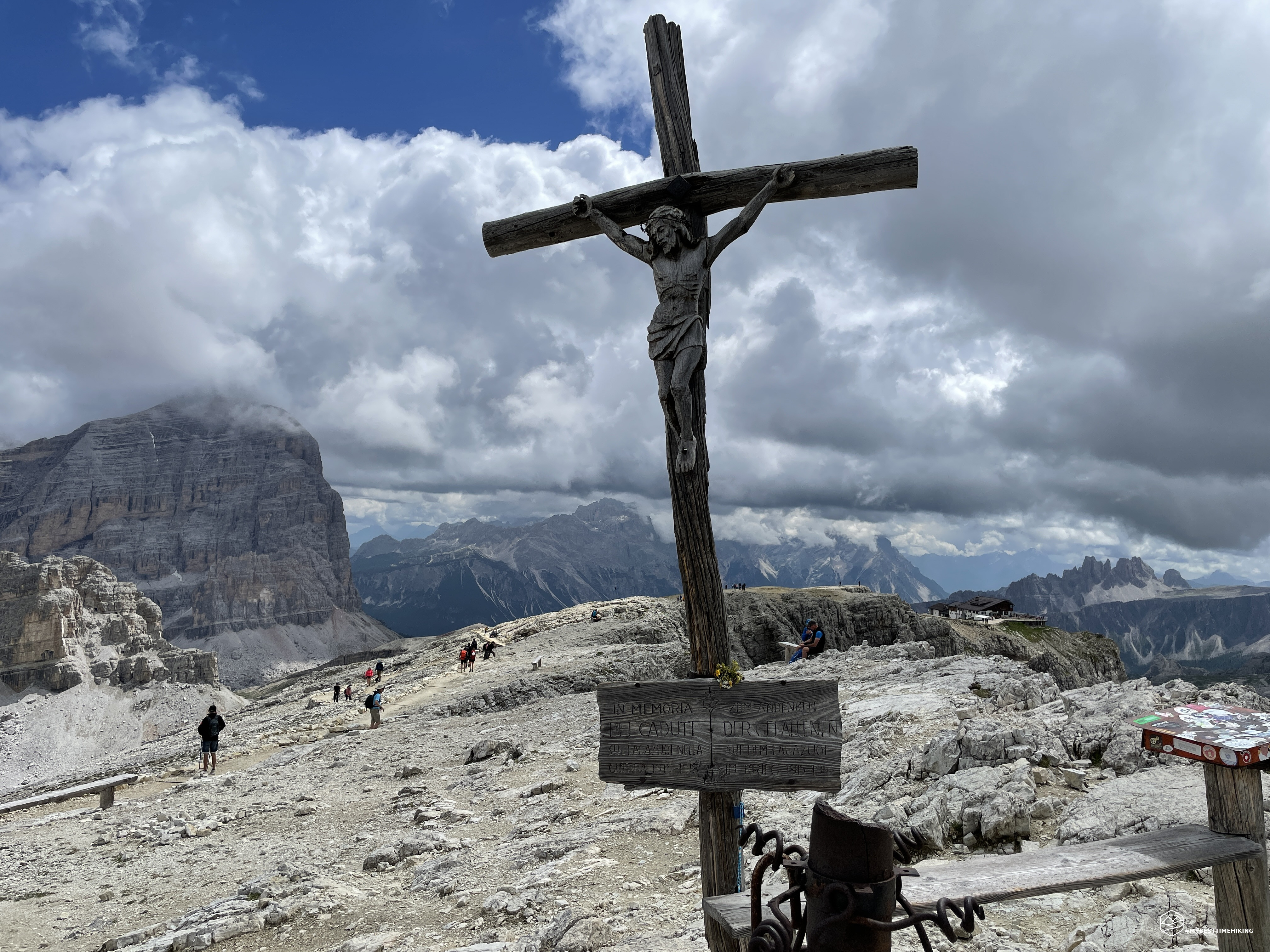
We continue towards the summit, skirting a small ridge which is also perforated to create a small tunnel that points towards the Great Wall. This last stretch up to the summit is a pleasant walk made easy and equipped also for wheelchairs that reach the refuge thanks to the cable car. In this way anyone can reach the historic peak of Lagazuoi. At an altitude of 2792m, an imposing cross with Christ determines the summit: we are on the top of the Piccolo Lagazuoi! A 360-degree panorama awaits us: from the magical mountains of Cadore, Sorapiss, Antelao, Pelmo, Civetta, passing through Averau, Nuvolau and 5 Torri, to the Marmolada, Sass de Stria, Col di Lana, to get to Alta Badia , at Passo Gardena, with the Sella Group, Sassongher, Piz de Lavarela, ending with Grande Lagazuoi and Tofane. A view to take your breath away.
Obligatory ritual photos with this panorama and we return to the refuge where a hearty restorative lunch awaits us. The fettuccine with venison is highly recommended! We rest for a while, we still enjoy the coolness and the view from the panoramic terrace and then we go down the same route as the climb. Delighted we return to the Falzarego pass and continue to look at the splendid feat we have carried out today. An unprecedented ascension for Giorgia who had never reached such a high peak.
An adventure for moderately trained hikers. Highly recommended for lovers of historical routes. An excursion that at every step evokes a story made up of sacrifices and love for the homeland.
DifficultyHikers - Itineraries on paths or evident traces in various types of terrain (pastures, debris, stony ground ...). They are generally marked with paint or cairns (pyramid-shaped stacked stones that allow you to identify the route even from a distance). They can also take place in snowy but only slightly inclined environments. They require the equipment described in the part dedicated to hiking and sufficient orientation skills, walking training for a few hours. |