Even if the calendar does not agree, the very hot summer of excursions begins already in early June! Today's adventure takes place in the fantastic Venetian Dolomites in the Cristallo group, together with my friend Andrea, to discover the top of the Cristallino di Misurina. A wonderful day, without clouds already from the first morning, welcomes us on the road that from Auronzo leads to Misurina, to reach the starting point at the Ponte della Val Popèna, before Carbonin.
We leave the car on the back with a decent parking, fasten the boots and go! It is 9 o'clock, we are already in short sleeves and I am already cursing for the choice of long pants ... The path to follow is CAI 222: the trail is clearly evident at first, continues with subsequent interruptions caused by landslides and landslides on the Rio Popèna bed. There is no chance to get lost and the trained eye of a good hiker can see the many "cairns" of stones that indicate the safe passage on the stony bed of the river. For the more "wild" you can also opt to go along the left bank of the river and immerse yourself in the vegetation.
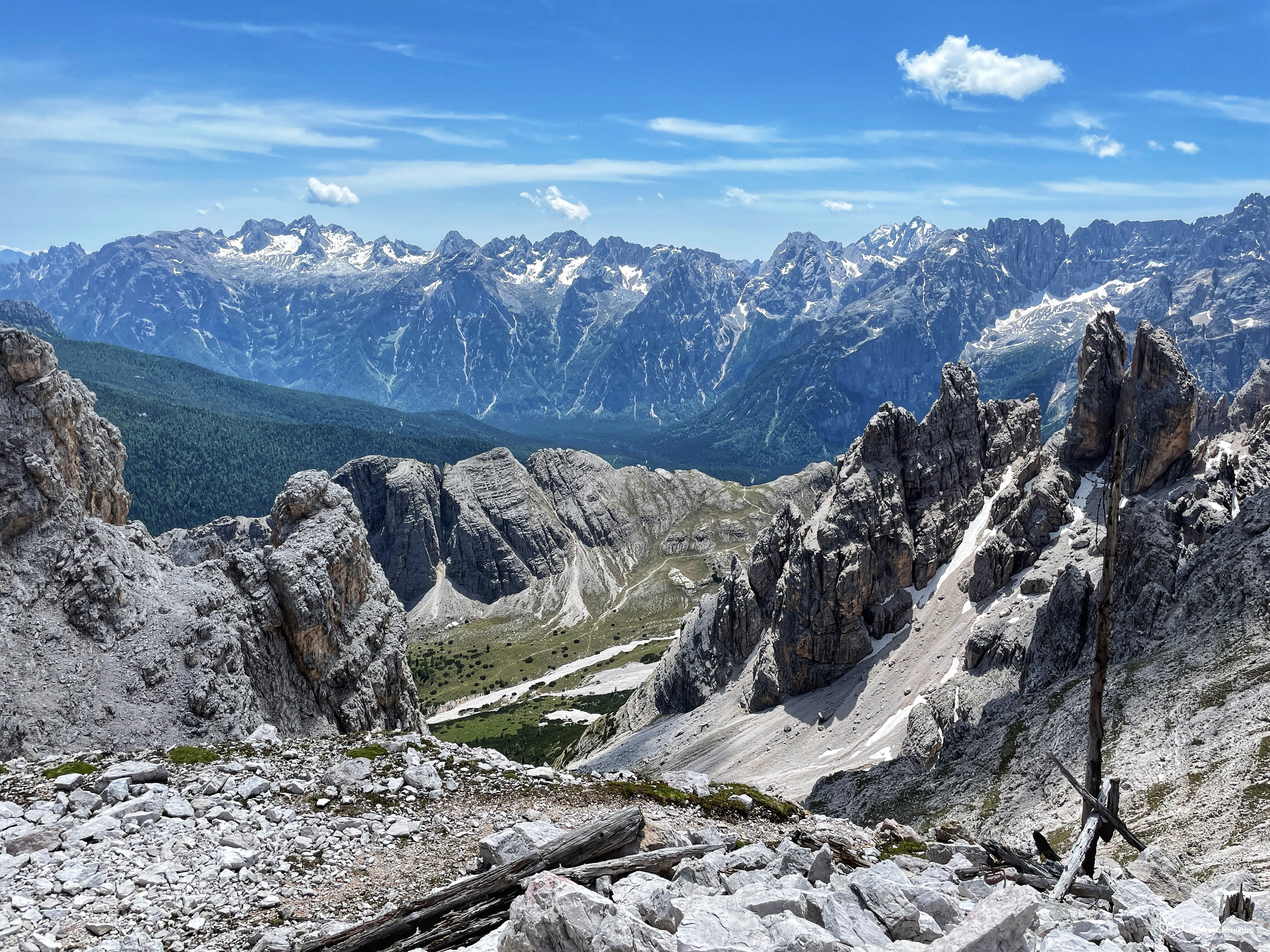
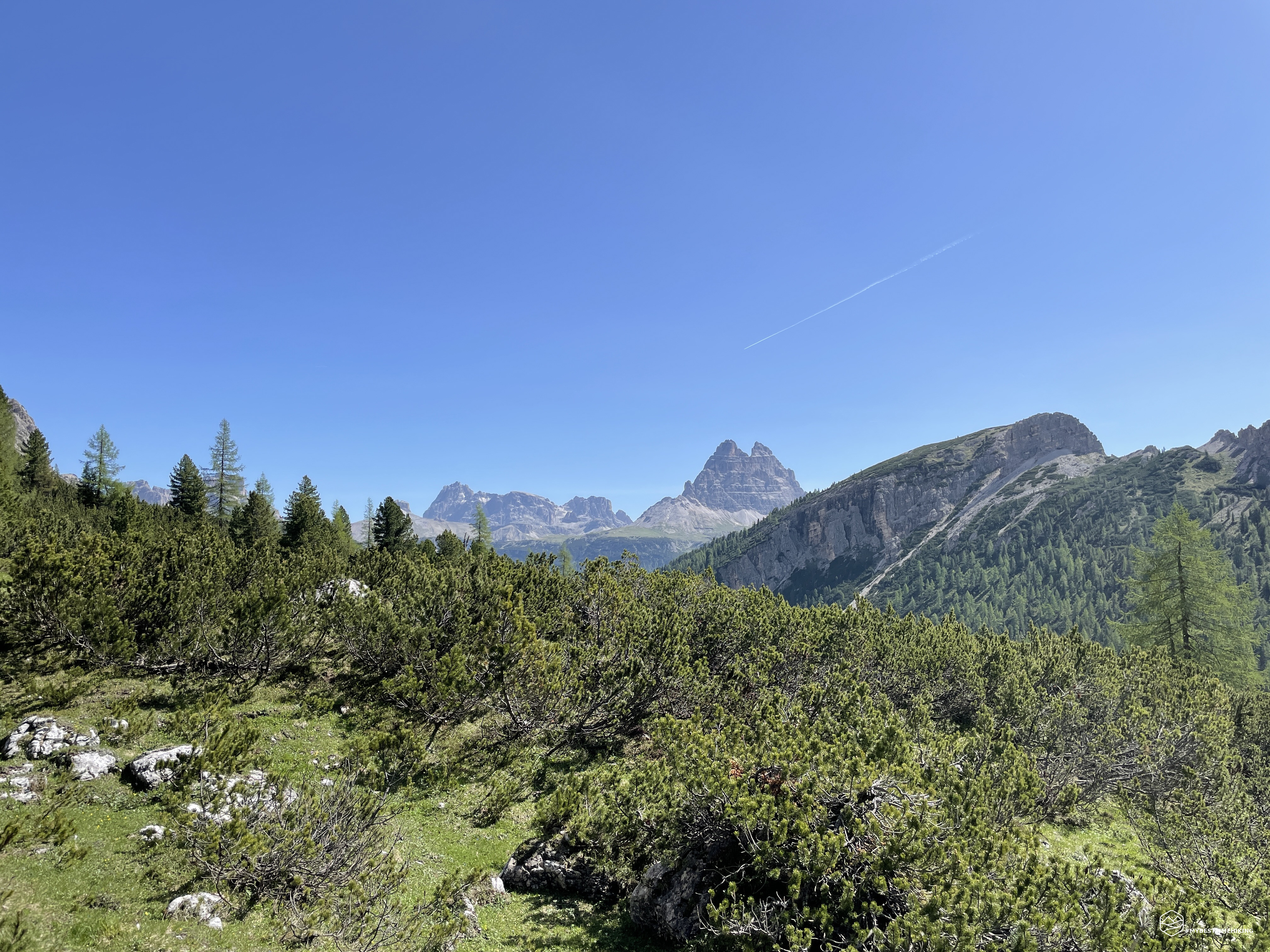
The ultimate goal is to reach the end of the vegetation by advancing into Val Popèna Alta and, in about an hour, you will reach the junction with the variant of Alta Via number 3 on the CAI 224 path and the deviation of the CAI 222a path. This last path is the one we undertake at a good pace as we enter a grove of mountain pines. The view from here is already splendid: at the bottom of Val Popèna it is possible to observe the characteristic bell towers of Popèna: thin and tapered pillars that stand out with incredible elegance! On the left the Costa del Popena with the top of Mount Popèna where, behind it, not visible, we know there is Misurina and its lake.
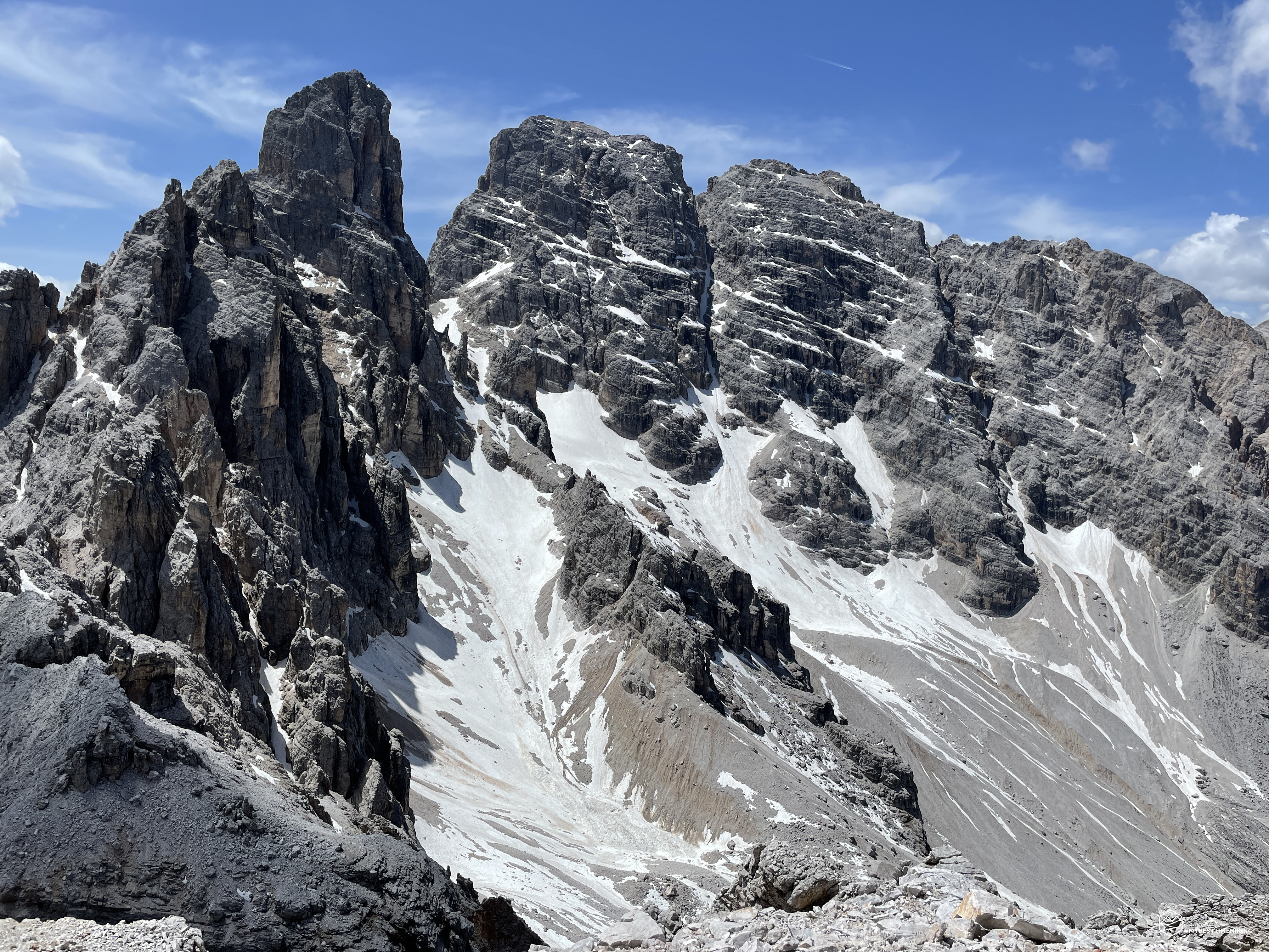
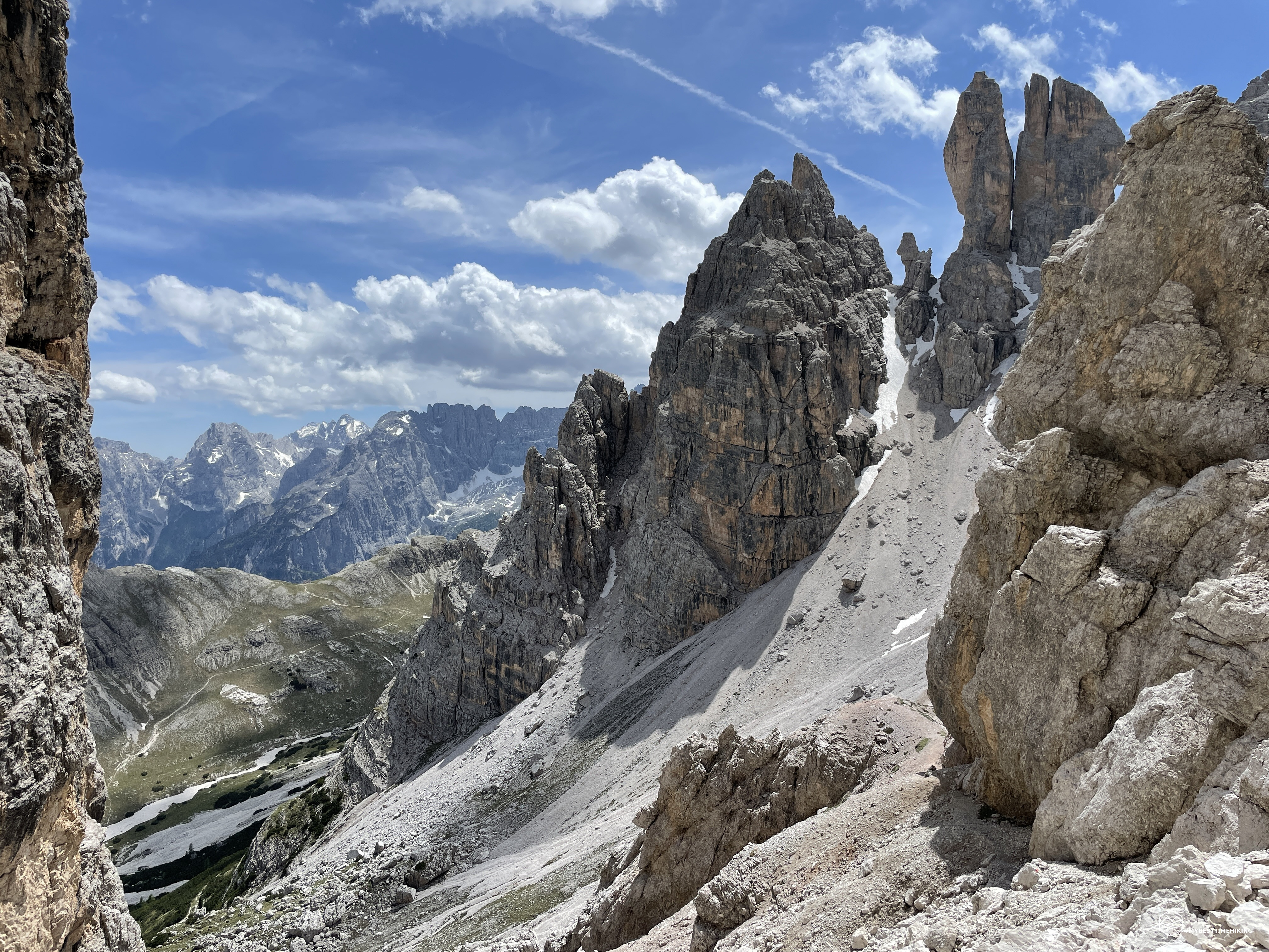
We thus enter the Val de le Barache, so called due to the presence, during the Great War, of wooden installations for the stowage of armaments, provisions and small shelters. We go up in a zigzag way, first surrounded by the baranci which, gradually thinning out, give way to a lunar landscape between tufts of grass and pearl gray stones. We rest at an altitude of about 2200 meters, where there is the last green spot. From here on, only stones and the bare rock of the Cristallino in front of us. The mountain is imposing, majestic, the gully on the right creeps up to the fork de le Bance and has only blocks of stacked boulders that are difficult to cross. On the left a clearly visible crack that rises over 300mt and ends in the legendary Michele fork. More or less in the center, the path we will have to take. It seems impossible to move easily between small ravines and live rock, but that's where we are going.
Fortunately, thanks to the CAI of Auronzo, in recent years the ascent route has been equipped with three sections of steel cable. The ascent is easy, the pass is always well anchored to the rock which offers comfortable holes where you can lean on safely. Thus we gain some altitude difference in speed and we go out on a ledge where we are presented with a wooden bridge overlooking the void and an old iron nail used in the past for the transport of heavy artillery. We overcome the wide ledge and begin the final climb. For easy rocks you always proceed following the red marks that indicate the easiest way to climb. The room for maneuver is not always abundant and there are not many places to stop for a rest. We go up until we reach a slightly exposed passage where we find a snowy patch. We choose to go down a couple of meters in a small terracing of rocks, and then go up to the left edge of the small snowfield and earn the way of the ledge on the opposite side.
Date
04-06-2022
Distance
12.23 KM
Hike type
Hike
Ascent
1115 mt
- Mountain
Cristallino di Misurina
- Address
Misurina, Veneto, Italy
- Altitude
2730.00 m
- Refuges
- Information
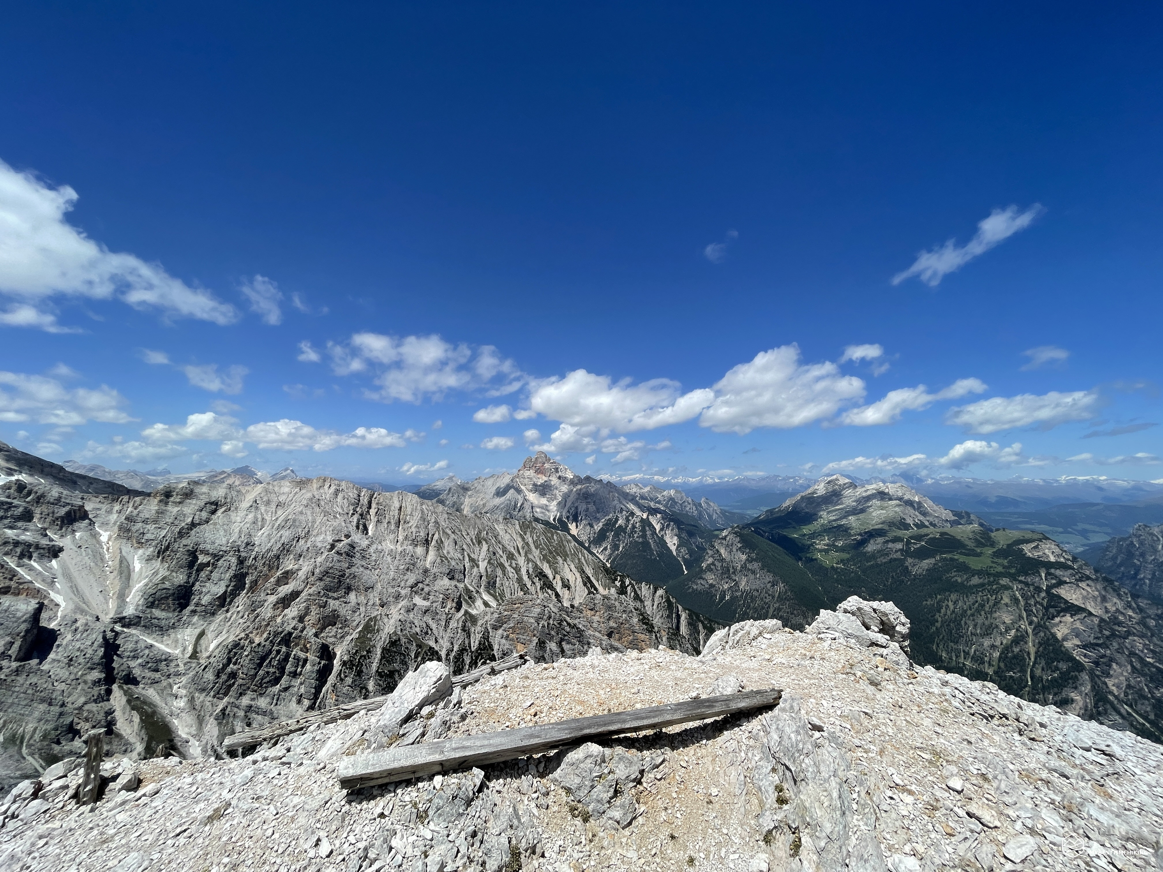
We arrive at an altitude of 2600 meters and we reach a fragment of wooden planks with a pole well stuck to the ground which indicates the obligatory stop for a stop. On this large open space we can sit and enjoy the splendid view that the mountain offers us: the glimpse of the Val Popèna with its fantastic bell towers, up to the majestic Sorapiss, the pyramidal tip of King Antelao and finally the unmistakable Marmarole.
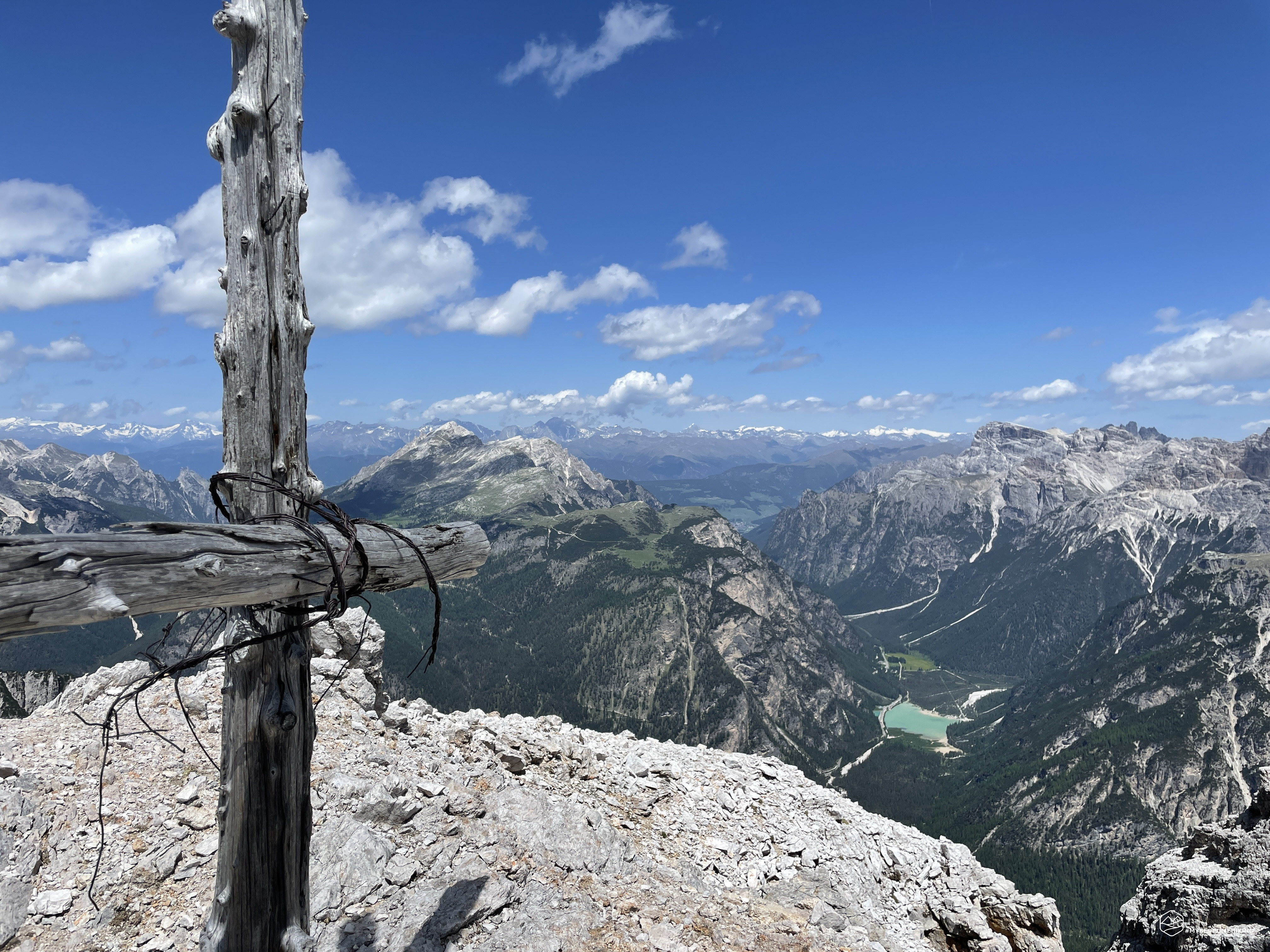
Last effort, we get up and aim straight for the summit. On the left we see a stone outpost overlooking the underlying Michele fork, an excellent lookout point for the time. We go up on a zigzag track between the rocks, the stamps are gone but we begin to see a wooden cross that stands out. At the base of the last summit a series of former shelters with old wooden planks stacked and perched on the edge of the mountain. A few more meters and here we are at the top! Perched, the wooden cross tied together with barbed wire dominates a breathtaking panorama: from the underlying Val di Landro with the emerald lake of the same name, to Mount Piana which looks down on peaks such as Mount Rudo, the Croda del Rondoi, the Picco di Vallandro up to the Croda Rossa d'Ampezzo, the Cristallo and the Piz Popèna!
Unfortunately we realize that we are not on the official summit, but on a not far away peak, about ten meters lower. We see the real peak there a few steps away, but it does not appeal to us much because we will not have a different view from the one we are having, indeed, we would not see the spectacular glacier view of the Popèna glacier and we would not have the mythical summit cross that instead stands out where it's us right now. We are convinced that this is the real Crystalline of Misurina, the most authentic one, where brave soldiers have perched to defend and scrutinize the enemy from a privileged observation post!
Ottone Brentari, historian and mountaineer of the late 19th century, wrote in his Cadore Historical-Alpine Guide (1886): It ends in various toothed points, of which the main ones are two (2840 m. 2811 that to N.). The ascent is easier than that of the Cristallo, but the view is much inferior even to that of other mountains which are even easier to climb. […]
This time I disagree with the famous historian because the view is truly exceptional and the satisfaction of reaching the top makes the adventure priceless.
After the classic ritual photos we begin the descent backwards along the same ascent route. The return is quite easy and you can easily identify the best route to take having a nice view from above on the path. The red stickers are always visible even when you go down and guarantee greater safety. But be careful at an altitude of about 2500m, there are red dots on the old path that lead to the scree of Val de le Bance: always keep right and continue on a small ledge that takes you back to the official route and, in short, to the aided section.
After the small ferratina we are back in the splendid Val Popèna, super excited by the wonderful experience and by the summit just conquered. We first descend into the dry riverbed of the Rio Popèna and find the final path among the fresh branches of the fir trees.
A demanding excursion, only for experienced hikers with experience of aided routes and who do not have vertigo problems. Good physical preparation and a supply of water are necessary with a beautiful clear day like today! A beautiful adventure that allows you to relive the strategic places of the Great War while respecting the mountaineering deeds that simple soldiers were able to accomplish with equipment from the past in these incredible mountains.
DifficultyExpert Hikers with Equipment - The equipped routes (or via ferrata) are indicated, they require the use of self-insurance devices. |