
Adventure rich in history on a mountain protected by an almost sacred aura. Mount Toc is a goal that I had reached about two years ago, in 2020, but I accepted the request to be a "guide" to my friend Angelo from Auronzano because it is a peak that deserves to be experienced again.
The day is splendid, full sun and not even a breath of air. Definitely too hot ... We park early in the morning just under the fateful Toc landslide. We take the only gravel road that goes down marked with a clear sign "Casera Vasei - CAI 907". After a while we enter the woods, still following the same signs. From here on, the path is always well marked and you can't get lost. Red-white marks are present and well cadenced on the branches of trees or on the rocks. The heat is felt immediately, today's day is really hot for the season and thanks to the trees, humidity is always the protagonist. The wood is mainly composed of beech trees, a typical shrub of these areas. The first part of the route straddles the border between Veneto and Friuli Venezia Giulia. Less than half an hour from the start we find the first glimpse that offers a view of Longarone: take all the air you can at this point because then for an abundant hour there will be only woods, leaves and humidity!
The climb is constant, it does not offer leveled areas to catch your breath. I did not remember it so hard and continuous. Perhaps even the very high temperature does not help to progress quickly. During the path in the woods there are several tracks that could be confusing: always remember that you have to go up, so always choose the way up.
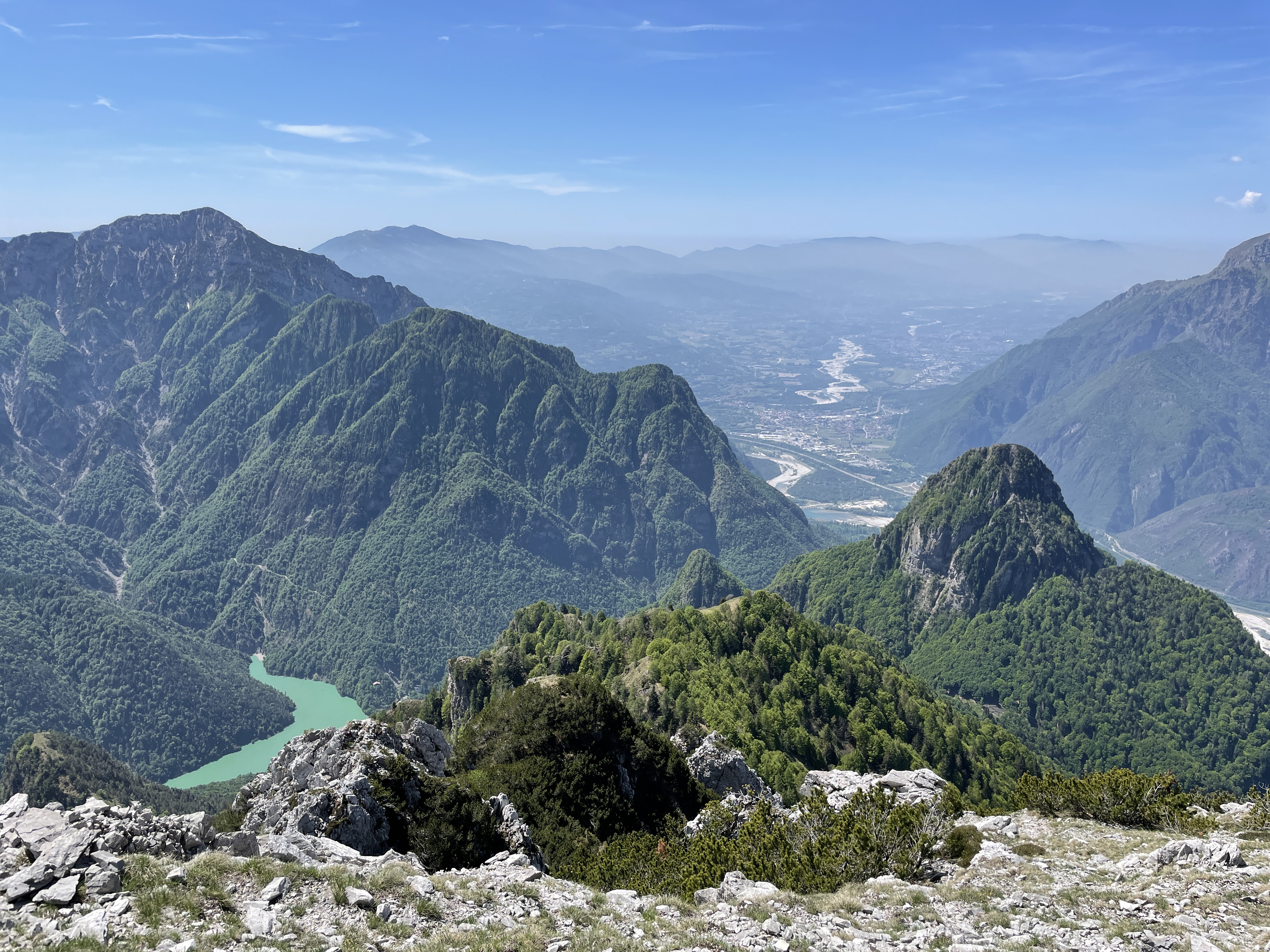
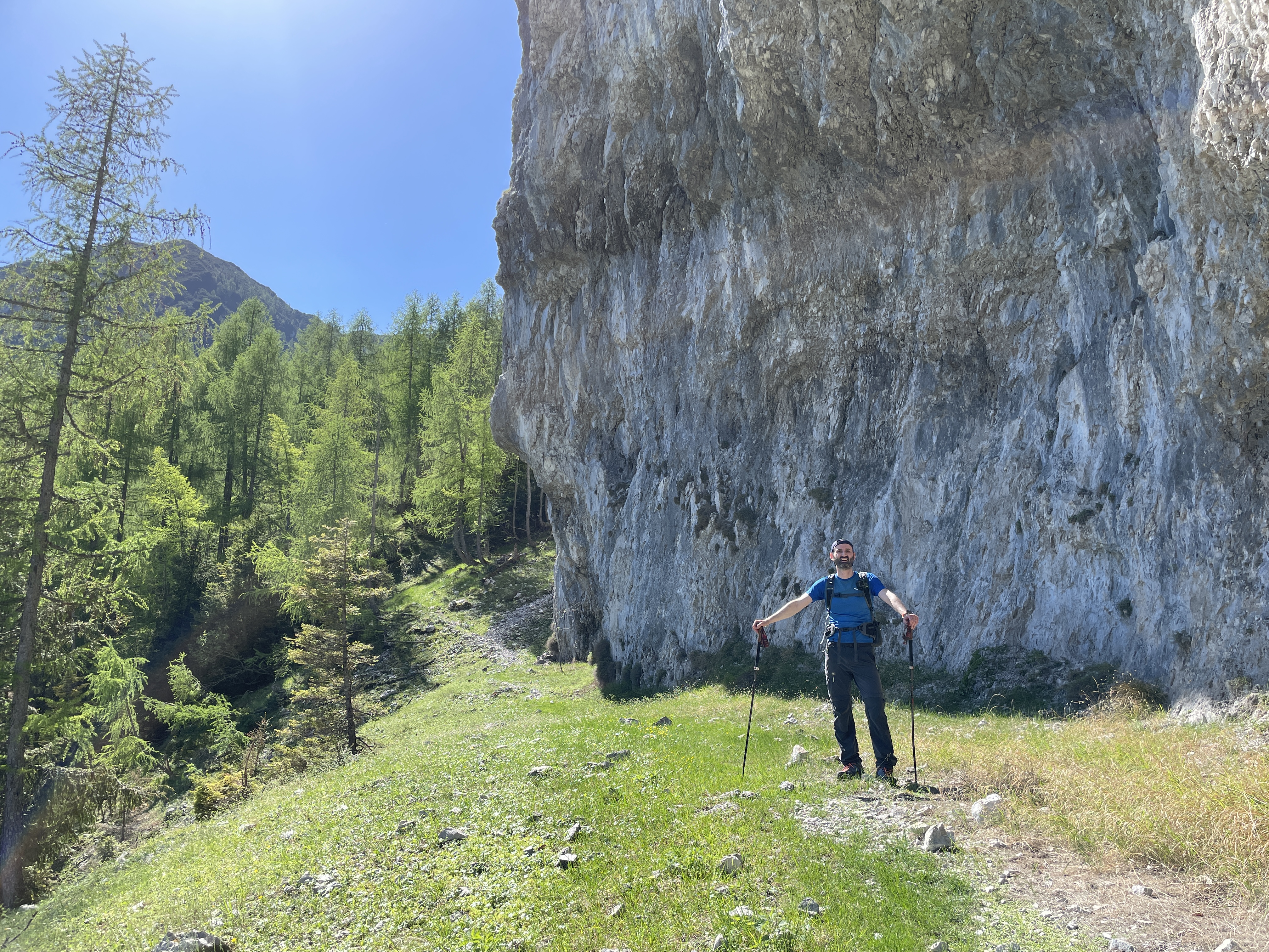
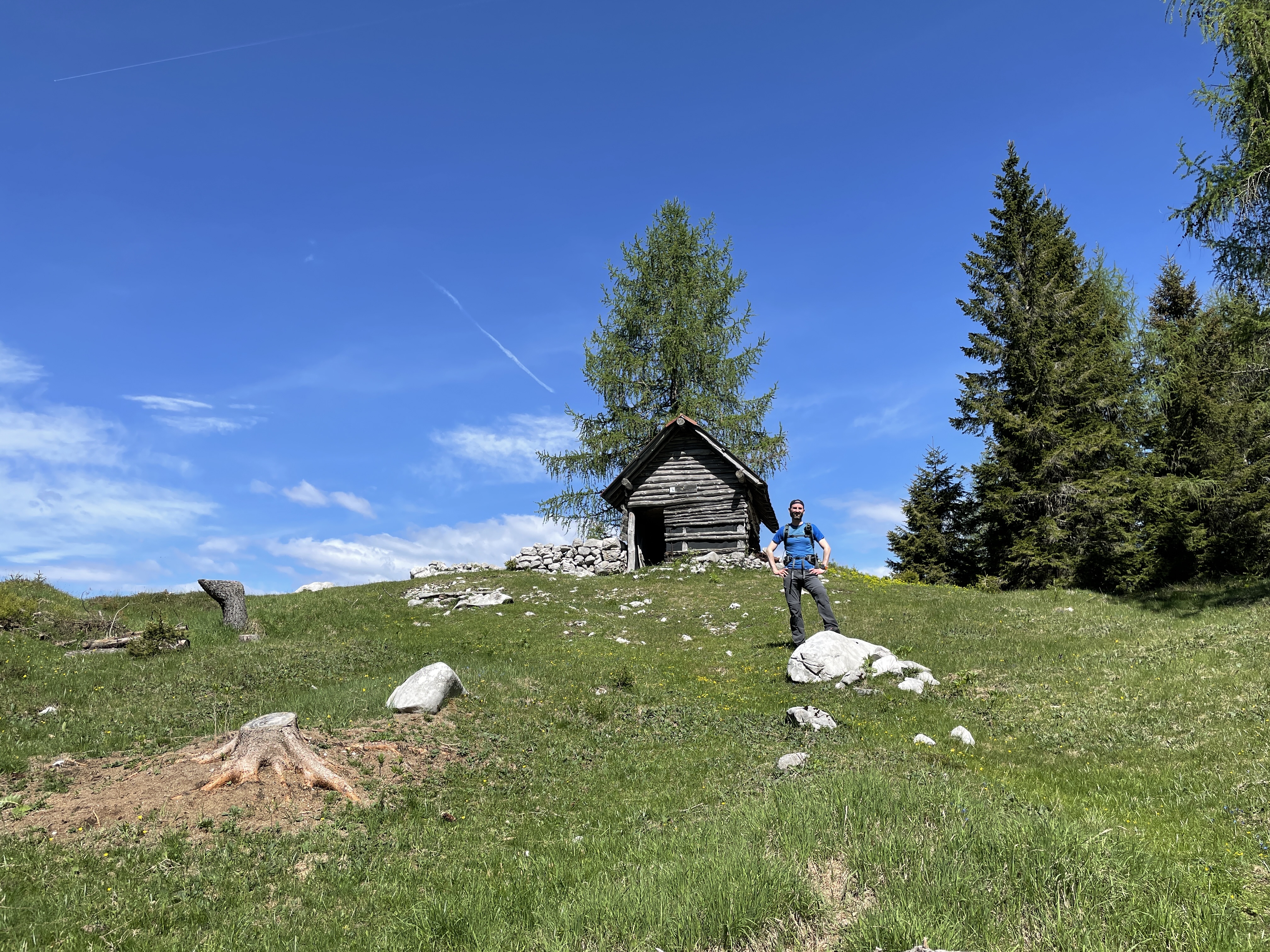
At an altitude of about 1450m, we leave the thick beech forest and arrive on a passage under a ridge of rock: the Croda Vasei. Here you have a splendid view of Lake Vajont and the town of Erto in the background. Monte Borgà stands out with its beautiful figure on the left. We continue and the vegetation changes again: now we are welcomed by fir trees and some solitary mountain pine. We go up in zigzag on the track that continues to proceed bristly up to an altitude of 1600m. Now the path becomes almost flat, the wood gives way to an increasingly airy clearing. The green grass welcomes us and directs us to a lonely hut on the right: the Casera Vasei!
A dairy open to all, very poorly maintained with a non-existent door and all accessories / tools in bulk inside. However, it creates a pleasant environment on this clearing that gives us a refreshing break. From here, heading south, we set off to reach the summit.
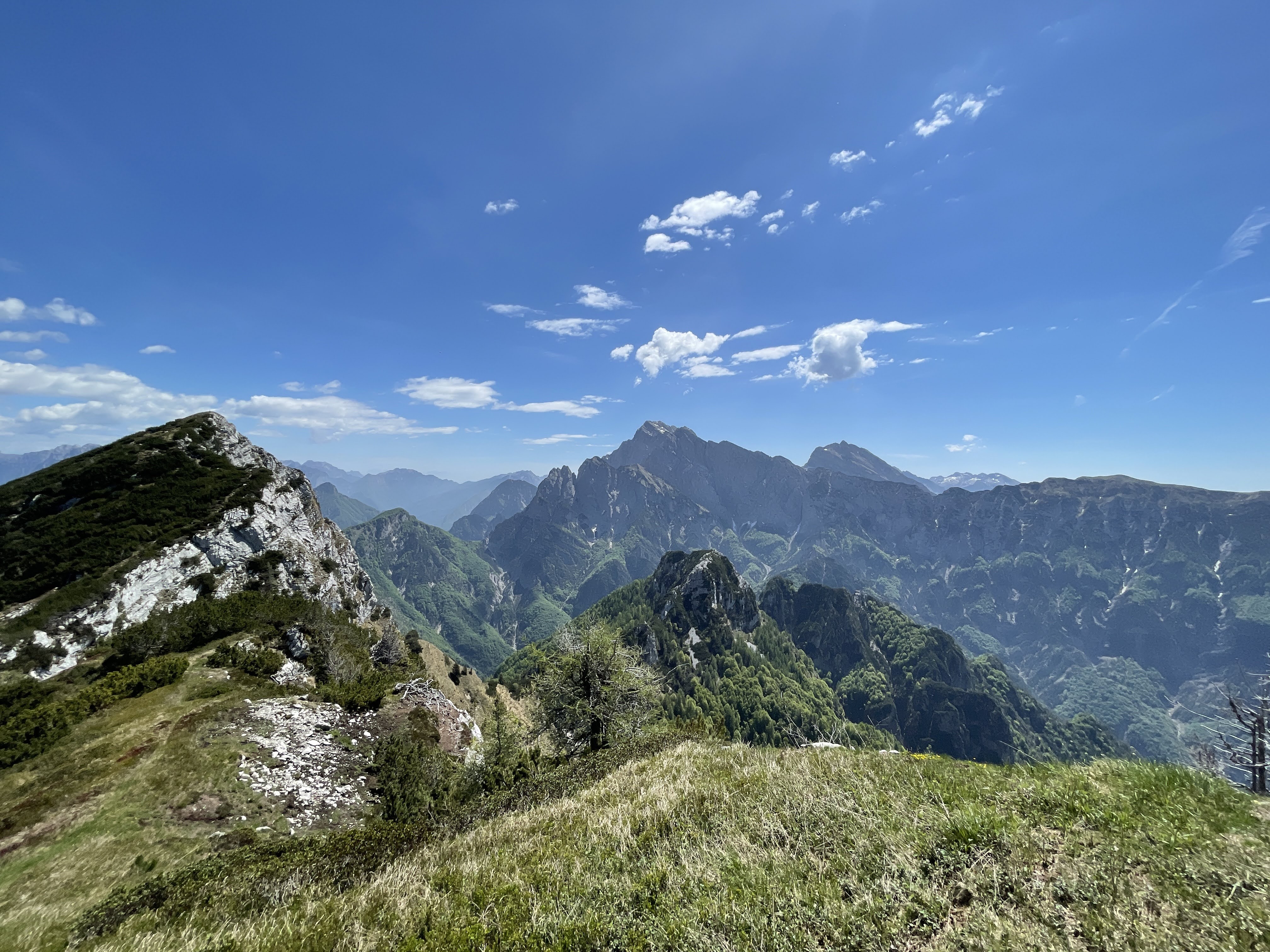
From now on, the slope is lower than the path traveled so far. There are several places where you can catch your breath. First part of the journey again in the middle of the vegetation up to a large opening where you can see a small scree that acts as a watershed for the two reachable peaks: top Mora and top Toc. Regardless of the choice, from here the tracks are very little marked, you need to have a good sense of direction. If you choose to keep to the left, continue to the Mora peak, on the right, however, you will arrive at our today's destination. I advise you to always keep to the right as much as possible, the pines begin and you may lose track because the vegetation regains its vital space. Do not give up, even at the cost of literally diving among the branches of the baranci, always keep to the right and notice the sharply sawn branches that show you the correct way. In short, you come out of this muggy scrub and a comfortable lawn heralds the last stretch. A window on a small fork allows you to enjoy a magical glimpse of the Col Nudo.
Date
21-05-2022
Distance
12.99 KM
Hike type
Hike
Ascent
1182 mt
- Mountain
Monte Toc
- Address
Diga del Vajont, Friuli Venezia Giulia, Italy
- Altitude
1922.00 m
- Refuges
- Information
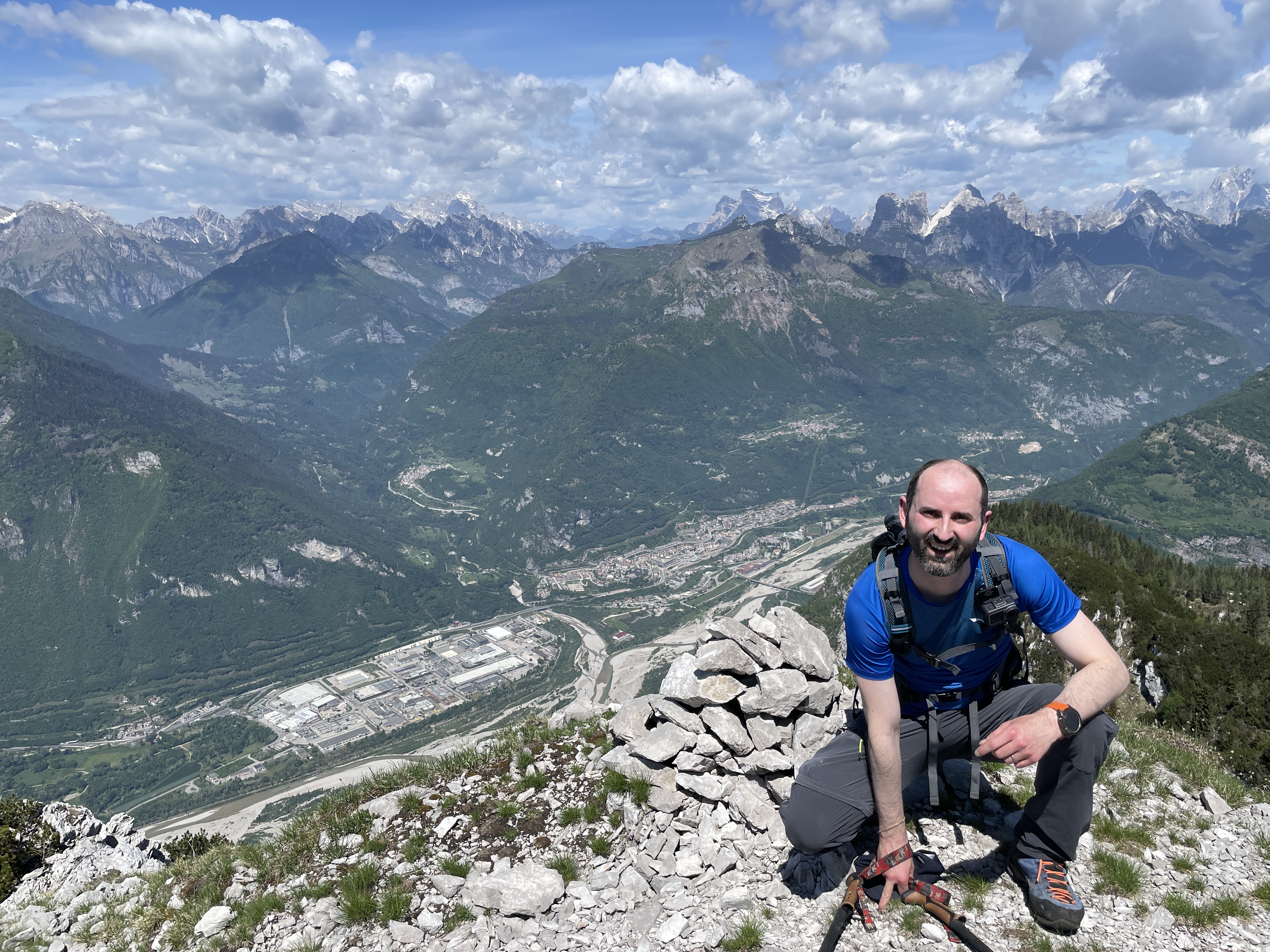
The track here is definitely noticeable and, after a new succession of mountain pines, we arrive at the foremost. Here is the first surprise: a very spartan summit cross that was not present years ago. Many might think that this is the summit, but this is not the case, just ahead of the cross, on the right there is a very hidden track that goes down (yes, it goes down!) In a corridor formed by baranci. The path immediately folds to the left and climbs up with a mixture of earth and gravel. Here is the most delicate point of the path: the way becomes increasingly thin and a false step would lead straight into a deep impluvium. You need a steady step and you can easily overcome. Another discovery: on the left, at the top, a beautiful Madonna peeps out. Last steps, the vegetation disappears, only gravel and rocks: here is the top of Mount Toc!
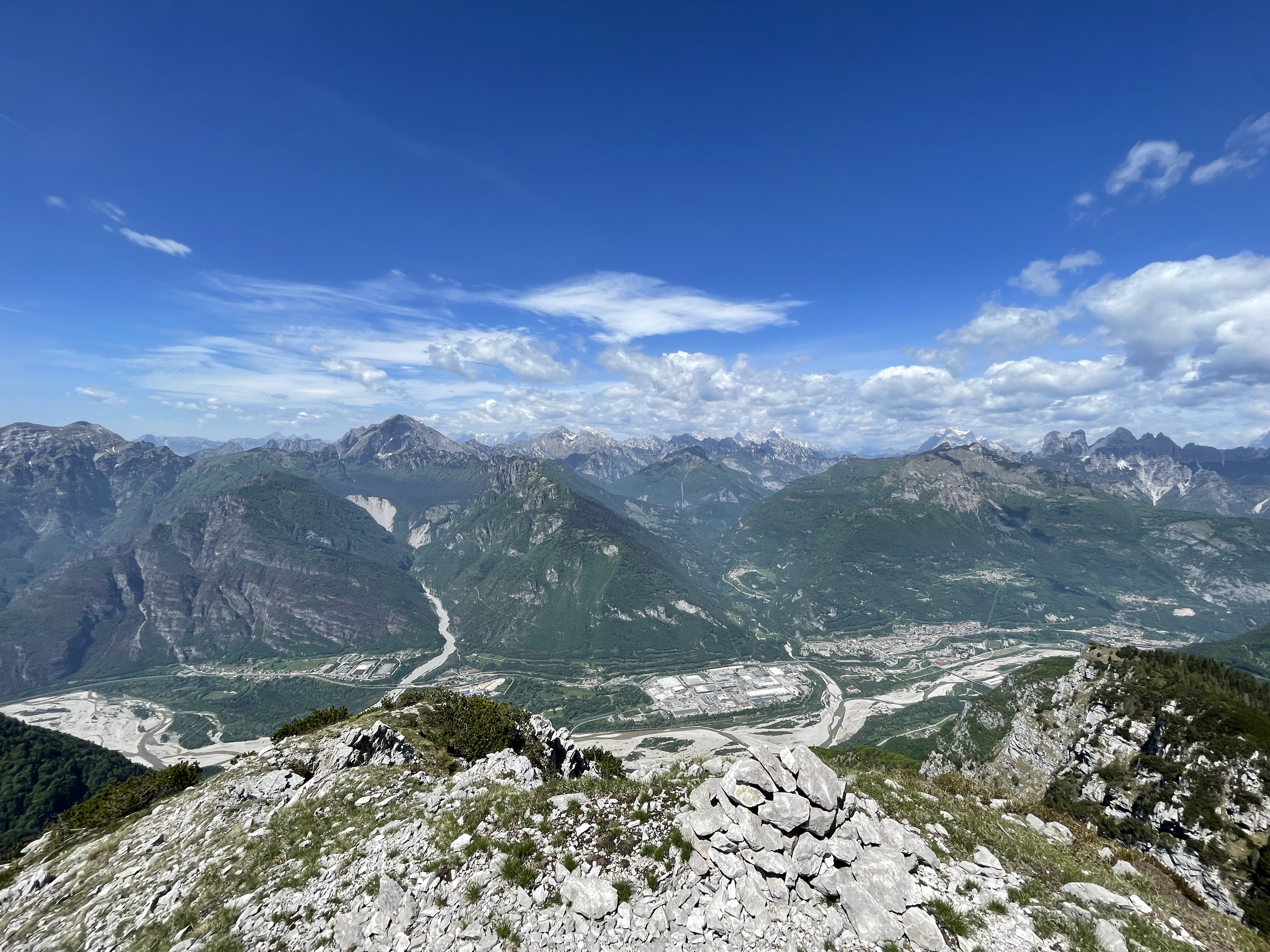
A bare top that stands out isolated on Longarone. A small metal notch on the IGM marks the top. A little further to the right is the last change from the first ascension: on a pyramid made up of rocks there is no longer any cross. The cross that was there two years ago has been moved to the forerunner leaving the true summit unguarded. The panorama is a breathtaking 360 degrees: from the Zoldo with the splendid view of Civetta and Pelmo, up to the Cadore peaks like King Antelao, continuing for Duranno, the Friulian peaks, ending again in Veneto on the Prealps with the unmistakable Col Nudo and the crest that leads up to Dolada. We breathe clean air, today there is not a breath of wind and only a slight haze inhibits our view of the sea. The classic ritual photos and we take the same path used for the climb.
We are inebriated by the spectacular scent of the baranci which are producing the first buds and pignette impregnated with balsamic resin. Returning to the saddle we see that the clouds advance from the Dolomites so, to avoid any surprises, we proceed quickly. We resume the track in the wild pine forest and we notice the mistake made on the way out where we had almost lost the real route. In the attached video I have reported precisely this point! In 45 minutes we return to the Vasei dairy and then off again into the woods. The descent is not much faster than the ascent because the steep slope forces you to slow down continuously to avoid going belly-up. In the beech undergrowth the presence of dry foliage sometimes hides smooth rocks below.
The path already seems twice as long as the climb, but in less than 2 hours from top of Toc we return to the parking lot where a newly found sun shines on the town of Casso.
This is the end of an adventure that is not unprecedented but that has given new stimuli and emotions! An excursion for experienced and trained hikers, especially for the final part of the summit. I greet Friuli and from the road, near the Vajont Dam, about the Toc and its landslide: a mountain that has no faults and which still deserves more respect and understanding today.
DifficultyExpert hikers - are generally signposted itineraries but with some difficulties: the terrain can consist of slippery slopes of grass, mixed rocks and grass, stony ground, slight snowy slopes or even single easy-to-climb rocky passages (use of hands in some places) . Although they are routes that do not require particular equipment, equipped sections can be presented even if they are not demanding. They require a good knowledge of the alpine environment, a safe step and the absence of vertigo. Physical preparation must be adequate for a fairly continuous day of walking. |