


The month of April has begun, spring should come alive ... and instead the snow continues to fall above 1000 meters giving winter-style views. Today's adventure takes place the next day in which rain and snow were the protagonists. The destination is unusual: I leave the Veneto to head east, in Friuli Venezia Giulia, in the Gemona del Friuli area. The creator of the excursion is Auronzano Angelo, companion of this adventure.
We reach the village of Montenars, more precisely Borgo Jôf (or Jôuf), where we park the car in the large parking lot of the cemetery. In front of us we see Mount Cuarnan (or Quarnan), beautifully covered in snow with a clear blue sky that contrasts. We are at an altitude of 524 meters and we must reach the summit at 1372 meters. Angelo has already collected information from the locals who advise us to take the ridge path on the outward journey, and then enjoy a more comfortable return. Let's go!
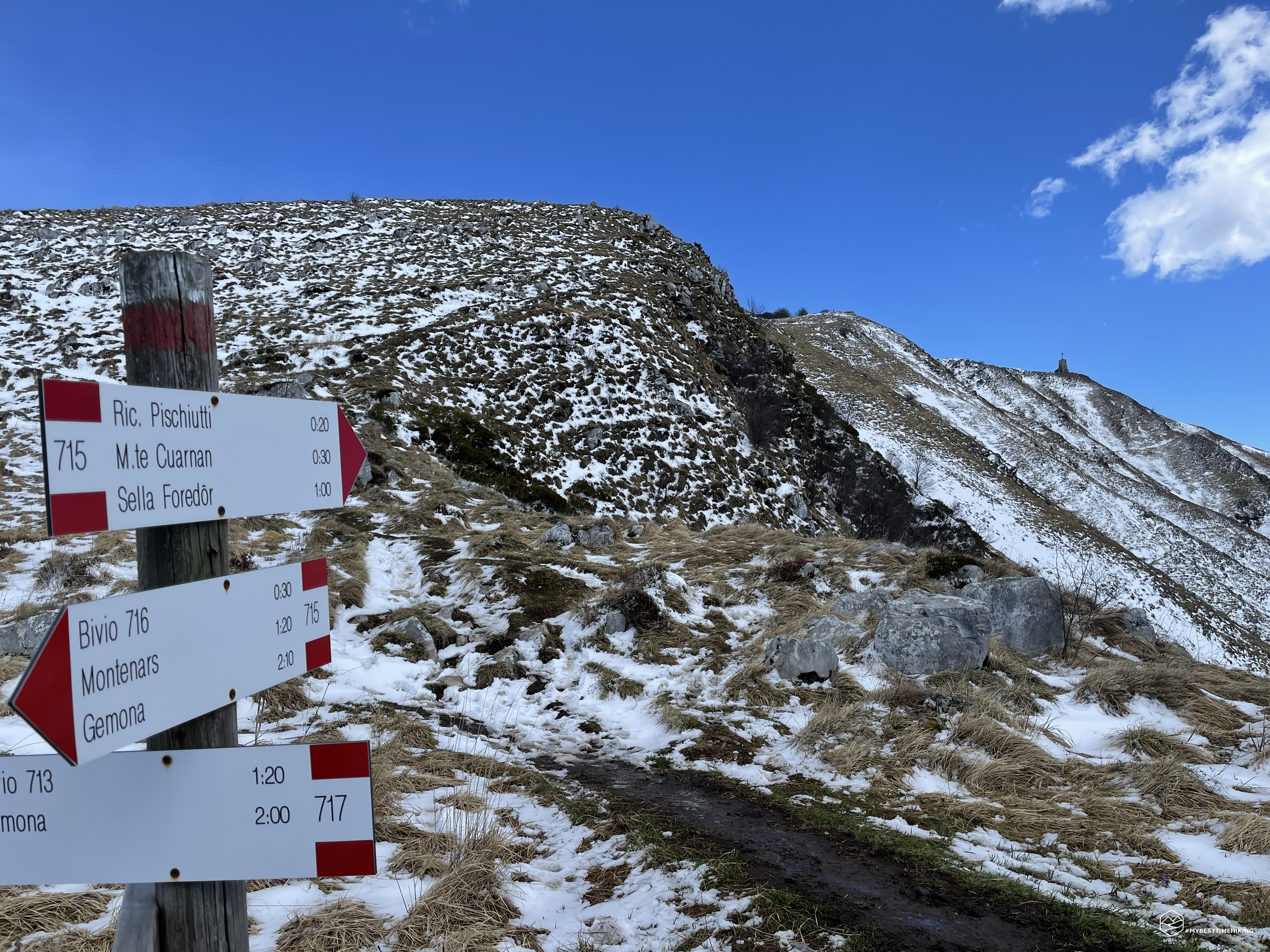
We start from the CAI 715 path, on a very rough road at first asphalted and then dirt. Clear indications notify us of the correct direction to take and we are also shown how far to go to the top: 2 hours and 20 minutes. We pass a beautiful fountain called "Fontane dal Pascut" and we find the first detour that allows us to start a narrower path that goes into the woods.
The trees are all covered in a thin layer of snow. The first rays of the morning sun are already beginning to melt the snow and a shower of fresh droplets falls from the branches. Even on the path there is still a compact snowpack that allows a sure footing. We go up in a zigzag counting several empty shells of out-of-season chestnuts. In less than an hour we reach a bare summit where a white wooden cross rises with a thin curtain: we have arrived at Cuc de Crôs. From here the view is super satisfying on Montenars and Artegna. The wide Tagliamento is distinguished and, already from here at an altitude of 848 meters, one can perceive the sparkle of the Friulian sea.
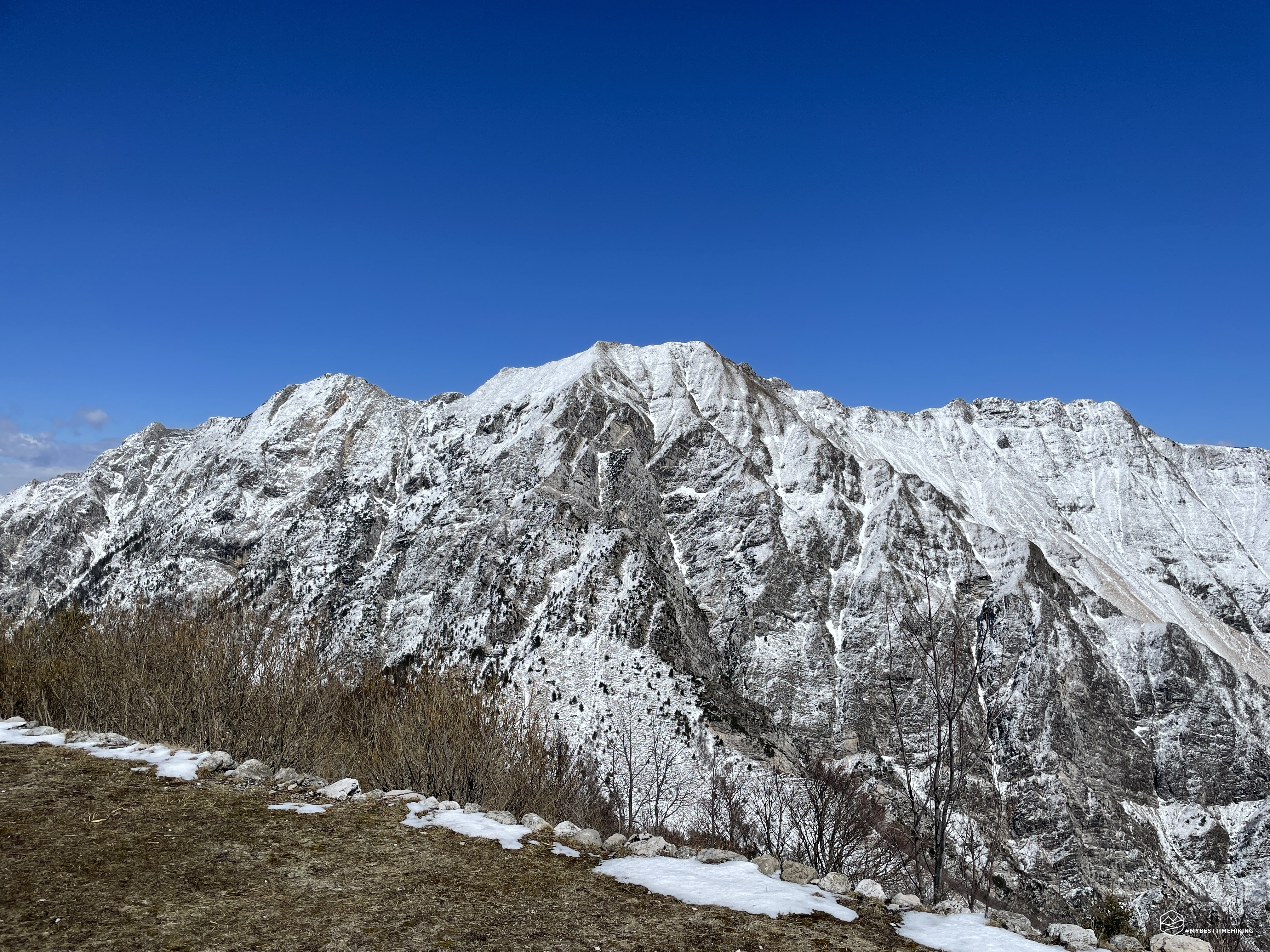
We resume the journey with a decisive but never tiring climb and soon we reach the crucial crossroads of the ring: here we have the whole Cuarnan in front of us. As recommended at the start, we decide to choose the CAI 714 path on the right. We enter the still bare vegetation but with the first spring buds. We follow an almost constant track at high altitude and cross the entire natural amphitheater created by the Cuarnan called "Las Preses". It is evident that this route passes under a fairly landslide area, pay particular attention in the case of fresh snow in the winter season. At this point the snow is melting more and more creating small streams already on this part of the route.
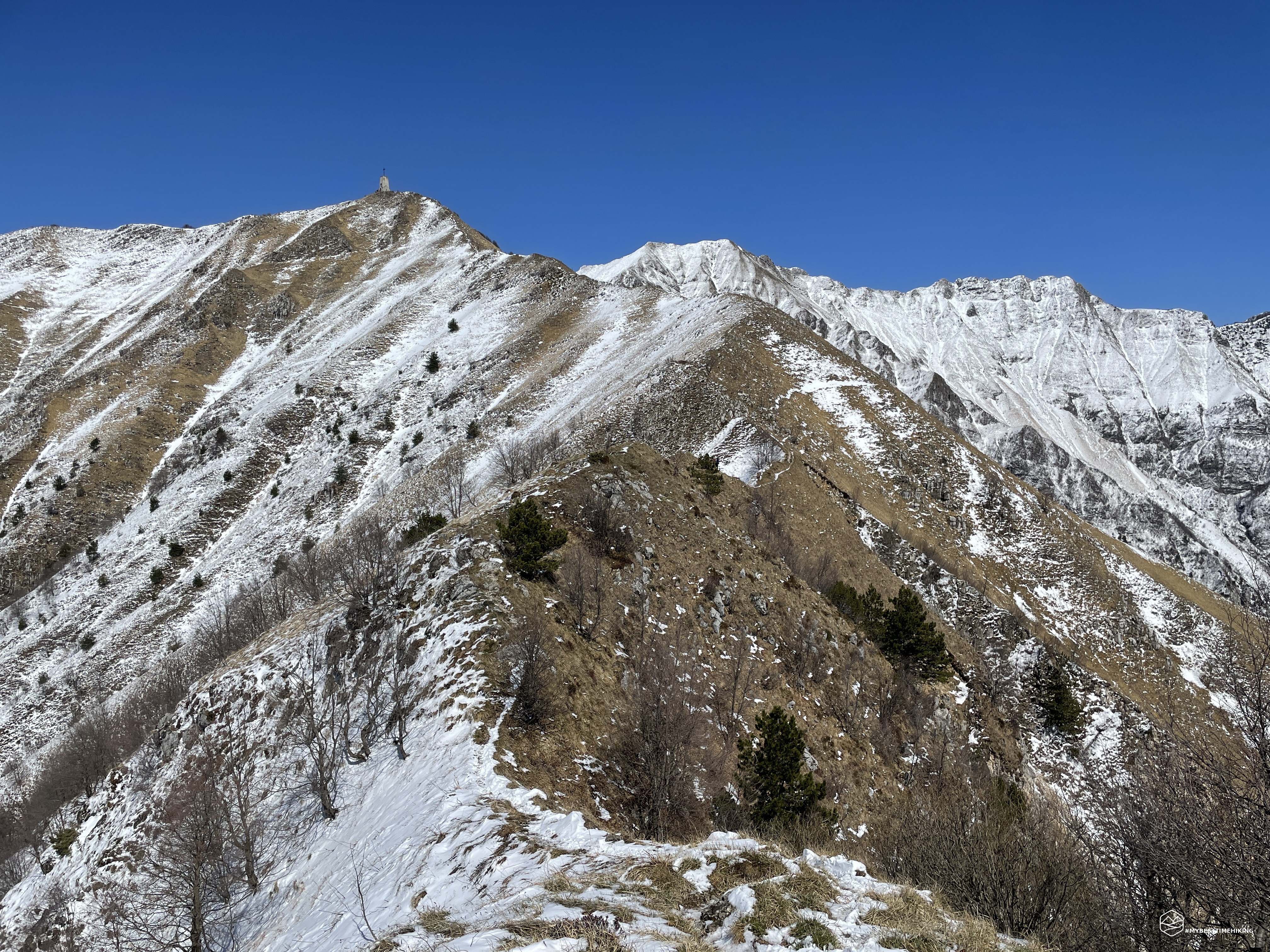
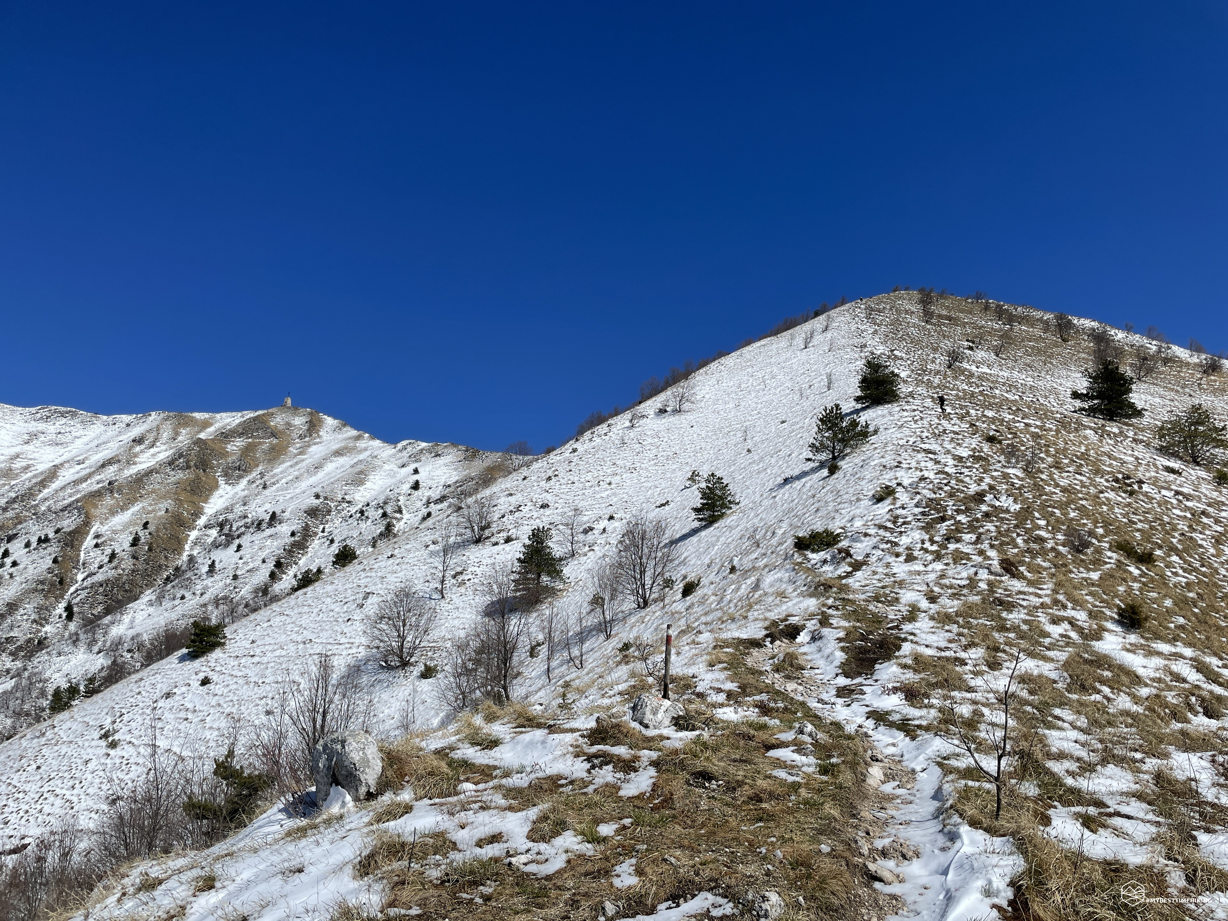
We are approaching the final ridge, some serpentine sections make us gain some altitude. We see the last branches stand out alone, we deviate to the left at an altitude of 1075 meters and leave the bush. In front of us the ridge. A blade, not too thin, which sinuously rises and falls to the summit. The church is clearly visible, close ... apparently. The climb here becomes more tiring, the first ridge to overcome seems the toughest. The view it offers at every step is priceless: on the right the Julian Alps with a view up to Slovenia, on the left the Cuarnan with its steep circular amphitheater. The best glance is by looking behind you, realizing the ridge you are traveling on. The wind whips impetuously here, it seems to be perpetually in the saddle. Although the day is nice and warm, the wind is really biting. Once you have passed the first hill, you have a complete view of the final stretch that leads you to the top, getting closer and closer.
From here on the ridge becomes slightly sharper, never dangerous, but requires a steady step. A last up and down that gives the adventure a touch of uniqueness compared to the usual excursions. In the final part some rocks allow you to gain altitude with easy natural steps. And, finally, the esplanade of the top!
Date
10-04-2022
Distance
12.67 KM
Hike type
Hike
Ascent
904 mt
- Mountain
Monte Cuarnan
- Address
Montenars, Friuli Venezia Giulia, Italy
- Altitude
1373.00 m
- Refuges
Ricovero Pischiutti
- Information
Arrived at the apex of Cuarnan, imposing in front of us, the church of the Redeemer in compact, angular, no frills masonry. Christianity wanted to celebrate the beginning of the 20th century of the Redemption by raising twenty crosses on the highest points of Italy. The chaplain of Montenars then had the idea of having this monument built on top of the Cuarnan to make his own contribution to the Jubilee of the Redemption. The work ended in 1902, the works lasted a year with over 7000 working days employed. At the inaugural mass, even 8000 faithful came from all over Friuli!
From up here the view is breathtaking at 360 degrees: towards the north, Monte Chiampon (Cjampon), a majestic pyramid that rises to 1709 meters. From this peak starts a chain of clearly visible ridges to the east that correspond to the Alta Via del CAI di Gemona (this could also be a very interesting next itinerary). In the distance the Triglav and the other peaks of the border. Towards the south, the Friuli plain as far as the mirror of the sea of Lignano and Bibione. The last snow of the season offers an original and particular view given the low height of the summit. On the left of the church portal you can find the summit book and also some postcards of Mount Cuarnan which can be purchased with a small offer. The wind up here has grown even colder, in contrast to the scorching sun. Ritual photo, a nice refreshing ration and we continue the way to the west on the path that now becomes the CAI 715.
We travel along the ridge towards Gemona del Friuli, on a path that remains almost at high altitude for a short stretch and then descends decisively. After less than 10 minutes we find the Pischiutti shelter, practically a 4-star hotel. It is a very comfortable brick bivouac with a large room to have a nice lunch in front of a warm wood stove. We continue to descend and from this point we notice that the path begins to become muddy. The snow becomes more and more loose and slippery. We stay on the grassy edge of the path to avoid getting bogged down and to go faster. At an altitude of approximately 1170 meters, we find a deviation in which there are traces that lead to Gemona, along the north-east side, and our road that we are traveling on towards Montenars.
We choose to undertake a small change of course and push east towards Monte Glemina and the Pale Furmiarie to try to have a view of Gemona. Unfortunately, however, even if we reach a more exposed point towards the town, this is still covered by the terminal ridge of the mountain. Gemona, in fact, is built at the foot of the Cuarnan and the more modest Glemina, and appears to be hidden from our view.
We return to the CAI 715 path and the most tiring part of the descent begins: the south side of Cuarnan turns out to be the one that has collected the most snow (even carried by the wind). In some places we notice up to 20-25 cm of snow. This would not be a problem if it were fresh, it would not be a problem if it were also compact or even a little icy ... alas we find it soaked, it is melting, the path has become a brook in flood. Mud, melted snow and grass on the ground create a perfect combination to have an absolutely unstable and slippery step. We are also in the stretch of the slope and this situation forces us to an unexpected slowdown. We overcome these 250 meters of difference in altitude as if we had them uphill and finally we arrive at the crossroads in the morning, actually concluding the Cuarnan ring!
We still have the last 350 meters passing through Cuc de Crôs, the chestnut wood, now completely dry and devoid of a single snowflake. We arrive in Borgo Jôf and soon to the parking lot of the departure.
We look back towards the top and we see an unrecognizable Cuarnan compared to the morning: the snow has melted almost completely, the whiteness of the top gives way to the barren grass that is about to wake up with spring. Thus ends the adventure in Friuli on a mountain suitable for moderately trained people, not difficult and which gave us wonderful emotions! In my opinion, the choice of the spring season is to be preferred given the altitude of Cuarnan (1372 meters) and doing it on a day in which the mountain has changed skin in a few hours was a really good choice! At the next excursion in Friuli Venezia Giulia. “Mandi”!
DifficultyHikers - Itineraries on paths or evident traces in various types of terrain (pastures, debris, stony ground ...). They are generally marked with paint or cairns (pyramid-shaped stacked stones that allow you to identify the route even from a distance). They can also take place in snowy but only slightly inclined environments. They require the equipment described in the part dedicated to hiking and sufficient orientation skills, walking training for a few hours. |