New "wild" adventure with the inseparable hiking companion Diego! The rapid organization in the few days before allowed us to define the details for a tour of the Treviso Pre-Alps. The starting point is the Fadalto, right from the pass and the goal is the Gaviol, a little-known CAI path on the west side of Pizzoc.
Arriving at the Fadalto saddle at 9 am, we look in the direction of Pizzoc: the whole route will be in the shade until the afternoon, the air is crisp and the thermometer shows 6 degrees! Looking instead towards the Visentin we notice the eastern side already kissed by the sun ... map in hand, determination of a new wild itinerary (already discussed in our other conversations) and off to the warmth!
Today's exploration, therefore, develops on Col Toront, on the same ridge as Col Visentin, through inaccessible and very little frequented paths.
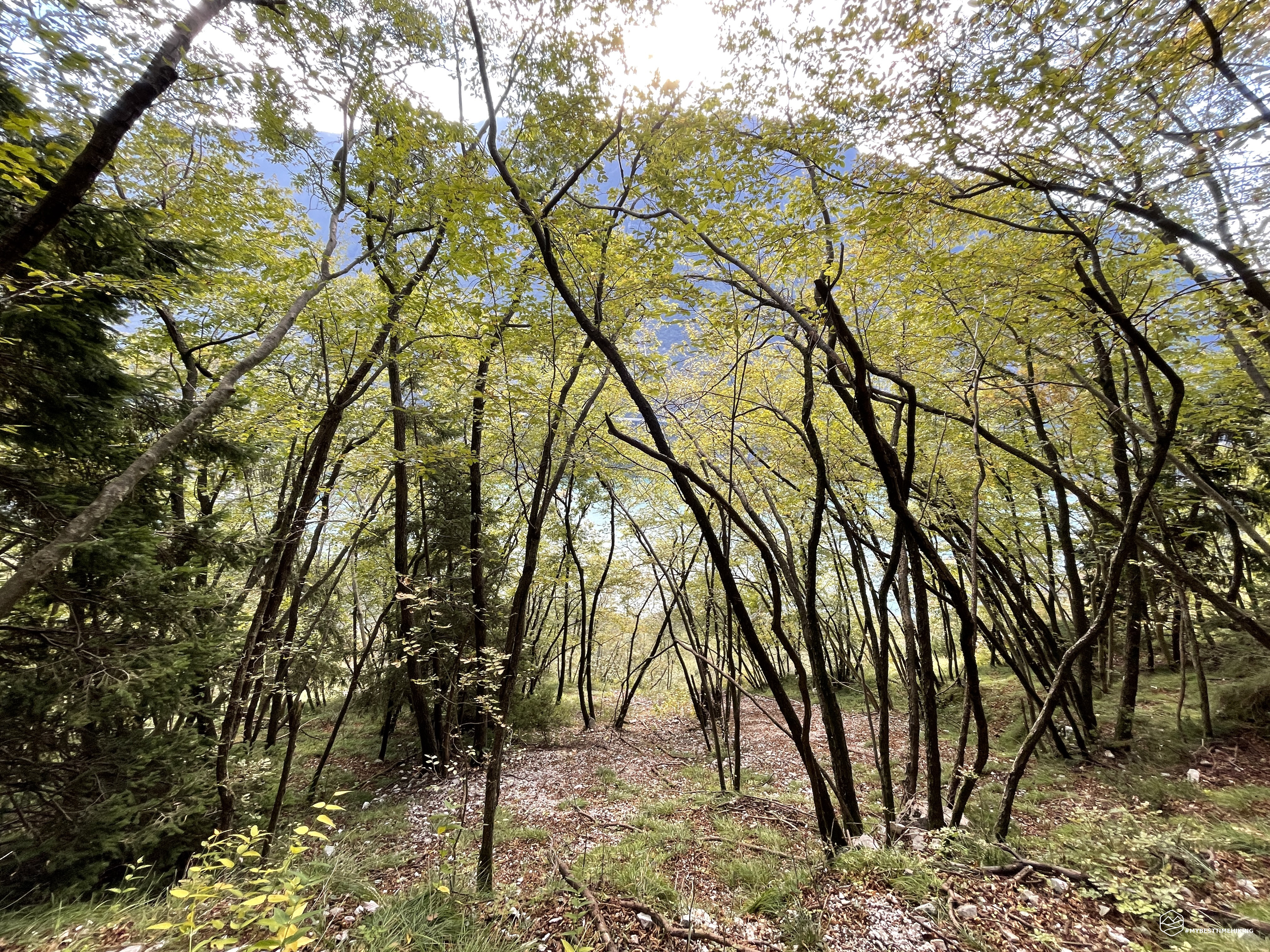
We cross the state road and take the E7 path, which we discover to be a spectacular route that from the Canary Islands passes through Portugal Spain, Andorra, France, Monaco, France, Italy, Slovenia, Croatia, Hungary, to finish its route in Romania! Unusually we go down to reach the town of Caloniche di sotto: a very characteristic village surrounded by mountain tranquility. A vertical CAI trail sign confirms that we are in the aforementioned village and indicates the deviation to the left that takes us along the CAI 985-1045 path called "Troi delle Casere" for a few tens of meters. And immediately here is an inhospitable route with thick vegetation: the “Troi de le Lisse”, a black trace on the Tobacco cartography that runs along the Croda Longa!
It is understood that the track is not traveled by many people, the vegetation rightly takes up all the available space. However, we find comfortable red dots, recently reported, on rocks and logs that allow us to continue safely for a good part of the route. The signs will certainly have been traced by Giovanni Carraro, a true expert and connoisseur of these less famous paths but with a great historical background. The Troi continues with a slight climb, you do not gain much altitude at this point. We pass a stony impluvium that allows you to have a beautiful view of the artificial lake (Lago Morto) of Nove. We reach some rocky ravines that in the past certainly gave shelter to shepherds or hunters.
The route becomes rougher with short passages in which a minimum of foresight is needed between stones and emerging roots. The path then opens up and we leave the dense vegetation for a fully rocky stretch where we lose the path to find it shortly after.
Here Diego tells me to look in front of me: a group of mouflons are there a few hundred meters from us! Unmistakable by their big horns, they run away shortly after in the direction we will have to go. So we go back into the thick vegetation and we reach an evident sign with the words "Strapeze, Pra de Larghet" which shows us the way of joining the Troi de le Lisse, just finished, and the Troi de Medo (CAI 985).
And finally here is the real climb: from here you gain a considerable difference in height with a continuous change between the woods and openings on stretches with outcropping rocks. We cross several dry impluviums that usually allow the correct flow of rainwater onto the Croda Longa. After about 500 meters of altitude we reach a deviation with a signal that tells us to proceed to our right. This route should be new as it is not present in the Tabacco cartography. Going straight on, however, you continue on the black dotted path of the map. A couple of branches placed in a cross and a stone on it perhaps indicate that this route is no longer maintained and in fact it would continue to be closed and no longer accessible. In any case, we choose this solution by exploring the historical stretch of the path and, in fact, we find very old and peeling trail signs. Due to the lack of obvious signs and human traces, we lose the official route several times and rely on GPS to find it.
Date
10-10-2021
Distance
14.96 KM
Hike type
Hike
Ascent
1111 mt
- Mountain
Col Toront
- Address
Sella di Faldalto, Veneto, Italy
- Altitude
1465.00 m
- Refuges
- Information
We arrive at a natural amphitheater that encloses us between imposing and apparently inaccessible rock spurs. We have to go around them with a path that rises on a spur to our right. Here the red marks seem to have come back more recent. Some stretches on the edge of the spur force us to have the utmost attention. The ground here is very slippery, the mud is hidden by a small dry layer but, once scratched, the foot does not have the right support and does not allow normal progression. Unfortunately, Diego soon realizes that slipping goes to hit a rock with his knee. We reach a clearing and leave the woods. A few minutes for Diego to catch his breath from this stoic accident and he continues his exploration. We continue to climb the rocky slope and we find ourselves in front of an aided path.
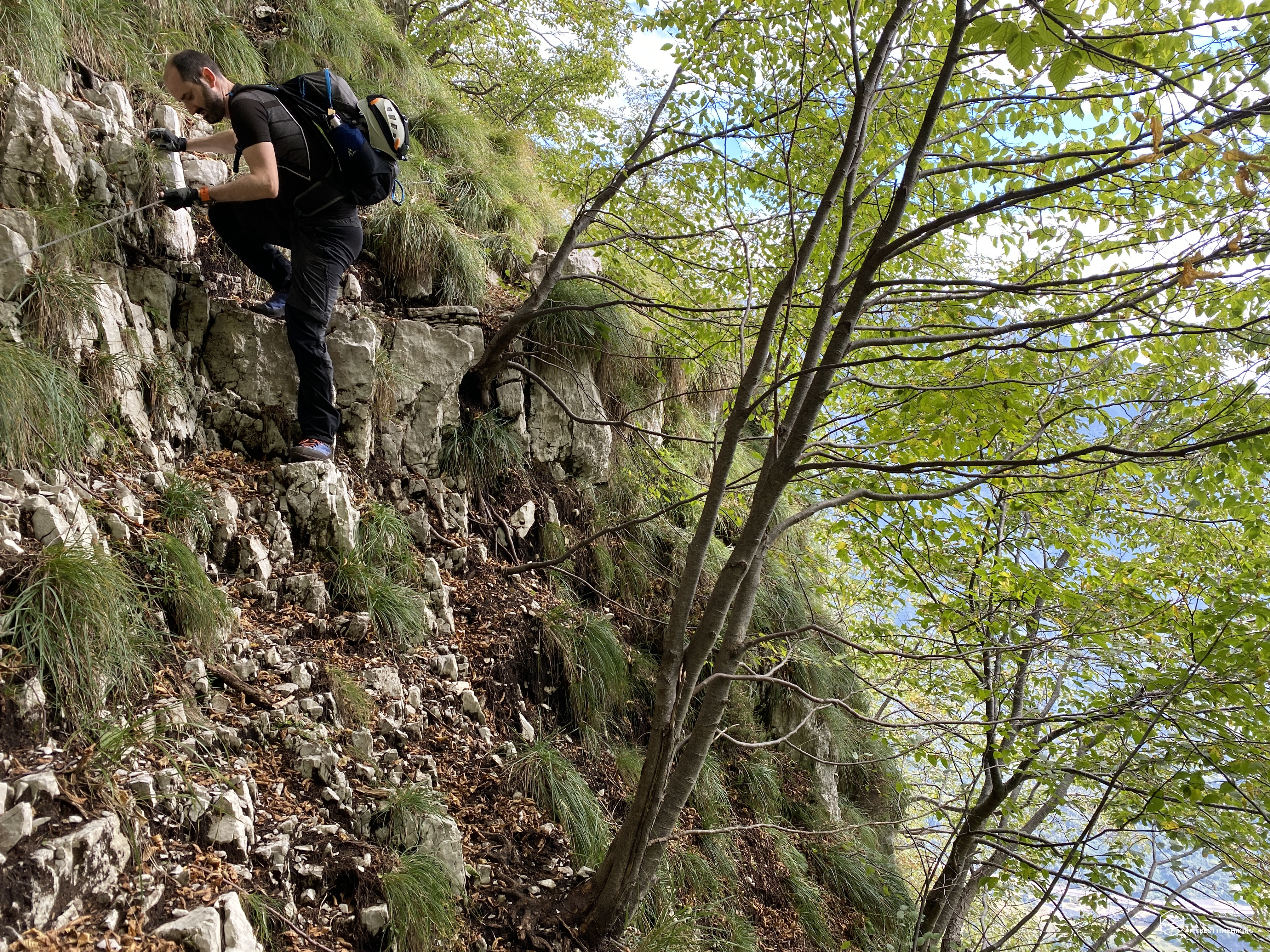
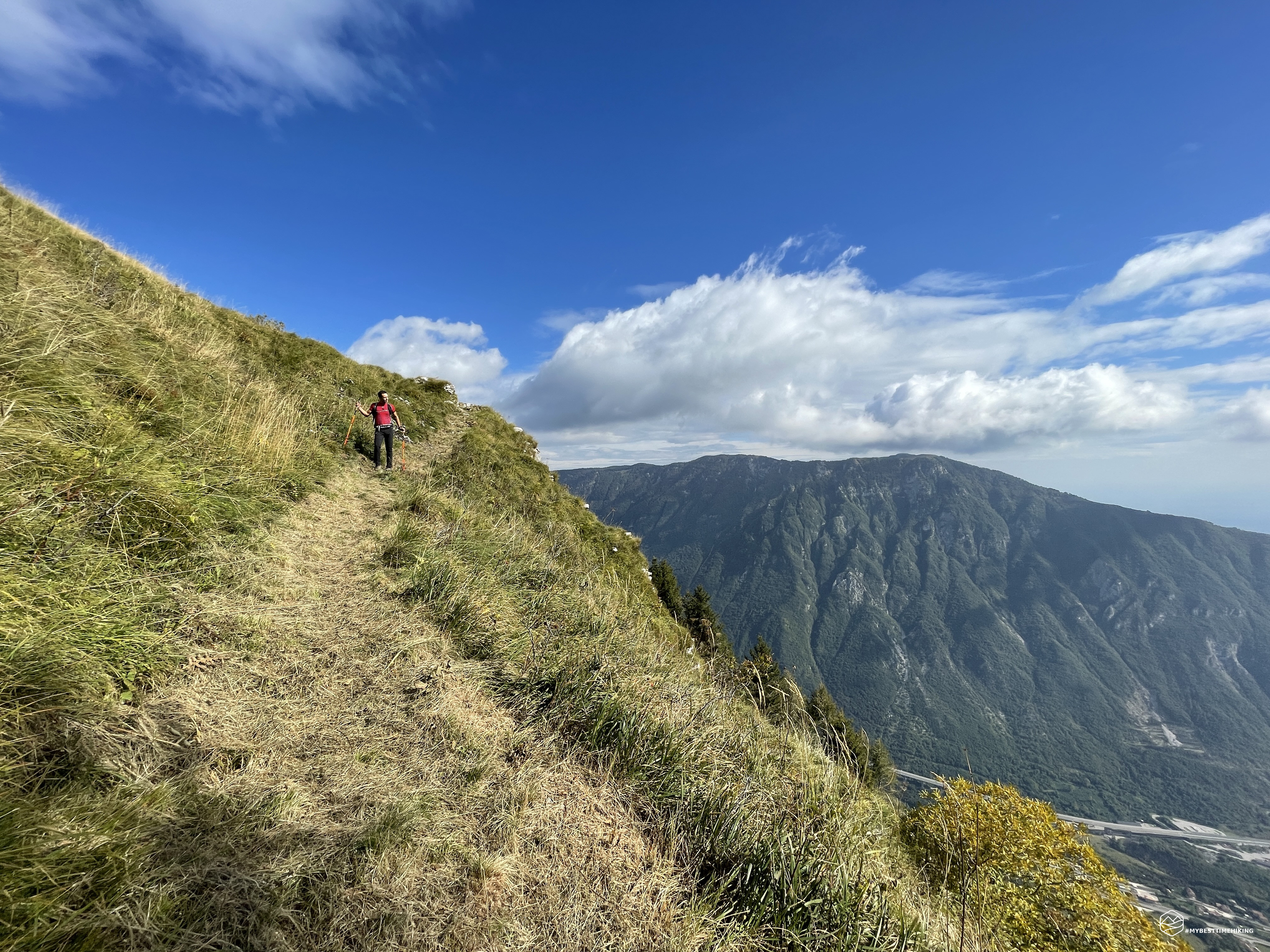
A short via ferrata, which allows us to overcome the exposed section in front of us with a little more tranquility. The metal cable is very thin, who knows how long it has been there without maintenance, so we proceed with great caution trying to cling as much as possible to the well-settled rocks rather than throwing all the weight on the metal cord. At the end of the aided section, in my opinion, there is the most challenging part of the excursion: a very steep slope, with the slippery mud left just before. A climb that has a natural drainage of water and rocky debris which, behind, leads to a cliff. The ascent proceed very calmly and carefully, the outcropping roots allow you to have a secure foothold on certain occasions. In the middle of the ascent, even the rocky ditches become a good point of support instead of continuing on the damp soil. After this gully we fold to the left on grassy ridges to be covered here too with the utmost attention because they are very narrow and a false step would make you slide for tens and tens of meters without the possibility of stopping.
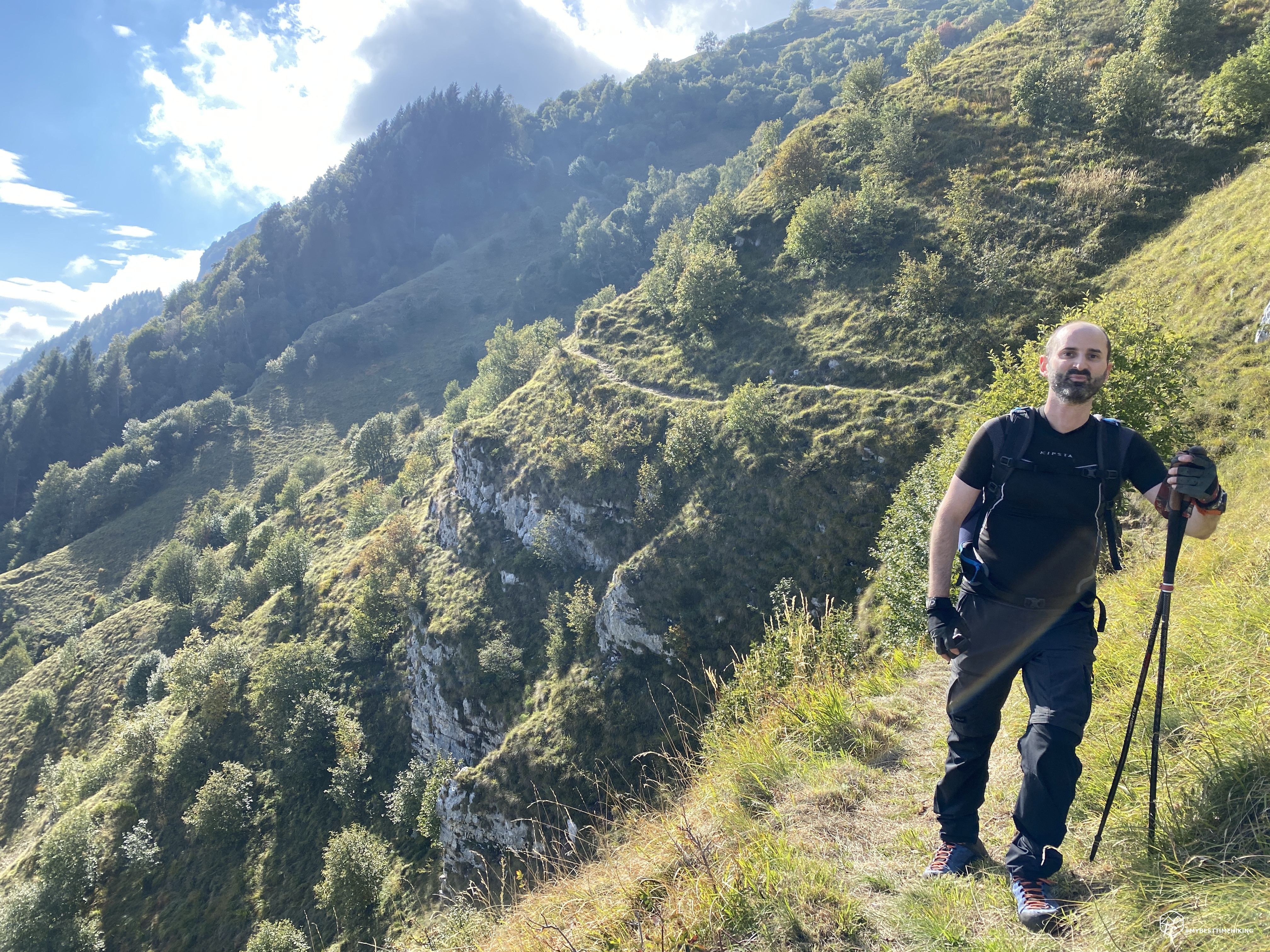
We come out on a grassy, airy clearing, which offers a splendid glimpse of the Dead Lake behind us. From the GPS there are only a few meters in altitude to reach 985, however in this last piece we have to juggle between nettles and brambles: we find a red dot right in front of a bush of nettles that we cannot get around! From here we begin to notice wooden poles with a red mark, very useful especially in summer when the grass is lush and above the knee high. Last piece on rocky debris and here is the Troi de Medo.
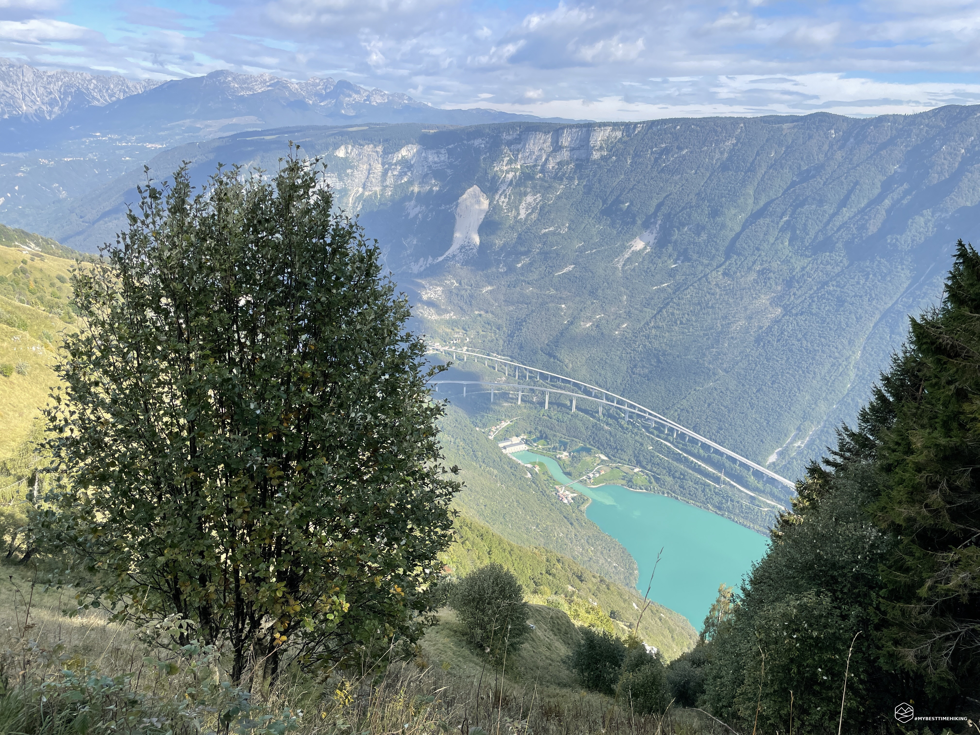
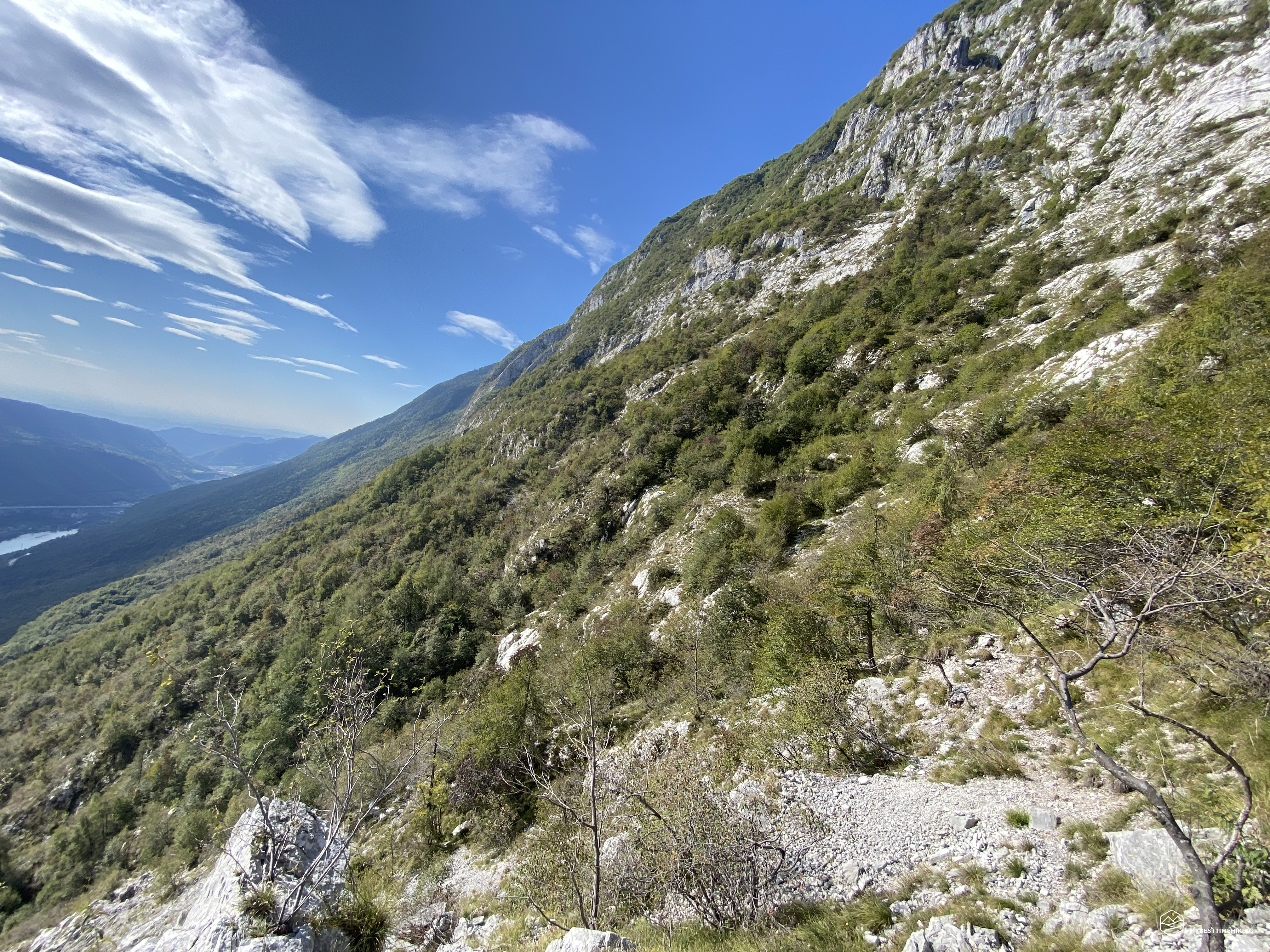
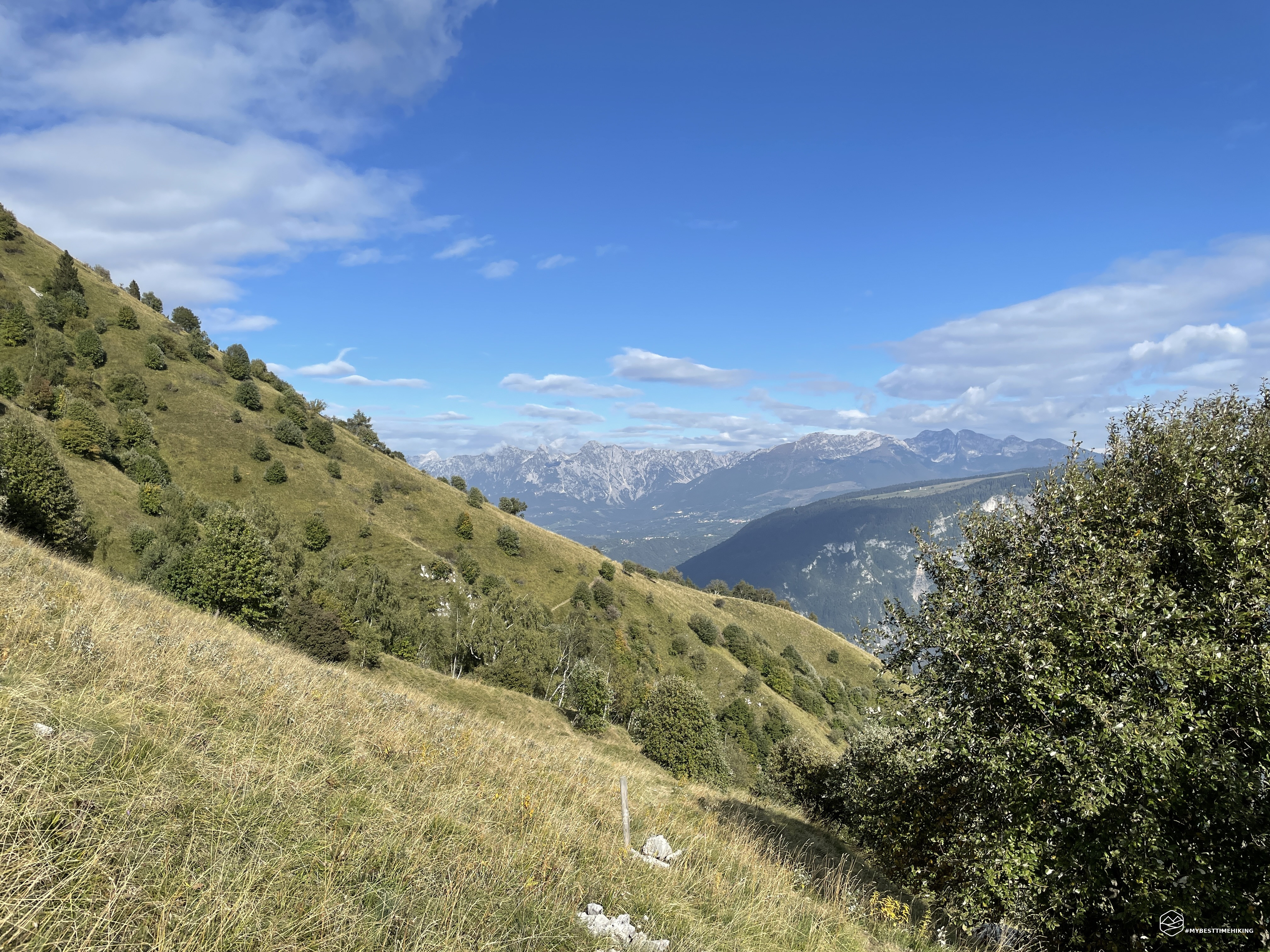
If so far we have traveled unmarked paths, this CAI 985 path looks like a small Troi with uncultivated grass, little trodden, with no trail markers. It is possible to identify it because the path is almost on a false plane and follows the sinuosity of the mountain. After a few hundred meters, however, the track becomes evident, mowed by the excess grass, it widens and becomes a comfortable and relaxing walk. The view over the Val Lapisina and the Pizzoc is a spectacular panorama made special by the verticality that the side of Col Toront offers: overhanging Lake Morto and the motorway viaduct.
In the most exposed part of the Troi de Medo it is possible to enjoy the view of the Venetian Pre-Alps closer to the Dolomites and in fact you can see the Col Nudo, the Messer and the other peaks of the Alpago. We pass the Casera Tombaril (ruins) and we find the deviation on the path E7 which descends decisively until it rejoins the Troi delle Casere. We cross several large dry impluviums that allow us to stay at high altitude and take an old abandoned road that leads us to the town of Caloniche di Sopra. From here, we will soon return to the Sella di Fadalto.
Today's excursion, although it did not have a sought-after or prestigious destination, proved to be a wonderful opportunity to explore those forgotten paths (we have not found a living soul). Routes that were not created for tourists, but that were routes of a mountain population who needed these tracks to connect villages, homes and loved ones. A dip in the past made unique by nature that has regained its wild environment!
If you want to deepen this adventure further, enjoy Diego's detailed report on his blog WINDCHILI - AROUND THE WORLD.
DifficultyExpert hikers - are generally signposted itineraries but with some difficulties: the terrain can consist of slippery slopes of grass, mixed rocks and grass, stony ground, slight snowy slopes or even single easy-to-climb rocky passages (use of hands in some places) . Although they are routes that do not require particular equipment, equipped sections can be presented even if they are not demanding. They require a good knowledge of the alpine environment, a safe step and the absence of vertigo. Physical preparation must be adequate for a fairly continuous day of walking. |