
For this fully-fledged EPIC adventure, I wanted to use a quote as a subtitle: "The high abode of the gods is silent".
I don't want to be a braggart and exaggerate the fabulous experience, but this was the title of a report that appeared in the magazine "Le Alpi Venete" of the Italian Alpine Club, in the 1988 spring-summer edition. The author, Danilo Pianetti, describes the exact itinerary that I, and the legendary Diego, have traveled today in the wild adventure that I report here in the next few lines. At the end of reading, and watching the video, you will understand why the choice of these words!
Wake up at dawn, a well-established habit for excursions to do in the Cortina area. The air is crisp even in Spinea, the weather forecasts give good weather throughout the day with a warm but acceptable temperature. In Treviso I find myself with Diego and let's go!
In about two hours we are already at the Sant'Uberto car park a few kilometers from Cortina d'Ampezzo. This parking lot is known to many for the starting point for Malga Ra Stua and the splendid Fanes waterfalls. We instead take the CAI 418 path in the direction of Cason de Antrùiles. We get ready, put on our boots and go!
We leave quietly with the dirt road downhill that leads to Pian de Loa, from where we can see the Boite river at the bottom. As soon as we pass a stream, we take a track on the right that goes into the woods. The closing of the path to Col Bechei is reported but, fortunately, it is not our destination. The path climbs and softens in the cool wood, we skirt a ravine overhanging the stream passed previously. In short we come out in an open clearing with a cabin equipped with wooden benches for pleasant picnics: here is the Cason de Antrùiles. The nearby fountain is not operational, but we are prepared and adequately supplied with plenty of water. We travel a few tens of meters on the gravel road, which allows us to reach Cason by off-road vehicle, and we begin a decisive climb on an unmarked track that goes back into the woods.
We begin to walk along the Ruoibes de Inze, a coast that runs along the orographic right of the stream and points towards the summit of the Croda de Antrùiles. The path is shown as a "difficult path (not marked)" on the Tobacco map, however we want to follow it precisely with the GPS to understand the actual conditions and practicability. After a few minutes we meet the first difficulty: a landslide has canceled a good piece of path. We have to go down towards the stream and go up again to regain the track. The bottom is very muddy and you have to be very careful not to be surprised by annoying quicksand. We go up the landslide and find a timid signpost. Between fallen trees in the woods and fresh dewy grass, we reach a new bright window without any trees: another landslide! Here the landslide has really eaten up a large chunk of the mountain and the ascent is not so inviting. We therefore decide, once we reach the bed of the stream, to follow it and use it as a way forward. It feels smoother and more comfortable ... it seems. Not far away we stop a series of Freemasons accompanied by some waterfalls and crashed trees in outline!
We then go up to find the forest, but the track is no longer there. With the GPS signal we look for it, we are close but still a little low. We find an area where the vegetation is very high and dense, the signal indicates that we are in the perfect position: we are above the track! Around us, however, there is only vegetation, no hint of a path .... After having crossed this portion of luxuriant wood, we leave the wood and see a barely visible sign on the gravel that descends from the Croda de Antrùiles. Here the Tabacco by hatching card passes to a dotted line that indicates an even more difficult way to see: the path, in fact, no longer exists! We continue to consult the map with the GPS signal in real time: sometimes we are just below the track, others above, we are unable in any way to travel the route regularly.
We therefore give up following the map and go to intuition. Unfortunately, the weather and the abundant rains of recent years have irreparably changed this corner of peace, giving indelible scars such as the creation of very deep impluviums, continuous landslides and fresh landslides. With a lot of attention and studying in real time the best advancement strategy to undertake, we are able to overcome the various adversities that arise. Sometimes we also pay with a few falls, but without major consequences. Diego manages to pave the way flawlessly on loose and unstable terrain. The most difficult and impervious part that presents itself to us is a succession of patches of young and dense mountain pines that are obligatory we must cross. A feast that reminds us of last year's adventure at the Colfiedo saddle!
N.B .: the path marked on the Tobacco map n ° 3 no longer exists! Although it is still reported on online maps, which should be constantly updated, do not trust the marked route. You risk, like us, to run into mountain pines, landslides and impluviums that are very, very, difficult to overcome.
Date
21-08-2021
Distance
22.48 KM
Hike type
Hike
Ascent
1396 mt
- Mountain
Croda Rossa d’Ampezzo
- Address
Cortina d’Ampezzo, Veneto, Italy
- Altitude
2515.00 m
- Refuges
Rifugio Fodara Vedla
- Information
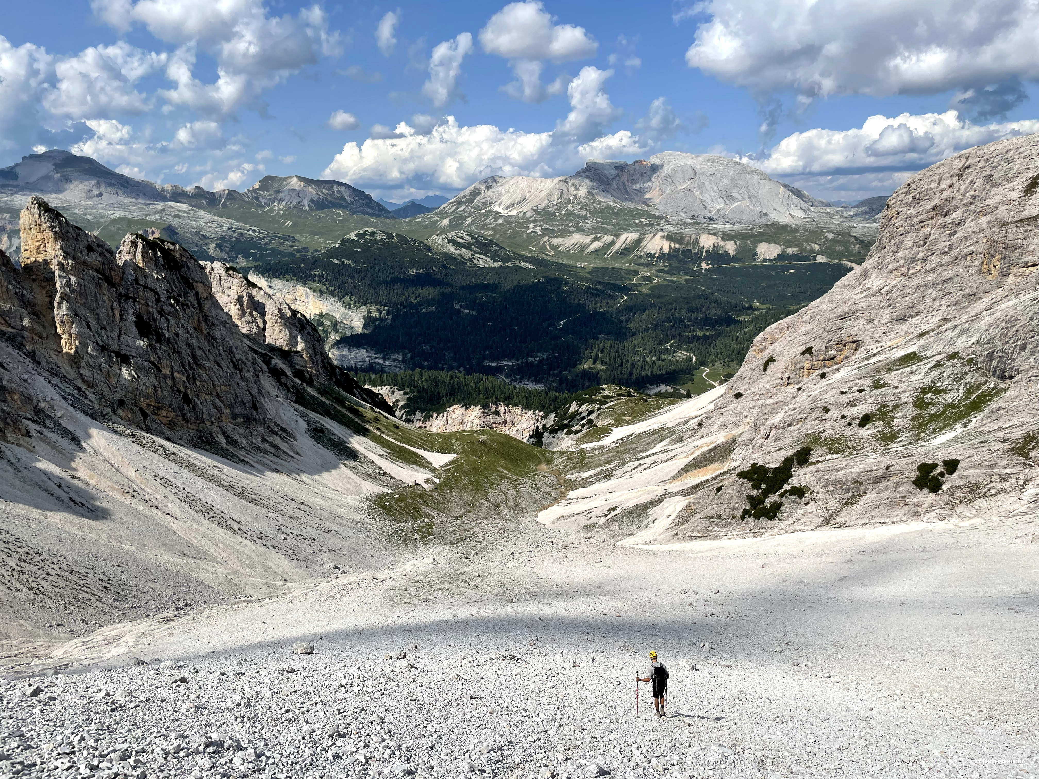
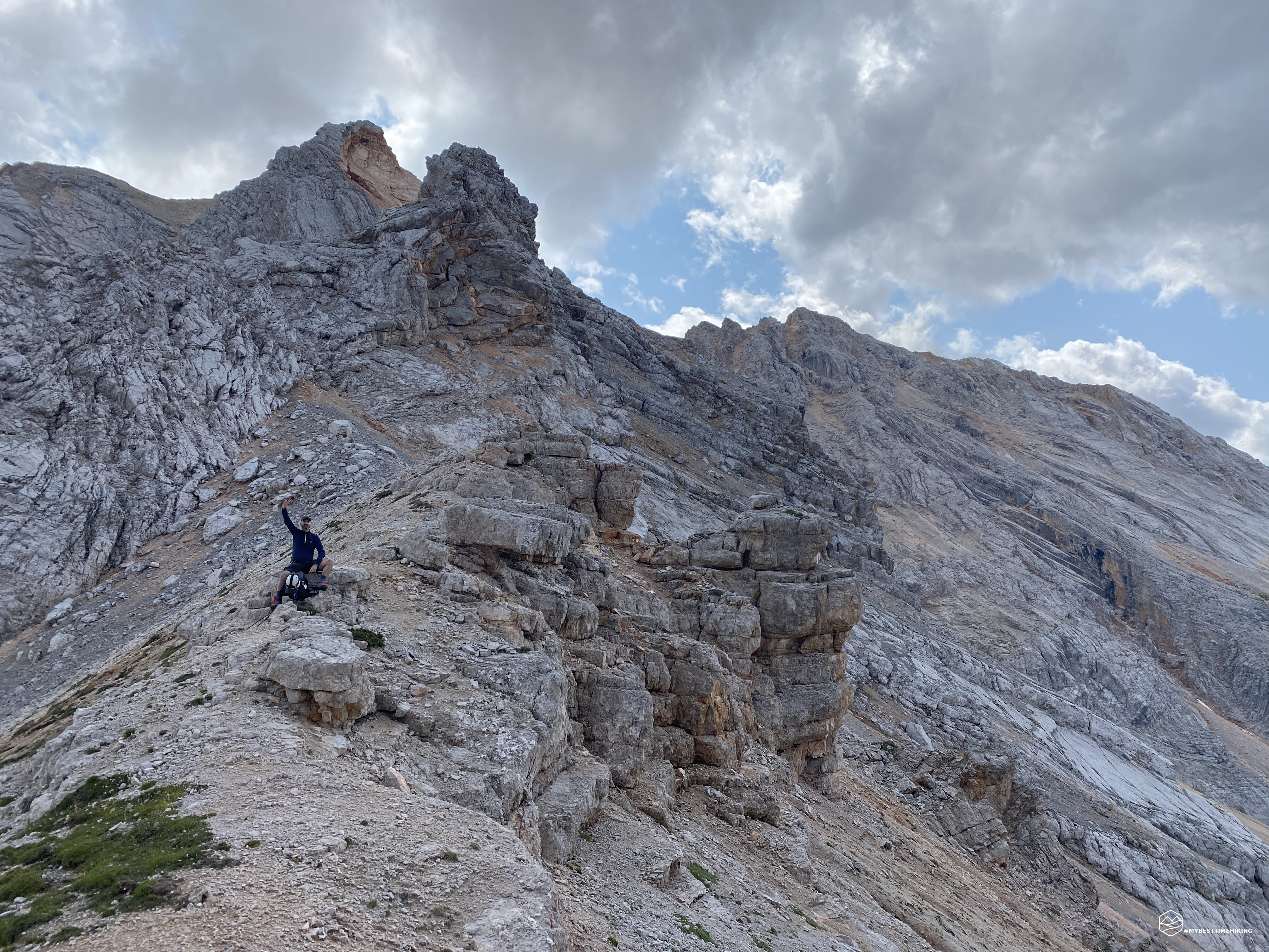
We are close to an altitude of 2000 meters and we see the light at the bottom of the last forest of baranci. The final effort allows us to go out, on the scree of Val de Meso! Enough vegetation, now we have in front of us only rocks and gravel surrounded, on the left, by the Croda de Antruiles mountain range which connects to the next Col Bechei, and the Croda da Ciamin on the right. There is no one, for several years, perhaps decades, this valley has not seen a human presence (at least in the summer season). Just us and a group of chamois descending from the Croda da Ciamin creating a din of crashing stones. At the bottom, in the center of our visual space, the famous Camin fork (or also called Ciamin fork) is perfectly distinguishable. Fatigue is already starting to make us feel, we are already almost one in the afternoon and we still have to reach the first fork. The unexpected made us slow down and we lost hours on the schedule. Reassured in the spirit by the sight of the first goal, we proceed swiftly. We cross the valley and gain meters in altitude, we pass the rocky summit on the right which is exactly in the center of the Val de Meso. On the left we noticed several gravel trails that seem less easy to overcome. On the right, however, the presence of some grassy patch facilitates the climb. Altitude 2300 meters, last 100 meters of altitude and we are on the ridge, we do them all in one breath: here is the Camin fork!
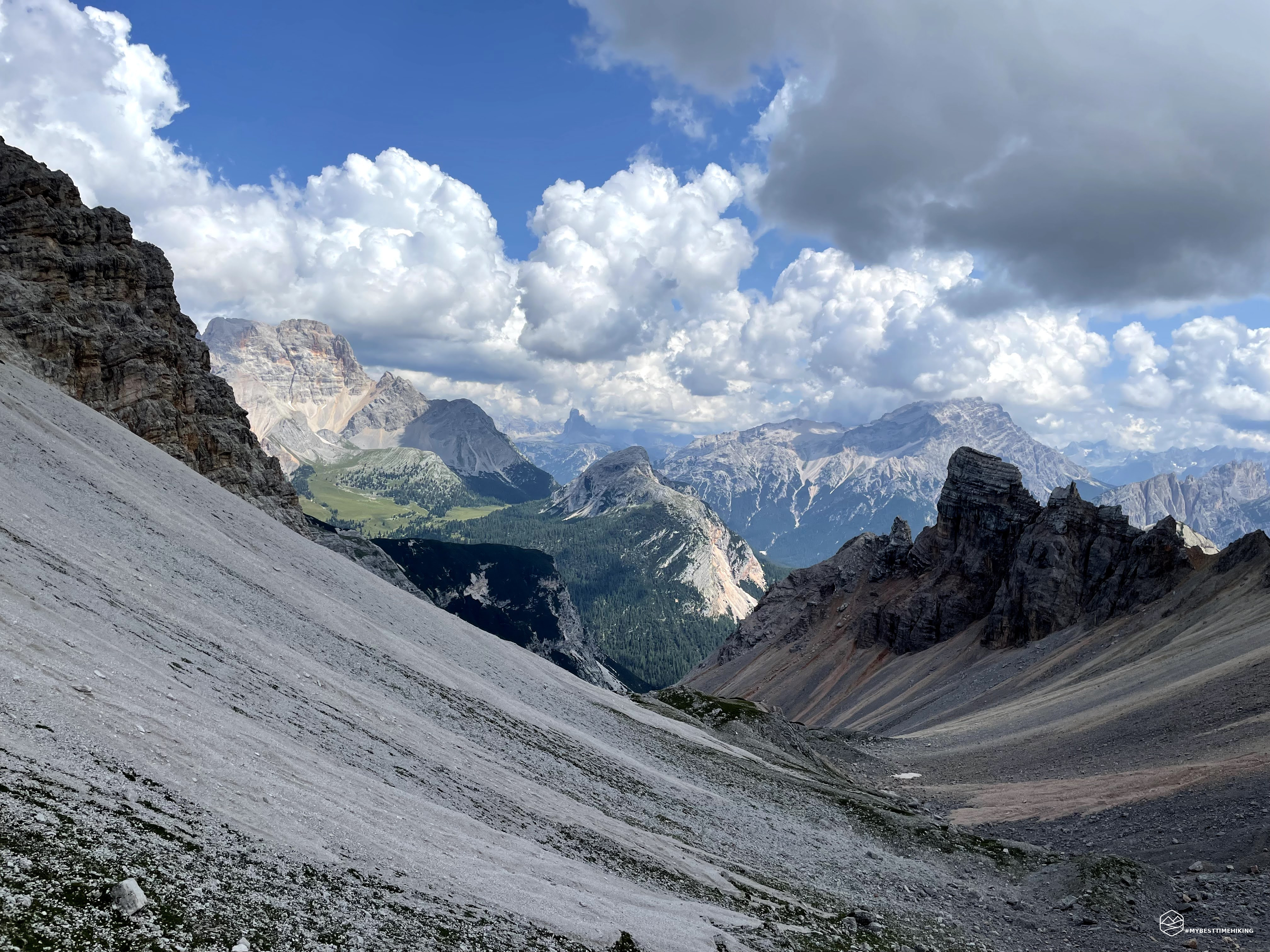
A spectacular view, we have reached Trentino Alto Adige and the massifs of Sass de the Crusc where the Sasso delle Nove is distinguishable. The tip of Piz de Sant Antone and an anonymous peak that overlooks the Utia Pices Fane and Utia de Fanes anticipate it. On the left stands the Col Bechei in all its magnificence. Behind us, the Val de Meso, where we came from and in the background the Croda Rossa. A very biting wind begins to pull, we cover ourselves and immediately leave for the last climb of the day to reach the Gran Valun saddle.
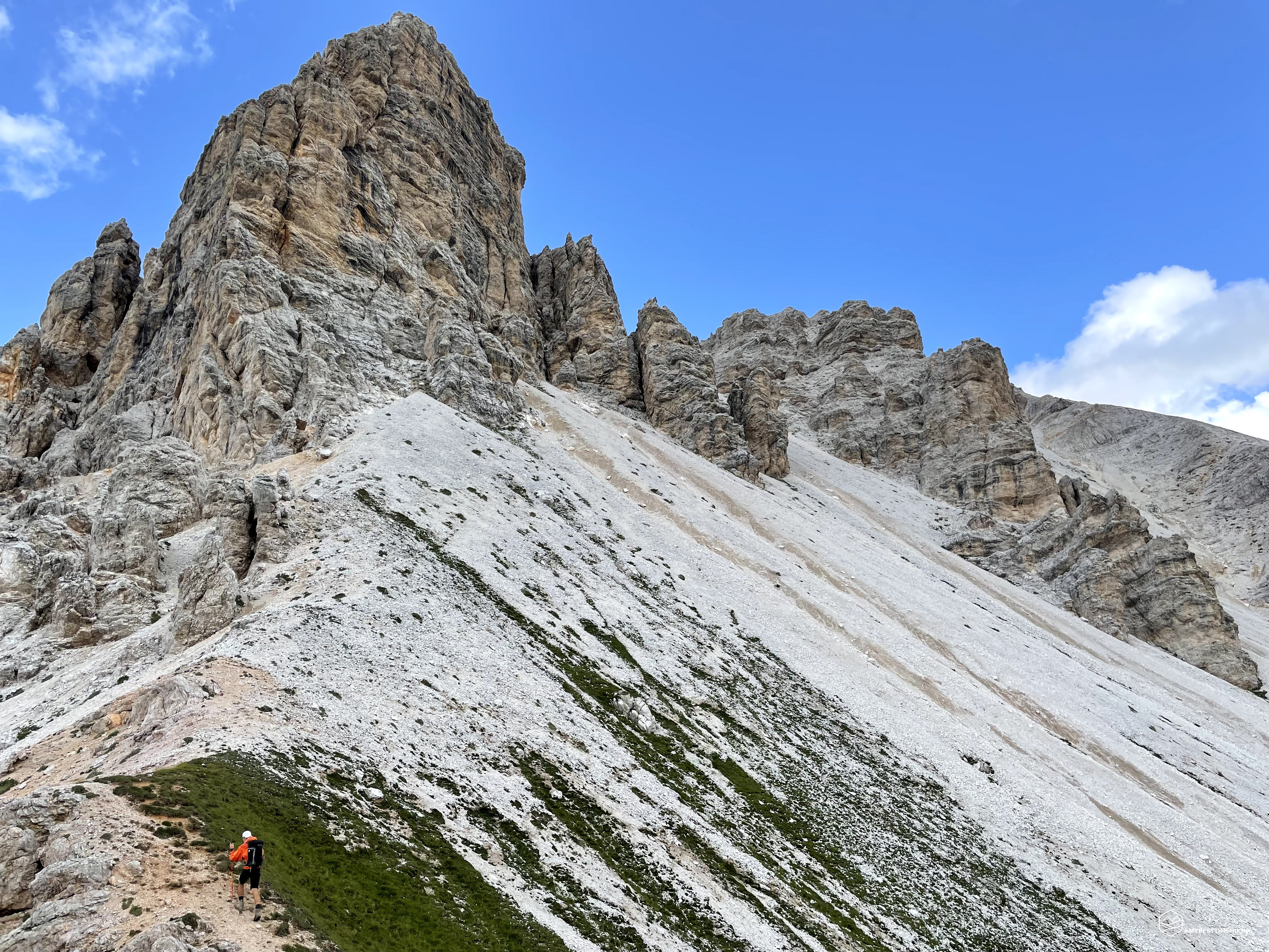
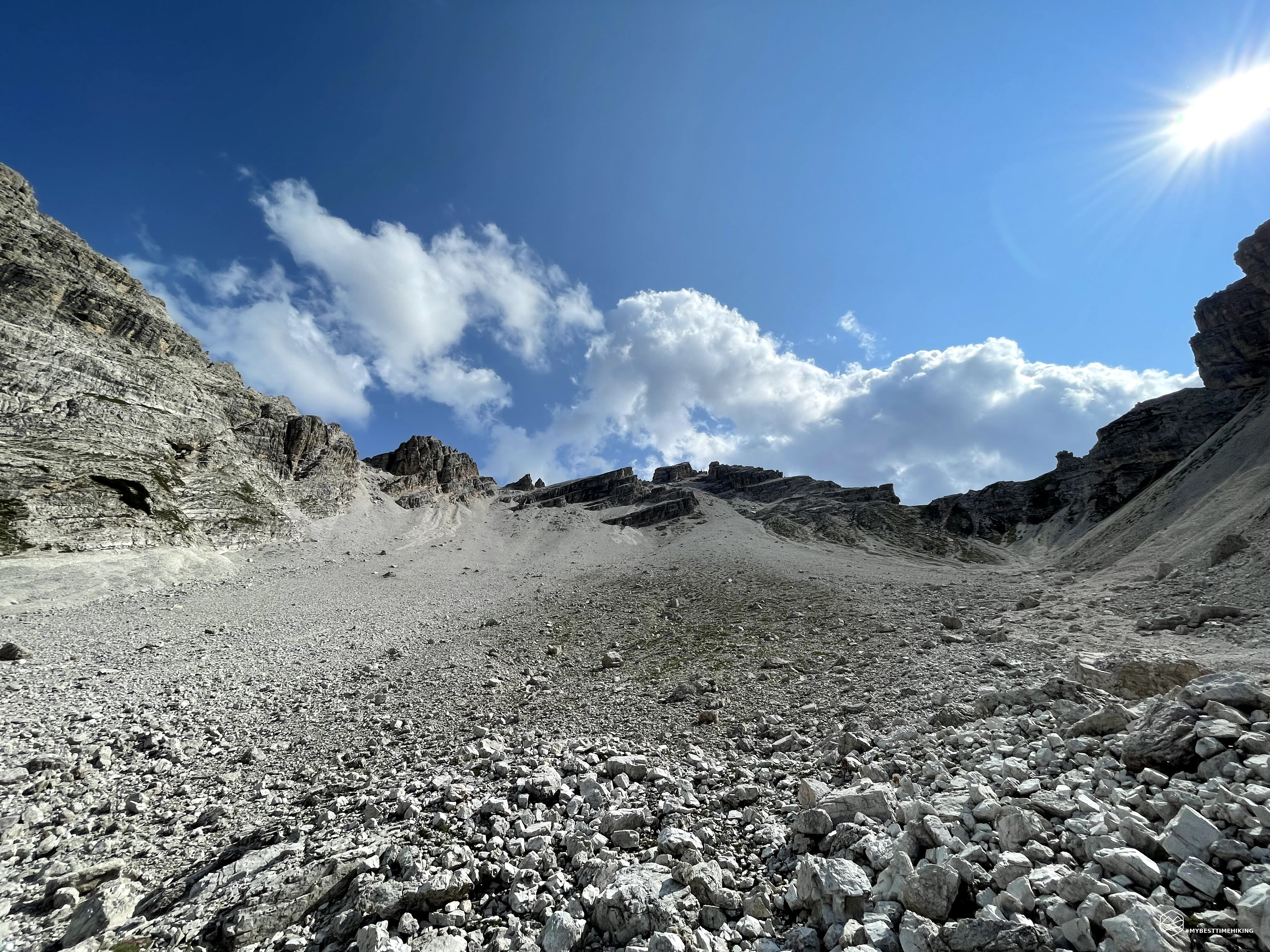
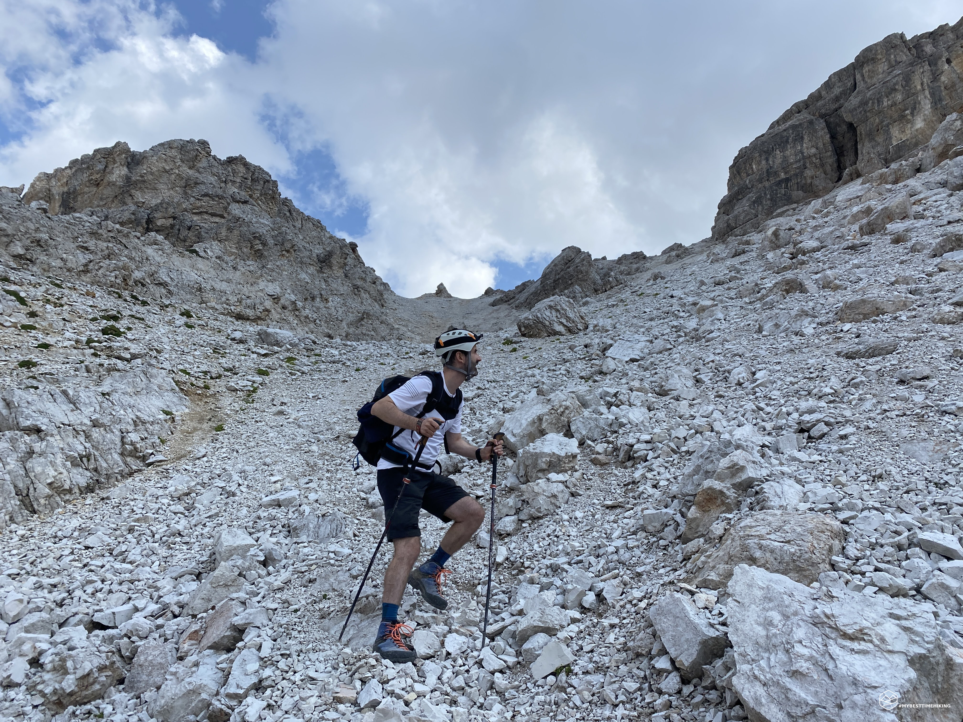
The climb is immediately very technical with a thin and compact gravel that does not allow you to proceed quickly. The wind is gone and we have to go back to the cooler short-sleeved shirt. After a long traverse, we arrive perpendicular to the gravel wall that allows access to the saddle. Diego chooses to stay on the left where, however, he finds an annoying gravel that makes it slip. I decide not to stay in the wake to avoid any stone discharges and I take the "direct route". I take two steps forward and one step back, you can't see the end, the climb is vertical! The stones that are moved to proceed give life to mini landslides that cover the boots if you are not quick to take the next step. The cramps arrive and I am forced to stop on the only boulder stuck in the scree. A couple of minutes and luckily I'm ready to go. The last few meters are endless, now I see the ridge. A few tufts of grass, earth, last effort peep out and I'm in the fork!
The view from the Gran Valun saddle is truly frightening: we are on a gravel blade from which the homonymous valley begins, so majestic that it looks like an amphitheater capable of holding millions of people! On the left the circus is bordered by the Banch dal Se chain, on the right, instead, a small, nameless rocky conformation takes shape that divides the Gran Valun from the Pice Valun. We are still in Trentino and all the peaks of the Fanes-Sennes-Braies Park stand out in front of us: From Muntejela de Senes, passing through Le Seneser up to the Croda del Beco and the Biella, Sennes and Pederù refuges at the foot of these giants . The wind is not as impetuous as in the Camin fork, the air is fresh, clean, clear. We have a very deep visibility, it seems to be on top of the world and we are in Italy, at an altitude of about 2500 meters! The Great Valun is the pinnacle of a throne from which the nearby mountains, and valleys below, await guidance on how to evolve and change over time. A throne from which you can hear the faintest whistle of Marmot from miles away thanks to the natural amphitheater.
We enjoy this dream, we regain our strength, we are super enthusiastic! At the bottom we see a dot that indicates the Fodara Vedla refuge, the next stop. We ran out of water, luckily "only" the descent awaits us. The weather was kind: if the sun shines all around us and allows us to enjoy splendid views, we have the cloud that protects us from the scorching sun and allows us to go on less hot.
The descent is pleasant, fun, we have "treadmills" of stones that make us move forward in complete tranquility and ease. In some places, however, we find the treacherous hard and slippery gravel, but we soon forget it with subsequent relaxing escalators. We go down 400mt in altitude and arrive we go flat at the end of the Gran Valun, we turn around and we notice the splendid scree just passed: there are no words to describe it in its size and verticality! We keep determined to the right to avoid the insidious overhanging crack in the rock that forms the Val dal Se, thus we find ourselves in an area with karst features. Here and there a series of dry and cracked sinkholes peep out from the heat. We find the green vegetation, still pines ... Here too the recent rains have changed the surrounding nature with landslides and landslides that do not allow us to find the original trace that leads to Fodara Vedla. Nightmare pines come true: we have to go through them one last time! We mistakenly follow a path that takes us to a shore of a small stream that ends overhanging ... we have to go back and turn left. The refuge is becoming more and more a mirage, even here the difficulties continue to add up! Finally, after several attempts to find the easiest way, we come out on the stream that arrives at the refuge. We give ourselves a quick wash and we reach Fodara Vedla exhausted.
It's 5pm! We are hungry, thirsty, we are cooked. Barley soup, mixed cheeses, bread, and Sacher cake to conclude: a meal finished in less than 30 minutes! All the dishes were delicious, the soup heavenly, the cheeses mouthwatering and the Sacher to dream! Let's retrace the mythical adventures we just experienced, but let's get back to the present immediately: we still have almost two hours to get to the parking lot! Backpack on your shoulder and off to Malga Ra Stua. We cross a beautiful meadow with full grazing cows, we cross the last hikers who reach the Fodara Vedla for a refreshing dinner. In short we arrive at Lago de Rudo: a small spot of water that allows you to mirror the Cima Lavinores. Thanks to the CAI path n ° 9, after a series of zigzags that allow you to lose considerable altitude, we reach the dirt road with CAI n ° 6 that leads us to Malga Ra Stua. There is no one left, only two shuttles awaiting the last few hikers to bring them back to Cortina. From here we follow the paved road and repeating every 10 minutes "what a cool ride", "mamma mia what stuff we did", "what a spectacle of the day", we arrive with our eyes still full of joy at the parking lot of Sant'Uberto.
The loop tour ends. We have traveled over 22 km with 1400 meters of positive difference in height, dozens of landslides and landslides overcome, countless forests of baranci crossed, 11 hours of walking and we are happy to have reached such remote places, unknown to most people. A full-fledged wilderness adventure!
If you want to enjoy more anecdotes about this adventure, enjoy Diego's detailed report on his blog WINDCHILI - AROUND THE WORLD.
DifficultyExpert Hikers with Equipment - The equipped routes (or via ferrata) are indicated, they require the use of self-insurance devices. |