When you undertake a way you are usually dedicated to ski mountaineering you always have a dose of uncertainty, more attention to detail towards an unknown track. It is the case of today's adventure, proposed by my friend Leonardo, who had made a part of this path in winter with his snowboard. The goal is Mount Cornor, we are in the area of Monte Cavallo between Veneto and Friuli-Venezia Giulia.
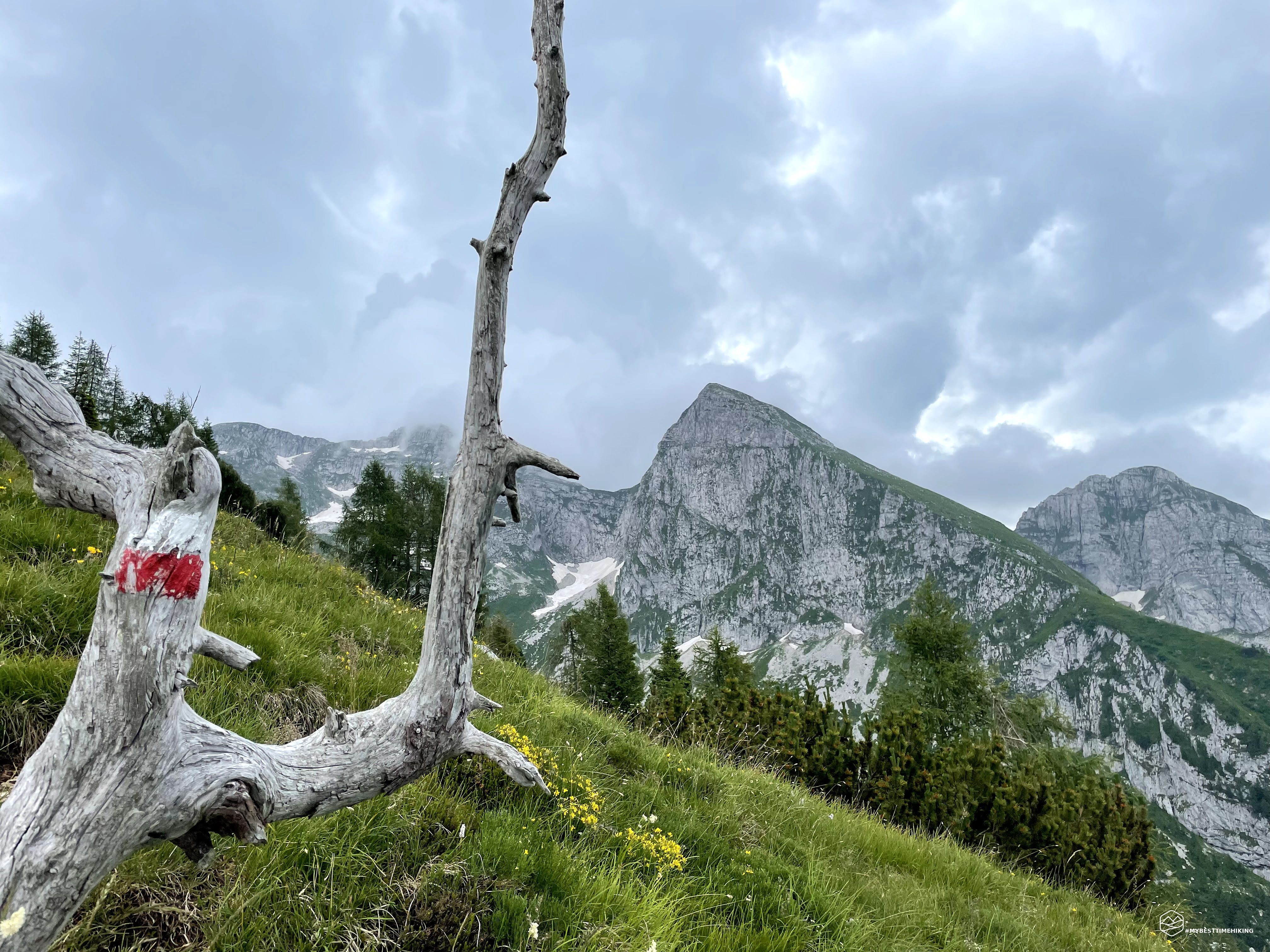
Let's start from the Alpago, after Tambre and more precisely Fraction Sant'Anna after with the INDES. We park in Malga Pian Grant and time this morning is quite covered. The sun has just got up on the therrium coast that leads to the top of the cows and immediately increases a very annoying moisture. It is precisely in the direction of the newly appointed top that we head. We follow the paved road to Malga Pian delle slabs for a short stretch: from here you take the path on the right bounded by a bar. The CAI signage presents the indication of the Seed Refuge. We walk a hundred meters and see the Cai 926 path on the left. The signage is clearly visible and very clear. From here begins the decisive and constant climb. We are on grazing meadows, the path is tight but clearly visible, we pass next to the apparently abandoned Pradosàn Malga. A few hundred meters later we enter the undergrowth following the so-called "Guslon ring", name taken from a top of over 2000m not far away. Now the path becomes more hidden, less marked and visible. We lose the track, but thanks to the GPS and to the Tobacco map we find the way going straight upright in the middle of the woods. A small roe deer is peeped in silence in silence right next to the stretch marked on the path that we find in a short time.
The vegetation stain we are beginning to thin out, the path increases the slope right in the final stretch before leaving the woods. This is the most toaster part of the climb, but it is a touch to continue earning quota. Leaving on a gravelly trait we can admire the first peaks: Cimon de Palantina, with the homonymous fork, the Pian Cansiglio with the unmistakable plain, the Pizzoc and, behind, the Visentin. Right on the side of the canglery, exactly above the meadows of the plain, we see a rainwreath. Looking for a few seconds we see that it is coming from our part! Within about ten minutes, in fact, a very thin constant drizzle accompanies us for a few moments, refreshed without getting any discomfort.
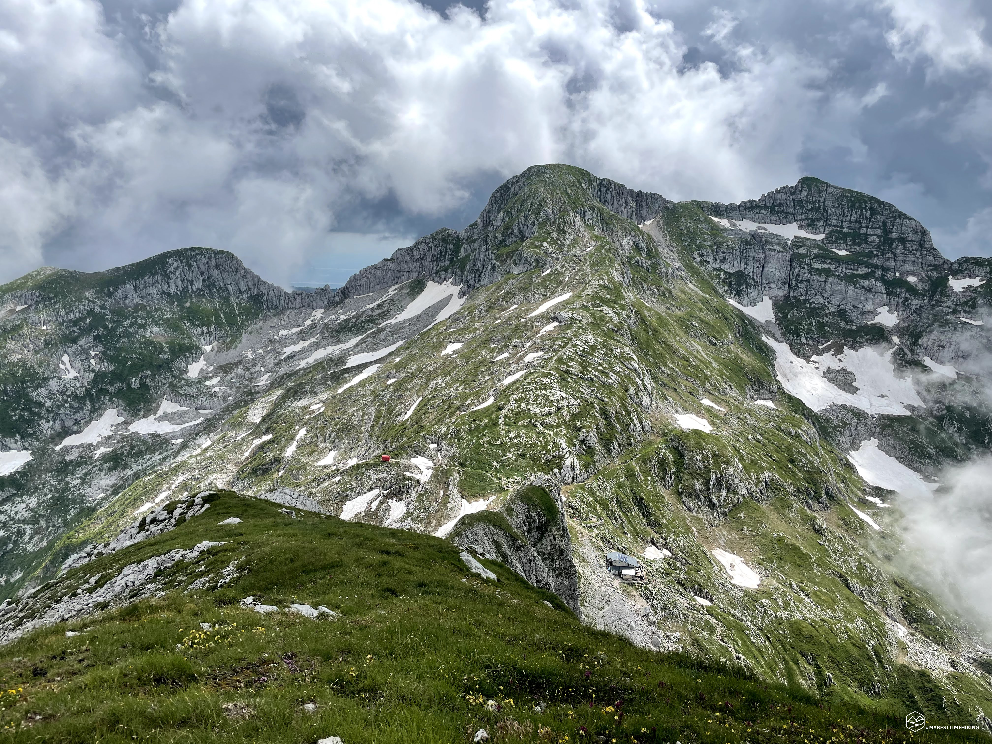
We reach the rock ridge just below the top of the cows and we walk this part of the path that keeps themselves at an altitude at an altitude of 1900m. We cross some scarce down and in a short time we arrive at the detour in which the Cai 923 path is reunited. We can see it separately under us that climbs in a decisive way up to the junction in which we stop to refresh us. The view is definitely affecting: an amphitheater on the peaks on the border between the two regions with the peak of Cima Manera (horse Cimon) right in front of us, majestic! A succession of clouds alternates moments of scarce visibility to others in which the view is kissed by the first shy sun that is made wide. Continuing straight for the path we are traveling, we arrive at the Semenza refuge, but we have to proceed towards the Cornor.
Date
11-07-2021
Distance
14.05 KM
Hike type
Hike
Ascent
1006 mt
- Mountain
Monte Cornor
- Address
Alpago, Veneto, Italy
- Altitude
2149.00 m
- Refuges
Rifugio Semenza
- Information
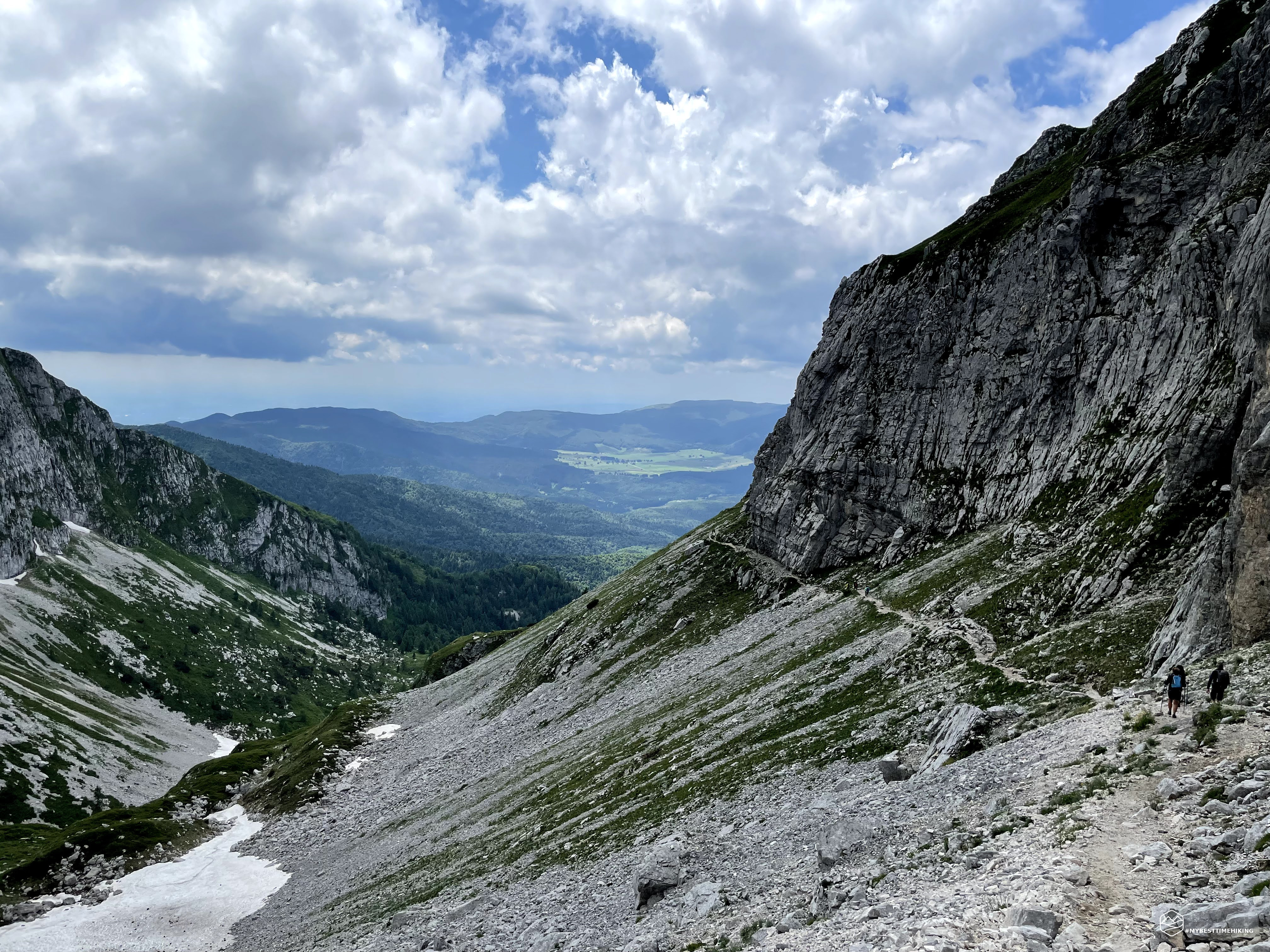
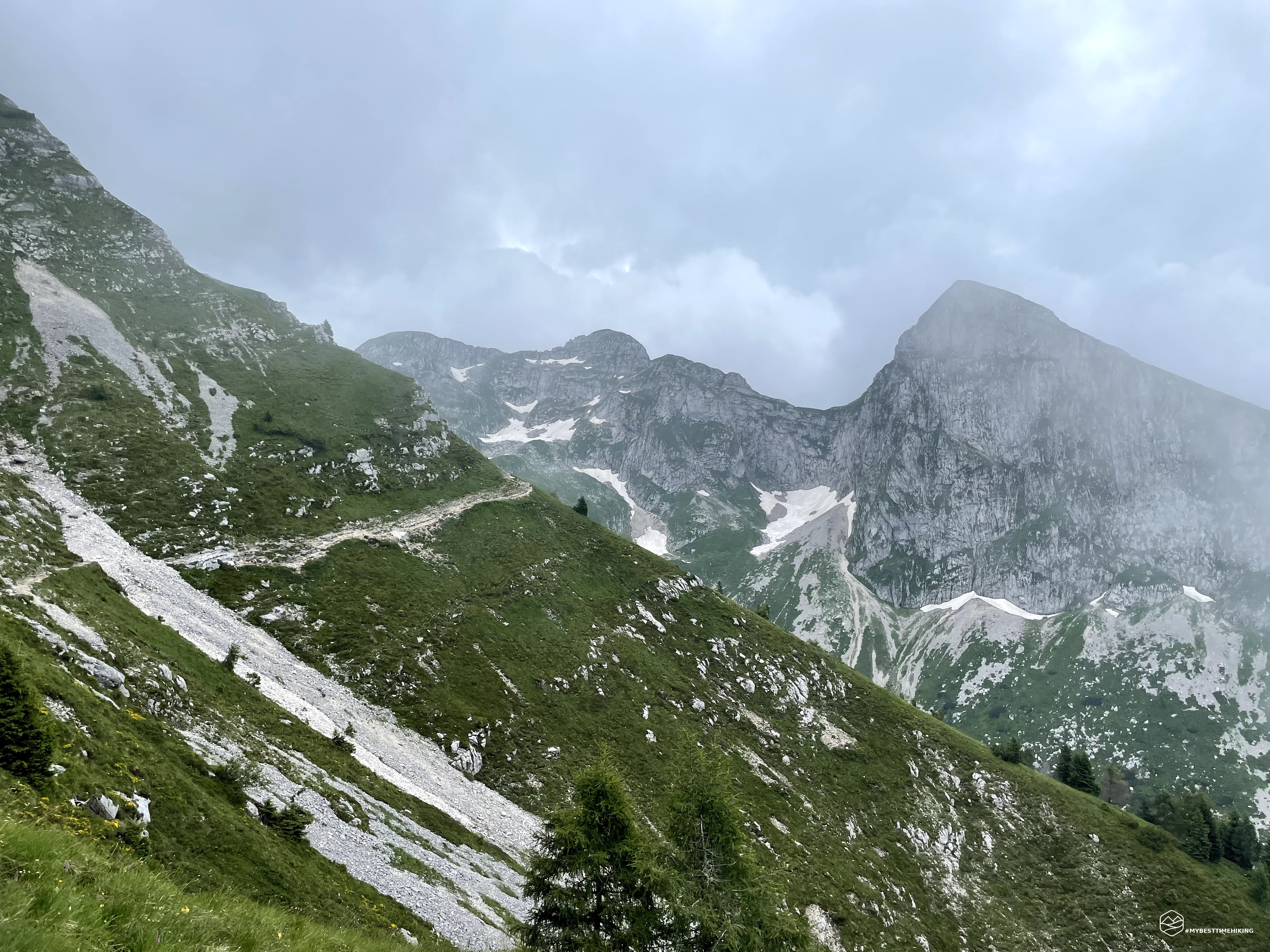
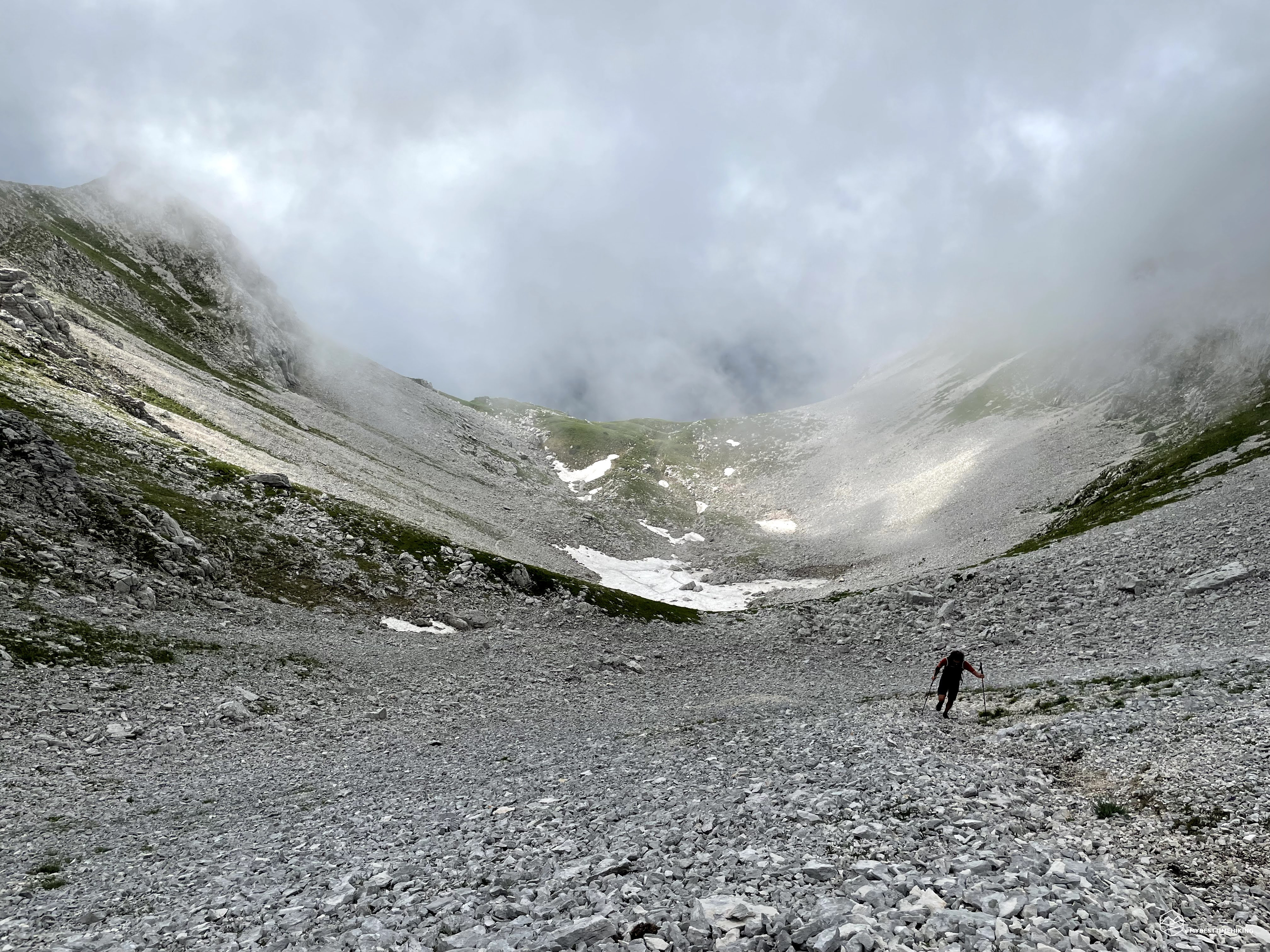
There are no marked paths, no trace, only one IRTA street on grassy meadows interspersed with the stony that can only be observed with the nose upside down. A look at the GPS and via creating progressive zigzag upwards. About twenty meters and we already reach a first fork (we thought we have already arrived!) And a screion is very extensive in front of us. After all, the true Cornor fork with the ridge rising towards the top on the right. The street goes down a little almost to reach a stain of snow, we keep it on the left and go up on the right side on a trace just mentioned among the boulders. Time is cupo back and at times we are wrapped in the clouds that allow us to see just a little before us. The clouds run quickly and hopefully pass soon to allow us to enjoy the view. As soon as the part of Sassoni ends, an almost vertical wall of gravel and very slippery stone where we make a great effort to advance. Fortunately the climbing piece with these features is short and fell softens after about 50 meters in altitude. Last steps and reach the fork! Still a series of low clouds do not show us the peaks in front of us towards Val Savis, the wind pulls very strong. We try to orient ourselves with the little visibility we have and decide to proceed immediately towards the summit. Last 70 mentions in height in grassy crest and reach the 2170mt of the top: Monte Cornor!
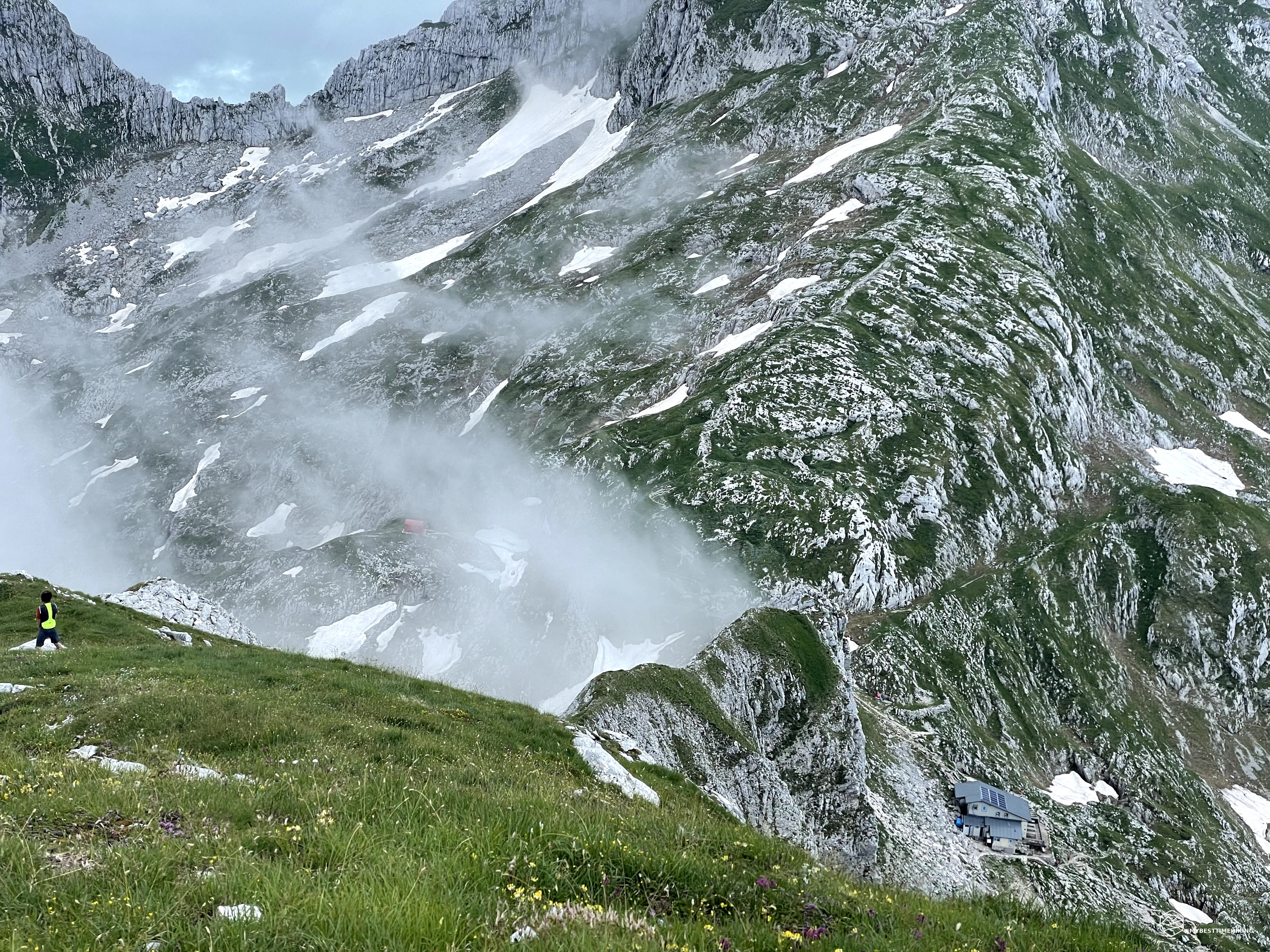
We are lucky and the weather improves when we reach the summit, the clouds of they slowly and discover the view: in front of us the mountain Castelat who opens the view of the Val Savis where abundant snow is still present. Here the tips of the mountains like the Messer and the Sestier are still covered and do not allow us to have the visual depth that should reach the Pelmo and the owl. Moving us again on the right we admire Cima Valgrande, top of Lastè with under his fork and the red bivouac, the Rifugio Semenza still checks on the right, finally the Cimon of the Horse and the Palantina. The last portion of the 360-degree panorama is a large window on the Cansiglio, the Pizzoch and the Visentin. There is also the summit book and is a must note our passage. Here we take a short break as time is being improved and the wind does not blow as strong as in fork. Leonardo studies the possibility of going down on the part of the Semenza refuge. A nice crest is visible that seems to be passable, at least up to a certain point. This section is not marked on the map and we must go to intuition and experience. We just need to be attentive to the rocky block towards the shelter that is not passable easily and keep us on the left side with the face towards the Sperlonga valley. Let's start the crossing of the ridge, but after a few steps we find ourselves in front of the impossibility of continuing to the rock ridge that invites us to go down. We turn on the left, we go down a few meter and resume on the right in another trace that I think was made by some deer. This brings us back to the ridge once the rocky ridge was passed which was truly impropeable to overcome on the top. Here the route is really on a razor blade and gives a very special emotion! We see that the Last fork bivouac is very close and, to reach it, we must again leave the crest and descend into the final section. It should be noted that the crest is very exposed, it is not easy and requires excellent physical preparation. The flaming red bivow is closed due to Covid but, even from closed, it always makes its beautiful figure distinguishing itself from the surrounding landscape.
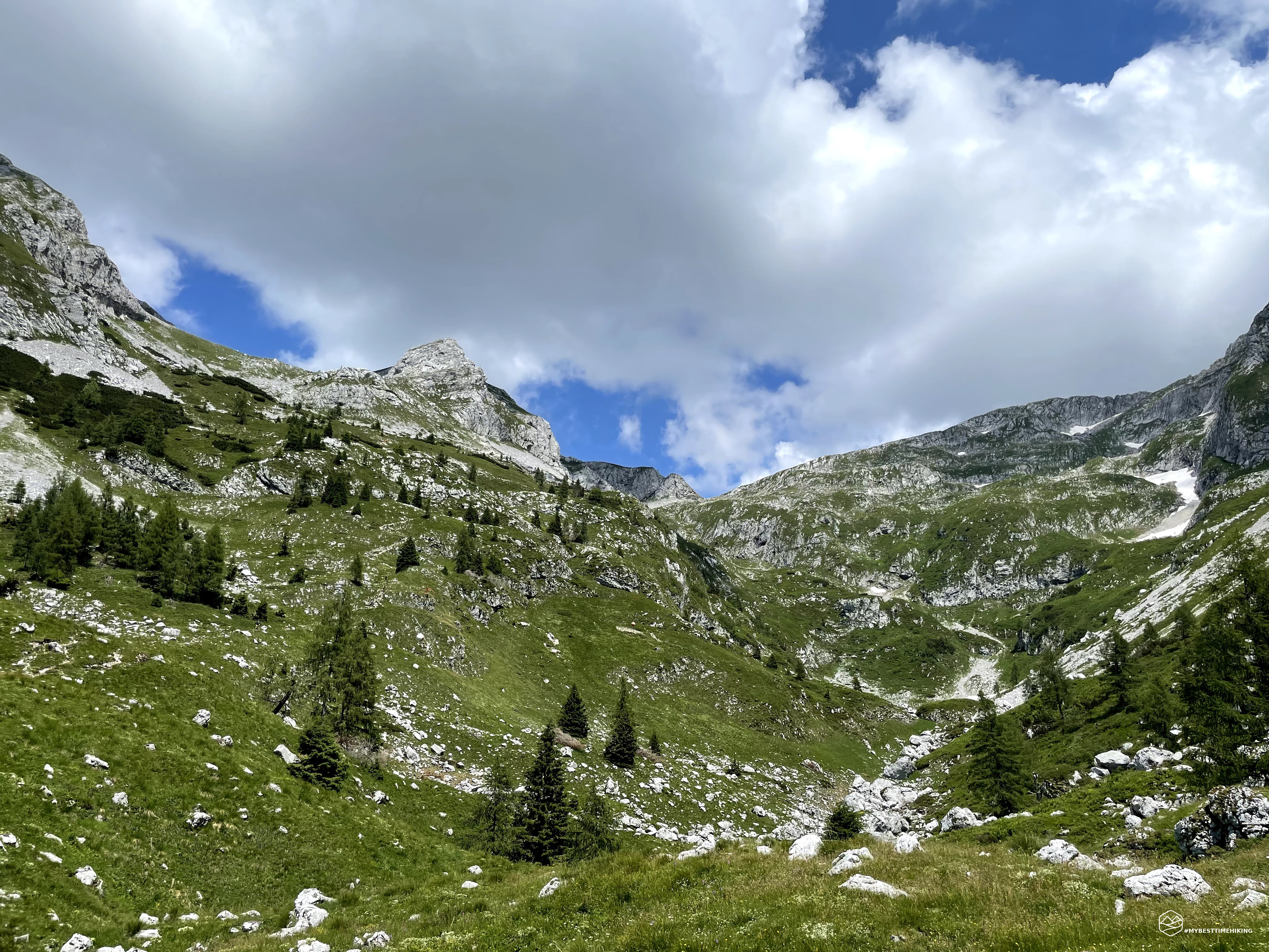
A nice lunch break and enjoy the view of the Val Salais. The weather starts to improve decisively, the sun turns all the peaks and the newly observed valleys giving a touch of depth and shine. La Top Lastè and the nearby Cima Manera are impressive in front of us. I can't wait to reach them in an upcoming excursion. The Semenza refuge is a few steps from the Last Fork. We pass it practically without looking at it so as not to collect with the tide of people present on the terrace and standing all around. Take the Cai 923 path and walk on a fake plan that cuts the rock ridge that creates Mount Cornor as soon as conquered. We return to the junction where in the morning we had climbed like deer and choose to continue along the path 923 creating a ring ride. The descent is decided, quite demanding because of the stones and gravel. The path undertaken for the uphill to the first leg (Cai 926) is definitely better, easier and I recommend it for the climb compared to this that we are about to travel for the return. Around the 1600m we arrive at the gates of the woods and here is the beautiful stone of the Madonna who wakes up all the excursionists I pass next to you. One last look at the Monte Horse Amphitheater and we grow in the vegetation. A wide wood that makes a lot of light filter. When the slope becomes sweeter we find the Mognol cabins where some family is doing a nice barbecue. From the Vario Forest we pass to a splendid phaggeta, cantiglio style, thick and very high. It gives us shadow and a regenerating freshness.
The path takes its name Cai 923-C, becomes much wider, sweet and almost flat. It allows a relaxing walk that ends about 1300mt where the beeches interrupt and the path becomes asphalted. After all, unlike the cloudy morning, we have the opportunity to admire Lake Santa Croce and the Dolalad massif. Starting to walk the paved road, we notice the path we took the way on our right a little higher. In short, we reach the slabs again and then the car to Malga Pian Grant.
Thus ends the magical excursion of today on a ski mountaineering way revisited for the summer season. A ring ride with over 1000mt difference in altitude, suitable for experienced and trained hikers looking for a more sought after street and out of the normal road to the Semenza refuge. Mount Cornor is a top of the Venetian Prealps to be discovered!
DifficultyExpert hikers - are generally signposted itineraries but with some difficulties: the terrain can consist of slippery slopes of grass, mixed rocks and grass, stony ground, slight snowy slopes or even single easy-to-climb rocky passages (use of hands in some places) . Although they are routes that do not require particular equipment, equipped sections can be presented even if they are not demanding. They require a good knowledge of the alpine environment, a safe step and the absence of vertigo. Physical preparation must be adequate for a fairly continuous day of walking. |