


New mountain adventure, new itinerary, new peak and… new region! This time I leave my beloved Veneto and immerse myself in the nearby Friuli Venezia Giulia in the most inaccessible and less known paths.
Today's companion in adventures, as well as the creator of the itinerary, is the legendary Tomaso who accompanies me on this excursion and will act as Cicero. Today's peak is the Jôuf in the Carnic Prealps, the mountain overlooking the city of Maniago.
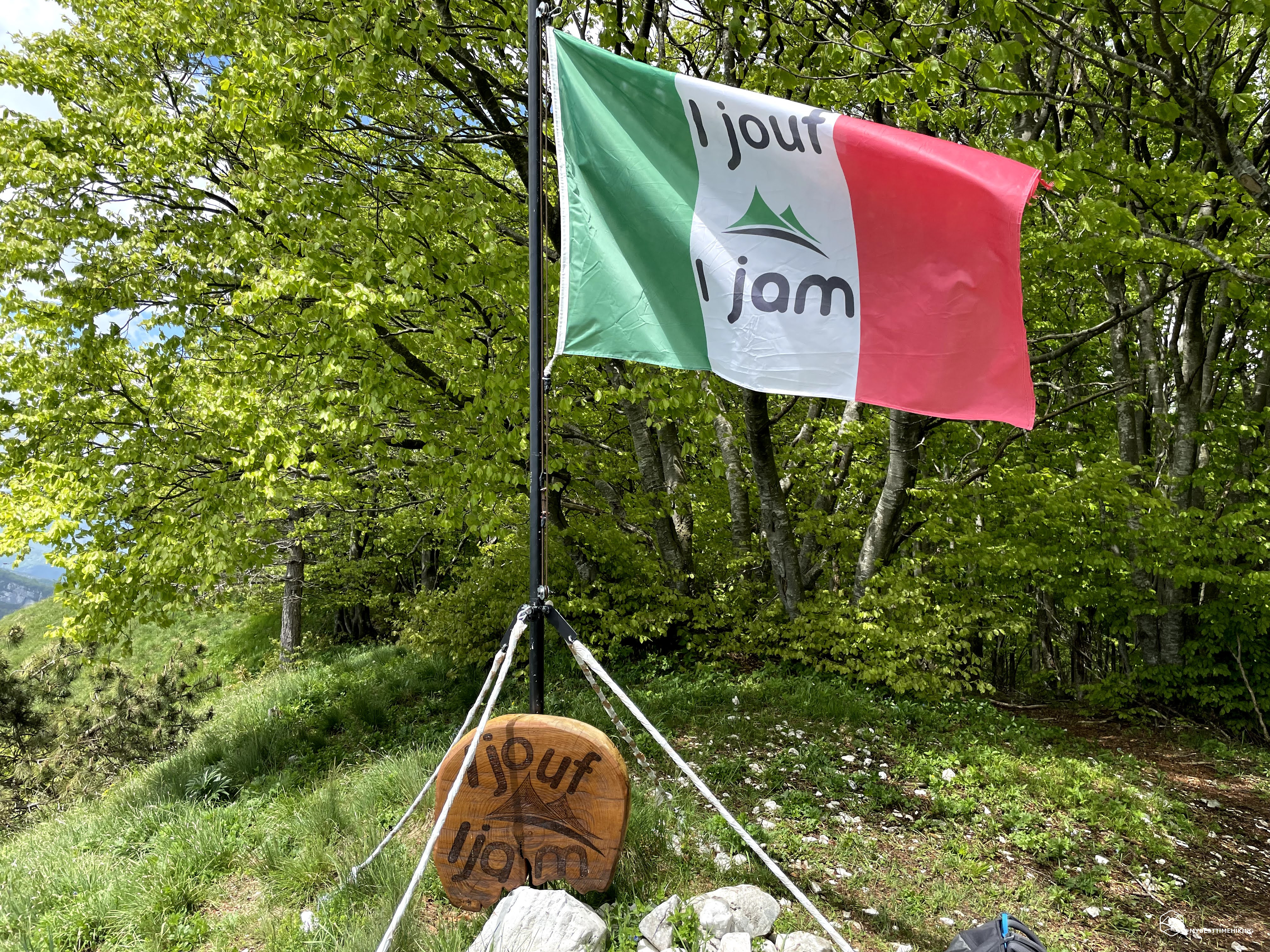
The word "Jôuf", in the autochthonous mountain area, means "wide pass" and its Italian translation is "yoke" which well represents the sinuosity of the ridges of this mountain.
We reach the town of Montereale Valcellina and take a slightly longer route that allows us to enjoy the splendid dam visible from the Ravedis bridge on the homonymous basin from whose waters the impetuous Cellina stream springs. After a couple of hairpin bends we arrive at a large parking lot where two paths rejoin: we begin the adventure with the Frassati path (CAI 899) which, after a while, joins the CAI 983 path.
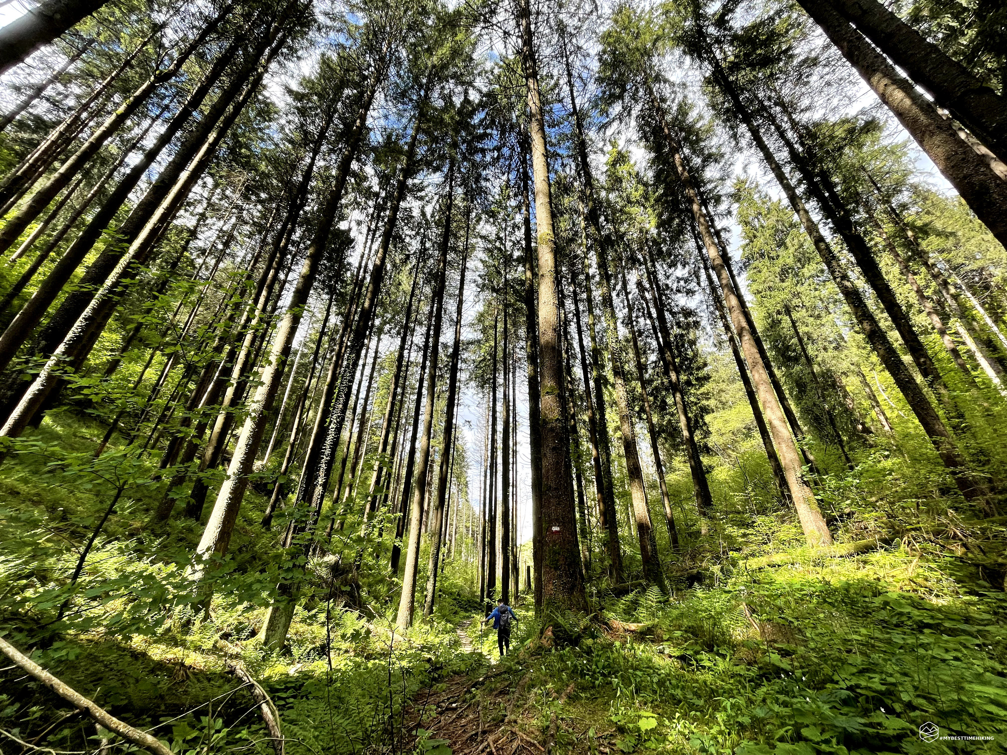
You immediately notice the presence of lush and dense nature, the forest awaits us and the unmistakable scent it releases reminds me of the holidays as a child in Carnia! The path crosses a small hut where a donkey lives that greets us with a bray sound. The path is continuously forked into a myriad of variations that allow you to choose the most suitable track: the more external and gentle path allows you to lengthen a little but avoids the rapid increase in altitude. This choice, in some cases, allows you to reach natural terraces from which you can admire a splendid view of Maniago and the territories enclosed between the Cellina and the Meduna. For the more athletic, however, there is always the "direct route" which climbs steeply and constantly. All the variants present glimpses in the middle of the woods interspersed with traces on a rocky path.
The route remains with these characteristics until it reaches the forest road, which cannot be used by car, which ends at the top of the Jôuf. Here we walk a short distance on a dirt road and then immerse ourselves again in the wildest nature and the surprise is around the corner: the wood that appears before us is a real forest! A forest with primitive facets at times given the large amount of ferns that peep out at the edge of the path. The humidity and the perceived coolness indicate a large amount of water that is maintained practically throughout the year. A series of trees felled by a recent storm have woody mushrooms on their barks used by adventurers to stoke a fire for the night. The route traveled is not very clean and has many trunks left in a disorderly way here and there, accentuating the perception of a "wild" and refined itinerary ... a few steps from the city of Maniago!
Soon the environment changes again and presents us with an enchanted forest made up of very tall trees, practically leafless to the tip, where the foliage reappears to form a green cushion. In this stretch of the route it really seems to be lost in the heart of the Dolomites or in some other remote corner of the planet!
At an altitude of 1000m, at the point where the path turns sharply to the left, we see in the vegetation on our right a sign on a boulder that indicates a source of water. We walk along this barely mentioned track and come out into an open clearing where a small outpost for poachers stands out. It seems abandoned, perhaps it is still used for bird watching since there are two chairs in correspondence with the small openings that give towards the top of the Jôuf. On the opposite side, an incredible panorama overlooking Maniago and the nearby Tagliamento river. Returning to the main path, we notice an expanse of fuchsia flowers as far as the eye can see, about to bloom. Only later do we understand that they are wild peonies (thanks Giorgia!).
Date
30-05-2021
Distance
13.93 KM
Hike type
Hike
Ascent
914 mt
- Mountain
Monte Jôuf
- Address
Maniago, Friuli Venezia Giulia, Italy
- Altitude
1242.00 m
- Refuges
- Information
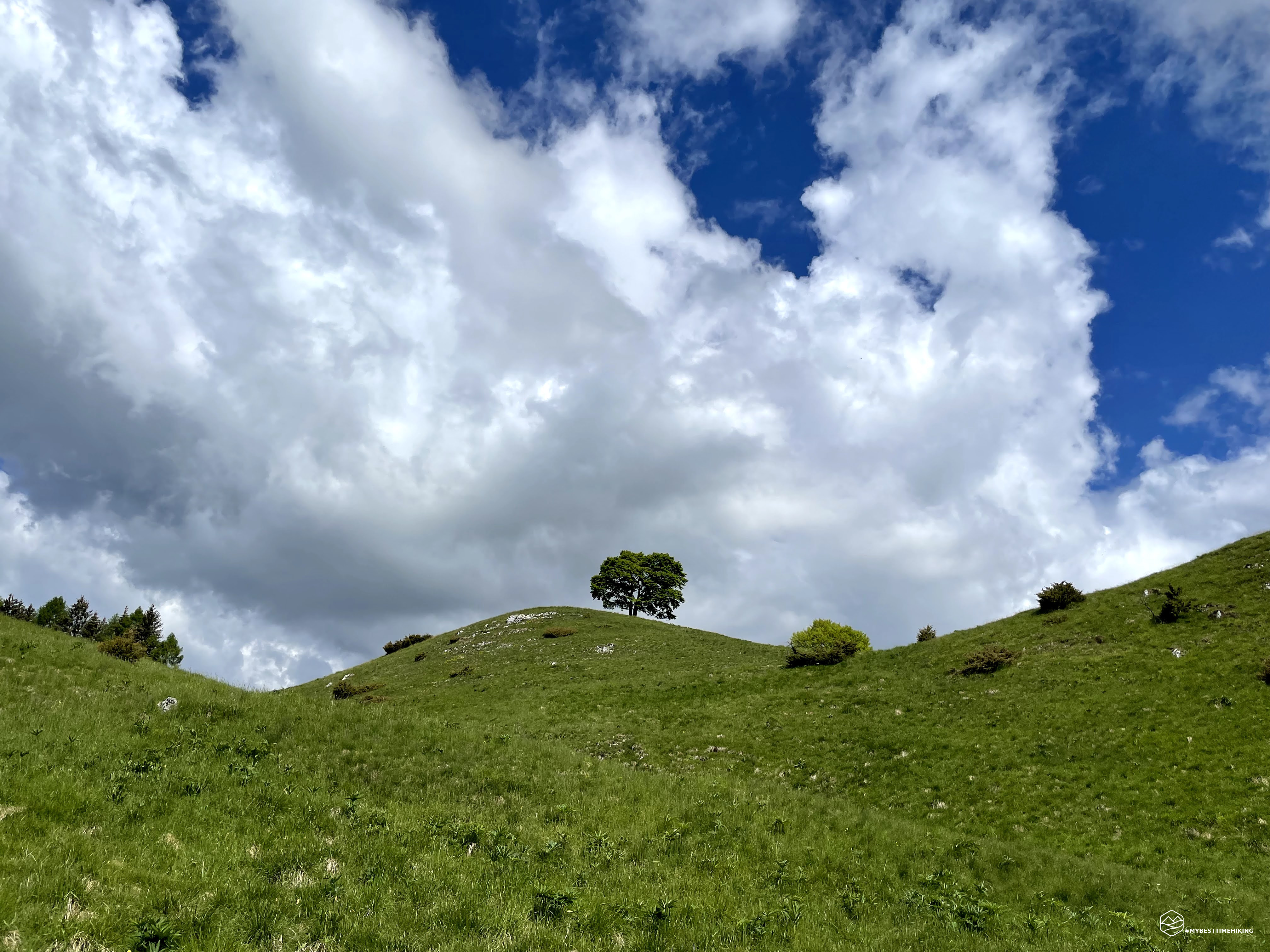
The last part of the route reaches the summit ridge where the bright green grass and the expanses of flowering daffodils make it a priceless postcard. We reach the Jôuf hut, now abandoned. It could really become an excellent meeting point with a minimum revaluation of the place, perhaps only for a restaurant, given the presence of the forest road that ends right here. The hut consists of a small farmhouse and a large structure for the cows that surely grazed in the past years.
We continue towards the summit and we notice a small summit from which a kind of tripod stands out. We don't think twice and we reach it by finding a truly impressive 360-degree observation point: from here you can even see the Gulf of Trieste, the mountains of Slovenia and Croatia. On the other side you can see the Piancavallo, now covered by a blanket of clouds, up to the Friulian mountain range headed by Mount Raut. The famous tripod that we had glimpsed shortly before is nothing more than a rear axle of an off-road vehicle placed vertically. Later we learned that it was once used as a ski lift!
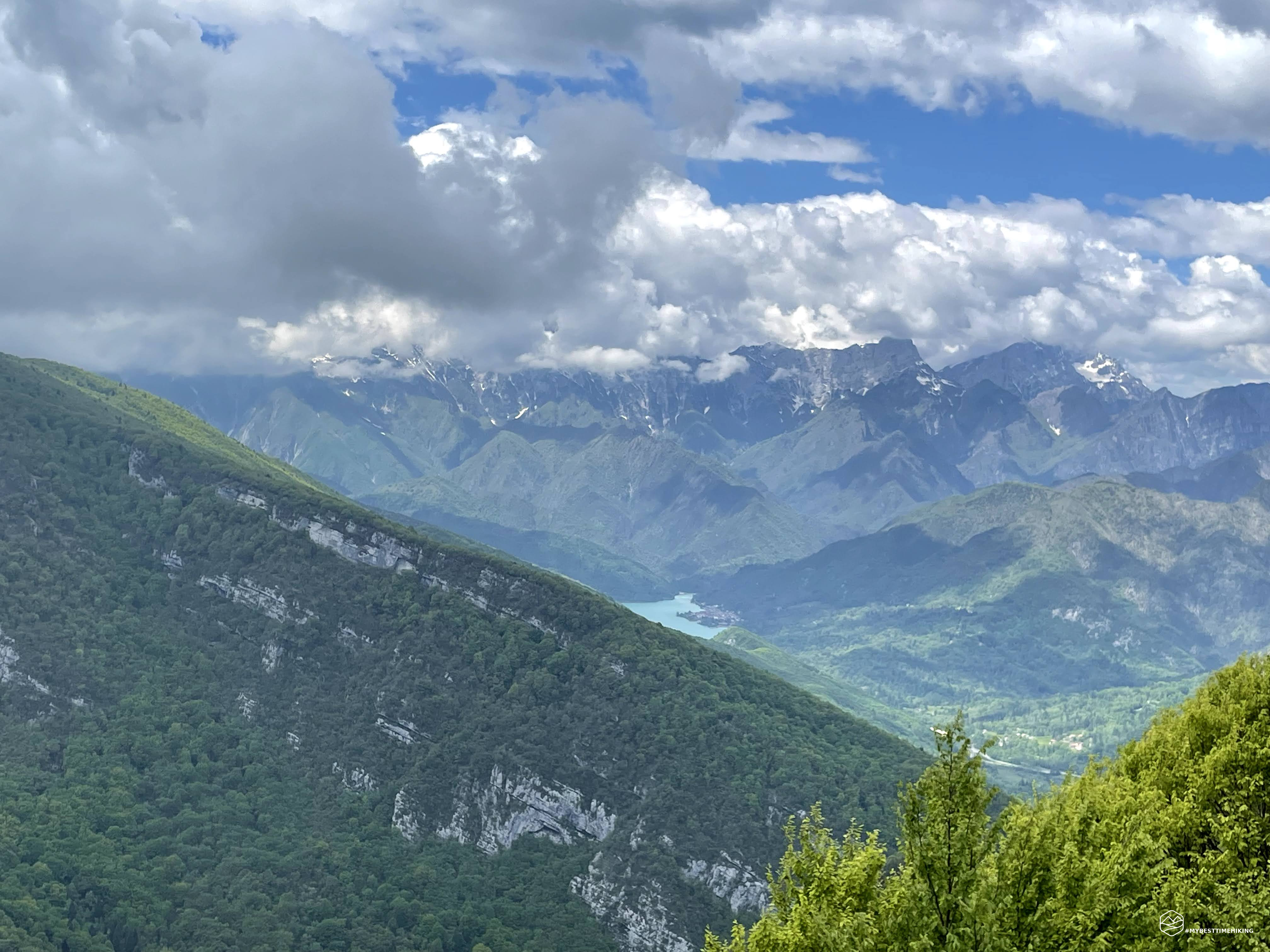
One last effort and soon we make a short descent and as much ascent to reach the summit cross at an altitude of 1224mt. From here you can dominate the entire town of Maniago and understand why this is considered their mountain. A hiker who arrived shortly before us warns us that what we have reached is not the real summit of Jôuf and that we still have to walk the ridge, beyond the nearby antennas, to get to the highest point at 1242mt. We thank and put the backpack back on our shoulders, we walk along the ridge and, after a small area of thick vegetation, we can see the Italian flag flying on the real top! We can observe the entire path that divides us: a short descent and subsequent ascent that rejoins the rocky ridge covered with soft fresh grass. The itinerary we have left to go through is very short but holds many surprises: the final uphill stretch is very steep, even if it is really short. From the top of this final ridge you have a breathtaking view of Cellina, the town of Vajont and Lake Ravedis which gives us the splendid emerald waters together with the spectacular waterfall that flows impetuously from its dam. The flag of the summit is stuck in a wooden sculpture bearing the name of the mountain and behind it we find a comfortable grove where we can rest, refresh ourselves and shelter from the biting wind present on the ridge. We take a last detour beyond the top of the Jôuf and find a natural terrace from which we can enjoy the view of Lake Barcis!
At the end of the restorative break we are going to go back. We return to the summit cross, up to the Jôuf hut where we decide to return from the "direttissima" that cuts the forest road. It is not a real path marked on the map, but they are a series of simple tracks created by hikers, runners or mushroom hunters, which create an imaginary vertical line to the final parking lot.
The path that awaits us is anything but monotonous and continues to vary like the CAI 983 path traveled on the outward journey. Of course, it proves steeper but it is possible to choose to take the dirt road of the forest to have a gentler path, but at the same time much longer. Worthy of note are the flowers that we find on the way back: from daffodils, to thistles to the splendid wild purple irises!
We complete the closure of the ring by returning to the parking lot with a total of almost 1000m of elevation gain for a total distance of 14km. A beautiful itinerary that can satisfy different expectations: from the less trained to the professional runner or experienced hiker. The large number of paths with different slopes, the presence of the comfortable dirt road and the non-prohibitive altitude make Mount Jôuf a destination within everyone's reach!
DifficultyHikers - Itineraries on paths or evident traces in various types of terrain (pastures, debris, stony ground ...). They are generally marked with paint or cairns (pyramid-shaped stacked stones that allow you to identify the route even from a distance). They can also take place in snowy but only slightly inclined environments. They require the equipment described in the part dedicated to hiking and sufficient orientation skills, walking training for a few hours. |